 Block
Aberdeen, Georgia
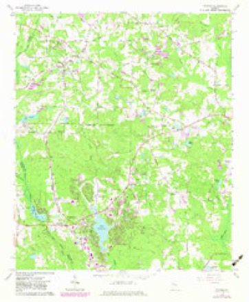
9 topographic sheets cover this place, the earliest surveyed in 1953 and the latest in 1979. It stands in the Peachtree City-Tyrone census division. It lies in ZIP code area 30269. The Survey maps it on the Tyrone quadrangle.
Topographic sheets covering this place
5 surveys from 9 printed sheetsMatched by testing this settlement's coordinate against the published boundary of every sheet in the United States Geological Survey's historical collection. Each opens the scanned sheet at the Survey.
- 1953 USGS Atlanta quadrangle1:250000, 2 printings
- 1957 USGS Atlanta quadrangle1:250000
- 1958 USGS Atlanta quadrangle1:250000
- 1965 USGS Tyrone quadrangle1:24000, 2 printings
- 1979 USGS Griffin quadrangle1:100000, 3 printings




Fires near this place
164 since 1992Regional context, not property-specific evidence. The federal wildfire occurrence database lists 164 fires within 5 miles of Aberdeen between 1992 and 2019, burning about 341 acres in total. 7 started naturally. 19 were recorded as arson. Distance is straight-line from the map coordinates, so a fire counted here may appear on a neighbouring settlement's page as well.
| Reported cause | Fires |
|---|---|
| Debris and open burning | 96 |
| Arson/incendiarism | 19 |
| Recreation and ceremony | 10 |
| Missing data/not specified/undetermined | 9 |
| Smoking | 8 |
| Equipment and vehicle use | 7 |
| Misuse of fire by a minor | 7 |
| Natural | 7 |
| Railroad operations and maintenance | 1 |
The most recent of them, most recent first, with the day each was reported and the service that recorded it.
| Date | Cause | Size | Reported by | Name on the report |
|---|---|---|---|---|
| 4 September 1993 | Debris and open burning | under an acre | Georgia Forestry Commission | not named |
| 24 September 2014 | Debris and open burning | 3.4 acres | Georgia Forestry Commission | FY2015-COWETA-003 |
| 1 September 1993 | Smoking | under an acre | Georgia Forestry Commission | not named |
| 22 August 1993 | Debris and open burning | under an acre | Georgia Forestry Commission | not named |
| 21 August 2000 | Natural | under an acre | Georgia Forestry Commission | FY2001-COWETA-007 |
| 2 August 2002 | Natural | under an acre | Georgia Forestry Commission | FY2003-FAYETTE-002 |
| 17 August 1995 | Debris and open burning | 1.9 acres | Georgia Forestry Commission | not named |
| 17 August 1995 | Natural | 1.3 acres | Georgia Forestry Commission | not named |
Settlements close enough to share some of these fires:
Mines and quarries near this place
2 within 5 milesRegional context, not property-specific evidence. The federal mineral resources record lists 2 workings within 5 miles of Aberdeen: 1 producer, 1 past producer. 1 still produces. What was taken out: Stone, Crushed/Broken, Marble, Dimension. Distance is straight-line from the map coordinates, so a quarry counted here may appear on a neighbouring settlement's page as well.
| Where | Site | Commodity | Status | Recorded |
|---|---|---|---|---|
| A.J. Mcelwaney Quarry | Marble, Dimension | Past Producer | ||
| Tyrone Quarry | Stone, Crushed/Broken | Producer |
Storms near this place
13 since 2008Regional context, not property-specific evidence. The National Weather Service names Aberdeen in 13 storm reports between 2008 and 2023: 6 thunderstorm wind, 3 flash flood, 2 hail, 1 lightning. No death or injury is recorded in these reports. Each account below is quoted exactly as the forecast office filed it, from the NOAA Storm Events Database, and each date opens the federal record of that event.
| When | Event | Place named | Harm | What the report says |
|---|---|---|---|---|
| December 2015 | Flash Flood | Aberdeen | $1,000,000 | A USGS stream gage on Whitewater Creek at Starrs Mill Park reached flood stage of 10 feet. The creek crest at 15.9 feet. Significant flooding occurred in the woodlands and fields along the creek downstream from the Starrs Mill Dam to Line Creek. Most of Starrs Mill Park was under 4 to 6 feet of water. The flood waters hit the bottom of the mill. Several roads and culverts were washed out due to the rapidly flowing flood waters. The flood waters of Cherry Branch damaged a condo in Tinsley Mill Village off Flat Creek Road. |
| March 2021 | Tornado (EF0) | Aberdeen | $50,000 | A National Weather Service survey determined that an EF0 tornado with maximum wind speeds 75 MPH and a maximum path width of 800 yards occurred in Fayette County. The Heard-Coweta County tornado moved east-northeast into Fayette County and northern Peachtree City crossing Line Creek east of Minix Road. It snapped a few trees near MacDuff Parkway where new homes were being constructed. Portable restrooms and light construction materials were also blown around. A few trees were downed on the CSX railroad tracks near Senoia Road and along Highway 74 near Kedron Drive. Large trees blocked the entrance to the Kedron Hills neighborhood at Loring Lane and Peachtree Parkway. The tornado finally ended near Astoria Lane at the northeast end of Kedron Hills in Peachtree City. [3/25/21: Tornado #2, County #3/3, EF-0, Heard, Coweta, Fayette, 2021:007]. |
| March 2020 | Thunderstorm Wind | Aberdeen | $45,000 | Local law enforcement, National Weather Service employees and the public reported numerous trees and power lines blown down across the county. |
| June 2019 | Flash Flood | Aberdeen | $10,000 | Local law enforcement relayed reports of flooding in the Tinsley Mill area of Peachtree City, in addition to a washed out culvert near Flat Creek Road and Flat Creek Court. Radar estimates indicate that 6 to 6.5 inches of rain occurred over the area in a short period of time, resulting in excessive runoff and flash flooding. |
| September 2011 | Flash Flood | Aberdeen | $10,000 | The Fayette County Emergency Management Director reported flash flooding in the Tinsley Mill Village area of Peachtree City. The flood was the result of Cherry Branch coming out of its banks as over two inches of rain fell in less than two hours in a flash flood prone area. The waters from Cherry Branch surrounded two condominums, but did not enter the properties. No evacuations were required. Elsewhere in Peachtree City, a detention pond on Crosstown Road flooded the basement of a home on Prestwick Lane with two to three feet of water and a pond at Luther Glass Park along South Peachtree Parkway overflowed and flooded portions of the adjacent golf cart path with approximately two feet of water. Monetary damage to the flooded basement and debris cleanup along roads, golf cart paths, and property was estimated to be approximately $10,000. |
| June 2018 | Thunderstorm Wind | Aberdeen | $7,000 | The Fayette County 911 center and the Emergency Manager reported trees and power lines blown from the west side of Peachtree City to Starrs Mill. |
| May 2009 | Thunderstorm Wind | Aberdeen | $5,000 | The Fayette County 911 Center reported that at least 20 trees were down across the county. The majority of the downed trees were in the western part of the county in the Peachtree City area. An off duty National Weather Service employee observed that four large pine trees were snapped along Georgia Highway 74 near the Cooper Lighting Facility about three miles south of Peachtree City. Amateur radio operators reported that a one foot-diameter tree was down in Fayetteville. |
| June 2023 | Thunderstorm Wind | Aberdeen | $1,000 | Tree down near intersection of Wynnmeade Pkwy and Hwy 54. |
| April 2009 | Lightning | Aberdeen | $500 | The public reported a lightning strike to a tree at a private residence on Bridge Point Drive. The tree was destroyed with tree debris scattered all about the immediate adjacent area. In addition, a light fixture near the tree was blown. |
| January 2023 | Thunderstorm Wind | Aberdeen | - | Reports of multiple trees down blocking roadways over north Peachtree City, including Hwy 74 and North Kedron, Belvedere Dr, Peachtree Pkwy at North Hill and Tinsley Mill. |
| June 2022 | Thunderstorm Wind | Aberdeen | - | Tree down on home with structural damage near the intersection of Tower Rd and Wynnmeade Pkwy. |
| June 2013 | Hail | Aberdeen | - | An off-duty National Weather Service employee reported pea to penny sized hail along Highway 74 near the golf cart bridge. |
| June 2008 | Hail | Aberdeen | - | The public observed penny to nickel-sized hail just north of Peachtree City and an off-duty National Weather Service employee observed penny-sized hail near Tyrone. |
Nearest settlements
The eight closest, with where each one stands in the county. Distances are straight-line, computed from the Geographic Names Information System coordinates.
| Map | Place | Distance | Sheets |
|---|---|---|---|
| Woodsmill | 0.1 miles | 9 | |
| Wisdom Woods | 0.5 miles | 9 | |
| Wynnmeade | 0.6 miles | 9 | |
| Cobblestone Creek | 0.6 miles | 9 | |
| Pinegate | 0.6 miles | 9 | |
| Westpark | 0.8 miles | 9 | |
| The Cloister | 0.8 miles | 9 | |
| Peachtree City | 0.9 miles | 9 |
Provenance
This settlement is recorded in the Geographic Names Information System as feature 326147. The sheet list is computed by point-in-boundary test against the United States Geological Survey's historical topographic inventory. Both are works of the United States government and carry no copyright under 17 U.S.C. 105.
Wildfire. Short, Karen C. 2022. Spatial wildfire occurrence data for the United States, 1992-2020 [FPA_FOD_20221014]. 6th Edition. Fort Collins, CO: Forest Service Research Data Archive. https://doi.org/10.2737/RDS-2013-0009.6 Collected with United States Government funding and usable without additional permissions or fees.
Mines and quarries. USGS Mineral Resources Data System (MRDS) https://mrdata.usgs.gov/mrds/ A work of the United States government, no copyright under 17 U.S.C. 105.
Storms. NOAA National Centers for Environmental Information, Storm Events Database https://www.ncei.noaa.gov/stormevents/ A work of the United States government, no copyright under 17 U.S.C. 105. Narratives are quoted verbatim from the National Weather Service report and are not edited or summarised.