 Block
Adairsville, Georgia
18 topographic sheets cover this place, the earliest surveyed in 1890 and the latest in 1981. It stands in the Adairsville census division. It lies in ZIP code area 30103. It lies near Penn Hollow. The Survey maps it on the Adairsville quadrangle. 4,878 people lived here at the 2020 count. It stands 719 feet above sea level.
On record in Adairsville
Buildings and businesses the archive holds for this place. Each opens its own page, with the source record it came from.
On the National Register 1 record
 Adairsville Historic Districtlisted 1987
Surveyed buildings and structures 1 record
- Woody Allen Road Bridge, Spanning Oothalooga Creek at County Road 316, Adairsvillefederal building survey, 6 photographs
Population over time
2 figuresAdairsville grew from 4,648 to 4,878 between 2010 and 2020. These are the recorded population figures Wikidata holds for this place, reached through the Geographic Names Information System number this page is keyed on rather than by name, so they belong to this place and not to another of the same name. Most are census counts, but not all are: an early figure may be a founding or settlement estimate, and an estimate published within five years of a census is left out. The change column is computed, and is left blank where more than 20 years separate a figure from the one before it, because a gap that long is not a change between two counts.
| Year | People | Change |
|---|---|---|
| 2010 | 4,648 | |
| 2020 | 4,878 | +230 (+5%) |
Topographic sheets covering this place
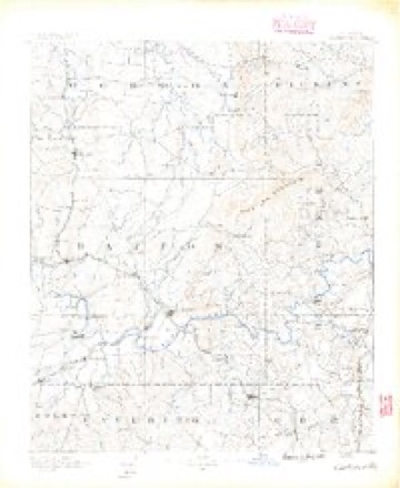
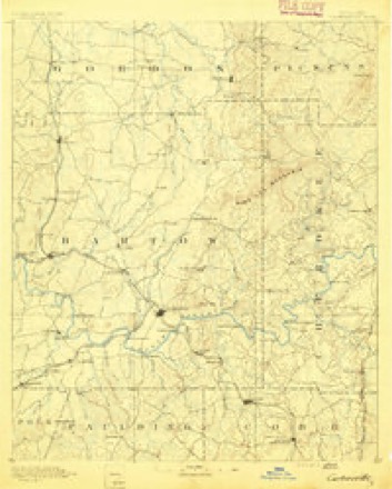
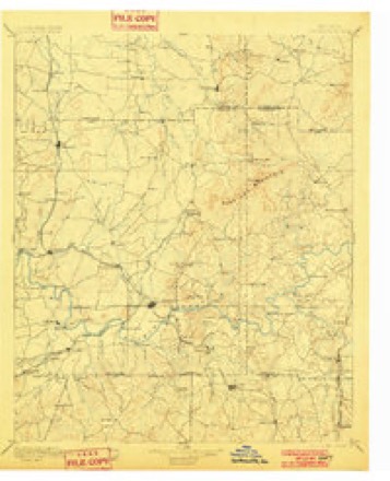
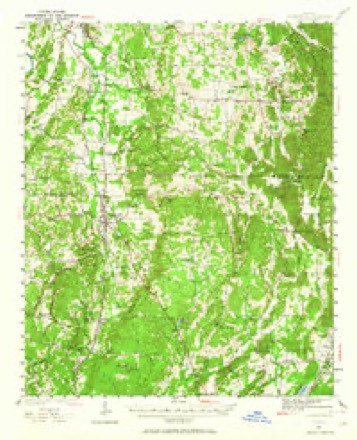
11 surveys from 18 printed sheetsMatched by testing this settlement's coordinate against the published boundary of every sheet in the United States Geological Survey's historical collection. Each opens the scanned sheet at the Survey.
- 1890 USGS Cartersville quadrangle1:125000
- 1891 USGS Cartersville quadrangle1:125000
- 1896 USGS Cartersville quadrangle1:125000, 4 printings
- 1941 USGS Adairsville quadrangle1:62500
- 1944 USGS Adairsville quadrangle1:62500, 2 printings
- 1955 USGS Rome quadrangle1:250000
- 1958 USGS Rome quadrangle1:250000, 3 printings
- 1961 USGS Rome quadrangle1:250000
- 1963 USGS Rome quadrangle1:250000
- 1972 USGS Adairsville quadrangle1:24000
- 1981 USGS Cartersville quadrangle1:100000, 2 printings




Photographs
1 photograph,Taken for the Office of War Information and the Farm Security Administration, who photographed the country between 1935 and 1944. Works of United States government photographers, with no known restriction on use. Each opens its catalogue record.
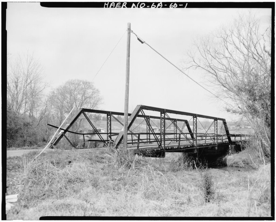
Photographer not recorded. Library of Congress
Fires near this place
380 since 1992Regional context, not property-specific evidence. The federal wildfire occurrence database lists 380 fires within 5 miles of Adairsville between 1992 and 2020, burning about 1,874 acres in total. 4 started naturally. 174 were recorded as arson. Distance is straight-line from the map coordinates, so a fire counted here may appear on a neighbouring settlement's page as well.
| Reported cause | Fires |
|---|---|
| Arson/incendiarism | 174 |
| Debris and open burning | 126 |
| Equipment and vehicle use | 29 |
| Missing data/not specified/undetermined | 20 |
| Misuse of fire by a minor | 12 |
| Recreation and ceremony | 11 |
| Natural | 4 |
| Railroad operations and maintenance | 2 |
| Smoking | 2 |
The most recent of them, most recent first, with the day each was reported and the service that recorded it.
| Date | Cause | Size | Reported by | Name on the report |
|---|---|---|---|---|
| 9 September 1998 | Debris and open burning | 4.1 acres | Georgia Forestry Commission | not named |
| 8 September 2005 | Arson/incendiarism | 2.0 acres | Georgia Forestry Commission | not named |
| 7 September 1998 | Equipment and vehicle use | under an acre | Georgia Forestry Commission | not named |
| 6 September 1995 | Arson/incendiarism | under an acre | Georgia Forestry Commission | not named |
| 5 September 2010 | Arson/incendiarism | 1.5 acres | Georgia Forestry Commission | FY2011-BARTOW-009 |
| 4 September 1998 | Debris and open burning | under an acre | Georgia Forestry Commission | not named |
| 4 September 1997 | Arson/incendiarism | under an acre | Georgia Forestry Commission | not named |
| 30 September 1993 | Debris and open burning | under an acre | Georgia Forestry Commission | not named |
Settlements close enough to share some of these fires:
Mines and quarries near this place
10 of 18 shownRegional context, not property-specific evidence. The federal mineral resources record lists 18 workings within 5 miles of Adairsville: 9 prospects, 5 past producers, 3 occurrences, 1 producer. 1 still produces. What was taken out: Aluminum, Stone, Crushed/Broken, Manganese, Clay. Distance is straight-line from the map coordinates, so a quarry counted here may appear on a neighbouring settlement's page as well.
| Where | Site | Commodity | Status | Recorded |
|---|---|---|---|---|
| Kerr Property | Iron, Manganese | Prospect | 1919 | |
| Nannie | Manganese | Occurrence | 1919 | |
| Universal Ceramics Pit | Clay | Producer | ||
| Unnamed Prospects | Mica | Occurrence | ||
| Highway Quarry | Stone, Crushed/Broken | Past Producer | ||
| Painter Quarry | Stone, Crushed/Broken | Past Producer | ||
| Davis 1 Prospect | Aluminum | Prospect | ||
| Davis 2 Prospect | Aluminum | Prospect | ||
| Lot 37 | Aluminum | Prospect | ||
| Lot 8 | Aluminum | Prospect |
Storms near this place
60 of 68 shownRegional context, not property-specific evidence. The National Weather Service names Adairsville in 68 storm reports between 1994 and 2025: 32 thunderstorm wind, 26 hail, 5 flash flood, 3 tornado. The reports record 1 death and 12 injuries. Each account below is quoted exactly as the forecast office filed it, from the NOAA Storm Events Database, and each date opens the federal record of that event.
| When | Event | Place named | Harm | What the report says |
|---|---|---|---|---|
| January 2013 | Tornado (EF3) | Adairsville | 1 killed, 9 hurt, $60,000,000 | A tornado touched down just southwest of Adairsville at approximately 1112 AM EST. The tornado strengthened to high-end EF-3 in Adairsville where dozens of homes were damaged or destroyed. At least 95 structures were damaged, with 31 destroyed, 17 sustaining major damage, and 47 with minor damage. Most of the damage to homes was a result of trees falling on homes in downtown Adairsville. The worst damage was along Highway 140 where a large portion of a manufacturing plant was destroyed. One fatality occurred when a tree fell on a mobile home. Over 100 cars were overturned near exit 306 on Interstate 75.|[01/30/13: Tornado #1, County #1-2, EF3, Bartow-Gordon, 2013:001]. |
| June 1994 | Tornado (F1) | Adairsville | 2 hurt, $500,000 | A short lived tornado touched down along Old U.S. Highway 41 two miles south of Adairsville. The tornado destroyed three double-wide mobile homes and moderately damage three others. One double-wide trailer, occupied by a sleeping 5 year old female child, was tossed 125 feet which disintegrated on impact. The child was found in the rubble uninjured and still asleep. Twenty other homes received considerable roof and porch damage while several trees and 20 to 30 power lines were downed before the tornado dissipated. A 1000 electric customers were without power and 1900 residents lost telephone service for at least three hours in the Adairsville area. Two minor injuries were reported from wind blown shattered glass. |
| May 2002 | Thunderstorm Wind | Adairsville | 1 hurt, $1,000,000 | The Cartersville Daily Tribune News and emergency management personnel reported that straight line thunderstorm winds estimated at 80 to 100 mph caused widespread damage to trees, power lines, and several structures across the northern part of the county from Adairsville, to Folsom, to Pine Log, to Rydal. Some of the worst damage occurred in Adairsville where a large corporation had a large portion of its roof blown off along with roof mounted ventilation systems. Debris in the form of flying glass injured one midnight shift worker. In addition, a barn was destroyed on Georgia 140 in Folsom, at least 4 roads were blocked and closed, and at least 2,500 were left without power. |
| April 2009 | Hail | Adairsville | $1,500,000 | Several reports of large hail were received from the public across northern Bartow county from west of Adairsville along the Floyd county line to east of Funkhouser along the Cherokee county line. Baseball-sized hail was observed in the Adairsville area, with 2.0 inch diameter sized-hail west of Adairsville and half-dollar-sized hail near Funkhouser. Windshields of vehicles were broken by the large hail in the Adairsville area. |
| February 2005 | Hail | Adairsville | $1,000,000 | The public reported hail ranging in size from quarters just north of Adairsville to nearly 2.0 inches in diameter in Adairsville. Extensive damage was reported to vehicles and roofs of homes in the area. |
| April 2009 | Hail | Adairsville | $500,000 | The public observed 2.0 inch diameter hail in the Adairsville area from a second severe thunderstorm that tracked across the northern part of Bartow county. |
| July 2010 | Hail | Adairsville | $437,000 | The Bartow County 911 Center relayed reports of nickel to golf ball-sized hail from the northwest part of the county between Adairsville and the Floyd and Gordon county lines. The large hail broke windows of homes in Adairsville. A couple of trees were also down from thunderstorms winds. One tree was down on Jarrett Loop Road and another on White Road. |
| August 2010 | Lightning | Adairsville | $250,000 | The Bartow County 911 Center reported that seven homes across the county were struck by lightning. Damages ranged from minor to moderate. |
| June 2010 | Thunderstorm Wind | Adairsville | $225,000 | The Bartow County 911 Center and the Daily Tribune News of Cartersville reported that more than a dozen trees were down near Adairsville and at least eight trees were down near Red Top Mountain State Park in the far southeast part of the county near Lake Allatoona. Several power lines were also down as a result. The most significant damage was in the Oakland Heights area where several vehicles were damaged from downed trees. A home on Cassville Road was damaged when a tree fell on the structure, which also damaged three adjacent vehicles. The most significant damage was in the Oakland Heights area were several vehicles were damaged from downed trees. In addition, a farm, also on Cassville Road, suffered damage when the roof was blown off a hay barn, several trees were blown down, and at least a couple of cows were injured or killed. |
| December 2011 | Tornado (EF0) | Adairsville | $150,000 | A damage survey conducted by the National Weather Service Forecast Office in Peachtree City, Georgia confirmed that the EF0 tornado that touched down in extreme northeast Floyd county continued into extreme northwest Bartow county before continuing into Gordon county. The tornado remained at EF0 intensity across extreme northwest Gordon county with a maximum path width of 440 yards. Damage survey members observed and county emergency personnel reported that a number of trees were down along Oak Grove Road just north of Georgia Highway 140. A few homes in this area also sustained minor to moderate damage from downed trees.||[12/22/11: Tornado #2, County #2-3, EF3, Floyd-Bartow-Gordon, 2011:028]. |
| April 2011 | Thunderstorm Wind | Adairsville | $50,000 | The Bartow County 911 Center reported that dozens of trees were blown down in the Adairsville area. In addition, a large pole barn on Doris Road in Adairsville was flattened by the strong thunderstorm wind gusts. An off duty National Weather Service meteorologist estimated wind gusts to be on the order of 60 mph along Interstate-75 east of Adairsville near mile marker 305. One tree was down near mile marker 306 on Interstate-75 blocking one of the northbound lanes. |
| June 1994 | Thunderstorm Wind | Adairsville | $50,000 | Thunderstorm winds downed several large trees and limbs across United States Highway 41 in Adairsville. Ten homes received roof and glass damage from wind toppled trees along United States Highway on the south side of Adairsville. |
| May 2025 | Thunderstorm Wind | Adairsville | $40,000 | Emergency Manager relayed a report of multiple trees and powerlines down near Park Street, including a tree down on a home. |
| July 2012 | Thunderstorm Wind | Adairsville | $15,000 | The Bartow County 911 Center reported numerous trees down in Adairsville. One tree fell on a mobile home. |
| May 2021 | Thunderstorm Wind | Adairsville | $10,000 | The Bartow County Emergency Manager reported a few trees blown down across the county from Adairsville to Cassville, Cartersville and Allatoona. |
| October 2010 | Thunderstorm Wind | Adairsville | $7,000 | The Bartow County Emergency Management Director reported that several trees were down across the county. In addition, one power line was down on a school bus. |
| May 2013 | Flash Flood | Adairsville | $6,000 | The public reported several roads in the Adairsville area with high water overflowing them from nearby drainage branches. This included Clear Deck Road, Mathews Road and East Pleasant Valley Road around 5 to 6 miles east to southeast of Adairsville. |
| May 2013 | Flash Flood | Adairsville | $6,000 | The public reported several roads in the Adairsville area with high water overflowing them from nearby drainage branches. This included Clear Deck Road, Mathews Road and East Pleasant Valley Road around 5 to 6 miles east to southeast of Adairsville. |
| May 2025 | Thunderstorm Wind | Adairsville | $5,000 | Emergency manager reported a few trees and power lines down at the intersection of Westover Dr NW and Twin Bridges Rd. |
| August 2019 | Thunderstorm Wind | Adairsville | $5,000 | The Bartow County Emergency Manager reported trees and power lines blown down across the north side of Adairsville, including along Twin Bridges Road, Woody Road near Dixie Highway, and I-75 just north of exit 306. |
| August 2014 | Thunderstorm Wind | Adairsville | $5,000 | The Emergency Manager reported a tree fell on a mobile home in the Ridgewood Mobile Home Park. There were also reports of numerous traffic accidents and 1 tree blocking the road near the Floyd County and Bartow County line. |
| February 2011 | Thunderstorm Wind | Adairsville | $5,000 | The Bartow County Emergency Management Director reported that many trees were down in the Adairsville area of northern Bartow county. |
| April 2011 | Thunderstorm Wind | Adairsville | $5,000 | The Bartow County 911 Center reported that several trees and power lines were down, mainly across the northern part of the county near Adairsville. |
| July 2005 | Thunderstorm Wind | Adairsville | $5,000 | The Bartow County 911 Center reported that several power lines were down in the Adairsville area. |
| March 1997 | Thunderstorm Wind | Adairsville | $5,000 | no account filed |
| January 2005 | Thunderstorm Wind | Adairsville | $3,000 | The public reported that straight-lined winds associated with a line of showers and thunderstorms caused damage to a chicken house. Some of the doors were blown off, some of the tins in the coops were blown away, and several shingles were blown off. |
| June 2002 | Thunderstorm Wind | Adairsville | $3,000 | The Adairsville police department reported that several trees and some power lines were blown down. |
| May 1998 | Hail | Adairsville | $3,000 | Several public reports stated that hail ranging from dime to as large as golf ball size fell in Adairsville, Cassville, and Cartersville. |
| March 2025 | Thunderstorm Wind | Adairsville | $2,000 | Power lines downed by strong winds near the intersection of lacey rd and white rd in adairsville. |
| March 2025 | Thunderstorm Wind | Adairsville | $2,000 | Power lines down near the intersection of boyd mountain rd and hall station rd in adairsville. |
| July 2023 | Thunderstorm Wind | Adairsville | $2,000 | A tree fell onto the front porch of a home on Elm St. |
| July 2023 | Thunderstorm Wind | Adairsville | $2,000 | A tree fell onto power lines on old highway 41 near Woodland Bridge Rd. |
| August 2007 | Thunderstorm Wind | Adairsville | $2,000 | The Bartow County 911 Center reported that eight trees were blown down in the far northwest part of the county. |
| June 2002 | Thunderstorm Wind | Adairsville | $2,000 | The Rome News Tribune reported that trees were blown down in the Adairsville area. Consequently, a number of residents in the northern part of the county endured a power outage. |
| January 1997 | Thunderstorm Wind | Adairsville | $2,000 | no account filed |
| August 2000 | Thunderstorm Wind | Adairsville | $1,500 | The public reported three trees down. |
| March 2025 | Thunderstorm Wind | Adairsville | $1,000 | Tree down near the intersection of big oak tree road nw and plantation road nw. |
| August 2024 | Thunderstorm Wind | Adairsville | $1,000 | Tree fell on car per em in city of Adairsville. |
| July 2024 | Thunderstorm Wind | Adairsville | $1,000 | Powerlines down at Railroad St and Hotel St . |
| February 2022 | Thunderstorm Wind | Adairsville | $1,000 | Powerlines knocked down near the intersection of Twin Bridges Rd and Westover Dr. |
| April 2011 | Thunderstorm Wind | Adairsville | $1,000 | The Bartow County 911 Center reported that three trees were down near Adairsville. |
| May 2025 | Thunderstorm Wind | Adairsville | - | A Georgia mesonet station near the intersection of I-75 and Folsom Rd SE reported a 59 mph wind gust. |
| March 2023 | Thunderstorm Wind | Adairsville | - | Trees and powerlines down near intersection of Manning Mill Rd and Joe Frank Harris Pkwy NW. |
| November 2020 | Flash Flood | Adairsville | - | The Emergency Manager reported water flowing over White Road and other nearby roadways due to rising water from neighboring creeks. Several fields and pastures were also inundated. Radar estimates indicate that 1.5 to 2.5 inches of rain fell quickly over the area, causing the flash flooding. |
| November 2018 | Flash Flood | Adairsville | - | Public reported that Dry Creek had risen out of its banks and over the roadway near the intersection of Wayside Road and Doris Road. |
| May 2018 | Flash Flood | Adairsville | - | Emergency Manager reported vehicles were trapped in floodwaters at the intersections of Hwy 140 and Twin Bridges Road and Hwy 140 and Oak Grove Road. Vehicle occupants were rescued without incident. |
| April 2011 | Hail | Adairsville | - | An amateur radio operator relayed a report of ping-pong ball-sized hail near Adairsville. The public observed penny-sized hail covering the ground east of Adairsville. WSR-88D radar data suggests that penny to quarter-sized hail likely occurred across much of northwest and north central Bartow county from west of Adairsville to Folsom. |
| May 2008 | Hail | Adairsville | - | The public observed half-dollar-sized hail from northwest to south of Adairsville. Nickel-sized hail was observed just north of White. As the storm continued southeastward, ping pong ball-sized hail was observed as the storm continued southeast toward the Cherokee county line. Radar data supported that nickel or larger sized hail fell across much of northern and eastern Bartow county from Adairsville to Pine Log, White, and to just north of Red Top Mountain State Park. |
| April 2008 | Hail | Adairsville | - | The public observed nickel-sized hail in extreme northwestern Bartow county, west of Adairsville. They noted that it had been hailing for at least five minutes. |
| April 2008 | Hail | Adairsville | - | The public observed penny-sized hail southeast of Adairsville. |
| April 2007 | Hail | Adairsville | - | The public reported penny to nickel-sized hail near Adairsville. |
| July 2007 | Hail | Adairsville | - | The Bartow County 911 Center reported quarter-sized hail in the Cassville-White Road area between Adairsville and Cassville. Several reports of pea-sized hail were received from nearby surrounding areas. |
| March 2007 | Hail | Adairsville | - | The public reported that half-dollar-sized hail fell for up to five minutes in the far northwest part of the county. |
| April 2006 | Hail | Adairsville | - | Numerous reports of hail were received from the public across much of Bartow county from Adairsville to southeast of Cartersville. Nickel-sized hail was reported in Adairsville, penny-sized hail in Kingston, and nickel to quarter-sized hail in Cartersville. This was one of several hail-producing thunderstorms that moved across Bartow county during the late morning and early afternoon. |
| May 2006 | Hail | Adairsville | - | The Bartow County 911 Center reported penny-sized hail. |
| February 2005 | Hail | Adairsville | - | An amateur radio operator reported quarter-sized hail. |
| April 2005 | Hail | Adairsville | - | The public reported penny to nickel-sized hail. |
| May 2003 | Hail | Adairsville | - | The Bartow county 911 center reported quarter-sized hail. |
| May 2003 | Hail | Adairsville | - | The public reported penny to quarter-sized hail in Adairsville and nickel-sized hail in Pleasant Valley. |
| April 2002 | Hail | Adairsville | - | Several reports of hail ranging in size from quarters, to half-dollars, to golf balls were received from the public. |
Nearest settlements
The eight closest, with where each one stands in the county. Distances are straight-line, computed from the Geographic Names Information System coordinates.
| Map | Place | Distance | Sheets |
|---|---|---|---|
| Snow Springs | 3.0 miles | 18 | |
| Summit (historical) | 4.2 miles | 18 | |
| Pleasant Valley | 4.3 miles | 19 | |
| Halls | 4.9 miles | 18 | |
| Folsom | 5.7 miles | 19 | |
| Gum Springs | 7.8 miles | 19 | |
| Sophia (historical) | 7.9 miles | 19 | |
| Dewey Crossroads | 8.0 miles | 19 |
Elsewhere
Matched on this settlement's Geographic Names Information System number rather than its name, so it cannot be a different place of the same name in another state.
| Wikipedia article on Adairsville | An encyclopaedic summary. Its text is share-alike, so it is linked here rather than copied. |
| Wikidata item Q346990 | The structured record the population and elevation above come from. Public domain (CC0). |
Provenance
This settlement is recorded in the Geographic Names Information System as feature 310389. The sheet list is computed by point-in-boundary test against the United States Geological Survey's historical topographic inventory. Both are works of the United States government and carry no copyright under 17 U.S.C. 105.
Wildfire. Short, Karen C. 2022. Spatial wildfire occurrence data for the United States, 1992-2020 [FPA_FOD_20221014]. 6th Edition. Fort Collins, CO: Forest Service Research Data Archive. https://doi.org/10.2737/RDS-2013-0009.6 Collected with United States Government funding and usable without additional permissions or fees.
Mines and quarries. USGS Mineral Resources Data System (MRDS) https://mrdata.usgs.gov/mrds/ A work of the United States government, no copyright under 17 U.S.C. 105.
Storms. NOAA National Centers for Environmental Information, Storm Events Database https://www.ncei.noaa.gov/stormevents/ A work of the United States government, no copyright under 17 U.S.C. 105. Narratives are quoted verbatim from the National Weather Service report and are not edited or summarised.