 Block
Atlanta, Georgia
23 topographic sheets cover this place, the earliest surveyed in 1888 and the latest in 1997. It stands in the Atlanta census division. It lies in ZIP code area 30334. The Survey maps it on the Southwest Atlanta quadrangle. 498,715 people lived here at the 2020 count. It stands 738 feet above sea level.
Research this city
On record in Atlanta
Buildings and businesses the archive holds for this place. Each opens its own page, with the source record it came from.
On the National Register 12 of 229 shown
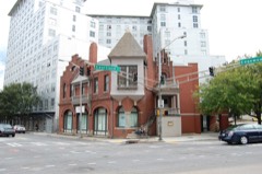 Dixie Coca-Cola Bottling Company PlantNational Historic Landmark · listed 1977
 Fox TheatreNational Historic Landmark · listed 1974
 Georgia State CapitolNational Historic Landmark · listed 1971
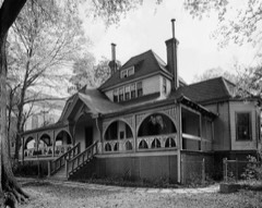 Joel Chandler Harris HouseNational Historic Landmark · listed 1966
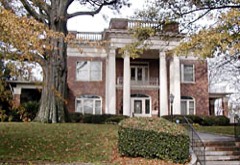 Herndon HomeNational Historic Landmark · listed 2000
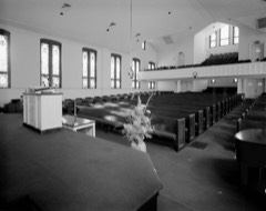 Martin Luther King Jr. Historic DistrictNational Historic Landmark · listed 1974
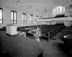 Martin Luther King Jr. National Historic Site and Preservation DistrictNational Historic Landmark · listed 1980
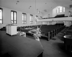 Prince Hall Masonic LodgeNational Historic Landmark · listed 2001
 Stone Hall, Atlanta UniversityNational Historic Landmark · listed 1974
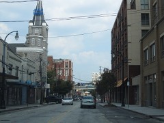 Sweet Auburn Historic DistrictNational Historic Landmark · listed 1976
 U.S. Post Office and CourthouseNational Historic Landmark · listed 1974
 63 Magnum Street Industrial Buildinglisted 1996
Every listing in Fulton County
Surveyed buildings and structures 12 of 129 shown
- 126-255 Auburn Avenue (Commercial Buildings), Auburn Avenue, Atlantafederal building survey, 91 photographs
- 3331 Oak Valley Road (House), Atlantafederal building survey, 1 photograph
- 3335 Oak Valley Road (House), Atlantafederal building survey, 1 photograph
- 3339 Oak Valley Road (House), Atlantafederal building survey, 1 photograph
- 3344 Oak Valley Road (House), Atlantafederal building survey, 1 photograph
- 3345 Oak Valley Road (House), Atlantafederal building survey, 2 photographs
- 3351 Oak Valley Road (House), Atlantafederal building survey, 1 photograph
- 3353 Oak Valley Road (House), Atlantafederal building survey, 1 photograph
- 3355 Oak Valley Road (House), Atlantafederal building survey, 1 photograph
- 3357 Oak Valley Road (House), Atlantafederal building survey, 1 photograph
- 3361 Oak Valley Road (House), Atlantafederal building survey, 1 photograph
- 3363 Oak Valley Road (House), Atlantafederal building survey, 1 photograph
Population over time
2 figuresAtlanta grew from 420,003 to 498,715 between 2010 and 2020. These are the recorded population figures Wikidata holds for this place, reached through the Geographic Names Information System number this page is keyed on rather than by name, so they belong to this place and not to another of the same name. Most are census counts, but not all are: an early figure may be a founding or settlement estimate, and an estimate published within five years of a census is left out. The change column is computed, and is left blank where more than 20 years separate a figure from the one before it, because a gap that long is not a change between two counts.
| Year | People | Change |
|---|---|---|
| 2010 | 420,003 | |
| 2020 | 498,715 | +78,712 (+19%) |
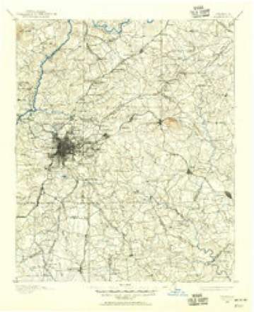
Topographic sheets covering this place
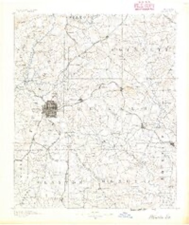
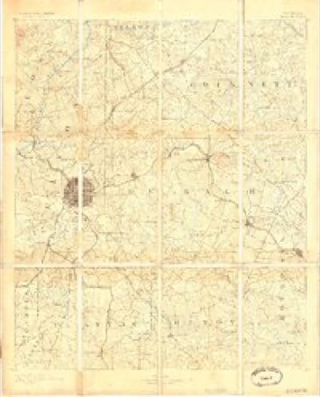
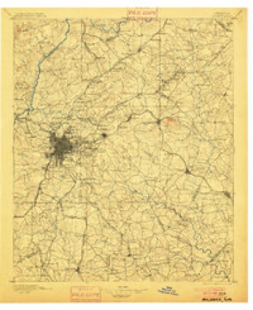
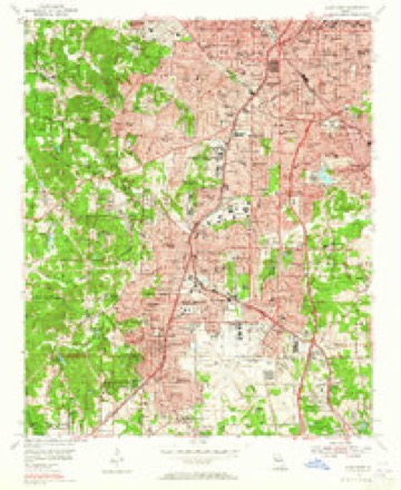
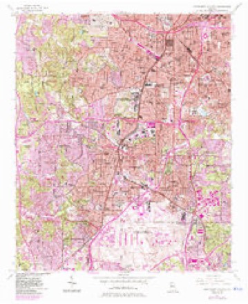
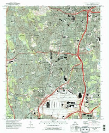
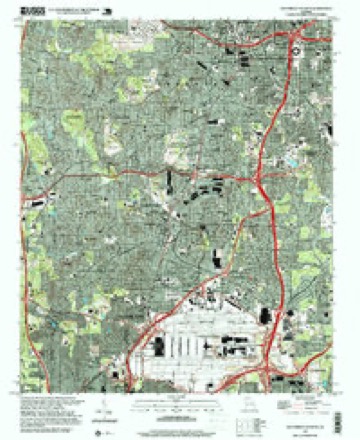
12 surveys from 23 printed sheetsMatched by testing this settlement's coordinate against the published boundary of every sheet in the United States Geological Survey's historical collection. Each opens the scanned sheet at the Survey.
- 1888 USGS Atlanta quadrangle1:125000
- 1890 USGS Atlanta quadrangle1:125000
- 1892 USGS Atlanta quadrangle1:125000
- 1895 USGS Atlanta quadrangle1:125000, 7 printings
- 1953 USGS Atlanta quadrangle1:250000, 2 printings
- 1954 USGS East Point quadrangle1:24000, 2 printings
- 1954 USGS Southwest Atlanta quadrangle1:24000, 3 printings
- 1957 USGS Atlanta quadrangle1:250000
- 1958 USGS Atlanta quadrangle1:250000
- 1981 USGS Atlanta quadrangle1:100000
- 1993 USGS Southwest Atlanta quadrangle1:24000, 2 printings
- 1997 USGS Southwest Atlanta quadrangle1:24000




Photographs
8 of 46 photographs shown, 1936 to 2017Taken for the Office of War Information and the Farm Security Administration, who photographed the country between 1935 and 1944. Works of United States government photographers, with no known restriction on use. Each opens its catalogue record.
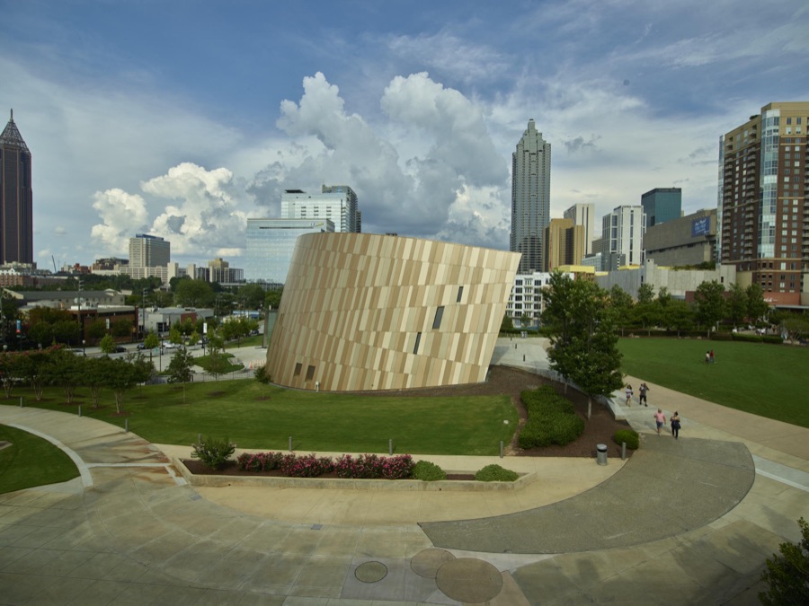
Highsmith, Carol M, 2017. Library of Congress

Highsmith, Carol M, 2017. Library of Congress
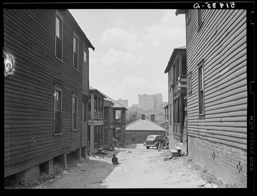
Wolcott, Marion Post, 1939. Library of Congress

Highsmith, Carol M, 2017. Library of Congress

Highsmith, Carol M, 2017. Library of Congress
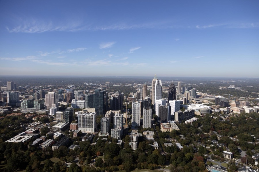
Highsmith, Carol M, 2017. Library of Congress

Evans, Walker, 1936. Library of Congress

Rothstein, Arthur, 1942. Library of Congress
Every photograph of Fulton County
Fires near this place
3 since 1998Regional context, not property-specific evidence. The federal wildfire occurrence database lists 3 fires within 5 miles of Atlanta between 1998 and 2005, burning about 15 acres in total. None started naturally. 1 was recorded as arson. Distance is straight-line from the map coordinates, so a fire counted here may appear on a neighbouring settlement's page as well.
| Reported cause | Fires |
|---|---|
| Missing data/not specified/undetermined | 1 |
| Arson/incendiarism | 1 |
| Debris and open burning | 1 |
The most recent of them, most recent first, with the day each was reported and the service that recorded it.
| Date | Cause | Size | Reported by | Name on the report |
|---|---|---|---|---|
| 23 March 2004 | Missing data/not specified/undetermined | 12 acres | Georgia Forestry Commission | not named |
| 22 March 1998 | Arson/incendiarism | 1.5 acres | Georgia Forestry Commission | not named |
| 7 November 2005 | Debris and open burning | 1.2 acres | Georgia Forestry Commission | not named |
Settlements close enough to share some of these fires:
Mines and quarries near this place
1 within 5 milesRegional context, not property-specific evidence. The federal mineral resources record lists 1 working within 5 miles of Atlanta: 1 producer. All of them still produce. What was taken out: Stone, Crushed/Broken. Distance is straight-line from the map coordinates, so a quarry counted here may appear on a neighbouring settlement's page as well.
| Where | Site | Commodity | Status | Recorded |
|---|---|---|---|---|
| Bellwood Quarry | Stone, Crushed/Broken | Producer |
Storms near this place
60 of 179 shownRegional context, not property-specific evidence. The National Weather Service names Atlanta in 179 storm reports between 1993 and 2025: 80 thunderstorm wind, 42 flash flood, 40 hail, 7 lightning. The reports record 7 deaths and 39 injuries. Each account below is quoted exactly as the forecast office filed it, from the NOAA Storm Events Database, and each date opens the federal record of that event.
| When | Event | Place named | Harm | What the report says |
|---|---|---|---|---|
| July 2003 | Thunderstorm Wind | Atlanta | 3 killed, $35,000 | The Fulton county Emergency Management Director, as well as the Atlanta-Journal Constitution, reported that a large, 100-year old oak tree fell on a Sport Utility Vehicle (SUV) stopped in traffic in the Virginia-Highland neighborhood of midtown Atlanta. Three of the four people in the vehicle were killed instantly when the tree fell on the vehicle, including a 37-year old mother and her two boys, one three years old and the other only six months old. The husband in the front seat was uninjured. There were several other reports of trees and even some power lines down during the thunderstorm which left up to 30,000 residents of Atlanta without power during the evening. |
| May 2011 | Thunderstorm Wind | Atlanta | 2 killed, $100,000 | The Fulton County Emergency Management Director and the public reported that at least a dozen trees were down across the north part of the county in the Buckhead and Sandy Springs areas. A number of roads were blocked from downed trees, especially across the northern part of the county. Two females in their 60s were killed when a large tree fell on their Mazda Miata sports car while traveling on West Paces Ferry Road at Nancy Creek Road, approximately four miles west-northwest of Buckhead. A downed tree limb on the MARTA tracks near the Arts Center Station caused delays for southbound trains. Several power lines were also down across the area with thousands of residents across the county left without power for several hours, many even into the next day. In addition, a UPS truck was set on fire when a large tree fell on the vehicle. |
| March 2008 | Tornado (EF2) | Atlanta | 1 killed, 30 hurt, $25,000,000 | A ground and aerial survey conducted by the National Weather Service Forecast Office in Peachtree City, Georgia in cooperation with the Atlanta Police Department, confirmed that an EF2 tornado tracked through the heart of the city of Atlanta causing millions of dollars of damage to buildings, including several high rise business and/or hotel buildings, within the downtown Atlanta area. The tornado also resulted in one death and 30 non-life threatening injuries. The death occurred on Decatur Street across from the Martin Luther King MARTA station.||The tornado first touched down near the intersection of Simpson and Burbank Streets in the Vine City neighborhood just west of downtown Atlanta. The tornado then tracked near due east over the center of the Georgia World Congress Center, about 100 yards north of the Georgia Dome, which was concurrently hosting an SEC basketball conference, across the CNN Omni Hotel Complex and the Phillips Arena, where an NBA basketball game was underway, across the Equitable Bank tower, across the Interstate 75/85 Downtown Connector at the Edgewood Exit, and then into the Cotton Mill Lofts across the Oakland Cemetery located near the Fulton/DeKalb county line. The tornado then weakened, but continued into extreme western DeKalb county before finally lifting for good.||The tornado had a total path length of six miles, five of which fell within Fulton county, and a maximum path width of 200 yards. Maximum wind speeds were estimated at 130 mph, which is a high end EF2. The tornado had a path width of 100 yards as it moved across the Georgia World Congress Center and CNN Omni Hotel complex and was ranked an EF1 at that point.||At least 50 homes were damaged by the tornado, as were several multi-story towers and commercial buildings near and east of Centennial Olympic Park. Windows were blown out of several of these high rise tower buildings at multiple heights. Damage in residential and industrial areas ranged from roofing materials blown from homes and businesses to trees falling on structures and vehicles. The Cotton Mill Lofts experienced some of the most significant damage with the roof blown off and exterior walls on the top or fourth floors blown inward. Two sections of the fourth flour collapsed all the way into the basement of the building, trapping several people. Most of the injuries observed were associated with this damage.||Damaged buildings and structures in the downtown Atlanta area included two Hermes 65-foot tall light towers at Centennial Olympic Park, the CNN Center/Omni Hotel, Ebenezer Baptist Church, Equitable Bank Building, Georgia-Pacific Building, Georgia World Congress Center, Grady Hospital, Jimmy Carter Presidential Library and Museum, Martin Luther King Center, Oakland Cemetery, SunTrust Building, Tabernacle, Ted's Montana Grill, Westin Peachtree Plaza Hotel, and Walton Building Barbershop.||In addition to the damage reports, a wind gust of 83 mph was measured at Atlanta Fire Station No. 13 at 447 Flat Shoals Road Southeast in Atlanta, and a wind gust of 65 mph was measured at Atlanta Fire Station No. 4 at 309 Edgewood Drive in Atlanta. |
| February 2025 | Thunderstorm Wind | Atlanta | 1 killed | Em reports a tree down on home on matilda pl nw near hortense pl nw. One fatality reported. |
| June 1996 | Thunderstorm Wind | Atlanta | 4 hurt, $5,000 | no account filed |
| May 1995 | Thunderstorm Wind | Atlanta | 3 hurt, $70,000 | Several trees were knocked down and powerlines snapped in the Buckhead area of Atlanta and in College Park. In Palmetto, three people were injured when a giant oak tree fell on their car. |
| June 2007 | Thunderstorm Wind | Atlanta | 1 hurt, $25,000 | The Fulton County Emergency Management Director reported that several trees were down around the city. One person was injured when a tree fell on their vehicle. |
| August 2012 | Lightning | Atlanta | 1 hurt | The Atlanta Fire Department reported that a man was injured when he was struck by lightning while working on the roof of the Marriott Marquis hotel on Peachtree Center Avenue. |
| April 2009 | Hail | Atlanta | $2,000,000 | The Fulton County Emergency Management Director reported that golf ball-sized hail fell at Turner Field just southeast of Atlanta. The public observed penny-sized hail on the north side of Atlanta. This was the fourth severe thunderstorm to track across Fulton county during the evening of April 23rd. |
| September 2002 | Flash Flood | Atlanta | $1,480,000 | The Fulton County Emergency Management Director reported that very heavy rain from a thunderstorm, moving southwest through the Atlanta metropolitan area, resulted in extensive flooding of homes and related property in the southwest Atlanta, East Point, and College Park areas. Rainfall in excess of 3 inches occurred in one hour or less throughout this area. The flooding was largely caused by clogged up drainage systems, trash, and other debris which collected along a fence which fell down as water pooled against it. Several homes were flooded as the result of this collapsed fence which acted much like a collapsed dam and a wall-of-water rushing downstream. Approximately 500 homes were flooded and damaged, with home damage apportioned as $956,000 in Atlanta, $134,435 in College Park, and $130,000 in East Point. Thirty-seven of these homes were declared uninhabitable by the county inspector as water rose to more than 18 inches deep in the homes and above electrical outlets, rendering them unsafe to inhabit. Water rose up to eight feet deep in one home and 4-foot deep water was common. Up to 20 residents had to be rescued by boat. More than 75% of these homes sustained major damage, deemed as in excess of $3500 damage, with the remaining 25% sustaining minor damage, deemed as in excess of $2300 but less than $3500 in damage. In addition to the damaged homes, at least a dozen cars were inundated and ruined in the flash flood and in excess of $90,000 of city and county overtime fees were required for clean up and repair. The flash flooding also resulted in numerous stranded vehicles on Interstate-75 and Interstate-20 near downtown as well as other roads in the immediate areas surrounding downtown Atlanta. Illustrating the extent of the very heavy rainfall was a rise on Peachtree Creek on the north side of Atlanta from 3 feet to in excess of 17 feet in just a couple of hours. The Governor of Georgia declared the area as a disaster area and was able to provide $1.2 million dollars of assistance to the residents affected. |
| July 2011 | Heavy Rain | Atlanta | $500,000 | The Atlanta Broadcast Media reported that heavy rainfall resulted in flooding of the downtown connector (Interstate 75/85) near the Grady Curve portion of the interstate. The flooding was largely caused by stopped up drains along the interstate. Several cars became stranded in high water between Interstate 20 and the split of Interstate 75/85 north of the city. Portions of the interstate had to be closed for approximately an hour until the drains could be cleared. In addition, the heavy rain caused damage to the roof of Grady Hospital. Water worked its way through to the floors below, as well as into the basement. Considerable damage was reported to portions of the building and medical equipment. The flooding was the result of persistent summertime afternoon thunderstorms moving from northeast to southwest across the city during the mid-afternoon hours. Rainfall of 2.0 to 2.5 inches fell in this portion of the city in the 2:30 to 3:30 pm EDT time frame. |
| May 1994 | Thunderstorm Wind | Atlanta | $500,000 | Several large trees and power lines were downed in the Buckhead area of Atlanta and in Grant and Chastain Parks near Downtown. At least 20,000 residents were without power for nearly two hours. |
| May 1993 | Hail | Atlanta | $500,000 | Golf ball-size hail damaged several vehicles over downtown Atlanta. |
| September 1996 | Tornado (F1) | Atlanta | $500,000 | no account filed |
| May 2003 | Flash Flood | Atlanta | $300,000 | The Fulton county 911 center, as well as local television news media reported that persistent thunderstorms in the hours after midnight resulted in flooding of several streets and roads in the Buckhead and Midtown Atlanta area. Several streets in the Buckhead area had to be closed. Flooding problems were also observed on Interstate 285 at Interstate 20 and on the I-75/I-85 downtown connector, as well as on several downtown Atlanta streets. A mudslide forced the closure of Northside Drive at Deering Road. More than a foot of mud was reported in the road. Another mudslide occurred adjacent to the 17th Street Bridge project and trapped two people in their vehicles. Several apartments at the Gables Cityscape in Midtown Atlanta were also flooded during the storm. In addition Peachtree and Nancy Creeks both quickly exceeded flood stage, with Peachtree Creek rising over 10 feet in less than an hour. The creek crested at 18.5 feet, which is 1.5 feet above the 17.0 foot flood stage. |
| July 2005 | Thunderstorm Wind | Atlanta | $250,000 | WXIA TV, Channel 11 of Atlanta, reported that thunderstorm winds caused considerable damage across the Atlanta metropolitan area during the early afternoon. At least a dozen large trees were blown down in the city, including North Avenue, Ponce De Leon, and Killian Boulevard. One large oak tree fell on and caused damage to two homes, one under construction on North Avenue. Another tree fell on a sidewalk near City Hall East on Ponce De Leon, a tree fell in a yard on Killian Boulevard, and a large tree fell on a building at the Hampton Oak Apartments, rendering some of the units uninhabitable. Some of the residents of these units had to be relocated because of the damage. Several power lines were also brought down by the fallen trees. Other trees were down throughout the city. |
| May 2003 | Flash Flood | Atlanta | $250,000 | Very heavy rain forced Peachtree Creek in North Atlanta to rise quickly to flood stage. The creek crested at 18.5 feet around 4 am EDT, 1.5 feet above the flood stage of 17.0 feet. Flooding of nearby roads, including Woodward Way resulted. In addition, the lower levels of several nearby apartments were also flooded. |
| September 2023 | Flash Flood | Atlanta | $200,000 | The public reported street flooding near and inundation of the Georgia Aquarium and World of Coca-Cola, forcing their temporary closure. Radar estimates indicate that between 2.5 and 3 inches of rain occurred over the area in under an hour, resulting in the flash flooding. |
| July 2013 | Thunderstorm Wind | Atlanta | $200,000 | A Philips Arena employee reported that a section of the arena roof sustained damage, resulting in the evacuation of some of the seating space. Roof debris was reported to be scattered on nearby sidewalks. No injuries were sustained. Several trees were blown down in the downtown area as well, including one onto a historic home on Beecher Street. |
| April 1996 | Thunderstorm Wind | Atlanta | $200,000 | no account filed |
| June 2011 | Lightning | Atlanta | $150,000 | The Fulton County Emergency Management Director reported that a home in west central Fulton county, just southeast of Sandtown, was struck and set on fire by lightning. The structure sustained at least moderate damage. |
| May 2009 | Thunderstorm Wind | Atlanta | $100,000 | The Fulton County Emergency Management Director reported that at least a dozen trees were down on the southwest side of Atlanta in the Childress and Adams Drive areas. A few homes in the area sustained minor to moderate damage from the downed trees. A tree was also down on the northeast side of Atlanta at Glen Arden Way and North Highland Avenue. |
| September 2009 | Flash Flood | Atlanta | $75,000 | The USGS stream gage on the South River at Hapeville in central Fulton county reached its flood stage of 15 feet at 135 pm EDT. The river remained above flood stage at this location until 536 pm EDT. One home on Macon Drive was flooded by the river. A car on Macon Drive also because submerged in water and was carried downstream. Flooding was also reported along Camp Creek near Hartsfield-Jackson Atlanta International Airport where the parking lots of several apartments were flooded. |
| April 2016 | Thunderstorm Wind | Atlanta | $70,000 | The Fulton County Emergency Manager reported a tree blown down on a house on Laurel Avenue SW with an entrapment. No injuries were reported. |
| July 2022 | Thunderstorm Wind | Atlanta | $50,000 | Large tree down on a house at intersection of Lavender Drive NW and Chappell Road NW. |
| July 2021 | Thunderstorm Wind | Atlanta | $50,000 | The Fulton County Emergency Manager reported numerous trees blown down across the Grant Park/Zoo-Atlanta, Glenwood Park, Ormewood Park and East Atlanta Village areas. |
| September 2009 | Flood | Atlanta | $50,000 | Fulton county Emergency Management personnel reported that general flooding continued for another hour or so after late morning and early afternoon flash flooding subsided. The damage was generally confined to the southern and central portion of the county. An apartment complex on Cleveland Avenue in the Hapeville area was flooded, affecting the homes of 17 people. The homes of 42 people across the county were affected by the flooding. Additional monetary damage was primarily in the form of flooded apartments. |
| August 2008 | Thunderstorm Wind | Atlanta | $50,000 | The Fulton County Emergency Management Director reported that at least a dozen trees were down just south of downtown Atlanta. Two homes on Adella Street were damaged a a result of trees that fell on the structures. |
| August 2007 | Thunderstorm Wind | Atlanta | $50,000 | The Fulton County Emergency Management Director reported that a tree was blown down onto a home near Avon and Cascade Avenues in southwest Atlanta. While there were no injuries, the home suffered significant damage. About six miles to the southeast of this location, a wind gust of 53 mph was measured by the ASOS located at the Atlanta Hartsfield-Jackson International Airport. Much of the airport and the ASOS are actually located just across the border in northern Clayton county. |
| May 1999 | Hail | Atlanta | $50,000 | Numerous large hail reports were received from the public. Sizes were mainly golf ball size with a couple of reports of hail as large as baseballs. One report said hail covered the driveway. The large hail caused damage to vehicles across the Atlanta metro area. |
| July 1995 | Thunderstorm Wind | Atlanta | $50,000 | Hartsfield International Airport reported a wind gust of 53 knots. Thunderstorm winds blew 150 pound containers onto a 727 on the tarmak, cracking the outer shell of the aircraft. At least six planes had to return to the hangars due to damage. |
| March 1996 | Thunderstorm Wind | Atlanta | $50,000 | no account filed |
| November 1997 | Flash Flood | Atlanta | $45,000 | no account filed |
| September 2023 | Flash Flood | Atlanta | $40,000 | The public reported deep, swiftly moving water in areas around the Garnett MARTA station, flooding roadways and carrying multiple vehicles in the flow. Radar estimates indicate that between 2.5 and 3 inches of rain occurred over the area in under an hour, resulting in the flash flooding. |
| May 2009 | Thunderstorm Wind | Atlanta | $35,000 | Atlanta metropolitan television stations reported that a large tree was blown down during a thunderstorm on Virginia Circle, about two miles north-northeast of downtown Atlanta. The tree fell across a power line and onto two cars. |
| July 2009 | Flash Flood | Atlanta | $30,000 | The USGS stream gage at the South Fork of Peachtree Creek reached its flood stage of 12.0 feet at 2045 EDT. The creek rose to a stage of 12.6 feet at 915 pm EDT, then fell back below flood stage at 1000 pm EDT. The Fulton County Emergency Management Director reported high water in the area. Several homes in the Virginia Highland area of far eastern Fulton county, near the DeKalb county line had flooded basements. Minor flooding was also observed along Piedmont Road slightly further north. The North Fork of Peachtree Creek rose above action stage, but did not reach flood stage during this event. |
| November 2002 | Thunderstorm Wind | Atlanta | $30,000 | The Fulton county Emergency Management Director reported that several trees were blown down in the North Atlanta and Buckhead areas. The Alpharetta/Roswell Neighbor newspaper reported that a large oak tree, covering an area of approximately 20 feet by 20 feet, literally destroyed a 150-year old two-story barn at the historic 1845 Smith Plantation in the historic Roswell District. The tree crushed the hand-split shingle roof and destroyed one side wall and the back wall. It was considered a total loss. |
| July 2022 | Thunderstorm Wind | Atlanta | $25,000 | Tree down on a house on Drewery Street NE. |
| May 2017 | Thunderstorm Wind | Atlanta | $25,000 | The local broadcast media reported trees blown down in Atlanta. One fell onto the 12th Street West Apartment Homes on 12th Street between West Peachtree Walk and Crescent Avenue another fell onto a truck on 6th Street at Durant Place. No injuries were reported. |
| June 2015 | Thunderstorm Wind | Atlanta | $25,000 | The Fulton County Emergency Manager and the local news media reported trees down along I-20 near Glenwood Avenue and in Buckhead. One tree fell on a car in Buckhead, no injuries were reported. |
| September 2010 | Thunderstorm Wind | Atlanta | $25,000 | The Georgia Institute of Technology (Georgia Tech) police department and the Atlanta Journal-Constitution reported that a large oak tree fell on the Campus Christian Fellowship building near the intersection of Fourth Street and Techwood Drive. The tree struck a transformer and a gas generator. Several blocks of the campus were left without power. Affected buildings included a dormitory and two fraternity houses. These buildings were evacuated until repairs could be made. |
| June 2009 | Thunderstorm Wind | Atlanta | $25,000 | The Fulton County Emergency Management Director reported that several trees were down in the central part of the county. Radar data indicates that most of this likely occurred between Six Flags and just northwest of East Point. A tree fell on a vehicle trapping two people inside. No injuries were reported. |
| July 2023 | Flash Flood | Atlanta | $20,000 | The public reported stalled cars from high water near Huff Road NW. Radar estimates indicate that between 3 and 4 inches of rain occurred over the area, resulting in the flash flooding. |
| June 2019 | Thunderstorm Wind | Atlanta | $20,000 | Several reports were received on social media from the Peachtree Heights neighborhood of trees and power lines blown down. A few locations include West Wesley Road NW near Habersham Road NW, Muscogee Avenue near Rivers Road, and around the duck pond at Lakeview Avenue and Parkside Drive. |
| June 2017 | Flash Flood | Atlanta | $20,000 | The Public and Broadcast Media reported flash flooding that resulted from heavy rain over the area. Flash Flooding inundated the Buford Connector near Monroe Drive and Armour Drive. Ottley Drive under the Marta service bridge was also flooded and impassable, leaving cars stranded. Radar estimates indicate that rainfall amounts of 4 to 5 inches occurred over the area. |
| June 2014 | Thunderstorm Wind | Atlanta | $20,000 | The broadcast media reported that a large tree fell on two cars. |
| July 2018 | Thunderstorm Wind | Atlanta | $15,000 | A report of trees blown down onto a house and another onto power lines was received from the Grant Park area. |
| April 2015 | Thunderstorm Wind | Atlanta | $10,000 | The Fulton County Emergency Manager reported trees blown down from Piedmont Park to Emory University and Wesley Woods. A tree was down on a power line at 10th Street and Monroe drive. Several trees were down in Wesley Woods. On the Emory University campus several trees were down, one on a fraternity house on Eagle Row Road, and power outages were reported from downed power lines. |
| July 2001 | Thunderstorm Wind | Atlanta | $10,000 | The Union City Police Department reported that a total of 16 trees were down throughout the city. The downed trees damaged four mobile homes and one house. Some of the trees were down on Interstate 85 at the Fairburn/Peachtree City exit, Georgia Highway 74. An amateur radio operator and the Fulton county 911 center also reported that several tree limbs were down on Interstate 75 near the Chattahoochee River which were impeding the flow of traffic. In addition, another tree was blown down on Cascade Road south of Adamsville. Winds were estimated by the Union City Police Department to be between 58 and 72 mph. |
| February 1999 | Thunderstorm Wind | Atlanta | $10,000 | Fulton county 911 reported trees down and power outages at Old Fairburn Road and Phaxton Road,and also at Powers Ferry and Northside Drive. |
| June 1998 | Thunderstorm Wind | Atlanta | $10,000 | Numerous trees and power lines were knocked down at Lennox Square in the Buckhead area. |
| August 1995 | Thunderstorm Wind | Atlanta | $10,000 | Thunderstorm winds knocked down numerous trees all over the city, including some which were very old and very large. Trees or limbs fell on more than 200 power lines. A tree also fell on an older automobile in Peachtree Hills. |
| April 1997 | Hail | Atlanta | $10,000 | no account filed |
| August 2023 | Thunderstorm Wind | Atlanta | $8,000 | Eight trees down in the Peoplestown area of Atlanta. |
| June 2004 | Thunderstorm Wind | Atlanta | $7,000 | The Fulton County Emergency Management Director reported that eight trees had fallen down in the Reynoldstown area of southeast Fulton county. One of the trees fell on a home on Kenyon Street Southeast causing damage to the structure. |
| October 2020 | Flash Flood | Atlanta | $5,000 | The Emergency Manager reported several inches of water inundated apartment buildings on Center Street NW, leading to evacuations. Radar estimates indicate that 3 to 5 inches of rain fell over the area, causing the flash flooding. |
| August 2014 | Thunderstorm Wind | Atlanta | $5,000 | The Emergency Manager reported numerous trees down across Fulton County. Locations included Bluefield Road at Wyland Drive, Donald Lee Hollowell Pkwy, West Wesley Road at Northside Drive, Paces Ferry Road, Mount Gilead Road at Campbellton Road, and Lucile Avenue at Lawton. |
| July 2005 | Lightning | Atlanta | $5,000 | WXIA TV, Channel 11 of Atlanta, reported that lightning strikes to two trees caused them to fall on power lines. One incident was reported on North Avenue and another in the Grove Park neighborhood. Residents of the area indicated that the tree literally exploded when it was struck by lightning. Nearly 18,000 residents of the Atlanta area were without power during the afternoon as a result of the lightning and wind damage in the area. |
| July 2005 | Flash Flood | Atlanta | $5,000 | Rainfall of four to six inches fell across much of the Atlanta Metropolitan area between 6 pm and 11 pm EDT. Official National Weather Service river gages showed that Peachtree Creek in north Atlanta reached its flood stage of 17 feet at 1020 pm EDT and Proctor Creek in southwest Atlanta reached its flood stage of 11 feet at 923 pm EDT. Peachtree Creek crested at 19.1 feet, over two feet above flood stage, at 115 am EDT July 7th. Proctor creek also rose above its flood stage and crested at 13.4 feet at 1015 pm EDT, which is over two feet above flood stage. Flooding of nearby roads and property occurs when these stages are reached, especially the 19 foot flood stage on Peachtree Creek which impacts several roads, a golf course, and several homes in the area. Repeated rounds of thunderstorms between 7 pm and 10 pm resulted in additional flooding of several streets in the Atlanta area. Atlanta's Hartsfield-Jackson International Airport recorded 5.14 inches of rain for the day, the sixth largest one-day rainfall total recorded at the location. |
| December 2004 | Thunderstorm Wind | Atlanta | $5,000 | WSB Channel 2 News of Atlanta reported that several trees and power lines were blown down by thunderstorm winds. The Fulton County 911 Center confirmed this information. |
Newspapers printed here
205,557 digitised pages16 papers published in this town, digitised by the Library of Congress and free to read: 26,003 issues, 205,557 pages. Every page is searchable, so a name or a street can be looked for directly in what the town printed about itself at the time.
| Newspaper | Published |
|---|---|
| Atlanta World | 192? to 1932 |
| The Atlanta Inquirer | 1960 to Current |
| Atlanta Semi-Weekly Journal | 1898 to 1920 |
| Atlanta Age | 1898 to 19?? |
| The Weekly Defiance | 1881 to 1889 |
| Voice of Missions | 1893 to 1900 |
| Atlanta Daily World | 1932 to Current |
| The Atlanta Constitution | 1885 to 19?? |
| Atlanta Tri-Weekly Journal | 1920 to 19?? |
| Atlanta Georgian | 1912 to 1939 |
| Weekly Jeffersonian | 1906 to 1907 |
| Watson's Weekly Jeffersonian | 1907 |
| People's Party Paper | 1891 to 1898 |
| The Presbyterian of the South : [Combining the] Southwestern Presbyterian, Central Presbyterian, Southern Presbyterian | 1909 to 1931 |
| The Golden Age | 1906 to 1920 |
| The Weekly Georgian | 1913 to 19?? |
What the paper printed
161,371 wordsFront pages of the local paper, read from the Library of Congress scans: 45 issues spread across its run from 1882 to 1922, 161,371 words in total. Each is reproduced on its own page, exactly as the recogniser returned it.
These pages read less well than anything else here, and the number is worth stating: about three words in four come through cleanly, against nine in ten for the building records. An 1896 broadsheet sets eight-point type in seven columns on microfilm, which is the hardest thing in this archive to read by machine. We tested our own recognisers against the Library's and they were not better, so the Library's text is what appears, with the wholly unreadable columns removed. Read it as a guide to what the paper covered, and follow the link to the scan before quoting anything.
| Issue | Paper | Length |
|---|---|---|
| 1909-02-10 | The Presbyterian of the South : [Combining the] Southwestern Presbyterian, Central Presbyterian, Southern Presbyterian | 199 words |
| 1909-07-28 | The Presbyterian of the South : [Combining the] Southwestern Presbyterian, Central Presbyterian, Southern Presbyterian | 206 words |
| 1909-10-13 | The Presbyterian of the South : [Combining the] Southwestern Presbyterian, Central Presbyterian, Southern Presbyterian | 612 words |
| 1922-12-27 | The Presbyterian of the South : [Combining the] Southwestern Presbyterian, Central Presbyterian, Southern Presbyterian | 1,787 words |
| 1906-04-05 | The Golden Age | 1,008 words |
| 1906-06-21 | The Golden Age | 1,054 words |
| 1906-08-30 | The Golden Age | 1,055 words |
| 1906-11-08 | The Golden Age | 1,038 words |
| 1915-04-22 | The Golden Age | 1,238 words |
| 1914-03-03 | The Weekly Georgian | 988 words |
| 1914-03-31 | The Weekly Georgian | 1,524 words |
| 1914-05-05 | The Weekly Georgian | 401 words |
| 1914-06-30 | The Weekly Georgian | 1,175 words |
| 1900-01-13 | Atlanta Age | 2,392 words |
| 1882-10-24 | The Weekly Defiance | 3,912 words |
| 1900-02-01 | Voice of Missions | 6,779 words |
| 1892-07-15 | People's Party Paper | 4,961 words |
| 1892-09-02 | People's Party Paper | 5,288 words |
| 1892-09-30 | People's Party Paper | 5,230 words |
| 1892-12-16 | People's Party Paper | 6,815 words |
| 1901-09-30 | Atlanta Semi-Weekly Journal | 8,083 words |
| 1901-10-24 | Atlanta Semi-Weekly Journal | 10,365 words |
| 1901-12-19 | Atlanta Semi-Weekly Journal | 5,666 words |
| 1920-03-05 | Atlanta Semi-Weekly Journal | 5,531 words |
| 1887-11-01 | The Atlanta Constitution | 9,091 words |
| 1887-11-29 | The Atlanta Constitution | 8,148 words |
| 1887-12-20 | The Atlanta Constitution | 8,876 words |
| 1903-12-28 | The Atlanta Constitution | 5,037 words |
| 1920-04-29 | Atlanta Tri-Weekly Journal | 6,274 words |
| 1920-06-29 | Atlanta Tri-Weekly Journal | 6,696 words |
| 1920-08-28 | Atlanta Tri-Weekly Journal | 6,327 words |
| 1920-10-28 | Atlanta Tri-Weekly Journal | 7,561 words |
| 1912-06-18 | Atlanta Georgian | 3,594 words |
| 1912-08-06 | Atlanta Georgian | 4,182 words |
| 1912-09-25 | Atlanta Georgian | 4,188 words |
| 1912-11-12 | Atlanta Georgian | 2,439 words |
| 1914-08-20 | Atlanta Georgian | 3,143 words |
| 1907-01-10 | Weekly Jeffersonian | 1,332 words |
| 1907-02-07 | Weekly Jeffersonian | 882 words |
| 1907-02-28 | Weekly Jeffersonian | 817 words |
| 1907-03-21 | Weekly Jeffersonian | 542 words |
| 1907-06-27 | Watson's Weekly Jeffersonian | 283 words |
| 1907-08-15 | Watson's Weekly Jeffersonian | 639 words |
| 1907-10-10 | Watson's Weekly Jeffersonian | 1,942 words |
| 1907-11-28 | Watson's Weekly Jeffersonian | 2,071 words |
Nearest settlements
The eight closest, with where each one stands in the county. Distances are straight-line, computed from the Geographic Names Information System coordinates.
| Map | Place | Distance | Sheets |
|---|---|---|---|
| Capitol Homes | 0.2 miles | 23 | |
| Slabtown (historical) | 0.3 miles | 24 | |
| Five Points | 0.4 miles | 24 | |
| Shermantown | 0.6 miles | 24 | |
| Snake Nation (historical) | 0.7 miles | 24 | |
| Summerhill | 0.8 miles | 23 | |
| Brooklyn | 0.9 miles | 24 | |
| Mechanicsville | 0.9 miles | 23 |
Elsewhere
Matched on this settlement's Geographic Names Information System number rather than its name, so it cannot be a different place of the same name in another state.
| Wikipedia article on Atlanta | An encyclopaedic summary. Its text is share-alike, so it is linked here rather than copied. |
| Wikidata item Q23556 | The structured record the population and elevation above come from. Public domain (CC0). |
Provenance
This settlement is recorded in the Geographic Names Information System as feature 351615. The sheet list is computed by point-in-boundary test against the United States Geological Survey's historical topographic inventory. Both are works of the United States government and carry no copyright under 17 U.S.C. 105.
Wildfire. Short, Karen C. 2022. Spatial wildfire occurrence data for the United States, 1992-2020 [FPA_FOD_20221014]. 6th Edition. Fort Collins, CO: Forest Service Research Data Archive. https://doi.org/10.2737/RDS-2013-0009.6 Collected with United States Government funding and usable without additional permissions or fees.
Mines and quarries. USGS Mineral Resources Data System (MRDS) https://mrdata.usgs.gov/mrds/ A work of the United States government, no copyright under 17 U.S.C. 105.
Storms. NOAA National Centers for Environmental Information, Storm Events Database https://www.ncei.noaa.gov/stormevents/ A work of the United States government, no copyright under 17 U.S.C. 105. Narratives are quoted verbatim from the National Weather Service report and are not edited or summarised.