 Block
Bainbridge, Georgia
12 topographic sheets cover this place, the earliest surveyed in 1954 and the latest in 1988. It stands in the Bainbridge census division. It lies in ZIP code area 39819. The Survey maps it on the Bainbridge quadrangle. 14,468 people lived here at the 2020 count. It stands 121 feet above sea level.
Research this city
On record in Bainbridge
Buildings and businesses the archive holds for this place. Each opens its own page, with the source record it came from.
On the National Register 6 records
 Bainbridge Commercial Historic Districtlisted 1987
 Bainbridge Residential Historic Districtlisted 1987
 J. W. Callahan Houselisted 1976
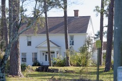 Curry Hill Plantationlisted 1973
 Decatur County Courthouselisted 1980
 First African Missionary Baptist Churchlisted 2002
Population over time
2 figuresBainbridge grew from 12,697 to 14,468 between 2010 and 2020. These are the recorded population figures Wikidata holds for this place, reached through the Geographic Names Information System number this page is keyed on rather than by name, so they belong to this place and not to another of the same name. Most are census counts, but not all are: an early figure may be a founding or settlement estimate, and an estimate published within five years of a census is left out. The change column is computed, and is left blank where more than 20 years separate a figure from the one before it, because a gap that long is not a change between two counts.
| Year | People | Change |
|---|---|---|
| 2010 | 12,697 | |
| 2020 | 14,468 | +1,771 (+14%) |
Topographic sheets covering this place
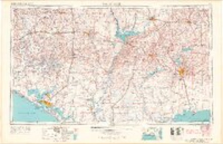
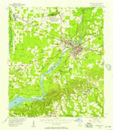
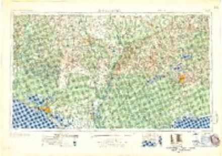
7 surveys from 12 printed sheetsMatched by testing this settlement's coordinate against the published boundary of every sheet in the United States Geological Survey's historical collection. Each opens the scanned sheet at the Survey.
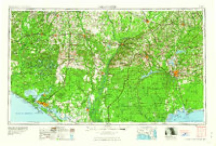
- 1954 USGS Tallahassee quadrangle1:250000, 4 printings
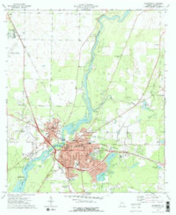
- 1955 USGS Bainbridge quadrangle1:62500
- 1959 USGS Tallahassee quadrangle1:250000
- 1960 USGS Tallahassee quadrangle1:250000
- 1974 USGS Bainbridge quadrangle1:24000, 2 printings
- 1978 USGS Bainbridge quadrangle1:100000
- 1988 USGS Tallahassee quadrangle1:250000, 2 printings
Fires near this place
573 since 1992Regional context, not property-specific evidence. The federal wildfire occurrence database lists 573 fires within 5 miles of Bainbridge between 1992 and 2020, burning about 1,089 acres in total. 12 started naturally. 75 were recorded as arson. Distance is straight-line from the map coordinates, so a fire counted here may appear on a neighbouring settlement's page as well.
| Reported cause | Fires |
|---|---|
| Debris and open burning | 417 |
| Arson/incendiarism | 75 |
| Smoking | 21 |
| Equipment and vehicle use | 14 |
| Missing data/not specified/undetermined | 14 |
| Misuse of fire by a minor | 13 |
| Natural | 12 |
| Recreation and ceremony | 5 |
| Railroad operations and maintenance | 2 |
The most recent of them, most recent first, with the day each was reported and the service that recorded it.
| Date | Cause | Size | Reported by | Name on the report |
|---|---|---|---|---|
| 9 September 1997 | Debris and open burning | under an acre | Georgia Forestry Commission | not named |
| 8 September 2016 | Debris and open burning | under an acre | Georgia Forestry Commission | FY2017-DECATUR-003 |
| 5 September 1997 | Debris and open burning | 1.1 acres | Georgia Forestry Commission | not named |
| 30 September 2016 | Debris and open burning | under an acre | Georgia Forestry Commission | FY2017-DECATUR-007 |
| 30 September 2016 | Debris and open burning | under an acre | Georgia Forestry Commission | FY2017-DECATUR-006 |
| 30 September 2016 | Debris and open burning | under an acre | Georgia Forestry Commission | FY2017-DECATUR-005 |
| 30 September 1993 | Debris and open burning | under an acre | Georgia Forestry Commission | not named |
| 29 September 2019 | Debris and open burning | under an acre | Georgia Forestry Commission | FY2020DECATUR029 |
Settlements close enough to share some of these fires:
Mines and quarries near this place
6 within 5 milesRegional context, not property-specific evidence. The federal mineral resources record lists 6 workings within 5 miles of Bainbridge: 4 producers, 2 past producers. 4 still produce. What was taken out: Sand and Gravel, Construction. Distance is straight-line from the map coordinates, so a quarry counted here may appear on a neighbouring settlement's page as well.
| Where | Site | Commodity | Status | Recorded |
|---|---|---|---|---|
| Adams Mine | Sand and Gravel, Construction | Past Producer | ||
| Flint Concrete Products | Sand and Gravel, Construction | Producer | ||
| Flint Mine No.2 | Sand and Gravel, Construction | Producer | ||
| Floyd Pit | Sand and Gravel, Construction | Past Producer | ||
| Reynolds Pit | Sand and Gravel, Construction | Producer | ||
| Rollins Pit | Sand and Gravel, Construction | Producer |
Storms near this place
60 of 91 shownRegional context, not property-specific evidence. The National Weather Service names Bainbridge in 91 storm reports between 1993 and 2026: 69 thunderstorm wind, 10 hail, 5 tornado, 3 flash flood. The reports record 2 injuries. Each account below is quoted exactly as the forecast office filed it, from the NOAA Storm Events Database, and each date opens the federal record of that event.
| When | Event | Place named | Harm | What the report says |
|---|---|---|---|---|
| February 2000 | Tornado (F1) | Bainbridge | 1 hurt, $1,000,000 | A tornado destroyed several homes, and downed trees and power lines at the intersection of CR 97 and CR 262. One person was injured by flying debris. Decatur County was declared a federal disaster area. Reported by the Decatur County EMA. |
| July 2002 | Lightning | Bainbridge | 1 hurt | A man was injured when he was struck by lightning while boating on the Flint River. Reported by Decatur County 911. |
| April 2009 | Flood | Bainbridge | $250,000 | Minor to moderate flooding was observed along the Flint River. Runoff from Twin Lakes, Lake Douglas and Slough flooded 25 mobile homes in the Slough Loop subdivision about 5 miles north of Bainbridge. |
| September 1998 | Tornado (F0) | Bainbridge | $50,000 | A brief F0 tornado touchdown just south of Bainbridge on GA 97. Some trees and power lines down. |
| May 1993 | Thunderstorm Wind | Bainbridge | $50,000 | Several large trees were toppled and power lines downed by thunderstorm winds. Georgia Power reported over 1200 customers lost power for an average of two hours. |
| August 2008 | Thunderstorm Wind | Bainbridge | $25,000 | Several trees and power lines were down. More than 1,000 residents in Bainbridge were without power. A large tree fell through the roof of an unoccupied home in the River Oaks subdivision. |
| March 2005 | Thunderstorm Wind | Bainbridge | $25,000 | A metal storage building was damaged. Numerous trees and power lines were snapped off on State Road 253. Reported by the public. |
| April 2022 | Thunderstorm Wind | Bainbridge | $20,000 | A tree fell on a vehicle on Sharpe Street at Scott Street with power lines also down. |
| May 2012 | Thunderstorm Wind | Bainbridge | $20,000 | Multiple trees were blown down across the road on Lord Avenue, Sims Street, and Progress Street. One tree fell on a house and another fell on a car. No injuries occurred. Monetary damage was estimated. |
| April 2011 | Thunderstorm Wind | West Bainbridge | $20,000 | Trees and power lines were blown down across the county. The monetary damage figure provided is a rough estimate. |
| May 1995 | Thunderstorm Wind | Bainbridge | $20,000 | Thunderstorm winds flipped a plane at the Decatur County Industrial Airport. A few trees were also reported downed in the area. |
| December 2021 | Tornado (EF0) | Bainbridge | $15,000 | An EF-0 tornado tracked through Bainbridge, GA on Wednesday afternoon, Dec 29th. The tornado first touched down just southwest of Evans St between S West St and Academy Street before uprooting a tree on Evans St. It then moved northeastward, with minor damage noted to a small apartment building on Potter St and a highway road sign knocked over on E Shotwell St. Minor tree damage and fallen branches were observed across E Broughton St, E Water St, and Planter St. The tornado then peeled back some of the metal roofing of a convenience store on the corner of E Calhoun St and Albany Rd and damaged a metal carport nearby. The tornado continued northeastward along Albany Rd, inflicting minor roof damage to a home and snapping a few tree branches before lifting just north of E Carter St. The total track of the tornado is estimated to be just under a mile with a maximum path width of 50 yards, which occurred near the start of the tornado. |
| June 2001 | Thunderstorm Wind | Bainbridge | $15,000 | Numerous trees down and a few roofs damaged. Reported by the Decatur County 911. |
| April 2023 | Thunderstorm Wind | Bainbridge | $10,000 | A tree fell onto a house on Boxwood Drive. |
| February 2021 | Thunderstorm Wind | Bainbridge | $10,000 | Trees and power lines were blown down on Russ St. A tree landed on a truck and resulted in damage to the truck. |
| June 2008 | Thunderstorm Wind | Bainbridge | $10,000 | Numerous trees and power lines were down. Scattered power outages reported in Bainbridge. |
| April 1998 | Thunderstorm Wind | Bainbridge | $10,000 | Several large trees blown into power poles with numerous power lines ablaze (approximately two miles NNE of Bainbridge). |
| November 1995 | Tornado (F1) | Bainbridge | $10,000 | A tornado touched down near Spring Creek and Airport Road causing structural damage to several residences. |
| June 2022 | Thunderstorm Wind | Bainbridge | $5,000 | Multiple trees and power lines were blown down. |
| February 2012 | Thunderstorm Wind | Bainbridge | $5,000 | Multiple trees and power lines were blown down. Monetary damage was estimated. |
| June 2011 | Thunderstorm Wind | West Bainbridge | $5,000 | Severe telephone poles and traffic signals were blown down in Bainbridge. The monetary damage figure provided is a rough estimate. |
| June 1994 | Thunderstorm Wind | Bainbridge | $5,000 | Several large oak trees were blown down along Georgia Highway 262 twelve miles northeast of Bainbridge. |
| April 2019 | Thunderstorm Wind | Bainbridge | $3,000 | Transformers were damaged on Fleming and Green Street. |
| July 2017 | Thunderstorm Wind | Bainbridge | $3,000 | Trees and power lines were blown down throughout Bainbridge. |
| May 2015 | Thunderstorm Wind | Bainbridge | $3,000 | Several trees were blown down in Bainbridge from a storm moving from southeast to northwest through the area. Trees were blown down near Shotwell and Monroe Street as well as Belcher Lane, Alday Road, and MLK Drive. The tree on MLK Drive was described as very large. |
| July 2012 | Thunderstorm Wind | Bainbridge | $3,000 | The Decatur county 911 dispatch reported several trees blown down. Monetary damage was estimated. |
| February 2012 | Thunderstorm Wind | Bainbridge | $3,000 | Trees were reported down near Black Jack Road. Monetary damage was estimated. |
| April 2006 | Thunderstorm Wind | Bainbridge | $2,500 | Shingles were blown off the roof of a house on Newton Road. Reported by Decatur County 911. |
| April 2018 | Thunderstorm Wind | Bainbridge | $2,000 | A tree was blown down onto a power line along Country Club Dr. |
| September 2015 | Thunderstorm Wind | Bainbridge | $2,000 | A tree was blown down onto power lines resulting in a power outage just south of the U.S. Highway 84 bypass. |
| July 2013 | Thunderstorm Wind | Bainbridge | $2,000 | Multiple trees were blown down in Bainbridge. |
| July 2008 | Thunderstorm Wind | Bainbridge | $2,000 | Several trees and power lines were blown down. |
| January 2006 | Thunderstorm Wind | Bainbridge | $2,000 | Decatur County 911 reported a few downed trees and power lines. |
| June 2004 | Thunderstorm Wind | Bainbridge | $2,000 | Downed trees on power lines reported by the Decatur County EMA. |
| June 2002 | Thunderstorm Wind | Bainbridge | $2,000 | Several downed trees and power lines reported by the Decatur County Sheriff. |
| May 1999 | Thunderstorm Wind | Bainbridge | $2,000 | Decatur County S.O. reported a large tree and a few power poles down on Martin Dr off SR 253. |
| June 1997 | Thunderstorm Wind | Bainbridge | $2,000 | no account filed |
| November 2011 | Thunderstorm Wind | Bainbridge | $1,500 | Trees were blown down near 267 N Pelham Road. Monetary damage was estimated. |
| November 2014 | Thunderstorm Wind | Bainbridge | $1,000 | A few trees were blown down at Country Club Road. |
| August 2013 | Thunderstorm Wind | Bainbridge | $1,000 | Two trees were blown down. |
| February 2007 | Thunderstorm Wind | Bainbridge | $1,000 | The Decatur County 911 dispatcher reported several trees down in Vada. |
| April 2003 | Thunderstorm Wind | Bainbridge | $1,000 | Downed trees just east of the Decatur County airport. Reported by a commercial pilot. |
| July 2002 | Thunderstorm Wind | Bainbridge | $1,000 | Downed trees reported by Decatur County 911. |
| July 2002 | Thunderstorm Wind | Bainbridge | $1,000 | Several downed trees reported by Decatur 911. |
| June 2000 | Thunderstorm Wind | Bainbridge | $1,000 | Numerous trees down. Reported by the Decatur County EMA. |
| June 1999 | Thunderstorm Wind | Bainbridge | $1,000 | Public reported several trees down. |
| June 1995 | Thunderstorm Wind | Bainbridge | $1,000 | Thunderstorm winds associated with Tropical Storm Allison knocked down several trees and powerlines within Bainbridge. |
| June 2007 | Thunderstorm Wind | Bainbridge | $500 | Several trees were down along State Highway 97. |
| June 2002 | Thunderstorm Wind | Bainbridge | $500 | Several downed trees reported by Decatur/Grady 911. |
| February 2008 | Thunderstorm Wind | Bainbridge | $250 | A few trees and power lines were knocked down near Dothan Road. |
| December 2007 | Thunderstorm Wind | Bainbridge | $250 | There were several large trees down on State Road 309. |
| August 2000 | Thunderstorm Wind | Bainbridge | $200 | A few trees down. Reported by Decatur County 911. |
| April 2023 | Hail | West Bainbridge | - | There were multiple reports of pea to quarter size hail from west of Bainbridge. |
| April 2023 | Thunderstorm Wind | Bainbridge | - | A tree was blown down at 141 Nebo Church Road. |
| April 2023 | Tornado (EF1) | Bainbridge | - | A brief tornado developed near Lake Douglas road and moved rapidly east, crossing Alday Road before dissipating in a heavily wood area. Convergent tree damage was used to differentiate the tornado track from widespread straight-line wind damage surrounding the path. No structural damage was noted, but the tree damage was supportive of an EF1 rating with maximum winds of 100 to 105 mph. |
| April 2023 | Thunderstorm Wind | Bainbridge | - | A tree was blown down onto Martin Luther King Jr Road. |
| June 2023 | Thunderstorm Wind | West Bainbridge | - | Numerous trees were blown down across Decatur county. |
| June 2023 | Thunderstorm Wind | West Bainbridge | - | The City of Bainbridge Boat Basin Weatherstem gusted to 71 mph. |
| June 2023 | Thunderstorm Wind | West Bainbridge | - | A tree was blown down near Miller Ave and Lake Dr. |
| June 2023 | Thunderstorm Wind | West Bainbridge | - | A tree was blown down near Copeland St and Martin St. |
Nearest settlements
The eight closest, with where each one stands in the county. Distances are straight-line, computed from the Geographic Names Information System coordinates.
| Map | Place | Distance | Sheets |
|---|---|---|---|
| West Bainbridge | 1.5 miles | 12 | |
| Hanover | 4.7 miles | 11 | |
| Lynn | 5.7 miles | 12 | |
| Mount Pleasant | 6.2 miles | 12 | |
| Otisco | 6.8 miles | 12 | |
| Ausmac | 6.9 miles | 12 | |
| Fowlstown | 7.1 miles | 11 | |
| Cyrene | 7.4 miles | 11 |
Elsewhere
Matched on this settlement's Geographic Names Information System number rather than its name, so it cannot be a different place of the same name in another state.
| Wikipedia article on Bainbridge | An encyclopaedic summary. Its text is share-alike, so it is linked here rather than copied. |
| Wikidata item Q788794 | The structured record the population and elevation above come from. Public domain (CC0). |
Provenance
This settlement is recorded in the Geographic Names Information System as feature 354431. The sheet list is computed by point-in-boundary test against the United States Geological Survey's historical topographic inventory. Both are works of the United States government and carry no copyright under 17 U.S.C. 105.
Wildfire. Short, Karen C. 2022. Spatial wildfire occurrence data for the United States, 1992-2020 [FPA_FOD_20221014]. 6th Edition. Fort Collins, CO: Forest Service Research Data Archive. https://doi.org/10.2737/RDS-2013-0009.6 Collected with United States Government funding and usable without additional permissions or fees.
Mines and quarries. USGS Mineral Resources Data System (MRDS) https://mrdata.usgs.gov/mrds/ A work of the United States government, no copyright under 17 U.S.C. 105.
Storms. NOAA National Centers for Environmental Information, Storm Events Database https://www.ncei.noaa.gov/stormevents/ A work of the United States government, no copyright under 17 U.S.C. 105. Narratives are quoted verbatim from the National Weather Service report and are not edited or summarised.