 Block
Barretts, Georgia
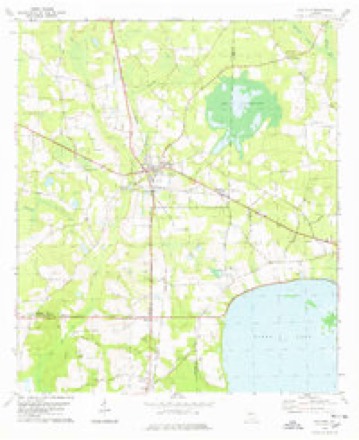
8 topographic sheets cover this place, the earliest surveyed in 1953 and the latest in 1988. It stands in the Barretts census division. It lies in ZIP code area 31645. The Survey maps it on the Ray City quadrangle.
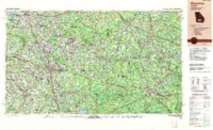
Topographic sheets covering this place
5 surveys from 8 printed sheetsMatched by testing this settlement's coordinate against the published boundary of every sheet in the United States Geological Survey's historical collection. Each opens the scanned sheet at the Survey.
- 1953 USGS Waycross quadrangle1:250000, 2 printings
- 1958 USGS Waycross quadrangle1:250000, 2 printings
- 1978 USGS Ray City quadrangle1:24000
- 1979 USGS Moultrie quadrangle1:100000, 2 printings
- 1988 USGS Waycross quadrangle1:250000
Fires near this place
304 since 1992Regional context, not property-specific evidence. The federal wildfire occurrence database lists 304 fires within 5 miles of Barretts between 1992 and 2020, burning about 1,096 acres in total. 15 started naturally. 27 were recorded as arson. Distance is straight-line from the map coordinates, so a fire counted here may appear on a neighbouring settlement's page as well.
| Reported cause | Fires |
|---|---|
| Debris and open burning | 223 |
| Arson/incendiarism | 27 |
| Equipment and vehicle use | 20 |
| Natural | 15 |
| Smoking | 6 |
| Misuse of fire by a minor | 4 |
| Missing data/not specified/undetermined | 3 |
| Railroad operations and maintenance | 3 |
| Recreation and ceremony | 3 |
The most recent of them, most recent first, with the day each was reported and the service that recorded it.
| Date | Cause | Size | Reported by | Name on the report |
|---|---|---|---|---|
| 7 September 1997 | Debris and open burning | under an acre | Georgia Forestry Commission | not named |
| 6 September 1999 | Debris and open burning | 1.7 acres | Georgia Forestry Commission | not named |
| 4 September 1995 | Debris and open burning | under an acre | Georgia Forestry Commission | not named |
| 26 September 2008 | Debris and open burning | under an acre | Georgia Forestry Commission | not named |
| 25 September 1999 | Debris and open burning | under an acre | Georgia Forestry Commission | not named |
| 23 September 2002 | Debris and open burning | under an acre | Georgia Forestry Commission | FY2003-LANIER-008 |
| 18 September 2004 | Arson/incendiarism | under an acre | Georgia Forestry Commission | not named |
| 16 September 2018 | Natural | under an acre | Georgia Forestry Commission | FY2019BERRIEN001 |
Settlements close enough to share some of these fires:
Storms near this place
17 since 2009Regional context, not property-specific evidence. The National Weather Service names Barretts in 17 storm reports between 2009 and 2025: 11 thunderstorm wind, 1 flood, 1 funnel cloud, 1 hail. No death or injury is recorded in these reports. Each account below is quoted exactly as the forecast office filed it, from the NOAA Storm Events Database, and each date opens the federal record of that event.
| When | Event | Place named | Harm | What the report says |
|---|---|---|---|---|
| April 2009 | Flood | Barretts | $2,500,000 | Moderate to major flooding along the Withlacoochee River north of Valdosta closed Franklinville Road and Little River Road, as well as several bridges. At least 100 homes were flooded. |
| March 2012 | Tornado (EF2) | Barretts | $250,000 | An NWS Storm Survey confirmed that an EF2 tornado occurred in Lowndes county, then moved into Lanier county where it strengthened into an EF3 with maximum winds around 140 mph. The path width was estimated to be around 390 yards wide with a path length in Lowndes county of slightly over 4 miles long. In Lowndes county, the tornado likely initially developed along Cat Creek Road. Several reports were received of funnels from this location while the event was ongoing. There was a house near Cat Creek Road that had uprooted trees on the property with one or two impacting the house. Trees were generally blown down to the northeast, although a street sign was bent to the ground facing to the northwest. A few trees were also blown down along a tree line across the road. At that point, the tornado entered a more heavily forested area with no access roads. However, an aerial flyover by emergency management confirmed sporadic tree damage and a continuous damage path in that area. After the tornado cleared this forested area, the damage path began to widen and the tornado damage increased in intensity. Along Arapaho Trail, about a half mile south of Highway 122, the first instance of EF2 damage occurred as a mobile home was completely destroyed with debris blown downstream, mainly into fencing on the property. Also in this location, a shed was completely destroyed, a camper was flipped, part of the roof of a house was removed, and a silo was destroyed with the debris found resting on the opposite side of the house from where it started. Debris from locations along Arapaho Trail were found well downstream, in some cases at least one third of a mile. Along the next cross street - Peters Road - mostly EF1 damage was observed with snapped and uprooted trees and some broken windows in houses. The survey team found a tree sitting on the ground with a root ball at the end, but could not locate the hole or source of the tree within at least several hundred yards. Along Peters Road gouges were observed in the ground as some debris began to impact the ground. As the tornado crossed Bemiss Road (Highway 125) near Walkers Crossing, the damage path began to reach its widest phase. The maximum width of the tornado was estimated to be around 390 yards or 0.22 miles based on the damage survey. Additional EF2 damage was observed on both sides of the road with wooden power poles snapped, hardwood trees snapped or uprooted, and several homes damaged. A second abandoned home was pushed six feet off the concrete foundation. Maximum winds along this part of Bemiss Road were estimated to be around 125 mph based on damage. Also near these homes, there were deep gouges in the ground, including this one that was close to 1 foot deep and 6 feet long. Large debris also continued to be found along the damage path, including strips of metal that were twisted around damaged trees. The tornado then continued east-northeast, crossing Highway 122 near Barber Road into Lanier county. The Lowndes county emergency manager estimated property damage for Lowndes county at around $250,000 with an additional $100,000 in crop damage from fallen pecan trees. |
| August 2023 | Flash Flood | Barretts | $50,000 | The road was washed out due to flash flooding near the intersection of Flatswood Lane and Cooper Road. |
| July 2009 | Thunderstorm Wind | Barretts | $20,000 | Numerous trees were down on several roads. A few homes sustained minor damage from fallen utility poles. |
| July 2014 | Thunderstorm Wind | Barretts | $10,000 | Ten trees were blown down along with several power lines near Bemiss Road. A structure fire also occurred. Monetary damage was estimated. |
| August 2019 | Lightning | Barretts | $5,000 | One house was struck by lightning in the northern part of Lowndes county. |
| May 2022 | Thunderstorm Wind | Barretts | $3,000 | Several trees and power lines were blown down near Hahira. |
| July 2014 | Thunderstorm Wind | Barretts | $1,000 | A tree was blown down on a power line on Skipper Bridge Road east of Staten Road. This report was relayed via Twitter from WALB-TV. |
| June 2012 | Thunderstorm Wind | Barretts | $1,000 | A tree blew down and blocked Bemiss Road. Monetary damage was estimated. |
| June 2025 | Thunderstorm Wind | Barretts | - | A tree was down at Quarterman Road and Hambrick Road. |
| April 2021 | Thunderstorm Wind | Barretts | - | A tree was blown down at 5200 Beatty Road. |
| February 2020 | Thunderstorm Wind | Barretts | - | A tree was blown down near the intersection of New Bethel Road and Barretts Road. |
| February 2020 | Thunderstorm Wind | Barretts | - | A tree was blown d own near Highway 122 East and Pinelake Circle. |
| February 2020 | Thunderstorm Wind | Barretts | - | A tree was blown down near Highway 122 East and Cheyenne Way. |
| July 2020 | Thunderstorm Wind | Barretts | - | A tree was blown down onto power lines near Bemiss and New Bethel Road. |
| March 2012 | Funnel Cloud | Barretts | - | A funnel cloud was spotted by the public near Cat Creek Road. This funnel touched down and became a significant tornado that moved through northeast Lowndes and Lanier counties. |
| March 2012 | Hail | Barretts | - | The public estimated hail up to golf ball size on Bemiss Road north of Moody AFB. Most stones were quarter size but a few were golf ball. This hail occurred with the same supercell that spawned a significant tornado in northeastern Lowndes and Lanier counties. |
Nearest settlements
The eight closest, with where each one stands in the county. Distances are straight-line, computed from the Geographic Names Information System coordinates.
| Map | Place | Distance | Sheets |
|---|---|---|---|
| Seaford (historical) | 3.0 miles | 6 | |
| Franklinville | 4.6 miles | 9 | |
| Bemiss | 5.2 miles | 6 | |
| Academy Acres | 7.8 miles | 6 | |
| Chapman (historical) | 8.2 miles | 6 | |
| Cherry Creek Hills | 8.3 miles | 9 | |
| Delmar | 8.7 miles | 6 | |
| Schoer Estates | 8.7 miles | 9 |
Provenance
This settlement is recorded in the Geographic Names Information System as feature 310827. The sheet list is computed by point-in-boundary test against the United States Geological Survey's historical topographic inventory. Both are works of the United States government and carry no copyright under 17 U.S.C. 105.
Wildfire. Short, Karen C. 2022. Spatial wildfire occurrence data for the United States, 1992-2020 [FPA_FOD_20221014]. 6th Edition. Fort Collins, CO: Forest Service Research Data Archive. https://doi.org/10.2737/RDS-2013-0009.6 Collected with United States Government funding and usable without additional permissions or fees.
Storms. NOAA National Centers for Environmental Information, Storm Events Database https://www.ncei.noaa.gov/stormevents/ A work of the United States government, no copyright under 17 U.S.C. 105. Narratives are quoted verbatim from the National Weather Service report and are not edited or summarised.