 Block
Blairsville, Georgia
23 topographic sheets cover this place, the earliest surveyed in 1886 and the latest in 1988. It stands in the Blairsville census division. It lies in ZIP code area 30512. It stands on Little Creek. The Survey maps it on the Blairsville quadrangle. 616 people lived here at the 2020 count. It stands 1,883 feet above sea level.
Research this city
On record in Blairsville
Buildings and businesses the archive holds for this place. Each opens its own page, with the source record it came from.
On the National Register 5 records
 Nottely Hydroelectric Projectlisted 2017
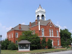 Old Union County Courthouselisted 1980
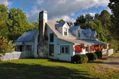 Raburn-Casteel Houselisted 2001
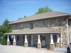 Union County Jaillisted 1985
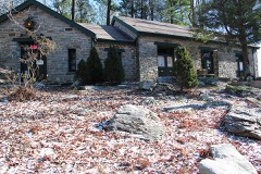 Walasi-Yi Innlisted 1979
Surveyed buildings and structures 1 record
- Smith Bridge, Spanning Nottely River on Dooley Road (County Road 83), Blairsvillefederal building survey, 6 photographs
Population over time
2 figuresBlairsville fell from 652 to 616 between 2010 and 2020. These are the recorded population figures Wikidata holds for this place, reached through the Geographic Names Information System number this page is keyed on rather than by name, so they belong to this place and not to another of the same name. Most are census counts, but not all are: an early figure may be a founding or settlement estimate, and an estimate published within five years of a census is left out. The change column is computed, and is left blank where more than 20 years separate a figure from the one before it, because a gap that long is not a change between two counts.
| Year | People | Change |
|---|---|---|
| 2010 | 652 | |
| 2020 | 616 | -36 (-6%) |
Topographic sheets covering this place
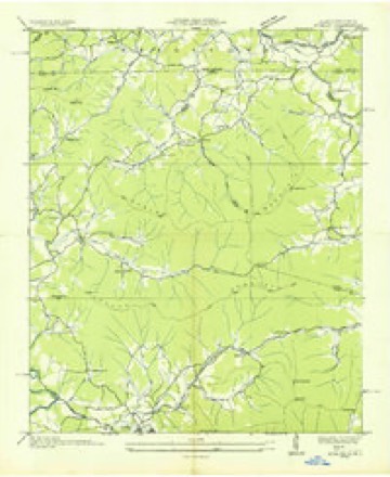
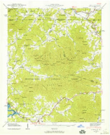
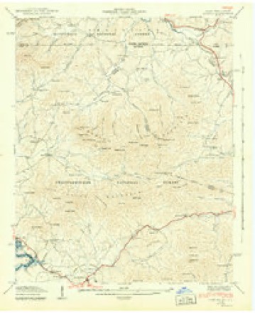
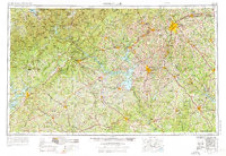
12 surveys from 23 printed sheetsMatched by testing this settlement's coordinate against the published boundary of every sheet in the United States Geological Survey's historical collection. Each opens the scanned sheet at the Survey.
- 1886 USGS Dahlonega quadrangle1:125000
- 1892 USGS Dahlonega quadrangle1:125000, 2 printings
- 1896 USGS Dahlonega quadrangle1:125000
- 1903 USGS Dahlonega quadrangle1:125000, 5 printings
- 1935 USGS Gumlog quadrangle1:24000
- 1941 USGS Gumlog quadrangle1:24000, 2 printings
- 1942 USGS Gumlog quadrangle1:24000, 2 printings
- 1954 USGS Greenville quadrangle1:250000, 3 printings
- 1958 USGS Greenville quadrangle1:250000
- 1966 USGS Blairsville quadrangle1:24000, 2 printings
- 1981 USGS Toccoa quadrangle1:100000, 2 printings
- 1988 USGS Blairsville quadrangle1:24000
Photographs
3 photographs, 2017Taken for the Office of War Information and the Farm Security Administration, who photographed the country between 1935 and 1944. Works of United States government photographers, with no known restriction on use. Each opens its catalogue record.
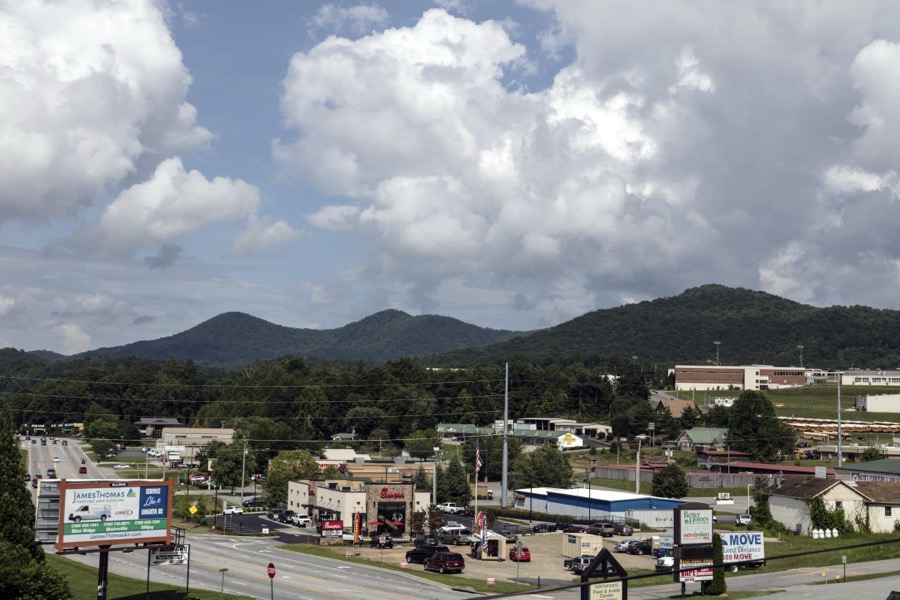
Highsmith, Carol M, 2017. Library of Congress
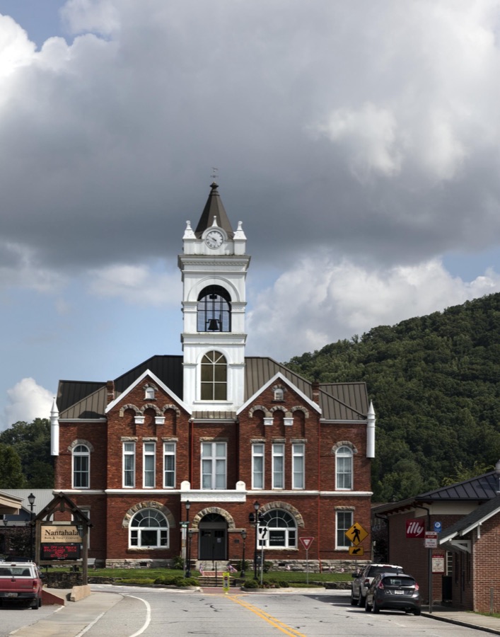
Highsmith, Carol M, 2017. Library of Congress
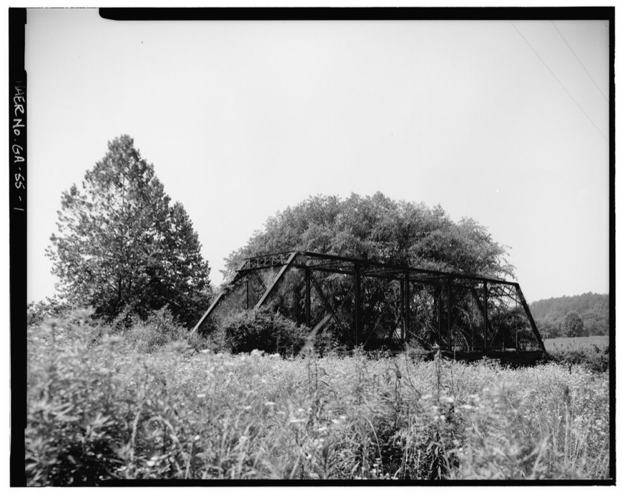
Photographer not recorded. Library of Congress
Fires near this place
371 since 1992Regional context, not property-specific evidence. The federal wildfire occurrence database lists 371 fires within 5 miles of Blairsville between 1992 and 2020, burning about 403 acres in total. 3 started naturally. 16 were recorded as arson. Distance is straight-line from the map coordinates, so a fire counted here may appear on a neighbouring settlement's page as well.
| Reported cause | Fires |
|---|---|
| Debris and open burning | 269 |
| Missing data/not specified/undetermined | 44 |
| Arson/incendiarism | 16 |
| Smoking | 14 |
| Equipment and vehicle use | 13 |
| Recreation and ceremony | 6 |
| Misuse of fire by a minor | 5 |
| Natural | 3 |
| Power generation/transmission/distribution | 1 |
The most recent of them, most recent first, with the day each was reported and the service that recorded it.
| Date | Cause | Size | Reported by | Name on the report |
|---|---|---|---|---|
| 8 September 1998 | Debris and open burning | under an acre | Georgia Forestry Commission | not named |
| 7 September 1998 | Debris and open burning | under an acre | Chattahoochee-Oconee National Forest | COLWELL ROAD |
| 4 September 1999 | Debris and open burning | 2.2 acres | Georgia Forestry Commission | not named |
| 4 September 1998 | Missing data/not specified/undetermined | under an acre | Chattahoochee-Oconee National Forest | IVY LOG GAP |
| 30 September 2008 | Debris and open burning | under an acre | Georgia Forestry Commission | not named |
| 26 September 1999 | Recreation and ceremony | under an acre | Georgia Forestry Commission | not named |
| 24 September 2008 | Debris and open burning | under an acre | Georgia Forestry Commission | not named |
| 20 September 1997 | Debris and open burning | under an acre | Georgia Forestry Commission | not named |
Settlements close enough to share some of these fires:
Mines and quarries near this place
10 of 11 shownRegional context, not property-specific evidence. The federal mineral resources record lists 11 workings within 5 miles of Blairsville: 7 past producers, 2 unknowns, 1 producer, 1 prospect. 1 still produces. What was taken out: Gold, Stone, Crushed/Broken, Corundum. Distance is straight-line from the map coordinates, so a quarry counted here may appear on a neighbouring settlement's page as well.
| Where | Site | Commodity | Status | Recorded |
|---|---|---|---|---|
| Track Rock Corundum Mine | Corundum | Past Producer | ||
| Wellborn Mountain Quarry | Stone, Crushed/Broken | Producer | ||
| Butt Mine | Gold | Past Producer | Vein | |
| Coosa Creek Gold Mine | Gold | Past Producer | ||
| Coosa Creek Placer Mine | Gold | Past Producer | Placer | |
| Crumley Creek | Gold | Past Producer | Placer | |
| Killian Mine | Gold | Past Producer | Vein | |
| Legal Tender Mine | Gold | Prospect | Vein | |
| Lot 184 Mine | Gold | Unknown | Vein | |
| Ross Mine | Gold | Unknown | Vein |
Storms near this place
40 since 1994Regional context, not property-specific evidence. The National Weather Service names Blairsville in 40 storm reports between 1994 and 2024: 16 hail, 13 thunderstorm wind, 4 flash flood, 4 lightning. No death or injury is recorded in these reports. Each account below is quoted exactly as the forecast office filed it, from the NOAA Storm Events Database, and each date opens the federal record of that event.
| When | Event | Place named | Harm | What the report says |
|---|---|---|---|---|
| June 1994 | Tornado (F1) | Blairsville | $500,000 | A weak tornado briefly touched down 10 miles west of Blairsville along U.S Highway 76 and skipped east then lifted about six miles west of Blairsville. Three to four homes were severely damaged and several large trees were either uprooted or snapped midway. |
| May 2011 | Hail | Blairsville | $385,000 | The Union County 911 Center reported that tennis ball-sized hail fell across the northwest part of the county between Jones Creek and Ivy Log. |
| April 2011 | Thunderstorm Wind | Blairsville | $300,000 | The Union County Emergency Management Director reported that hundreds of trees and dozens of power lines were down throughout the county. Four homes sustained minor to moderate damage from downed trees. Fifty-four roads were closed, at least temporarily, from downed trees. Much of the county was left without power for many hours. The public reported that at least nine trees were down in the far western part of the county near the Fannin county line at a private residence. Two of the trees fell on the home resulting in major damage to the structure. |
| April 2013 | Flash Flood | Blairsville | $100,000 | County officials reported that Anderson and Coosa Creeks flooded the Mountain Oak Cabins and Campground area around 3.5 miles southwest of Blairsville. The RV park was flooded in low lying areas with a few vacation homes inundated with water. A few culverts were washed out. The Youngcane and Jones Creeks flooded portions of Byers Road around 7 miles west of Blairsville. The flood waters topped the bridge and caused erosion damage to it. |
| March 1997 | Thunderstorm Wind | Blairsville | $60,000 | no account filed |
| June 1994 | Tornado (F1) | Blairsville | $50,000 | A weak tornado briefly touched down six miles south of Blairsville on Georgia Highway 129. Two to three homes received roof and window damage while several large trees were uprooted. |
| October 2020 | Flash Flood | Blairsville | $25,000 | Pappy's Trading Post published photos to their social media site of their property and nearby areas inundated by the Nottely River. The USGS river gage downstream reported the Nottely River rose to Minor Flood Stage, cresting at 14.68 feet. Radar estimates indicate that 4 to 6 inches of rain occurred in the area, resulting in the flash flooding. |
| July 2018 | Thunderstorm Wind | Blairsville | $25,000 | The Union County Emergency Manager reported more than two dozen trees blown down across the county, mainly south and east of Blairsville to the Union/White county line. |
| May 2011 | Lightning | Blairsville | $25,000 | The Union County reported that lightning struck a structure on Everett Box Drive in Blairsville causing damage to the structure. Specific damages were not provided. |
| May 2011 | Thunderstorm Wind | Blairsville | $25,000 | The Union County 911 Center reported that a tree was down on a home on Jones Creek Road in the west part of the county near Jones Creek. |
| April 2011 | Lightning | Blairsville | $25,000 | The Union County Emergency Management Director reported that there were two lightning-related structural fires in the county. No specific details regarding damages were provided. |
| March 2017 | Thunderstorm Wind | Blairsville | $9,000 | The Union County Emergency Manager reported trees and power lines blown down across the eastern portion of the county from around Town Mountain Road, Trackrock Gap Road, and Town Creek School Road to around the intersection of Wolf Creek Road and Earney Road. |
| June 2007 | Lightning | Blairsville | $5,000 | The Union County Emergency Management Director reported that lightning struck three structures in the city, including the 911 center. Damage there was confined mainly to electronic equipment. Minor damage occurred to the other structures. In addition to the lightning, pea-sized hail fell for up to five minutes in the city. |
| May 2003 | Flash Flood | Blairsville | $5,000 | The Union county 911 center reported that a road had become impassable because of rushing water across the road, while another road was closed because a bridge had become impassable with water flowing over the bridge. |
| July 2002 | Lightning | Blairsville | $5,000 | The public reported that lightning set a house on fire. No injuries were reported and damage estimates were not provided. |
| July 2011 | Thunderstorm Wind | Blairsville | $3,000 | The Union County 911 Center reported that several trees were down along U.S. Highway 76 west of Blairsville. |
| May 2002 | Thunderstorm Wind | Blairsville | $2,000 | The Union county 911 center reported that several trees were down. |
| July 1997 | Thunderstorm Wind | Blairsville | $2,000 | Several trees and power lines were knocked down by thunderstorm winds. |
| July 2024 | Thunderstorm Wind | Blairsville | $1,000 | A tree was downed on Rich Gap Rd between Owl Creek Rd and Lower Owltown Rd. |
| July 2004 | Thunderstorm Wind | Blairsville | $1,000 | The Union County 911 center reported that a few trees were blown down near the Tennessee border. |
| August 2004 | Thunderstorm Wind | Blairsville | $1,000 | The Union County 911 Center reported that several trees had been blown down. |
| July 2002 | Thunderstorm Wind | Blairsville | $1,000 | The Union county 911 center and the public reported that at least four trees were blown down by thunderstorm winds. |
| June 1998 | Thunderstorm Wind | Blairsville | $500 | The Union county 911 office reported 2 trees were blown down. |
| June 2011 | Hail | Blairsville | - | The Union County Emergency Management Director reported nickel-sized hail northeast of Blairsville. WSR-88D radar data suggests that similar-sized hail likely continued as the storm moved southwest toward Gaddistown and the Fannin county border. |
| June 2009 | Hail | Blairsville | - | The public observed nickel-sized hail near Blairsville. |
| August 2007 | Hail | Blairsville | - | The public observed penny-sized hail in the northwestern part of the county. Some three inch diameter limbs were also down in the area. |
| April 2006 | Hail | Blairsville | - | The public reported nickel-sized hail near U.S. Highway 76 and the Fannin county line. |
| May 2006 | Hail | Blairsville | - | The public reported golf ball-sized hail three miles north of Jones Creek at a public store along U.S. Highway 76 west of Blairsville. The hail storm, albeit to a lesser degree, continued to move southward across the west central part of the county. |
| February 2005 | Hail | Blairsville | - | The public reported penny-sized hail. |
| May 2004 | Hail | Blairsville | - | The Union County 911 center reported that dime to nickel-sized hail covered the ground. |
| May 2004 | Hail | Blairsville | - | The public reported that penny-sized hail fell for 5 minutes. |
| May 2004 | Hail | Blairsville | - | The public reported that hail, ranging in size from dimes to quarters, fell off and on for a period of nearly 30 minutes, covering the ground. The penny to quarter-sized hail was confined to about a five minute period at the beginning of the event. |
| April 2003 | Hail | Blairsville | - | The public reported quarter-sized hail. |
| July 2002 | Hail | Blairsville | - | The Union county 911 center reported golf ball size hail and the public reported nickel size hail. |
| July 2002 | Flood | Blairsville | - | The Union county 911 center reported that Ivy Log Creek had risen out of its banks. |
| May 1999 | Hail | Blairsville | - | Union county 911 reported quarter size hail just west of Blairsville. |
| May 1999 | Hail | Blairsville | - | Reports from a spotter and the public indicated quarter size hail. |
| January 1996 | Flash Flood | Blairsville | - | no account filed |
| June 1995 | Hail | Blairsville | - | no account filed |
| June 1995 | Hail | Blairsville | - | no account filed |
Nearest settlements
The eight closest, with where each one stands in the county. Distances are straight-line, computed from the Geographic Names Information System coordinates.
| Map | Place | Distance | Sheets |
|---|---|---|---|
| Youngstown | 1.1 miles | 23 | |
| Pleasant Hill | 1.9 miles | 23 | |
| Canal Lake | 2.5 miles | 23 | |
| Notalee Orchards | 2.5 miles | 23 | |
| Otto (historical) | 4.1 miles | 23 | |
| Caldwell (historical) | 4.2 miles | 23 | |
| Pleasant Grove | 4.2 miles | 23 | |
| Spile | 4.2 miles | 23 |
Elsewhere
Matched on this settlement's Geographic Names Information System number rather than its name, so it cannot be a different place of the same name in another state.
| Wikipedia article on Blairsville | An encyclopaedic summary. Its text is share-alike, so it is linked here rather than copied. |
| Wikidata item Q579734 | The structured record the population and elevation above come from. Public domain (CC0). |
Provenance
This settlement is recorded in the Geographic Names Information System as feature 331184. The sheet list is computed by point-in-boundary test against the United States Geological Survey's historical topographic inventory. Both are works of the United States government and carry no copyright under 17 U.S.C. 105.
Wildfire. Short, Karen C. 2022. Spatial wildfire occurrence data for the United States, 1992-2020 [FPA_FOD_20221014]. 6th Edition. Fort Collins, CO: Forest Service Research Data Archive. https://doi.org/10.2737/RDS-2013-0009.6 Collected with United States Government funding and usable without additional permissions or fees.
Mines and quarries. USGS Mineral Resources Data System (MRDS) https://mrdata.usgs.gov/mrds/ A work of the United States government, no copyright under 17 U.S.C. 105.
Storms. NOAA National Centers for Environmental Information, Storm Events Database https://www.ncei.noaa.gov/stormevents/ A work of the United States government, no copyright under 17 U.S.C. 105. Narratives are quoted verbatim from the National Weather Service report and are not edited or summarised.