 Block
Bonaire, Georgia
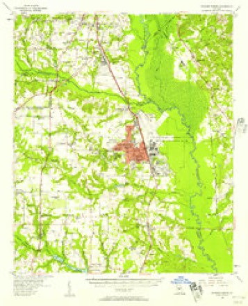
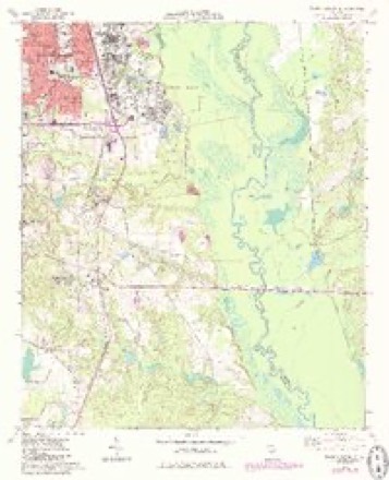
11 topographic sheets cover this place, the earliest surveyed in 1956 and the latest in 1988. It stands in the Warner Robins census division. It lies in ZIP code area 31005. The Survey maps it on the Warner Robins SE quadrangle. It stands 348 feet above sea level.
Topographic sheets covering this place
7 surveys from 11 printed sheetsMatched by testing this settlement's coordinate against the published boundary of every sheet in the United States Geological Survey's historical collection. Each opens the scanned sheet at the Survey.
- 1956 USGS Warner Robins quadrangle1:62500, 2 printings
- 1957 USGS Macon quadrangle1:250000
- 1958 USGS Macon quadrangle1:250000
- 1964 USGS Macon quadrangle1:250000, 2 printings
- 1973 USGS Warner Robins SE quadrangle1:24000, 2 printings
- 1978 USGS Macon quadrangle1:100000, 2 printings
- 1988 USGS Macon quadrangle1:250000
Fires near this place
281 since 1992Regional context, not property-specific evidence. The federal wildfire occurrence database lists 281 fires within 5 miles of Bonaire between 1992 and 2019, burning about 754 acres in total. 9 started naturally. 47 were recorded as arson. Distance is straight-line from the map coordinates, so a fire counted here may appear on a neighbouring settlement's page as well.
| Reported cause | Fires |
|---|---|
| Debris and open burning | 106 |
| Misuse of fire by a minor | 59 |
| Arson/incendiarism | 47 |
| Equipment and vehicle use | 20 |
| Missing data/not specified/undetermined | 15 |
| Recreation and ceremony | 13 |
| Smoking | 9 |
| Natural | 9 |
| Railroad operations and maintenance | 3 |
The most recent of them, most recent first, with the day each was reported and the service that recorded it.
| Date | Cause | Size | Reported by | Name on the report |
|---|---|---|---|---|
| 6 September 1997 | Smoking | under an acre | Georgia Forestry Commission | not named |
| 6 September 1997 | Arson/incendiarism | 1.1 acres | Georgia Forestry Commission | not named |
| 30 September 2003 | Debris and open burning | under an acre | Georgia Forestry Commission | not named |
| 18 September 2019 | Debris and open burning | 2.8 acres | Georgia Forestry Commission | FY2020TWIGGS004 |
| 18 September 1997 | Equipment and vehicle use | under an acre | Georgia Forestry Commission | not named |
| 15 September 1997 | Misuse of fire by a minor | under an acre | Georgia Forestry Commission | not named |
| 13 September 2011 | Debris and open burning | 1.3 acres | Georgia Forestry Commission | FY2012-HOUSTON-009 |
| 13 September 1995 | Debris and open burning | under an acre | Georgia Forestry Commission | not named |
Settlements close enough to share some of these fires:
Mines and quarries near this place
3 within 5 milesRegional context, not property-specific evidence. The federal mineral resources record lists 3 workings within 5 miles of Bonaire: 2 occurrences, 1 producer. 1 still produces. What was taken out: Kaolin, Sand and Gravel, Construction. Distance is straight-line from the map coordinates, so a quarry counted here may appear on a neighbouring settlement's page as well.
| Where | Site | Commodity | Status | Recorded |
|---|---|---|---|---|
| Unnamed Sand Deposit | Sand and Gravel, Construction | Occurrence | Alluvium | |
| Bear Creek Road Quarry | Kaolin | Occurrence | ||
| Kathleen Quarry | Kaolin | Producer |
Storms near this place
18 since 1998Regional context, not property-specific evidence. The National Weather Service names Bonaire in 18 storm reports between 1998 and 2023: 10 thunderstorm wind, 5 hail, 1 lightning, 1 flash flood. The reports record 15 injuries. Each account below is quoted exactly as the forecast office filed it, from the NOAA Storm Events Database, and each date opens the federal record of that event.
| When | Event | Place named | Harm | What the report says |
|---|---|---|---|---|
| September 2008 | Lightning | Bonaire | 12 hurt | The Macon Telegraph reported that 12 people, nine adults and three teenagers, were injured when lightning struck a goal post on the football field at Bonaire Middle School during a Thursday evening football game. The athletic director from the opposing school, Warner Robins, was left in critical condition and transferred to a burn center along with three of the other adults. |
| April 2022 | Tornado (EF3) | Bonaire | 3 hurt | A tornado rapidly intensified as it approached the Bonaire |community of northeast Houston County during the mid afternoon |hours of Tuesday, April 5th. As the tornado went across an open |field near the Old Hawkinsville Road and Cullen Road intersection,|two large high-tension transmission (power) towers were destroyed|and another large concrete power pole was snapped near its base. |Winds between 135 and 155 mph are a typical maximum wind-load |range for these electric towers/poles, supporting the rapidly |developing, now strong (EF2+) tornado. ||The tornado crossed the open field and did significant damage to |multiple homes. The first house had large sections of its roof and|second floor removed/torn away, along with numerous large trees |surrounding the property snapped near their bases. Not more than |150 yards away (to the northeast), two additional homes were hit |hard, with one completely destroyed. The damage around these areas|was consistent with EF2 to EF3 rating, with max winds approaching|160 MPH.||Less than 2 minutes later, the powerful tornado hit the south |side of Stathams Landing (neighborhood) where multiple homes had |minor to significant damage, particularly along Fairways Drive up |to Fifth Fairway. The worst of the damage in these locations |occurred at several homes along Fairways Drive were parts of the |roof and second story were destroyed, in addition to numerous |large trees snapped and uprooted around the properties. |Thankfully, the tornado appeared to have weakened slightly here, |but EF1 to low-end EF2 damage still was noted. Beyond Fifth |Fairway (street) is just open field/marsh area before Sandy Run |Creek and the county line. Little additional damage occurred here |and this drastic weakening of the tornado was supported by radar |as well. [4/5/22: Tornado #8, County #1/1, EF-3, Houston, 2022:011]. |
| August 2021 | Thunderstorm Wind | Bonaire | $100,000 | The Houston County Emergency Manager reported numerous trees and power lines blown down across the the northern end of the county in a swath around 2 miles wide from Bonaire across Warner Robins to Centerville. Several homes and vehicles had trees fall onto them, no injuries were reported. |
| May 2010 | Thunderstorm Wind | Bonaire | $100,000 | A trained storm spotter observed considerable thunderstorm wind damage in the west central part of Houston county, approximately six miles west of Bonaire, just northwest of Houston Lake. The damage appeared to have been caused by strong straight-line winds or a microburst. A nursing home off U.S. Highway 41, approximately 1.5 miles south of Georgia Highway 96, suffered considerable roof damage. A permanent awning was also torn off a home on St. John Avenue. At least 25 trees were uprooted or snapped in the vicinity. |
| August 2023 | Thunderstorm Wind | Bonaire | $5,000 | Multiple trees and powerlines reported down across the town of Bonaire. |
| August 2017 | Thunderstorm Wind | Bonaire | $5,000 | Powerlines down along 100 block of Allen Hwy. |
| September 2014 | Thunderstorm Wind | Bonaire | $5,000 | The Houston County Sheriffs Office reported three trees blown down in Bonaire. One tree and live power lines fell onto a vehicle entrapping the occupant. No injuries were reported to the occupant of the vehicle. |
| April 1998 | Thunderstorm Wind | Bonaire | $3,000 | Thunderstorm winds knocked several trees down and caused power outages. |
| September 2023 | Thunderstorm Wind | Bonaire | $1,000 | Tree on powerline on 500 block of County Rd. |
| August 2018 | Thunderstorm Wind | Bonaire | $1,000 | The Houston County Fire Department reported a large tree blown down on Church Street at Old Perry Road. |
| April 2013 | Thunderstorm Wind | Bonaire | $500 | The Houston County 911 Center reported that a couple of trees were blown down in the Bonaire area. |
| August 2006 | Thunderstorm Wind | Bonaire | $500 | The public reported that two large oak trees were blown down at a private residence. |
| August 2018 | Flash Flood | Bonaire | - | Flash flooding occurred in areas near Bonaire and Kathleen, with several roads closed as a result, including the intersection of County Road and 3rd Street, Bear Branch Road, and County Road. Poor drainage also contributed to flooding in a residential neighborhood, with 18 of standing water on the street. Radar estimates indicate that widespread 1.5 to 3 inches of rainfall occurred in a very short period of time. |
| May 2009 | Hail | Bonaire | - | A storm spotter reported penny-sized hail just north of the intersection of Georgia Highway 127 and Moody Road, between Kathleen and Bonaire. |
| July 2009 | Hail | Bonaire | - | A storm spotter observed penny-sized hail southwest of Bonaire. |
| August 2005 | Hail | Bonaire | - | The public reported penny-sized hail. Several small limbs and and twigs were blown down as well. |
| May 2001 | Hail | Bonaire | - | The public reported dime to nickel size hail. |
| August 2000 | Hail | Bonaire | - | The public reported quarter size hail. |
Nearest settlements
The eight closest, with where each one stands in the county. Distances are straight-line, computed from the Geographic Names Information System coordinates.
| Map | Place | Distance | Sheets |
|---|---|---|---|
| Bonaire Heights | 0.2 miles | 11 | |
| Lashley | 0.8 miles | 11 | |
| Kings Crossing | 1.7 miles | 11 | |
| Claybed | 1.8 miles | 11 | |
| Woodard Estates | 2.0 miles | 12 | |
| Forest Pointe | 2.0 miles | 11 | |
| Deerwood | 2.1 miles | 11 | |
| Hickory Woods | 2.1 miles | 11 |
Elsewhere
Matched on this settlement's Geographic Names Information System number rather than its name, so it cannot be a different place of the same name in another state.
| Wikipedia article on Bonaire | An encyclopaedic summary. Its text is share-alike, so it is linked here rather than copied. |
| Wikidata item Q4941095 | The structured record the population and elevation above come from. Public domain (CC0). |
Provenance
This settlement is recorded in the Geographic Names Information System as feature 311634. The sheet list is computed by point-in-boundary test against the United States Geological Survey's historical topographic inventory. Both are works of the United States government and carry no copyright under 17 U.S.C. 105.
Wildfire. Short, Karen C. 2022. Spatial wildfire occurrence data for the United States, 1992-2020 [FPA_FOD_20221014]. 6th Edition. Fort Collins, CO: Forest Service Research Data Archive. https://doi.org/10.2737/RDS-2013-0009.6 Collected with United States Government funding and usable without additional permissions or fees.
Mines and quarries. USGS Mineral Resources Data System (MRDS) https://mrdata.usgs.gov/mrds/ A work of the United States government, no copyright under 17 U.S.C. 105.
Storms. NOAA National Centers for Environmental Information, Storm Events Database https://www.ncei.noaa.gov/stormevents/ A work of the United States government, no copyright under 17 U.S.C. 105. Narratives are quoted verbatim from the National Weather Service report and are not edited or summarised.