 Block
Browndale, Georgia
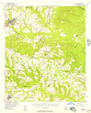
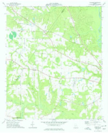
10 topographic sheets cover this place, the earliest surveyed in 1956 and the latest in 1988. It stands in the Hawkinsville census division. It lies in ZIP code area 31036. The Survey maps it on the Klondike quadrangle.
Topographic sheets covering this place
8 surveys from 10 printed sheetsMatched by testing this settlement's coordinate against the published boundary of every sheet in the United States Geological Survey's historical collection. Each opens the scanned sheet at the Survey.
- 1956 USGS Perry quadrangle1:62500, 2 printings
- 1957 USGS Macon quadrangle1:250000
- 1958 USGS Macon quadrangle1:250000
- 1964 USGS Macon quadrangle1:250000, 2 printings
- 1973 USGS Klondike quadrangle1:24000
- 1977 USGS Hawkinsville quadrangle1:100000
- 1978 USGS Hawkinsville quadrangle1:100000
- 1988 USGS Macon quadrangle1:250000
Fires near this place
350 since 1992Regional context, not property-specific evidence. The federal wildfire occurrence database lists 350 fires within 5 miles of Browndale between 1992 and 2020, burning about 1,192 acres in total. 15 started naturally. 30 were recorded as arson. Distance is straight-line from the map coordinates, so a fire counted here may appear on a neighbouring settlement's page as well.
| Reported cause | Fires |
|---|---|
| Debris and open burning | 231 |
| Equipment and vehicle use | 46 |
| Arson/incendiarism | 30 |
| Natural | 15 |
| Missing data/not specified/undetermined | 10 |
| Smoking | 9 |
| Recreation and ceremony | 7 |
| Misuse of fire by a minor | 2 |
The most recent of them, most recent first, with the day each was reported and the service that recorded it.
| Date | Cause | Size | Reported by | Name on the report |
|---|---|---|---|---|
| 8 September 1997 | Equipment and vehicle use | 2.2 acres | Georgia Forestry Commission | not named |
| 6 September 1997 | Equipment and vehicle use | 1.5 acres | Georgia Forestry Commission | not named |
| 4 September 2005 | Debris and open burning | under an acre | Georgia Forestry Commission | not named |
| 4 September 1999 | Debris and open burning | under an acre | Georgia Forestry Commission | not named |
| 30 September 2019 | Debris and open burning | under an acre | Georgia Forestry Commission | FY2020PULASKI009 |
| 29 September 1997 | Equipment and vehicle use | under an acre | Georgia Forestry Commission | not named |
| 28 September 2013 | Debris and open burning | under an acre | Georgia Forestry Commission | FY2014-PULASKI-004 |
| 28 September 2013 | Debris and open burning | under an acre | Georgia Forestry Commission | FY2014-PULASKI-003 |
Settlements close enough to share some of these fires:
Storms near this place
11 since 2008Regional context, not property-specific evidence. The National Weather Service names Browndale in 11 storm reports between 2008 and 2021: 6 thunderstorm wind, 2 hail, 2 tornado, 1 flash flood. No death or injury is recorded in these reports. Each account below is quoted exactly as the forecast office filed it, from the NOAA Storm Events Database, and each date opens the federal record of that event.
| When | Event | Place named | Harm | What the report says |
|---|---|---|---|---|
| April 2011 | Thunderstorm Wind | Browndale | $250,000 | The Pulaski County Emergency Management Director reported that up to 30 trees were down across the county. A number of power lines were down as well. Several roads were blocked at the height of the storm and Wood Street in Hawkinsville remained blocked from downed trees into the next day. One mobile home was destroyed by a downed tree and two other homes sustained minor to moderate damage. |
| February 2008 | Thunderstorm Wind | Browndale | $75,000 | The Pulaski County Emergency Management Director reported that several trees were blown down throughout the county. Trees were blocking parts of Upper River, Lower River, and Industrial Boulevard in Hawkinsville. In addition, a grain elevator was toppled over in Hawkinsville. |
| March 2009 | Thunderstorm Wind | Browndale | $25,000 | The Pulaski County Emergency Management Director reported that two trees were down in the area just southeast of Browndale. One of the trees was down on a home causing considerable damage to the roof of the structure. |
| June 2009 | Thunderstorm Wind | Browndale | $10,000 | The Pulaski County Emergency Management Director reported that several trees (at least a dozen, possibly more) were down across the county. Some roads were blocked from downed trees. Radar data suggests that the strongest winds tracked across the county from northeast of Browndale to just west of Finleyson. |
| November 2014 | Thunderstorm Wind | Browndale | $5,000 | The Pulaski County 911 Center reported trees and power lines down along Macedonia Church Road. |
| November 2014 | Tornado (EF0) | Browndale | $5,000 | A NWS storm survey team determined that the tornado that touched down in Houston county moved into Pulaski County causing EF-0 damage with maximum wind speeds of 75 MPH. Trees were snapped and uprooted and a shed and fence were damaged before the tornado lifted near Highway 129. [11/23/14: Tornado #9, County #2-2, EF0, Houston-Pulaski, 2014:026]. |
| July 2013 | Flash Flood | Browndale | $5,000 | The Pulaski County emergency manager reported ditches overflowed a portion of Buck Creek Road east of Klondike with two feet of water and flooded a residential yard. A portion of Georgia Highway 26 near Browndale had erosion damage due to an overflowing culvert. |
| April 2009 | Thunderstorm Wind | Browndale | $5,000 | WMAZ Television from Macon, Georgia reported that the metal roof of a home on U.S. Highway 341 near Brownwood was damaged from strong straight-line winds. Several outdoor objects were blown around. A tree was also down in the area and a window was blown out of a barn. |
| March 2018 | Hail | Browndale | $2,000 | The Pulaski County Emergency Manager reported quarter size hail around the intersection of Highway 230 and Mock Springs Road. |
| December 2021 | Tornado (EF0) | Browndale | - | This tornado touched down shortly after entering Pulaski County and began uprooting several trees on Mock Springs Rd. Traveling eastward, light damage was observed through several dirt roads including a covered awning that was completely destroyed on Fire Rd 624. The tornado continued eastward crossing Hwy 27 and HWY 257, where several trees were snapped and uprooted and minor damage to several homes which included removed vinyl siding, pierced vinyl siding by tree branches, removed gutters and shingles, and damage to a front porch awning. As the tornado crossed near Wallace, an open barn with with sheet metal roofing was also destroyed south of the Big Creek bridge on HWY 129. The tornado then moved across a swampy undeveloped area and maintained a TDS signature until passing over the Ocmulgee River, approximately 5 miles south of Hawkinsville. The tornado then dissipated over the wetland with no reported damage on the eastern side. [12/30/21: Tornado #4, County #1/1, EF-0, Pulaski, 2021:26]. |
| March 2010 | Hail | Browndale | - | The public observed penny to nickel-sized hail across the north part of the county, especially in the Klondike Road area. |
Nearest settlements
The eight closest, with where each one stands in the county. Distances are straight-line, computed from the Geographic Names Information System coordinates.
| Map | Place | Distance | Sheets |
|---|---|---|---|
| Tippetts | 6.1 miles | 11 | |
| Hawkinsville | 6.3 miles | 11 | |
| Hartford | 7.5 miles | 11 | |
| Goose Neck | 8.2 miles | 8 | |
| Wallace | 8.9 miles | 8 | |
| Mobley Crossing | 9.6 miles | 11 | |
| Finleyson | 12.9 miles | 8 |
Provenance
This settlement is recorded in the Geographic Names Information System as feature 331256. The sheet list is computed by point-in-boundary test against the United States Geological Survey's historical topographic inventory. Both are works of the United States government and carry no copyright under 17 U.S.C. 105.
Wildfire. Short, Karen C. 2022. Spatial wildfire occurrence data for the United States, 1992-2020 [FPA_FOD_20221014]. 6th Edition. Fort Collins, CO: Forest Service Research Data Archive. https://doi.org/10.2737/RDS-2013-0009.6 Collected with United States Government funding and usable without additional permissions or fees.
Storms. NOAA National Centers for Environmental Information, Storm Events Database https://www.ncei.noaa.gov/stormevents/ A work of the United States government, no copyright under 17 U.S.C. 105. Narratives are quoted verbatim from the National Weather Service report and are not edited or summarised.