 Block
Centerville, Georgia
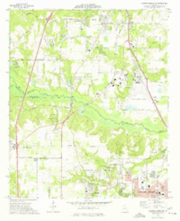
12 topographic sheets cover this place, the earliest surveyed in 1956 and the latest in 1988. It stands in the Warner Robins census division. It lies in ZIP code area 31028. The Survey maps it on the Warner Robins NW quadrangle. 8,228 people lived here at the 2020 count. It stands 449 feet above sea level.
Population over time
2 figuresCenterville grew from 7,148 to 8,228 between 2010 and 2020. These are the recorded population figures Wikidata holds for this place, reached through the Geographic Names Information System number this page is keyed on rather than by name, so they belong to this place and not to another of the same name. Most are census counts, but not all are: an early figure may be a founding or settlement estimate, and an estimate published within five years of a census is left out. The change column is computed, and is left blank where more than 20 years separate a figure from the one before it, because a gap that long is not a change between two counts.
| Year | People | Change |
|---|---|---|
| 2010 | 7,148 | |
| 2020 | 8,228 | +1,080 (+15%) |
Topographic sheets covering this place
7 surveys from 12 printed sheetsMatched by testing this settlement's coordinate against the published boundary of every sheet in the United States Geological Survey's historical collection. Each opens the scanned sheet at the Survey.
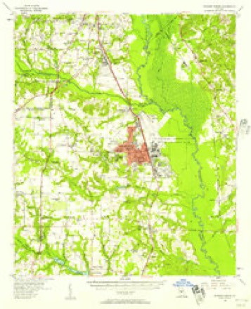
- 1956 USGS Warner Robins quadrangle1:62500, 2 printings
- 1957 USGS Macon quadrangle1:250000
- 1958 USGS Macon quadrangle1:250000
- 1964 USGS Macon quadrangle1:250000, 2 printings
- 1973 USGS Warner Robins NW quadrangle1:24000, 3 printings
- 1978 USGS Macon quadrangle1:100000, 2 printings
- 1988 USGS Macon quadrangle1:250000
Fires near this place
373 since 1992Regional context, not property-specific evidence. The federal wildfire occurrence database lists 373 fires within 5 miles of Centerville between 1992 and 2020, burning about 926 acres in total. 18 started naturally. 65 were recorded as arson. Distance is straight-line from the map coordinates, so a fire counted here may appear on a neighbouring settlement's page as well.
| Reported cause | Fires |
|---|---|
| Debris and open burning | 133 |
| Misuse of fire by a minor | 82 |
| Arson/incendiarism | 65 |
| Equipment and vehicle use | 30 |
| Natural | 18 |
| Missing data/not specified/undetermined | 15 |
| Recreation and ceremony | 13 |
| Smoking | 13 |
| Railroad operations and maintenance | 4 |
The most recent of them, most recent first, with the day each was reported and the service that recorded it.
| Date | Cause | Size | Reported by | Name on the report |
|---|---|---|---|---|
| 7 September 1997 | Recreation and ceremony | under an acre | Georgia Forestry Commission | not named |
| 6 September 2005 | Equipment and vehicle use | under an acre | Georgia Forestry Commission | not named |
| 4 September 2017 | Debris and open burning | 26 acres | Georgia Forestry Commission | FY2018-PEACH-001 |
| 4 September 1998 | Equipment and vehicle use | under an acre | Georgia Forestry Commission | not named |
| 4 September 1998 | Equipment and vehicle use | under an acre | Georgia Forestry Commission | not named |
| 4 September 1998 | Equipment and vehicle use | under an acre | Georgia Forestry Commission | not named |
| 30 September 1997 | Debris and open burning | under an acre | Georgia Forestry Commission | not named |
| 30 September 1994 | Natural | under an acre | Georgia Forestry Commission | not named |
Settlements close enough to share some of these fires:
Mines and quarries near this place
2 within 5 milesRegional context, not property-specific evidence. The federal mineral resources record lists 2 workings within 5 miles of Centerville: 2 producers. All of them still produce. What was taken out: Sand and Gravel, Construction. Distance is straight-line from the map coordinates, so a quarry counted here may appear on a neighbouring settlement's page as well.
| Where | Site | Commodity | Status | Recorded |
|---|---|---|---|---|
| J&J Lumber Co. Quarry | Sand and Gravel, Construction | Producer | ||
| Macon Sand Pit | Sand and Gravel, Construction | Producer |
Storms near this place
34 since 1997Regional context, not property-specific evidence. The National Weather Service names Centerville in 34 storm reports between 1997 and 2025: 16 thunderstorm wind, 12 hail, 4 tornado, 1 lightning. No death or injury is recorded in these reports. Each account below is quoted exactly as the forecast office filed it, from the NOAA Storm Events Database, and each date opens the federal record of that event.
| When | Event | Place named | Harm | What the report says |
|---|---|---|---|---|
| July 2008 | Hail | Centerville | $600,000 | Several reports of large hail were received from the public across northern Houston county. Quarter to golf ball-sized hail fell near and just northeast through east of Centerville and penny to quarter-sized hail fell in the Warner Robins area. |
| April 2016 | Tornado (EF1) | Centerville | $250,000 | A National Weather Service survey team found that a tornado touched down on the northeast side of Centerville snapping and uprooting trees along Sentry Oaks Drive. The tornado quickly strengthened as it moved east, briefly reaching EF-1 intensity with 90 MPH winds as it crossed Napier Avenue, Fisher Street and Carter Circle. Multiple large trees were snapped or uprooted in this area, several falling on homes. The tornado, weaker now, continued to move east causing sporadic damage in the form of snapped or uprooted trees in the area bounded by Watson Boulevard on the south and Green Street on the north, until crossing onto Robins AFB around the Green Street gate. Large pieces of a metal roof were stripped from a maintenance hangar just inside the western edge of the base. [04/01/16: Tornado #2, County #1-1, EF1, Houston, 2016:002]. |
| July 2007 | Thunderstorm Wind | Centerville | $175,000 | The Houston County 911 Center reported that more than a dozen trees were blown down across the county. One downed tree caused a power pole to be damaged along Georgia Highway 96 in Warner Robins. The public reported that a large and heavy piece of outdoor furniture was blown off a deck and numerous large limbs were down from pecan and pine trees. In Perry, a fire was ignited at the Shady Rest Apartments on Second Street when a tree fell onto a power line. Two of the apartments were completely destroyed. Another tree fell down at the neighboring church playground. A wind gust of 62 mph was recorded at Warner Robins Air Force Base at 342 pm EDT. |
| April 2017 | Tornado (EF1) | Centerville | $100,000 | A National Weather Service survey team found that an EF1 tornado with maximum wind speeds of 93 MPH and a maximum path width of 600 yards moved east into Houston County from Peach County. The tornado entered the county along US Highway 41 at the intersection with Dunbar Road. The tornado continued eastward across northern sections of Centerville and Warner Robins before ending just east of Highway 129 near the northern end of Robins AFB. The primary damage along this path was snapped or uprooted trees. A few of these trees struck homes causing damage. No injuries were reported. [04/03/17: Tornado #16, County #2/2, EF-1, Peach, Houston, 2017:048]. |
| April 2011 | Thunderstorm Wind | Centerville | $100,000 | The Houston County Emergency Management Director reported that a number of trees and power lines were down across the northern part of the county from Centerville to Warner Robins. Near Warner Robins, a number of trees were down on cars and homes causing minor to moderate damage. Trees were also down around Centerville, with amateur radio operators reporting that Crestwood Drive at Crestwood Circle was blocked in Centerville by a large downed tree. |
| June 2019 | Thunderstorm Wind | Centerville | $50,000 | Multiple reports of trees and powerlines down from just north of Centerville to between Green Street and Watson Blvd in Warner Robins. Trees were reported down on an apartment complex off of Tanya Place. Time estimated from radar. |
| August 2008 | Thunderstorm Wind | Centerville | $25,000 | The Houston County 911 Center reported that the roof of an apartment building was damaged by strong winds in a thunderstorm associated with the outer rain bands of tropical storm Fay. A portion of the roof collapsed. |
| June 1998 | Thunderstorm Wind | Centerville | $25,000 | Many trees were knocked down, some of them large. A citizen using hand-held equipment measured winds of 70 mph. |
| July 2020 | Thunderstorm Wind | Centerville | $15,000 | The Houston County Emergency Manager reported numerous trees and power lines blown down across the northern portion of the county from near Byron to Warner Robins. |
| April 2020 | Thunderstorm Wind | Centerville | $10,000 | Public report of a large tree down on a home off of Sunshine Way in Centerville. |
| September 2010 | Flood | Centerville | $10,000 | The Houston County Emergency Management Director reported that several roads from Warner Robins to Perry were flooded with several inches of water. At least two roads had to be closed. Two homes in Warner Robins were threatened by high water and were evacuated as a precaution. Two retention ponds were found overflowing. One home suffered minor flood damage in addition to debris removal from the flooded roads. |
| July 2000 | Thunderstorm Wind | Centerville | $10,000 | A former NWS employee reported trees and large limbs down around his house in Centerville caused by estimated 60 mph winds. A tree was reported down on a power line and in a parking lot at the Warner Robbins Air Force Base and a roof was damaged in Perry, where winds were also estimated to be 60 mph. |
| May 1998 | Hail | Centerville | $10,000 | Numerous public reports indicated hail ranging from dime size to as large as golf balls in Centerville, Perry, Warner Robins, and Bonaire. |
| August 2010 | Lightning | Centerville | $5,000 | An off-duty employee with Warner Robins Air Force Base reported that lightning struck his home in Warner Robins. While no fire was reported, damage was observed to electrical and telephone wiring and an air conditioning system. |
| April 2020 | Thunderstorm Wind | Centerville | $2,000 | EM reported power lines down on Margie Drive at Gunn Road. |
| June 2004 | Thunderstorm Wind | Centerville | $2,000 | The Houston County 911 center reported that several trees were blown down. |
| April 1998 | Thunderstorm Wind | Centerville | $2,000 | The same severe thunderstorm pulled some shingles off a house on Dunbar road near the Peach county line. |
| February 2025 | Thunderstorm Wind | Centerville | $1,000 | Ham radio operator reports tree down at gawin dr and meadowridge dr. |
| June 2013 | Thunderstorm Wind | Centerville | $750 | The Houston County Emergency Manager reported three trees down on Collins Road. |
| August 2015 | Thunderstorm Wind | Centerville | $500 | An amateur radio operator reported a measured wind gust of 55 mph. Minor damage occurred to his radio tower and several limbs were blown down. |
| June 2006 | Thunderstorm Wind | Centerville | $500 | The Houston County 911 Center reported that a large tree was blown down and was partially blocking a road. |
| March 2025 | Tornado (EF0) | Centerville | - | The tornado began in Centerville near Watson Blvd and Margie|Dr just 4 miles south of and 2 minutes after the first tornado|started in northern Peach County. This tornado traveled|quickly northeast then east-northeast through Centerville and|into northern parts of Warner Robins for a total of 3.6 miles,|downing hundreds of trees, many of which fell on approx.|100 homes and numerous vehicles resulting in some entrapments|but, thankfully, no injuries. Maximum winds were 75 mph. |
| April 2024 | Tornado (EF0) | Centerville | - | A brief tornado touched down in a field of trees just southwest of Hwy 41 and Watson Blvd intersection. A few trees were seen snapped near this intersection that took out powerlines/poles. About 1/2 to 3/4 of a mile east of this location along Watson Blvd a few retail signs were blown out. No notable structural damage occurred aside that. Damage was confirmed by Tornado Debris Signature (TDS) from the KJGX radar. |
| August 2023 | Hail | Centerville | - | Trained spotter reported 1 inch hail near the intersection of Gunn Rd and US Hwy 41. |
| August 2023 | Thunderstorm Wind | Centerville | - | Public report of a tree down on a house along North Hwy 41. |
| August 2011 | Hail | Centerville | - | The public observed nickel-sized hail around Centerville. |
| May 2009 | Hail | Centerville | - | Several reports of hail, ranging in size from pennies to quarters, were received from the Houston County 911 Center and trained spotters across northern Houston county. |
| April 2008 | Hail | Centerville | - | An amateur radio operator reported penny-sized hail near Warner Robins. |
| July 2008 | Hail | Centerville | - | The public observed penny-sized hail in the Warner Robins area. |
| December 2005 | Hail | Centerville | - | The public reported penny to quarter-sized hail. |
| July 2002 | Hail | Centerville | - | The public reported dime size hail. |
| April 1999 | Hail | Centerville | - | The public reported from dime to golf ball size hail lasting up to 10 minutes.. |
| June 1998 | Hail | Centerville | - | Two public reports indicated dime to nickel size hail fell in Centerville. |
| May 1997 | Hail | Centerville | - | no account filed |
Nearest settlements
The eight closest, with where each one stands in the county. Distances are straight-line, computed from the Geographic Names Information System coordinates.
| Map | Place | Distance | Sheets |
|---|---|---|---|
| Ashlund Ridge | 0.4 miles | 12 | |
| Sedgefield | 0.6 miles | 12 | |
| Fairview Estates | 0.8 miles | 12 | |
| Crestwood Estates | 1.0 miles | 12 | |
| Wellington Woods | 1.0 miles | 12 | |
| Quail Run North | 1.5 miles | 12 | |
| Hidden Oaks | 1.6 miles | 12 | |
| Fox Meadow Estates | 1.9 miles | 12 |
Elsewhere
Matched on this settlement's Geographic Names Information System number rather than its name, so it cannot be a different place of the same name in another state.
| Wikipedia article on Centerville | An encyclopaedic summary. Its text is share-alike, so it is linked here rather than copied. |
| Wikidata item Q2432482 | The structured record the population and elevation above come from. Public domain (CC0). |
Provenance
This settlement is recorded in the Geographic Names Information System as feature 355090. The sheet list is computed by point-in-boundary test against the United States Geological Survey's historical topographic inventory. Both are works of the United States government and carry no copyright under 17 U.S.C. 105.
Wildfire. Short, Karen C. 2022. Spatial wildfire occurrence data for the United States, 1992-2020 [FPA_FOD_20221014]. 6th Edition. Fort Collins, CO: Forest Service Research Data Archive. https://doi.org/10.2737/RDS-2013-0009.6 Collected with United States Government funding and usable without additional permissions or fees.
Mines and quarries. USGS Mineral Resources Data System (MRDS) https://mrdata.usgs.gov/mrds/ A work of the United States government, no copyright under 17 U.S.C. 105.
Storms. NOAA National Centers for Environmental Information, Storm Events Database https://www.ncei.noaa.gov/stormevents/ A work of the United States government, no copyright under 17 U.S.C. 105. Narratives are quoted verbatim from the National Weather Service report and are not edited or summarised.