 Block
Chappells Mill, Georgia
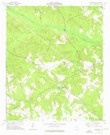
8 topographic sheets cover this place, the earliest surveyed in 1957 and the latest in 1988. It stands in the Dublin census division. It lies in ZIP code area 31021. The Survey maps it on the Nicklesville quadrangle.
Topographic sheets covering this place
6 surveys from 8 printed sheetsMatched by testing this settlement's coordinate against the published boundary of every sheet in the United States Geological Survey's historical collection. Each opens the scanned sheet at the Survey.
- 1957 USGS Macon quadrangle1:250000
- 1958 USGS Macon quadrangle1:250000
- 1964 USGS Macon quadrangle1:250000, 2 printings
- 1974 USGS Nicklesville quadrangle1:24000
- 1978 USGS Macon quadrangle1:100000, 2 printings
- 1988 USGS Macon quadrangle1:250000
Fires near this place
320 since 1992Regional context, not property-specific evidence. The federal wildfire occurrence database lists 320 fires within 5 miles of Chappells Mill between 1992 and 2020, burning about 1,059 acres in total. 20 started naturally. 21 were recorded as arson. Distance is straight-line from the map coordinates, so a fire counted here may appear on a neighbouring settlement's page as well.
| Reported cause | Fires |
|---|---|
| Debris and open burning | 206 |
| Equipment and vehicle use | 38 |
| Arson/incendiarism | 21 |
| Natural | 20 |
| Recreation and ceremony | 13 |
| Smoking | 10 |
| Missing data/not specified/undetermined | 6 |
| Misuse of fire by a minor | 6 |
The most recent of them, most recent first, with the day each was reported and the service that recorded it.
| Date | Cause | Size | Reported by | Name on the report |
|---|---|---|---|---|
| 7 September 2010 | Debris and open burning | under an acre | Georgia Forestry Commission | FY2011-LAURENS-021 |
| 4 September 2005 | Debris and open burning | under an acre | Georgia Forestry Commission | not named |
| 30 September 2005 | Debris and open burning | 6.3 acres | Georgia Forestry Commission | not named |
| 30 September 2005 | Debris and open burning | 4.9 acres | Georgia Forestry Commission | not named |
| 3 September 1999 | Debris and open burning | under an acre | Georgia Forestry Commission | not named |
| 3 September 1993 | Arson/incendiarism | under an acre | Georgia Forestry Commission | not named |
| 28 September 2016 | Debris and open burning | under an acre | Georgia Forestry Commission | FY2017-LAURENS-038 |
| 28 September 2003 | Equipment and vehicle use | 1.5 acres | Georgia Forestry Commission | not named |
Settlements close enough to share some of these fires:
Storms near this place
8 since 2008Regional context, not property-specific evidence. The National Weather Service names Chappells Mill in 8 storm reports between 2008 and 2023: 4 thunderstorm wind, 3 tornado, 1 flood. The reports record 2 deaths and 2 injuries. Each account below is quoted exactly as the forecast office filed it, from the NOAA Storm Events Database, and each date opens the federal record of that event.
| When | Event | Place named | Harm | What the report says |
|---|---|---|---|---|
| May 2008 | Tornado (EF2) | Chappells Mill | 2 killed, 2 hurt, $1,400,000 | A damage survey conducted by the National Weather Service Forecast Office in Peachtree City, Georgia confirmed that an EF2 tornado touched down in far northern Laurens county, just south of the Wilkinson county line. The tornado initially touched down as an EF0 tornado near the intersection of Old Macon Road and Oscar Wynn Road. The tornado quickly intensified to an EF2 tornado as it tracked almost due eastward and crossed U.S. Highway 441 at the 2700 block, about seven miles northwest of Dublin, or near the intersection of U.S. Highway 441 and Evergreen Road. Here, a double-wide mobile home was destroyed and the occupants, a man and woman in their early 50s were both killed. Their two grandchildren sustained non-life threatening injuries. Another home along Evergreen Road was also destroyed as the EF2 tornado continued on its eastward track. The tornado continued eastward and weakened back to an EF0 as it crossed the Oconee River. The tornado then once again strengthened to an EF2 as it crossed Buckeye Road in the 2100 block, approximaltely four miles north-northeast of East Dublin. EF2 tornado damage was noted to a home at 2185 Buckeye Road and EF1 tornado damage to another home at 1533 Buckeye Road. In between the destruction to the homes on Evergreen Road and those on Buckeye Road, sporadic tree and power line damage was observed, mostly consistent with an EF0 intensity rating. The tornado path length was about 15 miles. A maximum path width of 250 yards was observed at the tornado crossed U.S. Highway 441 at Evergreen Road.||All together this tornado resulted in the destruction of two mobile homes, major damage to six other site built homes, some shifted off their foundations, one home with a missing roof, and many other homes with minor roof or siding damage. Numerous sheds and outbuildings were also destroyed. Several dozen trees were either uprooted or snapped off along the path of the tornado, along with several power lines. |
| September 2010 | Tornado (EF0) | Chappells Mill | $15,000 | The Laurens County Emergency Management Director reported that a weak and brief EF0 tornado touched down between Evergreen and Southern Belle Roads, just west of U.S. Highway 441, about 10 miles northwest of Dublin. The tornado path length was estimated to only be 200 yards long with a maximum path width of 50 yards. Twelve to 15 trees were down along the path of the tornado. One of the downed trees destroyed an outbuilding and another caused minor damage to a home. Radar data showed only a 40 dBZ shower in the area at the time on a tail end of much stronger activity across north central and east central Georgia. No cloud-to-ground lightning was ever indicated in the shower that produced the tornado and the maximum cloud top on this cloud was below 20,000 feet. |
| April 2017 | Tornado (EF0) | Chappells Mill | $10,000 | A National Weather Service survey team found an EF0 tornado with maximum wind speeds of 80 MPH and a maximum path width of 150 yards moved east from Wilkinson County into Laurens County west of Wendell Dixon Road. The tornado crossed Wendell Dixon road and snapped or uprooted trees before ending around the intersection of Old Toomsboro Road and Oconee Church Road. No injuries were reported. [04/03/17: Tornado #23, County #2/2, EF-0, Wilkinson, Laurens, 2017:055]. |
| July 2013 | Flood | Chappells Mill | $3,000 | The Laurens County emergency manager reported additional rainfall around two inches on already wet soils caused flowing water over Old Toomsboro Road and Wyatt Road. |
| January 2022 | Thunderstorm Wind | Chappells Mill | $2,000 | Multiple trees and powerlines reported down along Old Macon Rd. |
| August 2013 | Thunderstorm Wind | Chappells Mill | $1,500 | The Laurens County 911 Center reported a tree down on Toombsboro Road and several trees down along Highway 338. |
| August 2023 | Thunderstorm Wind | Chappells Mill | $1,000 | A tree was downed in the 1800 block of Oconee Church Rd. |
| June 2020 | Thunderstorm Wind | Chappells Mill | $1,000 | The Laurens County 911 center reported a large tree blown down in the 2000 block of Oconee Church Road. |
Nearest settlements
The eight closest, with where each one stands in the county. Distances are straight-line, computed from the Geographic Names Information System coordinates.
| Map | Place | Distance | Sheets |
|---|---|---|---|
| Spring Hill | 2.6 miles | 8 | |
| Holly Hills | 8.1 miles | 8 | |
| Dudley | 8.3 miles | 8 | |
| Bender (historical) | 8.5 miles | 8 | |
| Haskins Crossing | 8.6 miles | 8 | |
| Montrose | 8.8 miles | 8 | |
| Whipples Crossing | 9.1 miles | 8 | |
| Shewmake | 10.2 miles | 8 |
Elsewhere
Matched on this settlement's Geographic Names Information System number rather than its name, so it cannot be a different place of the same name in another state.
| Wikidata item Q122588766 | The structured record the population and elevation above come from. Public domain (CC0). |
Provenance
This settlement is recorded in the Geographic Names Information System as feature 355119. The sheet list is computed by point-in-boundary test against the United States Geological Survey's historical topographic inventory. Both are works of the United States government and carry no copyright under 17 U.S.C. 105.
Wildfire. Short, Karen C. 2022. Spatial wildfire occurrence data for the United States, 1992-2020 [FPA_FOD_20221014]. 6th Edition. Fort Collins, CO: Forest Service Research Data Archive. https://doi.org/10.2737/RDS-2013-0009.6 Collected with United States Government funding and usable without additional permissions or fees.
Storms. NOAA National Centers for Environmental Information, Storm Events Database https://www.ncei.noaa.gov/stormevents/ A work of the United States government, no copyright under 17 U.S.C. 105. Narratives are quoted verbatim from the National Weather Service report and are not edited or summarised.