 Block
Collier, Georgia
10 topographic sheets cover this place, the earliest surveyed in 1951 and the latest in 1979. It stands in the Forsyth census division. It lies in ZIP code area 31029. The Survey maps it on the Johnstonville quadrangle.
Topographic sheets covering this place
6 surveys from 10 printed sheetsMatched by testing this settlement's coordinate against the published boundary of every sheet in the United States Geological Survey's historical collection. Each opens the scanned sheet at the Survey.
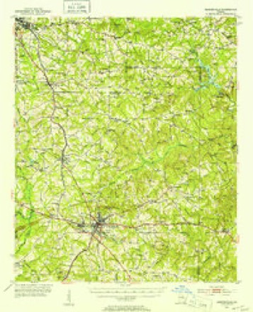
- 1951 USGS Barnesville quadrangle1:62500, 2 printings
- 1953 USGS Atlanta quadrangle1:250000, 2 printings
- 1957 USGS Atlanta quadrangle1:250000
- 1958 USGS Atlanta quadrangle1:250000
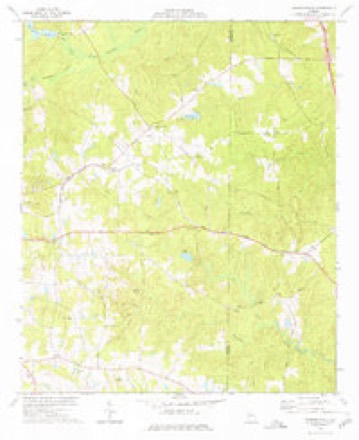
- 1973 USGS Johnstonville quadrangle1:24000
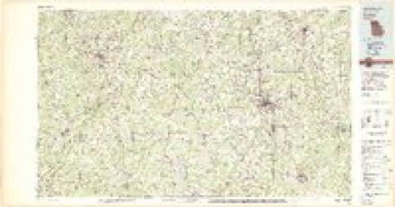
- 1979 USGS Griffin quadrangle1:100000, 3 printings



Fires near this place
254 since 1992Regional context, not property-specific evidence. The federal wildfire occurrence database lists 254 fires within 5 miles of Collier between 1992 and 2020, burning about 646 acres in total. 9 started naturally. 26 were recorded as arson. Distance is straight-line from the map coordinates, so a fire counted here may appear on a neighbouring settlement's page as well.
| Reported cause | Fires |
|---|---|
| Debris and open burning | 136 |
| Equipment and vehicle use | 33 |
| Arson/incendiarism | 26 |
| Missing data/not specified/undetermined | 23 |
| Misuse of fire by a minor | 15 |
| Natural | 9 |
| Smoking | 9 |
| Recreation and ceremony | 3 |
The most recent of them, most recent first, with the day each was reported and the service that recorded it.
| Date | Cause | Size | Reported by | Name on the report |
|---|---|---|---|---|
| 9 September 1998 | Debris and open burning | under an acre | Georgia Forestry Commission | not named |
| 30 September 1993 | Misuse of fire by a minor | 2.2 acres | Georgia Forestry Commission | not named |
| 30 September 1993 | Misuse of fire by a minor | 1.6 acres | Georgia Forestry Commission | not named |
| 28 September 2003 | Missing data/not specified/undetermined | 1.3 acres | Georgia Forestry Commission | not named |
| 28 September 2003 | Arson/incendiarism | under an acre | Georgia Forestry Commission | not named |
| 20 September 1995 | Debris and open burning | under an acre | Georgia Forestry Commission | not named |
| 18 September 1997 | Debris and open burning | under an acre | Georgia Forestry Commission | not named |
| 17 September 1999 | Smoking | under an acre | Georgia Forestry Commission | not named |
Settlements close enough to share some of these fires:
Mines and quarries near this place
10 of 11 shownRegional context, not property-specific evidence. The federal mineral resources record lists 11 workings within 5 miles of Collier: 6 prospects, 4 past producers, 1 occurrence. None of them still produces. What was taken out: Mica. Distance is straight-line from the map coordinates, so a quarry counted here may appear on a neighbouring settlement's page as well.
| Where | Site | Commodity | Status | Recorded |
|---|---|---|---|---|
| C A Ensign Mine | Mica | Past Producer | ||
| F B Willingham Prospect | Mica | Prospect | ||
| H B Manrey Prospect | Mica | Prospect | ||
| Ingraham Prospects | Mica | Prospect | ||
| L P Goodwin Mine | Mica | Past Producer | ||
| Old Callaway Prospect | Mica | Prospect | ||
| Old Childs Prospect | Mica | Prospect | ||
| Phinazee Mines | Mica | Past Producer | ||
| Thurman Mine | Mica | Past Producer | ||
| U.S.Fuller Prospect | Mica | Occurrence |
Storms near this place
5 since 2011Regional context, not property-specific evidence. The National Weather Service names Collier in 5 storm reports between 2011 and 2020: 3 thunderstorm wind, 1 hail, 1 tornado. The reports record 1 injury. Each account below is quoted exactly as the forecast office filed it, from the NOAA Storm Events Database, and each date opens the federal record of that event.
| When | Event | Place named | Harm | What the report says |
|---|---|---|---|---|
| April 2020 | Tornado (EF3) | Collier | 1 hurt, $10,000,000 | This tornado is a regeneration from the same storm which caused the Upson County EF-3 tornado to the southwest. This tornado first touched down along Potts Cemetery Road downing a few trees continuing NE crossing Hwy 41 and Ingram Rd snapping and|uprooting a few trees. This portion of the track was rated EF-0. The tornado intensified quickly NE of Hwy 41 into an EF-3 as it approached Goodwyne/Collier Rd. A large 100'x150' metal building and small home were completely destroyed. The metal frame and 3'x3'x3' concrete footers for the building were all pulled from the ground with the building and twisted amongst the wreckage leaving holes in the ground around the concrete slab. Several cars were flipped and thrown including a jeep which was thrown onto the small home which sat next to the metal building. The homeowner was inside his home in the bathroom sheltering and survived under the a large pile of debris from both the house and building. Rescue operations took 45 minutes to get to the homeowner under the debris. A small plane was destroyed, a mid-size tractor was |flipped over and a boat was thrown from the tornado at this location. High end EF1/EF2 Tree damage occurred in the area to the surrounding and to the NE of the building. As the Tornado continued NE along Collier Rd, numerous trees were snapped and |uprooted including a large tree onto a home near Collier and Smith Rd. The tornado crossed Interstate 75 near mile marker 188 throwing numerous trees onto the highway shutting it down for a period of time until they were cleared. By this point, the tornado|intensity decreased to EF0/EF1 and continued NE crossing English Rd downing trees and eventually Hwy 42 before weakening. NWS Radar imagery suggests debris was lofted to as high as 19,000 FT from this particular tornado. [04/13/20: Tornado #13, County #1/1, EF-3, Monroe, 2020:019]. |
| June 2018 | Thunderstorm Wind | Collier | $250,000 | A National Weather Service survey team determined that a long-lived multiple microburst event moved from southeastern Lamar County into west central Monroe County with winds as high as 95 mph. The damage path, around 5 miles wide, entered the county along Brent Road near Lee Williamson Road where an amateur weather station recorded a wind gust of 93 mph. Numerous large hardwood trees were uprooted or snapped as the damage path extended east southeast over 12 miles before ending around the intersection of Shi Road and Highway 41 near Bolingbroke. Some of these trees fell on homes or other structures causing considerable damage. Many power lines were downed across this area as well. No injuries were reported. |
| August 2011 | Thunderstorm Wind | Collier | $250,000 | The Monroe County 911 Center reported that dozens of trees were down across the county. At least six homes sustained minor to moderate damage from downed trees. One home had a portion of its roof blown off by high winds. |
| July 2012 | Thunderstorm Wind | Collier | $3,000 | The Monroe County 911 Center reported that several power lines were blown down across Highfalls Road west of Forsyth. |
| April 2011 | Hail | Collier | - | The Monroe County Emergency Management Director reported quarter-sized hail near Forsyth. WSR-88D radar data suggests that hail of quarter size likely began falling as the thunderstorm entered the western portion of the county near Collier then likely decreased to penny-size as the thunderstorm weakened and moved just north of Forsyth. |
Nearest settlements
The eight closest, with where each one stands in the county. Distances are straight-line, computed from the Geographic Names Information System coordinates.
| Map | Place | Distance | Sheets |
|---|---|---|---|
| Brighton Mills | 3.4 miles | 14 | |
| Brighton Heights | 3.4 miles | 14 | |
| Forsyth | 4.3 miles | 14 | |
| Brent | 4.5 miles | 10 | |
| Box Ankle | 5.3 miles | 14 | |
| Star Mills | 5.5 miles | 14 | |
| Higgins Mill | 5.7 miles | 11 | |
| Logwall | 5.8 miles | 14 |
Elsewhere
Matched on this settlement's Geographic Names Information System number rather than its name, so it cannot be a different place of the same name in another state.
| Wikipedia article on Collier | An encyclopaedic summary. Its text is share-alike, so it is linked here rather than copied. |
| Wikidata item Q54888687 | The structured record the population and elevation above come from. Public domain (CC0). |
Provenance
This settlement is recorded in the Geographic Names Information System as feature 355243. The sheet list is computed by point-in-boundary test against the United States Geological Survey's historical topographic inventory. Both are works of the United States government and carry no copyright under 17 U.S.C. 105.
Wildfire. Short, Karen C. 2022. Spatial wildfire occurrence data for the United States, 1992-2020 [FPA_FOD_20221014]. 6th Edition. Fort Collins, CO: Forest Service Research Data Archive. https://doi.org/10.2737/RDS-2013-0009.6 Collected with United States Government funding and usable without additional permissions or fees.
Mines and quarries. USGS Mineral Resources Data System (MRDS) https://mrdata.usgs.gov/mrds/ A work of the United States government, no copyright under 17 U.S.C. 105.
Storms. NOAA National Centers for Environmental Information, Storm Events Database https://www.ncei.noaa.gov/stormevents/ A work of the United States government, no copyright under 17 U.S.C. 105. Narratives are quoted verbatim from the National Weather Service report and are not edited or summarised.