 Block
Coosa, Georgia
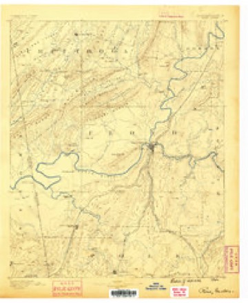
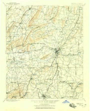
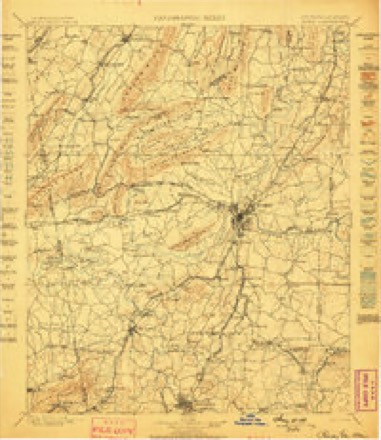
17 topographic sheets cover this place, the earliest surveyed in 1886 and the latest in 1981. It stands in the Rome census division. It lies in ZIP code area 30165. It stands on Cabin Creek. The Survey maps it on the Rock Mountain quadrangle. It stands 594 feet above sea level.
On record in Coosa
Buildings and businesses the archive holds for this place. Each opens its own page, with the source record it came from.
On the National Register 1 record
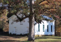 Sardis Presbyterian Church and Cemeterylisted 2005
Topographic sheets covering this place
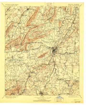
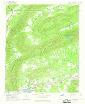
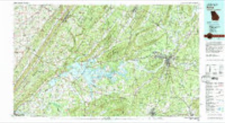
10 surveys from 17 printed sheetsMatched by testing this settlement's coordinate against the published boundary of every sheet in the United States Geological Survey's historical collection. Each opens the scanned sheet at the Survey.
- 1886 USGS Rome quadrangle1:125000
- 1898 USGS Rome quadrangle1:125000
- 1899 USGS Rome quadrangle1:125000
- 1904 USGS Rome quadrangle1:125000, 4 printings
- 1955 USGS Rome quadrangle1:250000
- 1958 USGS Rome quadrangle1:250000, 3 printings
- 1961 USGS Rome quadrangle1:250000
- 1963 USGS Rome quadrangle1:250000
- 1967 USGS Rock Mountain quadrangle1:24000, 2 printings
- 1981 USGS Rome quadrangle1:100000, 2 printings




Fires near this place
244 since 1992Regional context, not property-specific evidence. The federal wildfire occurrence database lists 244 fires within 5 miles of Coosa between 1992 and 2019, burning about 2,076 acres in total. 7 started naturally. 90 were recorded as arson. Distance is straight-line from the map coordinates, so a fire counted here may appear on a neighbouring settlement's page as well.
| Reported cause | Fires |
|---|---|
| Debris and open burning | 116 |
| Arson/incendiarism | 90 |
| Equipment and vehicle use | 10 |
| Missing data/not specified/undetermined | 9 |
| Recreation and ceremony | 8 |
| Natural | 7 |
| Smoking | 2 |
| Misuse of fire by a minor | 2 |
The most recent of them, most recent first, with the day each was reported and the service that recorded it.
| Date | Cause | Size | Reported by | Name on the report |
|---|---|---|---|---|
| 5 September 2007 | Debris and open burning | under an acre | Georgia Forestry Commission | not named |
| 30 September 2016 | Debris and open burning | under an acre | Georgia Forestry Commission | FY2017-FLOYD-018 |
| 30 September 1997 | Debris and open burning | 2.5 acres | Georgia Forestry Commission | not named |
| 29 September 2007 | Debris and open burning | 2.3 acres | Georgia Forestry Commission | not named |
| 29 September 1993 | Arson/incendiarism | 5.9 acres | Georgia Forestry Commission | not named |
| 28 September 2016 | Debris and open burning | under an acre | Georgia Forestry Commission | FY2017-FLOYD-017 |
| 25 September 2005 | Debris and open burning | under an acre | Georgia Forestry Commission | not named |
| 25 September 1999 | Debris and open burning | 1.2 acres | Georgia Forestry Commission | not named |
Settlements close enough to share some of these fires:
Mines and quarries near this place
9 within 5 milesRegional context, not property-specific evidence. The federal mineral resources record lists 9 workings within 5 miles of Coosa: 6 producers, 2 unknowns, 1 past producer. 6 still produce. What was taken out: Clay, Iron. Distance is straight-line from the map coordinates, so a quarry counted here may appear on a neighbouring settlement's page as well.
| Where | Site | Commodity | Status | Recorded |
|---|---|---|---|---|
| Unnamed | Iron | Unknown | ||
| Bickerstaff Clay Products | Clay | Unknown | ||
| Floyd County Mine | Clay | Producer | ||
| Lavender Clay Pit | Clay | Producer | ||
| Lavender Pit | Clay | Producer | ||
| Martin Mine | Clay | Producer | ||
| Neill Georgia Pit | Clay | Producer | ||
| Oconee Clay Products Co Pits | Clay | Past Producer | ||
| Oreburg Pit | Clay | Producer |
Storms near this place
24 since 1998Regional context, not property-specific evidence. The National Weather Service names Coosa in 24 storm reports between 1998 and 2020: 9 hail, 9 thunderstorm wind, 2 funnel cloud, 2 lightning. The reports record 3 injuries. Each account below is quoted exactly as the forecast office filed it, from the NOAA Storm Events Database, and each date opens the federal record of that event.
| When | Event | Place named | Harm | What the report says |
|---|---|---|---|---|
| December 2011 | Tornado (EF2) | Coosa | 3 hurt, $2,250,000 | A damage survey conducted by the National Weather Service Forecast Office in Peachtree City, Georgia, confirmed that an EF2 tornado, the first of six tornadoes to affect west Georgia on this day, touched down approximately three miles west-southwest of Rome, then continued on a northeastward track approximately 12 miles before lifting about 7 1/4 miles north-northeast of Rome. The tornado was determined to have a maximum path width of 200 yards with maximum winds estimated to be 125 mph. As the tornado first touched down just west of Rome, it was classified as an EF1 but strengthened to an EF2 as it moved toward the community of Walton Creek. The tornado remained at an EF2 intensity for approximately 1 1/2 miles as it crossed Georgia Highway 20. The tornado eventually lifted and dissipated just west of Georgia Highway 53, just north of Jones Bend Road. At least 20 homes along the path of the tornado sustained significant damage. Many trees and several power lines were also damage or destroyed by the tornado. In addition, three minor injuries were reported at one of the damaged homes. Numerous trees and power lines were down along the path of the tornado as well, including along Georgia Highway 27, Division Street, Shorter Avenue, Edmond Road, and Elm Street. Some traffic signals were also blown down.||[12/22/11: Tornado #1, County #1-1, EF2, Floyd, 2011:027]. |
| April 2009 | Hail | Coosa | $1,000,000 | Several reports of hail, ranging in size from pennies to baseballs were received from the northern part of Floyd county as yet a third supercell thunderstorm tracked across the region from Coosa to just south of Shannon. Hail in Rome ranged in size from less than pennies to baseballs. Golf ball-sized hail was observed near Shannon. |
| April 2011 | Hail | Coosa | $345,000 | Several reports of hail, ranging in size from quarters to golf balls, were received from the Floyd County Emergency Management Director and the public across the central portion of the county from southwest of Coosa, to Lindale and Rome. Golf ball-sized hail was observed in downtown Rome. |
| April 2006 | Hail | Coosa | $300,000 | Several reports of large hail were received from southern and western Floyd county, including Cave Spring, Lindale, and Silver Creek. The Floyd County Emergency Management Director and the public reported golf ball-sized hail from Cave Spring, to Blacksbluff Road and the Lock and Dam Park near Coosa, to five miles west of Lindale. Pea-sized hail was reported on the far east end of the county near the Bartow county border. Smaller pea-sized hail was observed on the south side of Rome and in Rome itself. |
| April 2010 | Thunderstorm Wind | Coosa | $100,000 | The Floyd County Emergency Management Director reported that strong wind gusts associated with a line of showers and isolated thunderstorms blew down at least a dozen trees across the county. An apartment building and adjacent garage were heavily damaged when a large oak tree fell on the structures. A vehicle was also damaged from a large downed tree limb. Some power lines were also impacted by the downed trees. |
| July 2008 | Lightning | Coosa | $50,000 | The Floyd County Emergency Management Director reported that a home was struck and set on fire by lightning. A specific damage amount was not provided. |
| January 2017 | Flash Flood | Coosa | $40,000 | Law Enforcement reported several road closures in the Coosa and greater Rome areas due to the heavy rainfall. Rainfall amounts of 3 to 5 inches with locally higher amounts contributed to a drain collapsing on Wayside Road in eastern Floyd County. Nearby, flood waters across Ward Mountain Road swept a car into a culvert near Dozier Creek. Additionally, large portions of southbound Highway 27 north of Rome were flooded. |
| July 2008 | Thunderstorm Wind | Coosa | $35,000 | The Floyd County Emergency Management Director reported that near two dozen trees and several power lines were down throughout the county. One tree was down on a home in the Rome area. |
| April 2011 | Thunderstorm Wind | Coosa | $25,000 | Amateur radio operators relayed reports of a number of trees down and some structural damage on the south side of Rome, near the Highway 1 Loop and U.S. Highway 27. |
| April 2020 | Thunderstorm Wind | Coosa | $5,000 | Report of a tree down on a house on Kraftsman Road. |
| July 2008 | Thunderstorm Wind | Coosa | $5,000 | The Floyd County Emergency Management Director reported that at least six trees were blown down near Coosa. The Rome News Tribune reported that many trees were blown down on several streets around Rome, including Faye Street, Dellwood Drive, Huffaker Road, Melrose Drive, Mount Alto Road, Horseleg Creek Road, and Hycliff Road. |
| July 2005 | Thunderstorm Wind | Coosa | $2,500 | The public reported that several trees were down between Coosa and Horseleg Creek, southwest of Rome. Some trees were down on Black Bluff Road as well. |
| May 2012 | Thunderstorm Wind | Coosa | $2,000 | Floyd County Emergency Management reported that several trees were blown down mainly in the Wheeling Drive area in Coosa. |
| January 2009 | Thunderstorm Wind | Coosa | $2,000 | A CocoRaHS observer on the southeast side of Rome reported that several trees and at least one power line were down in the area. A wind gust of 61 mph was measured at the Floyd Medical Center in Rome at 530 pm EST. |
| June 1999 | Thunderstorm Wind | Coosa | $1,500 | Thunderstorm winds knocked trees and powerlines down across the west and north part of the county. One tree fell on a car. |
| August 2006 | Lightning | Coosa | $250 | The Floyd County Emergency Management Director reported that lightning struck a tree on Coosa Valley Road, causing it to split and fall on the road. |
| June 2016 | Hail | Coosa | - | The Floyd County 911 center reported quarter sized hail on Alabama Highway near Coosa. |
| April 2009 | Funnel Cloud | Coosa | - | A deputy with the Floyd County Sheriff's Office observed a funnel cloud in the North Rome and Shannon area. Numerous reports of funnel clouds from Coosa, to north Rome, to Shannon and on towards northern Bartow county were received at the Floyd County 911 Center from 515 pm to 545 pm EDT. |
| August 2007 | Hail | Coosa | - | The public observed nickel-sized hail five miles west of Rome and a trained spotter observed penny-sized hail five miles southwest of Rome. |
| May 2002 | Hail | Coosa | - | The public reported dime size hail. |
| May 1999 | Hail | Coosa | - | There were several public reports of dime and nickel size hail |
| April 1998 | Funnel Cloud | Coosa | - | A spotter reported a funnel cloud southwest of Coosa. |
| June 1999 | Hail | Coosa | - | no account filed |
| June 1999 | Hail | Coosa | - | no account filed |
Nearest settlements
The eight closest, with where each one stands in the county. Distances are straight-line, computed from the Geographic Names Information System coordinates.
| Map | Place | Distance | Sheets |
|---|---|---|---|
| Krannert | 1.4 miles | 17 | |
| Oreburg | 2.3 miles | 17 | |
| Lavender | 2.7 miles | 17 | |
| Bone | 2.8 miles | 17 | |
| Mount Hope (historical) | 2.9 miles | 17 | |
| Livingston | 2.9 miles | 17 | |
| Benton | 3.0 miles | 17 | |
| Anniedelle | 3.4 miles | 17 |
Elsewhere
Matched on this settlement's Geographic Names Information System number rather than its name, so it cannot be a different place of the same name in another state.
| Wikipedia article on Coosa | An encyclopaedic summary. Its text is share-alike, so it is linked here rather than copied. |
| Wikidata item Q20657762 | The structured record the population and elevation above come from. Public domain (CC0). |
Provenance
This settlement is recorded in the Geographic Names Information System as feature 355297. The sheet list is computed by point-in-boundary test against the United States Geological Survey's historical topographic inventory. Both are works of the United States government and carry no copyright under 17 U.S.C. 105.
Wildfire. Short, Karen C. 2022. Spatial wildfire occurrence data for the United States, 1992-2020 [FPA_FOD_20221014]. 6th Edition. Fort Collins, CO: Forest Service Research Data Archive. https://doi.org/10.2737/RDS-2013-0009.6 Collected with United States Government funding and usable without additional permissions or fees.
Mines and quarries. USGS Mineral Resources Data System (MRDS) https://mrdata.usgs.gov/mrds/ A work of the United States government, no copyright under 17 U.S.C. 105.
Storms. NOAA National Centers for Environmental Information, Storm Events Database https://www.ncei.noaa.gov/stormevents/ A work of the United States government, no copyright under 17 U.S.C. 105. Narratives are quoted verbatim from the National Weather Service report and are not edited or summarised.