 Block
Cordele, Georgia
8 topographic sheets cover this place, the earliest surveyed in 1953 and the latest in 1988. It stands in the Cordele census division. It lies in ZIP code area 31015. The Survey maps it on the Cordele quadrangle. 10,220 people lived here at the 2020 count. It stands 315 feet above sea level.
Research this city
On record in Cordele
Buildings and businesses the archive holds for this place. Each opens its own page, with the source record it came from.
On the National Register 4 records
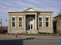 Cordele Commercial Historic Districtlisted 1989
 US Post Office-Cordelelisted 1984
- Gillespie-Selden Historic Districtlisted 1998
- O'Neal School Neighborhood Historic Districtlisted 2004
Population over time
2 figuresCordele fell from 11,147 to 10,220 between 2010 and 2020. These are the recorded population figures Wikidata holds for this place, reached through the Geographic Names Information System number this page is keyed on rather than by name, so they belong to this place and not to another of the same name. Most are census counts, but not all are: an early figure may be a founding or settlement estimate, and an estimate published within five years of a census is left out. The change column is computed, and is left blank where more than 20 years separate a figure from the one before it, because a gap that long is not a change between two counts.
| Year | People | Change |
|---|---|---|
| 2010 | 11,147 | |
| 2020 | 10,220 | -927 (-8%) |
Topographic sheets covering this place
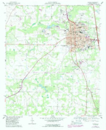
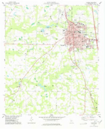
6 surveys from 8 printed sheetsMatched by testing this settlement's coordinate against the published boundary of every sheet in the United States Geological Survey's historical collection. Each opens the scanned sheet at the Survey.
- 1953 USGS Waycross quadrangle1:250000, 2 printings
- 1958 USGS Waycross quadrangle1:250000, 2 printings
- 1974 USGS Cordele quadrangle1:24000
- 1977 USGS Cordele quadrangle1:24000
- 1981 USGS Cordele quadrangle1:100000
- 1988 USGS Waycross quadrangle1:250000
Fires near this place
479 since 1992Regional context, not property-specific evidence. The federal wildfire occurrence database lists 479 fires within 5 miles of Cordele between 1992 and 2020, burning about 952 acres in total. 9 started naturally. 72 were recorded as arson. Distance is straight-line from the map coordinates, so a fire counted here may appear on a neighbouring settlement's page as well.
| Reported cause | Fires |
|---|---|
| Debris and open burning | 263 |
| Arson/incendiarism | 72 |
| Equipment and vehicle use | 64 |
| Railroad operations and maintenance | 24 |
| Misuse of fire by a minor | 18 |
| Missing data/not specified/undetermined | 13 |
| Recreation and ceremony | 11 |
| Natural | 9 |
| Smoking | 5 |
The most recent of them, most recent first, with the day each was reported and the service that recorded it.
| Date | Cause | Size | Reported by | Name on the report |
|---|---|---|---|---|
| 9 September 1995 | Debris and open burning | under an acre | Georgia Forestry Commission | not named |
| 8 September 2002 | Debris and open burning | under an acre | Georgia Forestry Commission | FY2003-CRISP-006 |
| 8 September 1997 | Arson/incendiarism | under an acre | Georgia Forestry Commission | not named |
| 8 September 1993 | Equipment and vehicle use | under an acre | Georgia Forestry Commission | not named |
| 6 September 2002 | Misuse of fire by a minor | under an acre | Georgia Forestry Commission | FY2003-CRISP-005 |
| 6 September 1997 | Debris and open burning | under an acre | Georgia Forestry Commission | not named |
| 4 September 1995 | Arson/incendiarism | under an acre | Georgia Forestry Commission | not named |
| 4 September 1995 | Arson/incendiarism | under an acre | Georgia Forestry Commission | not named |
Settlements close enough to share some of these fires:
Storms near this place
58 since 1993Regional context, not property-specific evidence. The National Weather Service names Cordele in 58 storm reports between 1993 and 2020: 29 thunderstorm wind, 12 hail, 6 flash flood, 4 flood. No death or injury is recorded in these reports. Each account below is quoted exactly as the forecast office filed it, from the NOAA Storm Events Database, and each date opens the federal record of that event.
| When | Event | Place named | Harm | What the report says |
|---|---|---|---|---|
| August 2013 | Lightning | Cordele | $200,000 | The Crisp County Emergency Manager reported that a business was struck by lightning and burned for a total loss. |
| June 2016 | Thunderstorm Wind | Cordele | $100,000 | The Crisp County Sheriff's Department and the county Emergency Manager reported numerous trees and power lines blown down in the Cordele area. A falling tree destroyed a mobile home near the corner of Crisp Street and Church Street. Power lines were down along Farmers Market Road between Highway 41 and I-75. Numerous trees and power lines were down in the vicinity of the Crisp Regional Hospital with several homes and vehicles damaged or destroyed by falling trees. |
| April 1997 | Thunderstorm Wind | Cordele | $52,000 | no account filed |
| December 2009 | Flash Flood | Cordele | $50,000 | The Crisp County Emergency Management Director reported flash flooding in the Cedar Lake subdivision. The flooding was a result of overflow from Cedar Lake. Several homes in the subdivision were threatened by flood waters. The water rose up into the crawl spaces of several homes in this neighborhood. Several of the residential streets were flooded and impassable. Monetary damage to roads and property was estimated to be $50,000. |
| December 2009 | Flash Flood | Cordele | $50,000 | The Crisp County Emergency Management Director reported flash flooding in the Cedar Creek Subdivision. Water rose as high as the floor boards of six to seven homes, but did not actually enter the house. However, the crawl spaces of the homes were flooded. Several roads in the area were under water as well. Pateville Road was closed because of flood waters from the northern branch of Swift Creek. The Cedar Creek subdivision is located approximately one mile southwest of the intersection of Interstate-75 and the U.S. Highway 280. Monetary damage to roads and property was estimated to be at least $50,000. |
| April 2008 | Thunderstorm Wind | Cordele | $50,000 | The Crisp County Emergency Management Director reported that numerous trees and several power lines were blown down within the city of Cordele. Roof damage was also reported to several buildings at the Turtons Shopping Center and an adjacent shopping center. The majority of the damage occurred between the intersections of 16th Avenue and 19th Street and between 3rd Street and 17th Avenue, or very near the intersection of Georgia Highway 30 and U.S. Highway 41. |
| May 2006 | Lightning | Cordele | $50,000 | The Cordele Dispatch reported that lightning struck a couple of large pine trees adjacent to a home in the city of Cordele. The lightning traveled through the electrical outlets setting a bedroom of the home on fire. Before the fire could be extinguished, the bedroom was completely destroyed. In a separate incident, lightning also struck an electrical transformer on a power pole and set it on fire. However, this fire was quickly extinguished. |
| June 1994 | Thunderstorm Wind | Cordele | $50,000 | Thunderstorm winds downed numerous trees, power lines and large tree limbs throughout Cordele. Several power outages were reported throughout Cordele and lasted for approximately three hours. Several homes along Tremont Road and in the Omar Heights subdivision sustained minor damage from the high wind and falling tree limbs. Most of the damage was confined to roofs and broken windows. |
| December 2014 | Flash Flood | Cordele | $35,000 | The Crisp County emergency manager reported significant overflowing of ditches and small creeks which were flooding several roads in the Cordele area. A few motorists became stranded in their cars due to the high water. The flood waters surrounded a few homes in the Second Avenue and Third Street section of town. The water level reached the foundations, but did not enter the houses. |
| August 2007 | Lightning | Cordele | $25,000 | The Crisp County Emergency Management Director reported that lightning struck a home starting a fire in the electrical system. The home sustained at least minor damage. |
| July 2007 | Thunderstorm Wind | Cordele | $25,000 | The Crisp County 911 Center reported that a portion of a roof of a tire business was blown off. Part of the roof landed on a nearby power line causing it to come down. In addition, 10 to 15 trees were blown down around the city and a couple of other power lines were also down as a result of downed trees. |
| April 2005 | Hail | Cordele | $18,000 | A trained spotter reported golf ball-sized hail just each of Cordele, while the public reported nickel-sized hail in Cordele. |
| February 2020 | Flash Flood | Cordele | $15,000 | The Emergency Manager reported rising water was threatening a home near the intersection of Ogburn Road and Stewart Street. Radar estimates indicate that 2 to 3.5 inches of rain fell over the area, falling on already saturated soils, causing flash flooding. |
| October 2019 | Tornado (EF0) | Cordele | $15,000 | A National Weather Service survey determined an EF0 tornado with maximum wind speeds of 75 mph and a maximum path width of 100 yards touched down between Market Avenue and Highway 41, toppling and overturning a shed off of blocks and lifting part of a metal roof off an industrial building. The tornado traveled north across Market Avenue, Seedling Drive and Drayton Lane to Highway 41 north of Steele Road, downing a few trees along the way. The tornado then turned northeast across Highway 41 and then Farmers Market Road downing several more trees before lifting near a pond west of Slim Road and south of Murray Road. [10/19/19: Tornado #1, County #1/1, EF-0, Crisp, 2019:028]. |
| April 2011 | Thunderstorm Wind | Cordele | $15,000 | The Crisp County Emergency Management Director reported that dozens of trees and power lines were down across the county. |
| January 2010 | Flash Flood | Cordele | $10,000 | The Crisp County Emergency Management Director reported flash flooding, once again in the Cedar Creek Subdivision of Cordelle. The flooding was largely the result of high water from adjacent Cedar Creek and overflow water from Cedar Creek Lake. This was the same area that experienced flash flooding in December 2009. Water approached the foundations of several homes in the subdivision. The crawl spaces of several homes were flooded as a result causing minor damage to property. |
| August 2007 | Thunderstorm Wind | Cordele | $10,000 | The Crisp County Emergency Management Director reported that at least 20 trees were down in the southwest part of the county, just northwest of Marshall along Cork Ferry Road. The Cordele Dispatch reported that several trees were down and a stretch of power line was down from Ferry Landing Road to the area around Lincolm Pinch. At least 300 customers were left without power. Several other trees were down in the north portion of the county, north of Cordele along U.S. Highway 41. |
| August 1998 | Thunderstorm Wind | Cordele | $10,000 | Crisp county 911 reported a trailer blown over and destroyed. |
| June 1997 | Thunderstorm Wind | Cordele | $10,000 | Thunderstorm winds caused structural damage to at least 5 homes when tree limbs fell on them. Several large trees were also downed on power lines and covering roads. Two hundred people were without power for several hours . |
| July 1995 | Thunderstorm Wind | Cordele | $10,000 | Thunderstorm winds knocked power lines down near Georgia Highway 257. A convenience store roof was also pulled off by the winds. |
| July 2000 | Thunderstorm Wind | Cordele | $5,000 | Crisp county 911 reported 10 trees knocked down by thunderstorm winds. |
| August 1994 | Thunderstorm Wind | Cordele | $5,000 | Thunderstorm winds blew off a tin roof on an out building along Braintree Road, 8 miles northeast of Cordele in Northeast Crisp County. The roof fell onto power lines which resulted in scattered power outages along Braintree Road. |
| June 1994 | Thunderstorm Wind | Cordele | $5,000 | Several large trees were downed along Georgia Highway 300. |
| June 2000 | Thunderstorm Wind | Cordele | $3,500 | The Crisp county 911 center reported that two trees were blown down on Presley Road. Another tree was blown down on a house on Canary street. |
| March 2011 | Thunderstorm Wind | Cordele | $3,000 | The Crisp County 911 Center reported that five trees and one power line were down across the county. A large sign was also damaged in Cordele. |
| July 2006 | Thunderstorm Wind | Cordele | $2,000 | The Dooly County Emergency Management Director reported that at least six trees were down on the northwest side of Cordele from there toward the Dooly county line as the result of a thunderstorm wind gust. One tree was also down near the intersection of U.S. Highway 41 and Georgia Highway 300 and at least one tree was down on Interstate-75 near Cordele. A couple of power lines were also down as a result of the downed trees. |
| July 1998 | Thunderstorm Wind | Cordele | $2,000 | Crisp county 911 reported trees and power lines were knocked down by thunderstorm winds in Cordele. Crisp county power reported a pecan tree down in Arabi. |
| August 2007 | Thunderstorm Wind | Cordele | $1,500 | The Crisp County 911 Center reported that six trees were blown down by strong thunderstorm winds. |
| August 2008 | Flood | Cordele | $1,000 | The Cordele Dispatch reported that heavy rainfall, on the order of three to four inches during the early morning hours resulted in flooding of several streets and low lying areas. The most significant flooding occurred along a headwater branch of Gum Creek that passes through Old Hospital Park in Cordele. Flooding in this area resulted in an entire block of Second Avenue being flooded and closed throughout the day. |
| May 2003 | Thunderstorm Wind | Cordele | $1,000 | The Crisp county 911 center reported that a few trees were blown down. |
| May 2003 | Thunderstorm Wind | Cordele | $1,000 | The Crisp county 911 center reported that several trees were blown down. |
| September 2002 | Thunderstorm Wind | Cordele | $1,000 | The Cordele Dispatch reported that wind blew a tree down on a power line, causing one portion of a neighborhood to be without power for an hour. |
| November 1995 | Thunderstorm Wind | Cordele | $1,000 | Thunderstorm winds knocked down five to 10 trees in Cordele and another was knocked down 10 miles southeast of Cordele. A funnel cloud was reported in the vicinity of the Crisp County High School. Over 20 homes lost power due to trees down on main power lines on Fleming Road and in the vicinity of 20th Avenue and Seventh Street. |
| June 1995 | Thunderstorm Wind | Cordele | $1,000 | Thunderstorm winds knocked numerous trees down on power lines. |
| July 1996 | Thunderstorm Wind | Cordele | $600 | no account filed |
| July 2014 | Thunderstorm Wind | Cordele | $500 | The Crisp County 911 Center reported two trees down near Georgia Veteran's State Park. |
| June 2003 | Thunderstorm Wind | Cordele | $500 | The Cordele county 911 center reported that two trees were blown down. |
| June 1999 | Thunderstorm Wind | Cordele | $500 | Crisp county 911 reported trees were blown down. |
| July 2003 | Thunderstorm Wind | Cordele | $250 | The Crisp county 911 center reported that one tree was blown down. |
| March 2020 | Flood | Cordele | - | The Emergency Manager reported that small ponds and a creek behind the Cedar Lake Subdivision were flooding, threatening nearby homes. Radar estimates indicate that 5 to 6 inches of rain occurred in the area, falling on saturated soils, resulting in flooding. |
| July 2018 | Hail | Cordele | - | The Crisp County Sheriffs Department reported quarter size hail in Cordele. |
| June 2013 | Hail | Cordele | - | The Crisp County Emergency Manager reported dime sized hail in Cordele. |
| March 2010 | Hail | Cordele | - | The public observed nickel-sized hail in Cordele and the Crisp County Emergency Management Director observed penny-sized hail near the intersection of U.S. Highway 41 and U.S. Highway 280. |
| May 2010 | Hail | Cordele | - | A storm spotter observed quarter-sized hail across the far northeast part of Crisp county, approximately six miles northeast to east-northeast of Cordele. |
| December 2009 | Flood | Cordele | - | The Crisp County Emergency Management Director reported that flash flooding evolved into several hours of general flooding in the Cedar Creek subdivision, just south of Cordele. The flooding was a result of continued high water from Swift Creek and Cedar Creek in the area. No additional monetary damage was incurred during this time period. |
| August 2006 | Lightning | Cordele | - | The Cordele Dispatch reported that lightning struck the Crisp County Health Department. Electrical power was disrupted to part of the building. A number of computers, phones, and the air conditoning system also were taken out of service as a result of the lightning strike. |
| March 2005 | Hail | Cordele | - | The Crisp County 911 Center reported penny-sized hail. The Cordele Dispatch reported penny-sized hail in Hatley. |
| August 2005 | Hail | Cordele | - | The Crisp County 911 Center reported penny-sized hail. |
| May 2003 | Heavy Rain | Cordele | - | The Crisp county 911 center reported that rainfall of nearly 6 inches since midnight had resulted in minor flooding of some roadways with localized flooding, particularly U.S. Highway 280. |
| May 2003 | Hail | Cordele | - | The Crisp county 911 center reported penny-sized hail. |
| December 2002 | Thunderstorm Wind | Cordele | - | The Crisp county 911 center reported that a lone tree was blown down. |
| December 2002 | Flood | Cordele | - | The Crisp county 911 center reported that there was minor flooding of U.S. Highway 41/Georgia Highway 90 in low lying areas. |
| March 2000 | Flash Flood | Cordele | - | Crisp county 911 reported several streets in Cordele closed because of high water. A newspaper reported over 4 inches of rain in a few hours. A car was swept into a drainage ditch and the driver climbed to safety. |
| May 1999 | Hail | Cordele | - | The public reported dime size hail. |
| September 1998 | Funnel Cloud | Cordele | - | The public reported a funnel cloud. |
| June 1998 | Hail | Cordele | - | Several public reports indicated dime to as large as golf ball size hail fell in Cordele. The hail covered the yard at one house. |
| May 1998 | Hail | Cordele | - | no account filed |
| March 1993 | Hail | Cordele | - | no account filed |
Newspapers printed here
21,181 digitised pages4 papers published in this town, digitised by the Library of Congress and free to read: 3,111 issues, 21,181 pages. Every page is searchable, so a name or a street can be looked for directly in what the town printed about itself at the time.
| Newspaper | Published |
|---|---|
| The Cordele Dispatch and Daily Sentinel | 1920 to 1926 |
| Cordele Daily Sentinel | 19?? to 1920 |
| The Cordele Dispatch | 1926 to 1971 |
| The Cordele Dispatch | 19?? to 1920 |
What the paper printed
32,331 wordsFront pages of the local paper, read from the Library of Congress scans: 15 issues spread across its run from 1916 to 1927, 32,331 words in total. Each is reproduced on its own page, exactly as the recogniser returned it.
These pages read less well than anything else here, and the number is worth stating: about three words in four come through cleanly, against nine in ten for the building records. An 1896 broadsheet sets eight-point type in seven columns on microfilm, which is the hardest thing in this archive to read by machine. We tested our own recognisers against the Library's and they were not better, so the Library's text is what appears, with the wholly unreadable columns removed. Read it as a guide to what the paper covered, and follow the link to the scan before quoting anything.
| Issue | Paper | Length |
|---|---|---|
| 1920-07-21 | The Cordele Dispatch and Daily Sentinel | 2,195 words |
| 1920-09-09 | The Cordele Dispatch and Daily Sentinel | 1,539 words |
| 1920-10-21 | The Cordele Dispatch and Daily Sentinel | 1,209 words |
| 1920-12-08 | The Cordele Dispatch and Daily Sentinel | 1,791 words |
| 1920-05-20 | Cordele Daily Sentinel | 1,905 words |
| 1920-05-27 | Cordele Daily Sentinel | 1,885 words |
| 1926-05-28 | The Cordele Dispatch | 1,554 words |
| 1926-07-21 | The Cordele Dispatch | 1,422 words |
| 1926-09-14 | The Cordele Dispatch | 2,142 words |
| 1927-12-14 | The Cordele Dispatch | 3,284 words |
| 1916-01-05 | The Cordele Dispatch | 2,018 words |
| 1916-05-24 | The Cordele Dispatch | 1,884 words |
| 1916-07-23 | The Cordele Dispatch | 3,445 words |
| 1916-09-20 | The Cordele Dispatch | 3,336 words |
| 1916-11-19 | The Cordele Dispatch | 2,722 words |
Nearest settlements
The eight closest, with where each one stands in the county. Distances are straight-line, computed from the Geographic Names Information System coordinates.
| Map | Place | Distance | Sheets |
|---|---|---|---|
| Wenona | 4.1 miles | 8 | |
| Penia | 4.4 miles | 7 | |
| Musselwhite | 4.5 miles | 7 | |
| Coney | 5.4 miles | 8 | |
| East Crisp | 5.5 miles | 7 | |
| Milldale (historical) | 5.6 miles | 8 | |
| Lamb Town | 5.7 miles | 8 | |
| McKenzie | 6.3 miles | 7 |
Elsewhere
Matched on this settlement's Geographic Names Information System number rather than its name, so it cannot be a different place of the same name in another state.
| Wikipedia article on Cordele | An encyclopaedic summary. Its text is share-alike, so it is linked here rather than copied. |
| Wikidata item Q2210265 | The structured record the population and elevation above come from. Public domain (CC0). |
Provenance
This settlement is recorded in the Geographic Names Information System as feature 312971. The sheet list is computed by point-in-boundary test against the United States Geological Survey's historical topographic inventory. Both are works of the United States government and carry no copyright under 17 U.S.C. 105.
Wildfire. Short, Karen C. 2022. Spatial wildfire occurrence data for the United States, 1992-2020 [FPA_FOD_20221014]. 6th Edition. Fort Collins, CO: Forest Service Research Data Archive. https://doi.org/10.2737/RDS-2013-0009.6 Collected with United States Government funding and usable without additional permissions or fees.
Storms. NOAA National Centers for Environmental Information, Storm Events Database https://www.ncei.noaa.gov/stormevents/ A work of the United States government, no copyright under 17 U.S.C. 105. Narratives are quoted verbatim from the National Weather Service report and are not edited or summarised.