 Block
Douglas, Georgia
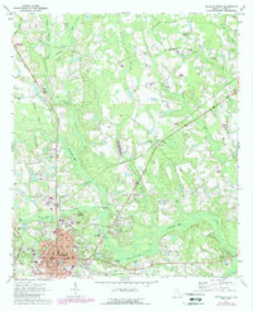
8 topographic sheets cover this place, the earliest surveyed in 1953 and the latest in 1988. It stands in the Douglas census division. It lies in ZIP code area 31533. The Survey maps it on the Douglas North quadrangle. 11,722 people lived here at the 2020 count. It stands 253 feet above sea level.
Research this city
On record in Douglas
Buildings and businesses the archive holds for this place. Each opens its own page, with the source record it came from.
On the National Register 6 records
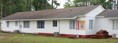 63rd Army Air Forces Contract Pilot School (Primary)listed 2013
 Downtown Douglas Historic Districtlisted 1993
 Eleventh District A & M School-South Georgia College Historic Districtlisted 2010
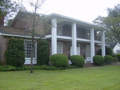 Gaskin Avenue Historic Districtlisted 1993
 Lonnie A. Pope Houselisted 1982
 Union Banking Company Buildinglisted 1982
Surveyed buildings and structures 3 records
- 602 East Ward Street (House), Douglasfederal building survey, 5 photographs
- 916-918 East Ward Street (House), Douglasfederal building survey, 5 photographs
- Gaskin Avenue Neighborhood, Bounded by Dart Street to east, CSX Railroad to south, Pearl & Madison Avenues to west, & Wilson & Gordon Streets to north, Douglasfederal building survey, 23 photographs
Population over time
2 figuresDouglas grew from 11,589 to 11,722 between 2010 and 2020. These are the recorded population figures Wikidata holds for this place, reached through the Geographic Names Information System number this page is keyed on rather than by name, so they belong to this place and not to another of the same name. Most are census counts, but not all are: an early figure may be a founding or settlement estimate, and an estimate published within five years of a census is left out. The change column is computed, and is left blank where more than 20 years separate a figure from the one before it, because a gap that long is not a change between two counts.
| Year | People | Change |
|---|---|---|
| 2010 | 11,589 | |
| 2020 | 11,722 | +133 (+1%) |
Topographic sheets covering this place
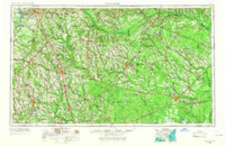
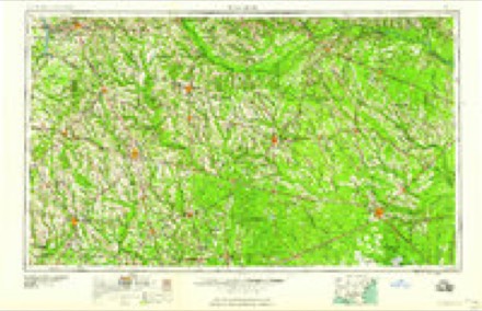
5 surveys from 8 printed sheetsMatched by testing this settlement's coordinate against the published boundary of every sheet in the United States Geological Survey's historical collection. Each opens the scanned sheet at the Survey.
- 1953 USGS Waycross quadrangle1:250000, 2 printings
- 1958 USGS Waycross quadrangle1:250000, 2 printings
- 1971 USGS Douglas North quadrangle1:24000, 2 printings
- 1979 USGS Hazlehurst quadrangle1:100000
- 1988 USGS Waycross quadrangle1:250000
Photographs
8 of 19 photographs shown, 1938Taken for the Office of War Information and the Farm Security Administration, who photographed the country between 1935 and 1944. Works of United States government photographers, with no known restriction on use. Each opens its catalogue record.

Lange, Dorothea, photographer, 1938. Library of Congress
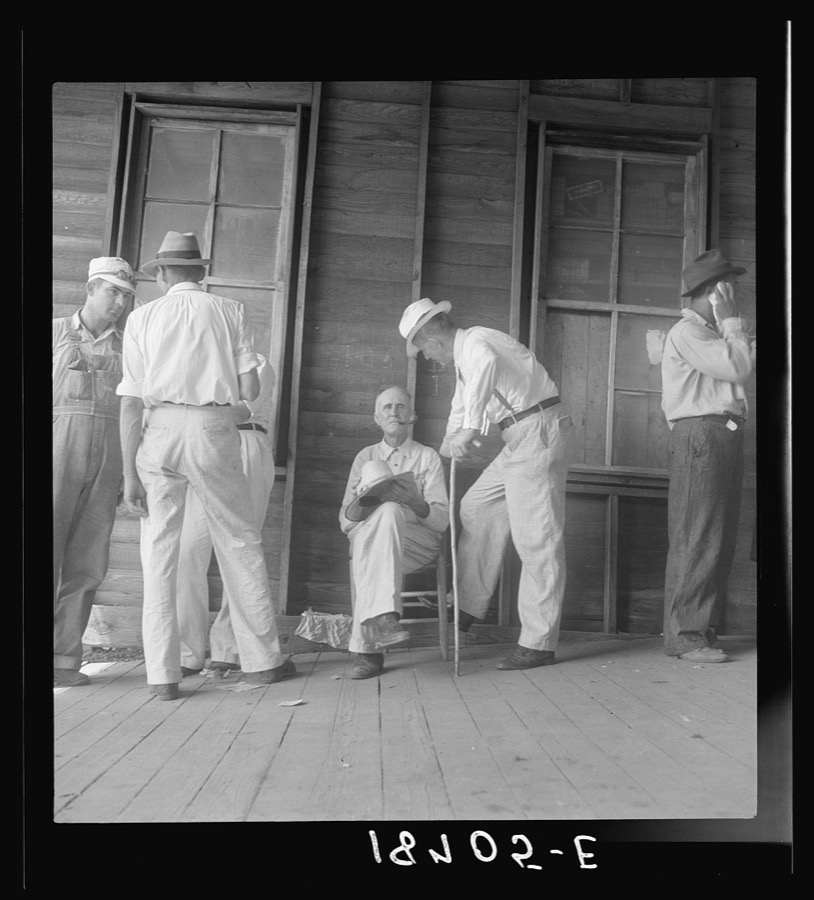
Lange, Dorothea, photographer, 1938. Library of Congress
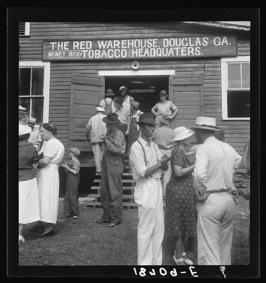
Lange, Dorothea, photographer, 1938. Library of Congress

Lange, Dorothea, photographer, 1938. Library of Congress

Lange, Dorothea, photographer, 1938. Library of Congress

Lange, Dorothea, photographer, 1938. Library of Congress
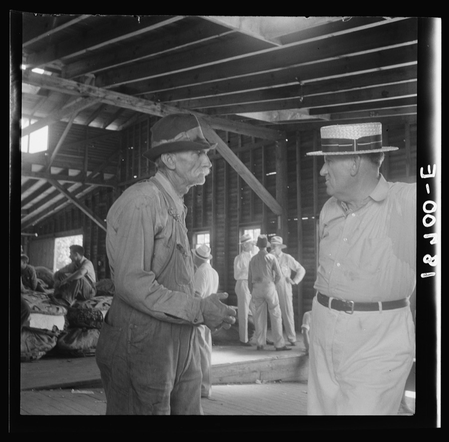
Lange, Dorothea, photographer, 1938. Library of Congress

Lange, Dorothea, photographer, 1938. Library of Congress
Every photograph of Coffee County
Fires near this place
428 since 1992Regional context, not property-specific evidence. The federal wildfire occurrence database lists 428 fires within 5 miles of Douglas between 1992 and 2020, burning about 966 acres in total. 12 started naturally. 56 were recorded as arson. Distance is straight-line from the map coordinates, so a fire counted here may appear on a neighbouring settlement's page as well.
| Reported cause | Fires |
|---|---|
| Debris and open burning | 265 |
| Arson/incendiarism | 56 |
| Misuse of fire by a minor | 33 |
| Equipment and vehicle use | 25 |
| Missing data/not specified/undetermined | 13 |
| Natural | 12 |
| Recreation and ceremony | 11 |
| Smoking | 10 |
| Railroad operations and maintenance | 3 |
The most recent of them, most recent first, with the day each was reported and the service that recorded it.
| Date | Cause | Size | Reported by | Name on the report |
|---|---|---|---|---|
| 8 September 2016 | Debris and open burning | under an acre | Georgia Forestry Commission | FY2017-COFFEE-015 |
| 7 September 1996 | Debris and open burning | under an acre | Georgia Forestry Commission | not named |
| 5 September 2017 | Debris and open burning | 1.0 acres | Georgia Forestry Commission | FY2018-COFFEE-006 |
| 4 September 2011 | Debris and open burning | under an acre | Georgia Forestry Commission | FY2012-COFFEE-013 |
| 30 September 2016 | Debris and open burning | 1.0 acres | Georgia Forestry Commission | FY2017-COFFEE-017 |
| 30 September 2008 | Equipment and vehicle use | under an acre | Georgia Forestry Commission | not named |
| 29 September 2016 | Debris and open burning | 4.0 acres | Georgia Forestry Commission | FY2017-COFFEE-016 |
| 29 September 2006 | Arson/incendiarism | 1.5 acres | Georgia Forestry Commission | not named |
Settlements close enough to share some of these fires:
Mines and quarries near this place
2 within 5 milesRegional context, not property-specific evidence. The federal mineral resources record lists 2 workings within 5 miles of Douglas: 1 occurrence, 1 producer. 1 still produces. What was taken out: Sand and Gravel, Construction. Distance is straight-line from the map coordinates, so a quarry counted here may appear on a neighbouring settlement's page as well.
| Where | Site | Commodity | Status | Recorded |
|---|---|---|---|---|
| Burkett Pit | Sand and Gravel, Construction | Producer | ||
| Unnamed Sand Deposit | Sand and Gravel, Construction | Occurrence | Alluvium |
Storms near this place
60 of 104 shownRegional context, not property-specific evidence. The National Weather Service names Douglas in 104 storm reports between 1993 and 2024: 69 thunderstorm wind, 21 hail, 4 tornado, 4 funnel cloud. The reports record 8 injuries. Each account below is quoted exactly as the forecast office filed it, from the NOAA Storm Events Database, and each date opens the federal record of that event.
| When | Event | Place named | Harm | What the report says |
|---|---|---|---|---|
| July 1998 | Thunderstorm Wind | Douglas | 6 hurt, $250,000 | Three mobile homes destroyed, eight damaged. Large trees and power lines were blown down. |
| November 2002 | Tornado (F2) | Douglas | 2 hurt, $500,000 | Tornado touched down in field along the Atkinson-Coffee County line near Marshal Corbet Road. Just inside of Coffee county one wood frame structure had a portion of its roof removed. Three large 100 yard long chicken houses were totally destroyed and machinery tossed about. One automobile was picked up and landed on the roof of a brick structure. Extensive roof damage to brick structure. Several work sheds destroyed. Trees snapped off and twisted at tops with debris wrapped in tree tops. Numerous large live oak trees felled. Clear evidence of rotation was noted by investigating officials. The storm continued north in a discontinuous path doing damage to cotton fields. the tornado crossed Highway 135 at the Satilla River with trees again snapped and twisted at the tops. Approximately 1 mile north of the Satilla River the tornado passed over an airstrip destroying a hanger/office structure and severely damaging a crop dusting aircraft. Debris from the destroyed chicken houses was identified at this site some 3 miles from its point of origin. This was the final discernable touchdown, although there was some evidence from debris further north that the system continued as a funnel cloud just above tree top level into southeast Douglas. |
| July 2017 | Thunderstorm Wind | Douglas | $15,000 | A roof was blown off of a building on South Peterson Avenue and several traffic lights were blown down off of the line. The cost of damage was unknown, but it was estimated for inclusion of this event in Storm Data. |
| February 2003 | Thunderstorm Wind | Douglas | $10,000 | Power lines down in and near Douglas and on Highway 135 in Southwestern Douglas. Power lines also down 5 miles south of Douglas and road signs flying across the road in Broxton. |
| May 1996 | Thunderstorm Wind | Douglas | $8,000 | no account filed |
| June 1994 | Thunderstorm Wind | Douglas | $5,000 | Numerous power lines were downed by thunderstorm winds. |
| October 1993 | Thunderstorm Wind | Douglas | $5,000 | Several large trees and power lines were blown down by thunderstorm winds. |
| June 2001 | Thunderstorm Wind | Douglas | $4,000 | Large trees and power lines were blown down. |
| June 2000 | Thunderstorm Wind | Douglas | $3,500 | Large trees and power lines were blown down. |
| June 2001 | Thunderstorm Wind | Douglas | $2,500 | Large trees and power lines were blown down. |
| May 2001 | Thunderstorm Wind | Douglas | $2,500 | Large trees and power lines were blown down. |
| April 1998 | Thunderstorm Wind | Douglas | $2,500 | Large trees and power lines were blown down. |
| June 1998 | Thunderstorm Wind | Douglas | $2,500 | Large trees and power lines were blown down. |
| October 1997 | Thunderstorm Wind | Douglas | $2,500 | Large trees and power lines were blown down. |
| February 1996 | Thunderstorm Wind | Douglas | $2,500 | no account filed |
| November 1996 | Thunderstorm Wind | Douglas | $2,500 | no account filed |
| June 2020 | Thunderstorm Wind | Douglas | $2,000 | A large tree was blown down in a backyard. A large branch fell onto a back porch and damaged some patio furniture. The cost of damage was estimated for the inclusion of the event in Storm Data. |
| June 2002 | Thunderstorm Wind | Douglas | $2,000 | Large trees down across roadways. |
| October 2002 | Thunderstorm Wind | Douglas | $2,000 | Large trees down on power lines Highway 158. Hail of unknown size also reported. |
| February 2000 | Thunderstorm Wind | Douglas | $1,500 | Large trees and power lines were blown down. |
| August 1999 | Thunderstorm Wind | Douglas | $1,500 | Large trees and power lines were blown down. |
| January 1999 | Thunderstorm Wind | Douglas | $1,500 | Large trees and power lines were blown down. |
| February 1998 | Thunderstorm Wind | Douglas | $1,500 | Large tress and power lines were blown down. |
| October 1997 | Tornado (F0) | Douglas | $1,500 | Large trees and power lines were blown down. |
| May 2024 | Thunderstorm Wind | Douglas | $1,000 | Power lines and trees were blown down with tin metal sheeting blown around across the city. Widespread damage was reported across the city. The time of damage was based on radar data. The cost of damage was unknown, but it was estimated for inclusion of the event in Storm Data. The wind speed estimate of 50 mph was extrapolated between a measured 55 mph gusts in Alma and a 38 mph wind gust in Douglas as storms moved across the area. |
| May 1999 | Thunderstorm Wind | Douglas | $1,000 | Large trees were blown down. |
| May 1997 | Thunderstorm Wind | Douglas | $600 | Large trees blocked US-441. |
| March 2000 | Thunderstorm Wind | Douglas | $500 | Large trees were blown down. |
| June 1997 | Thunderstorm Wind | Douglas | $500 | Large trees were blown down. |
| August 2015 | Thunderstorm Wind | Douglas | $250 | A tree was blown down in Douglas. The Douglas AWOS measured a wind gust to 32 mph. The cost of damage was estimated. |
| March 2024 | Thunderstorm Wind | Douglas | $200 | A tree was blown down on Lupo Lane and East Baker Highway. The cost of damage was unknown, but it was estimated for the inclusion of the event in Storm Data. |
| March 1997 | Thunderstorm Wind | Douglas | $50 | no account filed |
| August 2023 | Thunderstorm Wind | Douglas | - | A metal street sign was blown over at the intersection of Peterson Avenue and Ward Street. The time of damage was based on radar. |
| January 2023 | Thunderstorm Wind | Douglas | - | About 6 large trees were blown down across the county as a line of severe storms moved across the area. |
| August 2023 | Heavy Rain | Douglas | - | A public weather station along Lee Avenue measured 4.62 inches of storm total rainfall thus far in Douglas. |
| April 2021 | Flood | Douglas | - | There was at least 2 inches of standing water along Highway 32 between Douglas and Nicholls. |
| January 2021 | Heavy Rain | Douglas | - | A weather station measured 2.92 inches daily rainfall north of Douglas. |
| May 2021 | Thunderstorm Wind | Douglas | - | A residence off of Green Avenue with awning and gutter torn off. Trees were twisted and snapped on the property. The time of damage was based on radar imagery. |
| May 2021 | Thunderstorm Wind | Douglas | - | Trees and power lines were blown down across the Douglas city limits, especially across the north side of town toward Ambrose along State Road 32. Five to six homes were damaged due to trees falling onto the structures. |
| April 2020 | Thunderstorm Wind | Douglas | - | Trees and power lines were blown down. A roof collapsed on Sleepy Hollow Farm Road. |
| August 2019 | Heavy Rain | Douglas | - | The public measured about 3.67 inches of rain in about 2.5 hrs. |
| March 2019 | Hail | Douglas | - | Quarter size hail was photographed in Douglas. |
| July 2018 | Thunderstorm Wind | Douglas | - | Several trees were blown down within the city limits of Douglas. The time of damage was based on radar. |
| January 2017 | Thunderstorm Wind | Douglas | - | Multiple trees were blown down along Highway 32. |
| April 2017 | Thunderstorm Wind | Douglas | - | Trees and power lines were blown down near Douglas. Portion of a roof collapsed on a home. |
| June 2016 | Thunderstorm Wind | Douglas | - | Multiple trees were blown down across Douglas. |
| July 2016 | Thunderstorm Wind | Douglas | - | A large tree was blown down along Westgreen Road in Douglas. The time od damage was based on radar. |
| June 2015 | Thunderstorm Wind | Douglas | - | A roof was blown off of a structure. There were also several trees and power lines blown down with the city limits. |
| June 2015 | Thunderstorm Wind | Douglas | - | A tree was blown down, crushed a truck, and blocked Walker Street. Several power lines were blown down. |
| July 2015 | Thunderstorm Wind | Douglas | - | A tree was blown down along Spring Street. |
| February 2014 | Thunderstorm Wind | Douglas | - | Numerous tree were blown down throughout the county. |
| February 2013 | Thunderstorm Wind | Douglas | - | A large tree was blown down and went through a home on Gaskin Avenue in Douglas. |
| August 2013 | Thunderstorm Wind | Douglas | - | A large pine tree was blown down onto a home which caused extensive damage. The cost of damage was unknown. No injuries were reported. |
| May 2013 | Thunderstorm Wind | Douglas | - | Trees and power lines were blown down in Douglas. The time of damage was based on radar. |
| August 2013 | Thunderstorm Wind | Douglas | - | A tree was blown down in Douglas. |
| August 2013 | Thunderstorm Wind | Douglas | - | Power lines were blown down. |
| August 2012 | Thunderstorm Wind | Douglas | - | Trees were blown down along New Forest Highway northeast of Douglas. The time of damage was based on radar. |
| January 2012 | Hail | Douglas | - | Quarter size hail was reported NW of Douglas. |
| August 2011 | Thunderstorm Wind | Douglas | - | County dispatch reported that 15 different reports of trees blown down occurred across the Douglas city limits. The time of the events was based on radar imagery. |
| February 2009 | Thunderstorm Wind | Douglas | - | Large tree limbs were blown down at the Douglas Golf and Country Club. The time of damage was based on radar imagery. |
Nearest settlements
The eight closest, with where each one stands in the county. Distances are straight-line, computed from the Geographic Names Information System coordinates.
| Map | Place | Distance | Sheets |
|---|---|---|---|
| Oak Park | 2.0 miles | 8 | |
| Blystonel | 2.0 miles | 8 | |
| Upton | 2.5 miles | 7 | |
| Bethel | 3.4 miles | 8 | |
| Cherokee Hills | 3.6 miles | 8 | |
| Huffer | 4.8 miles | 8 | |
| Bay Meadows | 4.9 miles | 8 | |
| Lotts | 5.5 miles | 8 |
Elsewhere
Matched on this settlement's Geographic Names Information System number rather than its name, so it cannot be a different place of the same name in another state.
| Wikipedia article on Douglas | An encyclopaedic summary. Its text is share-alike, so it is linked here rather than copied. |
| Wikidata item Q1004791 | The structured record the population and elevation above come from. Public domain (CC0). |
Provenance
This settlement is recorded in the Geographic Names Information System as feature 313591. The sheet list is computed by point-in-boundary test against the United States Geological Survey's historical topographic inventory. Both are works of the United States government and carry no copyright under 17 U.S.C. 105.
Wildfire. Short, Karen C. 2022. Spatial wildfire occurrence data for the United States, 1992-2020 [FPA_FOD_20221014]. 6th Edition. Fort Collins, CO: Forest Service Research Data Archive. https://doi.org/10.2737/RDS-2013-0009.6 Collected with United States Government funding and usable without additional permissions or fees.
Mines and quarries. USGS Mineral Resources Data System (MRDS) https://mrdata.usgs.gov/mrds/ A work of the United States government, no copyright under 17 U.S.C. 105.
Storms. NOAA National Centers for Environmental Information, Storm Events Database https://www.ncei.noaa.gov/stormevents/ A work of the United States government, no copyright under 17 U.S.C. 105. Narratives are quoted verbatim from the National Weather Service report and are not edited or summarised.