 Block
Dubois, Georgia
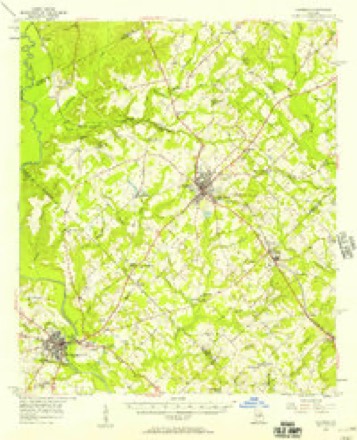
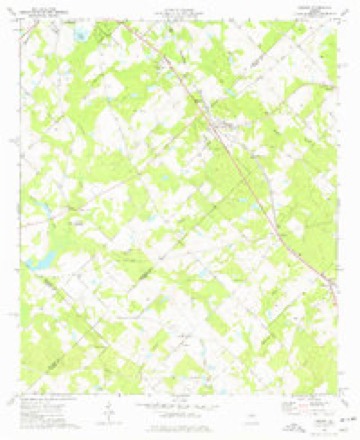
10 topographic sheets cover this place, the earliest surveyed in 1956 and the latest in 1988. It stands in the Eastman census division. It lies in ZIP code area 31014. The Survey maps it on the Empire quadrangle.
Topographic sheets covering this place
8 surveys from 10 printed sheetsMatched by testing this settlement's coordinate against the published boundary of every sheet in the United States Geological Survey's historical collection. Each opens the scanned sheet at the Survey.
- 1956 USGS Cochran quadrangle1:62500, 2 printings
- 1957 USGS Macon quadrangle1:250000
- 1958 USGS Macon quadrangle1:250000
- 1964 USGS Macon quadrangle1:250000, 2 printings
- 1974 USGS Empire quadrangle1:24000
- 1977 USGS Hawkinsville quadrangle1:100000
- 1978 USGS Hawkinsville quadrangle1:100000
- 1988 USGS Macon quadrangle1:250000
Fires near this place
630 since 1992Regional context, not property-specific evidence. The federal wildfire occurrence database lists 630 fires within 5 miles of Dubois between 1992 and 2020, burning about 2,350 acres in total. 15 started naturally. 79 were recorded as arson. Distance is straight-line from the map coordinates, so a fire counted here may appear on a neighbouring settlement's page as well.
| Reported cause | Fires |
|---|---|
| Debris and open burning | 420 |
| Arson/incendiarism | 79 |
| Equipment and vehicle use | 36 |
| Misuse of fire by a minor | 20 |
| Railroad operations and maintenance | 16 |
| Missing data/not specified/undetermined | 15 |
| Recreation and ceremony | 15 |
| Natural | 15 |
| Smoking | 14 |
The most recent of them, most recent first, with the day each was reported and the service that recorded it.
| Date | Cause | Size | Reported by | Name on the report |
|---|---|---|---|---|
| 8 September 2008 | Debris and open burning | under an acre | Georgia Forestry Commission | not named |
| 8 September 1999 | Debris and open burning | under an acre | Georgia Forestry Commission | not named |
| 7 September 2011 | Recreation and ceremony | under an acre | Georgia Forestry Commission | FY2012-DODGE-015 |
| 6 September 2020 | Debris and open burning | under an acre | Georgia Forestry Commission | FY2021DODGE007 |
| 6 September 2009 | Equipment and vehicle use | under an acre | Georgia Forestry Commission | not named |
| 30 September 2019 | Debris and open burning | under an acre | Georgia Forestry Commission | FY2020DODGE016 |
| 30 September 2011 | Debris and open burning | under an acre | Georgia Forestry Commission | FY2012-DODGE-020 |
| 3 September 2005 | Debris and open burning | under an acre | Georgia Forestry Commission | not named |
Settlements close enough to share some of these fires:
Storms near this place
6 since 2011Regional context, not property-specific evidence. The National Weather Service names Dubois in 6 storm reports between 2011 and 2024: 3 tornado, 3 thunderstorm wind. The reports record 1 death and 2 injuries. Each account below is quoted exactly as the forecast office filed it, from the NOAA Storm Events Database, and each date opens the federal record of that event.
| When | Event | Place named | Harm | What the report says |
|---|---|---|---|---|
| April 2011 | Tornado (EF2) | Dubois | 1 killed, 2 hurt, $150,000 | A damage survey conducted by the National Weather Service Forecast Office in Peachtree City, Georgia confirmed that an EF2 tornado tracked across northern Dodge county. The tornado touched down approximately 10 miles northwest of Eastman near Friendship UMC Road, just outside the Gresston community, and traveled east-northeast to near the intersection of Friendship UMC Road and U.S. Highway 23. The maximum path width was determined to be 50 yards wide with maximum winds of 130 mph. At the initial touch down location of the tornado, a double-wide mobile home was completely destroyed. A 45-year old male who resided in this mobile home, was killed. Two other residents of the home suffered injuries. Several trees nearby were also blown over or uprooted. Further east near the end of the tornado's path, another mobile home had its roof and front porch destroyed.||[04/04-04/05/11: Tornado #4, County #1-1, EF2, Dodge, 2011:006]. |
| April 2017 | Tornado (EF1) | Dubois | $200,000 | A National Weather Service survey team found that an EF1 tornado with maximum wind speeds of 105 MPH and a maximum path width of 350 yards touched down West of Hardy Road, damaging a few homes and storage buildings as it crossed Hardy Road. The damage was mostly minor roof damage. Several trees were snapped and uprooted in the area as well. The tornado moved northeast crossing Garrett Oxley road where it |destroyed a travel trailer and a small barn and lofting a metal parking cover that was never found. The van that was parked under the cover was turned sideways and left a scar in the ground about 7 feet in length from the tires dragging in the dirt. The tornado entered the northwest side of Gresston on Gresston Baptist Road where |numerous large pines were snapped and some roof damage was noted to the Baptist Church. Further northeast along Rozar-Goolsby Road, numerous trees were snapped or uprooted and several homes sustained roof damage. Another church along this street also sustained roof damage. The tornado continued northeast along Wilson Woodward Road snapping and uprooting trees before ending shortly after crossing Bell Line Road. No injuries were reported. [04/05/17: Tornado #6, County #1/1, EF-1, Dodge, 2017:065]. |
| April 2019 | Thunderstorm Wind | Dubois | $17,000 | The Dodge County Emergency Manager reported trees and power lines along Friendship UMC Road from around Antioch Church Road to past Hardy Road. A roof was damaged by the wind along this stretch of road as well. |
| September 2017 | Thunderstorm Wind | Dubois | $5,000 | The Dodge County 911 center reported trees blown down from Hardy Road near Dubois Church Road to Gresston Baptist Road near Hardy Road. |
| May 2024 | Tornado (EF1) | Dubois | - | An EF1 tornado with maximum winds at 90 mph touched down|Thursday, May 9th at At 12:50 PM EDT. EF0 damage to trees was|observed along Cochran Hwy roughly a tenth of a mile northwest of|the center of Dubois. The tornado tracked southeastward crossing|Wilson Woodward Road where a swath within a stand of hardwood|trees in a field were snapped and uprooted. The tornado continued|southeastward paralleling Bell Line Road before turning ESE and|lifting up a metal roof off the awning of a home and snapping|large branches from trees. The tornado then crossed Bell Line|Road and lifted shingles off the roof of a home and lifted the|roof off of a small outbuilding. A little further southeast|the tornado intensified to its strongest point where EF1 |damage to trees was observed on Chester|Highway and in the woods along Gum Swamp Road. As the tornado|approached the intersection of Gum Swamp Road and Dublin Hwy,|EF1 damage was observed as well as EF0 damage to a small|outbuilding. A TDS signature appears on the KJGX radar near the|beginning of the EF1 damage along Belt Line Rd and remains|visible through the Dublin hwy damage. The tornado continued|east southeast producing EF0 tree damage generally along and|north of a line paralleling Glyen Hickman Road/Golden Road before|turning eastward and dissipating. |
| April 2015 | Thunderstorm Wind | Dubois | - | A trained spotter reported a barn collapse near the intersection of Friendship UMC Road and Hardy Road. |
Nearest settlements
The eight closest, with where each one stands in the county. Distances are straight-line, computed from the Geographic Names Information System coordinates.
| Map | Place | Distance | Sheets |
|---|---|---|---|
| Carne (historical) | 1.3 miles | 10 | |
| Gresston | 1.6 miles | 10 | |
| Empire | 2.8 miles | 10 | |
| Roddy | 3.6 miles | 10 | |
| Dempsey | 4.4 miles | 9 | |
| Yonkers | 5.3 miles | 8 | |
| Dodge High | 5.6 miles | 9 | |
| Beehive (historical) | 8.1 miles | 8 |
Provenance
This settlement is recorded in the Geographic Names Information System as feature 331592. The sheet list is computed by point-in-boundary test against the United States Geological Survey's historical topographic inventory. Both are works of the United States government and carry no copyright under 17 U.S.C. 105.
Wildfire. Short, Karen C. 2022. Spatial wildfire occurrence data for the United States, 1992-2020 [FPA_FOD_20221014]. 6th Edition. Fort Collins, CO: Forest Service Research Data Archive. https://doi.org/10.2737/RDS-2013-0009.6 Collected with United States Government funding and usable without additional permissions or fees.
Storms. NOAA National Centers for Environmental Information, Storm Events Database https://www.ncei.noaa.gov/stormevents/ A work of the United States government, no copyright under 17 U.S.C. 105. Narratives are quoted verbatim from the National Weather Service report and are not edited or summarised.