 Block
Dunwoody, Georgia
21 topographic sheets cover this place, the earliest surveyed in 1888 and the latest in 1993. It stands in the Chamblee-Doraville census division. It lies in ZIP code area 30338. The Survey maps it on the Chamblee quadrangle. 51,683 people lived here at the 2020 count. It stands 1,129 feet above sea level.
On record in Dunwoody
Buildings and businesses the archive holds for this place. Each opens its own page, with the source record it came from.
On the National Register 2 records
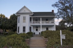 Cheek-Spruill Houselisted 2000
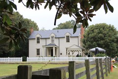 Donaldson-Bannister House and Cemeterylisted 2009
Population over time
2 figuresDunwoody grew from 46,267 to 51,683 between 2010 and 2020. These are the recorded population figures Wikidata holds for this place, reached through the Geographic Names Information System number this page is keyed on rather than by name, so they belong to this place and not to another of the same name. Most are census counts, but not all are: an early figure may be a founding or settlement estimate, and an estimate published within five years of a census is left out. The change column is computed, and is left blank where more than 20 years separate a figure from the one before it, because a gap that long is not a change between two counts.
| Year | People | Change |
|---|---|---|
| 2010 | 46,267 | |
| 2020 | 51,683 | +5,416 (+12%) |
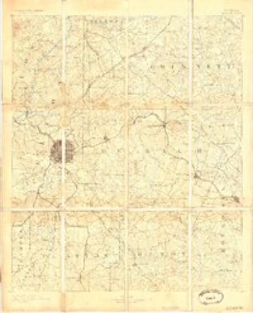
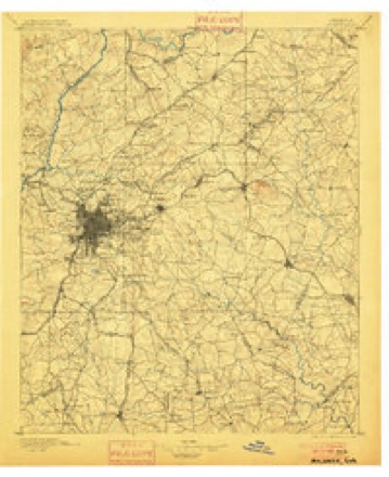
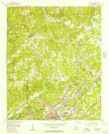
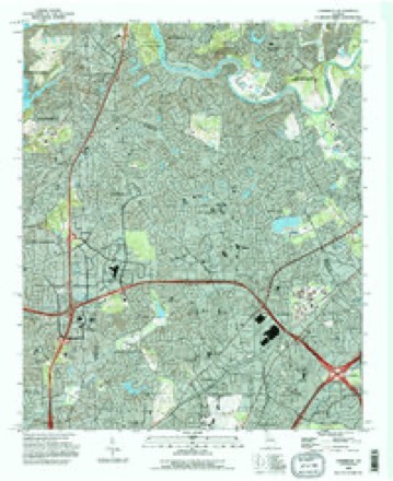
Topographic sheets covering this place
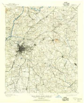
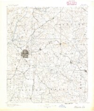
10 surveys from 21 printed sheetsMatched by testing this settlement's coordinate against the published boundary of every sheet in the United States Geological Survey's historical collection. Each opens the scanned sheet at the Survey.
- 1888 USGS Atlanta quadrangle1:125000
- 1890 USGS Atlanta quadrangle1:125000
- 1892 USGS Atlanta quadrangle1:125000
- 1895 USGS Atlanta quadrangle1:125000, 7 printings
- 1953 USGS Atlanta quadrangle1:250000, 2 printings
- 1954 USGS Chamblee quadrangle1:24000, 5 printings
- 1957 USGS Atlanta quadrangle1:250000
- 1958 USGS Atlanta quadrangle1:250000
- 1981 USGS Atlanta quadrangle1:100000
- 1993 USGS Chamblee quadrangle1:24000




Fires near this place
12 since 1993Regional context, not property-specific evidence. The federal wildfire occurrence database lists 12 fires within 5 miles of Dunwoody between 1993 and 2016, burning about 47 acres in total. 1 started naturally. 4 were recorded as arson. Distance is straight-line from the map coordinates, so a fire counted here may appear on a neighbouring settlement's page as well.
| Reported cause | Fires |
|---|---|
| Arson/incendiarism | 4 |
| Debris and open burning | 2 |
| Misuse of fire by a minor | 2 |
| Recreation and ceremony | 2 |
| Equipment and vehicle use | 1 |
| Natural | 1 |
The most recent of them, most recent first, with the day each was reported and the service that recorded it.
| Date | Cause | Size | Reported by | Name on the report |
|---|---|---|---|---|
| 21 September 1999 | Natural | under an acre | Chattahoochee River National Recreation Area | VICKERY |
| 15 September 1993 | Equipment and vehicle use | under an acre | Georgia Forestry Commission | not named |
| 13 September 1993 | Arson/incendiarism | 1.9 acres | Georgia Forestry Commission | not named |
| 29 June 1996 | Recreation and ceremony | 3.0 acres | Chattahoochee River National Recreation Area | VICKERY |
| 30 May 1994 | Arson/incendiarism | under an acre | Georgia Forestry Commission | not named |
| 18 April 1996 | Arson/incendiarism | 5.7 acres | Georgia Forestry Commission | not named |
| 1 April 1994 | Misuse of fire by a minor | 1.5 acres | Chattahoochee River National Recreation Area | GOODFRIDAY |
| 4 March 1994 | Recreation and ceremony | 1.2 acres | Chattahoochee River National Recreation Area | GOLDBRANCH |
Settlements close enough to share some of these fires:
Mines and quarries near this place
2 within 5 milesRegional context, not property-specific evidence. The federal mineral resources record lists 2 workings within 5 miles of Dunwoody: 1 past producer, 1 producer. 1 still produces. What was taken out: Gold, Sand and Gravel, Construction. Distance is straight-line from the map coordinates, so a quarry counted here may appear on a neighbouring settlement's page as well.
| Where | Site | Commodity | Status | Recorded |
|---|---|---|---|---|
| No Name | Gold | Past Producer | Vein | |
| Roswell Mine | Sand and Gravel, Construction | Producer |
Storms near this place
23 since 1997Regional context, not property-specific evidence. The National Weather Service names Dunwoody in 23 storm reports between 1997 and 2024: 10 thunderstorm wind, 6 hail, 2 tornado, 2 flash flood. The reports record 2 deaths and 1 injury. Each account below is quoted exactly as the forecast office filed it, from the NOAA Storm Events Database, and each date opens the federal record of that event.
| When | Event | Place named | Harm | What the report says |
|---|---|---|---|---|
| May 2004 | Lightning | Dunwoody | 1 killed, 1 hurt | The Atlanta-Journal/Constitution reported that a 34-year old man of Douglasville, who was installing a pool at a private residence, was struck and killed by lightning while leaning against a truck outside at the site. The bolt of lightning struck the ground about 30 feet from where the individual was located at the time. Another individual with the same construction crew had his back singed during the time of this same lightning strike. |
| April 1998 | Tornado (F2) | Dunwoody | 1 killed, $25,000,000 | The damage path began just northeast of Perimeter Mall in Dunwoody and extended well into Gwinnett county. There was significant widespread damage to trees and homes. One person was killed when a tree fell on his home. DeKalb College's north campus was closed after several buildings sustained major damage. |
| September 2009 | Flood | Dunwoody | $6,100,000 | Record, and in some cases catastrophic, flooding continued to expand across the northern and western portions of the Atlanta metropolitan area as renewed rounds of showers and thunderstorms with very heavy rain tracked repeatedly over the same areas throughout the day. Portions of hundreds of roads in the county were closed from flooding and washed out bridges and/or culverts. Hundreds of homes, apartments, and businesses sustained significant flood damage. Record flooding was occurring on Peachtree Creek, the North Fork of Peachtree Creek, and Nancy Creek in northeast Atlanta. The interchange of Interstate-285 and Interstate-85 in northeast DeKalb county, known as Spaghetti Junction was completely shut down for nearly an hour early on the 21st because of flooding. Major traffic backups occurred as a result. A mud slide blocked two westbound lanes of U.S. Highway 78 at Hugh Howell Road. Other mud slides were reported within the county. These are just some of the more significant examples of flood damage in the county. Monetary damage during this time frame across DeKalb county was estimated to exceed $6 million. |
| September 2009 | Flood | Dunwoody | $3,180,000 | DeKalb county emergency management personnel and USGS stream gages confirmed that major to record flooding continued to expand into all parts of the county. Hundreds of homes, apartments, businesses, and roads sustained damages from flooding. A number of culverts and/or bridges were washed out and several roads were closed. Flood waters began to recede after 830 am EDT on the 22nd, however, many areas remained in major to record flood through 715 am EDT on the 23rd. Monetary damage from flooding continued to mount, with damage near $3.2 million during this time frame. |
| September 2009 | Flash Flood | Dunwoody | $760,000 | Several USGS stream gages showed significant flooding commencing during this time frame across DeKalb county as thunderstorms with heavy rain, which had been west of the area most of the night, began to edge east-northeast and develop across Fulton, DeKalb, and Gwinnett counties. The South Fork of Peachtree Creek at Johnson Road reached its flood stage of 12.0 feet at 128 am EDT. The North Fork of Peachtree Creek at Buford Highway reached its flood stage of 12.0 feet at 201 am EDT. Many homes, apartments, and businesses began to experience significant flooding during this time frame, especially in the vicinity of the flooded creeks. A number of roads also became flooded, impassable, and were closed. Monetary damage to roads and property during this time frame was estimated to exceed $750,000. |
| December 2024 | Tornado (EF0) | Dunwoody | $200,000 | An EF0 tornado damaged approximately 10 homes and one apartment unit where the roof was partially ripped off of a three story building. About 50 to 100 large trees and several power poles were snapped or uprooted falling on several homes two of which had significant damage. No injuries have been reported. |
| May 2010 | Flash Flood | Dunwoody | $50,000 | Several creeks across DeKalb county reached and exceeded flood stage during this period. This was verified by USGS stream gages. On the South Fork of the Peachtree Creek at Johnson Road, the flood stage of 12.0 feet was reached at 640 am EDT. The creek continued to rise and crested at 14.1 feet at 815 am EDT. The North Fork of Peachtree Creek at Buford Highway reached its flood stage of 12.0 feet at 710 am EDT, then crested at 15.1 feet at 130 pm EDT. On Snapfinger Creek in the southern part of the county, the flood stage of 12.0 feet was reached at 740 am EDT. The creek continued to rise to 12.7 feet at 915 pm EDT. The DeKalb County Emergency Management Director reported that flood waters from the upper South Fork of Peachtree Creek flooded the crawl spaces of several apartments on Lansbury Village Drive. Forty-five people had to be evacuated until the buildings were inspected and cleared of structural problems related to the flood waters. Damages from the flash floods in DeKalb county were estimated to be $50,000. |
| March 2011 | Thunderstorm Wind | Dunwoody | $15,000 | The public reported that a large pine tree was blown down across their privacy fence and also scraped the side of the house. The tree tore off two screens and broke one window on the home. Pea-sized hail was also observed at the time. |
| June 2011 | Thunderstorm Wind | Dunwoody | $10,000 | The DeKalb County 911 Center reported that more than a dozen trees were down across the county. At least one power line was down. This was from a squall line of thunderstorms that passed through the county and was not caused by the more isolated thunderstorm that earlier caused damage to a home and truck near Chamblee. |
| April 1998 | Thunderstorm Wind | Dunwoody | $10,000 | The DeKalb county EMA reported thunderstorm winds damaged houses. |
| July 2016 | Thunderstorm Wind | Dunwoody | $5,000 | The DeKalb County Emergency Manager reported several trees blown down across northern DeKalb County. A large tree was blown down at the intersection of Chamblee Dunwoody Road and Nerine Circle. |
| June 2011 | Thunderstorm Wind | Dunwoody | $5,000 | The Atlanta Journal-Constitution reported that several trees and power lines were down throughout the county. |
| June 1998 | Thunderstorm Wind | Dunwoody | $5,000 | Newspaper and public reports indicated thunderstorm winds knocked down quite a few trees. |
| June 2018 | Thunderstorm Wind | Dunwoody | $3,000 | The public reported a tree blown down onto power lines and over a road in Dunwoody. |
| July 2024 | Thunderstorm Wind | Dunwoody | $1,000 | Tree down at Vernon Ridge Court and Vernon Ridge Drive. |
| July 2024 | Thunderstorm Wind | Dunwoody | $1,000 | A tree was reported down in the 1000 block of Redfield Terrace. |
| September 1999 | Thunderstorm Wind | Dunwoody | $500 | Public reports indicated thunderstorm winds knocked several trees down in the vicinity of Peachtree-Dunwoody Road and I-285. |
| April 2011 | Hail | Dunwoody | - | An amateur radio operator relayed a report of penny-sized hail from the far northern part of the county around Dunwoody. |
| April 2005 | Hail | Dunwoody | - | Numerous reports of hail, ranging in size from pennies to quarters were received from the public. At some locations the hail fell for a period of up to five minutes. Nickel-sized hail was reported in Chamblee, Tucker, Doraville, and Dunwoody, quarter-sized hail was reported in Chamblee, and half-dollar-sized hail was reported in Doraville. |
| September 1999 | Hail | Dunwoody | - | Three public reports indicated dime to quarter size hail. |
| April 1998 | Hail | Dunwoody | - | Several public reports were received of dime to nickel size hail. |
| June 1997 | Hail | Dunwoody | - | Dime to nickel sized hail was reported. |
| September 1997 | Hail | Dunwoody | - | A Weather Channel employee reported golfball sized hail in the Dunwoody area along and on the Fulton-De Kalb Counties line. Another report from the public was of half-dollar sized hail in the same area. |
Nearest settlements
The eight closest, with where each one stands in the county. Distances are straight-line, computed from the Geographic Names Information System coordinates.
| Map | Place | Distance | Sheets |
|---|---|---|---|
| Dunwoody West | 0.4 miles | 21 | |
| Wickford | 0.4 miles | 21 | |
| Fairfield | 0.6 miles | 21 | |
| Hidden Branches | 0.6 miles | 21 | |
| Trailridge | 0.6 miles | 21 | |
| Wynterhall | 0.6 miles | 21 | |
| Valley View | 0.6 miles | 21 | |
| Mount Vernon Springs | 0.7 miles | 21 |
Elsewhere
Matched on this settlement's Geographic Names Information System number rather than its name, so it cannot be a different place of the same name in another state.
| Wikipedia article on Dunwoody | An encyclopaedic summary. Its text is share-alike, so it is linked here rather than copied. |
| Wikidata item Q1208436 | The structured record the population and elevation above come from. Public domain (CC0). |
Provenance
This settlement is recorded in the Geographic Names Information System as feature 325929. The sheet list is computed by point-in-boundary test against the United States Geological Survey's historical topographic inventory. Both are works of the United States government and carry no copyright under 17 U.S.C. 105.
Wildfire. Short, Karen C. 2022. Spatial wildfire occurrence data for the United States, 1992-2020 [FPA_FOD_20221014]. 6th Edition. Fort Collins, CO: Forest Service Research Data Archive. https://doi.org/10.2737/RDS-2013-0009.6 Collected with United States Government funding and usable without additional permissions or fees.
Mines and quarries. USGS Mineral Resources Data System (MRDS) https://mrdata.usgs.gov/mrds/ A work of the United States government, no copyright under 17 U.S.C. 105.
Storms. NOAA National Centers for Environmental Information, Storm Events Database https://www.ncei.noaa.gov/stormevents/ A work of the United States government, no copyright under 17 U.S.C. 105. Narratives are quoted verbatim from the National Weather Service report and are not edited or summarised.