 Block
Eastman, Georgia
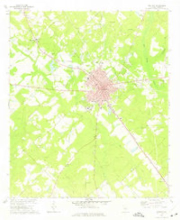
9 topographic sheets cover this place, the earliest surveyed in 1957 and the latest in 1988. It stands in the Eastman census division. It lies in ZIP code area 31023. The Survey maps it on the Eastman quadrangle. 5,658 people lived here at the 2020 count. It stands 390 feet above sea level.
Research this city
On record in Eastman
Buildings and businesses the archive holds for this place. Each opens its own page, with the source record it came from.
On the National Register 6 records
 Dodge County Courthouselisted 1980
 Dodge County Jaillisted 2013
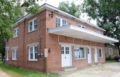 Eastman Bus Stationlisted 2002
 William Pitt Eastman Houselisted 1995
 Peabody Schoollisted 2004
 Williamson Mausoleum at Orphans Cemeterylisted 1997
Population over time
2 figuresEastman grew from 4,962 to 5,658 between 2010 and 2020. These are the recorded population figures Wikidata holds for this place, reached through the Geographic Names Information System number this page is keyed on rather than by name, so they belong to this place and not to another of the same name. Most are census counts, but not all are: an early figure may be a founding or settlement estimate, and an estimate published within five years of a census is left out. The change column is computed, and is left blank where more than 20 years separate a figure from the one before it, because a gap that long is not a change between two counts.
| Year | People | Change |
|---|---|---|
| 2010 | 4,962 | |
| 2020 | 5,658 | +696 (+14%) |
Topographic sheets covering this place
7 surveys from 9 printed sheetsMatched by testing this settlement's coordinate against the published boundary of every sheet in the United States Geological Survey's historical collection. Each opens the scanned sheet at the Survey.
- 1957 USGS Macon quadrangle1:250000
- 1958 USGS Macon quadrangle1:250000
- 1964 USGS Macon quadrangle1:250000, 2 printings
- 1972 USGS Eastman quadrangle1:24000, 2 printings
- 1977 USGS Hawkinsville quadrangle1:100000
- 1978 USGS Hawkinsville quadrangle1:100000
- 1988 USGS Macon quadrangle1:250000
Fires near this place
748 since 1992Regional context, not property-specific evidence. The federal wildfire occurrence database lists 748 fires within 5 miles of Eastman between 1992 and 2020, burning about 1,694 acres in total. 28 started naturally. 131 were recorded as arson. Distance is straight-line from the map coordinates, so a fire counted here may appear on a neighbouring settlement's page as well.
| Reported cause | Fires |
|---|---|
| Debris and open burning | 437 |
| Arson/incendiarism | 131 |
| Equipment and vehicle use | 59 |
| Misuse of fire by a minor | 36 |
| Natural | 28 |
| Missing data/not specified/undetermined | 21 |
| Recreation and ceremony | 18 |
| Smoking | 13 |
| Railroad operations and maintenance | 5 |
The most recent of them, most recent first, with the day each was reported and the service that recorded it.
| Date | Cause | Size | Reported by | Name on the report |
|---|---|---|---|---|
| 9 September 2011 | Debris and open burning | under an acre | Georgia Forestry Commission | FY2012-DODGE-016 |
| 8 September 2008 | Equipment and vehicle use | under an acre | Georgia Forestry Commission | not named |
| 8 September 1997 | Equipment and vehicle use | under an acre | Georgia Forestry Commission | not named |
| 7 September 1997 | Debris and open burning | 1.6 acres | Georgia Forestry Commission | not named |
| 6 September 2010 | Arson/incendiarism | under an acre | Georgia Forestry Commission | FY2011-DODGE-015 |
| 6 September 2002 | Debris and open burning | under an acre | Georgia Forestry Commission | FY2003-DODGE-017 |
| 6 September 1993 | Natural | 3.1 acres | Georgia Forestry Commission | not named |
| 5 September 2010 | Debris and open burning | under an acre | Georgia Forestry Commission | FY2011-DODGE-014 |
Settlements close enough to share some of these fires:
Storms near this place
52 since 1993Regional context, not property-specific evidence. The National Weather Service names Eastman in 52 storm reports between 1993 and 2024: 31 thunderstorm wind, 10 hail, 5 flash flood, 3 lightning. The reports record 2 injuries. Each account below is quoted exactly as the forecast office filed it, from the NOAA Storm Events Database, and each date opens the federal record of that event.
| When | Event | Place named | Harm | What the report says |
|---|---|---|---|---|
| April 2007 | Tornado (EF1) | Eastman | 2 hurt, $350,000 | A damage survey conducted by the National Weather Service in Peachtree City, Georgia confirmed that an EF1 tornado, with a maximum wind speed of 90 mph, had touched down about one mile west of downtown Eastman and traveled north-northeast to a point about four miles north-northeast of downtown Eastman. The total path length of the tornado was 4.5 miles with a maximum path width of 100 yards. A number of retail buildings on U.S. Highway 23 sustained minor damage. However, an adjacent greenhouse was destroyed. The announcers booth at the Eastman High School football field was destroyed. Two unsecured mobile homes along the path of the tornado were destroyed. A man and woman were injured when a home in the the Greenwood Heights Subdivision was destroyed. Both injuries were the result of fallen and flying debris. The home was destroyed by a large tree which crashed through the home. Numerous trees and power lines were downed along the path of the tornado, several of which fell on and caused damage to homes. |
| April 2007 | Tornado (EF2) | Eastman | $500,000 | A damage survey conducted by the National Weather Service in Peachtree City, Georgia confirmed that yet another tornado touched down in Dodge county and traveled very near the city of Eastman once again. This tornado was from a different complex of thunderstorms than the one that caused the first tornado earlier. However, this was the same complex of thunderstorms that caused the tornado earlier in Crisp county. This time the tornado touched down one mile south of downtown Eastman, traveling northeast. The total path length was 4.5 miles with a maximum path width of 200 yards. The maximum wind speed within the tornado was estimated to be 120 mph. The Dodge County Road Department's garage was destroyed. Two mobile homes in the area were destroyed. A nearby home suffered significant damage when parts of its roof, an exterior wall, and patio were removed. An adjacent barn was also destroyed. Several other homes in the area sustained minor damage. |
| June 2006 | Lightning | Eastman | $75,000 | The Dodge County News of Eastman reported that lightning struck a home on Glen Hickman Road causing significant damage to the home. The top floor was destroyed by fire and the bottom floor suffered heat and water damage. |
| May 2014 | Tornado (EF0) | Eastman | $50,000 | A National Weather Service survey team determined that an EF0 anticyclonic tornado touched down near the Dodge County Hospital off Plaza Avenue, initially uprooting trees and peeling back the roof of a nursing home. The tornado continue on a northward track, causing minor roof, siding, and gutter damage to several community homes and downing large tree branches just east of Georgia Highway 117. A front porch of a home off Harrell Avenue collapsed as a result of the winds. Several trees were downed or uprooted, and a brick building and CVS store near the intersection of Highway 117 and Highway 23/Oak Street sustained roof loss. The tornado continued northward causing roof and gutter damage to numerous residential and commercial buildings in Eastman, east of Oak Street and 5th Avenue/Georgia Highway 46. Additional tree damage was observed north of Eastman-Dublin Highway near 7th Avenue. After downing trees near a home at the intersection of Shady Acres and Old Eastman-Dublin Road, the tornado lift. Maximum winds were estimated at 80 MPH.|[05/14/14: Tornado #1, County #1-1, EF0, Dodge, 2014:006]. |
| May 1995 | Thunderstorm Wind | Eastman | $45,000 | Thunderstorm winds knocked over a silo on Tripp Farms. Trees were knocked down county-wide. |
| February 2008 | Thunderstorm Wind | Eastman | $35,000 | The Dodge County Emergency Management Director reported that a couple of large pecan trees were blown down just south of Eastman. One tree landed on a truck and another on a mobile home causing considerable damage to the property. An amateur radio operator reported that a couple of trees were down off Rock Springs Road south of U.S. Highway 341. |
| September 2021 | Flash Flood | Eastman | $30,000 | The Emergency Manager relayed multiple reports of flash flooding including road closures and washed out roads in and around the city of Eastman. Some of these reports include Wilson Woodward Road (washed out), from 7th to 9th, MLK Blvd to Cooper Drive, Abbeville Highway, Level Church and near the intersection of Airport Road and Ready Branch Road. Radar estimates indicate that between 4 and 5 inches of rain, with localized areas of up to 8 inches, had fallen over the area in a short period of time, resulting in the flash flooding. |
| June 1998 | Thunderstorm Wind | Eastman | $25,000 | A newspaper reported thunderstorm winds took part of the roof off of a bank and tore a hangar door from an aircraft shop at Georgia Technical Institute. |
| October 2015 | Flash Flood | Eastman | $15,000 | The Dodge County emergency manager reported intense rainfall in Eastman caused rapid runoff that entered portions of the Eastman Gardens Apartment Complex. At least six apartments were flooded with several inches of water. |
| July 2009 | Thunderstorm Wind | Eastman | $10,000 | The Dodge County Emergency Management Director and WMAZ Television of Macon reported that several trees and power lines were blown down around Eastman. The roof was also blown off a barn under construction near Eastman. |
| April 1999 | Thunderstorm Wind | Eastman | $10,000 | The public reported a barn blown down by thunderstorm winds. |
| July 1999 | Lightning | Eastman | $10,000 | Lightning struck the chimney on a new home on Friendship Church Road. Falling brick caused damage to the roof and deck. There was also water damage inside the house. |
| June 2010 | Thunderstorm Wind | Eastman | $5,000 | The Dodge County Emergency Management Director reported that more than 10 trees were blown down across the county. Six roads were temporarily blocked from downed trees. Some of the blocked roads included Middleground Church Road, Eastman-Cochran Road, Antioch Church Road, Chester Road, and Mitchell Road. |
| March 1998 | Lightning | Eastman | $5,000 | A church was damaged when lightning struck a tree which fell onto it. The church was located on Rocky Spring Road in Dodge county. The time was estimated. |
| October 1993 | Thunderstorm Wind | Eastman | $5,000 | Thunderstorm winds downed several power lines along Mt. Avery road. |
| June 2018 | Thunderstorm Wind | Eastman | $4,000 | The Dodge County 911 center reported power lines blown down around the intersection of Highway 117 and Pine Crest Drive. |
| July 2020 | Thunderstorm Wind | Eastman | $3,000 | The Dodge County Emergency Manager reported 3 trees blown down on Highway 87 south of Eastman. |
| June 1997 | Thunderstorm Wind | Eastman | $2,500 | Several trees were knocked down along Georgia Highway 87. |
| June 2007 | Thunderstorm Wind | Eastman | $2,000 | The public reported that strong thunderstorm winds blew down a power line and also broke off a railroad crossing arm. |
| July 2007 | Thunderstorm Wind | Eastman | $2,000 | The Dodge County 911 Center reported that ten trees were down in the western part of the county, west of Eastman. |
| July 2002 | Thunderstorm Wind | Eastman | $2,000 | The Dodge county 911 center reported that some trees and power lines were down. |
| May 1998 | Hail | Eastman | $2,000 | The public reported golf ball size hail covering the yard. |
| July 1997 | Thunderstorm Wind | Eastman | $2,000 | Several trees were knocked down by the Post Office in Eastman as well as along Georgia Highway 117 just south of Eastman. |
| June 2013 | Thunderstorm Wind | Eastman | $1,500 | Amateur radio operators and the broadcast media relayed reports of trees down on Bethel Street between 1st and 2nd Avenue as well as at Main and 5th Streets. An amateur radio operator estimated the gust at 60 MPH. |
| July 2012 | Thunderstorm Wind | Eastman | $1,500 | The Dodge County 911 Center reported that six to eight trees were blown down in the Eastman area. |
| June 2009 | Thunderstorm Wind | Eastman | $1,500 | The Dodge County Emergency Management Director reported that approximately six trees were down within the county. Most of the trees were located in the far southern part of the county around Rhine, although one tree was down on Georgia Highway 87 at Isham Springs Road. |
| April 2024 | Thunderstorm Wind | Eastman | $1,000 | Tree down on Edna Moore Road between Hwy 341 and Hwy 87. |
| June 2020 | Thunderstorm Wind | Eastman | $1,000 | The Dodge County Emergency Manager reported power lines blown down across the intersection of 5th Avenue and Ogden Street. |
| March 2015 | Thunderstorm Wind | Eastman | $1,000 | The Dodge County 911 center reported trees blown down in Eastman and Plainfield. |
| July 2010 | Thunderstorm Wind | Eastman | $1,000 | The Dodge County Emergency Management Director reported that two trees and one power line were down near Eastman. |
| December 2008 | Thunderstorm Wind | Eastman | $1,000 | WMAZ Television of Macon reported that about three large trees were blown down in northern Dodge county. |
| March 2001 | Thunderstorm Wind | Eastman | $1,000 | The Dodge county 911 center reported that the wing of a glider parked at the Eastman airport was damaged. |
| August 1999 | Thunderstorm Wind | Eastman | $1,000 | Dodge county 911 reported trees and power lines down. |
| May 1999 | Thunderstorm Wind | Eastman | $1,000 | A radio station reported thunderstorm winds knocked a few trees down and caused roof damage between Eastman and Hawkinsville. Power outages were also reported. |
| April 1997 | Thunderstorm Wind | Eastman | $1,000 | no account filed |
| June 2013 | Thunderstorm Wind | Eastman | $500 | The Dodge County 911 Center reported that two trees were blown down in Eastman. One was down along Highway 87 and another on Rocky Springs Road near Highway 341. |
| July 1998 | Thunderstorm Wind | Eastman | $500 | Dodge county 911 reported several trees down across secondary roads near highway 341. |
| June 1996 | Thunderstorm Wind | Eastman | $500 | no account filed |
| February 2003 | Thunderstorm Wind | Eastman | $250 | The Dodge county 911 center reported that one tree was down. |
| September 2023 | Hail | Eastman | - | Report of quarter-sized hail on 800 block of Chester Hwy. Lasted 6-7 minutes. |
| September 2021 | Flash Flood | Eastman | - | There were several social media reports of flooding of the Eastman Walmart Parking lot. Radar estimates indicate that between 4 and 5 inches of rain had fallen over the area in a short period of time, resulting in the flash flooding. |
| June 2020 | Hail | Eastman | - | A photo of hail the size of quarters was shared on social media from the intersection of 9th Avenue and Pine Drive in Eastman. |
| October 2019 | Flash Flood | Eastman | - | The Emergency Manager reported water over the road at Sheldon Street and 6th Avenue. A drainage ditch had to be cleared. Radar estimates indicate that 3 to 5 inches of rain quickly accumulated over the area, causing the issue. |
| October 2019 | Flash Flood | Eastman | - | The Emergency Manager reported water over Norman Street. Radar estimates indicate that 3 to 5 inches of rainfall accumulated quickly over the area, causing the flooding. |
| September 2019 | Hail | Eastman | - | The Dodge County Emergency Manager reported hail the size of pennies at the EMA office in Eastman. |
| March 2011 | Hail | Eastman | - | The public observed quarter-sized hail between Eastman and Plainfield. |
| June 2009 | Hail | Eastman | - | The public observed penny-sized hail. |
| June 2009 | Hail | Eastman | - | The public observed quarter-sized hail around Eastman. The Dodge County 911 Center observed pea-sized hail in Eastman. Radar data suggests that penny to nickel-sized hail likely fell from Eastman to approximately six miles east-northeast of Eastman. |
| August 2008 | Hail | Eastman | - | The public observed penny-sized hail between Gresston and Plainfield. |
| March 2005 | Hail | Eastman | - | The public observed quarter-sized hail just south of Eastman. |
| July 2003 | Hail | Eastman | - | The public reported penny-sized hail. |
| January 2003 | Thunderstorm Wind | Eastman | - | The Dodge county 911 center reported pea size hail. |
Nearest settlements
The eight closest, with where each one stands in the county. Distances are straight-line, computed from the Geographic Names Information System coordinates.
| Map | Place | Distance | Sheets |
|---|---|---|---|
| Amoskeag (historical) | 2.3 miles | 9 | |
| Lowery | 2.7 miles | 9 | |
| Dodge High | 3.5 miles | 9 | |
| Dempsey | 4.6 miles | 9 | |
| Godwinsville | 5.0 miles | 9 | |
| Saunders | 6.2 miles | 8 | |
| Mukerson | 6.6 miles | 8 | |
| Horne | 7.0 miles | 8 |
Elsewhere
Matched on this settlement's Geographic Names Information System number rather than its name, so it cannot be a different place of the same name in another state.
| Wikipedia article on Eastman | An encyclopaedic summary. Its text is share-alike, so it is linked here rather than copied. |
| Wikidata item Q1278280 | The structured record the population and elevation above come from. Public domain (CC0). |
Provenance
This settlement is recorded in the Geographic Names Information System as feature 355610. The sheet list is computed by point-in-boundary test against the United States Geological Survey's historical topographic inventory. Both are works of the United States government and carry no copyright under 17 U.S.C. 105.
Wildfire. Short, Karen C. 2022. Spatial wildfire occurrence data for the United States, 1992-2020 [FPA_FOD_20221014]. 6th Edition. Fort Collins, CO: Forest Service Research Data Archive. https://doi.org/10.2737/RDS-2013-0009.6 Collected with United States Government funding and usable without additional permissions or fees.
Storms. NOAA National Centers for Environmental Information, Storm Events Database https://www.ncei.noaa.gov/stormevents/ A work of the United States government, no copyright under 17 U.S.C. 105. Narratives are quoted verbatim from the National Weather Service report and are not edited or summarised.