 Block
Ellijay, Georgia
17 topographic sheets cover this place, the earliest surveyed in 1888 and the latest in 1981. It stands in the Ellijay census division. It lies in ZIP code area 30540. It stands on Cartecay River. The Survey maps it on the Ellijay quadrangle. 1,862 people lived here at the 2020 count. It stands 1,280 feet above sea level.
Research this city
On record in Ellijay
Buildings and businesses the archive holds for this place. Each opens its own page, with the source record it came from.
On the National Register 2 records
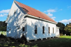 Cartecay Methodist Church and Cemeterylisted 2001
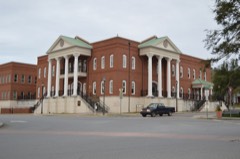 Gilmer County Courthouselisted 1980
Population over time
2 figuresEllijay grew from 1,619 to 1,862 between 2010 and 2020. These are the recorded population figures Wikidata holds for this place, reached through the Geographic Names Information System number this page is keyed on rather than by name, so they belong to this place and not to another of the same name. Most are census counts, but not all are: an early figure may be a founding or settlement estimate, and an estimate published within five years of a census is left out. The change column is computed, and is left blank where more than 20 years separate a figure from the one before it, because a gap that long is not a change between two counts.
| Year | People | Change |
|---|---|---|
| 2010 | 1,619 | |
| 2020 | 1,862 | +243 (+15%) |
Topographic sheets covering this place
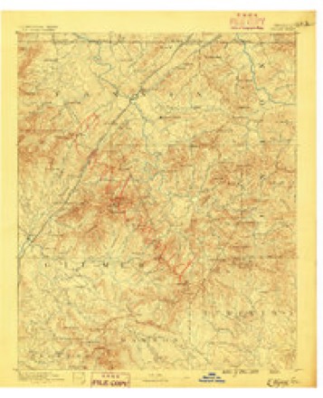
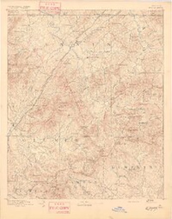
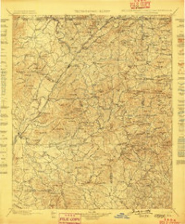
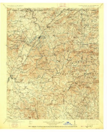
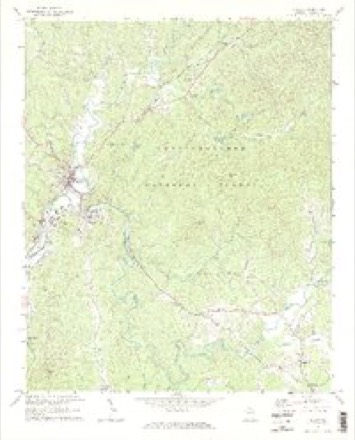
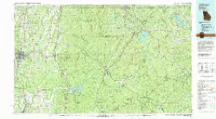
10 surveys from 17 printed sheetsMatched by testing this settlement's coordinate against the published boundary of every sheet in the United States Geological Survey's historical collection. Each opens the scanned sheet at the Survey.
- 1888 USGS Ellijay quadrangle1:125000
- 1892 USGS Ellijay quadrangle1:125000
- 1898 USGS Ellijay quadrangle1:125000, 2 printings
- 1911 USGS Ellijay quadrangle1:125000, 4 printings
- 1955 USGS Rome quadrangle1:250000
- 1958 USGS Rome quadrangle1:250000, 3 printings
- 1961 USGS Rome quadrangle1:250000
- 1963 USGS Rome quadrangle1:250000
- 1971 USGS Ellijay quadrangle1:24000, 2 printings
- 1981 USGS Dalton quadrangle1:100000




Fires near this place
206 since 1992Regional context, not property-specific evidence. The federal wildfire occurrence database lists 206 fires within 5 miles of Ellijay between 1992 and 2020, burning about 365 acres in total. 6 started naturally. 32 were recorded as arson. Distance is straight-line from the map coordinates, so a fire counted here may appear on a neighbouring settlement's page as well.
| Reported cause | Fires |
|---|---|
| Debris and open burning | 133 |
| Arson/incendiarism | 32 |
| Missing data/not specified/undetermined | 18 |
| Smoking | 7 |
| Natural | 6 |
| Misuse of fire by a minor | 4 |
| Recreation and ceremony | 3 |
| Equipment and vehicle use | 3 |
The most recent of them, most recent first, with the day each was reported and the service that recorded it.
| Date | Cause | Size | Reported by | Name on the report |
|---|---|---|---|---|
| 6 September 1999 | Smoking | under an acre | Georgia Forestry Commission | not named |
| 5 September 1997 | Arson/incendiarism | under an acre | Georgia Forestry Commission | not named |
| 24 September 1999 | Debris and open burning | under an acre | Georgia Forestry Commission | not named |
| 24 September 1999 | Misuse of fire by a minor | under an acre | Georgia Forestry Commission | not named |
| 21 September 2010 | Missing data/not specified/undetermined | under an acre | Georgia Forestry Commission | FY2011-GILMER-007 |
| 17 September 1998 | Debris and open burning | under an acre | Georgia Forestry Commission | not named |
| 29 August 2011 | Missing data/not specified/undetermined | under an acre | Georgia Forestry Commission | FY2012-GILMER-002 |
| 2 August 2006 | Equipment and vehicle use | under an acre | Georgia Forestry Commission | not named |
Settlements close enough to share some of these fires:
Mines and quarries near this place
10 of 16 shownRegional context, not property-specific evidence. The federal mineral resources record lists 16 workings within 5 miles of Ellijay: 10 past producers, 5 prospects, 1 occurrence. None of them still produces. What was taken out: Iron, Gold, Marble, Dimension, Stone, Crushed/Broken. Distance is straight-line from the map coordinates, so a quarry counted here may appear on a neighbouring settlement's page as well.
| Where | Site | Commodity | Status | Recorded |
|---|---|---|---|---|
| Gilmer County Quarry No. 2 | Stone, Crushed/Broken | Past Producer | ||
| Holt Property | Marble, Dimension | Occurrence | ||
| Whitaker Property | Marble, Dimension | Prospect | ||
| Holt | Gold | Prospect | Placer | |
| Turkey Pen | Gold | Prospect | Placer | |
| Whitaker | Gold | Prospect | Placer | |
| White Path | Gold | Past Producer | Stream Placer | |
| White Path Quarry | Gold | Past Producer | ||
| Cartecay Iron Property | Iron | Past Producer | ||
| Ellijay Mining Company Property | Iron | Past Producer |
Storms near this place
60 of 75 shownRegional context, not property-specific evidence. The National Weather Service names Ellijay in 75 storm reports between 1994 and 2023: 32 thunderstorm wind, 28 hail, 9 flash flood, 6 lightning. The reports record 1 death and 1 injury. Each account below is quoted exactly as the forecast office filed it, from the NOAA Storm Events Database, and each date opens the federal record of that event.
| When | Event | Place named | Harm | What the report says |
|---|---|---|---|---|
| August 2000 | Lightning | Ellijay | 1 killed | Several Georgia newspapers reported that lightning struck and killed a 46-year old standing outside on the front porch of his home. The lightning bolt is believed to have traveled from a tall pine tree, approximately 10 feet away, through the ground, up through the man's body, and out his head. He was killed instantly. |
| July 2003 | Flash Flood | Ellijay | 1 hurt, $1,000,000 | The Gilmer county 911 center, along with the Times Courier of Ellijay, reported that excessive rainfall of three to seven inches in a one to three hour period had resulted in extensive flooding, especially along and near Georgia Highway 52 from Ellijay to Cartecay. Oiltown, Turkey, Clear, and Harris Branch Creeks had all quickly risen well out of their banks flooding out adjacent areas, several roads and bridges, and some homes. Major flooding was also reported on the Coosawattee River as it flows toward Carters Lake. Several people in the area had to be rescued from flood waters. Several roads and bridges in the area were washed out and many had to be closed. At least one home and a church were washed away by the raging flood waters of the Harris Branch Creek. The House of Prayer Chapel on Georgia Highway 382 was completely lifted from its foundation, turned sideways, and moved more than 20 feet down the river. Another log home nearby, also along Harris Branch Creek, was likewise removed from its foundation, at which point it crumbled apart as it was swept down the flooded creek. One person, who was in the home at the time, rode the home down the river for nearly an hour before she was able to escape from a second story window with just minor injury. The home was reduced to splinters shortly thereafter. In Cartecay, the Cartecay Townhouses were flooded as well as 12 mobile homes in the Maple Village Mobile Home Park. There were numerous reports of automobiles, trees, parts of homes, decks, and even appliances such as refrigerators being washed down the Coosawattee river toward Carters Lake. Several people in the area had to be rescued from flood waters. As many as 50 people had to take shelter in the Gilmer County Highschool. |
| May 2006 | Hail | Ellijay | $400,000 | Numerous reports of large hail were received from the Gilmer County Emergency Management Director and the public across Gilmer county as a thunderstorm with a large and long lasting swath of golf ball to baseball and orange-sized hail tracked from the northwest corner to the southeast corner of the county. Extensive damage to homes and vehicles was observed across much of the county. The Gilmer county Emergency Management Director reported that at least 70 homes in the Cartecay and Ellijay areas sustained significant damage from the hail, along with at least 45 vehicles and two pieces of county fire fighting equipment. Quarter to golf ball-sized hail was reported from north of Ellijay to well east of Ellijay. Golf ball to baseball-sized hail fell across areas southeast of Ellijay near Cartecay. At one location in southeast Gilmer county where 2.75 inch hail was reported, the public reported that the large hail put at least 20 holes in the metal roof of a building, some the size of a human fist. Both the metal and styrofoam insulation were completely penetrated by the large hailstones. A three inch hole was discovered in the shingles and plywood decking on the nearby house. The hail storm tracked roughly along Georgia Highway 52 from northwest to southeast. |
| December 2015 | Flash Flood | Ellijay | $300,000 | A USGS stream gauge on the Cartecay River off Georgia Highway 52 near East Ellijay reached flood stage of 7 feet. The river had the second highest crest in its history at 11.1 feet. Major flooding occurred upstream and downstream from the gauge which affected around 15 townhouses and homes on Riverside Drive with at least one foot of water. Also a large portion of Maple Village Mobile Homes Park flooded near the merger of the river and Owltown Creek. |
| May 2011 | Hail | Ellijay | $200,000 | The public observed golf ball-sized hail between Tailes Creek and Mountaintown. |
| September 2004 | Flash Flood | Ellijay | $75,000 | The Times Courier of Ellijay reported that heavy rain associated with Tropical Storm Frances, resulted in flash flooding that washed away part of a road and a home. The home was condemned and the residents were evacuated. |
| September 1996 | Thunderstorm Wind | Ellijay | $50,000 | no account filed |
| June 2009 | Thunderstorm Wind | Ellijay | $45,000 | The Gilmer County Emergency Management Director reported that at least 40 trees were either uprooted or twisted across the county. Several power lines were also down. The roof was also ripped off an old fire station near Ellijay that had been converted into a parks and recreational building. Pea-sized hail was also observed during the thunderstorm. |
| May 2011 | Thunderstorm Wind | Ellijay | $30,000 | The public reported that at least 10 trees were snapped or uprooted between Tails Creek and Mountaintown, approximately five miles west-northwest of Ellijay. An outbuilding and a truck were damaged from downed trees. Most of this damage occurred in the Wildwood Subdivision on Honeysuckle Court. |
| April 2009 | Thunderstorm Wind | Ellijay | $30,000 | The Gilmer County Emergency Management Director reported that several trees were down across the county. Radar data suggest that the majority of the downed trees were in the southern half of the county. A roof was blown off a home northwest of Ellijay. |
| September 2010 | Lightning | Ellijay | $25,000 | The Gilmer County 911 Center reported that a lightning strike caused a fire at the Gilmer County Water pump station in Ellijay. One tree was also blown down in the area. |
| August 2003 | Lightning | Ellijay | $25,000 | The Gilmer county 911 center reported that lightning struck a home near Walnut Mountain and set it on fire. Damage estimates were inconclusive. |
| August 2014 | Thunderstorm Wind | Ellijay | $10,000 | The Gilmer County Emergency Manager reported trees down countywide. Roads were blocked and trees had fallen on houses. Multiple power outages also reported. |
| May 2003 | Flash Flood | Ellijay | $10,000 | The Gilmer county 911 center reported that several roads between Ellijay and the Carters Lake are were flooded, and one road was washed out. |
| December 2008 | Flash Flood | Ellijay | $6,000 | The Gilmer County Emergency Management Director reported that two areas in the county suffered from flash flooding. At least six inches of water from a local stream was flowing over Yukon Road just north of Scarlett Drive. Approximatly $1000 of erosion damage was observed to the asphalt road. Further east, another flash flood was observed when flood waters from Holden Creek tore out a 10 by 12 foot section of Big Creek Road just west of Pisgah Road. Damage to the road was estimated to be $5000. |
| June 2018 | Thunderstorm Wind | Ellijay | $5,000 | Gilmer County EMA reported several trees and utility lines down in the 1000 block of Old Hwy 5 N. Vehicle accident also occurred at this location but no injuries were reported. Additional trees and powerlines were reported down in the southwest part of the county, along Sunlight Road. |
| September 2009 | Flash Flood | Ellijay | $5,000 | The Gilmer County Emergency Management Director reported that one home sustained flood damage when Cox Creek overflowed its banks near the intersection of Cox Creek Road and Boardtown Road, just northwest of Ellijay. Four other homes were threatened by the flood waters and the residents of all five homes were evacuated during the event as a precaution. Repeated showers and thunderstorms had moved across the area during the morning hours. |
| July 2004 | Thunderstorm Wind | Ellijay | $5,000 | The public reported that several trees and power lines had been blown down. |
| July 2003 | Thunderstorm Wind | Ellijay | $5,000 | A storm spotter, as well as the Gilmer county 911 center, reported that a number of trees and some power lines had been blown down in the southern areas of the county, particularly just south of Ellijay and along Georgia Highway 52 southeast of Ellijay. |
| May 1997 | Flash Flood | Ellijay | $4,000 | no account filed |
| October 2014 | Thunderstorm Wind | Ellijay | $3,000 | The Gilmer County Emergency Manager reported multiple trees and limbs down countywide. |
| June 2008 | Thunderstorm Wind | Ellijay | $3,000 | The Gilmer County 911 Center reported that several trees and at least one power line were down in the Ellijay area. Doppler radar data indicates that strong winds likely affected the area between Ellijay and Cherry Log. |
| July 2008 | Thunderstorm Wind | Ellijay | $3,000 | The Gilmer County 911 Center reported that several trees were down across the county. |
| July 2008 | Thunderstorm Wind | Ellijay | $3,000 | The Gilmer County Fire and Rescue Department reported that four trees were down on power lines and an additional tree was uprooted between Georgia Highway 5 and Georgia Highway 282, just southwest of Ellijay. |
| June 2004 | Lightning | Ellijay | $3,000 | The Gilmer county 911 center reported that lightning strikes caused damage to trees and power lines in the area. Three trees were either split apart or set on fire by lightning. The lightning also caused damage to power lines in the area. |
| July 2004 | Thunderstorm Wind | Ellijay | $3,000 | The Gilmer county 911 center reported that several trees had been blown down. |
| July 1997 | Thunderstorm Wind | Ellijay | $3,000 | Thunderstorm winds knocked down numerous trees across the county. |
| May 1997 | Thunderstorm Wind | Ellijay | $3,000 | Several trees were knocked down and power lines were snapped in Ellijay. |
| April 1997 | Thunderstorm Wind | Ellijay | $3,000 | no account filed |
| February 2009 | Thunderstorm Wind | Ellijay | $2,000 | The Gilmer County 911 Center reported that a few trees were down on Georgia Highway 5 in the northeast part of the county and a few trees were down on Georgia Highway 52 in the southeast part of the county. |
| May 2003 | Thunderstorm Wind | Ellijay | $2,000 | The Gilmer county 911 center reported that some trees were blown down. |
| September 2002 | Thunderstorm Wind | Ellijay | $2,000 | The Amicalola Electric Membership Cooperative reported that at least nine trees were down in scattered areas around the northern and western part of the county. |
| May 1998 | Hail | Ellijay | $2,000 | The public reported quarter to golf ball size hail. |
| June 2023 | Thunderstorm Wind | Ellijay | $1,000 | Emergency manager reported a tree down blocking the roadway on McCutchen St between Bob Pinson St and Barclay St. |
| May 2015 | Thunderstorm Wind | Ellijay | $1,000 | Gilmer county EM reported additional trees down near Highways 52 and 382. |
| June 2011 | Thunderstorm Wind | Ellijay | $1,000 | The Gilmer County Emergency Management Director reported that four trees were blown down from another round of thunderstorms. The first thunderstorm was an isolated cell that only affected the northeast part of the county. The second area of thunderstorm activity was a line that moved across the entire county from northwest to southeast. |
| June 2011 | Thunderstorm Wind | Ellijay | $1,000 | The Gilmer County 911 Center reported that four trees were down in the Ellijay area. |
| June 2010 | Thunderstorm Wind | Ellijay | $1,000 | The Gilmer County 911 Center reported that three trees were down between Ellijay and Mountaintown. |
| July 2006 | Thunderstorm Wind | Ellijay | $1,000 | The Gilmer County 911 Center reported that four trees were blown down across the north part of the county, with one tree down just north of Ellijay. |
| July 2004 | Thunderstorm Wind | Ellijay | $1,000 | The public reported that several trees were down. |
| May 2003 | Lightning | East Ellijay | $1,000 | The Times Courier of Ellijay reported that lightning struck a phone line and a power line at the intersection of Old Georgia Highway 5 South and Progress Road causing a small fire. |
| June 1999 | Thunderstorm Wind | Ellijay | $1,000 | The Ellijay police department reported trees down. |
| June 1995 | Thunderstorm Wind | Ellijay | $1,000 | Thunderstorm winds knocked trees down near Zion Hill Church. |
| July 1995 | Thunderstorm Wind | Ellijay | $1,000 | Thunderstorm winds blew trees down onto power lines on Flat Branch Road, just north of Ellijay. |
| May 2003 | Lightning | Ellijay | $500 | The Times Courier of Ellijay reported that lightning struck a log home off Big Creek Road causing very minor damage to the structure. |
| May 1994 | Thunderstorm Wind | Ellijay | $500 | A couple of large trees were downed by thunderstorm winds along Georgia Highway 52. |
| January 1996 | Thunderstorm Wind | Ellijay | $500 | no account filed |
| May 2011 | Hail | East Ellijay | - | The public observed quarter-sized hail across the eastern portion of the county, including the east side of Ellijay. This was from a second severe thunderstorm that tracked from south central to northeast Gilmer county. |
| May 2011 | Hail | Ellijay | - | The public reported that yet a third thunderstorm dropped quarter-sized hail mainly on the east side of Ellijay. This thunderstorm was slightly weaker than the previous two storms which tracked across the county. |
| June 2008 | Hail | East Ellijay | - | A deputy with the Gilmer County Sheriff's Office observed 10 to 15 minutes of penny-sized hail on the east side of the county. The 911 Center observed penny-sized hail in East Ellijay. |
| July 2008 | Hail | Ellijay | - | A deputy with the Gilmer County Sheriff's office observed quarter-sized hail in the Ellijay area. While hail the size of quarters was the largest observed, pea to quarter-sized hail fell for up to five minutes at one location near Ellijay. |
| August 2008 | Hail | Ellijay | - | A storm spotter observed nickel-sized hail in northwest Gilmer county. Radar data suggests that hail of similar size likely fell southward of this point near the Murray county line into west central and southwest Gilmer county as well. |
| April 2006 | Hail | Ellijay | - | The Gilmer County 911 Center reported penny-sized hail. |
| June 2006 | Hail | Ellijay | - | The public reported penny-sized hail on the east side of Ellijay. |
| May 2006 | Hail | Ellijay | - | The public reported penny-sized hail. |
| May 2006 | Hail | Ellijay | - | The public reported penny-sized hail. |
| May 2006 | Hail | Ellijay | - | An amatuer radio operator reported penny-sized hail. |
| April 2006 | Hail | Ellijay | - | Numerous reports of hail, ranging in size from pennies to quarters, were received from the public and the Gilmer County 911 Center from Ellijay, to Cartecay, to Pisgah, on the far eastern border of the county. Penny to quarter-sized hail was reported from Ellijay to Cartecay, while nickel-sized hail was reported in the Pisgah area. |
| February 2005 | Hail | Ellijay | - | The Gilmer County 911 Center reported nickel-sized hail. |
| February 2005 | Thunderstorm Wind | Ellijay | - | The public reported that several trees were blown down in the Ellijay area. |
Nearest settlements
The eight closest, with where each one stands in the county. Distances are straight-line, computed from the Geographic Names Information System coordinates.
| Map | Place | Distance | Sheets |
|---|---|---|---|
| East Ellijay | 0.9 miles | 17 | |
| Kiker | 2.2 miles | 19 | |
| New Hope | 2.7 miles | 19 | |
| Webb | 3.2 miles | 19 | |
| Turniptown (historical) | 3.4 miles | 17 | |
| Roosevelt | 3.7 miles | 19 | |
| Northcutt | 3.7 miles | 17 | |
| Ella Gap | 3.8 miles | 17 |
Elsewhere
Matched on this settlement's Geographic Names Information System number rather than its name, so it cannot be a different place of the same name in another state.
| Wikipedia article on Ellijay | An encyclopaedic summary. Its text is share-alike, so it is linked here rather than copied. |
| Wikidata item Q1814374 | The structured record the population and elevation above come from. Public domain (CC0). |
Provenance
This settlement is recorded in the Geographic Names Information System as feature 331651. The sheet list is computed by point-in-boundary test against the United States Geological Survey's historical topographic inventory. Both are works of the United States government and carry no copyright under 17 U.S.C. 105.
Wildfire. Short, Karen C. 2022. Spatial wildfire occurrence data for the United States, 1992-2020 [FPA_FOD_20221014]. 6th Edition. Fort Collins, CO: Forest Service Research Data Archive. https://doi.org/10.2737/RDS-2013-0009.6 Collected with United States Government funding and usable without additional permissions or fees.
Mines and quarries. USGS Mineral Resources Data System (MRDS) https://mrdata.usgs.gov/mrds/ A work of the United States government, no copyright under 17 U.S.C. 105.
Storms. NOAA National Centers for Environmental Information, Storm Events Database https://www.ncei.noaa.gov/stormevents/ A work of the United States government, no copyright under 17 U.S.C. 105. Narratives are quoted verbatim from the National Weather Service report and are not edited or summarised.