 Block
Flowery Branch, Georgia
16 topographic sheets cover this place, the earliest surveyed in 1891 and the latest in 1999. It stands in the Flowery Branch census division. It lies in ZIP code area 30542. The Survey maps it on the Flowery Branch quadrangle. 9,391 people lived here at the 2020 count. It stands 1,122 feet above sea level.
On record in Flowery Branch
Buildings and businesses the archive holds for this place. Each opens its own page, with the source record it came from.
On the National Register 1 record
- Flowery Branch Commercial Historic Districtlisted 1985
Population over time
2 figuresFlowery Branch grew from 5,679 to 9,391 between 2010 and 2020. These are the recorded population figures Wikidata holds for this place, reached through the Geographic Names Information System number this page is keyed on rather than by name, so they belong to this place and not to another of the same name. Most are census counts, but not all are: an early figure may be a founding or settlement estimate, and an estimate published within five years of a census is left out. The change column is computed, and is left blank where more than 20 years separate a figure from the one before it, because a gap that long is not a change between two counts.
| Year | People | Change |
|---|---|---|
| 2010 | 5,679 | |
| 2020 | 9,391 | +3,712 (+65%) |
Topographic sheets covering this place
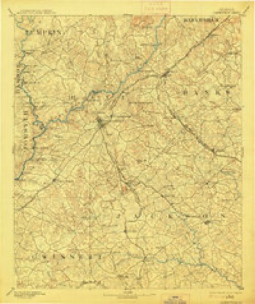
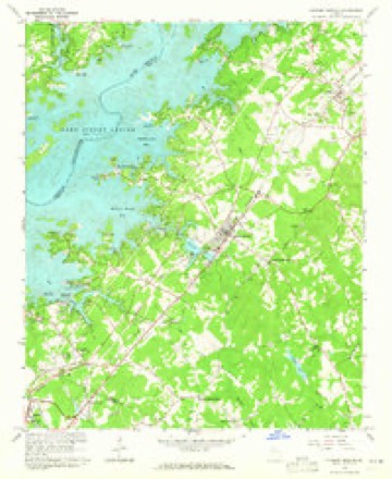
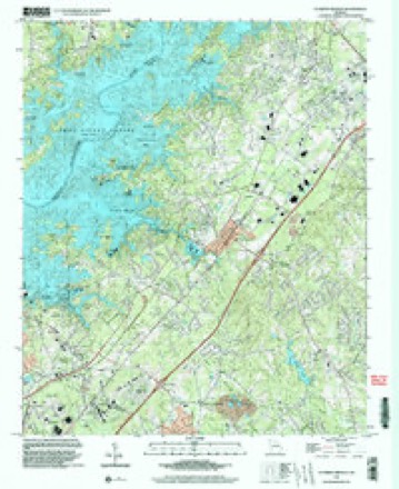
6 surveys from 16 printed sheetsMatched by testing this settlement's coordinate against the published boundary of every sheet in the United States Geological Survey's historical collection. Each opens the scanned sheet at the Survey.
- 1891 USGS Gainesville quadrangle1:125000, 5 printings
- 1954 USGS Greenville quadrangle1:250000, 3 printings
- 1958 USGS Greenville quadrangle1:250000
- 1964 USGS Flowery Branch quadrangle1:24000, 4 printings
- 1979 USGS Commerce quadrangle1:100000, 2 printings
- 1999 USGS Flowery Branch quadrangle1:24000

Fires near this place
234 since 1992Regional context, not property-specific evidence. The federal wildfire occurrence database lists 234 fires within 5 miles of Flowery Branch between 1992 and 2019, burning about 424 acres in total. 4 started naturally. 56 were recorded as arson. Distance is straight-line from the map coordinates, so a fire counted here may appear on a neighbouring settlement's page as well.
| Reported cause | Fires |
|---|---|
| Debris and open burning | 95 |
| Arson/incendiarism | 56 |
| Misuse of fire by a minor | 21 |
| Missing data/not specified/undetermined | 18 |
| Equipment and vehicle use | 17 |
| Smoking | 14 |
| Recreation and ceremony | 9 |
| Natural | 4 |
The most recent of them, most recent first, with the day each was reported and the service that recorded it.
| Date | Cause | Size | Reported by | Name on the report |
|---|---|---|---|---|
| 5 September 2003 | Equipment and vehicle use | under an acre | Georgia Forestry Commission | not named |
| 30 September 2019 | Debris and open burning | under an acre | Georgia Forestry Commission | FY2020HALL003 |
| 3 September 2011 | Arson/incendiarism | 6.4 acres | Georgia Forestry Commission | FY2012-HALL-005 |
| 25 September 1999 | Arson/incendiarism | 14 acres | Georgia Forestry Commission | not named |
| 24 September 2004 | Misuse of fire by a minor | under an acre | Georgia Forestry Commission | not named |
| 16 September 1999 | Arson/incendiarism | 2.7 acres | Georgia Forestry Commission | not named |
| 14 September 1996 | Debris and open burning | under an acre | Georgia Forestry Commission | not named |
| 7 August 2007 | Recreation and ceremony | under an acre | Georgia Forestry Commission | not named |
Settlements close enough to share some of these fires:
Mines and quarries near this place
4 within 5 milesRegional context, not property-specific evidence. The federal mineral resources record lists 4 workings within 5 miles of Flowery Branch: 3 past producers, 1 producer. 1 still produces. What was taken out: Gold, Stone, Crushed/Broken. Distance is straight-line from the map coordinates, so a quarry counted here may appear on a neighbouring settlement's page as well.
| Where | Site | Commodity | Status | Recorded |
|---|---|---|---|---|
| Friendship Quarry | Stone, Crushed/Broken | Producer | ||
| Banks Property | Gold | Past Producer | Vein | |
| Muddy Creek Prospect | Gold | Past Producer | Vein | |
| Vickers Prospect | Gold | Past Producer | Vein |
Storms near this place
48 since 1994Regional context, not property-specific evidence. The National Weather Service names Flowery Branch in 48 storm reports between 1994 and 2025: 27 thunderstorm wind, 13 hail, 3 lightning, 3 flash flood. The reports record 1 injury. Each account below is quoted exactly as the forecast office filed it, from the NOAA Storm Events Database, and each date opens the federal record of that event.
| When | Event | Place named | Harm | What the report says |
|---|---|---|---|---|
| April 2007 | Thunderstorm Wind | Flowery Branch | 1 hurt, $1,000,000 | A survey conducted by the National Weather Service in Peachtree City, Georgia and damage reports received from the Hall Emergency Management Director, a cooperative observer, and the public confirmed that a microburst with straight-line winds of 70 to 80 mph with isolated damage of 100-110 mph caused considerable damage to a subdivision just east of Interstate-985 and just south of Flowery Branch. The path of damage was approximately one-half mile long and a mile wide. At least 35 homes sustained roof and siding damage and dozens of large trees were blown down or completely uprooted in the area. One home was blown 15 feet off its foundation and destroyed as it collapsed. Windows were blown out of at least one home and several vehicles. Other vehicles were damaged from downed trees or debris. One man was injured when his locked and bolted door blew open with the winds and knocked him into a nearby wall. There were reports of other trees down in the southern part of the county, but especially in the far southern part of the county near the Gwinnett county line. The majority of the damage was confined to Devonshire, Hillsdale, and Glenmore Drives. |
| April 2016 | Thunderstorm Wind | Flowery Branch | $3,000,000 | A National Weather Service survey team found a 4.6 mile long, 0.5 mile wide, path of thunderstorm wind damage stretching from around the Old Federal Road Park on the shores of Lake Lanier northeast to the area around Mundy Mill Road and Millside Parkway northeast of Oakwood. Hundreds of trees were blown down causing damage to over 53 homes. Five homes were destroyed and nine had major damage. No injuries were reported. |
| March 2011 | Hail | Flowery Branch | $1,780,000 | The public observed golf ball-sized hail in Flowery Branch. Otherwise, mostly quarter-sized hail was observed elsewhere across the southern part of Hall county near Oakwood and Flowery Branch. WSR-88D radar data suggests that quarter-sized hail likely continued eastward toward Chestnut Mountain. |
| May 2013 | Flash Flood | Flowery Branch | $1,000,000 | Trudy Drive was completely washed out by a drainage branch flowing into Lake Lanier. There was a 50 to 75 foot large gap in the road with at least a 10 foot drop off. Several other roads were closed and damaged by flood waters as drainage branches become rapidly flowing creeks and overwhelmed culverts. These roads included portions of Atlanta Highway, McEver Road, Stephens Road, Flowery Way, Spring Street and Cove Creek Road in the Flowery Branch area. |
| April 2009 | Hail | Flowery Branch | $1,000,000 | The public observed nickel to quarter-sized hail near the Gwinnett county line south of Flowery Branch and golf ball-sized hail in the Gainesville area. Radar data suggests that large hail, likely near golf ball-sized hail continued northeast from Gainesville toward Lula. |
| August 2020 | Thunderstorm Wind | Flowery Branch | $200,000 | The Hall County Emergency Manager reported significant wind damage in the area from the Holiday Marina to Aqualand Marina. Several docks and structures as well numerous boats were damaged or destroyed. Based on the extent and nature of the damage, wind speeds between 60 and 70 mph were estimated. |
| April 2006 | Thunderstorm Wind | Flowery Branch | $50,000 | The Hall County Emergency Management Director reported that thunderstorm winds caused damage to the roofs of several floating docks and floating walkways at the Aqualand Marina on the southeast end of Lake Lanier. The public reported that two large trees were blown over at a home between Oakwood and Flowery Branch and a freezer was knocked over at the same location. Another report from the public indicated that at least eight trees were down five miles south of Gainesville with minor building damage observed. |
| June 2018 | Thunderstorm Wind | Flowery Branch | $30,000 | Hall County Fire/Rescue reported wind damage in and around the Aqualand Marina on Lake Lanier. Several trees were blown down along Lights Ferry Road. A marina dock with 20 people on board separated from its moorings, no injuries were reported. Two docks at the marina were deemed unsafe due to wind damage. |
| June 2019 | Thunderstorm Wind | Flowery Branch | $25,000 | The Hall County Emergency Manager reported trees blown down onto campers and tents at a campground on Lake Lanier and a tree blown down onto a home on Mooney Drive near Gainesville. No injuries were reported. |
| June 2018 | Flash Flood | Flowery Branch | $10,000 | Emergency Manager reported that a portion of Cantrell Road was washed out as a result of flash flooding. Radar estimates indicate that three to four inches of rain fell over the local area. |
| July 2008 | Thunderstorm Wind | Flowery Branch | $10,000 | The Hall County Emergency Management Director reported that many trees and power lines were down across the county. Radar velocity and reflectivity data suggests that the majority of the damage was across the southern half of the county. |
| July 2008 | Lightning | Flowery Branch | $10,000 | The Gainesville Times reported that lightning struck a 30 by 10 foot storage building in the 5200 block of Gainesville Street. The building and all of its contents, which included lawn mowers, saws, garden equipment, a pressure washer, and other items were completely destroyed by the resulting fire. |
| February 2009 | Thunderstorm Wind | Flowery Branch | $6,000 | The White County 911 Center reported that around 30 trees were blown down from Flowery Branch through the Gainesville area. |
| July 2023 | Thunderstorm Wind | Flowery Branch | $5,000 | Multiple trees down on Mcever Road near the intersection of Lights Ferry Road. |
| July 2023 | Thunderstorm Wind | Flowery Branch | $5,000 | Report of multiple trees down across Flowery Branch. |
| August 2004 | Thunderstorm Wind | Flowery Branch | $5,000 | Local news media reported that a dock on Lake Lanier at Aqualand was damaged by thunderstorm wind gusts. |
| June 2003 | Flash Flood | Flowery Branch | $5,000 | The Hall county 911 center reported that flash flooding had resulted in the washout of the Black Jack Road bridge. |
| May 2002 | Thunderstorm Wind | Flowery Branch | $5,000 | The public reported that several large trees, up to 2 feet in diameter, had been blown down. |
| August 1998 | Flood | Flowery Branch | $5,000 | Slow moving thunderstorms produced 5 to 6 inches of rain overnight in southwest Hall county. Low lying roads were covered with water, and 2 of them were washed out. |
| July 1998 | Thunderstorm Wind | Flowery Branch | $5,000 | Hall county 911 reported trees were knocked down on a mobile home. |
| May 1998 | Hail | Flowery Branch | $5,000 | Several public reports indicated hail ranging from baseball size near the Gwinnett county line at Shoal Creek down to dime size in Gainesville. |
| May 2014 | Thunderstorm Wind | Flowery Branch | $3,000 | The Hall County 911 Center reported that nine trees and several powerlines were down across the county. |
| June 2003 | Thunderstorm Wind | Flowery Branch | $3,000 | The Hall county 911 center reported that several trees and power lines were down. |
| January 2014 | Thunderstorm Wind | Flowery Branch | $2,500 | The Hall County 911 Center reported that 10 trees were blown down across the western portion of the county. |
| December 2024 | Thunderstorm Wind | Flowery Branch | $2,000 | Two trees down across roadways along southern shores of Lake Lanier in Buford. |
| June 2018 | Lightning | Flowery Branch | $2,000 | The Hall County Fire Department reported minor damage to a residence on Deep Court due to lightning striking the home. |
| December 2005 | Hail | Flowery Branch | $2,000 | The public reported half-dollar-sized hail in Flowery Branch while a Sky Warn spotter reported penny-sized hail in Flowery Branch. Another report was received from the public of quarter-sized hail southeast of Chestnut Mountain in the far southeast part of the county near the Barrow county line. |
| July 1997 | Thunderstorm Wind | Flowery Branch | $2,000 | Thunderstorm winds knocked down trees and power lines. |
| September 2014 | Thunderstorm Wind | Flowery Branch | $1,500 | The 911 center reported several trees and power lines blown down across the county including in the Flowery Branch area and on Briarwood Drive in Oakwood. |
| June 2025 | Thunderstorm Wind | Flowery Branch | $1,000 | Tree down in Alberta Banks Park near Redford Rd. |
| February 2024 | Thunderstorm Wind | Flowery Branch | $1,000 | Tree downed along Atlanta Hwy at Gaines Ferry Road. |
| December 2024 | Thunderstorm Wind | Flowery Branch | $1,000 | Powerline down across roadway at intersection of Wade Orr Rd and Mount Salem Cir. |
| May 2024 | Thunderstorm Wind | Flowery Branch | $1,000 | EM reported tree down at Mcever Rd and Pine Cir. |
| September 2014 | Thunderstorm Wind | Flowery Branch | $750 | Atlanta broadcast media reported estimated 60-70 mph winds. Two large pine trees were blown over and one hardwood was snapped about 25 feet above the ground. |
| December 2021 | Tornado (EF0) | Flowery Branch | - | A brief, weak tornado spun up nearly immediately behind a line of|strong showers and thunderstorms as is tracked across southern|Hall County. Based on radar and NWS ground surveys, the narrow|tornado appeared to touch down between Sweetwater Point and Club|View Court, just south of Gaines Ferry Road. In this area,|several trees were snapped or uprooted with one falling onto a 2-|car garage. Additional trees were seen snapped or uprooted in a|fairly consistent path from Secret Cove Court to Athletic Club|Drive. The damage appeared to get more sporadic but additional|tree damage was seen along the storm's path until around|Laurelwood Trail and Sweetgum Trail which is just north of Gaines|Ferry Road. This tornado took a east-southeast track behind the|main leading line of storms. [12/30/21: Tornado #2, County #1/1, EF-0, Hall, 2021:24]. |
| December 2021 | Thunderstorm Wind | Flowery Branch | - | Several trees down with reports of damage to some homes as a result in the 6000 block of Gaines Ferry Rd. |
| July 2020 | Thunderstorm Wind | Flowery Branch | - | A home weather station on a boat dock on Sweetwater Point recorded a wind gust of 63 MPH. |
| May 2015 | Hail | Flowery Branch | - | HAM radio operator reported penny-sized hail about 3 miles north of Buford. |
| June 2013 | Thunderstorm Wind | Flowery Branch | - | The broadcast media passed along a report of a 59 MPH wind gust measured from a viewer's Davis weather station. |
| April 2011 | Hail | Flowery Branch | - | The public observed penny-sized hail near Flowery Branch. WSR-88D radar data suggests that penny-sized hail also likely fell between Flowery Branch and Lake Lanier Islands in the far southwest part of the county. This hail was falling from a separate, yet simultaneously occurring thunderstorm north of Murrayville, which was producing nickel-sized hail. |
| March 2008 | Hail | Flowery Branch | - | An amateur radio operator reported 1.5 inch hail on Lake Lanier Island. Numerous reports of hail, ranging in size from pennies to quarters, were received from the public and storm spotters in southern Hall county, especially in the Flowery Branch area. |
| August 2000 | Lightning | Flowery Branch | - | The Hall county 911 reported that a house was struck by lightning. However, no injuries were reported and the extent of the damage was unknown. |
| May 1999 | Hail | Flowery Branch | - | There were 2 reports of dime size hail. |
| February 1998 | Hail | Flowery Branch | - | Widespread dime size hail was reported by GEMA. |
| October 1997 | Hail | Flowery Branch | - | Three public reports of dime size hail were received. |
| August 1994 | Hail | Flowery Branch | - | EMA officials reported dime sized hail. |
| April 1997 | Hail | Flowery Branch | - | no account filed |
| June 1997 | Hail | Flowery Branch | - | no account filed |
Nearest settlements
The eight closest, with where each one stands in the county. Distances are straight-line, computed from the Geographic Names Information System coordinates.
| Map | Place | Distance | Sheets |
|---|---|---|---|
| Wayne | 0.8 miles | 16 | |
| Spout Spring Crossroads | 1.0 miles | 16 | |
| Forest Park | 1.1 miles | 16 | |
| Loch Arbor | 1.5 miles | 16 | |
| Woodbridge | 1.6 miles | 16 | |
| Trudy Estates | 1.7 miles | 16 | |
| Hammer | 1.7 miles | 16 | |
| Green Meadows | 1.9 miles | 16 |
Elsewhere
Matched on this settlement's Geographic Names Information System number rather than its name, so it cannot be a different place of the same name in another state.
| Wikipedia article on Flowery Branch | An encyclopaedic summary. Its text is share-alike, so it is linked here rather than copied. |
| Wikidata item Q1816032 | The structured record the population and elevation above come from. Public domain (CC0). |
Provenance
This settlement is recorded in the Geographic Names Information System as feature 331733. The sheet list is computed by point-in-boundary test against the United States Geological Survey's historical topographic inventory. Both are works of the United States government and carry no copyright under 17 U.S.C. 105.
Wildfire. Short, Karen C. 2022. Spatial wildfire occurrence data for the United States, 1992-2020 [FPA_FOD_20221014]. 6th Edition. Fort Collins, CO: Forest Service Research Data Archive. https://doi.org/10.2737/RDS-2013-0009.6 Collected with United States Government funding and usable without additional permissions or fees.
Mines and quarries. USGS Mineral Resources Data System (MRDS) https://mrdata.usgs.gov/mrds/ A work of the United States government, no copyright under 17 U.S.C. 105.
Storms. NOAA National Centers for Environmental Information, Storm Events Database https://www.ncei.noaa.gov/stormevents/ A work of the United States government, no copyright under 17 U.S.C. 105. Narratives are quoted verbatim from the National Weather Service report and are not edited or summarised.