 Block
Gainesville, Georgia
15 topographic sheets cover this place, the earliest surveyed in 1891 and the latest in 1979. It stands in the Gainesville census division. It lies in ZIP code area 30501. The Survey maps it on the Gainesville quadrangle. 42,296 people lived here at the 2020 count. It stands 1,250 feet above sea level.
Research this city
On record in Gainesville
Buildings and businesses the archive holds for this place. Each opens its own page, with the source record it came from.
On the National Register 12 of 16 shown
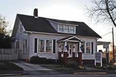 Bailey-Harper House-Doctors Buildinglisted 2006
 Brenau College Districtlisted 1978
 Candler Street Schoollisted 1982
 Dixie Hunt Hotellisted 1985
 Federal Building and Courthouselisted 1974
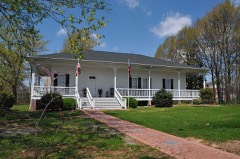 Gainesville Commercial Historic Districtlisted 2003
 Hall County Courthouselisted 1995
 Jackson Buildinglisted 1985
 Logan Buildinglisted 1990
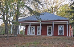 Beulah Rucker House-Schoollisted 1995
- Alta Vista Cemeterylisted 2012
- Chicopee Mill and Village Historic Districtlisted 1985
Surveyed buildings and structures 2 records
- Bolling Bridge, State Route 53 at the Chestatee River, Gainesvillefederal building survey, 1 photograph
- Odd Fellows Hall, Sycamore & Summitt Streets, Gainesvillefederal building survey, 5 photographs
Population over time
3 figuresGainesville grew from 344 to 42,296 between 1860 and 2020. These are the recorded population figures Wikidata holds for this place, reached through the Geographic Names Information System number this page is keyed on rather than by name, so they belong to this place and not to another of the same name. Most are census counts, but not all are: an early figure may be a founding or settlement estimate, and an estimate published within five years of a census is left out. The change column is computed, and is left blank where more than 20 years separate a figure from the one before it, because a gap that long is not a change between two counts.
| Year | People | Change |
|---|---|---|
| 1860 | 344 | |
| 2010 | 33,804 | |
| 2020 | 42,296 | +8,492 (+25%) |
Topographic sheets covering this place
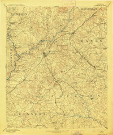
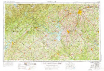
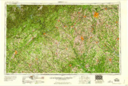
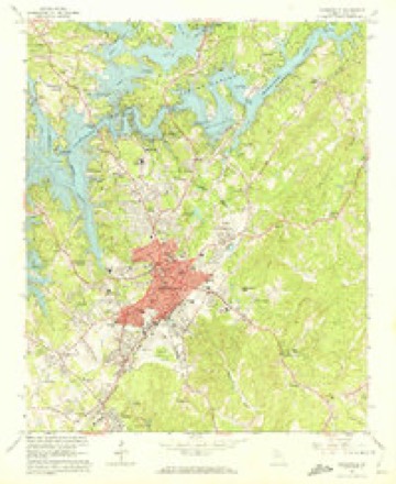
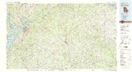
5 surveys from 15 printed sheetsMatched by testing this settlement's coordinate against the published boundary of every sheet in the United States Geological Survey's historical collection. Each opens the scanned sheet at the Survey.
- 1891 USGS Gainesville quadrangle1:125000, 5 printings
- 1954 USGS Greenville quadrangle1:250000, 3 printings
- 1958 USGS Greenville quadrangle1:250000
- 1964 USGS Gainesville quadrangle1:24000, 4 printings
- 1979 USGS Commerce quadrangle1:100000, 2 printings
Photographs
2 photographs, 1936Taken for the Office of War Information and the Farm Security Administration, who photographed the country between 1935 and 1944. Works of United States government photographers, with no known restriction on use. Each opens its catalogue record.
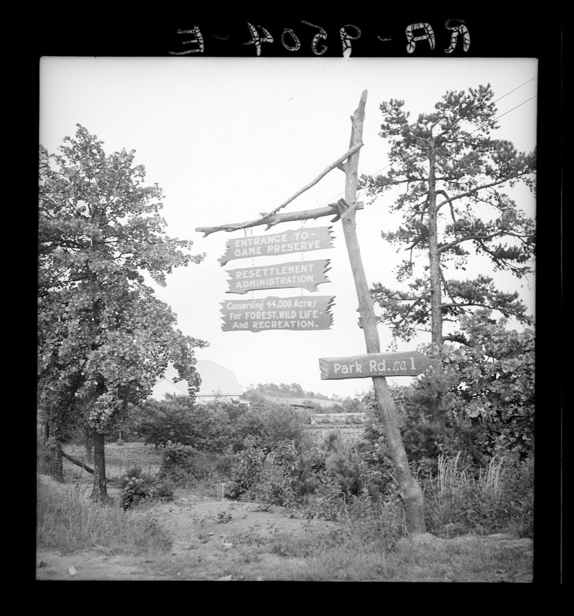
Lange, Dorothea, photographer, 1936. Library of Congress
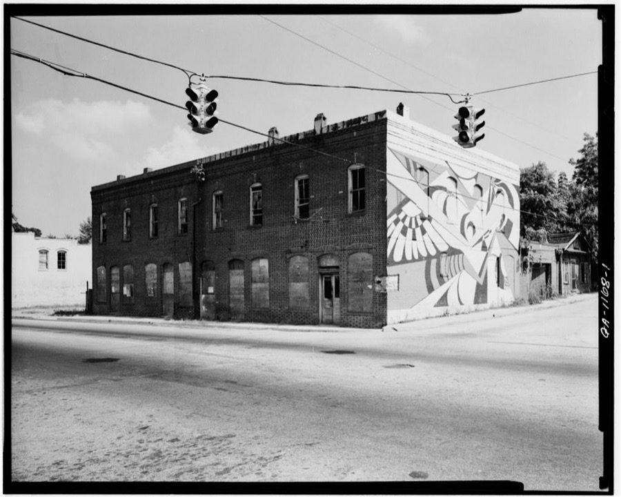
Photographer not recorded. Library of Congress
Fires near this place
239 since 1992Regional context, not property-specific evidence. The federal wildfire occurrence database lists 239 fires within 5 miles of Gainesville between 1992 and 2020, burning about 397 acres in total. 1 started naturally. 40 were recorded as arson. Distance is straight-line from the map coordinates, so a fire counted here may appear on a neighbouring settlement's page as well.
| Reported cause | Fires |
|---|---|
| Debris and open burning | 104 |
| Arson/incendiarism | 40 |
| Missing data/not specified/undetermined | 28 |
| Equipment and vehicle use | 25 |
| Misuse of fire by a minor | 21 |
| Smoking | 9 |
| Railroad operations and maintenance | 6 |
| Recreation and ceremony | 5 |
| Natural | 1 |
The most recent of them, most recent first, with the day each was reported and the service that recorded it.
| Date | Cause | Size | Reported by | Name on the report |
|---|---|---|---|---|
| 28 September 2006 | Equipment and vehicle use | under an acre | Georgia Forestry Commission | not named |
| 26 September 2019 | Debris and open burning | under an acre | Georgia Forestry Commission | FY2020HALL002 |
| 23 September 2004 | Missing data/not specified/undetermined | under an acre | Georgia Forestry Commission | not named |
| 19 September 2007 | Debris and open burning | under an acre | Georgia Forestry Commission | not named |
| 18 September 2010 | Misuse of fire by a minor | under an acre | Georgia Forestry Commission | FY2011-HALL-006 |
| 18 September 1999 | Missing data/not specified/undetermined | 1.9 acres | Georgia Forestry Commission | not named |
| 9 August 2007 | Equipment and vehicle use | under an acre | Georgia Forestry Commission | not named |
| 5 August 1996 | Arson/incendiarism | under an acre | Georgia Forestry Commission | not named |
Settlements close enough to share some of these fires:
Mines and quarries near this place
10 of 14 shownRegional context, not property-specific evidence. The federal mineral resources record lists 14 workings within 5 miles of Gainesville: 9 prospects, 4 past producers, 1 producer. 1 still produces. What was taken out: Gold, Mica, Stone, Crushed/Broken. Distance is straight-line from the map coordinates, so a quarry counted here may appear on a neighbouring settlement's page as well.
| Where | Site | Commodity | Status | Recorded |
|---|---|---|---|---|
| Gainesville Quarry | Stone, Crushed/Broken | Producer | ||
| Merk | Gold, Mica | Prospect | Vein | |
| Brenau College | Gold | Prospect | Vein | |
| Currahee Mine | Gold | Prospect | Vein | |
| Dean | Gold | Prospect | Vein | |
| Jones | Gold | Past Producer | Vein | |
| Longstreet Mine | Gold | Prospect | Vein | |
| Mammoth Mine | Gold | Prospect | Vein | |
| Maynas Mine | Gold | Past Producer | Vein | |
| O'Shields | Gold | Prospect | Vein |
Storms near this place
60 of 81 shownRegional context, not property-specific evidence. The National Weather Service names Gainesville in 81 storm reports between 1993 and 2025: 40 hail, 28 thunderstorm wind, 5 lightning, 2 tornado. The reports record 2 deaths. Each account below is quoted exactly as the forecast office filed it, from the NOAA Storm Events Database, and each date opens the federal record of that event.
| When | Event | Place named | Harm | What the report says |
|---|---|---|---|---|
| July 2005 | Lightning | Gainesville | 2 killed, $750,000 | The Gainesville Times reported that a 14-year old girl and her 17-month old cousin died when lightning struck a tree under which they were standing at Old Federal Park on Lake Lanier. The two died within an hour of the incident at a nearby hospital in Gainesville. The 14-year old was holding the little girl in her arms and standing underneath a tree when lightning struck. The two were not hit directly, but the lightning ran down the tree and into them. Lightning was also to blame for fires at eight homes and two businesses across the county. |
| June 2008 | Hail | Gainesville | $1,000,000 | Several reports of large hail were received from the public from the area between Murrayville and Gainesville. Golf ball-sized hail was observed two miles north of Gainesville, while quarter-sized hail was observed four to five miles northwest of Gainesville, or just southeast of Murrayville. Hail covered the ground in these later areas. A few trees were also blown down in the area. |
| June 2001 | Flash Flood | Gainesville | $500,000 | The Gainesville Times newspaper reported that excess rainfall from thunderstorms, on the order of 4 or more inches during a two to three hour period, resulted in flooding of Flat Creek and the subsequent flooding of Downtowner Mobile Home Park on McConnell Road. Twenty-five mobile homes were damaged or destroyed by the flood waters. Flood waters rose up above the doors and windows of the mobile homes. In addition, several roads in Gainesville were flooded and a section of the Atlanta Highway had to be closed. On Thompson Bridge Road, a Publix Grocery Store was flooded by overflowing and blocked drains. However, water was only 4-5 inches deep in the store and little significant damage was reported here. |
| March 2008 | Hail | Gainesville | $300,000 | A storm spotter observed golf ball-sized hail just northwest of Lula. The public observed ping-pong ball-sized hail approximately five miles north of Gainesville along near Georgia Highway 284/Clarks Bridge Road. |
| April 2001 | Lightning | Gainesville | $150,000 | The Times newspaper in Gainesville reported that lightning struck a house on Cedar Creek Road east of Gainesville in eastern Hall county. The lightning ignited a fire in the kitchen which resulted in moderate to heavy damage to the interior of the home and heavy damage to the attic. A utility pole was also struck and set on fire by lightning on the same street. Numerous outages to telephone, cable, and power were reported in the area because of the intense cloud-to-ground lightning. |
| March 2008 | Thunderstorm Wind | Gainesville | $75,000 | The Hall County Fire and Rescue Department reported that up to 20 trees and several power lines were down in the Gainesville area, and up to three miles south of Gainesville. It was originally reported that a tornado had touched down on the south side of Gainesville, but an aerial survey conducted by the National Weather Service Forecast office in Peachtree City, Georgia in cooperation with the Georgia State Patrol concluded that the damage observed in Hall county was from straight-line winds and not that of a tornado. Several power lines were also down in the area, including several near the intersection of Georgia Highway 53 and McEver Road, about three miles west-southwest of Gainesville. The Gainesville Times reported that two brand new Hondas at Milton Martin Honda were destroyed when a tree was blown down onto them. |
| November 2004 | Thunderstorm Wind | Gainesville | $75,000 | The Hall County Emergency Management Director reported that a home on Camp Spring Drive suffered extensive damage from strong thunderstorm wind gusts. Half of the roof was blown off the home and the garage collapsed. At another location, namely Georgia Highway 60 South, a 100 by 50 foot storage building was destroyed. Many trees were blown down throughout the Gainesville area. |
| July 2008 | Heavy Rain | Gainesville | $50,000 | An amateur radio operator reported that heavy rain, on the order of 2 inches in an hour or less, caused a roof of a building on Queen City Parkway, just south of downtown Gainesville, to collapse. |
| July 1999 | Lightning | Gainesville | $50,000 | A bolt of lightning ignited a fire that gutted a house on the south side of Gainesville. |
| July 1998 | Thunderstorm Wind | Gainesville | $50,000 | Thunderstorm winds knocked trees and power lines down. Some trees fell on houses, causing damage. A church steeple collapsed, a car was turned upside down, and the awning at a service station was damaged. Hall county 911 reported trees were knocked down from Gainesville to the Forsyth county line, with debris all along the route. A 175 foot tower was knocked down. |
| June 2013 | Thunderstorm Wind | Gainesville | $30,000 | The Hall County Emergency Manager reported several trees down in Gainesville. A tree and power lines were down on a car, trapping the occupant, and another tree was downed on a pickup truck, also trapping the occupant. No injuries were reported. Trees and power lines were down along Blueberry Hills Drive, Athens Street, Stallworth Street, MLK Jr. Boulevard, and East Ridge Road. |
| June 1998 | Thunderstorm Wind | Gainesville | $30,000 | Thunderstorm winds knocked several trees down in the Flat Creek Road area southwest of Gainesville and in the Barrett Road area of east Hall county. Three homes were damaged by falling trees. Trees were also tangled in power lines. |
| March 2008 | Thunderstorm Wind | Gainesville | $25,000 | The Hall County Emergency Management Director reported that a tree was down on a home in Gainesville. A couple of trees were also down in the Lula area. |
| August 2002 | Thunderstorm Wind | Gainesville | $25,000 | The Hall county 911 center reported that several trees and power lines were blown down across the eastern portion of the county from Gainesville to Gillsville and Belmont. One 30 foot tree fell on a house in Gillsville on Georgia Highway 52, causing minor damage to the roof. |
| August 2000 | Thunderstorm Wind | Gainesville | $20,000 | The Hall county 911 center reported that two trees, blown down by thunderstorm winds, had caused considerable damage to two homes. One tree fell on the roof of one home causing considerable roof damage. The other also fell on the roof of a home, but broke several windows out as well. |
| August 2004 | Thunderstorm Wind | Gainesville | $7,000 | The Hall County 911 Center reported that a number of trees had been blown down around the county. In addition, the public reported that sheet metal was ripped off a building. |
| December 2024 | Thunderstorm Wind | Gainesville | $6,000 | Half a dozen trees down across roadways in Gainesville. |
| June 2007 | Lightning | Gainesville | $5,000 | The Hall County 911 Center reported that lightning struck a building in the city causing minor damage. |
| January 2007 | Thunderstorm Wind | Gainesville | $5,000 | The Hall County 911 Center reported that a number of trees and power lines were down throughout the central and eastern part of the county, especially from Gainesville to Lula. The most significant damage occurred in the Lula area. Power lines were down in White Sulfer, Pavery, Branon, and Gainesville as well. |
| July 2004 | Thunderstorm Wind | Gainesville | $5,000 | The public reported that a trailer and several trees were blown over on Brown's Bridge Road west of Gainesville. |
| August 2000 | Thunderstorm Wind | Gainesville | $5,000 | The Hall county 911 center reported wind damage at Clarks Bridge Park. |
| June 1994 | Tornado (F0) | Gainesville | $5,000 | A short lived tornado was reported 15 miles north of Gainesville along a remote section of Georgia Highway 52. Several large pine trees were uprooted or snapped midway up from the crown. |
| January 2014 | Thunderstorm Wind | Gainesville | $4,000 | The Hall County 911 Center reported that 10 trees and power lines were blown down across the eastern portion of the county. |
| July 2007 | Thunderstorm Wind | Gainesville | $3,000 | The Hall County 911 Center reported that 10 trees were down across the county, mainly the western and southern portions. Pea-sized hail was also reported in Gainesville. |
| May 2000 | Thunderstorm Wind | Gainesville | $3,000 | The Hall county 911 center reported large trees and some power lines down on Point View Circle. |
| September 2003 | Thunderstorm Wind | Gainesville | $2,000 | The Hall county 911 center reported that at least three, possibly four trees were down in the city. One of the trees was down on a power line. |
| September 1996 | Thunderstorm Wind | Gainesville | $2,000 | no account filed |
| July 2005 | Thunderstorm Wind | Gainesville | $1,500 | The Times of Gainesville reported that a tree was blown down during a thunderstorm causing a couple of power lines to come down. Approximately 165 residents were without power for a few hours as a result. |
| June 2025 | Thunderstorm Wind | Gainesville | $1,000 | Tree down along South Enota Drive NE near the intersection with Park Hill Drive. |
| June 2023 | Thunderstorm Wind | Gainesville | $1,000 | Public report of an oak tree down on Cumberland Valley Rd. |
| July 2007 | Lightning | Gainesville | $1,000 | The Gainesville Times reported that lightning struck several trees on McEver Road, toppling them and causing them to catch on fire. |
| May 2006 | Thunderstorm Wind | Gainesville | $1,000 | The public reported several trees down in a small confined area northwest of Gainesville. |
| July 2000 | Thunderstorm Wind | Gainesville | $1,000 | The public reported some trees down. |
| May 2002 | Thunderstorm Wind | Gainesville | $750 | The Hall county 911 center reported several trees down. |
| June 1994 | Tornado (F0) | Gainesville | $500 | A weak and short lived tornado briefly touched down along U.S Highway 23 and uprooted a few large pines trees. |
| June 1995 | Thunderstorm Wind | Gainesville | $400 | Thunderstorm winds knocked trees down near Gainesville at New Holland Mill and also at Jim Hood Road. |
| June 2025 | Thunderstorm Wind | Gainesville | - | Tree down at the 800 block of Chattahoochee Street. |
| October 2021 | Flash Flood | Gainesville | - | The Emergency Manager reported flooding at several locations in Gainesville, including but not limited to Chestatee Road at Pearl Nix Parkway, 1300 block of Cumberland Drive, 1700 block of MLK Boulevard, Wessell Road at Dixon Drive, High Street at Pine Street, and Race Street between Jesse Jewell Parkway and College Avenue. Radar estimates indicate that a 2.5 to 3 inches accumulated in the area, resulting in the flash flooding. |
| October 2012 | Heavy Rain | Gainesville | - | Two intersections in downtown Gainesville were closed due to road ponding caused by slow drainage. Around two inches of rain had fallen in around one hour. |
| August 2008 | Hail | Gainesville | - | The public observed quarter-sized hail on the southwest and south side of Gainesville. |
| June 2007 | Hail | Gainesville | - | The public observed nickel-sized hail along Interstate 985 and Georgia Highway 385 in northeast Hall county. Minor street flooding was also observed. |
| April 2006 | Hail | Gainesville | - | The public reported penny-sized hail in the Gainesville area. |
| June 2006 | Hail | Gainesville | - | An officer with the Hall County Sheriff's Department observed penny-sized hail on the north side of Gainesville. |
| May 2006 | Hail | Gainesville | - | The public reported quarter-sized hail in the Flowery Branch area and penny to nickel-sized hail on the southwest side of Gainesville. |
| April 2005 | Hail | Gainesville | - | The Hall County 911 Center reported penny-sized hail. |
| April 2005 | Hail | Gainesville | - | The public reported penny-sized hail. |
| June 2005 | Hail | Gainesville | - | The Hall County 911 Center observed golf ball-sized hail at the 911 center in downtown Gainesville. A spotter observed quarter to half-dollar-sized hail at the square in downtown Gainesville. |
| December 2004 | Hail | Gainesville | - | Several reports were received from the public of nickel-sized hail in Gainesville, while the public reported quarter-sized hail 10 miles north of Gainesville. In Oakwood, just south of Gainesville, pea-sized hail fell, but collected up to one-half inch deep on the ground. |
| August 2003 | Hail | Gainesville | - | The public reported penny-sized hail. |
| August 2003 | Hail | Gainesville | - | The public reported penny-sized hail. |
| August 2003 | Hail | Gainesville | - | The public reported penny-sized hail. |
| July 2003 | Hail | Gainesville | - | Several reports of hail, ranging in size from pennies to quarters, were received from the public and the county 911 center. The public reported quarter-sized hail in Gainesville and penny-sized hail in Oakwood. The county 911 center reported nickel-sized hail in Gainesville. In one instance, along Browns Bridge Road on the west side of Gainesville, the hail was reported to have covered the ground several inches deep. |
| November 2002 | Thunderstorm Wind | Gainesville | - | The Hall county Emergency Management Director reported pea size hail. |
| May 2002 | Hail | Gainesville | - | The Hall county 911 center reported dime size hail. |
| April 2001 | Hail | Gainesville | - | The Hall county 911 center reported dime size hail. |
| May 2001 | Hail | Gainesville | - | Numerous reports were received from the public of half-dollar, golf ball, and baseball size hail. In addition, there were several reports of wall clouds and rotating wall clouds from Lake Lanier to Gainesville. While damage to roofs and vehicles likely occurred, damage estimates were not provided. |
| June 2001 | Hail | Gainesville | - | The public reported quarter size hail in Gainesville and a storm spotter reported dime size hail in Clermont. |
| June 2001 | Flood | Gainesville | - | The Gainesville police reported that several streets were flooded in Gainesville. |
| July 2000 | Hail | Gainesville | - | The public reported quarter size hail. |
| August 2000 | Flood | Gainesville | - | The public reported street flooding . |
Nearest settlements
The eight closest, with where each one stands in the county. Distances are straight-line, computed from the Geographic Names Information System coordinates.
| Map | Place | Distance | Sheets |
|---|---|---|---|
| Gower Springs (historical) | 1.2 miles | 15 | |
| New Holland | 1.3 miles | 15 | |
| Tyner | 1.4 miles | 15 | |
| Gainesville Mills | 1.5 miles | 15 | |
| Rainbow Village | 1.7 miles | 15 | |
| Morning Side Hills | 1.7 miles | 15 | |
| Green Hills | 1.8 miles | 15 | |
| Westside | 1.8 miles | 15 |
Elsewhere
Matched on this settlement's Geographic Names Information System number rather than its name, so it cannot be a different place of the same name in another state.
| Wikipedia article on Gainesville | An encyclopaedic summary. Its text is share-alike, so it is linked here rather than copied. |
| Wikidata item Q651051 | The structured record the population and elevation above come from. Public domain (CC0). |
Provenance
This settlement is recorded in the Geographic Names Information System as feature 355972. The sheet list is computed by point-in-boundary test against the United States Geological Survey's historical topographic inventory. Both are works of the United States government and carry no copyright under 17 U.S.C. 105.
Wildfire. Short, Karen C. 2022. Spatial wildfire occurrence data for the United States, 1992-2020 [FPA_FOD_20221014]. 6th Edition. Fort Collins, CO: Forest Service Research Data Archive. https://doi.org/10.2737/RDS-2013-0009.6 Collected with United States Government funding and usable without additional permissions or fees.
Mines and quarries. USGS Mineral Resources Data System (MRDS) https://mrdata.usgs.gov/mrds/ A work of the United States government, no copyright under 17 U.S.C. 105.
Storms. NOAA National Centers for Environmental Information, Storm Events Database https://www.ncei.noaa.gov/stormevents/ A work of the United States government, no copyright under 17 U.S.C. 105. Narratives are quoted verbatim from the National Weather Service report and are not edited or summarised.