 Block
Grayson, Georgia
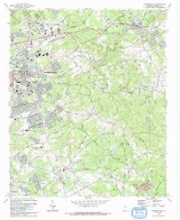
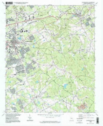
18 topographic sheets cover this place, the earliest surveyed in 1896 and the latest in 1998. It stands in the Snellville-Grayson census division. It lies in ZIP code area 30017. The Survey maps it on the Lawrenceville quadrangle. 4,730 people lived here at the 2020 count. It stands 1,096 feet above sea level.
Population over time
2 figuresGrayson grew from 2,666 to 4,730 between 2010 and 2020. These are the recorded population figures Wikidata holds for this place, reached through the Geographic Names Information System number this page is keyed on rather than by name, so they belong to this place and not to another of the same name. Most are census counts, but not all are: an early figure may be a founding or settlement estimate, and an estimate published within five years of a census is left out. The change column is computed, and is left blank where more than 20 years separate a figure from the one before it, because a gap that long is not a change between two counts.
| Year | People | Change |
|---|---|---|
| 2010 | 2,666 | |
| 2020 | 4,730 | +2,064 (+77%) |
Topographic sheets covering this place
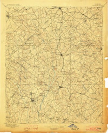
10 surveys from 18 printed sheetsMatched by testing this settlement's coordinate against the published boundary of every sheet in the United States Geological Survey's historical collection. Each opens the scanned sheet at the Survey.
- 1896 USGS Monroe quadrangle1:125000, 5 printings
- 1953 USGS Athens quadrangle1:250000, 3 printings
- 1958 USGS Athens quadrangle1:250000
- 1959 USGS Athens quadrangle1:250000
- 1963 USGS Athens quadrangle1:250000
- 1964 USGS Lawrenceville quadrangle1:24000, 2 printings
- 1980 USGS Athens quadrangle1:100000, 2 printings
- 1988 USGS Athens quadrangle1:250000
- 1992 USGS Lawrenceville quadrangle1:24000
- 1998 USGS Lawrenceville quadrangle1:24000
Fires near this place
101 since 1992Regional context, not property-specific evidence. The federal wildfire occurrence database lists 101 fires within 5 miles of Grayson between 1992 and 2018, burning about 323 acres in total. 2 started naturally. 35 were recorded as arson. Distance is straight-line from the map coordinates, so a fire counted here may appear on a neighbouring settlement's page as well.
| Reported cause | Fires |
|---|---|
| Arson/incendiarism | 35 |
| Debris and open burning | 24 |
| Misuse of fire by a minor | 17 |
| Recreation and ceremony | 11 |
| Smoking | 6 |
| Equipment and vehicle use | 4 |
| Natural | 2 |
| Missing data/not specified/undetermined | 2 |
The most recent of them, most recent first, with the day each was reported and the service that recorded it.
| Date | Cause | Size | Reported by | Name on the report |
|---|---|---|---|---|
| 7 September 2018 | Recreation and ceremony | 2.2 acres | Georgia Forestry Commission | FY2019GWINNETT001 |
| 2 September 1993 | Natural | under an acre | Georgia Forestry Commission | not named |
| 4 August 1992 | Arson/incendiarism | 4.4 acres | Georgia Forestry Commission | not named |
| 30 August 1997 | Recreation and ceremony | 1.3 acres | Georgia Forestry Commission | not named |
| 29 August 2011 | Misuse of fire by a minor | 1.3 acres | Georgia Forestry Commission | FY2012-GWINNETT SOUTH-002 |
| 20 August 1993 | Debris and open burning | 1.2 acres | Georgia Forestry Commission | not named |
| 2 August 1995 | Arson/incendiarism | 1.5 acres | Georgia Forestry Commission | not named |
| 2 August 1995 | Debris and open burning | under an acre | Georgia Forestry Commission | not named |
Settlements close enough to share some of these fires:
Mines and quarries near this place
3 within 5 milesRegional context, not property-specific evidence. The federal mineral resources record lists 3 workings within 5 miles of Grayson: 3 producers. All of them still produce. What was taken out: Stone, Crushed/Broken, Granite. Distance is straight-line from the map coordinates, so a quarry counted here may appear on a neighbouring settlement's page as well.
| Where | Site | Commodity | Status | Recorded |
|---|---|---|---|---|
| Dixie Blue Quarry | Granite | Producer | ||
| Grayson Granite Quarry | Stone, Crushed/Broken | Producer | ||
| Grayson Quarry | Stone, Crushed/Broken | Producer |
Storms near this place
22 since 1994Regional context, not property-specific evidence. The National Weather Service names Grayson in 22 storm reports between 1994 and 2023: 12 thunderstorm wind, 4 lightning, 3 hail, 2 flash flood. The reports record 1 death. Each account below is quoted exactly as the forecast office filed it, from the NOAA Storm Events Database, and each date opens the federal record of that event.
| When | Event | Place named | Harm | What the report says |
|---|---|---|---|---|
| June 1994 | Tornado (F2) | Grayson | 1 killed, $5,000,000 | A tornado touched down near Georgia Highway 124, four miles west of Grayson then moved east and tore into the Williums Acres subdivisions near Grayson. Five large homes were destroyed, 20 homes received major damage while another 34 had minor damage inflicted. One large two-story brick home (5300 square feet) took a direct hit in the Greystone subdivision and was reduced to rubble. The only known fatality occurred in the lower bedroom ,of this structure. The tornado threw the second story of the ,house 50 feet off the foundation while the first floor disin,tegrated. Ironically, upon inspection of the dislodged second floor of the home, stuffed animals remained intact and undisturbed on a bedroom window sill. Most of the homes that suffered major or complete damage in the Greystone subdivision were in a clear-cut zone. Those homes that were in wooded areas received the least amount of damage. At Pinehurst Trace road near the Grayson subdivision, another home was lifted and blown across the road were it broke in half. Most of the damage was concentrated near Georgia Highway 84, one mile southwest of Grayson and along Ozora Church Road, two miles southeast of Grayson. Damage estimates to property from this tornado was estimated at nearly 1 million dollars. (F10P) |
| June 2011 | Lightning | Grayson | $250,000 | The Gwinnett County Emergency Management Director reported that lightning struck a home in the 2500 block of Cobble Creek Lane in Grayson. The structure suffered extensive fire, smoke, and water damage. |
| June 2007 | Lightning | Grayson | $100,000 | The Gwinnett Daily Post of Lawrenceville reported that lightning struck a home on Willowwind Drive on the Gwinnett county side of Loganville near the Walton county line. The bonus room over the garage was set on fire. A neighbor attempted to investigate the situation but was overcome by smoke inhalation and had to be treated at a local hospital as a result. |
| December 2009 | Thunderstorm Wind | Grayson | $20,000 | The public reported that straight-line winds caused considerable damage to a Dacula neighborhood on Alcovy River Drive. Nearly a dozen trees were down. One home suffered minor damage when a tree fell on the structure. In addition, a privacy fence was destroyed when a large pine tree crushed through the structure. |
| September 1995 | Thunderstorm Wind | Grayson | $20,000 | Thunderstorm winds knocked down a wall at a construction site. The fallen wall caused a chain reaction of walls. |
| August 2019 | Lightning | Grayson | $15,000 | The Gwinnett County Emergency Manager reported a lighting caused fire at a residence in the 700 block of Windsor Place Circle. |
| July 2011 | Thunderstorm Wind | Grayson | $12,000 | The public reported that more than 50 large trees were uprooted or splintered in the Harbin area of far east central Gwinnett county, near the Barrow county line. Many of these were large oak, sweet gum, hickory nut, and pine trees. Power outages were noted in the area that lasted well into the early morning hours of the next day. |
| May 2021 | Thunderstorm Wind | Grayson | $10,000 | The Gwinnett County Emergency reported a few trees blown down across Grayson. |
| June 2020 | Thunderstorm Wind | Grayson | $10,000 | The Gwinnett County Emergency Manager reported trees and power lines blown down across the eastern portion of the county from around the Tribble Mill Park area to Loganville. |
| June 2019 | Thunderstorm Wind | Grayson | $10,000 | The Gwinnett County Emergency Manager reported trees and power lines blown down from Lawrenceville across Grayson to Loganville. Trees and power lines were downed near the intersection of Webb Gin House Road SW and Memory Way SW with trees down across the road on Plantation Run Drive SW. |
| August 2015 | Thunderstorm Wind | Grayson | $7,000 | The public reported multiple trees down near Rosebud Road and Highway 20. |
| May 2006 | Lightning | Grayson | $7,000 | The Gwinnett Daily Post of Lawrenceville reported that lightning struck the gas line of a home causing a fire in the basement of a home on Hillside Drive. Minor damage was reported to the basement of the home. |
| December 2015 | Flash Flood | Grayson | $3,000 | A USGS stream gauge on Brushy Fork Creek at Beaver Road or 3 miles west to southwest of Loganville reached flood stage of 9 feet. The creek crest at 9.7 feet. Minor flooding occurred in the woodlands and fields upstream and downstream from the gauge. |
| May 2003 | Thunderstorm Wind | Grayson | $3,000 | The Gwinnett county Skywarn coordinator reported that three large trees were down in Lilburn, and countless number of limbs in the same area. The public also reported that one tree was blown down in Grayson. |
| May 1998 | Thunderstorm Wind | Grayson | $1,000 | Thunderstorm winds knocked trees down that blocked highways 81 and 316 in Gwinnett county. |
| June 2019 | Thunderstorm Wind | Grayson | $500 | The Gwinnett County Emergency Manager reported a large tree blown down near the intersection of Hillside Drive SW and Grayson Highway SW. |
| August 2023 | Thunderstorm Wind | Grayson | - | Powerlines downed across Grayson New Hope Road and New Hope Road. |
| January 2023 | Thunderstorm Wind | Grayson | - | Powerlines down at intersection of Herring Rd SE and Camp Mitchell Rd SE. |
| July 2018 | Flash Flood | Grayson | - | Public reported minor flooding of Bay Creek Road. Radar estimates indicated rainfall amounts of 3 to 4 inches fell in the area, with locally higher amounts. |
| July 2011 | Hail | Grayson | - | The public observed penny-sized hail near Harbin. |
| March 2005 | Hail | Grayson | - | The public reported penny-sized hail. |
| April 2005 | Hail | Grayson | - | The Gwinnett County SkyWarn Coordinator and the public reported penny-sized hail. |
Nearest settlements
The eight closest, with where each one stands in the county. Distances are straight-line, computed from the Geographic Names Information System coordinates.
| Map | Place | Distance | Sheets |
|---|---|---|---|
| Waterton | 1.3 miles | 18 | |
| Graystone | 1.5 miles | 18 | |
| Timbercrest | 1.8 miles | 18 | |
| Graystone North | 2.0 miles | 18 | |
| Pinehurst Trace | 2.1 miles | 18 | |
| Carmel East | 2.2 miles | 18 | |
| Waverly Woods | 2.3 miles | 18 | |
| Cotton Creek | 2.4 miles | 21 |
Elsewhere
Matched on this settlement's Geographic Names Information System number rather than its name, so it cannot be a different place of the same name in another state.
| Wikipedia article on Grayson | An encyclopaedic summary. Its text is share-alike, so it is linked here rather than copied. |
| Wikidata item Q3260866 | The structured record the population and elevation above come from. Public domain (CC0). |
Provenance
This settlement is recorded in the Geographic Names Information System as feature 314805. The sheet list is computed by point-in-boundary test against the United States Geological Survey's historical topographic inventory. Both are works of the United States government and carry no copyright under 17 U.S.C. 105.
Wildfire. Short, Karen C. 2022. Spatial wildfire occurrence data for the United States, 1992-2020 [FPA_FOD_20221014]. 6th Edition. Fort Collins, CO: Forest Service Research Data Archive. https://doi.org/10.2737/RDS-2013-0009.6 Collected with United States Government funding and usable without additional permissions or fees.
Mines and quarries. USGS Mineral Resources Data System (MRDS) https://mrdata.usgs.gov/mrds/ A work of the United States government, no copyright under 17 U.S.C. 105.
Storms. NOAA National Centers for Environmental Information, Storm Events Database https://www.ncei.noaa.gov/stormevents/ A work of the United States government, no copyright under 17 U.S.C. 105. Narratives are quoted verbatim from the National Weather Service report and are not edited or summarised.