 Block
Grovetown, Georgia
20 topographic sheets cover this place, the earliest surveyed in 1922 and the latest in 1988. It stands in the Grovetown-Harlem census division. It lies in ZIP code area 30813. The Survey maps it on the Grovetown quadrangle. 15,577 people lived here at the 2020 count. It stands 482 feet above sea level.
Population over time
2 figuresGrovetown grew from 11,216 to 15,577 between 2010 and 2020. These are the recorded population figures Wikidata holds for this place, reached through the Geographic Names Information System number this page is keyed on rather than by name, so they belong to this place and not to another of the same name. Most are census counts, but not all are: an early figure may be a founding or settlement estimate, and an estimate published within five years of a census is left out. The change column is computed, and is left blank where more than 20 years separate a figure from the one before it, because a gap that long is not a change between two counts.
| Year | People | Change |
|---|---|---|
| 2010 | 11,216 | |
| 2020 | 15,577 | +4,361 (+39%) |
Topographic sheets covering this place
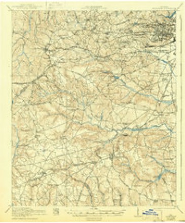
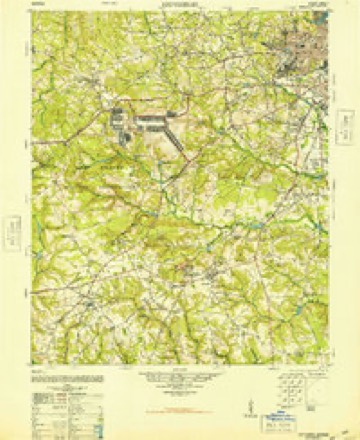
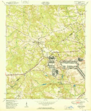
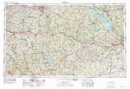
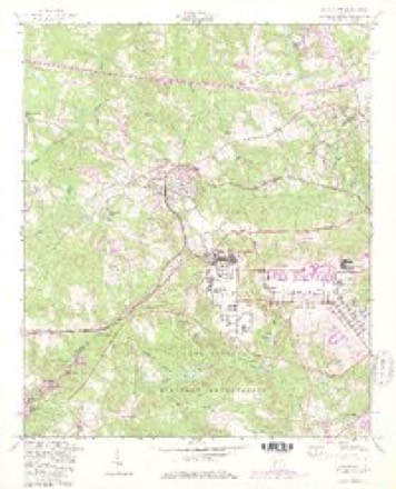
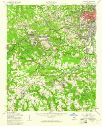
11 surveys from 20 printed sheetsMatched by testing this settlement's coordinate against the published boundary of every sheet in the United States Geological Survey's historical collection. Each opens the scanned sheet at the Survey.
- 1922 USGS Hephzibah quadrangle1:62500, 3 printings
- 1948 USGS Hephzibah quadrangle1:62500, 2 printings
- 1950 USGS Grovetown quadrangle1:24000
- 1953 USGS Athens quadrangle1:250000, 3 printings
- 1957 USGS Grovetown quadrangle1:24000, 4 printings
- 1957 USGS Hephzibah quadrangle1:62500, 2 printings
- 1958 USGS Athens quadrangle1:250000
- 1959 USGS Athens quadrangle1:250000
- 1963 USGS Athens quadrangle1:250000
- 1981 USGS Thomson quadrangle1:100000
- 1988 USGS Athens quadrangle1:250000
Fires near this place
210 since 1992Regional context, not property-specific evidence. The federal wildfire occurrence database lists 210 fires within 5 miles of Grovetown between 1992 and 2020, burning about 636 acres in total. 4 started naturally. 37 were recorded as arson. Distance is straight-line from the map coordinates, so a fire counted here may appear on a neighbouring settlement's page as well.
| Reported cause | Fires |
|---|---|
| Debris and open burning | 101 |
| Arson/incendiarism | 37 |
| Missing data/not specified/undetermined | 18 |
| Misuse of fire by a minor | 17 |
| Equipment and vehicle use | 14 |
| Recreation and ceremony | 10 |
| Smoking | 7 |
| Natural | 4 |
| Railroad operations and maintenance | 2 |
The most recent of them, most recent first, with the day each was reported and the service that recorded it.
| Date | Cause | Size | Reported by | Name on the report |
|---|---|---|---|---|
| 9 September 2011 | Debris and open burning | under an acre | Georgia Forestry Commission | FY2012-COLUMBIA-010 |
| 9 September 2007 | Missing data/not specified/undetermined | 4.3 acres | Georgia Forestry Commission | not named |
| 8 September 1995 | Arson/incendiarism | under an acre | Georgia Forestry Commission | not named |
| 5 September 1999 | Smoking | 6.9 acres | Georgia Forestry Commission | not named |
| 26 September 1993 | Debris and open burning | under an acre | Georgia Forestry Commission | not named |
| 23 September 2019 | Recreation and ceremony | 2.1 acres | Georgia Forestry Commission | FY2020RICHMOND009 |
| 23 September 2019 | Debris and open burning | under an acre | Georgia Forestry Commission | FY2020COLUMBIA002 |
| 19 September 1999 | Smoking | 16 acres | Georgia Forestry Commission | not named |
Settlements close enough to share some of these fires:
Mines and quarries near this place
3 within 5 milesRegional context, not property-specific evidence. The federal mineral resources record lists 3 workings within 5 miles of Grovetown: 1 past producer, 1 occurrence, 1 producer. 1 still produces. What was taken out: Stone, Crushed/Broken, Brick Clay, Clay. Distance is straight-line from the map coordinates, so a quarry counted here may appear on a neighbouring settlement's page as well.
| Where | Site | Commodity | Status | Recorded |
|---|---|---|---|---|
| Bel Air Mine Ga Vitr Brick | Clay | Producer | ||
| Belair Pit | Brick Clay | Occurrence | ||
| Grovetown Quarry | Stone, Crushed/Broken | Past Producer |
Storms near this place
60 of 61 shownRegional context, not property-specific evidence. The National Weather Service names Grovetown in 61 storm reports between 1994 and 2025: 28 thunderstorm wind, 25 hail, 6 flash flood, 1 heavy rain. No death or injury is recorded in these reports. Each account below is quoted exactly as the forecast office filed it, from the NOAA Storm Events Database, and each date opens the federal record of that event.
| When | Event | Place named | Harm | What the report says |
|---|---|---|---|---|
| April 2011 | Thunderstorm Wind | Grovetown | $180,000 | Numerous trees and powerlines down across the county with several homes sustaining severe damage. |
| February 2012 | Thunderstorm Wind | Grovetown | $50,000 | EM reported numerous trees and powerlines down across the southeast portions of the county. A couple of trees fell on vehicles. |
| July 2012 | Hail | Grovetown | $20,000 | A SKYWARN spotter reported golfball size hail on Columbia Road just north of I-20. |
| April 2011 | Hail | Grovetown | $20,000 | Public reported half dollar size hail in Grovetown. |
| August 2016 | Flash Flood | Grovetown | $10,000 | Columbia County, GA Dispatch reported Robinson Avenue in Grovetown was washed out due to heavy rainfall. |
| March 2011 | Thunderstorm Wind | Grovetown | $10,000 | EM reported a semi trailer overtured from wind gusts associated with a thunderstorm. The semi was in the rest area along I-20. |
| April 1997 | Hail | Grovetown | $10,000 | no account filed |
| August 2015 | Thunderstorm Wind | Grovetown | $2,000 | SKYWARN spotter reported trees down at a parking lot located at 5010 Steiner Way. |
| September 2020 | Flash Flood | Grovetown | $1,000 | Reynolds Farm Rd was closed due to flooding. |
| September 2020 | Flash Flood | Grovetown | $1,000 | Horizon South Parkway was closed due to flooding. |
| August 2012 | Flash Flood | Grovetown | $1,000 | Law Enforcement reported flash flooding in the area of John Deere Parkway and Horizon South. |
| February 2021 | Lightning | Grovetown | $500 | Trained spotter reported a lightning strike to a mobile home on Railroad Ave. There were no injuries. No structural damage occurred but an electrical box was damaged. Time estimated. |
| June 1994 | Thunderstorm Wind | Grovetown | $500 | A few power lines were downed by thunderstorm winds. |
| June 2020 | Hail | Grovetown | $100 | Broadcast media relayed a report from the public of penny size hail. |
| June 2018 | Thunderstorm Wind | Grovetown | $50 | SKYWARN Spotter reported estimated winds of 40-50 mph in Grovetown. |
| March 2022 | Hail | Grovetown | $10 | Public reported 0.25 inch hail WNW of Grovetown. |
| March 2022 | Hail | Grovetown | $10 | Public report of hail near dime size ENE of Grovetown. |
| July 2019 | Hail | Grovetown | $10 | Public reported, via mPING, pea size hail. |
| June 2025 | Thunderstorm Wind | Grovetown | - | Columbia County Dispatch reported a tree down along I20 at Mile Marker 190. Time estimated by radar. |
| January 2024 | Thunderstorm Wind | Grovetown | - | Several trees were downed including trees down on William Few Pkwy near Grovetown HS. |
| May 2024 | Hail | Grovetown | - | Spotter reported dime to quarter size hail near the intersection of S. Old Belair Road and Millhaven Road in Evans. The hail continued for 5 minutes. |
| July 2024 | Flash Flood | Grovetown | - | Broadcast Media reported flood waters entering homes in the Ivy Falls neighborhood of Grovetown, GA. |
| September 2024 | Flash Flood | Grovetown | - | Trained spotter reported Old Brezelia Rd closed due to flash flooding. |
| March 2023 | Hail | Grovetown | - | Numerous public reports with photos, via social media, of quarter to ping pong ball size hail in Grovetown. |
| March 2023 | Hail | Grovetown | - | Trained spotter reported 1 inch hail on Sweet Meadow Dr in Grovetown. Time estimated. |
| June 2023 | Thunderstorm Wind | Grovetown | - | Trees down at Wrightsboro Rd and Gateway Blvd, NE of Grovetown. Time estimated. |
| July 2023 | Thunderstorm Wind | Grovetown | - | Trees were downed on Mill Pond Ct, Sugar Creek Dr, and Lewis Rd. Time estimated. |
| September 2023 | Hail | Grovetown | - | Amateur radio operator forwarded a report of quarter sized hail at Old Belair Road. Specific location not provided. Time estimated by radar. |
| September 2023 | Thunderstorm Wind | Grovetown | - | A tree was down, blocking all westbound lanes of Interstate 20 at mile marker 190, near Lewiston Road. |
| May 2022 | Thunderstorm Wind | Grovetown | - | City of Grovetown reports numerous trees and powerlines down in several areas of the city. Some impacted locations include Railroad Avenue, Harlem Grovetown Road in the area of Fire Station #2, Green Street at W Robinson Avenue, and the area of 5100 Wrightsboro Road. |
| May 2022 | Thunderstorm Wind | Grovetown | - | Report of trees down at the Intersection of Horizon South Parkway and Gateway Blvd. |
| March 2022 | Hail | Grovetown | - | Public reported hail, at least the size of a quarter, that nearly covered the ground. The hail also produced small dents in a vehicle. |
| August 2021 | Thunderstorm Wind | Grovetown | - | Public report, via social media, of a tree down on Fermoy Lane, along with estimated wind gusts of 60 mph. Time estimated. |
| February 2020 | Thunderstorm Wind | Grovetown | - | Multiple downed trees along Harlem Grovetown Rd. Time estimated. |
| August 2020 | Thunderstorm Wind | Grovetown | - | Trees and power lines were downed around the East Robinson Ave and Katherine St area. Two homes were damaged from fallen trees. Time estimated. |
| July 2019 | Thunderstorm Wind | Grovetown | - | Multiple trees down at 970 Reynolds Farm Rd. Time estimated. |
| February 2019 | Thunderstorm Wind | Grovetown | - | Local broadcast media reported a large tree down on Newman Ln in Grovetown. |
| June 2018 | Hail | Grovetown | - | SKYWARN Spotter reported pea-to-dime size hail in Grovetown. |
| May 2017 | Thunderstorm Wind | Grovetown | - | County dispatch reported trees down near the intersection of Old Berzelia Rd and Newmantown Rd. |
| July 2017 | Thunderstorm Wind | Grovetown | - | Columbia Co GA Sheriff's Dept reported trees down on power lines near the intersection of Autumn Trail and Sugarcreek Dr. |
| July 2017 | Thunderstorm Wind | Grovetown | - | Columbia Co GA Sheriff's Dept reported trees down on power lines on Gibbs Rd S. |
| February 2016 | Thunderstorm Wind | Grovetown | - | County Sheriff Dispatch reported trees and power lines down in the Grovetown area. |
| May 2016 | Hail | Grovetown | - | Several reports of hail ranging from pea to nickel size hail in the Evans and Martinez areas. |
| July 2016 | Thunderstorm Wind | Grovetown | - | Broadcast media reported trees down in the Crawford Mills neighborhood in Grovetown near Brookwood Elementary School. Also a tree down along I-20 near mile marker 193 blocking both lanes of the eastbound traffic. |
| July 2013 | Heavy Rain | Grovetown | - | Ivy Falls Subdivision had 2.43 inches of rain within an hour. |
| July 2012 | Hail | Grovetown | - | Public reported quarter size hail. |
| May 2011 | Hail | Grovetown | - | Augusta media said the public observed nickel size hail in Grovetown. |
| May 2011 | Hail | Grovetown | - | EM reported quarter size hail in Grovetown. |
| May 2008 | Hail | Grovetown | - | Public reported 1 inch hail. |
| July 2008 | Thunderstorm Wind | Grovetown | - | Emergency management reported trees and powerlines down on Baker Place road, Baker Place Lane, and Louisville road near I-20. |
| April 2007 | Hail | Grovetown | - | SKYWARN spotters and public reported penny to nickel size hail. |
| March 2007 | Thunderstorm Wind | Grovetown | - | Sheriff reported trees down in the Grovetown area. |
| April 2007 | Thunderstorm Wind | Grovetown | - | WRDW TV reported numerous trees down in the Grovetown area and also at the intersection of Wrightsboro road and I-20. |
| April 2006 | Hail | Grovetown | - | Public Works employee reported penny size hail |
| July 2006 | Thunderstorm Wind | Grovetown | - | Emergency Manager reported trees down in Grovetown. |
| February 2005 | Hail | Grovetown | - | EOC reported 3/4 inch hail in Grovetown. |
| May 2005 | Hail | Grovetown | - | EM reported nickel size hail on I-20. |
| July 2000 | Thunderstorm Wind | Grovetown | - | EPD director reported trees and powerlines down in Lewiston area. |
| April 1998 | Hail | Grovetown | - | SKYWARN reports 1 inch hail. |
| April 1998 | Hail | Grovetown | - | TV 12 weather reports golf ball size hail. |
Nearest settlements
The eight closest, with where each one stands in the county. Distances are straight-line, computed from the Geographic Names Information System coordinates.
| Map | Place | Distance | Sheets |
|---|---|---|---|
| Forrest (historical) | 0.8 miles | 20 | |
| Kettle Creek | 2.0 miles | 20 | |
| Sugarcreek | 2.5 miles | 20 | |
| Lewiston Downs | 2.9 miles | 20 | |
| Buffalo Ranch | 3.4 miles | 20 | |
| Lake Royal | 3.4 miles | 20 | |
| Belglade | 3.6 miles | 20 | |
| Maple Creek | 3.7 miles | 20 |
Elsewhere
Matched on this settlement's Geographic Names Information System number rather than its name, so it cannot be a different place of the same name in another state.
| Wikipedia article on Grovetown | An encyclopaedic summary. Its text is share-alike, so it is linked here rather than copied. |
| Wikidata item Q2728276 | The structured record the population and elevation above come from. Public domain (CC0). |
Provenance
This settlement is recorded in the Geographic Names Information System as feature 356123. The sheet list is computed by point-in-boundary test against the United States Geological Survey's historical topographic inventory. Both are works of the United States government and carry no copyright under 17 U.S.C. 105.
Wildfire. Short, Karen C. 2022. Spatial wildfire occurrence data for the United States, 1992-2020 [FPA_FOD_20221014]. 6th Edition. Fort Collins, CO: Forest Service Research Data Archive. https://doi.org/10.2737/RDS-2013-0009.6 Collected with United States Government funding and usable without additional permissions or fees.
Mines and quarries. USGS Mineral Resources Data System (MRDS) https://mrdata.usgs.gov/mrds/ A work of the United States government, no copyright under 17 U.S.C. 105.
Storms. NOAA National Centers for Environmental Information, Storm Events Database https://www.ncei.noaa.gov/stormevents/ A work of the United States government, no copyright under 17 U.S.C. 105. Narratives are quoted verbatim from the National Weather Service report and are not edited or summarised.