 Block
Heard, Georgia
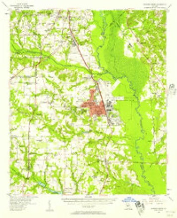
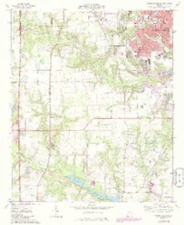
12 topographic sheets cover this place, the earliest surveyed in 1956 and the latest in 1988. It stands in the Perry census division. It lies in ZIP code area 31047. The Survey maps it on the Warner Robins SW quadrangle.
Topographic sheets covering this place
7 surveys from 12 printed sheetsMatched by testing this settlement's coordinate against the published boundary of every sheet in the United States Geological Survey's historical collection. Each opens the scanned sheet at the Survey.
- 1956 USGS Warner Robins quadrangle1:62500, 2 printings
- 1957 USGS Macon quadrangle1:250000
- 1958 USGS Macon quadrangle1:250000
- 1964 USGS Macon quadrangle1:250000, 2 printings
- 1973 USGS Warner Robins SW quadrangle1:24000, 3 printings
- 1978 USGS Macon quadrangle1:100000, 2 printings
- 1988 USGS Macon quadrangle1:250000
Fires near this place
466 since 1992Regional context, not property-specific evidence. The federal wildfire occurrence database lists 466 fires within 5 miles of Heard between 1992 and 2020, burning about 1,310 acres in total. 11 started naturally. 53 were recorded as arson. Distance is straight-line from the map coordinates, so a fire counted here may appear on a neighbouring settlement's page as well.
| Reported cause | Fires |
|---|---|
| Debris and open burning | 235 |
| Misuse of fire by a minor | 73 |
| Arson/incendiarism | 53 |
| Equipment and vehicle use | 42 |
| Smoking | 20 |
| Missing data/not specified/undetermined | 16 |
| Recreation and ceremony | 15 |
| Natural | 11 |
| Railroad operations and maintenance | 1 |
The most recent of them, most recent first, with the day each was reported and the service that recorded it.
| Date | Cause | Size | Reported by | Name on the report |
|---|---|---|---|---|
| 7 September 1997 | Recreation and ceremony | under an acre | Georgia Forestry Commission | not named |
| 6 September 1997 | Smoking | under an acre | Georgia Forestry Commission | not named |
| 5 September 1997 | Equipment and vehicle use | under an acre | Georgia Forestry Commission | not named |
| 4 September 2017 | Debris and open burning | 26 acres | Georgia Forestry Commission | FY2018-PEACH-001 |
| 4 September 1998 | Equipment and vehicle use | under an acre | Georgia Forestry Commission | not named |
| 4 September 1998 | Equipment and vehicle use | under an acre | Georgia Forestry Commission | not named |
| 4 September 1998 | Equipment and vehicle use | under an acre | Georgia Forestry Commission | not named |
| 27 September 2011 | Natural | under an acre | Georgia Forestry Commission | FY2012-PEACH-008 |
Settlements close enough to share some of these fires:
Mines and quarries near this place
1 within 5 milesRegional context, not property-specific evidence. The federal mineral resources record lists 1 working within 5 miles of Heard: 1 occurrence. None of them still produces. What was taken out: Kaolin. Distance is straight-line from the map coordinates, so a quarry counted here may appear on a neighbouring settlement's page as well.
| Where | Site | Commodity | Status | Recorded |
|---|---|---|---|---|
| Bear Creek Road Quarry | Kaolin | Occurrence |
Storms near this place
10 since 2010Regional context, not property-specific evidence. The National Weather Service names Heard in 10 storm reports between 2010 and 2023: 7 thunderstorm wind, 1 lightning, 1 hail, 1 tornado. No death or injury is recorded in these reports. Each account below is quoted exactly as the forecast office filed it, from the NOAA Storm Events Database, and each date opens the federal record of that event.
| When | Event | Place named | Harm | What the report says |
|---|---|---|---|---|
| January 2017 | Tornado (EF2) | Heard | $250,000 | A National Weather Service survey team found that the tornado that began in southeast Peach County and briefly crossed into a small portion of western Houston County before once again moving into a small portion of Peach County, moved back into Houston County along U.S Highway 41. The tornado intensified to an EF2 along this portion of its path with maximum wind speeds of 115 MPH. The tornado tracked east along Sandefur Road causing significant damage to trees and power lines with minor roof damage to homes south of Sandefur Road along Griswold Way. The tornado turned more northeasterly damaging a sports complex and a business along Cohen Walker Road. The tornado crossed Highway 96 near Peach Blossom Road and continued northeast through neighborhoods west of Bonanza Drive causing minor roof damage and downing trees and power lines as it continued across Faegan Mill Road and Moody Drive. At this point the tornado intensified to its strongest level. Brick fences were blown down and numerous trees were snapped or uprooted along Sandy Run Road and Echo Lane. The worst damage occurred near the WalMart and adjacent neighborhoods around Windmill Court. Two large HVAC units were tossed around 50 yards from the top of the WalMart. The auto bay garage doors on the back of the store were blown in and the roof lifted. Rafters on the opposite end of the store were twisted. Along Windmill Court and Hidden Creek Circle one house had most if its roof blown off and windows and doors blown in. Across the street, another home had a garage door and windows blown in and parts of its roof blown off. The tornado continued northeast and struck a mobile home park along Maxwell Drive and Sherry Lane where more than a dozen mobile homes were damaged. One mobile home was nearly completely destroyed. The tornado ended in this area. This tornado ultimately travelled over 13 miles across portions of Peach and Houston Counties. [01/21/17: Tornado #12, County #4/4, EF2, Peach-Houston-Peach-Houston, 2017:013]. |
| April 2010 | Lightning | Heard | $150,000 | The Houston Home Journal of Perry reported that lightning struck and set a home on fire on Sandefur Road. The home sustained major damage as the roof was almost completely destroyed. |
| August 2017 | Thunderstorm Wind | Heard | $6,000 | Large tree reported down on powerlines off of Johnson Court. |
| April 2020 | Thunderstorm Wind | Heard | $5,000 | Multiple trees reported down near Houston Lake. |
| January 2017 | Thunderstorm Wind | Heard | $5,000 | The public reported a large pecan tree uprooted on South Tamie Circle near Kathleen. The trunk of the tree was 4-5 feet in diameter near the base. |
| August 2023 | Thunderstorm Wind | Heard | $1,000 | Emergency manager reported a tree down along Royal Crest Circle. |
| June 2023 | Thunderstorm Wind | Heard | $1,000 | Report of tree on house on Coopers Mill near the intersection of N Lake Drive. |
| June 2023 | Thunderstorm Wind | Heard | - | Report of powerlines down at Sandefur Rd and Danny Carpenter Dr. |
| June 2023 | Thunderstorm Wind | Heard | - | Tree on house on Silk Tree Trace near the intersection of Red Maple Trail. |
| July 2012 | Hail | Heard | - | Amateur Radio operators and the public reported nickel to quarter sized hail fell across Warner Robins for at least 10 minutes. |
Nearest settlements
The eight closest, with where each one stands in the county. Distances are straight-line, computed from the Geographic Names Information System coordinates.
| Map | Place | Distance | Sheets |
|---|---|---|---|
| Shady Grove | 1.0 miles | 12 | |
| Cardinal Ridge | 1.2 miles | 12 | |
| Pilgrim Rest | 1.3 miles | 12 | |
| Sleepy Hollow | 2.1 miles | 12 | |
| Settlers Landing | 2.2 miles | 12 | |
| Doublegate | 2.2 miles | 12 | |
| South Springs | 2.3 miles | 12 | |
| South Pointe | 2.4 miles | 12 |
Provenance
This settlement is recorded in the Geographic Names Information System as feature 1730635. The sheet list is computed by point-in-boundary test against the United States Geological Survey's historical topographic inventory. Both are works of the United States government and carry no copyright under 17 U.S.C. 105.
Wildfire. Short, Karen C. 2022. Spatial wildfire occurrence data for the United States, 1992-2020 [FPA_FOD_20221014]. 6th Edition. Fort Collins, CO: Forest Service Research Data Archive. https://doi.org/10.2737/RDS-2013-0009.6 Collected with United States Government funding and usable without additional permissions or fees.
Mines and quarries. USGS Mineral Resources Data System (MRDS) https://mrdata.usgs.gov/mrds/ A work of the United States government, no copyright under 17 U.S.C. 105.
Storms. NOAA National Centers for Environmental Information, Storm Events Database https://www.ncei.noaa.gov/stormevents/ A work of the United States government, no copyright under 17 U.S.C. 105. Narratives are quoted verbatim from the National Weather Service report and are not edited or summarised.