 Block
Hinesville, Georgia
18 topographic sheets cover this place, the earliest surveyed in 1918 and the latest in 1981. It stands in the Hinesville census division. It lies in ZIP code area 31313. The Survey maps it on the Hinesville quadrangle. 34,891 people lived here at the 2020 count. It stands 75 feet above sea level.
Research this city
On record in Hinesville
Buildings and businesses the archive holds for this place. Each opens its own page, with the source record it came from.
On the National Register 3 records
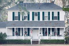 Bacon-Fraser Houselisted 1985
 Liberty County Courthouselisted 1980
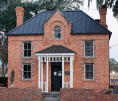 Liberty County Jaillisted 1992
Population over time
3 figuresHinesville grew from 162 to 34,891 between 1880 and 2020. These are the recorded population figures Wikidata holds for this place, reached through the Geographic Names Information System number this page is keyed on rather than by name, so they belong to this place and not to another of the same name. Most are census counts, but not all are: an early figure may be a founding or settlement estimate, and an estimate published within five years of a census is left out. The change column is computed, and is left blank where more than 20 years separate a figure from the one before it, because a gap that long is not a change between two counts.
| Year | People | Change |
|---|---|---|
| 1880 | 162 | |
| 2010 | 33,437 | |
| 2020 | 34,891 | +1,454 (+4%) |
Topographic sheets covering this place
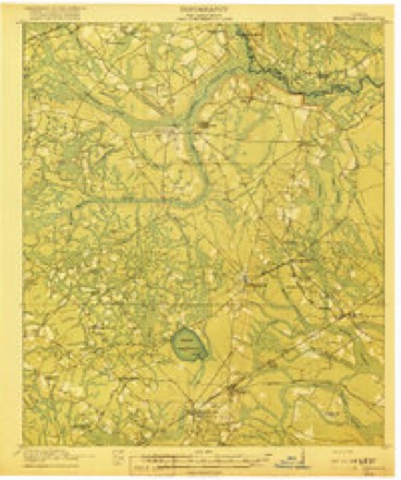
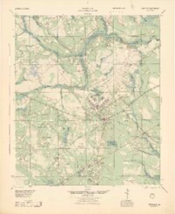
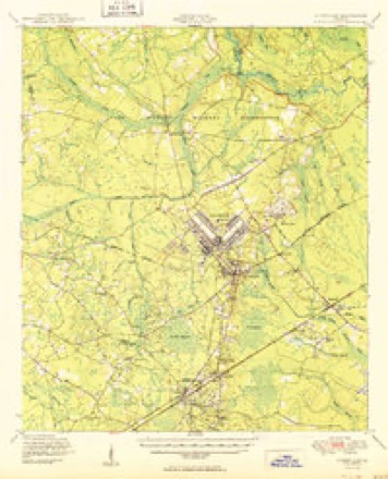
10 surveys from 18 printed sheetsMatched by testing this settlement's coordinate against the published boundary of every sheet in the United States Geological Survey's historical collection. Each opens the scanned sheet at the Survey.
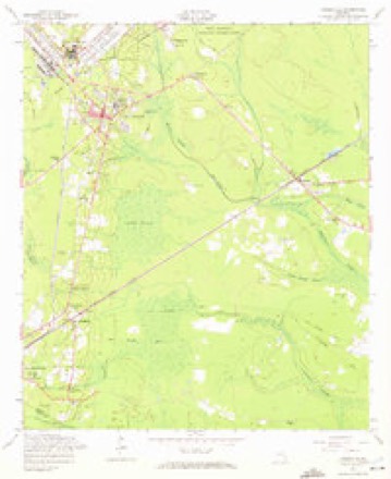
- 1918 USGS Hinesville quadrangle1:62500, 4 printings
- 1944 USGS Hinesville quadrangle1:62500
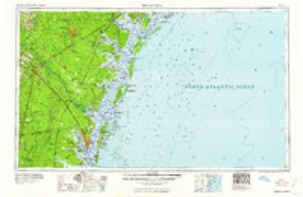
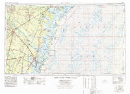
- 1946 USGS Brunswick quadrangle1:250000
- 1948 USGS Brunswick quadrangle1:250000
- 1950 USGS Hinesville quadrangle1:62500, 2 printings
- 1956 USGS Brunswick quadrangle1:250000, 2 printings
- 1958 USGS Hinesville quadrangle1:24000, 3 printings
- 1961 USGS Brunswick quadrangle1:250000
- 1978 USGS Brunswick quadrangle1:250000, 2 printings
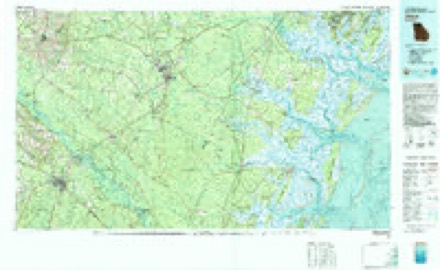
- 1981 USGS Jesup quadrangle1:100000
Photographs
8 of 26 photographs shown, 1941Taken for the Office of War Information and the Farm Security Administration, who photographed the country between 1935 and 1944. Works of United States government photographers, with no known restriction on use. Each opens its catalogue record.
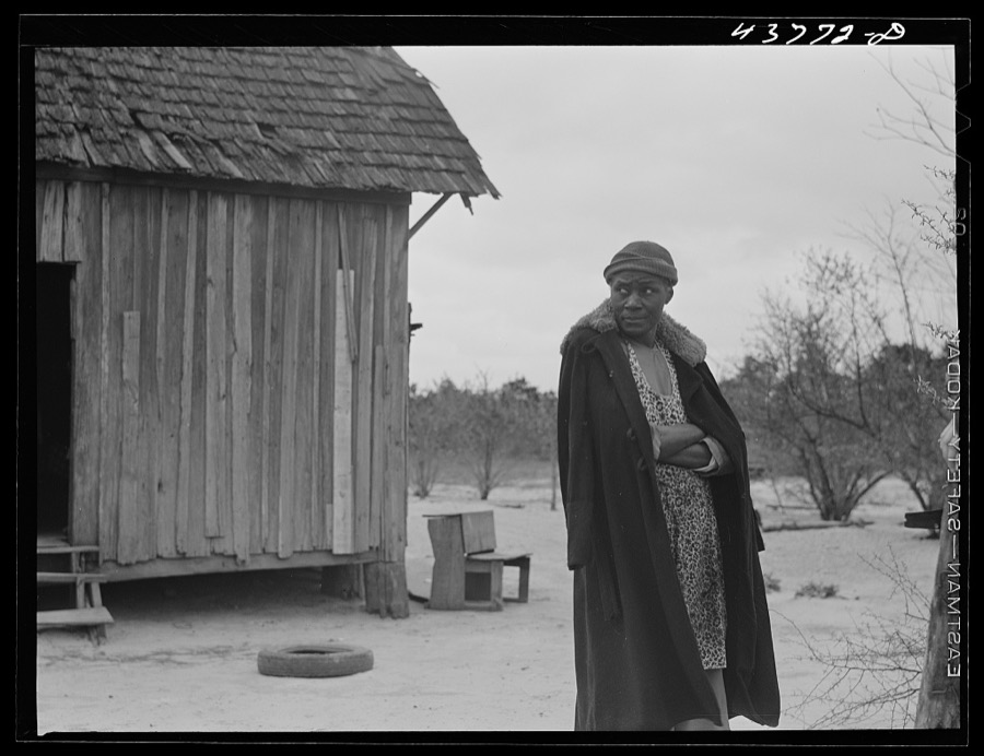
Delano, Jack, 1941. Library of Congress

Delano, Jack, 1941. Library of Congress

Delano, Jack, 1941. Library of Congress

Delano, Jack, 1941. Library of Congress
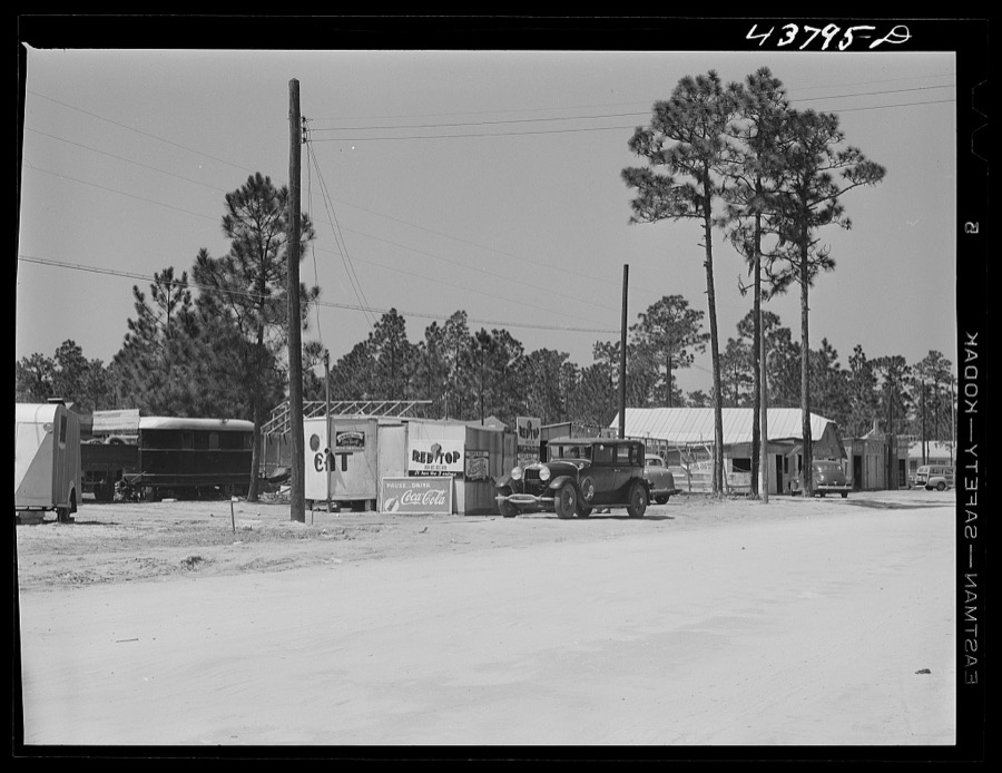
Delano, Jack, 1941. Library of Congress
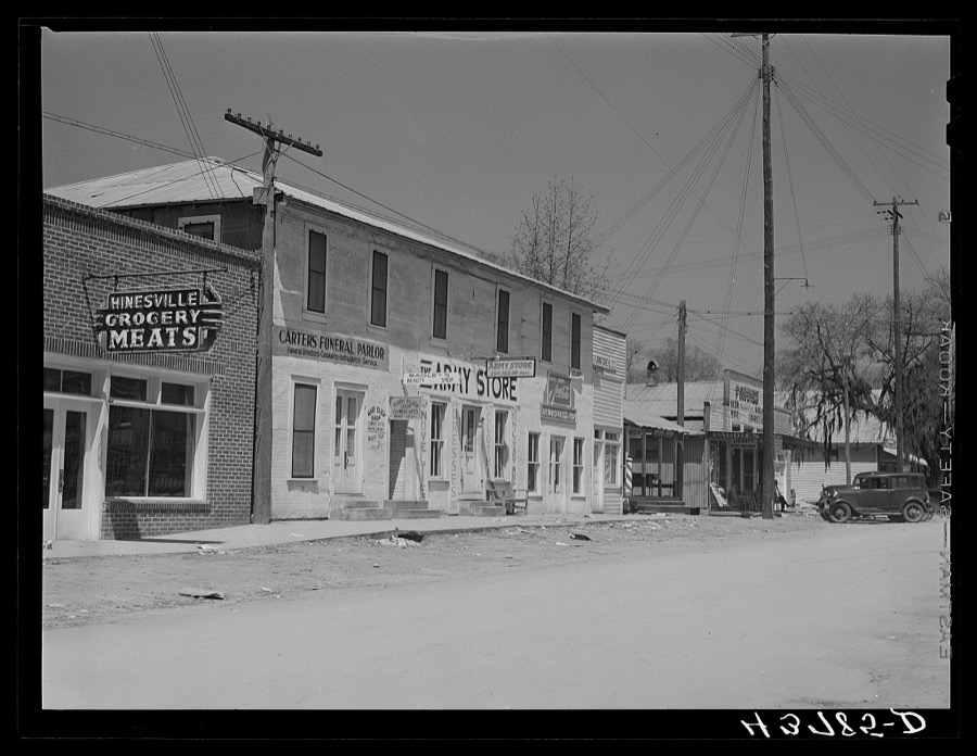
Delano, Jack, 1941. Library of Congress

Delano, Jack, 1941. Library of Congress
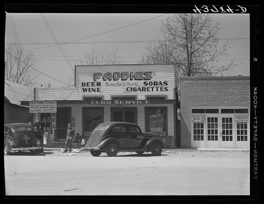
Delano, Jack, 1941. Library of Congress
Every photograph of Liberty County
Fires near this place
444 since 1992Regional context, not property-specific evidence. The federal wildfire occurrence database lists 444 fires within 5 miles of Hinesville between 1992 and 2020, burning about 1,816 acres in total. 8 started naturally. 203 were recorded as arson. Distance is straight-line from the map coordinates, so a fire counted here may appear on a neighbouring settlement's page as well.
| Reported cause | Fires |
|---|---|
| Arson/incendiarism | 203 |
| Debris and open burning | 144 |
| Misuse of fire by a minor | 55 |
| Missing data/not specified/undetermined | 20 |
| Natural | 8 |
| Recreation and ceremony | 6 |
| Equipment and vehicle use | 4 |
| Smoking | 2 |
| Railroad operations and maintenance | 2 |
The most recent of them, most recent first, with the day each was reported and the service that recorded it.
| Date | Cause | Size | Reported by | Name on the report |
|---|---|---|---|---|
| 4 September 2008 | Arson/incendiarism | 2.2 acres | Georgia Forestry Commission | not named |
| 24 September 2004 | Arson/incendiarism | under an acre | Georgia Forestry Commission | not named |
| 24 September 2004 | Arson/incendiarism | under an acre | Georgia Forestry Commission | not named |
| 24 September 1993 | Arson/incendiarism | 1.3 acres | Georgia Forestry Commission | not named |
| 20 September 1997 | Arson/incendiarism | 1.5 acres | Georgia Forestry Commission | not named |
| 16 September 1998 | Misuse of fire by a minor | under an acre | Georgia Forestry Commission | not named |
| 15 September 2018 | Debris and open burning | under an acre | Georgia Forestry Commission | FY2019LIBERTY001 |
| 11 September 1999 | Misuse of fire by a minor | under an acre | Georgia Forestry Commission | not named |
Settlements close enough to share some of these fires:
Storms near this place
60 of 82 shownRegional context, not property-specific evidence. The National Weather Service names Hinesville in 82 storm reports between 1993 and 2025: 54 thunderstorm wind, 13 hail, 9 flash flood, 4 lightning. The reports record 1 death and 8 injuries. Each account below is quoted exactly as the forecast office filed it, from the NOAA Storm Events Database, and each date opens the federal record of that event.
| When | Event | Place named | Harm | What the report says |
|---|---|---|---|---|
| April 1998 | Tornado (F2) | Hinesville | 1 killed, 7 hurt, $38,000,000 | F2 tornado moved from Long County into Liberty County, which encompasses much of Fort Stewart Army Base. One soldier was killed while in an administrative building and seven others were injured. Seven buildings were destroyed while another fifty-five(55) suffered different degrees of damage. |
| June 2010 | Lightning | Hinesville | 1 hurt | The 911 center reported a lightning strike very close to Fraser Circle where a 9 year old boy was outside. The boy was treated for lightning related injuries. |
| July 2006 | Thunderstorm Wind | Hinesville | $50,000 | Several trees down in Hinesville with one tree falling on a house. |
| June 2009 | Lightning | Hinesville | $30,000 | Law Enforcement reported several homes were struck by lightning and started on fire. |
| July 2008 | Flash Flood | Hinesville | $20,000 | The public library on Memorial Drive in Hinesville, Georgia was flooded. |
| July 2006 | Thunderstorm Wind | Hinesville | $20,000 | Trees and powerlines down throughout city. |
| June 2008 | Lightning | Hinesville | $15,000 | The Hinesville Fire Department reported a lightning strike caused a house fire on Clay Street in Hinesville, Georgia. |
| May 1997 | Thunderstorm Wind | Hinesville | $15,000 | Tree fell on two cars. |
| September 2011 | Thunderstorm Wind | Hinesville | $12,000 | The Liberty county Emergency Manager reported several trees down in and around Hinesville, Georgia. One tree was reported down on a home and another down on a vehicle. |
| July 2006 | Thunderstorm Wind | Hinesville | $10,000 | Tree fell on house on Pineview Court. |
| June 2012 | Thunderstorm Wind | Hinesville | $5,000 | A spotter reported large limbs down on Stewart Drive. |
| June 1994 | Thunderstorm Wind | Hinesville | $5,000 | Several trees and power lines were downed along U.S. Highway 84 due to thunderstorm winds. |
| July 2012 | Thunderstorm Wind | Hinesville | $3,000 | A County Official reported a few trees down near Hinesville. |
| March 2009 | Thunderstorm Wind | Hinesville | $3,000 | Law Enforcement reported an awning torn down at Liberty Tire and Brake off of Highway 84. Power lines were also reported down on Gausett Pafford Road in Hinesville, Georgia. |
| August 2012 | Thunderstorm Wind | Hinesville | $2,000 | A tree fell on a house along Windward Drive. |
| July 2006 | Tornado (F0) | Hinesville | $2,000 | Spotter witnessed a car with people inside picked up in a rotating fashion 6 ft in the air and then dropped. Damage to the car. No injuries. |
| June 2013 | Thunderstorm Wind | Hinesville | $1,750 | The Liberty County 911 call center reported a large tree limb downed a power line and was blocking Wilson Avenue near North Main Street. |
| June 2013 | Thunderstorm Wind | Hinesville | $1,500 | The public reported an 80 foot pine tree down on a fence. The damage was likely caused by outflow. |
| August 2012 | Lightning | Hinesville | $1,500 | The Liberty County 911 call center reported that lightning struck a tree causing it to fall on a house in Hinesville. |
| April 2008 | Thunderstorm Wind | Hinesville | $1,500 | Several trees were reported down at a residence just west of Hinesville, Georgia. |
| August 2020 | Thunderstorm Wind | Hinesville | $1,250 | A power line was reported down on the 600 block of McDowell Road. |
| June 2013 | Thunderstorm Wind | Hinesville | $1,250 | The public reported power lines down near the intersection of Highway 84 and Veterans Parkway. |
| June 2013 | Thunderstorm Wind | Hinesville | $1,000 | The Liberty County 911 call center reported a large tree down on Lakeview Court. The damage was likely caused by outflow. |
| August 2007 | Thunderstorm Wind | Hinesville | $1,000 | The Hinesville Police Department reported that a tree fell on a power pole causing it to snap in two in front of their offices. |
| August 2020 | Thunderstorm Wind | Hinesville | $500 | The Liberty County 911 Call Center reported a large limb down near the intersection of South Main Street and General Screven Way. |
| July 2011 | Thunderstorm Wind | Hinesville | $500 | Law Enforcement reported a tree down on Huckleberry Lane, 1 mile south of Hinesville, Georgia. |
| July 2011 | Thunderstorm Wind | Hinesville | $500 | Law Enforcement reported one tree down on Ashmore Road in Hinesville, Georgia. |
| July 2011 | Thunderstorm Wind | Hinesville | $500 | Law Enforcement reported a tree down near the intersection of South Main Street and Ryon Avenue in Hinesville, Georgia. |
| May 2009 | Thunderstorm Wind | Hinesville | $500 | Law enforcement reported a tree down and blocking the entrance of Shady Oaks Mobile Home Park in Hinesville, Georgia. |
| July 2008 | Thunderstorm Wind | Hinesville | $500 | A medium size oak tree was reported down in the Walmart parking lot in Hinesville, Georgia. |
| October 2011 | Thunderstorm Wind | Hinesville | $200 | A large tree limb was reported down near the intersection of S Main Street and Deen Street. |
| July 2025 | Thunderstorm Wind | Hinesville | - | Liberty County dispatch reported a large limb down in the roadway at Olmstead Drive and North Main Street. Also, power lines were down on Sabreena Circle. |
| March 2024 | Hail | Hinesville | - | Local broadcast media relayed a rpeort of nickel sized hail in Hinesville. |
| January 2023 | Thunderstorm Wind | Hinesville | - | Liberty County dispatch reported that power lines were blown down onto a tree which sparked a small fire along the 800 block of East Oxford Lane. |
| August 2023 | Thunderstorm Wind | Hinesville | - | Law enforcement reported one tree down in Hinesville, GA. |
| October 2023 | Hail | Hinesville | - | The public reported quarter to ping pong ball size hail in Hinesville, GA. |
| October 2023 | Thunderstorm Wind | Hinesville | - | Law enforcement reported a tree down on power lines and a home at 521 Azalea Street. Structural damage was reported to the home. |
| April 2021 | Thunderstorm Wind | Hinesville | - | The Liberty County Warning Point relayed a report of a tree down on Bacon Road. |
| August 2020 | Thunderstorm Wind | Hinesville | - | A picture shared via social media indicated damage to a garage door at a car dealership. |
| August 2020 | Thunderstorm Wind | Hinesville | - | Pictures via social media indicated roofing material on the ground from a business near the intersection of Pineland Avenue and Elma G Miles Parkway. |
| June 2019 | Thunderstorm Wind | Hinesville | - | The Liberty County 911 Call Center reported multiple trees down near Courtland Drive and Nottingham Way. |
| June 2019 | Thunderstorm Wind | Hinesville | - | The Liberty County 911 Call Center reported a tree on a residence. |
| June 2019 | Thunderstorm Wind | Hinesville | - | The Liberty County 911 Call Center reported a tree down near Rebecca Street and West Memorial Drive. |
| June 2019 | Thunderstorm Wind | Hinesville | - | The Liberty County 911 Call Center reported multiple trees down along Wallace Martin Drive. |
| January 2017 | Thunderstorm Wind | Hinesville | - | Liberty County dispatch reported that a portion of a commercial structure roof had caved in near the intersection of Weeping Willow Drive and Veterans Parkway. |
| May 2017 | Hail | Hinesville | - | Penny sized hail was reported near the intersection of Cambridge Court and Wexford Drive. |
| May 2017 | Thunderstorm Wind | Hinesville | - | Liberty County dispatch reported a power pole knocked down at 324 West Memorial Drive. |
| June 2016 | Flash Flood | Hinesville | - | A Liberty County emergency manager reported a roadway washout on Kings Road. |
| September 2014 | Thunderstorm Wind | Hinesville | - | The Liberty County Emergency Manager reported that a large tree was blown down onto Oak Street near the intersection with Palm Drive. The tree was blocking both lanes. |
| August 2014 | Thunderstorm Wind | Hinesville | - | The Liberty County 911 Call Center reported a large limb down on a power line and blocking the entrance to a business. |
| October 2014 | Thunderstorm Wind | Hinesville | - | The Liberty County 911 Call Center reported a tree down on Maxwelton Circle. |
| June 2012 | Hail | Hinesville | - | Golf ball size hail fell at the Liberty County Warning Point. |
| June 2012 | Hail | Hinesville | - | A trained spotter reported numerous golf ball sized hail near a hospital in Hinesville. |
| June 2012 | Hail | Hinesville | - | A spotter reported golf ball size hail along Stewart Drive. |
| July 2012 | Thunderstorm Wind | Hinesville | - | The Fort Stewart AWOS measured a peak wind gust of 57 mph. |
| August 2011 | Thunderstorm Wind | Hinesville | - | Emergency management reported 25 to 30 trees down at and near an apartment complex along Highway 196. Approximately 12 cars were damaged from fallen trees at the complex. Minor structural damage and a few shingles were off the roof of the apartment complex. A wooden fence was also blown over. A 10 by 10 feet area of roofing was also torn off a restaurant within one block of the apartment complex. |
| March 2009 | Flash Flood | Hinesville | - | Law Enforcement reported one to one and a half feet of water covering the intersection of Cherokee Circle and Highway 84 in Hinesville, Georgia. |
| October 2009 | Hail | Hinesville | - | The public reported penny size hail in Hinesville, Georgia. |
| July 2008 | Flash Flood | Hinesville | - | Portions of Fraiser Street, East Henry Street, and South Main Street were reported to be flooded by Law Enforcement officials. |
| July 2008 | Flash Flood | Hinesville | - | High water was reported on South Main Street in Hinesville, Georgia. The waters were approaching homes adjacent to the road. |
Nearest settlements
The eight closest, with where each one stands in the county. Distances are straight-line, computed from the Geographic Names Information System coordinates.
| Map | Place | Distance | Sheets |
|---|---|---|---|
| Sandy Run | 0.4 miles | 18 | |
| Fraser Acres | 0.5 miles | 18 | |
| Pineview | 0.5 miles | 18 | |
| Harrison Heights | 0.5 miles | 18 | |
| Garden Acres | 0.5 miles | 18 | |
| Lancaster Estates | 0.8 miles | 18 | |
| Olmstead | 0.8 miles | 18 | |
| Ashmore | 0.8 miles | 18 |
Elsewhere
Matched on this settlement's Geographic Names Information System number rather than its name, so it cannot be a different place of the same name in another state.
| Wikipedia article on Hinesville | An encyclopaedic summary. Its text is share-alike, so it is linked here rather than copied. |
| Wikidata item Q1994691 | The structured record the population and elevation above come from. Public domain (CC0). |
Provenance
This settlement is recorded in the Geographic Names Information System as feature 331992. The sheet list is computed by point-in-boundary test against the United States Geological Survey's historical topographic inventory. Both are works of the United States government and carry no copyright under 17 U.S.C. 105.
Wildfire. Short, Karen C. 2022. Spatial wildfire occurrence data for the United States, 1992-2020 [FPA_FOD_20221014]. 6th Edition. Fort Collins, CO: Forest Service Research Data Archive. https://doi.org/10.2737/RDS-2013-0009.6 Collected with United States Government funding and usable without additional permissions or fees.
Storms. NOAA National Centers for Environmental Information, Storm Events Database https://www.ncei.noaa.gov/stormevents/ A work of the United States government, no copyright under 17 U.S.C. 105. Narratives are quoted verbatim from the National Weather Service report and are not edited or summarised.