 Block
Huber, Georgia
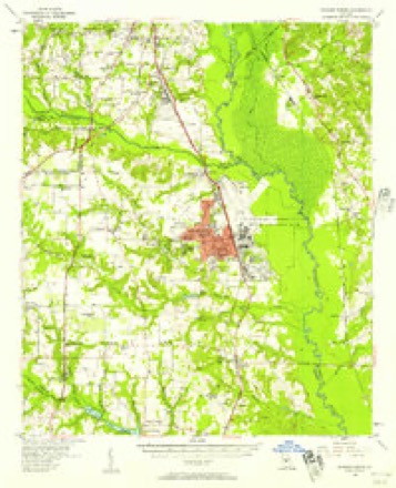
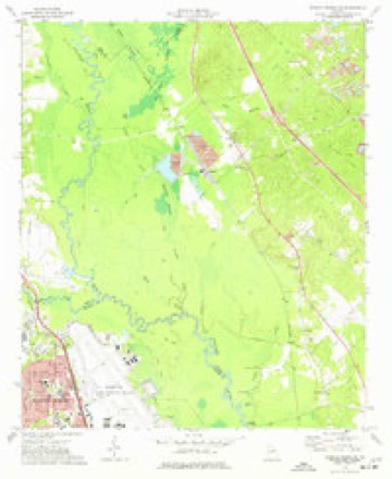
11 topographic sheets cover this place, the earliest surveyed in 1956 and the latest in 1988. It stands in the South Twiggs census division. It lies in ZIP code area 31217. The Survey maps it on the Warner Robins NE quadrangle.
Topographic sheets covering this place
7 surveys from 11 printed sheetsMatched by testing this settlement's coordinate against the published boundary of every sheet in the United States Geological Survey's historical collection. Each opens the scanned sheet at the Survey.
- 1956 USGS Warner Robins quadrangle1:62500, 2 printings
- 1957 USGS Macon quadrangle1:250000
- 1958 USGS Macon quadrangle1:250000
- 1964 USGS Macon quadrangle1:250000, 2 printings
- 1973 USGS Warner Robins NE quadrangle1:24000, 2 printings
- 1978 USGS Macon quadrangle1:100000, 2 printings
- 1988 USGS Macon quadrangle1:250000
Fires near this place
334 since 1992Regional context, not property-specific evidence. The federal wildfire occurrence database lists 334 fires within 5 miles of Huber between 1992 and 2020, burning about 897 acres in total. 6 started naturally. 41 were recorded as arson. Distance is straight-line from the map coordinates, so a fire counted here may appear on a neighbouring settlement's page as well.
| Reported cause | Fires |
|---|---|
| Debris and open burning | 184 |
| Arson/incendiarism | 41 |
| Equipment and vehicle use | 35 |
| Missing data/not specified/undetermined | 27 |
| Smoking | 26 |
| Misuse of fire by a minor | 9 |
| Recreation and ceremony | 6 |
| Natural | 6 |
The most recent of them, most recent first, with the day each was reported and the service that recorded it.
| Date | Cause | Size | Reported by | Name on the report |
|---|---|---|---|---|
| 9 September 2017 | Debris and open burning | under an acre | Georgia Forestry Commission | FY2018-TWIGGS-003 |
| 9 September 2003 | Missing data/not specified/undetermined | under an acre | Georgia Forestry Commission | not named |
| 5 September 1995 | Debris and open burning | under an acre | Georgia Forestry Commission | not named |
| 28 September 2008 | Equipment and vehicle use | under an acre | Georgia Forestry Commission | not named |
| 25 September 2001 | Missing data/not specified/undetermined | under an acre | Georgia Forestry Commission | FY2002-TWIGGS-006 |
| 24 September 2005 | Arson/incendiarism | under an acre | Georgia Forestry Commission | not named |
| 22 September 2008 | Equipment and vehicle use | under an acre | Georgia Forestry Commission | not named |
| 21 September 2010 | Natural | 2.3 acres | Georgia Forestry Commission | FY2011-BIBB-002 |
Settlements close enough to share some of these fires:
Mines and quarries near this place
10 of 41 shownRegional context, not property-specific evidence. The federal mineral resources record lists 41 workings within 5 miles of Huber: 21 past producers, 17 producers, 3 occurrences. 17 still produce. What was taken out: Kaolin, Sand and Gravel, Construction, Clay, Clay, Kaolin. Distance is straight-line from the map coordinates, so a quarry counted here may appear on a neighbouring settlement's page as well.
| Where | Site | Commodity | Status | Recorded |
|---|---|---|---|---|
| Hinson Mine | Clay, Kaolin | Occurrence | ||
| Lawson Quarry | Stone, Crushed/Broken | Past Producer | ||
| Georgia Kaolin Company. | Clay | Occurrence | ||
| Mine | Clay | Past Producer | ||
| Huber Pit | Sand and Gravel, Construction | Occurrence | ||
| Huber Sand Pit | Sand and Gravel, Construction | Producer | ||
| Macon Sand Pit | Sand and Gravel, Construction | Producer | ||
| Bond Mine | Kaolin | Producer | ||
| Dry Branch Pit A | Kaolin | Producer | ||
| Ga. Kaolin Mine 50 | Kaolin | Producer |
Storms near this place
23 since 1995Regional context, not property-specific evidence. The National Weather Service names Huber in 23 storm reports between 1995 and 2024: 17 thunderstorm wind, 4 hail, 2 tornado. No death or injury is recorded in these reports. Each account below is quoted exactly as the forecast office filed it, from the NOAA Storm Events Database, and each date opens the federal record of that event.
| When | Event | Place named | Harm | What the report says |
|---|---|---|---|---|
| March 2019 | Tornado (EF1) | Huber | $50,000 | A National Weather Service survey team found that an EF1 tornado with maximum wind speeds of90 mph and a maximum path width of 300 yards in the small community of Huber. The tornado touched down very near the KaMin factory on Huber Road where a number of large trees were snapped or uprooted. The tornado moved east across Huber Road and Huber Clay County Road where a large number of pine trees were snapped or uprooted. A number of other trees were snapped or uprooted near the Chance Hill Church on Cochran Short Route, or Highway 23. A pine tree fell on a house in this location as well before the tornado lifted shortly after crossing the highway. No injuries were reported. [03/03/19: Tornado #4, County #1/1, EF1, Twiggs, 2019:009]. |
| April 2017 | Tornado (EF1) | Huber | $30,000 | A National Weather Service survey team found that an EF1 tornado with maximum wind speeds of 93 MPH and a maximum path width of 440 yards touched down in Twiggs County about 4 miles northeast of Robins AFB long US Highway 129-Alt. The tornado travelled east crossing Alton White Boulevard and Friendship Church Road. The tornado than followed along Bullard Road crossing I-16 before lifting just past Marion Ripley Road. This tornado remained over rural, wooded country and damage consisted of numerous hardwood and softwood trees snapped or uprooted. No injuries were reported. [04/03/17: Tornado #18, County #1/1, EF-1, Twiggs, 2017:050]. |
| February 2019 | Thunderstorm Wind | Huber | $10,000 | The Twiggs County Emergency Manager reported numerous trees and power lines blown down in the eastern portion of the county from around Bullard to Jeffersonville. |
| June 2015 | Thunderstorm Wind | Huber | $8,000 | The Twiggs County 911 Center reported several trees blown from around Sgoda Road and White Springs Church Road to Bullard Road near I-16. |
| November 2018 | Thunderstorm Wind | Huber | $7,000 | The Twiggs County Emergency Manager reported several trees blown down from Huber to near Myricks Mill. |
| August 2015 | Thunderstorm Wind | Huber | $5,000 | The Twiggs County 911 Center reported several trees down on I-16 near mile marker 12. |
| August 2008 | Thunderstorm Wind | Huber | $5,000 | The Twiggs County 911 Center reported that more than a dozen trees were blown down across the county. Doppler radar base velocity data indicated wind speeds up to 65 mph tracked across much of the county from northwest to southeast. |
| July 2007 | Thunderstorm Wind | Huber | $4,000 | The Twiggs County Deputy Emergency Management Director reported that ten trees and one power line were down across the county. Some trees were down on Interstate-16, Georgia Highway 96, and one local road. |
| November 2011 | Thunderstorm Wind | Huber | $3,000 | The Twiggs County 911 Center reported that at least six trees were down in the northwest part of the county near Huber. Several of the trees were down on Interstate-16 and two trees were down on U.S. Highway 129. Power outages were observed in the area. |
| August 2011 | Thunderstorm Wind | Huber | $2,000 | The Twiggs County 911 Center reported that at least six trees were down across the county. WSR-88D base velocity data indicated that these events likely occurred across the northern half of the county from Huber to just northwest of Jeffersonville. |
| June 2008 | Thunderstorm Wind | Huber | $2,000 | The Twiggs County 911 Center reported that at least six trees were blown down just northeast of Huber along U.S. Highways 129 and 80 northeast of Huber and also along Sgoda Road. |
| August 2024 | Thunderstorm Wind | Huber | $1,000 | Several trees down across northwest side of county per em. |
| May 2024 | Thunderstorm Wind | Huber | $1,000 | A large tree was reported down across Key Rd. |
| September 2023 | Thunderstorm Wind | Huber | $1,000 | Tree down at 2500 block of Sgoda Rd, near Sgoda Cir. |
| July 2021 | Thunderstorm Wind | Huber | $1,000 | The Twiggs County 911 center reported a tree blown down across Highway 129. |
| April 2020 | Thunderstorm Wind | Huber | $1,000 | Tree down at the intersection of Hwy 129 and Friendship Church Road. |
| June 2019 | Thunderstorm Wind | Huber | $1,000 | The Twiggs County Sheriff's Office reported a power line blown down across Sgoda Road. |
| July 1995 | Thunderstorm Wind | Huber | $500 | Thunderstorm winds blew a few large trees down across highway. |
| June 2000 | Thunderstorm Wind | Huber | $300 | The Twiggs county 911 center and the public reported trees down on Interstate 16 at Exit 12 near Horseshoe Circle. |
| May 2008 | Hail | Huber | - | The public observed quarter-sized hail just north of Huber. Radar supported that hail of penny to quarter-size likely fell across much of the northern part of the county from Huber to Fitzpatrick. |
| May 2005 | Hail | Huber | - | An amatuer radio operator reported penny-sized hail on Interstate-16 just northeast of Huber. |
| March 2003 | Hail | Huber | - | An amateur radio operator reported nickel size hail. |
| May 2001 | Hail | Huber | - | The Twiggs county 911 center reported dime size hail. |
Nearest settlements
The eight closest, with where each one stands in the county. Distances are straight-line, computed from the Geographic Names Information System coordinates.
| Map | Place | Distance | Sheets |
|---|---|---|---|
| Reids | 1.1 miles | 11 | |
| Bullard | 6.0 miles | 11 | |
| Marion | 6.9 miles | 11 | |
| Fitzpatrick | 7.0 miles | 11 | |
| Dry Branch | 7.3 miles | 10 | |
| Ripley | 7.5 miles | 11 | |
| Mount Calvary | 7.5 miles | 10 | |
| Myricks Mill | 11.0 miles | 10 |
Provenance
This settlement is recorded in the Geographic Names Information System as feature 356326. The sheet list is computed by point-in-boundary test against the United States Geological Survey's historical topographic inventory. Both are works of the United States government and carry no copyright under 17 U.S.C. 105.
Wildfire. Short, Karen C. 2022. Spatial wildfire occurrence data for the United States, 1992-2020 [FPA_FOD_20221014]. 6th Edition. Fort Collins, CO: Forest Service Research Data Archive. https://doi.org/10.2737/RDS-2013-0009.6 Collected with United States Government funding and usable without additional permissions or fees.
Mines and quarries. USGS Mineral Resources Data System (MRDS) https://mrdata.usgs.gov/mrds/ A work of the United States government, no copyright under 17 U.S.C. 105.
Storms. NOAA National Centers for Environmental Information, Storm Events Database https://www.ncei.noaa.gov/stormevents/ A work of the United States government, no copyright under 17 U.S.C. 105. Narratives are quoted verbatim from the National Weather Service report and are not edited or summarised.