 Block
Kinderlou, Georgia
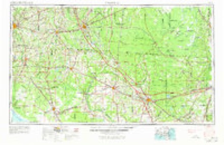
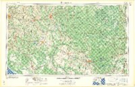
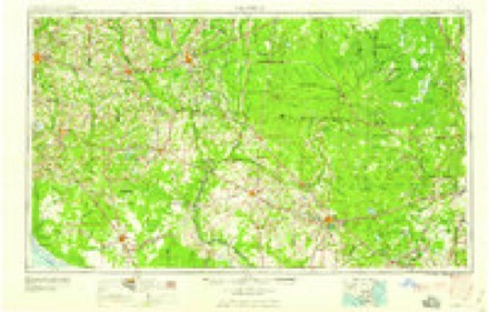
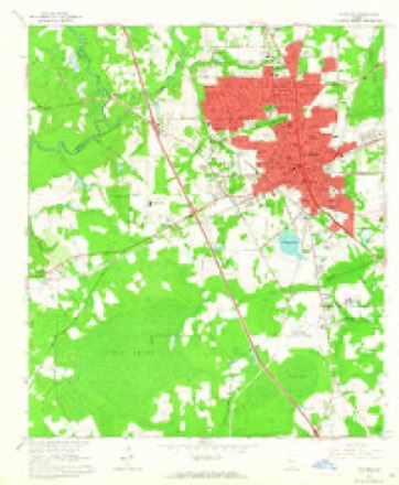
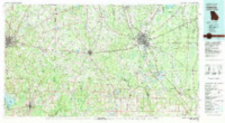
9 topographic sheets cover this place, the earliest surveyed in 1954 and the latest in 1981. It stands in the Valdosta census division. It lies in ZIP code area 31601. The Survey maps it on the Valdosta quadrangle.
Topographic sheets covering this place
5 surveys from 9 printed sheetsMatched by testing this settlement's coordinate against the published boundary of every sheet in the United States Geological Survey's historical collection. Each opens the scanned sheet at the Survey.
- 1954 USGS Valdosta quadrangle1:250000, 2 printings
- 1958 USGS Valdosta quadrangle1:250000
- 1959 USGS Valdosta quadrangle1:250000
- 1961 USGS Valdosta quadrangle1:24000, 4 printings
- 1981 USGS Valdosta quadrangle1:100000
Fires near this place
368 since 1992Regional context, not property-specific evidence. The federal wildfire occurrence database lists 368 fires within 5 miles of Kinderlou between 1992 and 2020, burning about 3,125 acres in total. 17 started naturally. 56 were recorded as arson. Distance is straight-line from the map coordinates, so a fire counted here may appear on a neighbouring settlement's page as well.
| Reported cause | Fires |
|---|---|
| Debris and open burning | 177 |
| Arson/incendiarism | 56 |
| Equipment and vehicle use | 33 |
| Smoking | 24 |
| Railroad operations and maintenance | 23 |
| Misuse of fire by a minor | 17 |
| Natural | 17 |
| Missing data/not specified/undetermined | 14 |
| Recreation and ceremony | 7 |
The most recent of them, most recent first, with the day each was reported and the service that recorded it.
| Date | Cause | Size | Reported by | Name on the report |
|---|---|---|---|---|
| 9 September 2010 | Debris and open burning | 4.1 acres | Georgia Forestry Commission | FY2011-LOWNDES-006 |
| 9 September 1998 | Arson/incendiarism | under an acre | Georgia Forestry Commission | not named |
| 9 September 1997 | Debris and open burning | 3.0 acres | Georgia Forestry Commission | not named |
| 8 September 1997 | Debris and open burning | under an acre | Georgia Forestry Commission | not named |
| 5 September 2020 | Debris and open burning | 6.6 acres | Georgia Forestry Commission | FY2021LOWNDES001 |
| 5 September 1997 | Debris and open burning | 1.3 acres | Georgia Forestry Commission | not named |
| 25 September 2003 | Debris and open burning | 1.1 acres | Georgia Forestry Commission | not named |
| 20 September 1996 | Equipment and vehicle use | under an acre | Georgia Forestry Commission | not named |
Settlements close enough to share some of these fires:
Storms near this place
27 since 2003Regional context, not property-specific evidence. The National Weather Service names Kinderlou in 27 storm reports between 2003 and 2024: 12 thunderstorm wind, 5 flash flood, 4 heavy rain, 2 hail. The reports record 1 death. Each account below is quoted exactly as the forecast office filed it, from the NOAA Storm Events Database, and each date opens the federal record of that event.
| When | Event | Place named | Harm | What the report says |
|---|---|---|---|---|
| August 2003 | Lightning | Kinderlou | 1 killed | A Lowndes County teen was struck by lightning while outside his home. Three days later, he died of cardiac failure at Shands Hospital in Gainesville. Reported by the Valdosta Daily Times. |
| April 2016 | Flood | Kinderlou | $10,000 | A picture was submitted showing Carter Way Road washed out in western Lowndes county. This road intersects with Tiger Creek which feeds into the Withlacoochee River. Damage was estimated. Tiger Creek likely overflowed due to heavy rainfall amounts in the previous couple of days, leading to the washout. Damage was estimated. |
| April 2016 | Flood | Kinderlou | $10,000 | A picture was submitted showing portion of Carter Way Road washed out due to persistent moderate to heavy rainfall. Damage was estimated. |
| April 2021 | Thunderstorm Wind | Kinderlou | $1,000 | A line was blown down at 5559 India Road. |
| April 2015 | Thunderstorm Wind | Kinderlou | $1,000 | Trees were blown down in the western part of Lowndes county. |
| June 2014 | Thunderstorm Wind | Kinderlou | $1,000 | A tree was blown down along Highway 84. |
| July 2012 | Thunderstorm Wind | Kinderlou | $1,000 | A tree was blown down at Spain Ferry Road and Ousley Road. Monetary damage was estimated. |
| May 2012 | Thunderstorm Wind | Kinderlou | $1,000 | A tree was blown down on Highway 84 West near the Brooks county line. Monetary damage was estimated. |
| July 2012 | Thunderstorm Wind | Kinderlou | $1,000 | The Lowndes county 911 dispatch reported a tree down near the Brooks/Lowndes county border. Monetary damage was estimated. |
| April 2024 | Flash Flood | Kinderlou | - | The road was partially washed out near Carter Way and Old Quitman Highway. |
| November 2024 | Flash Flood | Kinderlou | - | Flooding was reported on State Highway 38 westbound at Pecan Plantation Road. |
| April 2023 | Thunderstorm Wind | Kinderlou | - | A tree was blown down along Rocky Ford Road. |
| April 2023 | Thunderstorm Wind | Kinderlou | - | An Ambient Weather Station measured a gust of 50 knots or 58 mph. |
| April 2023 | Thunderstorm Wind | Kinderlou | - | A tree was blown down across Adams Road. |
| June 2023 | Thunderstorm Wind | Kinderlou | - | A tree was blown down near Adams Road and Knights Ferry Road. |
| August 2022 | Flash Flood | Kinderlou | - | Flooding was reported along Highway 84. |
| August 2021 | Thunderstorm Wind | Kinderlou | - | There were several trees blown down on Knights Ferry Road. |
| June 2018 | Thunderstorm Wind | Kinderlou | - | A tree was blown down on Old Quitman Highway south of Highway 84. |
| December 2018 | Flash Flood | Kinderlou | - | Flooding was reported across several dirt roads throughout Lowndes county. |
| August 2015 | Flash Flood | Kinderlou | - | Water was reported to have risen up to a house on Riverside Road due to heavy rainfall of around 4 inches in 3 hours. |
| December 2014 | Tornado (EF0) | Kinderlou | - | A fire department reported a brief tornado touchdown in a field. No structural damage occurred. There was a small but visible tornadic debris signature on KVAX dual-pol radar as well. The tornado was rated EF0. |
| March 2012 | Heavy Rain | Kinderlou | - | A 24 hour total of 4.75 inches was measured at GA-LW-5. |
| March 2012 | Heavy Rain | Kinderlou | - | A 24 hour total of 4.25 inches was measured at GA-LW-7. |
| March 2012 | Heavy Rain | Kinderlou | - | A storm total of 4.41 inches was measured at the Withlacoochee river near Quitman. |
| July 2011 | Heavy Rain | Kinderlou | - | Heavy rainfall of 4.48 was measured in a 3 hour period between 9 am and 12 pm EDT at the USGS Water Resources Division Gauge QUTG1. |
| May 2008 | Hail | Kinderlou | - | Nickel size hail was reported two miles west of Interstate 75 on US Highway 84. |
| May 2008 | Hail | Kinderlou | - | Golf ball size hail was reported near US Highway 84. |
Nearest settlements
The eight closest, with where each one stands in the county. Distances are straight-line, computed from the Geographic Names Information System coordinates.
| Map | Place | Distance | Sheets |
|---|---|---|---|
| Westwood Estates | 1.8 miles | 9 | |
| Lawton | 2.4 miles | 9 | |
| West Valdosta | 3.0 miles | 9 | |
| Lakeview Heights | 3.2 miles | 9 | |
| Ousley | 3.4 miles | 7 | |
| Troupville | 3.7 miles | 9 | |
| Provident | 3.9 miles | 9 | |
| Hallmark Heights | 4.2 miles | 9 |
Provenance
This settlement is recorded in the Geographic Names Information System as feature 332149. The sheet list is computed by point-in-boundary test against the United States Geological Survey's historical topographic inventory. Both are works of the United States government and carry no copyright under 17 U.S.C. 105.
Wildfire. Short, Karen C. 2022. Spatial wildfire occurrence data for the United States, 1992-2020 [FPA_FOD_20221014]. 6th Edition. Fort Collins, CO: Forest Service Research Data Archive. https://doi.org/10.2737/RDS-2013-0009.6 Collected with United States Government funding and usable without additional permissions or fees.
Storms. NOAA National Centers for Environmental Information, Storm Events Database https://www.ncei.noaa.gov/stormevents/ A work of the United States government, no copyright under 17 U.S.C. 105. Narratives are quoted verbatim from the National Weather Service report and are not edited or summarised.