 Block
La Grange, Georgia
12 topographic sheets cover this place, the earliest surveyed in 1899 and the latest in 1978. It stands in the LaGrange census division. It lies in ZIP code area 30240. The Survey maps it on the La Grange quadrangle. 30,858 people lived here at the 2020 count. It stands 781 feet above sea level.
Research this city
On record in La Grange
Buildings and businesses the archive holds for this place. Each opens its own page, with the source record it came from.
On the National Register 6 records
 Nutwoodlisted 1974
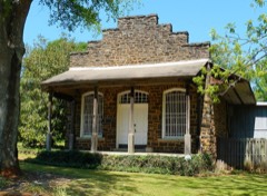 Potts Brothers Storelisted 1983
 Reid-Glanton Houselisted 1972
- Rutledge Houselisted 1977
- Strickland Houselisted 1976
- Vernon Road Historic Districtlisted 1984
Surveyed buildings and structures 12 of 53 shown
- 1000 Houston Street (House), 1000 Houston Street, La Grangefederal building survey, 1 photograph
- 107 DeGroat Street (House), 107 DeGroat Street, La Grangefederal building survey, 1 photograph
- 1103 Troup Street (House), 1103 Troup Street, La Grangefederal building survey, 1 photograph
- 119 Burr Street (House), La Grangefederal building survey, 3 photographs
- 1312 Washington Street (House), 1312 Washington Street, La Grangefederal building survey, 1 photograph
- 2 Hood Street (House), 2 Hood Street, La Grangefederal building survey, 1 photograph
- 208 Vine Street (House), 208 Vine Street, La Grangefederal building survey, 1 photograph
- 209 Ware Street (House), 209 Ware Street, La Grangefederal building survey, 1 photograph
- 306 Dix Street (House), La Grangefederal building survey, 4 photographs
- 308 Dix Street (House), La Grangefederal building survey, 4 photographs
- 310 Dix Street (House), La Grangefederal building survey, 3 photographs
- 310 Ware Street (House), 310 Ware Street, La Grangefederal building survey, 1 photograph
Population over time
2 figuresLa Grange grew from 29,588 to 30,858 between 2010 and 2020. These are the recorded population figures Wikidata holds for this place, reached through the Geographic Names Information System number this page is keyed on rather than by name, so they belong to this place and not to another of the same name. Most are census counts, but not all are: an early figure may be a founding or settlement estimate, and an estimate published within five years of a census is left out. The change column is computed, and is left blank where more than 20 years separate a figure from the one before it, because a gap that long is not a change between two counts.
| Year | People | Change |
|---|---|---|
| 2010 | 29,588 | |
| 2020 | 30,858 | +1,270 (+4%) |
Topographic sheets covering this place
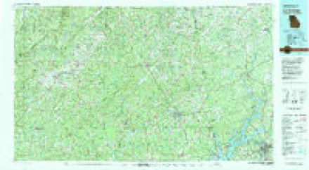
7 surveys from 12 printed sheetsMatched by testing this settlement's coordinate against the published boundary of every sheet in the United States Geological Survey's historical collection. Each opens the scanned sheet at the Survey.
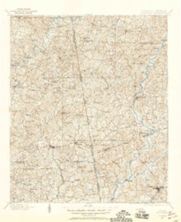
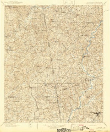
- 1899 USGS Wedowee quadrangle1:125000
- 1902 USGS Wedowee quadrangle1:125000, 3 printings
- 1953 USGS Atlanta quadrangle1:250000, 2 printings
- 1957 USGS Atlanta quadrangle1:250000
- 1958 USGS Atlanta quadrangle1:250000
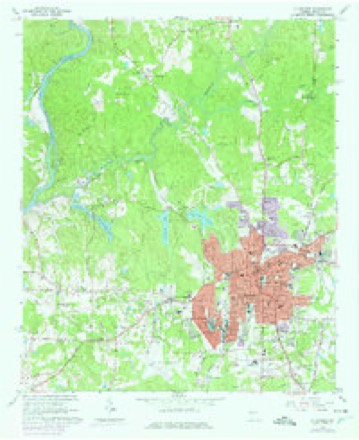
- 1964 USGS La Grange quadrangle1:24000, 3 printings
- 1978 USGS La Grange quadrangle1:100000



Photographs
8 of 49 photographs shown, 1939Taken for the Office of War Information and the Farm Security Administration, who photographed the country between 1935 and 1944. Works of United States government photographers, with no known restriction on use. Each opens its catalogue record.
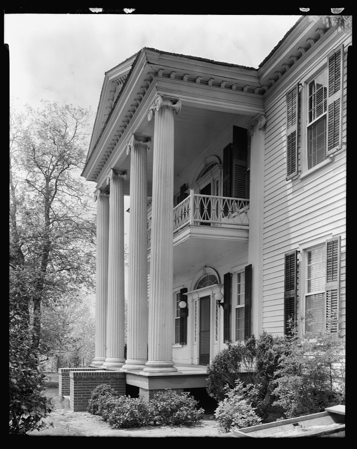
Johnston, Frances Benjamin, 1939. Library of Congress
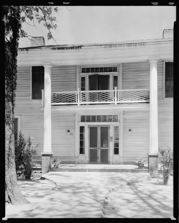
Johnston, Frances Benjamin, 1939. Library of Congress
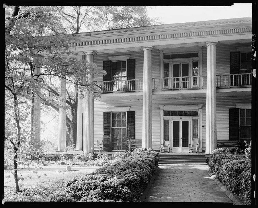
Johnston, Frances Benjamin, 1939. Library of Congress
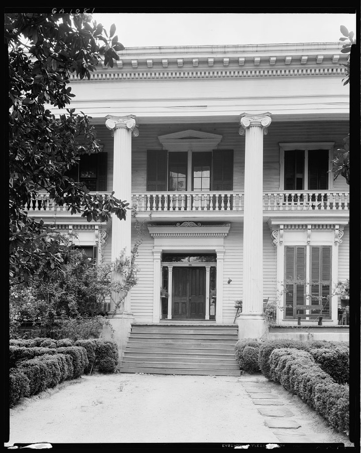
Johnston, Frances Benjamin, 1939. Library of Congress

Johnston, Frances Benjamin, 1939. Library of Congress
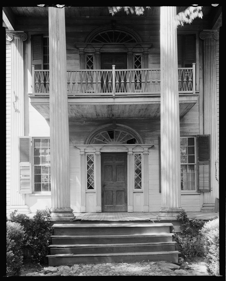
Johnston, Frances Benjamin, 1939. Library of Congress
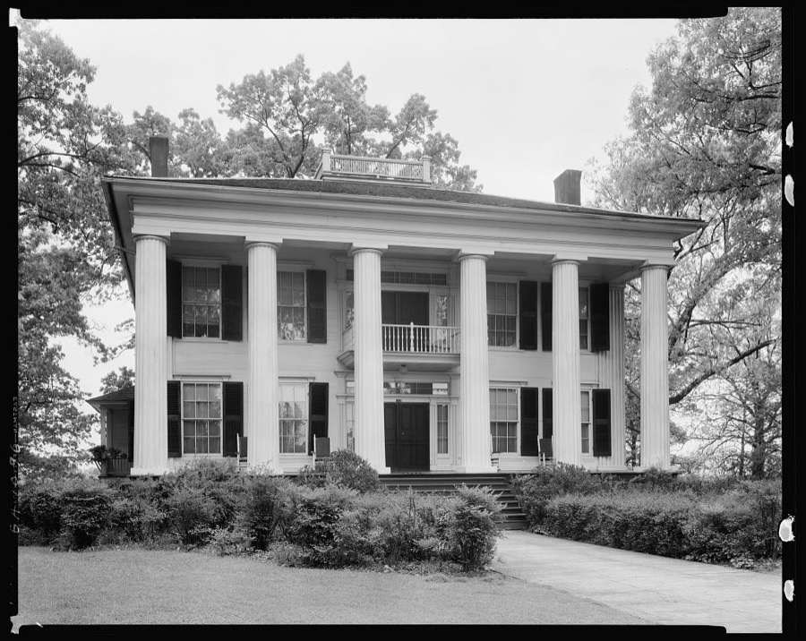
Johnston, Frances Benjamin, 1939. Library of Congress
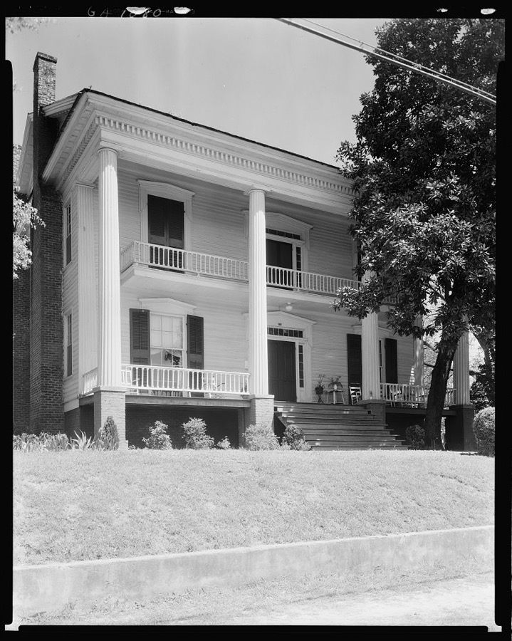
Johnston, Frances Benjamin, 1939. Library of Congress
Every photograph of Troup County
Fires near this place
164 since 1992Regional context, not property-specific evidence. The federal wildfire occurrence database lists 164 fires within 5 miles of La Grange between 1992 and 2016, burning about 436 acres in total. 5 started naturally. 13 were recorded as arson. Distance is straight-line from the map coordinates, so a fire counted here may appear on a neighbouring settlement's page as well.
| Reported cause | Fires |
|---|---|
| Debris and open burning | 85 |
| Misuse of fire by a minor | 17 |
| Arson/incendiarism | 13 |
| Railroad operations and maintenance | 12 |
| Equipment and vehicle use | 11 |
| Recreation and ceremony | 10 |
| Missing data/not specified/undetermined | 6 |
| Natural | 5 |
| Smoking | 5 |
The most recent of them, most recent first, with the day each was reported and the service that recorded it.
| Date | Cause | Size | Reported by | Name on the report |
|---|---|---|---|---|
| 6 September 1999 | Debris and open burning | under an acre | Georgia Forestry Commission | not named |
| 29 September 2011 | Recreation and ceremony | under an acre | Georgia Forestry Commission | FY2012-TROUP-003 |
| 25 September 2008 | Debris and open burning | 2.4 acres | Georgia Forestry Commission | not named |
| 15 September 1999 | Arson/incendiarism | 1.0 acres | Georgia Forestry Commission | not named |
| 11 September 1993 | Debris and open burning | 3.1 acres | Georgia Forestry Commission | not named |
| 29 August 2002 | Misuse of fire by a minor | under an acre | Georgia Forestry Commission | FY2003-TROUP-005 |
| 26 August 2002 | Debris and open burning | 2.0 acres | Georgia Forestry Commission | FY2003-TROUP-004 |
| 24 August 2010 | Missing data/not specified/undetermined | 1.3 acres | Georgia Forestry Commission | FY2011-TROUP-001 |
Settlements close enough to share some of these fires:
Mines and quarries near this place
5 within 5 milesRegional context, not property-specific evidence. The federal mineral resources record lists 5 workings within 5 miles of La Grange: 3 prospects, 1 producer, 1 occurrence. 1 still produces. What was taken out: Mica, Barium-Barite, Stone, Crushed/Broken. Distance is straight-line from the map coordinates, so a quarry counted here may appear on a neighbouring settlement's page as well.
| Where | Site | Commodity | Status | Recorded |
|---|---|---|---|---|
| Lagrange Quarry | Stone, Crushed/Broken | Producer | ||
| Crosby Prospect | Mica | Prospect | ||
| Davis Prospect | Mica | Occurrence | ||
| Hart Prospect | Barium-Barite | Prospect | ||
| Mat Teague Prospect | Barium-Barite | Prospect |
Storms near this place
60 of 112 shownRegional context, not property-specific evidence. The National Weather Service names La Grange in 112 storm reports between 1993 and 2026: 52 thunderstorm wind, 45 hail, 9 lightning, 4 flash flood. The reports record 1 injury. Each account below is quoted exactly as the forecast office filed it, from the NOAA Storm Events Database, and each date opens the federal record of that event.
| When | Event | Place named | Harm | What the report says |
|---|---|---|---|---|
| April 2006 | Lightning | La Grange | 1 hurt | The Troup County 911 Center reported that a 44 year-old male was struck by lightning knocking him unconscious and singeing his hair and clothes. He was left disoriented for some time and required medical attention. |
| April 2013 | Hail | La Grange | $1,748,000 | Several reports were relayed from the public of quarter to baseball sized hail in the LaGrange area. Damage was reported to windows, cars and roofs. |
| December 2005 | Hail | La Grange | $1,500,000 | Numerous reports of very large hail were received from the public across a large part of central Troup county from west of LaGrange near West Point Lake east to Mountville along the eastern border of the county. Many of the hail reports were of golf ball to baseball-sized hail. Hail the size of quarters to golf balls completely covered the ground at one shopping center in La Grange. Dozens of car windshields were broken during the hailstorm. The most significant damage occurred at a Toyata dealership in LaGrange, where 240 vehicles were damaged. |
| June 2011 | Hail | La Grange | $425,000 | The Troup County 911 Center reported golf ball-sized hail just south of LaGrange and the public observed quarter-sized hail near Smiths Crossroads. |
| July 2000 | Lightning | La Grange | $350,000 | The La Grange Daily News reported that lightning caused an estimated $100,000 damge to a house on Riverbend Road, caused another house fire at the corner of Mooty Bridge Road and John Harris Road, and destroyed two backup electrical generators at the City Hall. |
| June 2007 | Lightning | La Grange | $250,000 | The LaGrange Daily News reported that lightning struck a transformer outside the Dunson United Methodist Church on Barnard Avenue. The lightning traveled through the electrical lines into one of the air conditioners in the crawl space resulting in a fire which caused considerable damage to the structure. |
| January 2007 | Thunderstorm Wind | La Grange | $200,000 | The LaGrange Daily News reported that several buildings were damaged or destroyed and numerous trees and power lines were down, mostly in the north part of the county and in the LaGrange area. A metal storage building was destroyed at a Dermatology Clinic on Whitesville Road and Stay Lodge, also on Whitesville Road, lost about half of the shingles on its roof. Damage estimates for the building and destroyed property were in excess of $100,000. The Southern Pipe plant on Webster Street in La Grange was severely damaged when the wind picked up a utility building and hurled it through the side of the business. Damages to this facility alone were estimated at $35,000. The storm also ripped off a wall of the Faith Temple Church on Edgewood Avenue and a number of trees were blown down at West Georgia Technical College, one of which damaged the roof of a campus building. A tree was also blown down onto a trailer on Kelley Street. A number of trees were reported down across the county. |
| August 2005 | Lightning | La Grange | $200,000 | The La Grange Daily News reported that lightning struck a home on Shoal Creek Drive. The $110,000 dollar home was completely destroyed. Another home was struck on Wright Street, causing major damage to the structure. |
| May 2009 | Thunderstorm Wind | La Grange | $125,000 | The Troup County 911 Center reported that at least seven trees were blown down in the La Grange area. The La Grange Daily news reported that one of the downed trees fell on an adjacent porch and two vehicles in the 300 block of Park Avenue. Another large oak tree split and fell on a home in the 1200 block of Third Avenue, damaging the roof and totaling a Honda Civic. On Houston Street, a tree was blown down onto a power line and an adjacent vehicle. A few other power lines were also down in the area. |
| June 2002 | Thunderstorm Wind | La Grange | $100,000 | The LaGrange Daily News, along with the public, storm spotters, and the local post office all reported a considerable amount of wind damage in the LaGrange area. Numerous large trees were blown down or uprooted, several landing on homes, power lines, and in the city streets. The northbound lanes of Interstate 85 near LaGrange were closed for a period of time as tree debris blocked the lanes. Numerous lengthy power outages resulted from all of the downed trees and power lines around the city. Many traffic signals were rendered inoperative by the power outage, causing numerous traffic problems. City crews estimated that it would cost $10,000 just to clean up all of the debris in the streets. Three homes sustained major damage to roofs when large trees were blown over onto them. At one home, the downed tree also broke out a window, damaged a computer just inside the window, and caused considerable damage to a 1995 Chevrolet Cavalier. Another home suffered $10,000 in damage when a large Silver Maple tree fell through the roof. At yet another home, $3,000 worth of damage was caused when a tree fell on a power line and pulled the main electrical line from the house. There were several other reports of electrical meters being ripped from the sides of homes as power lines were pulled down by trees and took the meters along with them. Another car was heavily damaged when part of a large oak tree fell on an automobile at another residence. A storage building was also destroyed by the wind. |
| April 2014 | Lightning | La Grange | $75,000 | The Troup County Emergency Manager reported that lightning struck a house, causing a fire with extensive damage. |
| August 2007 | Lightning | La Grange | $50,000 | The Troup County 911 Center reported that lightning struck a home and set it on fire. Damage estimates to the home were indeterminate. A couple of trees were also struck by lightning causing them to fall. An electrical transformer was also struck and rendered inoperative by a lightning strike in the same general area. Finally, fire fighters responded to a grass fire on Stovall Road that was caused by a lightning strike. |
| June 2003 | Flash Flood | La Grange | $50,000 | The Troup county 911 center reported that extensive flooding was occurring in the city. At least 15 roads were flooded and 30 homes had to be evacuated because of flood waters. Water got into a number of homes in the city. Parts of the county reported over 4 inches of rain during the day. |
| May 1993 | Tornado (F0) | La Grange | $50,000 | A weak tornado briefly touched down 10 miles southwest of La Grange in extreme southwestern Troup county near Georgia Highway 29 and West Point road. A few large trees were uprooted along the tornado path. |
| August 2005 | Thunderstorm Wind | La Grange | $40,000 | The Troup County 911 Center reported that thunderstorm winds blew down between 10 and 20 trees across the city, along with a number of power poles. It appeared that there may have been a microburst or downburst associated with this thunderstorm. A tree fell on a vehicle as it was being driven into a driveway of a private residence. The tree also brought down power lines onto the vehicle as well. At another location on Ridgecrest Road, a tree fell on a vehicle occupied by three people. No injuries were reported with this incident. About one-tenth of the city was left without power during the thunderstorm. |
| July 2016 | Thunderstorm Wind | La Grange | $30,000 | The Troup County 911 center reported numerous trees down across the southern half of the county, some onto houses. No injuries were reported. |
| February 2025 | Thunderstorm Wind | La Grange | $20,000 | Em reports 20 or more trees down across the city of lagrange. |
| June 2003 | Thunderstorm Wind | La Grange | $20,000 | The Troup county 911 center reported that trees were down on three homes in the city, resulting in minor damage to each of the structures. Some power lines were also blown down as well. |
| November 2004 | Thunderstorm Wind | La Grange | $15,000 | The Troup County 911 Center and the La Grange News reported that several trees were down in and around the city. In addition, one tree was down on a home. |
| July 2000 | Thunderstorm Wind | La Grange | $15,000 | The La Grange Daily News reported numerous trees down throughout Troup county, particularly in the La Grange area. Trees were down on power lines and blocking some roads. There was also a report of a very large tree limb, nearly one-half of the tree, falling on a house which damaged the roof and took out a fence. The storm damage was concentrated in the Lafayette Parkway, Country Club Road, and Mill Village areas of La Grange, but numerous other city streets were also affected. |
| July 1999 | Thunderstorm Wind | La Grange | $15,000 | A newspaper reported thunderstorm winds took part of the roof off of a flea market on West Point Road. A large sign and a fence were also blown down. Troup county 911 reported power lines blown down. |
| March 2020 | Thunderstorm Wind | La Grange | $10,000 | The Troup County Emergency Manager reported a shed blown over and damaged on Buck Murphy Road. |
| June 2002 | Thunderstorm Wind | La Grange | $10,000 | The Troup county 911 center reported that three trees were blown down, one which landed on a house and the other two on power lines. |
| July 1999 | Thunderstorm Wind | La Grange | $10,000 | Reports from Troup county 911 and the public indicated trees and power lines were knocked down at several locations in the county, but mainly in the southern part. A newspaper reported an old rotten oak tree fell on a countrry store at Bartley and Jarrell Hogg Roads. Another report said there was a possible funnel cloud. |
| June 1997 | Flash Flood | La Grange | $10,000 | Whitfield road was closed due to water covering the road north of La Grange. Troup county 911 also reported a creek was flooding Hightower Road.. |
| May 1995 | Thunderstorm Wind | La Grange | $10,000 | Thunderstorm winds knocked down several trees in La Grange, trees were reportedly downed across the county, power outages occured across the county, and was still out after three hours. |
| July 2015 | Thunderstorm Wind | La Grange | $8,000 | The Troup County 911 Center reported trees blown down near Hogansville Road and Patillo Road, on Hines Road, in the 400 block of Whitesville Street and at the intersection of I-85 and I-185. |
| April 2001 | Lightning | La Grange | $8,000 | The La Grange Daily News reported that lightning struck a home on Lower Big Springs Road near Hilyer. The lightning traveled through the electrical system, causing an estimated $8,000 in damages, $6,000 to the home and $2,000 to the electrical system. |
| June 2019 | Thunderstorm Wind | La Grange | $6,000 | The Troup County Emergency Manager reported several trees blown down from LaGrange to Baughs Cross Road. |
| March 2025 | Thunderstorm Wind | La Grange | $5,000 | Multiple trees down across the city of lagrange stretching from the SW along US29 to the NW along GA14. |
| December 2024 | Thunderstorm Wind | La Grange | $5,000 | Multiple trees down within the city of Lagrange. |
| January 2010 | Thunderstorm Wind | La Grange | $5,000 | The Troup County 911 Center reported that two trees were down in the county as a line of thunderstorms moved through the county. One tree was down on a home on South Oak Drive, approximately five miles south of La Grange, and another tree was down on Whitaker Road three miles northeast of La Grange. The strong winds also caused a porch of a home on Hamilton Street, approximately eight miles south of La Grange, to collapse. |
| June 2003 | Flash Flood | La Grange | $5,000 | The Troup county 911 center reported a number of roads in the La Grange area were flooded as heavy rain and thunderstorms once again moved over the area. While flooding was the worst in La Grange, some flooding was also reported in other parts of the county as well. |
| February 1998 | Thunderstorm Wind | La Grange | $5,000 | Severe thunderstorm winds blew out windows of a storefront and caused roof damage and other damage to the building. |
| May 2004 | Thunderstorm Wind | La Grange | $3,000 | The Troup county 911 center reported that three trees were blown down, two of which landed on a trailer. |
| June 2003 | Thunderstorm Wind | La Grange | $3,000 | The Troup county 911 center reported that several trees and power lines were down. |
| April 2013 | Thunderstorm Wind | La Grange | $2,000 | The public reported multiple trees down on power lines on South Davis Road and Highway 27. |
| June 2011 | Thunderstorm Wind | La Grange | $2,000 | The Troup County 911 Center reported that three trees and one power line were down in the LaGrange area. WSR-88d base velocity data suggested that the strongest winds affected areas just southwest of LaGrange to near Baughs Crossroads. |
| June 2008 | Thunderstorm Wind | La Grange | $2,000 | The Troup County 911 Center reported that four trees and two power lines were down on the west side of La Grange and along the eastern shores of West Point Lake. |
| April 2002 | Thunderstorm Wind | La Grange | $2,000 | The Troup county 911 center reported that several trees were blown down. |
| July 2001 | Thunderstorm Wind | La Grange | $1,500 | The Troup county 911 center reported that six trees were blown down between La Grange and the extreme southeast corner of the county near Pine Mountain. |
| May 1997 | Thunderstorm Wind | La Grange | $1,500 | Thunderstorm winds knocked down trees and tree limbs. Several tree limbs were downed onto power lines resulting in widespread power outages. |
| January 2026 | Thunderstorm Wind | La Grange | $1,000 | Tree down on the 100 block of pine cir. |
| April 2025 | Thunderstorm Wind | La Grange | $1,000 | A tree was downed onto a house in the 200 block of clearview court. |
| May 2024 | Thunderstorm Wind | La Grange | $1,000 | Em reported tree down on powerline at Cary St and Wood Glen Apartments. |
| July 2023 | Thunderstorm Wind | La Grange | $1,000 | Tree down across i-85 in Troup County near Hamilton Rd. |
| June 2010 | Thunderstorm Wind | La Grange | $1,000 | The Troup County 911 Center reported that tree limbs had fallen on power lines in the far southwest part of the county. A trained spotter reported that two trees were down in the far southwest part of the county, generally five to seven miles southwest of LaGrange. |
| March 2003 | Thunderstorm Wind | La Grange | $1,000 | The Troup county 911 center reported that a few trees were blown down. |
| April 2001 | Lightning | La Grange | $1,000 | The La Grange Daily News reported that lightning struck the chimney of a home on Roanoke Road between Pyne and La Grange, causing minor damage to the structure. |
| April 2000 | Thunderstorm Wind | La Grange | $1,000 | A HAM Radio operator reported trees down on power lines in LaGrange, and 3 inch diameter limbs down on a house near the Troup/Heard county line. |
| July 2000 | Thunderstorm Wind | La Grange | $1,000 | The Troup county 911 center reported trees down. |
| February 1999 | Thunderstorm Wind | La Grange | $1,000 | Troup county 911 received reports of several trees down and power outages. |
| July 1999 | Thunderstorm Wind | La Grange | $1,000 | Troup county 911 reported trees blown down. |
| April 1998 | Thunderstorm Wind | La Grange | $1,000 | Thunderstorm winds knocked trees down. |
| June 2013 | Thunderstorm Wind | La Grange | $750 | The Troup County 911 Center reported three trees down in LaGrange. |
| May 2005 | Hail | La Grange | $500 | The public reported quarter-sized hail, which put some minor dents in a metal garage on U.S. Highway 27. |
| July 2005 | Thunderstorm Wind | La Grange | $500 | The Troup County 911 Center reported that a couple of trees were blown down at a private residence. No damage was reported to the adjacent home. |
| December 2004 | Thunderstorm Wind | La Grange | $500 | The Troup County 911 Center reported that a couple of trees were blown down. |
| June 2002 | Lightning | La Grange | $500 | The LaGrange Daily News reported that lightning struck a tree. |
| August 2002 | Thunderstorm Wind | La Grange | $500 | The Troup county 911 center reported that some trees were blown down. |
Nearest settlements
The eight closest, with where each one stands in the county. Distances are straight-line, computed from the Geographic Names Information System coordinates.
| Map | Place | Distance | Sheets |
|---|---|---|---|
| Riverview | 1.3 miles | 12 | |
| Greenwich Woods Estates | 1.6 miles | 12 | |
| Lees Crossing | 1.7 miles | 12 | |
| Brookstone Estates | 1.9 miles | 12 | |
| Rockwell Estates | 2.5 miles | 12 | |
| Sassafrass Hills | 2.8 miles | 12 | |
| Wildwood | 2.9 miles | 12 | |
| Piney Hills | 2.9 miles | 12 |
Elsewhere
Matched on this settlement's Geographic Names Information System number rather than its name, so it cannot be a different place of the same name in another state.
| Wikipedia article on La Grange | An encyclopaedic summary. Its text is share-alike, so it is linked here rather than copied. |
| Wikidata item Q593529 | The structured record the population and elevation above come from. Public domain (CC0). |
Provenance
This settlement is recorded in the Geographic Names Information System as feature 316522. The sheet list is computed by point-in-boundary test against the United States Geological Survey's historical topographic inventory. Both are works of the United States government and carry no copyright under 17 U.S.C. 105.
Wildfire. Short, Karen C. 2022. Spatial wildfire occurrence data for the United States, 1992-2020 [FPA_FOD_20221014]. 6th Edition. Fort Collins, CO: Forest Service Research Data Archive. https://doi.org/10.2737/RDS-2013-0009.6 Collected with United States Government funding and usable without additional permissions or fees.
Mines and quarries. USGS Mineral Resources Data System (MRDS) https://mrdata.usgs.gov/mrds/ A work of the United States government, no copyright under 17 U.S.C. 105.
Storms. NOAA National Centers for Environmental Information, Storm Events Database https://www.ncei.noaa.gov/stormevents/ A work of the United States government, no copyright under 17 U.S.C. 105. Narratives are quoted verbatim from the National Weather Service report and are not edited or summarised.