 Block
Lizella, Georgia
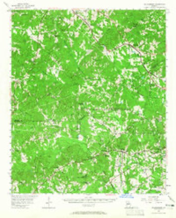
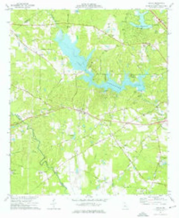
11 topographic sheets cover this place, the earliest surveyed in 1956 and the latest in 1988. It stands in the Lizella census division. It lies in ZIP code area 31052. The Survey maps it on the Lizella quadrangle. It stands 561 feet above sea level.
Topographic sheets covering this place
7 surveys from 11 printed sheetsMatched by testing this settlement's coordinate against the published boundary of every sheet in the United States Geological Survey's historical collection. Each opens the scanned sheet at the Survey.
- 1956 USGS Bolingbroke quadrangle1:62500, 2 printings
- 1957 USGS Macon quadrangle1:250000
- 1958 USGS Macon quadrangle1:250000
- 1964 USGS Macon quadrangle1:250000, 2 printings
- 1974 USGS Lizella quadrangle1:24000, 2 printings
- 1978 USGS Macon quadrangle1:100000, 2 printings
- 1988 USGS Macon quadrangle1:250000
Fires near this place
176 since 1992Regional context, not property-specific evidence. The federal wildfire occurrence database lists 176 fires within 5 miles of Lizella between 1992 and 2020, burning about 683 acres in total. 6 started naturally. 20 were recorded as arson. Distance is straight-line from the map coordinates, so a fire counted here may appear on a neighbouring settlement's page as well.
| Reported cause | Fires |
|---|---|
| Debris and open burning | 111 |
| Arson/incendiarism | 20 |
| Misuse of fire by a minor | 16 |
| Equipment and vehicle use | 9 |
| Recreation and ceremony | 6 |
| Missing data/not specified/undetermined | 6 |
| Natural | 6 |
| Smoking | 2 |
The most recent of them, most recent first, with the day each was reported and the service that recorded it.
| Date | Cause | Size | Reported by | Name on the report |
|---|---|---|---|---|
| 7 September 2012 | Debris and open burning | under an acre | Georgia Forestry Commission | FY2013-CRAWFORD-011 |
| 23 September 2010 | Arson/incendiarism | 3.8 acres | Georgia Forestry Commission | FY2011-BIBB-003 |
| 22 September 2019 | Debris and open burning | 7.4 acres | Georgia Forestry Commission | FY2020CRAWFORD003 |
| 21 September 1997 | Arson/incendiarism | under an acre | Georgia Forestry Commission | not named |
| 20 September 2005 | Equipment and vehicle use | 2.3 acres | Georgia Forestry Commission | not named |
| 19 September 1993 | Equipment and vehicle use | 1.8 acres | Georgia Forestry Commission | not named |
| 13 September 2005 | Missing data/not specified/undetermined | 1.6 acres | Georgia Forestry Commission | not named |
| 1 September 2011 | Missing data/not specified/undetermined | under an acre | Georgia Forestry Commission | FY2012-BIBB-003 |
Settlements close enough to share some of these fires:
Storms near this place
26 since 1995Regional context, not property-specific evidence. The National Weather Service names Lizella in 26 storm reports between 1995 and 2023: 14 thunderstorm wind, 9 hail, 2 tornado, 1 flood. No death or injury is recorded in these reports. Each account below is quoted exactly as the forecast office filed it, from the NOAA Storm Events Database, and each date opens the federal record of that event.
| When | Event | Place named | Harm | What the report says |
|---|---|---|---|---|
| May 2008 | Tornado (EF2) | Lizella | $5,000,000 | A damage survey conducted by the National Weather Service Forecast Office in Peachtree City, Georgia confirmed that an EF2 tornado touched down near Lizella and continued across Bibb county into extreme western Twiggs county near Dry Branch producing sporadic, but significant damage as it varied in intensity from EF0 to EF2. The tornado tracked from just east-northeast of Lizella across the south shores of Lake Tobesofkee, then across the city of Macon, producing widespread significant damage, and then eastward to the Twiggs county line. By far the most significant damage occurred within the city of Macon, especially along Eisenhower Parkway and Pio Nono Avenue where two businesses were completely destroyed and several others were heavily damaged. Macon State College was also hit by the tornado, destroying the gymnasium and causing significant damage to a number of other buildings on the campus. In addition, more than 50 percent of the trees on the campus either snapped in half or uprooted. Maximum wind speeds within the tornado were estimated at 130 mph, which occurred near the intersection of Eisenhower Parkway and Pio Nono Avenue. Nearly all of the 18 mile long path of the tornado fell within Bibb county. Less than one mile of the tornado occurred within Twiggs county. The maximum path width of the tornado was estimated to be 100 yards, mainly as it traveled through the Macon State College area.||A summary of damages from Bibb county shows that 1,479 homes suffered at least some damage as a result of the storms. Ninety-three of these homes were destroyed, 275 suffered major damage, and 569 sustained minor damage. |
| March 2011 | Hail | Lizella | $2,260,000 | Several reports of golf ball-sized hail were received from the western half of Bibb county from Lizella and Lake Tobesofkee to near Macon. There was even one report of tennis-ball-sized hail near Lizella. The hail decreased to quarter size as the storm moved into the western suburbs of Macon and to nickel size as it moved further into Macon. However, there were several reports within the city of Macon of hail covering the ground like snow. Nickel-sized hail was observed at the terminal station in downtown Macon. There was also one report of a damaged camper at a campground near Macon caused by a downed tree. |
| May 2008 | Hail | Lizella | $1,000,000 | Numerous reports of large hail were received from the broadcast media, the public, and amateur radio operators from much of Bibb county. Penny to quarter-sized hail was reported from amateur radio operators in north central Bibb county and northwest of Macon. The largest hail observed was golf ball-sized by personnel at WMAZ Television in Macon. Hail reports continued to the east side of the county where the public observed penny-sized hail from the intersection of Interstate-75 and Interstate-16 to about five or six miles down Interstate-16 toward the Twiggs county line. |
| February 2008 | Thunderstorm Wind | Lizella | $150,000 | An aerial and ground survey conducted by the National Weather Service Forecast Office in Peachtree City in cooperation with the Georgia State Patrol and the Bibb county Emergency Management Director concluded that the supercell that had spawned an almost continuous tornado from southern Alabama across Stewart, Chattahoochee, Marion, Taylor, and Crawford counties, continued into Bibb county, but only as thunderstorm with straight-line wind gusts of 80 to 90 mph across far northern Bibb county. The survey was unable to confirm a tornado touchdown within Bibb county. The path of wind damage began just northwest of Lizella in northwest Bibb county near the Crawford county line and continued on an east to east-northeastward track across far northern Bibb county, across the northern portion of Macon, and into the Arkwright area. Numerous large pine and oak trees were blown down, uprooted, or split off along the wind damage path. Several homes and office buildings sustained damage from downed trees or roof damage from the wind. At least four homes had significant damage. At least 50 large trees were uprooted in the area. The majority of the damage occurred along Arkwright Road in the northeast part of the county. |
| May 2008 | Thunderstorm Wind | Lizella | $150,000 | A damage survey conducted by the National Weather Service in Peachtree City, Georgia concluded that in addition to the EF2 tornado damage from Lizella, through Macon, and east to the Twiggs county line near Dry Branch, extensive straight-line wind damage was also observed south of the tornado path across central and southern Bibb county. The damage consisted mainly of widespread downed trees and power lines with some minor structural damage. At least one outbuilding was destroyed. |
| April 2011 | Thunderstorm Wind | Lizella | $75,000 | The Macon ASOS in southern Bibb County at the Middle Georgia Regional Airport recorded a wind gust of 65 mph at 137 am EDT. The Bibb County Emergency Management Director reported that wind damage across the county was widespread. Dozens of trees and power lines were down countywide, even outside the small area affected by the EF1 tornado, just southwest of Skipperton. Seven roads across the county were closed as a result of downed trees and power lines. Several homes sustained minor damage as a result of downed trees. Heard Elementary school sustained significant roof damage, on the order of $12,000. |
| April 2009 | Flood | Lizella | $30,000 | The Bibb County Emergency Management Director reported that around 100 homes in the Macon area experienced basement flooding as a result of several days of heavy rainfall. Parts of the county had a three-day rainfall total of five to six inches. This rain fell on saturated soils from prior weeks of above normal rainfall. In addition, up to 20 roads had to be closed as a result of flooding or ponding of water. Minor flooding was also observed in fields and woodlands adjacent to creeks, streams, and rivers across the county. Flood damages were generally the result of basement flooding, with only minor road repair or debris removal required. |
| August 2008 | Thunderstorm Wind | Lizella | $25,000 | The Bibb County Sheriff's Office reported that several trees and some power lines were down within the county. Three trees were down near Lizella. A tree was down on an apartment on Houston Avenue on the southside of Macon, and a few power lines were down on the west side of Macon with another power line down on the east side of Macon. Radar data indicated that winds likely gusted to 60 mph across the west central, central, and southeast parts of the county as the thunderstorms moved through those areas. |
| March 2007 | Tornado (EF3) | Lizella | $25,000 | A storm survey conducted by the National Weather Service in Peachtree City, GA concluded that an EF3 tornado which originally touched down approximately four miles east of Knoxville in Crawford county, continued east-northeast into Bibb county lifting just southeast of Lizella. The tornado entered Bibb county three miles south-southeast of Lizella and lifted about one mile east-southeast of Lizella. The path length within Bibb county was about three miles long with a maximum path width of one-quarter mile wide. Damage within Bibb county was primarily confined to trees and power lines. However, one home did sustain damage on Lower Thomaston Road. Several trees were down east of Lizella near U.S. Highway 80. |
| July 2010 | Thunderstorm Wind | Lizella | $15,000 | The Bibb County Emergency Management Agency reported that over two dozen trees were down from the northwest part of the county, north and northwest of Lake Tobesofkee southeast across the county to south and south-southeast of Macon. At least a dozen trees were down within the city of Macon as well. A Skywarn Spotter measured a wind gust of 62 mph one mile south of the intersection of Eisenhower Parkway and Pio Nono Avenue, approximately one mile south of downtown Macon. |
| August 2011 | Thunderstorm Wind | Lizella | $5,000 | The Bibb County 911 Center reported that from four to six power lines were down across the county, along with several trees and large tree limbs. |
| June 2009 | Thunderstorm Wind | Lizella | $5,000 | The Bibb County Emergency Management Director reported that a number of trees were blown down across the western portion of the county. |
| May 2010 | Thunderstorm Wind | Lizella | $3,000 | The Macon Telegraph reported that a few trees were down scattered about the county. A few of the trees fell on power lines causing power outages to approximately 2000 people. |
| June 2018 | Thunderstorm Wind | Lizella | $2,000 | The Bibb County 911 center reported power lines blown down on Highway 80 at the Bibb/Crawford County line. |
| March 2003 | Thunderstorm Wind | Lizella | $2,000 | The Bibb county Emergency Management Director reported that several trees were down in the western part of the county as a result of thunderstorm winds. |
| August 2023 | Thunderstorm Wind | Lizella | $1,000 | Tree down on Fulton Mill Rd between Dixon Rd and Hunnicutt Rd. |
| April 2020 | Thunderstorm Wind | Lizella | $1,000 | Tree reported down at Knoxville and Moncreif. |
| May 2009 | Thunderstorm Wind | Lizella | $1,000 | The public reported that four trees were blown down in the far northwestern part of the county near the Monroe county line. Some pea-sized hail may also have been observed in the same area. |
| January 1995 | Thunderstorm Wind | Lizella | $150 | Thunderstorm winds knocked down tree limbs which snapped several powerlines in and one mile west of the town. |
| March 2011 | Hail | Lizella | - | An amateur radio operator relayed a report of quarter-sized hail across western Bibb county, approximately two miles south of Lizella. WSR-88D radar data suggests that similar-sized hail occurred from the Crawford county line west of Lizella to a point approximately four miles east-southeast of Lizella. |
| February 2008 | Hail | Lizella | - | The Bibb County 911 Center reported penny-sized hail. |
| May 2008 | Hail | Lizella | - | An amateur radio operator reported nickel-sized hail east of Lizella and the public observed penny-sized hail west of Macon. Radar supported that at least penny-sized hail likely continued into the southeast part of Bibb county. |
| March 2003 | Hail | Lizella | - | Amateur radio operators reported quarter size hail. |
| March 2002 | Hail | Lizella | - | Several reports of dime to golf ball size hail were received from the county. The public reported dime to quarter size hail up to 10 minutes in duration in the Lizella area. An amateur radio operator reported dime to quarter size hail in the Lake Wildwood Subdivison 6 miles west-northwest of Macon. The public reported golf ball size hail on the north side of Macon and nickel size hail in Macon. |
| April 2002 | Hail | Lizella | - | The public reported dime size hail. |
| June 1998 | Hail | Lizella | - | The public reported nickel size hail on Lake Tobesofkee. |
Nearest settlements
The eight closest, with where each one stands in the county. Distances are straight-line, computed from the Geographic Names Information System coordinates.
| Map | Place | Distance | Sheets |
|---|---|---|---|
| Sofkee Estates | 0.4 miles | 11 | |
| Blanton Acres | 0.5 miles | 11 | |
| West Point | 1.1 miles | 11 | |
| Shadowood | 1.3 miles | 11 | |
| Phelps Estates | 1.6 miles | 11 | |
| Christophers Cove | 2.8 miles | 11 | |
| Pineworth by the Lake | 2.9 miles | 11 | |
| Beaveroaks | 3.2 miles | 11 |
Elsewhere
Matched on this settlement's Geographic Names Information System number rather than its name, so it cannot be a different place of the same name in another state.
| Wikipedia article on Lizella | An encyclopaedic summary. Its text is share-alike, so it is linked here rather than copied. |
| Wikidata item Q6660594 | The structured record the population and elevation above come from. Public domain (CC0). |
Provenance
This settlement is recorded in the Geographic Names Information System as feature 317263. The sheet list is computed by point-in-boundary test against the United States Geological Survey's historical topographic inventory. Both are works of the United States government and carry no copyright under 17 U.S.C. 105.
Wildfire. Short, Karen C. 2022. Spatial wildfire occurrence data for the United States, 1992-2020 [FPA_FOD_20221014]. 6th Edition. Fort Collins, CO: Forest Service Research Data Archive. https://doi.org/10.2737/RDS-2013-0009.6 Collected with United States Government funding and usable without additional permissions or fees.
Storms. NOAA National Centers for Environmental Information, Storm Events Database https://www.ncei.noaa.gov/stormevents/ A work of the United States government, no copyright under 17 U.S.C. 105. Narratives are quoted verbatim from the National Weather Service report and are not edited or summarised.