 Block
Macon, Georgia
14 topographic sheets cover this place, the earliest surveyed in 1956 and the latest in 1988. It stands in the Macon West census division. It lies in ZIP code area 31201. It stands on Vineville Branch. The Survey maps it on the Macon West quadrangle. 157,346 people lived here at the 2020 count. It stands 381 feet above sea level.
Research this city
On record in Macon
Buildings and businesses the archive holds for this place. Each opens its own page, with the source record it came from.
On the National Register 12 of 77 shown
 Johnston-Hay HouseNational Historic Landmark · listed 1971
 Raines-Carmichael HouseNational Historic Landmark · listed 1971
 Capt. R. J. Anderson Houselisted 1971
 Judge Clifford Anderson Houselisted 1971
 Ambrose Baber Houselisted 1973
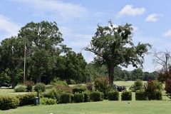 Charles L. Bowden Golf Courselisted 2015
 Thomas C. Burke Houselisted 1971
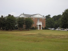 Candler Library Buildinglisted 2004
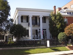 Cannonball Houselisted 1971
 Central City Park Bandstandlisted 1972
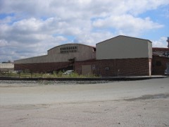 Cherokee Brick and Tile Companylisted 2002
 Christ Episcopal Churchlisted 1971
Surveyed buildings and structures 12 of 22 shown
- Andrews House, 110 Third Street, Maconfederal building survey, 4 photographs
- Baber House, Walnut Street, Maconfederal building survey, 9 photographs
- Barnes Building, 477 Cotton Avenue, Maconfederal building survey, 20 photographs
- Birdsey House, Vineville Avenue, Maconfederal building survey, 1 photograph
- Bumper Distributors Building, 543 Broadway Lane, Maconfederal building survey, 6 photographs
- Cadwalader Raines House, Maconfederal building survey, 3 photographs
- Callaway House, Pine Street, Maconfederal building survey, 1 photograph
- Canning House, 854-56 Mulberry Street, Maconfederal building survey, 1 photograph
- Coleman House, Maconfederal building survey, 1 photograph
- College Street Viaduct, College Street over Norfolk Southern Railway, Maconfederal building survey, 1 photograph
- Emerson & Holmes Building, 556 Mulberry Street, Maconfederal building survey, 5 photographs
- First Presbyterian Church, 682-690 Mulberry Street, Maconfederal building survey, 1 photograph
Population over time
2 figuresMacon grew from 91,351 to 157,346 between 2010 and 2020. These are the recorded population figures Wikidata holds for this place, reached through the Geographic Names Information System number this page is keyed on rather than by name, so they belong to this place and not to another of the same name. Most are census counts, but not all are: an early figure may be a founding or settlement estimate, and an estimate published within five years of a census is left out. The change column is computed, and is left blank where more than 20 years separate a figure from the one before it, because a gap that long is not a change between two counts.
| Year | People | Change |
|---|---|---|
| 2010 | 91,351 | |
| 2020 | 157,346 | +65,995 (+72%) |
Topographic sheets covering this place
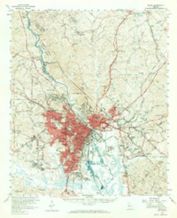
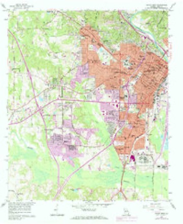
7 surveys from 14 printed sheetsMatched by testing this settlement's coordinate against the published boundary of every sheet in the United States Geological Survey's historical collection. Each opens the scanned sheet at the Survey.
- 1956 USGS Macon quadrangle1:62500, 3 printings
- 1956 USGS Macon West quadrangle1:24000, 4 printings
- 1957 USGS Macon quadrangle1:250000
- 1958 USGS Macon quadrangle1:250000
- 1964 USGS Macon quadrangle1:250000, 2 printings
- 1978 USGS Macon quadrangle1:100000, 2 printings
- 1988 USGS Macon quadrangle1:250000
What the histories say of this town
115,141 words1 chapter about Macon from the published histories of the county, public domain and reproduced complete.
| Chapter | From | Length |
|---|---|---|
| Historical Record of Macon and Central Georgia : Containing Many Inter | Historical Record of Macon and Central Georgia : Containing Many Interesting and Valuable Reminiscences Connected with the Whole State, Including Numerous Incidents and Facts Never Before Published and of Great Historic Value (1879) | 115,141 words in 8 parts |
Photographs
8 of 50 photographs shown, 1936 to 2017Taken for the Office of War Information and the Farm Security Administration, who photographed the country between 1935 and 1944. Works of United States government photographers, with no known restriction on use. Each opens its catalogue record.
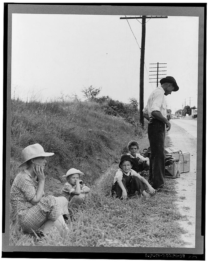
Lange, Dorothea, photographer, 1937. Library of Congress
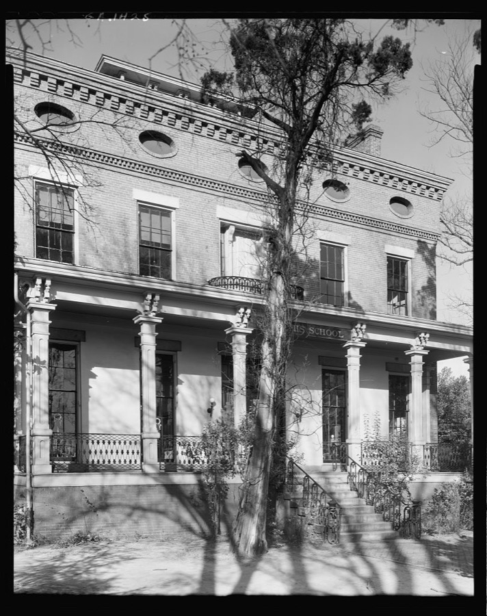
Johnston, Frances Benjamin, 1939. Library of Congress
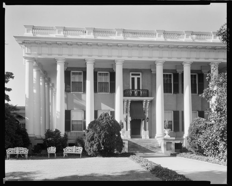
Johnston, Frances Benjamin, 1939. Library of Congress
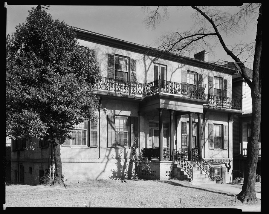
Johnston, Frances Benjamin, 1939. Library of Congress
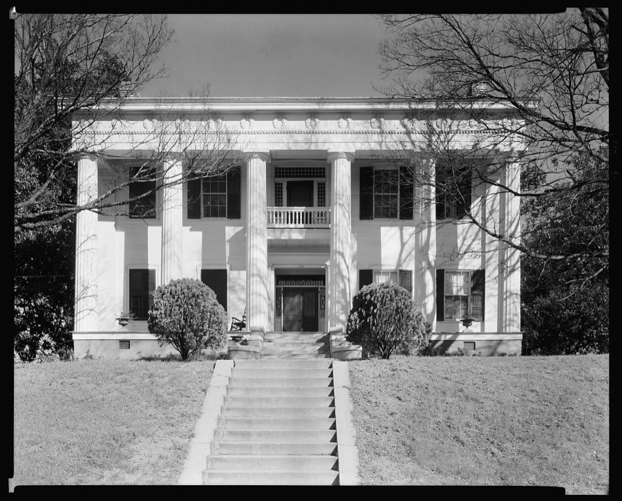
Johnston, Frances Benjamin, 1939. Library of Congress
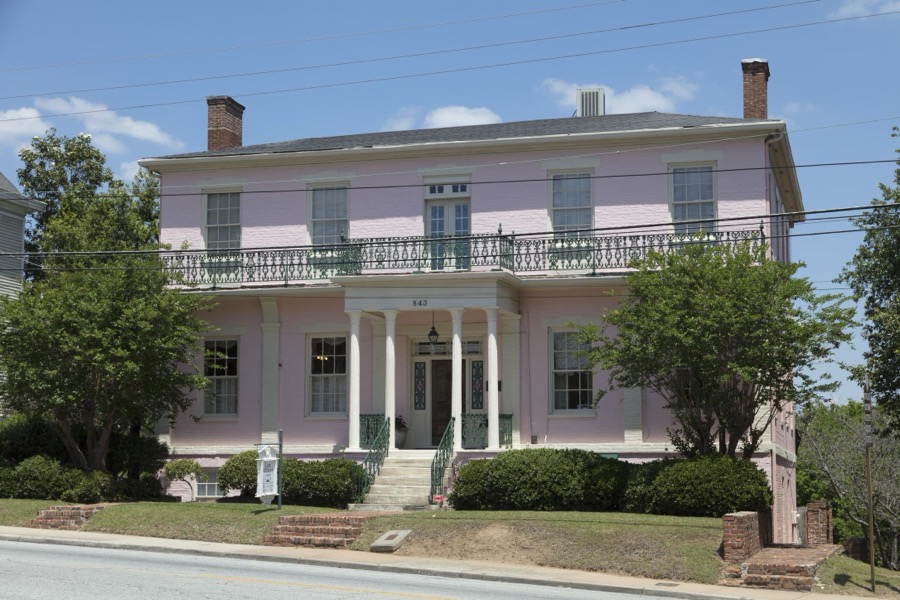
Highsmith, Carol M, 2017. Library of Congress
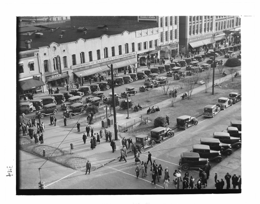
Evans, Walker, 1936. Library of Congress

Highsmith, Carol M, 2017. Library of Congress
Every photograph of Bibb County
Fires near this place
210 since 1992Regional context, not property-specific evidence. The federal wildfire occurrence database lists 210 fires within 5 miles of Macon between 1992 and 2020, burning about 382 acres in total. 8 started naturally. 41 were recorded as arson. Distance is straight-line from the map coordinates, so a fire counted here may appear on a neighbouring settlement's page as well.
| Reported cause | Fires |
|---|---|
| Debris and open burning | 85 |
| Arson/incendiarism | 41 |
| Misuse of fire by a minor | 20 |
| Equipment and vehicle use | 15 |
| Smoking | 15 |
| Missing data/not specified/undetermined | 12 |
| Recreation and ceremony | 9 |
| Natural | 8 |
| Railroad operations and maintenance | 5 |
The most recent of them, most recent first, with the day each was reported and the service that recorded it.
| Date | Cause | Size | Reported by | Name on the report |
|---|---|---|---|---|
| 6 September 1993 | Arson/incendiarism | 1.6 acres | Georgia Forestry Commission | not named |
| 5 September 2010 | Misuse of fire by a minor | 1.0 acres | Georgia Forestry Commission | FY2011-BIBB-001 |
| 4 September 2020 | Misuse of fire by a minor | 3.5 acres | Georgia Forestry Commission | FY2021BIBB002 |
| 30 September 1999 | Arson/incendiarism | 15 acres | Georgia Forestry Commission | not named |
| 25 September 2019 | Debris and open burning | 2.0 acres | Georgia Forestry Commission | FY2020BIBB001 |
| 2 September 1997 | Debris and open burning | 1.4 acres | Georgia Forestry Commission | not named |
| 19 September 1997 | Debris and open burning | 1.1 acres | Georgia Forestry Commission | not named |
| 19 September 1993 | Debris and open burning | 23 acres | Georgia Forestry Commission | not named |
Settlements close enough to share some of these fires:
Mines and quarries near this place
5 within 5 milesRegional context, not property-specific evidence. The federal mineral resources record lists 5 workings within 5 miles of Macon: 4 producers, 1 past producer. 4 still produce. What was taken out: Clay, Sand and Gravel, Construction, Fullers Earth. Distance is straight-line from the map coordinates, so a quarry counted here may appear on a neighbouring settlement's page as well.
| Where | Site | Commodity | Status | Recorded |
|---|---|---|---|---|
| Pikes Peak Fuller's Earth | Fullers Earth | Past Producer | Cristobalite, Opal, Montmorillonite | |
| Warner Robins Sand Pit | Sand and Gravel, Construction | Producer | ||
| Burns Brick Co Mine | Clay | Producer | ||
| Burns Mine | Clay | Producer | ||
| Cherokee Mine | Clay | Producer |
Storms near this place
60 of 120 shownRegional context, not property-specific evidence. The National Weather Service names Macon in 120 storm reports between 1993 and 2023: 65 thunderstorm wind, 42 hail, 5 flood, 4 lightning. No death or injury is recorded in these reports. Each account below is quoted exactly as the forecast office filed it, from the NOAA Storm Events Database, and each date opens the federal record of that event.
| When | Event | Place named | Harm | What the report says |
|---|---|---|---|---|
| July 2005 | Flash Flood | Macon | $500,000 | The Macon Telegraph reported that slow moving and persistent thunderstorms dumped up to three inches of rain on saturated ground across Macon and much of Bibb county during the mid to late afternoon. The heavy rain resulted in considerable flooding. At least 10 units of an apartment complex were flooded when water rushed down a hill caused by a dam break on a nearby pond. The water rose above the first level of the apartment and many residents had to be rescued from their apartments through the windows. Another home nearby was flooded with up to 18 inches of water in the basement after an area of water 40 feet wide rushed toward his home from the dam breakage. The flash flooding in the area also caused a number of sinkholes to develop. A police patrol car stalled in four foot deep water at one of the sinkhole incidents. |
| July 2007 | Thunderstorm Wind | Macon | $225,000 | The public and the Bibb County 911 Center reported that at least two dozen trees were blown down around the city of Macon. The Macon Telegraph reported that numerous trees were toppled onto power lines around the city leaving as many as 20,000 residents without power during the height of the storm. Neighborhoods in the southern part of the county suffered the greatest damage from downed trees. One tree fell through the roof of a home on Ashland Drive causing damage throughout the house. Another tree fell onto three vehicles outside a home on Goodall Mill Road. |
| March 2010 | Hail | Macon | $125,000 | Several reports of hail ranging in size from pennies to golf balls were received from the public and one trained storm spotter from the far north and northeast part of the county, near Lake Wildwood and Wesleyan. |
| May 1995 | Thunderstorm Wind | Macon | $125,000 | Winds of 57 to 70 mph were recorded at Macon, tree limbs were blown down throughout town, and fences were knocked over. Several businesses suffered wind damage to their roofs. Power was out for several hours. |
| September 2011 | Thunderstorm Wind | Macon | $100,000 | Amateur radio operators reported a thunderstorm downburst just southeast of Macon that caused considerable damage to trees and property in the area. At least 14 trees were either uprooted or blown over. The downed trees caused minor to moderate damage to three structures in the area. |
| January 2006 | Hail | Macon | $100,000 | The public reported golf ball-sized hail. |
| July 2003 | Flash Flood | Macon | $100,000 | The Bibb county Emergency Management Director reported that extensive flooding had occurred in parts of Macon. Several streets, roads, and railroad crossings were flooded with up to 1.5 feet of water over roads and into buildings in some areas. Riverside Drive was closed because of flooding. The most extensive flooding reported was to a nursing home. Over one-and-a-half feet of water got into the nursing home causing significant inconvenience and damage. |
| August 2000 | Lightning | Macon | $100,000 | The Macon Telegraph reported that lightning struck a two-story house on Beaver Oaks Drive. The resulting fire burned most of the home's attic, with smoke and water damage affecting other parts of the house. No one was injured in the blaze. |
| June 1998 | Thunderstorm Wind | Macon | $100,000 | More than 500 trees were felled by thunderstorm winds, some onto houses. Crews spent the entire night clearing the debris. Power outages affected about 40,000 homes and businesses. |
| July 2000 | Thunderstorm Wind | Macon | $75,000 | The Macon Telegraph, the public, a former NWS employee, and amateur radio operators reported numerous trees down in the Macon area. One vehicle was destroyed and another severely damaged in Macon when large trees fell on them. A house was also damaged in Macon when a large tree fell on the roof. Trees were reported down on power lines and roads. The strong wind was also responsible for blowing a window out of a downtown Macon building. Winds at the Middle Georgia Regional Airport in Macon were clocked at 52 mph. |
| May 1995 | Thunderstorm Wind | Macon | $75,000 | Thunderstorm trees knocked down 30 to 40 trees in Macon. More than half of the county was without power for at least part of the night. Several homes sustained damage from trees falling upon them. |
| May 2012 | Thunderstorm Wind | Macon | $60,000 | The Bibb County 911 Center and Macon Broadcast Media reported that at least seven trees were blown down at various locations across Macon. Trees fell on homes along Second Avenue and along Saint Charles Place. |
| September 1999 | Lightning | Macon | $50,000 | Lightning sparked a fire that caused damage to the attic of a house at Walnut and New streets which had been converted into 2 businesses. |
| August 1994 | Thunderstorm Wind | Macon | $50,000 | A parked car was severely damaged from a large oak tree blown down by thunderstorm winds along Tucker Road near Weslean College. |
| April 2005 | Thunderstorm Wind | Macon | $25,000 | The Bibb County Emergency Management Director reported that numerous trees and power lines were down throughout the city. The Macon Telegraph reported that trees were down on power lines in four different areas of Macon. In addition, thunderstorm winds capsized a boat on Lake Tobesofkee, approximately 9 miles west of Macon. |
| July 2002 | Lightning | Macon | $15,000 | An amateur radio operator reported that a house was struck and set on fire by lightning. |
| November 1996 | Thunderstorm Wind | Macon | $15,000 | no account filed |
| February 2009 | Thunderstorm Wind | Macon | $10,000 | The public reported that a number of trees were down in the Macon area. The carport of a home was damaged from fallen trees. |
| August 2008 | Thunderstorm Wind | Macon | $10,000 | The public reported that at least two large trees were blown down south of Macon. One of the downed trees caused roof damage to a home. |
| November 2004 | Thunderstorm Wind | Macon | $10,000 | The Bibb County 911 Center reported widespread damage to trees in the Macon area. In the southern part of the county, a few trees were also blown down. |
| July 1999 | Thunderstorm Wind | Macon | $10,000 | A HAM radio operator reported trees down on houses near the Bibb/Jones county line. A newspaper report said trees fell on power lines, which knocked out traffic lights. |
| August 2009 | Thunderstorm Wind | Macon | $5,000 | The public and the Bibb County 911 Center reported that numerous trees, some large, were down generally on the south side of Macon. |
| May 2005 | Thunderstorm Wind | Macon | $5,000 | An amateur radio operator reported that several trees and one power line were blown down five miles northwest of Macon. In the northeast part of the county, a car was blown off U.S. Highway 129 northeast of Macon. |
| August 2005 | Thunderstorm Wind | Macon | $5,000 | The Macon Telegraph reported that a number of trees and power lines were brought down by thundertorm winds. About 2000 residents of the city were left without power following the storm. |
| June 2003 | Thunderstorm Wind | Macon | $5,000 | The Bibb county sheriff's office reported that a number of trees were down west of Macon on Columbus Road. The Lamar County Electric Member Cooperative reported that a number of power lines were down as a result. |
| September 2000 | Flood | Macon | $5,000 | The Bibb county Emergency Management Director reported minor flooding on U.S. Highway 41 in the south part of Macon. In addition, small streams in the area were out of their banks and up to 2 feet of water was reported in a nursing home in the southeast part of the city. Radar rainfall estimates and surface observation reports indicated that 2 to 3 inches of rain fell in the area in a 1 to 2 hour period. |
| April 1998 | Thunderstorm Wind | Macon | $5,000 | The Macon Field Office of GEMA reported thunderstorm winds knocked down trees and power lines countywide. |
| May 1998 | Thunderstorm Wind | Macon | $5,000 | The Monroe county fire chief reported numerous trees were knocked down by thunderstorm winds. |
| June 1994 | Thunderstorm Wind | Macon | $5,000 | Numerous large trees and limbs were downed by thunderstorm winds throughout Macon. |
| June 1994 | Thunderstorm Wind | Macon | $5,000 | Several large trees and power lines were downed by thunder- storm winds. |
| August 1994 | Thunderstorm Wind | Macon | $5,000 | Thunderstorms winds downed numerous trees and power lines throughout Macon. One tree fell on a house and caused roof and rafter damage. Wind downed power lines caused numerous power outages in the vicinity of I-475. |
| May 1993 | Thunderstorm Wind | Macon | $5,000 | More than 20 pecan trees were blown down and power lines toppled from thunderstorm winds. Hart County Hartwell,13,1345EST,,,0,0,0,4,,Hail (0.88) A one to two inch accumulation of hail covered the ground, rooftops and roadways in the city of Hartwell. Damage was reported to tree foliage, gardens and crops. |
| August 1993 | Thunderstorm Wind | Macon | $5,000 | Several large trees were downed by thunderstorm winds. One automobile was damaged by a falling tree in downtown Macon. |
| April 1996 | Thunderstorm Wind | Macon | $5,000 | no account filed |
| June 2011 | Thunderstorm Wind | Macon | $3,000 | The Bibb County 911 Center reported that several trees were down around the city of Macon. WSR-88D base velocity data suggests that the strongest winds likely affected the northern and northeast parts of the county toward Jones county. |
| August 2003 | Thunderstorm Wind | Macon | $3,000 | The Bibb county 911 center reported that some power lines were down on the west side of Macon. |
| July 2002 | Thunderstorm Wind | Macon | $3,000 | Several reports of trees down were received from the public and the county 911 center of trees down in the Barrington Hall subdivision of Macon and five miles northwest of Macon. A lone tree was reported down west of Lizella near the Crawford county line. |
| June 2000 | Thunderstorm Wind | Macon | $3,000 | The public reported a tree down on a car on Finneydale Drive. |
| April 1998 | Hail | Macon | $3,000 | Several reports of dime to quarter size hail were received. Roof damage was also reported. |
| July 1997 | Thunderstorm Wind | Macon | $3,000 | Thunderstorm winds knocked down tree limbs and power lines on the east side of town. |
| April 1997 | Thunderstorm Wind | Macon | $2,500 | no account filed |
| May 2016 | Thunderstorm Wind | Macon | $2,000 | The Bibb County 911 center reported trees blown down on Emory Drive and at Main Street and Hydrolia Street. |
| January 2006 | Thunderstorm Wind | Macon | $2,000 | The Bibb County Emergency Management Director reported that a few trees were down across the eastern portion of the county. |
| June 2006 | Thunderstorm Wind | Macon | $2,000 | The Bibb County 911 Center reported that several, more than six, trees were down on the south and southwest side of Macon, including one large tree down on Interstate-475. |
| June 2001 | Thunderstorm Wind | Macon | $2,000 | An amateur radio operator reported that trees were blown down. |
| July 1998 | Thunderstorm Wind | Macon | $2,000 | Bibb county 911 reported more trees down on the east side of Macon. |
| July 1997 | Thunderstorm Wind | Macon | $2,000 | Thunderstorm winds knocked down several trees and power lines. |
| May 1997 | Thunderstorm Wind | Macon | $2,000 | Trees were downed in six different locations across Bibb County. |
| July 1995 | Thunderstorm Wind | Macon | $2,000 | Thunderstorm winds knocked a light pole down next to the Weather Service office in Macon. |
| August 2006 | Thunderstorm Wind | Macon | $1,500 | The Bibb County 911 Center reported that a tree was blown down near one of the schools in Macon. In addition, a couple of power lines were also down. Resulting power outages affected a number of people in the city. |
| July 2011 | Thunderstorm Wind | Macon | $1,000 | The Bibb County 911 Center reported that a couple of trees and one power line were down, mainly on the west side of Macon. |
| May 2008 | Thunderstorm Wind | Macon | $1,000 | The public reported that five trees were blown down in the Macon area. |
| April 2005 | Thunderstorm Wind | Macon | $1,000 | The Georgia Forestry Commision reported that a few trees were blown down in the Macon area. |
| June 2004 | Thunderstorm Wind | Macon | $1,000 | The Bibb County 911 center reported that several trees were blown down on the north side of the city. |
| January 2001 | Thunderstorm Wind | Macon | $1,000 | The public reported several tree limbs blown down, along with one live tree and several dead trees which fell on a power line from North Macon to South Macon. |
| July 1999 | Thunderstorm Wind | Macon | $1,000 | Macon 911 reported trees down on power lines. |
| April 1998 | Thunderstorm Wind | Macon | $1,000 | Bibb county 911 reported thunderstorm winds knocked down several trees around the county. |
| July 1998 | Thunderstorm Wind | Macon | $1,000 | Bibb county 911 reported several trees downed on the east side of Macon. |
| May 1997 | Thunderstorm Wind | Macon | $1,000 | Several large trees were downed near the Monroe/Bibb County line. |
| June 1995 | Thunderstorm Wind | East Macon | $750 | Thunderstorm winds blew trees down on power lines. |
Newspapers printed here
70,183 digitised pages1 paper published in this town, digitised by the Library of Congress and free to read: 12,370 issues, 70,183 pages. Every page is searchable, so a name or a street can be looked for directly in what the town printed about itself at the time.
| Newspaper | Published |
|---|---|
| The Macon Sentinel | 1899 to 19?? |
What the paper printed
3,627 wordsFront pages of the local paper, read from the Library of Congress scans: 1 issue from 1900, 3,627 words in total. Each is reproduced on its own page, exactly as the recogniser returned it.
These pages read less well than anything else here, and the number is worth stating: about three words in four come through cleanly, against nine in ten for the building records. An 1896 broadsheet sets eight-point type in seven columns on microfilm, which is the hardest thing in this archive to read by machine. We tested our own recognisers against the Library's and they were not better, so the Library's text is what appears, with the wholly unreadable columns removed. Read it as a guide to what the paper covered, and follow the link to the scan before quoting anything.
| Issue | Paper | Length |
|---|---|---|
| 1900-01-27 | The Macon Sentinel | 3,627 words |
Nearest settlements
The eight closest, with where each one stands in the county. Distances are straight-line, computed from the Geographic Names Information System coordinates.
| Map | Place | Distance | Sheets |
|---|---|---|---|
| Oglethorpe Homes | 0.8 miles | 14 | |
| North Highlands | 1.0 miles | 14 | |
| Shirley Hills | 1.3 miles | 14 | |
| Vineville | 1.5 miles | 14 | |
| Unionville | 1.6 miles | 14 | |
| Riverside Hills | 1.7 miles | 14 | |
| Highland Circle | 1.8 miles | 14 | |
| Heritage Acres | 2.0 miles | 14 |
Elsewhere
Matched on this settlement's Geographic Names Information System number rather than its name, so it cannot be a different place of the same name in another state.
| Wikipedia article on Macon | An encyclopaedic summary. Its text is share-alike, so it is linked here rather than copied. |
| Wikidata item Q219656 | The structured record the population and elevation above come from. Public domain (CC0). |
Provenance
This settlement is recorded in the Geographic Names Information System as feature 332301. The sheet list is computed by point-in-boundary test against the United States Geological Survey's historical topographic inventory. Both are works of the United States government and carry no copyright under 17 U.S.C. 105.
Wildfire. Short, Karen C. 2022. Spatial wildfire occurrence data for the United States, 1992-2020 [FPA_FOD_20221014]. 6th Edition. Fort Collins, CO: Forest Service Research Data Archive. https://doi.org/10.2737/RDS-2013-0009.6 Collected with United States Government funding and usable without additional permissions or fees.
Mines and quarries. USGS Mineral Resources Data System (MRDS) https://mrdata.usgs.gov/mrds/ A work of the United States government, no copyright under 17 U.S.C. 105.
Storms. NOAA National Centers for Environmental Information, Storm Events Database https://www.ncei.noaa.gov/stormevents/ A work of the United States government, no copyright under 17 U.S.C. 105. Narratives are quoted verbatim from the National Weather Service report and are not edited or summarised.