 Block
Murrayville, Georgia
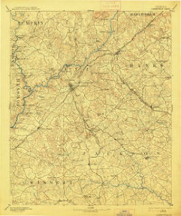
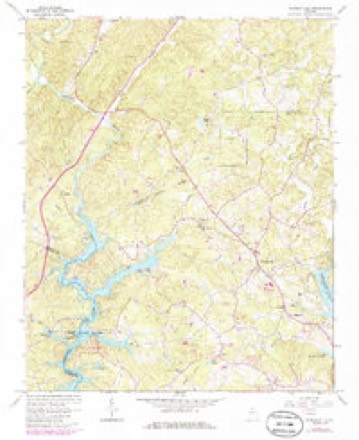
15 topographic sheets cover this place, the earliest surveyed in 1891 and the latest in 1979. It stands in the Murrayville census division. It lies in ZIP code area 30564. It stands on Gin Branch. The Survey maps it on the Murrayville quadrangle. It stands 1,283 feet above sea level.
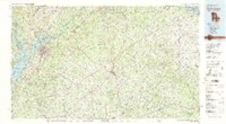
Topographic sheets covering this place
5 surveys from 15 printed sheetsMatched by testing this settlement's coordinate against the published boundary of every sheet in the United States Geological Survey's historical collection. Each opens the scanned sheet at the Survey.
- 1891 USGS Gainesville quadrangle1:125000, 5 printings
- 1954 USGS Greenville quadrangle1:250000, 3 printings
- 1958 USGS Greenville quadrangle1:250000
- 1964 USGS Murrayville quadrangle1:24000, 4 printings
- 1979 USGS Commerce quadrangle1:100000, 2 printings
Fires near this place
342 since 1992Regional context, not property-specific evidence. The federal wildfire occurrence database lists 342 fires within 5 miles of Murrayville between 1992 and 2019, burning about 448 acres in total. 5 started naturally. 33 were recorded as arson. Distance is straight-line from the map coordinates, so a fire counted here may appear on a neighbouring settlement's page as well.
| Reported cause | Fires |
|---|---|
| Debris and open burning | 217 |
| Arson/incendiarism | 33 |
| Missing data/not specified/undetermined | 24 |
| Equipment and vehicle use | 22 |
| Misuse of fire by a minor | 18 |
| Recreation and ceremony | 18 |
| Smoking | 5 |
| Natural | 5 |
The most recent of them, most recent first, with the day each was reported and the service that recorded it.
| Date | Cause | Size | Reported by | Name on the report |
|---|---|---|---|---|
| 8 September 1999 | Debris and open burning | under an acre | Georgia Forestry Commission | not named |
| 6 September 1998 | Debris and open burning | under an acre | Georgia Forestry Commission | not named |
| 6 September 1998 | Debris and open burning | under an acre | Georgia Forestry Commission | not named |
| 5 September 1998 | Debris and open burning | 2.4 acres | Georgia Forestry Commission | not named |
| 29 September 2007 | Equipment and vehicle use | under an acre | Georgia Forestry Commission | not named |
| 25 September 1999 | Missing data/not specified/undetermined | under an acre | Georgia Forestry Commission | not named |
| 24 September 2018 | Debris and open burning | under an acre | Georgia Forestry Commission | FY2019LUMPKIN002 |
| 23 September 1996 | Debris and open burning | under an acre | Georgia Forestry Commission | not named |
Settlements close enough to share some of these fires:
Mines and quarries near this place
10 of 14 shownRegional context, not property-specific evidence. The federal mineral resources record lists 14 workings within 5 miles of Murrayville: 8 prospects, 6 past producers. None of them still produces. What was taken out: Gold, Mica. Distance is straight-line from the map coordinates, so a quarry counted here may appear on a neighbouring settlement's page as well.
| Where | Site | Commodity | Status | Recorded |
|---|---|---|---|---|
| Merck Mine | Mica | Past Producer | ||
| Big Joe Mine | Gold | Prospect | Vein | |
| Cool Spring Church | Gold | Past Producer | Vein | |
| Elrod/Stephens/Keath/Newton/Ivy Mt./Prater Mines | Gold | Past Producer | Vein | |
| Ivy Mtn. | Gold | Prospect | Vein | |
| Johnson Property | Gold | Past Producer | Vein | |
| Keath | Gold | Prospect | Vein | |
| Newton | Gold | Prospect | Vein | |
| Odom | Gold | Prospect | Vein | |
| Parks Mine Et Al. | Gold | Past Producer | Vein |
Storms near this place
47 since 1995Regional context, not property-specific evidence. The National Weather Service names Murrayville in 47 storm reports between 1995 and 2025: 26 thunderstorm wind, 16 hail, 4 tornado, 1 flash flood. The reports record 10 deaths and 96 injuries. Each account below is quoted exactly as the forecast office filed it, from the NOAA Storm Events Database, and each date opens the federal record of that event.
| When | Event | Place named | Harm | What the report says |
|---|---|---|---|---|
| March 1998 | Tornado (F3) | Murrayville | 10 killed, 96 hurt, $15,000,000 | no account filed |
| April 2021 | Hail | Murrayville | $1,800,000 | A retired National Weather Service employee reported hail as big as golf balls on Chestatee Point on Lake Lanier. |
| March 2008 | Hail | Murrayville | $1,000,000 | Numerous reports of large hail, the size of quarters and larger, were received from the public and the broadcast media across the northern half of Hall county. Nickel-sized hail was reported by the public in Murrayville in northwest Hall county, ping-pong ball-sized hail west of Gainesville on the east side of Lake Lanier, with at least a half-a-dozen reports of ping-pong to golf ball-sized hail around the Gainesville area. The Times of Gainesville reported that Hardy Chevrolet had up to 500 vehicles suffering some form of damage from hail. At Moss Robertson Cadillac/Mazda/Isuzu, more than 100 vehicles were damaged from hail. Milton Martin Honda had 63 vehicles damaged from hail. |
| July 2000 | Tornado (F1) | Murrayville | $350,000 | An NWS Storm Survey team from the Peachtree City WFO confirmed that an F0 to weak F1 briefly tornado touched down in the Leisure Lakes Village mobile home park area of Murrayville in the far north part of the county. At least half a dozen homes were severely damaged by falling trees. There was also substantial damage reported to other trees and power lines in the same general area. |
| November 1996 | Tornado (F1) | Murrayville | $300,000 | no account filed |
| April 2008 | Thunderstorm Wind | Murrayville | $125,000 | The Hall County Emergency Management Director reported that a mobile home was destroyed by thunderstorm winds on Clarks Bridge Road about eight miles northeast of Gainesville. Another home nearby also had a tree fall on the roof causing damage to the structure. Several trees were down in the Wahoo Creek Bridge area on Mount Vernon Road, one which fell on and damaged an unoccupied vehicle. A few trees and power lines were also down in the Murrayville area in northwest Hall county. |
| June 2025 | Thunderstorm Wind | Murrayville | $50,000 | Widespread wind damage swath stretching across central Hall county through Gainesville and continuing eastward. Wind damage indicative of over 80mph wind gusts. |
| February 2011 | Thunderstorm Wind | Murrayville | $50,000 | The Hall County 911 Center reported that a dozen trees were down across the county. A back wall of the Department of Family Services Building on McEver Road was damaged when a tree fell into the structure. Several power lines were also down across the county, with up to 4000 people left without power from the thunderstorm wind event. |
| July 2000 | Thunderstorm Wind | Murrayville | $50,000 | The public, along with several local newspapers, reported numerous trees and power lines down across much of the northern half of Hall county from Murrayville, to Gainesville, to Lula. Several boats docked at the north end of Lake Lanier were also reported to have been turned over. Damage was concentrated in the area north of Little River Bridge on U.S. 129 and south of Clermont. The North Hall neighborhood of Muscadine Valley and River North were particularly hard hit where dozens of pine trees were snapped in half and power lines were downed. This damage was in addition to two separate F0-F1 tornadoes that touched down in Murrayville and Lula during the same time frame. |
| May 2003 | Thunderstorm Wind | Murrayville | $30,000 | The Hall county Emergency Management Director reported that a number of trees were down north and northwest of Gainesville in Murrayville and on Clarks-Bridges Road north of the north end of Lake Lanier. A mobile home sustained damage in Murrayville because of downed trees. Other trees were down in Gainesville and Oakwood. There were numerous sightings of funnel clouds northwest of Gainesville from Clermont to near White Sulphur. |
| June 2011 | Thunderstorm Wind | Murrayville | $25,000 | The Atlanta Journal-Constitution reported that a number of trees and power lines were down throughout Hall county. The Hall County Emergency Management Director reported damage to a traffic signal and billboard in the far southern part of the county near the Gwinnett county line, just east of Rest Haven. In addition, there was damage at the Road Atlanta Lanier Speedway in the far southeast portion of the county. Several canopies were blown over and damaged some of the race cars being used during a Saturday evening racing event. A flag in the infield was ripped from the top of the pole. Several trees and large tree limbs were also down in the woods surrounding the track and strewn about the grounds of the facility. |
| August 2024 | Thunderstorm Wind | Murrayville | $20,000 | Numerous trees down north of Gainsville between Thompson Bridge Rd and US129 up to Lumpkin county line. |
| July 2021 | Flash Flood | Murrayville | $15,000 | The Emergency Manager reported Willie Robinson Road washed out due to high flow on Latham Creek. Radar estimates indicate 2 to 3 inches of rain quickly fell on already wet soils from rain that occurred in the preceding few days. This quickly accumulating rainfall resulted in the flash flooding. |
| August 2015 | Thunderstorm Wind | Murrayville | $15,000 | The Hall County Emergency Manager reported about a dozen trees blown down west of Murrayville. One tree fell on a mobile home on Crystal Lake Drive. |
| April 2013 | Tornado (EF1) | Murrayville | $10,000 | A National Weather Service storm survey team determined that the tornado that touched down in Lumpkin County crossed over into Hall County briefly. It crossed Old Whelchel Road, snapping a few trees and downing powerlines. Two homes sustained very minor roof damage.|[04/11/13: Tornado #3, County #2-3, EF1, Lumpkin-Hall-Lumpkin, 2013:007]. |
| April 2009 | Thunderstorm Wind | Murrayville | $10,000 | The Hall County Emergency Management Director reported that several trees were blown down scattered about the county. Most of the damage appeared to be in the Flowery Branch and Gainesville areas. An outbuilding was destroyed in Flowery Branch. |
| March 1997 | Thunderstorm Wind | Murrayville | $10,000 | no account filed |
| June 2017 | Thunderstorm Wind | Murrayville | $3,000 | The Hall County 911 center reported trees blown down from Highland Circle to Clarks Bridge Road. |
| August 2007 | Thunderstorm Wind | Murrayville | $3,000 | The Hall County 911 Center reported that about 10 trees were down well north of Gainesville, just southeast of Murrayville. |
| June 2025 | Thunderstorm Wind | Murrayville | $1,000 | Tree and wires down near the intersection of Hopewell Church Road and Letha Road. |
| June 2025 | Thunderstorm Wind | Murrayville | $1,000 | Tree down on Cool Springs Road near the intersection with Chestatee Road. |
| June 2025 | Thunderstorm Wind | Murrayville | $1,000 | Tree down near the intersection of Ben Parks Road and Jake Kemp Road. |
| June 2025 | Thunderstorm Wind | Murrayville | $1,000 | Tree down along Old Whelchel Rd in extreme northern Hall County, GA. |
| July 2024 | Thunderstorm Wind | Murrayville | $1,000 | Tree down at Walnut Grove Way and Blue Sky Ct. |
| July 2023 | Thunderstorm Wind | Murrayville | $1,000 | Tree down at intersection of Mount Vernon Rd and Ben Parks Rd. |
| July 2023 | Thunderstorm Wind | Murrayville | $1,000 | Tree down on 5000 block of Hopewell Church Rd. |
| May 2018 | Thunderstorm Wind | Murrayville | $1,000 | The Hall County Emergency Manager reported a tree blown down across Buckhorn Road. |
| July 2012 | Thunderstorm Wind | Murrayville | $1,000 | The Hall County 911 Center reported that four trees were blown down in the northwestern portion of the county, including Thomas Road and Price Road. |
| May 1998 | Thunderstorm Wind | Murrayville | $1,000 | Hall county 911 reported tree damage. There was an unconfirmed report of a tornado. |
| July 2005 | Thunderstorm Wind | Murrayville | $500 | The public reported that one tree was blown down along with several large limbs. |
| July 2003 | Thunderstorm Wind | Murrayville | $250 | The Hall county 911 center reported that one tree was blown down northwest of Murrayville near the Lumpkin county line. |
| June 2025 | Thunderstorm Wind | Murrayville | - | Public report of a tree down at Thompson Bridge Rd and Mount Vernon Rd. |
| March 2023 | Thunderstorm Wind | Murrayville | - | Report of a tree down near intersection of Chestatee Rd and Cool Springs Rd. |
| June 2022 | Hail | Murrayville | - | Quarter sized hail reported at Chestatee Rd and Sequoia Rd. |
| May 2020 | Hail | Murrayville | - | A trained spotter reported hail the size of quarters near Murrayville. |
| April 2011 | Hail | Murrayville | - | The public observed nickel-sized hail on the north side of Murrayville. |
| June 2011 | Hail | Murrayville | - | Several reports of penny to nickel-sized hail were received from the public across northwest and north central Hall county, near Murrayville and Clermont. |
| April 2009 | Hail | Murrayville | - | The Hall County Emergency Management Director relayed reports of penny-sized hail. |
| May 2006 | Hail | Murrayville | - | The public reported penny-sized hail in the extreme northwest corner of the county near the Dawson county line. |
| May 2006 | Hail | Murrayville | - | The public reported penny-sized hail. |
| June 2005 | Hail | Murrayville | - | The public reported nickel-sized hail. |
| May 2003 | Hail | Murrayville | - | The public reported nickel-sized hail. |
| June 2001 | Hail | Murrayville | - | The public reported quarter size hail. |
| June 2001 | Hail | Murrayville | - | A storm spotter reported nickel size hail 10 miles northwest of Gainesville near Maravilla, while amateur radio operators and the public reported nickel size hail in Gainesville. |
| July 2000 | Hail | Murrayville | - | The public and the Gainesville Times Newspaper both provided numerous reports of hail ranging in size from dimes to golfballs across the northern part of the county from Murrayville, to Gainesville, to Clermont, to Lula. Golfball size hail was particularly widespread across the northern part of Gainesville where two reports indicated that hail was piled up 2 1/2 feet deep on roads and in yards. One report of such hail accumulations was on Jim Hood Road north of Gainesville and another on U.S. Highway 129, also north of Gainesville. |
| April 1999 | Hail | Murrayville | - | Hall county 911 received a report of dime size hail. |
| June 1995 | Hail | Murrayville | - | no account filed |
Nearest settlements
The eight closest, with where each one stands in the county. Distances are straight-line, computed from the Geographic Names Information System coordinates.
| Map | Place | Distance | Sheets |
|---|---|---|---|
| Marlow | 0.2 miles | 15 | |
| Elrod | 1.3 miles | 15 | |
| Wahoo Forest | 1.7 miles | 15 | |
| Indian Hills | 1.9 miles | 15 | |
| Leisure Lake | 2.0 miles | 15 | |
| McCrary | 2.1 miles | 13 | |
| Wahoo Valley | 2.1 miles | 15 | |
| North Forest | 2.2 miles | 15 |
Elsewhere
Matched on this settlement's Geographic Names Information System number rather than its name, so it cannot be a different place of the same name in another state.
| Wikipedia article on Murrayville | An encyclopaedic summary. Its text is share-alike, so it is linked here rather than copied. |
| Wikidata item Q19987251 | The structured record the population and elevation above come from. Public domain (CC0). |
Provenance
This settlement is recorded in the Geographic Names Information System as feature 332457. The sheet list is computed by point-in-boundary test against the United States Geological Survey's historical topographic inventory. Both are works of the United States government and carry no copyright under 17 U.S.C. 105.
Wildfire. Short, Karen C. 2022. Spatial wildfire occurrence data for the United States, 1992-2020 [FPA_FOD_20221014]. 6th Edition. Fort Collins, CO: Forest Service Research Data Archive. https://doi.org/10.2737/RDS-2013-0009.6 Collected with United States Government funding and usable without additional permissions or fees.
Mines and quarries. USGS Mineral Resources Data System (MRDS) https://mrdata.usgs.gov/mrds/ A work of the United States government, no copyright under 17 U.S.C. 105.
Storms. NOAA National Centers for Environmental Information, Storm Events Database https://www.ncei.noaa.gov/stormevents/ A work of the United States government, no copyright under 17 U.S.C. 105. Narratives are quoted verbatim from the National Weather Service report and are not edited or summarised.