 Block
Newnan, Georgia
10 topographic sheets cover this place, the earliest surveyed in 1953 and the latest in 1979. It stands in the Newnan census division. It lies in ZIP code area 30263. The Survey maps it on the Newnan North quadrangle. 42,549 people lived here at the 2020 count. It stands 971 feet above sea level.
Research this city
On record in Newnan
Buildings and businesses the archive holds for this place. Each opens its own page, with the source record it came from.
On the National Register 12 of 15 shown
 Coweta County Courthouselisted 1980
 William Leonard Crowder Home Placelisted 1986
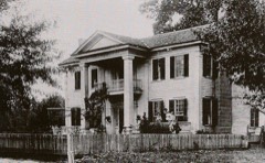 Goodwyn-Bailey Houselisted 1992
 Gordon-Banks Houselisted 1972
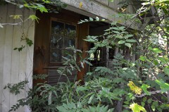 Powell Chapel Schoollisted 2003
 Vinewoodlisted 2011
 Willcoxon-Arnold Houselisted 1991
- Cole Town Districtlisted 1982
- Greenville Street-LaGrange Street Historic Districtlisted 1983
- Newnan Commercial Historic Districtlisted 1990
- Newnan Cotton Mill and Mill Village Historic Districtlisted 2002
- Northwest Newnan Residential Historic Districtlisted 1982
Every listing in Coweta County
Surveyed buildings and structures 1 record
- Blount House, (moved to Newnan vicinity, GA), Haddockfederal building survey, 3 photographs
Population over time
2 figuresNewnan grew from 33,039 to 42,549 between 2010 and 2020. These are the recorded population figures Wikidata holds for this place, reached through the Geographic Names Information System number this page is keyed on rather than by name, so they belong to this place and not to another of the same name. Most are census counts, but not all are: an early figure may be a founding or settlement estimate, and an estimate published within five years of a census is left out. The change column is computed, and is left blank where more than 20 years separate a figure from the one before it, because a gap that long is not a change between two counts.
| Year | People | Change |
|---|---|---|
| 2010 | 33,039 | |
| 2020 | 42,549 | +9,510 (+29%) |
Topographic sheets covering this place
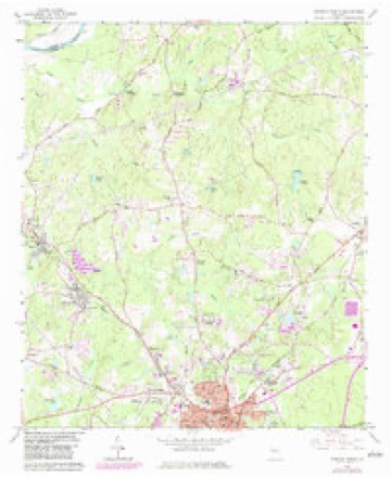
5 surveys from 10 printed sheetsMatched by testing this settlement's coordinate against the published boundary of every sheet in the United States Geological Survey's historical collection. Each opens the scanned sheet at the Survey.
- 1953 USGS Atlanta quadrangle1:250000, 2 printings
- 1957 USGS Atlanta quadrangle1:250000
- 1958 USGS Atlanta quadrangle1:250000
- 1965 USGS Newnan North quadrangle1:24000, 3 printings
- 1979 USGS Griffin quadrangle1:100000, 3 printings




Photographs
8 of 17 photographs shown, 2024Taken for the Office of War Information and the Farm Security Administration, who photographed the country between 1935 and 1944. Works of United States government photographers, with no known restriction on use. Each opens its catalogue record.

Highsmith, Carol M, 2024. Library of Congress

Highsmith, Carol M, 2024. Library of Congress

Highsmith, Carol M, 2024. Library of Congress
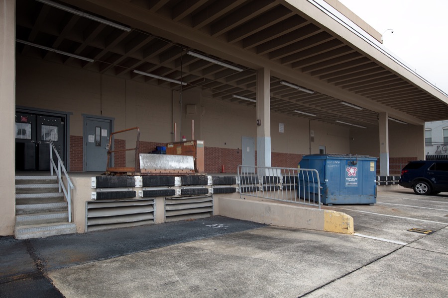
Highsmith, Carol M, 2024. Library of Congress
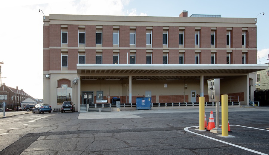
Highsmith, Carol M, 2024. Library of Congress

Highsmith, Carol M, 2024. Library of Congress
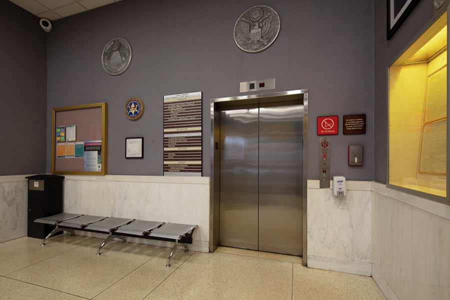
Highsmith, Carol M, 2024. Library of Congress
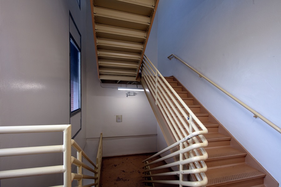
Highsmith, Carol M, 2024. Library of Congress
Every photograph of Coweta County
Fires near this place
332 since 1992Regional context, not property-specific evidence. The federal wildfire occurrence database lists 332 fires within 5 miles of Newnan between 1992 and 2019, burning about 991 acres in total. 8 started naturally. 50 were recorded as arson. Distance is straight-line from the map coordinates, so a fire counted here may appear on a neighbouring settlement's page as well.
| Reported cause | Fires |
|---|---|
| Debris and open burning | 181 |
| Arson/incendiarism | 50 |
| Misuse of fire by a minor | 23 |
| Missing data/not specified/undetermined | 20 |
| Recreation and ceremony | 13 |
| Smoking | 13 |
| Railroad operations and maintenance | 13 |
| Equipment and vehicle use | 11 |
| Natural | 8 |
The most recent of them, most recent first, with the day each was reported and the service that recorded it.
| Date | Cause | Size | Reported by | Name on the report |
|---|---|---|---|---|
| 5 September 1999 | Arson/incendiarism | under an acre | Georgia Forestry Commission | not named |
| 25 September 1993 | Debris and open burning | under an acre | Georgia Forestry Commission | not named |
| 18 September 2019 | Debris and open burning | 1.0 acres | Georgia Forestry Commission | FY2020COWETA006 |
| 12 September 2005 | Smoking | under an acre | Georgia Forestry Commission | not named |
| 10 September 2002 | Smoking | under an acre | Georgia Forestry Commission | FY2003-COWETA-006 |
| 10 September 1995 | Arson/incendiarism | under an acre | Georgia Forestry Commission | not named |
| 4 August 2004 | Misuse of fire by a minor | 1.0 acres | Georgia Forestry Commission | not named |
| 26 August 2011 | Natural | under an acre | Georgia Forestry Commission | FY2012-COWETA-003 |
Settlements close enough to share some of these fires:
Mines and quarries near this place
3 within 5 milesRegional context, not property-specific evidence. The federal mineral resources record lists 3 workings within 5 miles of Newnan: 3 past producers. None of them still produces. What was taken out: Granite. Distance is straight-line from the map coordinates, so a quarry counted here may appear on a neighbouring settlement's page as well.
| Where | Site | Commodity | Status | Recorded |
|---|---|---|---|---|
| B D Cole Quarry | Granite | Past Producer | ||
| Lyndon Hill Quarry | Granite | Past Producer | ||
| Sam Hill Quarry | Granite | Past Producer |
Storms near this place
60 of 141 shownRegional context, not property-specific evidence. The National Weather Service names Newnan in 141 storm reports between 1994 and 2026: 54 thunderstorm wind, 53 hail, 23 lightning, 3 flood. The reports record 5 injuries. Each account below is quoted exactly as the forecast office filed it, from the NOAA Storm Events Database, and each date opens the federal record of that event.
| When | Event | Place named | Harm | What the report says |
|---|---|---|---|---|
| May 1995 | Thunderstorm Wind | Newnan | 5 hurt, $150,000 | A National Weather Service employee reported a one-quarter-mile pile of trees were snapped in half, trees were one to two feet in diameter. Winds were estimated at 70 mph. Elsewhere in the county two workers were injured when the house they were constructing was knocked over by thunderstorm winds. Three people were also injured by a large tree limb which fell onto their car. One home in the Thomas Overby subdivision suffered slight damage and a car parked nearby was destroyed when a tree fell on them. |
| February 2009 | Hail | Newnan | $700,000 | The public observed golf ball-sized hail in the Newnan area and nickel-sized hail south of Sharpsburg. Nickel-sized hail was observed around Turin. |
| June 2006 | Hail | Newnan | $540,000 | Several reports of hail, ranging in size from pennies to even one golf ball size, were received from the Newnan area. The public reported penny-sized hail at one location in the city, with golf ball-sized hail reported from the public at another location. The Newnan Times-Herald reported half-dollar-sized hail, and the Emergency Management Director reported quarter-sized hail. Much of the hail fell within the town square of the city. The largest hail fell mostly in the time frame of 310 pm EDT to 315 pm EDT, with mainly penny-sized hail reported after 315 pm EDT. |
| June 2008 | Hail | Newnan | $500,000 | The public observed penny to golf ball-sized hail on the west side of Newnan along Welcome Road and penny-sized hail was reported just east of downtown Newnan at the intersection of Georgia Highway 34, Bullsboro Road, and Interstate-85. |
| May 2003 | Thunderstorm Wind | Newnan | $500,000 | An aerial storm survey, conducted by an employee of the National Weather Service Office in Peachtree City, Georgia, along with numerous reports from the public, amateur radio operators, and a plethora of articles and pictures from the Newnan Times-Herald newspaper, indicated that strong thunderstorm winds caused extensive damage to trees in the Summer Grove Subdivison southeast of Newnan, east of Interstate-85 and south of Lower Fayetteville Road. The Coweta county Emergency Management Director estimated that several hundred trees were blown down, along with a number of telephone poles and associated power lines and telephone wires. The majority of the damage in the subdivision occurred near Chandler Lake. Literally hundreds of trees in the subdivision were blown down. Damage to homes in this area was minor, although there were a couple of instances where trees fell on homes, one falling through the roof of a home. Extensive and even more significant damage to trees and homes was observed east of the Summer Grove subdivision to Georgia Highway 154 and Fisher Road in the Sharpsburg area. In the Heritage Trace subdivision, a tree fell on two homes and trapped the occupants. Another home had a part of its siding blown off. Numerous large trees were reported down by the public in the White Oak Subdivision off Georgia Highway 34 east of Newnan. White Oak Drive and Mary Freeman Road were both closed because of downed trees and power lines. One tree even fell into a resident's swimming pool. Another tree fell on and crushed a brand new minivan. The chimney cover at Links Court on the Greens at White Oak was blown off. Damage to homes in the area was largely in the form of peeled shingles and other light to moderate roof damage, although there were a couple of homes that received damage from fallen trees. Damage was also reported to a taxi service on Greenville Street where the awning was blown off. |
| January 2007 | Tornado (F2) | Newnan | $350,000 | A damage survey conducted by the National Weather Service office in Peachtree City, GA confirmed that an F2 tornado had touched down approximately 8 miles southwest of Newnan near the intersection of Bohannon Road and New Corinth Road near Blalock Lake. The tornado then traveled northeast between Old Corinth Road and New Corinth Road traveling approximately 4 miles to the northeast along Earl North Road before lifting. As the tornado crossed Walker Brooks Road and Joe Brown Road just northeast of its touchdown point, a home was destroyed. The winds in the tornado at this point were estimated to range between 125 and 135 mph. As the tornado continued northeast along Earl North Road, several homes sustained minor to moderate damage. A number of trees and at least two power lines were also downed along the path of the tornado. Damage was also reported to a convenience store awning and several storage sheds were destroyed. Portions of Earl North Road were blocked from downed trees and telephone poles. While several residents, including a 14-year old boy were trapped in homes from debris and downed trees, no injuries were reported and all were rescued safely. The tornado path length was approximately four miles long with a maximum path width of 200 yards. |
| July 2007 | Lightning | Newnan | $250,000 | The Times Herald of Newnan reported that lightning struck a tree approximately 50 feet from a home on Tabby Lynch Road. The lightning travelled underground on a gas line and ignited the home on fire. The home was declared a total loss. It took a crew of 12 firefighters 1 1/2 hours to put out the fire. No one was home at the time of the incident. |
| May 2003 | Lightning | Newnan | $200,000 | The Newnan Times-Herald reported that lightning struck a home on Vineyard Drive setting the attic on fire. The resulting fire was confined to the attic and adjacent garage. However, the living room and the kitchen suffered water damage. Two vehicles parked in the garage also suffered significant damage, including a classic 1975 Ford Mustang. |
| July 1998 | Lightning | Newnan | $200,000 | Fires started by lightning damaged residences in Olympia Park subdivision, on Summers-McKoy Road, and on Westside School Road. Also a mobile home on highway 29 was slightly damaged. A shop building and a utility building also suffered damage. |
| February 2007 | Lightning | Newnan | $150,000 | The Newnan Times-Herald reported that lightning struck an outbuilding on 140 Bill Hart Road. The building housed a cabinet shop. |
| May 2003 | Lightning | Newnan | $150,000 | The Times Herald of Newnan reported that lightning struck a home on Jeb Stuart Road setting the attic and roof on fire, both of which suffered major damage. The master bedroom and bath also suffered minor damage. |
| July 1999 | Lightning | Newnan | $150,000 | Fires started by lightning damaged homes on Pintail Drive, Mallard Drive and Alder Drive. All 3 were in the Newnan area. |
| October 2020 | Tornado (EF0) | Newnan | $100,000 | A National Weather Service survey team found that an EF0 tornado with maximum wind speeds of 79 mph and a maximum path width of 90 yards travelled 0.37 miles across the southwest side of Newnan. The tornado touched down on the north side of Newnan High School and moved north, ending just south of Westview Cemetery causing tree and structural damage. The most extensive damage occurred at Newnan High School where a portion of the roof was blown off. No injuries were reported. [10/10/20: Tornado #2, County #1/1, EF-0, Coweta, 2020:029]. |
| February 2005 | Hail | Newnan | $100,000 | The public reported golf ball-sized hail in Senoia, half-dollar-sized hail just east of Newnan, and nickel-sized hail in Sharpsburg. |
| August 2005 | Lightning | Newnan | $100,000 | Fox 5 News of Atlanta reported that lightning struck a home southwest of Newnan. The home was set on fire resulting in moderate damage to the structure. No one was home at the time of the incident. |
| August 1998 | Lightning | Newnan | $80,000 | Lightning started a fire at a house on Evergreen causing extensive damage. Two other homes in the Newnan area were struck by lightning also, but no serious damage occurred. |
| March 1996 | Thunderstorm Wind | Newnan | $80,000 | no account filed |
| May 2010 | Lightning | Newnan | $75,000 | The Times Herald of Newnan reported that a 7000 square foot home was struck by lightning. The lightning ran through the electrical lines of the home and ignited some cardboard boxes stored near an electrical outlet. The fire was confined to one room. |
| May 2003 | Lightning | Newnan | $75,000 | The Times-Herald of Newnan reported that lightning struck the power lines adjacent to a home on Howard Road. A fire erupted in the basement causing moderate damage to the basement and light to moderate damage to the main floor of the home. |
| July 2016 | Thunderstorm Wind | Newnan | $50,000 | The Coweta County Emergency Manager reported that at least seven trees snapped or blown down in Newnan. Some streets impacted include Greenville, East Broad, LaGrange and 1st Avenue. A large tree fell on a house on Wilcoxen Street. No injuries were reported. |
| April 2011 | Thunderstorm Wind | Newnan | $50,000 | Several reports were received from amateur radio operators of many trees and power lines down in Newnan and Senoia. Trees were down on Buddy West Road, Georgia Highway 16 and Georgia Highway 54, and Line Creek Road among others. Several houses in the southern part of the county suffered minor damage from these winds. This damage was outside the tornado in the southwest part of the county. |
| May 2003 | Lightning | Newnan | $50,000 | An amateur radio operator reported that lightning struck and set a home on fire causing moderate damage to the structure. The Newnan Times-Herald reported that lightning struck the VC Street power station which suppies power to the western portion of Newnan. |
| May 2001 | Lightning | Newnan | $50,000 | The Times Herald newspaper of Newnan reported that lightning struck a home on Beverly Park Court. The lightning set the home on fire. Moderate damage was sustained to the roof and to some inside ceilings. |
| November 2004 | Thunderstorm Wind | Newnan | $40,000 | The Times/Heard of Newnan and the public reported that strong straight-lined thunderstorm winds blew down dozens of trees and power lines throughout the county. Several roads had to be closed for a period of time, including Interstate 85 near Exit 41. A home on Lower Fayetteville Road was damaged and two barns were destroyed at a farm on Smokey Road southwest of Newnan. The damage to the barns resulted in the loss of two livestock that were inside one of the barns. In Newnan, a resident reported that the wind removed a metal storage shed from its foundation. |
| July 2010 | Thunderstorm Wind | Newnan | $30,000 | The Newnan Times-Herald reported that strong thunderstorm wind gusts blew down a large 100-year old oak tree onto the right front corner of a Coweta county school building near Newnan. The downed tree caused damage to the metal roof, guttering, and minor damage to the conrete roof support underneath. The Newnan fire department reported that they received over two dozen calls of downed trees and power lines around Newnan from the afternoon storms. |
| June 2006 | Lightning | Newnan | $30,000 | The Times Herald of Newnan reported that a tree fell on the Breakaway Child Care building on Washington Street as a result of a lightning strike. In another incident, lightning struck and set a home on fire on U.S. Highway 29 North. Minor power outages were also reported in the area as a result of lightning strikes. |
| July 2018 | Thunderstorm Wind | Newnan | $25,000 | The Coweta County Emergency Manager reported trees blown down in Newnan around Mansour Circle. One tree fell onto a house, no injuries were reported. |
| February 2007 | Lightning | Newnan | $25,000 | The Newnan Times-Herald reported that lightning set a home on Bethlehem Church Road on fire. The lightning actually struck an adjacent tree which caused the lightning to travel through a cable starting a fire in the garage. |
| July 2000 | Thunderstorm Wind | Newnan | $13,000 | The Newnan Times Herald reported tree limbs down throughout Coweta county on roads and power lines. In one instance a tree limb knocked a power line down onto a minivan on Smokey Road southwest of Newnan While the car sustained considerable damage, no injuries were reported. |
| December 2024 | Thunderstorm Wind | Newnan | $10,000 | Tree down on house on 20 block of Parks View Dr. |
| August 2000 | Thunderstorm Wind | Newnan | $10,000 | The Coweta county 911 center reported numerous trees were blown down, with two trees reported on Pete Davis Road. |
| March 2003 | Flash Flood | Newnan | $8,500 | An off duty National Weather Service employee reported that flash flooding caused extensive damage to his home in the Thomas Crossroads area east of Newnan. |
| July 2000 | Thunderstorm Wind | Newnan | $8,000 | The public reported that strong thunderstorm winds picked up a storage shed 10 miles west of Newnan and tossed it about. The storm also knocked down a power line down in Newnan. |
| January 2026 | Thunderstorm Wind | Newnan | $5,000 | Several trees and powerlines down in the area along miller farmer rd near corn crib dr. |
| January 2021 | Thunderstorm Wind | Newnan | $5,000 | The Coweta County 911 center reported a few trees blown down from Old Corinth Road of the southwest side of Newnan to Highway 54 southwest of Sharpsburg. |
| May 2015 | Lightning | Newnan | $5,000 | Lightning hit a natural gas line and caused fires at 2 homes on Poplar Road. Reported by Emergency Management. |
| July 2010 | Heavy Rain | Newnan | $5,000 | A cluster of thunderstorms developed across central Coweta county shortly just after midnight on July 25th and persisted around Newnan for two to three hours. Three to four inches of rain fell in this area during this time frame resulting in flash flooding and flooding of streets and property. Shenadoah Boulevard near the White Oak Golf Course was flooded with up to four feet of water flowing over the road. Several other roads in the area were flooded with up to two feet of water over some of these as well. A resident of Newnan reported that water was two feet deep in his yard on Prestwick Drive. Flash flooding was observed along McCullom-Sharpsburg Road or Georgia Highway 154, Thomason Road, East Broad Street, Jefferson Street, and Postal Parkway. Walt Sanders Road, just off Georgia Highway 34, was closed with one to two feet of water over it as well. Damage was confined to minor debris removal in the flooded areas. |
| March 2008 | Thunderstorm Wind | Newnan | $5,000 | The Times Herald of Newnan reported that trees and power lines were down in four different areas. |
| March 2005 | Lightning | Newnan | $5,000 | The Times Herald of Newnan reported that lightning struck a home on Smokey Road in southwest Coweta county causing damage to the electrical system of the home, but little other damage. |
| September 2004 | Heavy Rain | Newnan | $5,000 | The Newnan Times/Herald reported that more than 6 inches of rain fell across the county during the early morning hours in association with Tropical Storm Frances. The heavy rain caused a large sinkhole to develop on East Washington Street. The road was closed as a result. |
| April 2001 | Lightning | Newnan | $5,000 | The Times-Herald Newspaper in Newnan reported that lightning struck several homes in the county. While no major damage was reported, minor damage resulted to four homes, three on Springfield Drive and another on Gordon Road. |
| July 2012 | Thunderstorm Wind | Newnan | $4,000 | The Coweta County Emergency Manager reported that seven trees and several power lines were blown down from east Newnan to the Turin area. |
| July 2007 | Thunderstorm Wind | Newnan | $3,000 | The Coweta County Emergency Management Director and the County 911 Center reported that three trees were blown down, two of which fell on power lines. |
| July 2003 | Thunderstorm Wind | Newnan | $3,000 | The Coweta county 911 center, as well as the public, reported that a number of trees were blown down. |
| July 1998 | Lightning | Newnan | $3,000 | Lightning hit a home on highway 29 and knocked a hole in the roof. There was no fire, just damage from the force of the lightning. |
| April 1997 | Thunderstorm Wind | Newnan | $2,500 | no account filed |
| March 2026 | Thunderstorm Wind | Newnan | $2,000 | Em reports two trees down in the neighborhoods near browns mill battlefield along smokey rd and potts rd at hickory hills dr. |
| June 2010 | Thunderstorm Wind | Newnan | $2,000 | The Coweta County 911 Center reported that a couple of trees and power lines were down approximately three miles southeast of Newnan on East Front Street and at the Oak Inn Hotel on U.S. Highway 29. |
| October 2010 | Thunderstorm Wind | Newnan | $2,000 | The Newnan Times-Herald wrote that the Coweta County Emergency Management Director reported that a few trees and power lines were blown down in the Newnan vicinity. Trees blocked parts of Fischer Road near Sharpsburg and Belk Road near Newnan. A couple of power line were also down as a result of downed trees. |
| June 2005 | Thunderstorm Wind | Newnan | $2,000 | The Times/Herald of Newnan reported that thunderstorm winds tore the facade off the old Kmart store and knocked down a few trees in the area. |
| July 2002 | Thunderstorm Wind | Newnan | $2,000 | The Newnan Times Herald reported that several large trees were blown down in Newnan, including a 100 foot Poplar tree. Damage was most extensive in the Bridgewater subdivision. Trees were also down on power lines in Senoia. |
| June 1998 | Thunderstorm Wind | Newnan | $2,000 | A HAM operator reported a measured wind gust of 67 mph and the public reported downed trees. |
| August 1995 | Thunderstorm Wind | Newnan | $2,000 | Thunderstorm winds knocked power lines down.In Newnan, a three-foot diameter limb was blown down and the flag pole at the Municipal Building was blown over at a sharp angle. |
| May 1998 | Hail | Newnan | $2,000 | no account filed |
| June 2023 | Thunderstorm Wind | Newnan | $1,000 | Public report of powerlines down at Festiva Dr and Sweetbriar Rd. |
| June 2023 | Thunderstorm Wind | Newnan | $1,000 | Emergency manager reported a tree down at the 1500 block of Holbrook Rd. |
| August 2023 | Thunderstorm Wind | East Newnan | $1,000 | A tree was reported down near the intersection of E Wood St and E Front St. |
| July 2019 | Thunderstorm Wind | East Newnan | $1,000 | The Coweta County Emergency Manager reported a large oak tree blown down across E. Gordon Road blocking the roadway. |
| June 2017 | Thunderstorm Wind | Newnan | $1,000 | The Coweta County Emergency Manager reported a tree blown down near the intersection of Highway 29 South and Reese Street in Newnan. Line of storms had a history of producing wind damage in Heard County. |
| June 2011 | Lightning | Newnan | $1,000 | The Coweta County 911 Center reported that a power pole was struck and taken out by a lightning strike. |
Nearest settlements
The eight closest, with where each one stands in the county. Distances are straight-line, computed from the Geographic Names Information System coordinates.
| Map | Place | Distance | Sheets |
|---|---|---|---|
| McBride | 1.4 miles | 10 | |
| West Newnan | 1.5 miles | 10 | |
| Lynhaven | 1.8 miles | 10 | |
| Sherwood Forest | 1.9 miles | 10 | |
| Wedgewood | 2.0 miles | 10 | |
| Smokey Acres | 2.0 miles | 10 | |
| Gloverton | 2.0 miles | 10 | |
| Pine Hills | 2.3 miles | 10 |
Elsewhere
Matched on this settlement's Geographic Names Information System number rather than its name, so it cannot be a different place of the same name in another state.
| Wikipedia article on Newnan | An encyclopaedic summary. Its text is share-alike, so it is linked here rather than copied. |
| Wikidata item Q988123 | The structured record the population and elevation above come from. Public domain (CC0). |
Provenance
This settlement is recorded in the Geographic Names Information System as feature 332499. The sheet list is computed by point-in-boundary test against the United States Geological Survey's historical topographic inventory. Both are works of the United States government and carry no copyright under 17 U.S.C. 105.
Wildfire. Short, Karen C. 2022. Spatial wildfire occurrence data for the United States, 1992-2020 [FPA_FOD_20221014]. 6th Edition. Fort Collins, CO: Forest Service Research Data Archive. https://doi.org/10.2737/RDS-2013-0009.6 Collected with United States Government funding and usable without additional permissions or fees.
Mines and quarries. USGS Mineral Resources Data System (MRDS) https://mrdata.usgs.gov/mrds/ A work of the United States government, no copyright under 17 U.S.C. 105.
Storms. NOAA National Centers for Environmental Information, Storm Events Database https://www.ncei.noaa.gov/stormevents/ A work of the United States government, no copyright under 17 U.S.C. 105. Narratives are quoted verbatim from the National Weather Service report and are not edited or summarised.