 Block
Noonday, Georgia
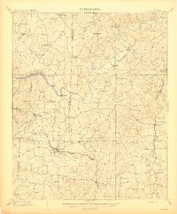
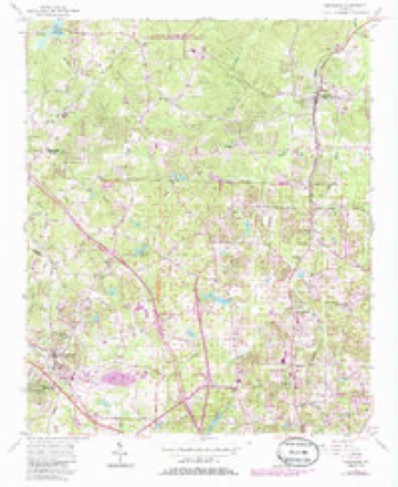
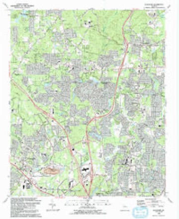
23 topographic sheets cover this place, the earliest surveyed in 1890 and the latest in 1992. It stands in the Northeast Cobb census division. It lies in ZIP code area 30066. It stands on Little Noonday Creek. The Survey maps it on the Kennesaw quadrangle.
Topographic sheets covering this place
12 surveys from 23 printed sheetsMatched by testing this settlement's coordinate against the published boundary of every sheet in the United States Geological Survey's historical collection. Each opens the scanned sheet at the Survey.
- 1890 USGS Cartersville quadrangle1:125000
- 1891 USGS Cartersville quadrangle1:125000
- 1896 USGS Cartersville quadrangle1:125000, 4 printings
- 1907 USGS Acworth quadrangle1:62500
- 1909 USGS Acworth quadrangle1:62500
- 1955 USGS Rome quadrangle1:250000
- 1956 USGS Kennesaw quadrangle1:24000, 5 printings
- 1958 USGS Rome quadrangle1:250000, 3 printings
- 1961 USGS Rome quadrangle1:250000
- 1963 USGS Rome quadrangle1:250000
- 1981 USGS Cartersville quadrangle1:100000, 2 printings
- 1992 USGS Kennesaw quadrangle1:24000, 2 printings





Fires near this place
212 since 1992Regional context, not property-specific evidence. The federal wildfire occurrence database lists 212 fires within 5 miles of Noonday between 1992 and 2016, burning about 487 acres in total. 4 started naturally. 58 were recorded as arson. Distance is straight-line from the map coordinates, so a fire counted here may appear on a neighbouring settlement's page as well.
| Reported cause | Fires |
|---|---|
| Debris and open burning | 63 |
| Arson/incendiarism | 58 |
| Misuse of fire by a minor | 44 |
| Missing data/not specified/undetermined | 13 |
| Recreation and ceremony | 11 |
| Equipment and vehicle use | 10 |
| Smoking | 6 |
| Natural | 4 |
| Railroad operations and maintenance | 3 |
The most recent of them, most recent first, with the day each was reported and the service that recorded it.
| Date | Cause | Size | Reported by | Name on the report |
|---|---|---|---|---|
| 9 September 1999 | Arson/incendiarism | under an acre | Georgia Forestry Commission | not named |
| 9 September 1998 | Recreation and ceremony | 2.4 acres | Georgia Forestry Commission | not named |
| 8 September 1996 | Arson/incendiarism | under an acre | Georgia Forestry Commission | not named |
| 8 September 1996 | Arson/incendiarism | under an acre | Georgia Forestry Commission | not named |
| 5 September 2002 | Misuse of fire by a minor | under an acre | Georgia Forestry Commission | FY2003-CHEROKEE-006 |
| 5 September 1997 | Arson/incendiarism | 2.5 acres | Georgia Forestry Commission | not named |
| 5 September 1997 | Arson/incendiarism | 1.1 acres | Georgia Forestry Commission | not named |
| 5 September 1997 | Arson/incendiarism | under an acre | Georgia Forestry Commission | not named |
Settlements close enough to share some of these fires:
Mines and quarries near this place
10 of 11 shownRegional context, not property-specific evidence. The federal mineral resources record lists 11 workings within 5 miles of Noonday: 8 past producers, 2 prospects, 1 producer. 1 still produces. What was taken out: Gold, Mica, Stone, Crushed/Broken, Iron, Manganese. Distance is straight-line from the map coordinates, so a quarry counted here may appear on a neighbouring settlement's page as well.
| Where | Site | Commodity | Status | Recorded |
|---|---|---|---|---|
| Bell-Star Mine | Iron, Manganese | Prospect | 1918 | |
| Kennesaw Quarry | Stone, Crushed/Broken | Producer | ||
| Delay Prospect | Mica | Prospect | ||
| J V Ledford Mine | Mica | Past Producer | ||
| M M Cole Mine | Mica | Past Producer | ||
| Kelogg Mine | Gold | Past Producer | Stream Placer | |
| Kitchens Property | Gold | Past Producer | Placer | |
| M.D. Smith | Gold | Past Producer | Stream Placer | |
| Old Bell Cut | Gold | Past Producer | Placer | |
| Van Prospect | Gold | Past Producer | Stream Placer |
Storms near this place
10 since 2006Regional context, not property-specific evidence. The National Weather Service names Noonday in 10 storm reports between 2006 and 2025: 3 thunderstorm wind, 2 tornado, 2 flash flood, 1 flood. No death or injury is recorded in these reports. Each account below is quoted exactly as the forecast office filed it, from the NOAA Storm Events Database, and each date opens the federal record of that event.
| When | Event | Place named | Harm | What the report says |
|---|---|---|---|---|
| September 2009 | Flood | Noonday | $11,400,000 | Record, and in some cases catastrophic, flooding continued to expand across the northern and western portions of the Atlanta metropolitan area as renewed rounds of showers and thunderstorms with very heavy rain tracked repeatedly over the same areas throughout the day. Portions of hundreds of roads in the county were closed from flooding and washed out bridges and/or culverts. Hundreds of homes, apartments, and businesses sustained significant flood damage. Record flooding was occurring on the Chattahoochee River at Vinings and on Sope Creek near Marietta. Monetary damage during this time frame across Cobb county was estimated to be at least $10,000,000. Total damages for Cobb county during this time frame were nearly $11.5 million. |
| April 2006 | Tornado (F1) | Noonday | $5,990,000 | A survey conducted by the National Weather Service in Peachtree City, GA concluded that a second and stronger F1 tornado affected far northern Cobb county and continued eastward into North Fulton county. The tornado touched down in the Noonday community or about seven miles north of Marietta just south of the intersection fo Canton Road/Georgia Highway 5 and Jamerson Road and traveled east a more or less continuous 18-mile long path into North Fulton county. Substantial damage was reported to homes and trees at the tornado's initial touchdown point in the Jamerson subdivision. At least 60 homes in the Jamerson subdivision sustained damage, 10 with major damage and 50 with minor damage. In addition, at least 200 trees were down in this area. Intermittent damage continued eastward from this point toward North Fulton county. Minor damage was reported to several homes in the Sweat Mountain area just before the tornado crossed into North Fulton county. Within Cobb county, this tornado traveled a 7-mile long path with a path width of anywhere from 10 to 200 yards. The overall path length of this tornado, including both Cobb and Fulton counties, was 18-miles long.Cobb county officials reported that tornado damage in the county consisted of:13 residences destroyed75 residences with major damage57 residences with minor damage38 residences affected1 commercial property destroyed10 commercial property with major damage16 commercial property with minor damage1 commercial property affected825 trees down30 roads impacted because of downed trees and power linescosting Cobb County $122,000 |
| June 2013 | Tornado (EF0) | Noonday | $300,000 | The tornado that touched down just inside the Cherokee County line moved into Cobb County and strengthened to an EF-1. The tornado tracked southeast through Cobb County with the most significant damage occurring near Wendwood Drive Northeast and near Bishop Lake where dozens of trees were snapped and uprooted, many causing damage to homes. The tornado continued to track southeast, and crossed the Chattahoochee River at the Cobb-Fulton County line near the Morgan Falls Dam.|[06/13/13: Tornado #2, County #2-3, EF1, Cherokee-Cobb-Fulton, 2013:012]. |
| July 2010 | Lightning | Noonday | $200,000 | The Marietta Daily Journal reported that lightning struck a home on Helga Way between Kennesaw and Woodstock in northeast Cobb county. The home was severely damaged from the fire which took at least 30 minutes to contain. |
| July 2007 | Thunderstorm Wind | Noonday | $40,000 | The public reports that an apparent thunderstorm downburst or microburst resulted in six or more large trees down in a heavily wooded neighborhood in north Cobb county. Streets included were Devonshire Drive, Buckingham Circle, and Sunset Circle. One tree was down on a home, causing damage to the structure. A couple of trees were down on power lines, and Devonshire Road was blocked from a downed tree. Some of the trees were at least 100-years old. In addition, a street sign was down in the area. |
| September 2009 | Flash Flood | Noonday | $10,000 | Several USGS stream gages showed significant flooding occurring across Cobb county as the record and catastrophic flash flooding continued to unfold across the county as repeated rounds of thunderstorms with heavy rain tracked from southwest to northwest across the area. Rainfall amounts in excess of 10 inches were observed in much of the county during the nighttime and early morning hours. Sope Creek near Marietta reached flood stage of 12 feet at 238 am EDT, Nickajack Creek near Mableton reached its flood stage of 10 feet at 504 am EDT, and the Chattahoochee River near Vinings and Cobb Parkway reached its flood stage of 14 feet at 346 am EDT. Many roads adjacent these rivers and creeks suffered significant flooding, became impassable and were closed. Many other smaller creeks and streams in these same general areas also went into flood. Monetary damage to roads during this time frame was estimated at $10,000. |
| May 2012 | Thunderstorm Wind | Noonday | $2,000 | The Cobb County 911 Center reported that at least six trees were blown down off of Shallowford Road just east of Canton Road. One of the trees fell on a house. |
| March 2025 | Thunderstorm Wind | Noonday | $1,000 | A large tree fell on turtle landing . |
| November 2018 | Flash Flood | Noonday | - | A member of the public reported that water was flowing over Kemp Road Northeast, blocking access to a neighborhood pool and clubhouse. Radar estimates indicate that the area received 3 to 4 inches of rain in a short period of time, and the small creek downstream from North Landing Lake rose out of its banks and flowed over the roadway. ||WATER WAS REPORTED OVER THE ROADWAY ON THE ROAD LEADING TO THE POOL AND CLUBHOUSE OFF OF KEMP ROAD. |
| January 2013 | Hail | Noonday | - | The public reported 1 inch hail. |
Nearest settlements
The eight closest, with where each one stands in the county. Distances are straight-line, computed from the Geographic Names Information System coordinates.
| Map | Place | Distance | Sheets |
|---|---|---|---|
| Jamerson Forest | 0.6 miles | 23 | |
| Shallowford Forest | 0.9 miles | 23 | |
| Kings Crossing | 1.0 miles | 23 | |
| Willow Creek | 1.1 miles | 23 | |
| Lakeside Hills | 1.2 miles | 23 | |
| Blackwell Chase | 1.3 miles | 23 | |
| Lake Latimer | 1.4 miles | 23 | |
| Falcon Hills | 1.5 miles | 23 |
Provenance
This settlement is recorded in the Geographic Names Information System as feature 332508. The sheet list is computed by point-in-boundary test against the United States Geological Survey's historical topographic inventory. Both are works of the United States government and carry no copyright under 17 U.S.C. 105.
Wildfire. Short, Karen C. 2022. Spatial wildfire occurrence data for the United States, 1992-2020 [FPA_FOD_20221014]. 6th Edition. Fort Collins, CO: Forest Service Research Data Archive. https://doi.org/10.2737/RDS-2013-0009.6 Collected with United States Government funding and usable without additional permissions or fees.
Mines and quarries. USGS Mineral Resources Data System (MRDS) https://mrdata.usgs.gov/mrds/ A work of the United States government, no copyright under 17 U.S.C. 105.
Storms. NOAA National Centers for Environmental Information, Storm Events Database https://www.ncei.noaa.gov/stormevents/ A work of the United States government, no copyright under 17 U.S.C. 105. Narratives are quoted verbatim from the National Weather Service report and are not edited or summarised.