 Block
Pyles Marsh, Georgia
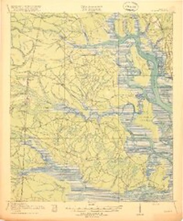
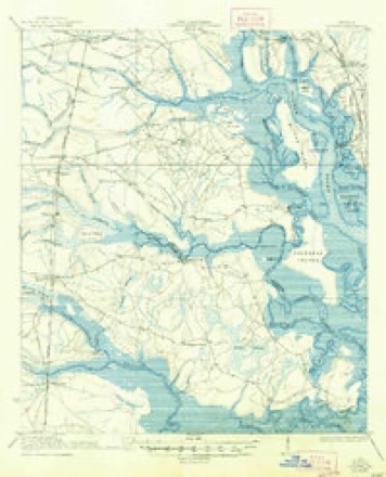
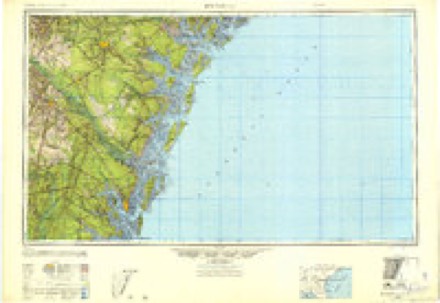
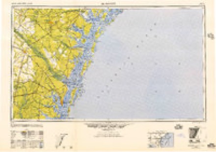
19 topographic sheets cover this place, the earliest surveyed in 1918 and the latest in 1993. It stands in the Everett census division. It lies in ZIP code area 31523. It lies near Hermitage Island. The Survey maps it on the Brunswick West quadrangle. It stands 3 feet above sea level.
Topographic sheets covering this place
11 surveys from 19 printed sheetsMatched by testing this settlement's coordinate against the published boundary of every sheet in the United States Geological Survey's historical collection. Each opens the scanned sheet at the Survey.
- 1918 USGS Bladen quadrangle1:62500, 2 printings
- 1939 USGS Bladen quadrangle1:62500, 2 printings
- 1946 USGS Brunswick quadrangle1:250000
- 1948 USGS Brunswick quadrangle1:250000
- 1956 USGS Brunswick quadrangle1:250000, 2 printings
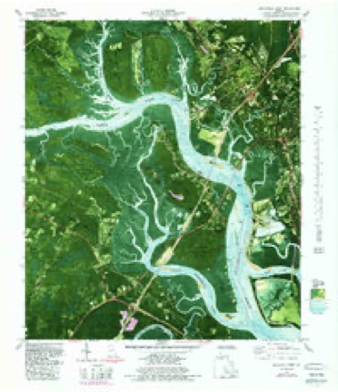
- 1956 USGS Brunswick West quadrangle1:24000, 2 printings
- 1961 USGS Brunswick quadrangle1:250000
- 1978 USGS Brunswick quadrangle1:250000, 2 printings
- 1979 USGS Brunswick West quadrangle1:24000, 2 printings
- 1981 USGS Brunswick quadrangle1:100000, 3 printings
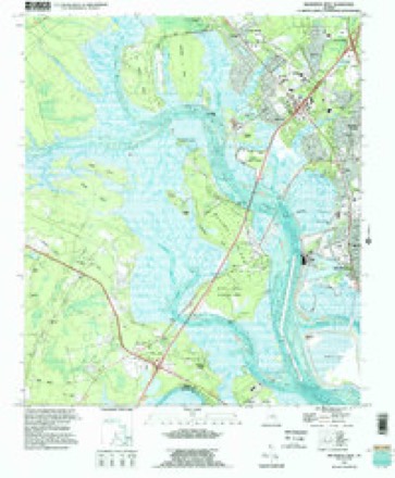
- 1993 USGS Brunswick West quadrangle1:24000
Fires near this place
294 since 1992Regional context, not property-specific evidence. The federal wildfire occurrence database lists 294 fires within 5 miles of Pyles Marsh between 1992 and 2020, burning about 786 acres in total. 34 started naturally. 71 were recorded as arson. Distance is straight-line from the map coordinates, so a fire counted here may appear on a neighbouring settlement's page as well.
| Reported cause | Fires |
|---|---|
| Debris and open burning | 106 |
| Arson/incendiarism | 71 |
| Natural | 34 |
| Misuse of fire by a minor | 29 |
| Equipment and vehicle use | 23 |
| Railroad operations and maintenance | 14 |
| Missing data/not specified/undetermined | 9 |
| Recreation and ceremony | 6 |
| Smoking | 2 |
The most recent of them, most recent first, with the day each was reported and the service that recorded it.
| Date | Cause | Size | Reported by | Name on the report |
|---|---|---|---|---|
| 9 September 2004 | Equipment and vehicle use | under an acre | Georgia Forestry Commission | not named |
| 9 September 1997 | Equipment and vehicle use | under an acre | Georgia Forestry Commission | not named |
| 9 September 1997 | Equipment and vehicle use | under an acre | Georgia Forestry Commission | not named |
| 26 September 1994 | Natural | under an acre | Georgia Forestry Commission | not named |
| 21 September 2001 | Debris and open burning | under an acre | Georgia Forestry Commission | FY2002-GLYNN-002 |
| 14 September 1999 | Debris and open burning | under an acre | Georgia Forestry Commission | not named |
| 9 August 2005 | Equipment and vehicle use | under an acre | Georgia Forestry Commission | not named |
| 4 August 2006 | Natural | 1.8 acres | Georgia Forestry Commission | not named |
Settlements close enough to share some of these fires:
Storms near this place
52 since 2007Regional context, not property-specific evidence. The National Weather Service names Pyles Marsh in 52 storm reports between 2007 and 2025: 28 thunderstorm wind, 7 hail, 6 funnel cloud, 5 tornado. No death or injury is recorded in these reports. Each account below is quoted exactly as the forecast office filed it, from the NOAA Storm Events Database, and each date opens the federal record of that event.
| When | Event | Place named | Harm | What the report says |
|---|---|---|---|---|
| June 2016 | Thunderstorm Wind | Pyles Marsh | $1,000 | A tree 2-3 ft in diamater was uprooted at the intersection of Nightingale Lane and Thornhall Drive which blocked the road. The cost of damage was estimated for the event to be included nin Storm Data. |
| May 2025 | Thunderstorm Wind | Pyles Marsh | $500 | Estimated wind gusts of 40-45 mph occurred on HWY-17 just south of the HWY-82 | intersection. Several large tree branches were broken and loose lightweight metal blown about. The cost of damage was unknown, but it was estimated for inclusion of the event in Storm Data. |
| March 2025 | Funnel Cloud | Pyles Marsh | - | A GA Department of Transportation camera captured a funnel cloud near State Road 520 and Interstate 95 in Brunswick. It was not discernable if the cloud extended to the ground nor if there was any surface debris. |
| May 2025 | Funnel Cloud | Pyles Marsh | - | Funnel cloud spotted over I-95 near Jekyll | Island exit 29. |
| August 2025 | Flood | Pyles Marsh | - | At 8 am, emergency management reported that the intersection of L Street and Stonewall Street was impassable due to flood water. The time of the report was approximated based on radar which indicated about 0.5-1.5 inches of rainfall had fallen in the area around the time of the report. At 8:30 am, emergency management reported portions of Albany Street had flooding including ponding water near construction sites. The time of street flooding was based on radar trends. |
| August 2025 | Flood | Pyles Marsh | - | Delete this. |
| July 2024 | Thunderstorm Wind | Pyles Marsh | - | The public reported 1-inch tree limbs broken, shingles blown off and a portion of metal roof blown off just west of the Highway 17, HWY 82, HWY 303 Intersection. The time of damage was based on radar data. |
| August 2023 | Thunderstorm Wind | Pyles Marsh | - | A tree was blown down on Magnolia Street in Brunswick. |
| March 2023 | Thunderstorm Wind | Pyles Marsh | - | Multiple trees were blown down near the intersection of Highway 17 and Highway 82 near Interstate 95. The time of damage was based on radar. |
| March 2023 | Thunderstorm Wind | Pyles Marsh | - | A tree was blown down and blocked West Fancy Bluff Road. The time of damage was based on radar. |
| August 2023 | Tornado (EF0) | Pyles Marsh | - | NWS Survey team found evidence of a weak tornado yesterday in southern Glynn |county. This tornado was spawned by outer rain bands from Hurricane Idalia. |This particular tornado began just south of Highway 17 and crossed the highway |around Fancy Bluff with mostly tree damage and downed powerlines, traversing |the area from southeast to northwest. It then crossed through Emanuel |Church Road with tree limbs downed, then shifted a bit more west-northwest |toward Georgetown and near Bladen where large tree branches were downed. |The tree damage supports damage rating of an EF-0 rating with maximum winds |near 70 mph. |
| August 2023 | Tornado (EF1) | Pyles Marsh | - | Outer rainbands on the NE side of Hurricane |Idalia spawned isolated tornadoes during the morning hours |across portions of SE Georgia. |||A tornado with peak intensity of EF1 impacted the south and |west sides of the city of Brunswick where trees and some |structures were damaged beginning near Gloucester Street. |The tornado tracked NNW near Newcastle Street, then storm |took more of a NW track near the intersection of Interstate |95 and the New Jesup Highway/US Highway 341. Mainly tree |damage occurred including numerous large limbs and some |large hard wood trees blown down and snapped. There was some |structure damage to mainly outbuildings including sheds |and fences. |
| September 2022 | Flood | Pyles Marsh | - | Newcastle Street was flooded in Brunswick. Radar estimated about 2.5 to 3.5 inches of rainfall. |
| December 2020 | Thunderstorm Wind | Pyles Marsh | - | The Brunswick Glynco Airport ASOS measured a wind gust to 59 mph. |
| April 2019 | Hail | Pyles Marsh | - | Nickel to dime size hail was reported in Brunswick. |
| July 2018 | Heavy Rain | Pyles Marsh | - | A weather station along Bartow Street in Brunswick, just west of Coffin Park, measured 3.71 inches since midnight. |
| December 2018 | Thunderstorm Wind | Pyles Marsh | - | Trees were blown down in the Royal Oaks subdivision. |
| December 2018 | Tornado (EF1) | Pyles Marsh | - | National Weather Service Jacksonville Storm survey|revealed damage consistent with EF-1 tornado damage in Royal Drive|Subdivision east of I-95 and south of Jekyll Island Causeway in|Glynn County. A combination of waterspout and tornado likely|formed near I-95 on a section of the Little Satilla River before |causing damage within the subdivision. A couple dozen trees were |damaged with several snapped at the trunk. A Doppler Radar debris |signature was evident between 3-5,000 feet indicating lofted |tornado debris. The tornado damage concludes on the south side of|the Jekyll Island Causeway. The survey team was unable to find|damage west of I-95 so the start point given is where damage to |trees and docks began, however, it is possible that the tornado |started on the Little Satilla River farther west. |
| May 2016 | Thunderstorm Wind | Pyles Marsh | - | A tree was blown down onto a vehicle on Jekyll Island. |
| May 2016 | Thunderstorm Wind | Pyles Marsh | - | A tree was blown down on Taylor Drive. |
| June 2016 | Thunderstorm Wind | Pyles Marsh | - | Multiple power lines were blown down across the county. |
| June 2015 | Thunderstorm Wind | Pyles Marsh | - | A large tree was blown down and blocking interstate 95 southbound. |
| June 2015 | Thunderstorm Wind | Pyles Marsh | - | Trees were blown down within the city limits of Brunswick. One tree fell on a home with no reported injuries. The time of damage was based on radar. |
| July 2015 | Thunderstorm Wind | Pyles Marsh | - | Multiple power lines and a tree was blown down in Brunswick. |
| June 2014 | Thunderstorm Wind | Pyles Marsh | - | Power lines were damaged by thunderstorm wind gusts along Newcastle Street. The time of damage was based on radar. |
| August 2013 | Thunderstorm Wind | Pyles Marsh | - | A roof was damaged near Sterling west of Brunswick. The time of wind damage was based on radar. |
| June 2013 | Funnel Cloud | Pyles Marsh | - | The Georgia Highway Patrol reported a funnel cloud near Interstate 95. |
| June 2013 | Funnel Cloud | Pyles Marsh | - | The Georgia State Patrol received a funnel cloud report near Brunswick. The time was based on radar. |
| June 2013 | Funnel Cloud | Pyles Marsh | - | The Georgia State Patrol received a funnel cloud report on State Road 25 northwest of Jekyll Island. The time was based on radar. |
| July 2012 | Tornado (EF0) | Pyles Marsh | - | A tornado (waterspout) was near the Sidney Lanier bridge. The spout moved slowy and became rain-wrapped while dissipating over nearby marshland. |
| May 2012 | Hail | Pyles Marsh | - | Law enforcement observed nickel size hail at the intersection of Interstate 95 and Exit 29 in Brunswick. The hail lasted for about 10 minutes. |
| May 2012 | Hail | Pyles Marsh | - | Quarter size hail was reported on the southside of Brunswick. The time of hail was based on radar. |
| May 2012 | Thunderstorm Wind | Pyles Marsh | - | Law enforcement estimated winds of 65 mph at the intersection of Interstate 95 and Exit 29 for Brunswick. |
| July 2012 | Thunderstorm Wind | Pyles Marsh | - | Trees and power lines were blown down across the county. The time of damage was based on radar imagery of the outflow gust front. |
| April 2009 | Flood | Pyles Marsh | - | Heavy rainfall at Interstate 95 and U.S. Highway 17 produced localized flooding in a roadway. |
| June 2009 | Tornado (EF0) | Pyles Marsh | - | A tornado developed over the Little Satilla River and tracked quickly northeast impacting the Royal Oaks Subdivision. Damage occurred to a Sunoco Gas Station near the intersection of Interstate 95 and U.S. Highway 17 which included a collapsed wall and damaged windows. Numerous trees were blown down with minor damaged noted to some residences. |
| August 2009 | Thunderstorm Wind | Pyles Marsh | - | Trees were blown down near Brunswick. |
| August 2009 | Thunderstorm Wind | Pyles Marsh | - | Numerous trees were blown down across the eastern portions of Glynn County. |
| June 2009 | Thunderstorm Wind | Pyles Marsh | - | Pine trees were blown down near the intersection of Interstate 95 and U.S. Highway 17. The time of the event was based on radar. |
| March 2008 | Thunderstorm Wind | Pyles Marsh | - | A local utility company reported several trees down on power lines west of Interstate 95. The times were estimated by radar. |
| August 2008 | Thunderstorm Wind | Pyles Marsh | - | Trees and power lines were blown down with the most damage in Brunswick to St. Simons Island. The time of damage was based on radar imagery. |
| August 2008 | Thunderstorm Wind | Pyles Marsh | - | An article from the Brunswick News reported that the Brunswick Public Works department had to respond to several downed trees throughout the city around 5 pm local time. Radar imagery indicates that the damage likely occurred around 505 to 510 pm. One tree was down across Ocean Avenue and another was down across the 400 block of Abermarle Street. |
| May 2008 | Thunderstorm Wind | Pyles Marsh | - | Thunderstorm wind gusts blew down a tree through a window in Brunswick. |
| May 2008 | Thunderstorm Wind | Pyles Marsh | - | Trees and power lines were blown down across Brunswick. |
| July 2008 | Funnel Cloud | Pyles Marsh | - | Georgia law enforcement reported a funnel cloud at Exit 20 on Interstate 95. |
| May 2008 | Hail | Pyles Marsh | - | The Brunswick Police Department observed quarter size hail. |
| May 2008 | Heavy Rain | Pyles Marsh | - | Glynn County emergency Management reported widespread street flooding. Portions of the roadways were becoming impassable but no roads were closed. |
| July 2007 | Thunderstorm Wind | Pyles Marsh | - | Trees were uprooted on Walker Road and Old Jesup Road. Two trees also fell on a home but the extent of damage was unknown. |
| August 2007 | Thunderstorm Wind | Pyles Marsh | - | Trees and power lines were blown down all over the county. |
| May 2025 | Hail | Pyles Marsh | - | no account filed |
| May 2025 | Hail | Pyles Marsh | - | no account filed |
| May 2008 | Hail | Pyles Marsh | - | no account filed |
Nearest settlements
The eight closest, with where each one stands in the county. Distances are straight-line, computed from the Geographic Names Information System coordinates.
| Map | Place | Distance | Sheets |
|---|---|---|---|
| Shady Acres | 0.8 miles | 19 | |
| Brobston | 1.2 miles | 17 | |
| High Hill Lake | 1.6 miles | 19 | |
| Highland Park | 1.7 miles | 19 | |
| Clover Heights | 1.9 miles | 19 | |
| Oak Bluff | 2.0 miles | 19 | |
| Sterling | 2.0 miles | 17 | |
| Glendale Gardens | 2.2 miles | 19 |
Elsewhere
Matched on this settlement's Geographic Names Information System number rather than its name, so it cannot be a different place of the same name in another state.
| Wikidata item Q14686803 | The structured record the population and elevation above come from. Public domain (CC0). |
Provenance
This settlement is recorded in the Geographic Names Information System as feature 332768. The sheet list is computed by point-in-boundary test against the United States Geological Survey's historical topographic inventory. Both are works of the United States government and carry no copyright under 17 U.S.C. 105.
Wildfire. Short, Karen C. 2022. Spatial wildfire occurrence data for the United States, 1992-2020 [FPA_FOD_20221014]. 6th Edition. Fort Collins, CO: Forest Service Research Data Archive. https://doi.org/10.2737/RDS-2013-0009.6 Collected with United States Government funding and usable without additional permissions or fees.
Storms. NOAA National Centers for Environmental Information, Storm Events Database https://www.ncei.noaa.gov/stormevents/ A work of the United States government, no copyright under 17 U.S.C. 105. Narratives are quoted verbatim from the National Weather Service report and are not edited or summarised.