 Block
Remerton, Georgia
9 topographic sheets cover this place, the earliest surveyed in 1954 and the latest in 1981. It stands in the Valdosta census division. It lies in ZIP code area 31601. It stands on Onemile Branch. The Survey maps it on the Valdosta quadrangle. 1,334 people lived here at the 2020 count. It stands 187 feet above sea level.
Population over time
2 figuresRemerton grew from 1,123 to 1,334 between 2010 and 2020. These are the recorded population figures Wikidata holds for this place, reached through the Geographic Names Information System number this page is keyed on rather than by name, so they belong to this place and not to another of the same name. Most are census counts, but not all are: an early figure may be a founding or settlement estimate, and an estimate published within five years of a census is left out. The change column is computed, and is left blank where more than 20 years separate a figure from the one before it, because a gap that long is not a change between two counts.
| Year | People | Change |
|---|---|---|
| 2010 | 1,123 | |
| 2020 | 1,334 | +211 (+19%) |
Topographic sheets covering this place
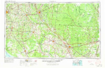
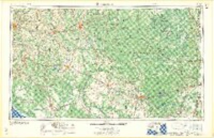
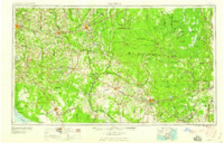
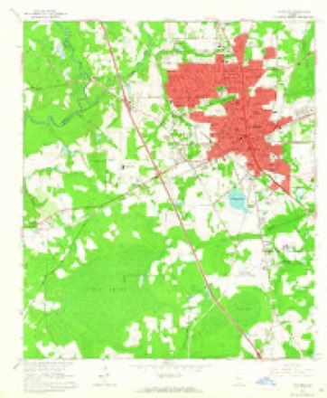
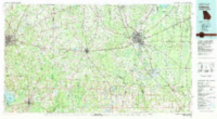
5 surveys from 9 printed sheetsMatched by testing this settlement's coordinate against the published boundary of every sheet in the United States Geological Survey's historical collection. Each opens the scanned sheet at the Survey.
- 1954 USGS Valdosta quadrangle1:250000, 2 printings
- 1958 USGS Valdosta quadrangle1:250000
- 1959 USGS Valdosta quadrangle1:250000
- 1961 USGS Valdosta quadrangle1:24000, 4 printings
- 1981 USGS Valdosta quadrangle1:100000
Fires near this place
438 since 1992Regional context, not property-specific evidence. The federal wildfire occurrence database lists 438 fires within 5 miles of Remerton between 1992 and 2020, burning about 2,909 acres in total. 13 started naturally. 81 were recorded as arson. Distance is straight-line from the map coordinates, so a fire counted here may appear on a neighbouring settlement's page as well.
| Reported cause | Fires |
|---|---|
| Debris and open burning | 184 |
| Arson/incendiarism | 81 |
| Equipment and vehicle use | 35 |
| Smoking | 35 |
| Misuse of fire by a minor | 34 |
| Railroad operations and maintenance | 32 |
| Missing data/not specified/undetermined | 13 |
| Natural | 13 |
| Recreation and ceremony | 11 |
The most recent of them, most recent first, with the day each was reported and the service that recorded it.
| Date | Cause | Size | Reported by | Name on the report |
|---|---|---|---|---|
| 9 September 2010 | Debris and open burning | 4.1 acres | Georgia Forestry Commission | FY2011-LOWNDES-006 |
| 9 September 1997 | Debris and open burning | 3.0 acres | Georgia Forestry Commission | not named |
| 8 September 1997 | Debris and open burning | under an acre | Georgia Forestry Commission | not named |
| 8 September 1997 | Railroad operations and maintenance | under an acre | Georgia Forestry Commission | not named |
| 5 September 2008 | Railroad operations and maintenance | 1.2 acres | Georgia Forestry Commission | not named |
| 5 September 1997 | Debris and open burning | 1.3 acres | Georgia Forestry Commission | not named |
| 28 September 2006 | Debris and open burning | under an acre | Georgia Forestry Commission | not named |
| 25 September 2003 | Debris and open burning | 1.1 acres | Georgia Forestry Commission | not named |
Settlements close enough to share some of these fires:
Storms near this place
59 since 2008Regional context, not property-specific evidence. The National Weather Service names Remerton in 59 storm reports between 2008 and 2025: 40 thunderstorm wind, 17 flash flood, 2 hail. No death or injury is recorded in these reports. Each account below is quoted exactly as the forecast office filed it, from the NOAA Storm Events Database, and each date opens the federal record of that event.
| When | Event | Place named | Harm | What the report says |
|---|---|---|---|---|
| March 2024 | Thunderstorm Wind | Remerton | $3,500,000 | Based on storm reports and radar data, damage began near the I-75 Exit 18 in Valdosta and continued East-Northeast through the northwest portion of Valdosta. Within this area, numerous large pine trees were uprooted with a few snapped along the swath of severe winds. All trees uprooted or snapped were facing to the east or northeast, which is indicative of straight-line wind damage. Moreover, radar data from Moody Air Force Base displayed a distinct downburst signature throughout the duration of the storm in Valdosta. Examination of the photos and drone imagery from Valdosta Fire and Lowndes County EMA showed that in some areas, damage was extensive with widespread pine trees falling onto homes. In total, 32 homes were affected, with a few homes being directly impacted by pine trees, effectively sliced in half. Damage to all single family homes was due to tree impacts, with no damage noted due directly to the straight-line winds. Wind damage reports extended as far north as Lakeshore Drive. The path width peaked at just over 1 mile wide, mainly in the area inside Inner Perimeter Road. Based on the size and number of trees uprooted and a few snapped, the maximum winds within this area is rated at 75 mph. |
| August 2023 | Flash Flood | Remerton | $50,000 | The road was washed out near the intersection of Melody Lane and W Gordon Street due to flash flooding. |
| August 2023 | Flash Flood | Remerton | $50,000 | A portion of Gornto Road was washed out due to flash flooding. |
| August 2023 | Flash Flood | Remerton | $50,000 | A portion of Jennifer Circle was washed out due to flash flooding. |
| January 2017 | Thunderstorm Wind | Remerton | $50,000 | A tree was down on a house and power lines were down on 5 houses in the Pinecliff Drive area of Valdosta. |
| November 2024 | Flash Flood | Remerton | $10,000 | Water entered a home on Winding Way in northwest Valdosta. At least one inch of water was reported on the floor of the home. |
| July 2015 | Thunderstorm Wind | Remerton | $10,000 | A tree fell on a house near Remerton. |
| August 2020 | Thunderstorm Wind | Remerton | $5,000 | The 1100 block of West Gordon Street had large pine trees broken at the top and blown onto the power lines. At 1104 West Gordon, a brick faade wall came down. Damage was estimated. |
| August 2015 | Thunderstorm Wind | Remerton | $5,000 | A large tree was blown down onto a house on Gornto Road. Damage was estimated. |
| August 2025 | Thunderstorm Wind | Remerton | $2,000 | A tree and a power line were blown down along Sustella Ave. |
| August 2025 | Thunderstorm Wind | Remerton | $2,000 | A tree blew down and resulted in a power outage along Terrace Blvd according to the Georgia Power Outage map. |
| June 2025 | Thunderstorm Wind | Remerton | $2,000 | The Lowndes county dispatch reported trees down on power lines along Gornto Road. |
| November 2025 | Thunderstorm Wind | Remerton | $2,000 | Power lines were blown down near Valdosta State University. |
| July 2023 | Thunderstorm Wind | Remerton | $2,000 | A power line was blown down at 340 Norman Drive. |
| July 2023 | Thunderstorm Wind | Remerton | $2,000 | A tree was blown down onto a power line on Johnson Street. |
| April 2016 | Thunderstorm Wind | Remerton | $2,000 | Power lines were blown down along North Perimeter Road. |
| July 2012 | Thunderstorm Wind | Remerton | $2,000 | The Lowndes county 911 dispatch reported a tree down on a power line along Inner Perimeter Road. Monetary damage was estimated. |
| August 2021 | Thunderstorm Wind | Remerton | $1,000 | A tree was blown down onto power lines just north of Valdosta State University. |
| February 2020 | Thunderstorm Wind | Remerton | $1,000 | A tree was blown down on a power line at 106 Pine Circle. |
| August 2020 | Thunderstorm Wind | Remerton | $1,000 | A tree was blown down onto a power line. |
| June 2018 | Thunderstorm Wind | Remerton | $1,000 | A tree was blown down onto a power line near the 1600 block of North Patterson Street. |
| April 2015 | Thunderstorm Wind | Remerton | $1,000 | A tree was blown down in Remerton. |
| March 2012 | Thunderstorm Wind | Remerton | $1,000 | A tree was blown down in the road at 1304 Pinehurst Ct. Monetary damage was estimated. |
| August 2014 | Thunderstorm Wind | Remerton | $500 | Trees were blown down at Baytree Road and Norman Drive. |
| July 2025 | Flash Flood | Remerton | - | Water was reported over the roadway near the 2400 block of Gornto Road. |
| July 2024 | Flash Flood | Remerton | - | Social media reports indicated flooding north of Valdosta. |
| July 2024 | Flash Flood | Remerton | - | Flooding was reported by the YMCA on Gornto Road in Valdosta. |
| July 2024 | Flash Flood | Remerton | - | Flooding was reported off St Augustine Road near I-75. |
| July 2024 | Flash Flood | Remerton | - | Water was reported over the roadway along Norman Dr near Lowndes High School. |
| July 2024 | Flash Flood | Remerton | - | The public reported water flowing like rapids near I-75 and Valdosta Highway. |
| November 2024 | Flash Flood | Remerton | - | Water was across Berkley Road. |
| November 2024 | Flash Flood | Remerton | - | A picture on social media showed that a section of Berkley Street was flooded. |
| November 2024 | Flash Flood | Remerton | - | River Street was flooded at Saunders Park. |
| November 2024 | Flash Flood | Remerton | - | The intersection of St Augustine Road and River Street was flooded. |
| November 2024 | Flash Flood | Remerton | - | The road was undermined due to flash flooding at St Augustine Road at Hightower Creek. |
| March 2024 | Flash Flood | Remerton | - | A creek overflowed and submerged three cars along University Drive. |
| July 2023 | Thunderstorm Wind | Remerton | - | A tree was blown down just north of Valdosta. |
| July 2023 | Thunderstorm Wind | Remerton | - | Lowndes county dispatch reported a tree down just north of Valdosta. |
| July 2023 | Thunderstorm Wind | Remerton | - | A tree was blown down at 5112 San Juline Cir W. |
| July 2023 | Thunderstorm Wind | Remerton | - | A tree blew down at 1426 W Hill Ave. |
| July 2023 | Thunderstorm Wind | Remerton | - | A tree blew down at 1606 River Street. |
| June 2023 | Thunderstorm Wind | Remerton | - | A tree was blown down. |
| June 2023 | Thunderstorm Wind | Remerton | - | A tree was blown down. |
| August 2022 | Thunderstorm Wind | Remerton | - | A tree was blown down onto Poplar St. |
| June 2022 | Flash Flood | Remerton | - | Significant flooding occurred in a Walmart Supercenter parking lot. |
| April 2021 | Thunderstorm Wind | Remerton | - | A tree was blown down at Forrest Street and Knights Academy Road. |
| February 2020 | Thunderstorm Wind | Remerton | - | A tree was blown down near the intersection of Smith Street and Lilly Street. |
| July 2020 | Thunderstorm Wind | Remerton | - | A tree was blown down near Wood Valley Drive. |
| April 2018 | Thunderstorm Wind | Remerton | - | Trees were blown down in Troupville. |
| May 2016 | Hail | Remerton | - | Golf ball sized hail was reported near Valdosta. |
| May 2016 | Thunderstorm Wind | Remerton | - | Numerous trees were blown down. |
| July 2016 | Thunderstorm Wind | Remerton | - | A tree was blown down at 5500 Highway 41 North. |
| June 2015 | Thunderstorm Wind | Remerton | - | Several large pine trees were snapped on Patterson Street near Valdosta State University. |
| June 2015 | Thunderstorm Wind | Remerton | - | Trees were blown down on Oak Street. |
| June 2015 | Thunderstorm Wind | Remerton | - | A tree was blown down onto Pine Street. |
| January 2014 | Thunderstorm Wind | Remerton | - | The public reported via social media that large branches were blown down on Jerry Jones Road. |
| September 2012 | Thunderstorm Wind | Remerton | - | An isolated thunderstorm developed over portions of Valdosta and produced a severe downburst. Numerous trees and power lines were blown down in a swath through the city and to the northeast, including some trees on houses. The damage appeared to start south of the Valdosta State University campus and spread northeastward. |
| March 2008 | Thunderstorm Wind | Remerton | - | There were reports of some downed trees between Valdosta and the Florida/Georgia state line. |
| March 2011 | Hail | Remerton | - | no account filed |
Nearest settlements
The eight closest, with where each one stands in the county. Distances are straight-line, computed from the Geographic Names Information System coordinates.
| Map | Place | Distance | Sheets |
|---|---|---|---|
| Hallmark Heights | 0.8 miles | 9 | |
| Provident | 0.8 miles | 9 | |
| Dellwood | 0.9 miles | 9 | |
| Wood Valley | 1.0 miles | 9 | |
| Mederer Acres | 1.2 miles | 9 | |
| Troupville | 1.5 miles | 9 | |
| Eager | 1.8 miles | 9 | |
| Valdosta | 1.9 miles | 9 |
Elsewhere
Matched on this settlement's Geographic Names Information System number rather than its name, so it cannot be a different place of the same name in another state.
| Wikipedia article on Remerton | An encyclopaedic summary. Its text is share-alike, so it is linked here rather than copied. |
| Wikidata item Q3260873 | The structured record the population and elevation above come from. Public domain (CC0). |
Provenance
This settlement is recorded in the Geographic Names Information System as feature 332830. The sheet list is computed by point-in-boundary test against the United States Geological Survey's historical topographic inventory. Both are works of the United States government and carry no copyright under 17 U.S.C. 105.
Wildfire. Short, Karen C. 2022. Spatial wildfire occurrence data for the United States, 1992-2020 [FPA_FOD_20221014]. 6th Edition. Fort Collins, CO: Forest Service Research Data Archive. https://doi.org/10.2737/RDS-2013-0009.6 Collected with United States Government funding and usable without additional permissions or fees.
Storms. NOAA National Centers for Environmental Information, Storm Events Database https://www.ncei.noaa.gov/stormevents/ A work of the United States government, no copyright under 17 U.S.C. 105. Narratives are quoted verbatim from the National Weather Service report and are not edited or summarised.