 Block
Riverdale, Georgia
21 topographic sheets cover this place, the earliest surveyed in 1888 and the latest in 1993. It stands in the Riverdale census division. It lies in ZIP code area 30274. It stands on Team Stream. The Survey maps it on the Riverdale quadrangle. 15,129 people lived here at the 2020 count. It stands 925 feet above sea level.
Population over time
2 figuresRiverdale fell from 15,134 to 15,129 between 2010 and 2020. These are the recorded population figures Wikidata holds for this place, reached through the Geographic Names Information System number this page is keyed on rather than by name, so they belong to this place and not to another of the same name. Most are census counts, but not all are: an early figure may be a founding or settlement estimate, and an estimate published within five years of a census is left out. The change column is computed, and is left blank where more than 20 years separate a figure from the one before it, because a gap that long is not a change between two counts.
| Year | People | Change |
|---|---|---|
| 2010 | 15,134 | |
| 2020 | 15,129 | -5 (-0%) |
Topographic sheets covering this place
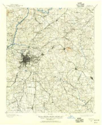
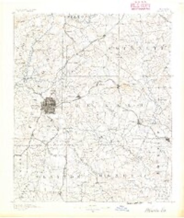
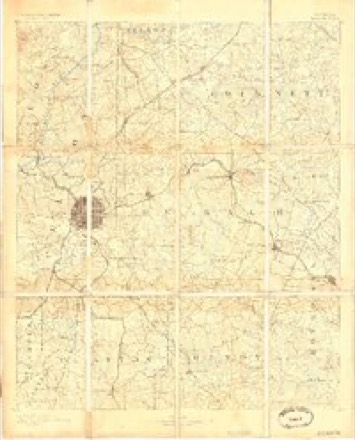
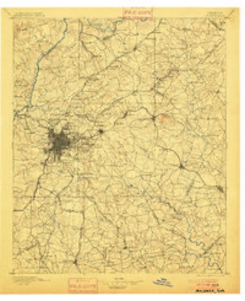
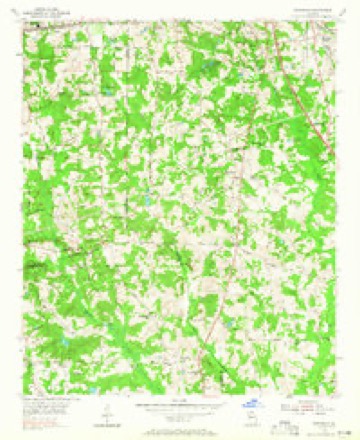
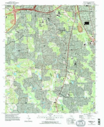
10 surveys from 21 printed sheetsMatched by testing this settlement's coordinate against the published boundary of every sheet in the United States Geological Survey's historical collection. Each opens the scanned sheet at the Survey.
- 1888 USGS Atlanta quadrangle1:125000
- 1890 USGS Atlanta quadrangle1:125000
- 1892 USGS Atlanta quadrangle1:125000
- 1895 USGS Atlanta quadrangle1:125000, 7 printings
- 1953 USGS Atlanta quadrangle1:250000, 2 printings
- 1954 USGS Riverdale quadrangle1:24000, 5 printings
- 1957 USGS Atlanta quadrangle1:250000
- 1958 USGS Atlanta quadrangle1:250000
- 1981 USGS Atlanta quadrangle1:100000
- 1993 USGS Riverdale quadrangle1:24000




Fires near this place
105 since 1992Regional context, not property-specific evidence. The federal wildfire occurrence database lists 105 fires within 5 miles of Riverdale between 1992 and 2016, burning about 226 acres in total. 1 started naturally. 53 were recorded as arson. Distance is straight-line from the map coordinates, so a fire counted here may appear on a neighbouring settlement's page as well.
| Reported cause | Fires |
|---|---|
| Arson/incendiarism | 53 |
| Misuse of fire by a minor | 23 |
| Debris and open burning | 13 |
| Recreation and ceremony | 7 |
| Smoking | 4 |
| Missing data/not specified/undetermined | 4 |
| Natural | 1 |
The most recent of them, most recent first, with the day each was reported and the service that recorded it.
| Date | Cause | Size | Reported by | Name on the report |
|---|---|---|---|---|
| 29 August 1993 | Arson/incendiarism | under an acre | Georgia Forestry Commission | not named |
| 22 August 1993 | Arson/incendiarism | under an acre | Georgia Forestry Commission | not named |
| 17 August 1995 | Arson/incendiarism | under an acre | Georgia Forestry Commission | not named |
| 15 August 1995 | Misuse of fire by a minor | under an acre | Georgia Forestry Commission | not named |
| 1 August 1995 | Arson/incendiarism | under an acre | Georgia Forestry Commission | not named |
| 8 July 1995 | Misuse of fire by a minor | 1.2 acres | Georgia Forestry Commission | not named |
| 8 July 1993 | Arson/incendiarism | 2.2 acres | Georgia Forestry Commission | not named |
| 5 July 1996 | Missing data/not specified/undetermined | 1.4 acres | Georgia Forestry Commission | not named |
Settlements close enough to share some of these fires:
Mines and quarries near this place
2 within 5 milesRegional context, not property-specific evidence. The federal mineral resources record lists 2 workings within 5 miles of Riverdale: 2 producers. All of them still produce. What was taken out: Stone, Crushed/Broken. Distance is straight-line from the map coordinates, so a quarry counted here may appear on a neighbouring settlement's page as well.
| Where | Site | Commodity | Status | Recorded |
|---|---|---|---|---|
| Forest Park Quarry | Stone, Crushed/Broken | Producer | ||
| Red Oak Quarry | Stone, Crushed/Broken | Producer |
Storms near this place
41 since 1995Regional context, not property-specific evidence. The National Weather Service names Riverdale in 41 storm reports between 1995 and 2024: 16 thunderstorm wind, 11 hail, 6 flash flood, 3 lightning. The reports record 1 death and 1 injury. Each account below is quoted exactly as the forecast office filed it, from the NOAA Storm Events Database, and each date opens the federal record of that event.
| When | Event | Place named | Harm | What the report says |
|---|---|---|---|---|
| March 2021 | Thunderstorm Wind | Riverdale | 1 killed, $15,000 | The local print media reported a large limb fell onto a truck outside of a home on Lakeview Drive. A man getting into the truck was struck and killed by the falling limb. |
| June 2013 | Thunderstorm Wind | Riverdale | 1 hurt, $80,000 | The Clayton County 911 Center reported at least 10 trees down county wide. One tree fell on a car, injuring a woman inside. Another tree fell on a house. |
| July 2000 | Thunderstorm Wind | Riverdale | $4,000,000 | The Atlanta Journal and Constitution, along with the Clayton county 911 center, ham radio operators, and the public reported strong thunderstorm winds caused widespread destruction of trees across northern Clayton county. The damage path continued from southern Fulton county near College Park through Riverdale to Forest Park and Morrow in Clayton county. The area from College Park to Riverdale along Georgia Highway 314 bore the brunt of the storm. Hundreds of trees were down on homes and power lines. Parts of Bethsaida Road and Cheryl Lee Road had to be closed because they were blocked by trees. |
| January 2006 | Hail | Riverdale | $2,000,000 | Numerous reports of large hail were received from the public in Jonesboro, Morrow, Rex, and Lovejoy. Golf ball-sized hail was reported by a storm spotter and also by the Clayton County 911 Center in Jonesboro. The public reported quarter-sized hail in Morrow and Jonesboro. A storm spotter reported quarter-sized hail in the Rex area near the intersection of U.S. Highway 23 and Interstate-675 and the public reported quarter-sized hail in Lovejoy. Another individual reported observing penny-sized hail on Interstate-285 just south of Hartsfield-Jackson International Airport. |
| March 2021 | Tornado (EF1) | Riverdale | $250,000 | A National Weather Service survey determined that an EF1 tornado with maximum wind speeds of 90 MPH and a maximum path width of 100 yards briefly touched down in Clayton County. Damage was first surveyed along Bethsaida Road near the intersection with Lakefield Forrest Drive where several trees were uprooted or snapped and several power lines were blown down. The tornado moved southeast reaching its maximum intensity as it crossed West Fayetteville Road snapping or uprooting numerous trees, including several which fell onto homes along Bethaven Road and Zebulon Court. The tornado continued southeast along Bethaven Road, lifting before it reached the intersection of Bethaven road and Monarch Drive. [3/1/21: Tornado #1, County #1/1, EF-1, Clayton, 2021:005]. |
| August 2009 | Lightning | Riverdale | $250,000 | The Clayton County 911 Center reported that lightning strikes resulted in two house fires in the Riverdale area. Specific damages were not provided. One tree was also blown down by thunderstorm winds. |
| July 2005 | Flash Flood | Riverdale | $250,000 | The Clayton County Emergency Management Director reported significant flooding in three different areas within the county. One area was along Jester's Creek just north of Jonesboro where an entire trailer community was flooded. Fourteen of the mobile homes in the community were damaged beyond repair by the flood waters and had to be evacuated. Fifty-two residents of the community had to be moved to shelters. Flooding was also reported to several homes in Jonesboro along River Road. Water was reported to have been two feet deep in some of these homes. In Riverdale, several homes were flooded along Mockingbird Trail and Roxsbury drive. Flooding was generally limited to the basements of these site-built homes. Flooding was also reported at several homes in Lovejoy as well. All in all, the county received 44 calls of home flooding during the early morning hours of July 11th. A bridge near the Southern Regional Medical Center was flooded from the Flint River, causing emergency vehicles to have to be rerouted. Lovejoy Creek rose above its flood stage of 12.0 feet at 7 am EDT and rose to a record 18.9 feet later that evening at 11 pm EDT as all of the flood waters upstream drained into the creek. This was the second highest crest at this location, only surpassed by a reading of 23.6 feet on July 5, 1994 during Tropical Storm Alberto. Rainfall of 8-10 inches was recorded across much of the county, especially the western sections. |
| December 2015 | Flash Flood | Riverdale | $150,000 | A USGS stream gauge on the Flint River at North Bridge Road or 4 miles west to southwest of Lovejoy reached flood stage of 12 feet. The river crest at 16.9 feet. Significant flooding affected the basements of numerous homes along Roxbury Drive...Rambo Court...and Mockingbird Road. Several mobile homes were flooded along Museum Circle. The flooding of Upper Riverdale Road cut off access to Southern Regional Hospital. Several roads were flooded including Upper Riverdale Road...Arrowhead Boulevard...Mockingbird Road...Museum Circle...Turner Road...Harbour Town and North Bridge Road. |
| June 1999 | Lightning | Riverdale | $100,000 | A newspaper report indicated lightning may have been responsible for a fire which started in the attic and nearly destroyed a church on Sullivan Road near Riverdale Road. |
| September 2009 | Flood | Riverdale | $50,000 | The Clayton County 911 Center reported that several roads were flooded throughout the county, especially the northern sections near the Atlanta Hartsfield-Jackson International Airport, Jonesboro, Riverdale, and Forest Park. However, no roads were reported to have been closed during this time frame. Some homes and apartments suffered minor flooding, especially in the Riverdale area. Monetary damage was estimated to be $50,000. |
| August 2018 | Flash Flood | Riverdale | $40,000 | Emergency Manager reported flash flooding in Riverdale, including portions of Upper Riverdale Road. Water was also flowing over Garden Walk Boulevard, resulting in a portion of the road being washed out. A culvert at Windsor Drive was washed out from high flow from Jester Creek. Radar estimates indicate that rainfall amounts of 3 to 4 inches, with locally higher amounts, occurred over the area in a short period of time. |
| August 2020 | Flash Flood | Riverdale | $35,000 | The Emergency Manager reported part of Jesters Creek Trail washed out near Comerce Road. Additionally, first responders reported apartments off Sheldon Court were flooded with at least half a foot of water. A portion of a road collapsed at a third location off Garden Walk Boulevard. Radar estimates indicate that more than 3 inches of rain occurred in a 2 hour period, resulting in the flash flooding. |
| February 2019 | Tornado (EF0) | Riverdale | $25,000 | A National Weather Service survey team found that a brief, EF0 tornado with a maximum winds speed of 75 mph and a maximum path width of 100 yards occurred in northern Clayton County. The tornado touched down along Highway 85 between Forest Park and Riverdale where trees were blown down or snapped on either side of the highway just south of Orr Road. The tornado ripped shingles off the roof of an apartment building and downed several trees around the apartment complex as it moved east-northeast. The tornado crossed I-75 and downed trees along Pineridge Drive between Virginia Circle and Ash Street before lifting along School Lane just northwest of Forest Park High School where it blew down several large limbs onto the roof of a home. No injuries were reported. [02/12/19: Tornado #2, County #1/1, EF-0, Clayton, 2019:002]. |
| July 2002 | Lightning | Riverdale | $25,000 | The News Daily of Jonesboro reported that lightning struck a home setting fire to the structure. Quick action of the homeowner limited the amount of damage. Nonetheless, damage was extensive enough that repairs were expected to take two to three months. Nearly 7000 residents of the county were without power much of the evening either because of cloud-to-ground lightning strikes or wind damage. |
| May 1995 | Thunderstorm Wind | Riverdale | $25,000 | Thunderstorm winds knocked down several trees just south of the post office off King Road and also on Valley Road in Riverdale. A chimney was knocked off on Taylor Road. In Forest Park, several homes sustained roof damage when large tree limbs fell on them. Two homes under construction in Jonesboro were completely blown over. |
| May 2018 | Thunderstorm Wind | Riverdale | $15,000 | The Clayton County 911 center and the broadcast media reported a tree blown down near the intersection of Bernardo Drive and Lake Ridge Parkway and a gas station canopy damaged and partially collapsed due to strong winds at the intersection of Highway 138 and Taylor Road. |
| July 2012 | Thunderstorm Wind | Riverdale | $15,000 | The Clayton County 911 Center and the public reported several trees and numerous power lines down, mainly in the Riverdale area. One tree fell on a car. |
| March 1999 | Thunderstorm Wind | Riverdale | $15,000 | A newspaper reported thunderstorm wind damage at Williamsburg Park subdivision off Flat Shoals Road. One home was damaged from a falling tree. Trees falling on power lines caused power outages. There was damage to gutters and siding on several other homes in Clayton county. |
| June 2017 | Thunderstorm Wind | Riverdale | $10,000 | The local electric utility company reported scattered power lines blown down from south of Riverdale to Morrow. Locations include Lyle Drive, Martha Drive and Brian Lane, and Castleton Lane. |
| June 2012 | Thunderstorm Wind | Riverdale | $7,000 | The Clayton County 911 Center reported that numerous trees and power lines were downed across the county, mainly in the northern portion. The worst damage was concentrated along Thornhedge Drive. |
| September 2009 | Flood | Riverdale | $5,000 | Clayton county Emergency Management personnel reported that general flooding continued across a small portion of far northern Clayton county as late morning and early afternoon flash flooding subsided. Additional minor property damage was observed. |
| September 2009 | Flash Flood | Riverdale | $5,000 | The Clayton County Emergency Management Director reported flash flooding as a result of the Flint River along Upper Riverdale Road adjacent to Southern Regional Hospital. Water was one to two feet deep in this area. Portions of the road were closed and several homes were threatened by high water. Two homes on Roxbury drive in the vicinity were evacuated as a precaution. Overall damage was minor and confined mainly to debris removal. |
| April 1998 | Hail | Riverdale | $5,000 | Dime size hail fell in western Clayton county. Up to golfball size hail occurred in northern parts of the county, where a vehicle was reportedly damaged in Ellenwood. |
| August 2011 | Thunderstorm Wind | Riverdale | $3,000 | An off duty National Weather Service employee observed a few trees and at least one power line down along Georgia Highway 314 from just north of the Fayette county line to approximately two miles south of Hartsfield-Jackson Atlanta International Airport. |
| June 1999 | Thunderstorm Wind | Riverdale | $3,000 | Clayton county 911 reported a lot of power lines blown down. |
| August 2024 | Thunderstorm Wind | Riverdale | $2,000 | Two trees down along pine gate drive. |
| July 2001 | Thunderstorm Wind | Riverdale | $1,500 | The Clayton county 911 center reported that a tree had fallen down on the roof of a house in Riverdale. The ASOS at Atlanta's Hartsfield International Airport recorded 61 mph. |
| July 2024 | Thunderstorm Wind | Riverdale | $1,000 | Tree down on home near the intersection of Caribou Trail and Salem Place. |
| June 2007 | Thunderstorm Wind | Riverdale | $1,000 | The Clayton County 911 Center reported that a couple of power lines were down at the intersection of Georgia Highways 85 and 138. |
| June 1999 | Thunderstorm Wind | Riverdale | $500 | The public reported 2 pine trees were uprooted. |
| February 1998 | Hail | Riverdale | $500 | Dime size hail was reported to have damaged a car. |
| October 2020 | Flash Flood | Riverdale | - | The Emergency Manager reported flooding along the Flint River resulting in the closures of Upper Riverdale Road at Garden Walk Boulevard, Roxbury Drive, and Arrowhead Boulevard. Radar estimates indicate that 3 to 5 inches of rain occurred in the area, resulting in the flash flooding. |
| June 2012 | Hail | Riverdale | - | The security detail at the Southern Regional Medical Center reported that quarter sized hail fell at the facility. |
| April 2010 | Hail | Riverdale | - | The public observed quarter-sized hail between Riverdale and Jonesboro. |
| September 2010 | Hail | Riverdale | - | The public observed quarter-sized hail south of Jonesboro and nickel-sized hail north of Jonesboro. |
| June 2007 | Hail | Riverdale | - | The public reported penny-sized hail. |
| May 2003 | Hail | Riverdale | - | The public reported quarter-sized hail. |
| May 2000 | Funnel Cloud | Riverdale | - | The Riverdale City Police reported a funnel cloud. |
| July 2000 | Hail | Riverdale | - | The public reported 1.00 to 1.50 inch diameter hail. |
| July 1998 | Hail | Riverdale | - | no account filed |
| March 1996 | Hail | Riverdale | - | no account filed |
Nearest settlements
The eight closest, with where each one stands in the county. Distances are straight-line, computed from the Geographic Names Information System coordinates.
| Map | Place | Distance | Sheets |
|---|---|---|---|
| Sherwood Park | 0.4 miles | 21 | |
| Cedar Hill Estates | 0.5 miles | 21 | |
| Steeplechase | 0.8 miles | 21 | |
| Evans Park | 0.8 miles | 21 | |
| Brooks Manor | 0.9 miles | 21 | |
| Oak Village | 0.9 miles | 21 | |
| River Valley Estates | 1.0 miles | 21 | |
| Willow Creek Estates | 1.0 miles | 21 |
Elsewhere
Matched on this settlement's Geographic Names Information System number rather than its name, so it cannot be a different place of the same name in another state.
| Wikipedia article on Riverdale | An encyclopaedic summary. Its text is share-alike, so it is linked here rather than copied. |
| Wikidata item Q3260888 | The structured record the population and elevation above come from. Public domain (CC0). |
Provenance
This settlement is recorded in the Geographic Names Information System as feature 321635. The sheet list is computed by point-in-boundary test against the United States Geological Survey's historical topographic inventory. Both are works of the United States government and carry no copyright under 17 U.S.C. 105.
Wildfire. Short, Karen C. 2022. Spatial wildfire occurrence data for the United States, 1992-2020 [FPA_FOD_20221014]. 6th Edition. Fort Collins, CO: Forest Service Research Data Archive. https://doi.org/10.2737/RDS-2013-0009.6 Collected with United States Government funding and usable without additional permissions or fees.
Mines and quarries. USGS Mineral Resources Data System (MRDS) https://mrdata.usgs.gov/mrds/ A work of the United States government, no copyright under 17 U.S.C. 105.
Storms. NOAA National Centers for Environmental Information, Storm Events Database https://www.ncei.noaa.gov/stormevents/ A work of the United States government, no copyright under 17 U.S.C. 105. Narratives are quoted verbatim from the National Weather Service report and are not edited or summarised.