 Block
Roswell, Georgia
22 topographic sheets cover this place, the earliest surveyed in 1890 and the latest in 1992. It stands in the Roswell-Alpharetta census division. It lies in ZIP code area 30075. It stands on Hog Wallow Creek. The Survey maps it on the Roswell quadrangle. 92,833 people lived here at the 2020 count. It stands 1,050 feet above sea level.
On record in Roswell
Buildings and businesses the archive holds for this place. Each opens its own page, with the source record it came from.
On the National Register 5 records
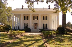 Barrington Halllisted 1971
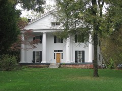 Bulloch Halllisted 1971
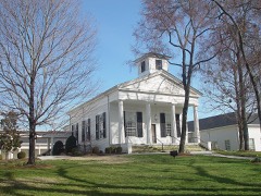 Roswell Historic Districtlisted 1974
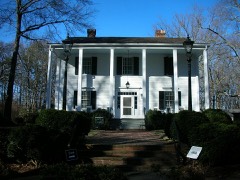 Archibald Smith Houselisted 2006
- Methodist Cemeterylisted 2021
Surveyed buildings and structures 5 records
- Barrington Hall, 535 Barrington Drive, Roswellfederal building survey, 1 photograph
- Bulloch Hall, Roswellfederal building survey, 5 photographs
- Lewis Place, Roswellfederal building survey, 1 photograph
- Mimosa Hall, Roswellfederal building survey, 4 photographs
- Old Methodist Church, Roswellfederal building survey, 1 photograph
Population over time
2 figuresRoswell grew from 88,346 to 92,833 between 2010 and 2020. These are the recorded population figures Wikidata holds for this place, reached through the Geographic Names Information System number this page is keyed on rather than by name, so they belong to this place and not to another of the same name. Most are census counts, but not all are: an early figure may be a founding or settlement estimate, and an estimate published within five years of a census is left out. The change column is computed, and is left blank where more than 20 years separate a figure from the one before it, because a gap that long is not a change between two counts.
| Year | People | Change |
|---|---|---|
| 2010 | 88,346 | |
| 2020 | 92,833 | +4,487 (+5%) |
Topographic sheets covering this place
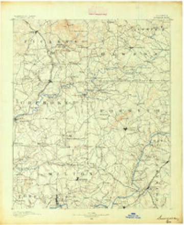
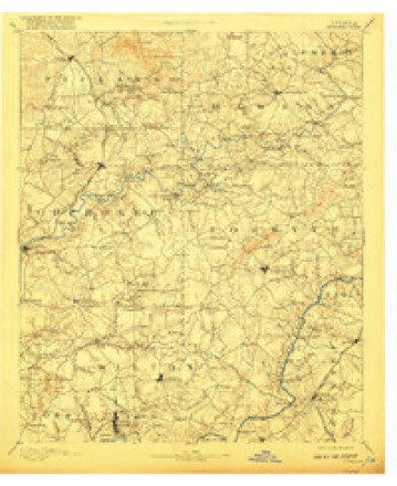
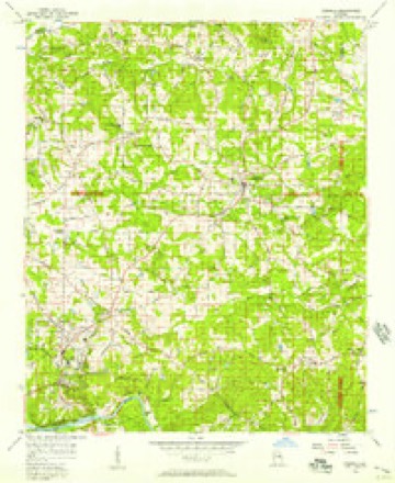
9 surveys from 22 printed sheetsMatched by testing this settlement's coordinate against the published boundary of every sheet in the United States Geological Survey's historical collection. Each opens the scanned sheet at the Survey.
- 1890 USGS Suwanee quadrangle1:125000
- 1894 USGS Suwanee quadrangle1:125000, 6 printings
- 1955 USGS Rome quadrangle1:250000
- 1956 USGS Roswell quadrangle1:24000, 5 printings
- 1958 USGS Rome quadrangle1:250000, 3 printings
- 1961 USGS Rome quadrangle1:250000
- 1963 USGS Rome quadrangle1:250000
- 1981 USGS Cartersville quadrangle1:100000, 2 printings
- 1992 USGS Roswell quadrangle1:24000, 2 printings




Photographs
1 photograph, 1939Taken for the Office of War Information and the Farm Security Administration, who photographed the country between 1935 and 1944. Works of United States government photographers, with no known restriction on use. Each opens its catalogue record.
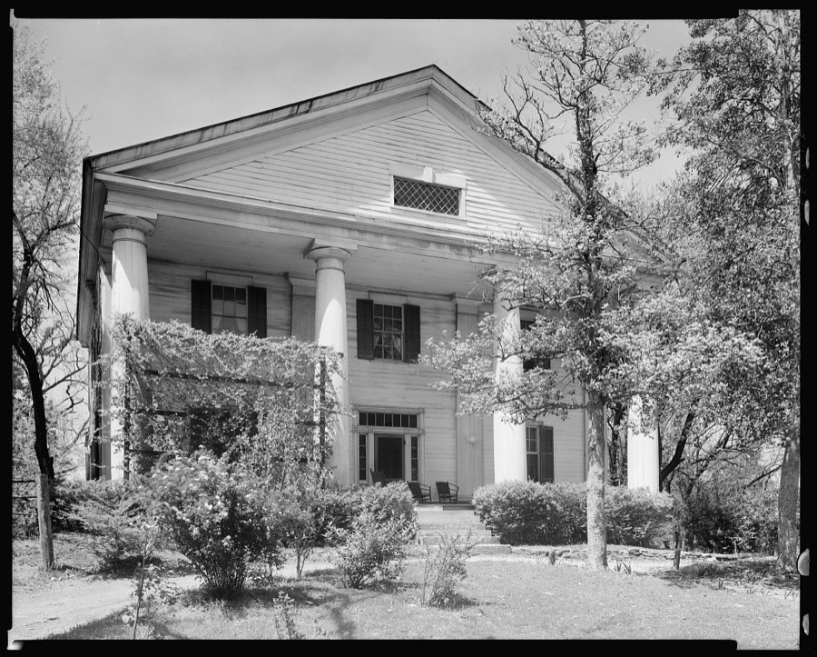
Johnston, Frances Benjamin, 1939. Library of Congress
Fires near this place
14 since 1993Regional context, not property-specific evidence. The federal wildfire occurrence database lists 14 fires within 5 miles of Roswell between 1993 and 2016, burning about 44 acres in total. 2 started naturally. 4 were recorded as arson. Distance is straight-line from the map coordinates, so a fire counted here may appear on a neighbouring settlement's page as well.
| Reported cause | Fires |
|---|---|
| Arson/incendiarism | 4 |
| Debris and open burning | 3 |
| Recreation and ceremony | 2 |
| Natural | 2 |
| Equipment and vehicle use | 2 |
| Misuse of fire by a minor | 1 |
The most recent of them, most recent first, with the day each was reported and the service that recorded it.
| Date | Cause | Size | Reported by | Name on the report |
|---|---|---|---|---|
| 21 September 1999 | Natural | under an acre | Chattahoochee River National Recreation Area | VICKERY |
| 8 June 2007 | Arson/incendiarism | 2.6 acres | Georgia Forestry Commission | not named |
| 29 June 1996 | Recreation and ceremony | 3.0 acres | Chattahoochee River National Recreation Area | VICKERY |
| 1 May 1993 | Arson/incendiarism | 1.6 acres | Georgia Forestry Commission | not named |
| 5 April 1995 | Arson/incendiarism | 1.0 acres | Georgia Forestry Commission | not named |
| 1 April 1994 | Misuse of fire by a minor | 1.5 acres | Chattahoochee River National Recreation Area | GOODFRIDAY |
| 4 March 1996 | Equipment and vehicle use | 24 acres | Georgia Forestry Commission | not named |
| 4 March 1994 | Recreation and ceremony | 1.2 acres | Chattahoochee River National Recreation Area | GOLDBRANCH |
Settlements close enough to share some of these fires:
Mines and quarries near this place
10 of 11 shownRegional context, not property-specific evidence. The federal mineral resources record lists 11 workings within 5 miles of Roswell: 6 past producers, 4 prospects, 1 producer. 1 still produces. What was taken out: Gold, Mica, Sand and Gravel, Construction, Copper. Distance is straight-line from the map coordinates, so a quarry counted here may appear on a neighbouring settlement's page as well.
| Where | Site | Commodity | Status | Recorded |
|---|---|---|---|---|
| Daniels Prospect | Mica | Prospect | ||
| Ocoee Mine | Copper | Past Producer | ||
| Roswell Mine | Sand and Gravel, Construction | Producer | ||
| Fuller Prospect | Gold | Past Producer | Stream Placer | |
| Green Placer/Mcclure/Nunnaly | Gold | Past Producer | Stream Placer | |
| Lizzard Lope | Gold | Prospect | Placer | |
| Mason (Gold) | Gold | Prospect | Placer | |
| Mcclure No.2 | Gold | Past Producer | Stream Placer | |
| No Name | Gold | Past Producer | Vein | |
| Nunnaly | Gold | Prospect | Placer |
Storms near this place
60 of 72 shownRegional context, not property-specific evidence. The National Weather Service names Roswell in 72 storm reports between 1994 and 2026: 32 thunderstorm wind, 28 hail, 6 flash flood, 3 lightning. The reports record 8 injuries. Each account below is quoted exactly as the forecast office filed it, from the NOAA Storm Events Database, and each date opens the federal record of that event.
| When | Event | Place named | Harm | What the report says |
|---|---|---|---|---|
| April 1998 | Thunderstorm Wind | Roswell | 4 hurt, $5,000 | The Fulton county EMA reported numerous trees were downed in northern Fulton county. Four minor injuries resulted. |
| February 2008 | Thunderstorm Wind | Roswell | 2 hurt, $2,000,000 | The Fulton County Emergency Management Director reported that the same squall line that rolled through several west central and northwest Georgia counties early in the morning caused extensive damage across Fulton county as well. More than 50 trees were down across the county with at least 20 structures sustaining damage. A number of power lines were also down across these areas. The most concentrated damage continued from northeast Cobb county, within a 0.3 to 1.0 mile wide path, into north Fulton county from the Fulton/Cobb county line west of Roswell to just north of downtown Roswell. This portion of the damage was a continuation of the survey conducted by The Weather Channel. Hundreds of trees were blown down, several on homes. More than 300 trees along were blown down in 80-acre Roswell Park on Woodstock Road. The downed trees caused extensive damage to facilities within the park, including a children's playground, picnic shelters, and a maintenance building. Damage was reported to homes and other structures in Sandy Springs, Atlanta, Milton, and Johns Creek, College Park, and Fairburn. Heavy damage was noted in the Sandy Springs area. A business sign suffered damage near Hartsfield-Jackson International Airport. Two injuries were reported from a home on Moorehouse Drive Southwest in the city of Atlanta when a tree fell on the structure causing the roof and wall to collapse. An adult male and a pregnant adult female were injured as a result. Both injuries were non-life threatening. Damage was reported along Holcomb Bridge Road, Warsaw Road, and Park Bridge Lane. In Fairburn, two homes were damaged when trees fell on the structures on White Mill and Rivertown Roads. |
| July 2005 | Lightning | Roswell | 2 hurt | The Revue News of Alpharetta/Roswell reported that two Roswell police officers were injured when lightning struck a tree adjacent to them. Both officers were treated and released for injuries. |
| April 2015 | Hail | Roswell | $4,000,000 | The public reported golf ball size hail at Georgia Highway 400 and Holcomb Bridge Road. |
| April 2009 | Hail | Roswell | $600,000 | The Fulton County Emergency Management Director reported that penny to golf ball-sized hail fell across far northern Fulton county around Alpharetta. The public observed penny-sized hail near Crabapple. Most of the hail reports were penny to nickel-sized. |
| May 2010 | Flash Flood | Roswell | $500,000 | Several creeks across Fulton county reached or exceeded flood stage during this period. This information was verified by USGS stream gages on the creeks. Proctor Creek at Jackson Parkway in Atlanta reached its flood stage of 13.0 feet at 655 am EDT. The creek continued to rise and crested at 14.4 feet at 815 am EDT. Flood stage on Peachtree Creek at Northside Drive of 18.0 feet was reached at 815 am EDT. The creek continued to rise and crested at 19.2 feet at 1215 pm EDT. On Nancy Creek at Rickenbacker Drive, major flood stage of 13.0 feet was reached at 1105 am EDT. The creek eventually crested at 13.2 feet at 1200 pm EDT before finally beginning to fall. The Fulton County Emergency Management Director reported that at least 50 homes were affected by the flood waters of Nancy and Peachtree Creeks. A swift water rescue was required along Nancy Creek where a female had to be removed from the top of a home on Fairfield Road approximately four miles west of North Atlanta. Flood waters covered portions of Cochran Mill Road, Cascade-Palmetto Highway, and Vandiver Road at Amen Road in central Fulton county, all a result of local creeks out of their banks. Portions of Interstate-20 west of Atlanta were closed during the height of the flooding. Damages to property and roads from the flooding were estimated to be $500,000. |
| September 2021 | Flash Flood | Roswell | $60,000 | The Emergency Manager reported flooding over portions of north Fulton county due to quickly accumulating rainfall over the area. Radar estimates indicate 3 to 6 inches of rain occurred over the area, resulting in the flash flooding. According to the NOAA Atlas 14, these rainfall amounts have a 0.5% to 0.2% chance of occurrence in a given year. ||The Emergency Manager reported flash flooding at the intersection of Willeo Road and Azalea Drive, Haynes Bridge Road and Westside Parkway, and Riverside Road along the Chattahoochee River. Flooding at Encore Parkway at North Point Center East caused at least one vehicle to stall in the intersection. |
| June 2013 | Tornado (EF1) | Roswell | $60,000 | A National Weather Service storm survey team determined that the tornado that began in Cherokee County and passed through Cobb County lifted in Fulton County. It moved over the Chattahoochee River near Morgan Falls, retaining its EF-1 strength as it snapped and uprooted dozens of trees along the riverbank. It damaged roofs at the Laurel at Overlook Park Apartments. Netting polls at the driving range at the Steel Canyon Golf Club were damaged, with the netting ripped off or tangled. The tornado continued southeast, snapping or uprooting trees until it finally lifted just short of the DeKalb County line, where it snapped and uprooted a few trees along Twin Branch Road.|[06/13/13: Tornado #2, County #3-3, EF1, Cherokee-Cobb-Fulton, 2013:012]. |
| June 1998 | Lightning | Roswell | $20,000 | Roswell firefighters responded to calls where at least 3 houses were struck by lightning. |
| October 2014 | Tornado (EF0) | Roswell | $15,000 | NWS Storm Survey team found a tornado touched down near Willow Point Parkway in east Cobb County and traveled north northeast into Fulton County north of Timber Ridge Road before lifting along Willeo Road near the Chattahoochee River. EF1 damage was indicated in Cobb County with maximum wind speeds around 95 MPH and a path width of 100 yards. EF0 Damage was indicated after the tornado crossed into Fulton County. Damage was confined mainly to trees snapped or uprooted with some damage to homes from falling trees. [10/14/14: Tornado #5, County #2-2, EF0, Cobb-Fulton, 2014:015]. |
| June 2015 | Thunderstorm Wind | Roswell | $10,000 | An Atlanta area television news station reported power lines blown down on Atlanta Street between Oak Street and Magnolia Street in Roswell. Atlanta Street was closed for some time while the power lines were cleared from the roadway. |
| April 2015 | Thunderstorm Wind | Roswell | $10,000 | The Fulton County Emergency Manager relayed numerous reports of trees down from north Sandy Springs to Roswell, Alpharetta and Johns Creek. This included a tree on a house on Softpine Trail, a tree blocking the roadway at Spaulding Drive and Ball Creek Way and a tree on a house in Roswell. |
| May 2013 | Flash Flood | Roswell | $10,000 | The USGS stream gage on the Big Creek at Kimball Bridge Road near Alpharetta reached flood stage of 7 feet. The creek crest at 10.3 feet. Minor flooding occurred. The USGS stream gage on the Chattahoochee River near Berkeley Lake and Norcross reached flood stage of 12 feet. The river crest at 12.4 feet. Minor flooding occurred. The Chattahoochee River rose out of its banks and flooded the paddocks and access road to the stables at the Huntcliff River Club near Sandy Springs. Emergency officials evacuated 20 horses from the stables. |
| August 2000 | Thunderstorm Wind | Roswell | $10,000 | Several sources, including the Fulton county 911 center, a television station reporter, the Atlanta Journal and Constitution, and the public, reported trees down in various places across North Atlanta. Trees were reported down on Johnson's Ferry Road and on several downtown Atlanta streets, including Ponce De Leon Street, Midtown Road at Techwood, and Williams Street at the Forum, all of which blocked traffic for several hours. In addition, a fence was blown down at Chastain Park, a few miles north of downtown Atlanta. |
| April 2002 | Thunderstorm Wind | Roswell | $7,000 | The public reported that several trees and some power lines were blown down. |
| April 2020 | Thunderstorm Wind | Roswell | $5,000 | Large tree down on Magnolia Street in Roswell. Also brought down some powerlines. |
| August 2007 | Thunderstorm Wind | Roswell | $5,000 | The Fulton County 911 Center reported that at least three trees and power lines were down in the northern part of the county, southwest of Roswell. The public reported that two trees were down in their yard in the north part of Atlanta near Sandy Springs. |
| May 1994 | Thunderstorm Wind | Roswell | $5,000 | Several large trees and a few power lines were downed by thunderstorm winds. |
| June 1994 | Thunderstorm Wind | Roswell | $5,000 | Numerous trees and power lines were downed by thunderstorm winds. |
| May 1994 | Thunderstorm Wind | Roswell | $5,000 | Several large trees were blown down along Hightower Trail. |
| June 2025 | Thunderstorm Wind | Roswell | $2,000 | Two trees down near Turner Mcdonald Parkway from Northridge Rd to Roberts Drive. |
| May 1998 | Hail | Roswell | $2,000 | The public reported nickel to golf ball size hail across northern Fulton county. |
| June 1998 | Thunderstorm Wind | Roswell | $2,000 | The public reported golf ball size hail and several trees blown down. |
| March 2026 | Thunderstorm Wind | Roswell | $1,000 | Em reports tree on structure at summit springs rd in sandy springs. |
| February 2025 | Thunderstorm Wind | Roswell | $1,000 | A tree fell across ball mill road ne at dunwoody club drive. |
| August 2024 | Thunderstorm Wind | North Roswell | $1,000 | Large tree down on shallowford rd near the intersection of whisperwood dr. |
| December 2024 | Thunderstorm Wind | North Roswell | $1,000 | A tree fell across the 1000 block of Jones Road. |
| December 2024 | Thunderstorm Wind | Roswell | $1,000 | A tree was blown down into the roadway in the 300 block of Grimes Bridge Rd. |
| December 2024 | Thunderstorm Wind | Roswell | $1,000 | Multiple trees down on the near Spalding Dr and Mt Vernon Rd. |
| August 2023 | Thunderstorm Wind | Roswell | $1,000 | A large pine tree was reported down on ga-400 northbound just south of Holcomb Bridge Road. |
| June 2022 | Thunderstorm Wind | Roswell | $1,000 | Powerlines and tree fell onto vehicle on Atlanta St in Roswell. |
| June 2002 | Thunderstorm Wind | Roswell | $1,000 | The public reported that several trees were blown down. |
| March 1999 | Thunderstorm Wind | Roswell | $1,000 | North Fulton county 911 reported 3 to 4 trees knocked down by thunderstorm winds. |
| June 1999 | Thunderstorm Wind | Roswell | $1,000 | North Fulton county 911 reported trees were blown down. |
| May 1998 | Hail | Roswell | $1,000 | The public made several reports of dime size to 11/2 inch hail. |
| June 1999 | Thunderstorm Wind | Roswell | $500 | North Georgia Power company and the public reported 2 trees down with power lines down. |
| June 1999 | Thunderstorm Wind | Roswell | $500 | The public reported pine trees snapped off and several trees down. |
| April 1996 | Thunderstorm Wind | Roswell | $500 | no account filed |
| May 2000 | Thunderstorm Wind | Roswell | $300 | The public reported two trees down in Roswell. |
| July 2003 | Thunderstorm Wind | Roswell | $100 | The public reported that several tree limbs were blown down. Wind gusts were estimated at 50 mph. Pea-sized hail was also reported. |
| June 2025 | Hail | Roswell | - | Public report of 1 inch hail. |
| June 2025 | Hail | Roswell | - | Mping report of 1 inch hail between Dunwoody and Peachtree Corners. |
| June 2025 | Hail | Roswell | - | Public report of 1-inch hail near Ison Rd NE and Roswell Road. |
| June 2025 | Hail | Roswell | - | Public report hail the size of walnuts, or one and a half inches, near the intersection of Northcliff Trace and Stoneglen Close. |
| June 2025 | Thunderstorm Wind | Roswell | - | Roughly 30 trees reported down from around Bluffwind Chase going northeast, crossing Northcliff Trace and Stoneglen Close. About half of these trees were uprooted and another half were snapped about 20 feet above the ground. |
| January 2023 | Flash Flood | North Roswell | - | The Emergency Manager reported a water rescue near the intersection of Crossville Road and Mansell Road due to high water on Hog Wallow Creek. Radar estimates indicate that 3 to 4 inches of rain occurred quickly over the area, resulting in the rises of local creeks and streams. |
| June 2023 | Thunderstorm Wind | North Roswell | - | Public reports tree limbs broken and shingles blown off of a building near Canton St and Woodstock Rd. |
| February 2020 | Flash Flood | Roswell | - | The Emergency Manager reported Willeo Road closed between the intersection with Azalea Drive and the Chattahoochee Nature Center due to flooding of the Chattahoochee River. Radar estimates indicate that 3 to 4 inches of rain occurred over the area in a short period of time, falling on wet soils and resulting in flash flooding. |
| June 2020 | Hail | North Roswell | - | An amateur radio operator reported hail the size of quarters at Roswell High School. |
| June 2020 | Hail | North Roswell | - | The public reported hail the size of walnuts along Oakfield Lane. |
| July 2018 | Flash Flood | North Roswell | - | Public reported minor street flooding on Crabapple Road in Roswell. Fulton 911 reported Houze Road and Highway 9 at Oxbo Road were closed due to flooding. Radar estimates indicate that between 3 to 4 inches of rain fell in the Roswell area, with locally higher amounts. |
| June 2011 | Hail | Roswell | - | A meteorologist with Georgia Public Television reported penny-sized hail in north Fulton county near Roswell. |
| February 2011 | Hail | Roswell | - | A trained storm spotter observed half-dollar-sized hail in the Roswell area and penny to nickel-sized hail in the Alphretta area. This was a continuation of the same storm cell that moved across northern Cobb county entering Fulton county near Sweat Mountain. |
| April 2009 | Hail | Roswell | - | The public observed quarter-sized hail in the Roswell area. This was the third severe thunderstorm to affect Fulton county during the evening of April 23rd. |
| May 2008 | Hail | Roswell | - | The Fulton County Emergency Management Director reported quarter-sized hail in the Alpharetta area and the public observed penny-sized hail in the Alpharetta area. Similar-sized hail fell along the Cherokee county line. Radar supported quarter-sized or larger hail across much of north Fulton county from northwest of Roswell to southeast of Alpharetta near the Gwinnett county border. |
| June 2006 | Hail | Roswell | - | The public reported penny-sized hail from Roswell to Alpharetta. In addition, wind gusts to 50 mph were estimated during the thunderstorm. |
| May 2006 | Hail | Roswell | - | The public reported penny-sized hail. |
| April 2002 | Hail | Roswell | - | Numerous reports were received from the public of hail ranging in size from dimes to golf balls. Most of the large half-dollar to golf ball size hail reports came from the Roswell and Alpharetta areas. At least one person indicated that the hail covered the ground and another indicated that it hailed for several minutes. |
| April 2002 | Funnel Cloud | Roswell | - | A local police officer reported sighting a funnel cloud. Doppler radar showed significant rotation on this cell in this general area at the time. |
| June 2002 | Hail | Roswell | - | The public reported dime size hail. |
Nearest settlements
The eight closest, with where each one stands in the county. Distances are straight-line, computed from the Geographic Names Information System coordinates.
| Map | Place | Distance | Sheets |
|---|---|---|---|
| North Point | 1.6 miles | 23 | |
| Roswell Oaks | 1.7 miles | 23 | |
| Boulder Creek | 2.1 miles | 23 | |
| Greenway | 2.7 miles | 23 | |
| Wildwood Springs | 4.1 miles | 23 | |
| Highland Colony | 4.2 miles | 23 | |
| Rivergate | 4.3 miles | 21 | |
| Spalding Hills | 4.3 miles | 21 |
Elsewhere
Matched on this settlement's Geographic Names Information System number rather than its name, so it cannot be a different place of the same name in another state.
| Wikipedia article on Roswell | An encyclopaedic summary. Its text is share-alike, so it is linked here rather than copied. |
| Wikidata item Q585176 | The structured record the population and elevation above come from. Public domain (CC0). |
Provenance
This settlement is recorded in the Geographic Names Information System as feature 332929. The sheet list is computed by point-in-boundary test against the United States Geological Survey's historical topographic inventory. Both are works of the United States government and carry no copyright under 17 U.S.C. 105.
Wildfire. Short, Karen C. 2022. Spatial wildfire occurrence data for the United States, 1992-2020 [FPA_FOD_20221014]. 6th Edition. Fort Collins, CO: Forest Service Research Data Archive. https://doi.org/10.2737/RDS-2013-0009.6 Collected with United States Government funding and usable without additional permissions or fees.
Mines and quarries. USGS Mineral Resources Data System (MRDS) https://mrdata.usgs.gov/mrds/ A work of the United States government, no copyright under 17 U.S.C. 105.
Storms. NOAA National Centers for Environmental Information, Storm Events Database https://www.ncei.noaa.gov/stormevents/ A work of the United States government, no copyright under 17 U.S.C. 105. Narratives are quoted verbatim from the National Weather Service report and are not edited or summarised.