 Block
Sandfly, Georgia
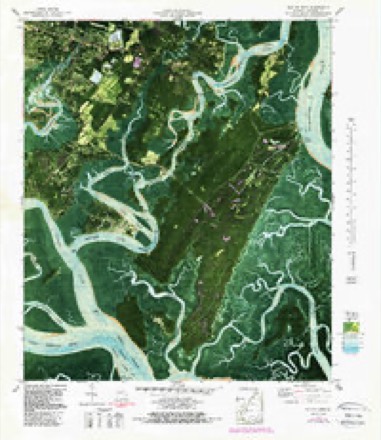
15 topographic sheets cover this place, the earliest surveyed in 1944 and the latest in 1981. It stands in the Montgomery census division. It lies in ZIP code area 31406. It lies near Wylly Island. The Survey maps it on the Isle of Hope quadrangle.
On record in Sandfly
Buildings and businesses the archive holds for this place. Each opens its own page, with the source record it came from.
On the National Register within a mile 1 record
The National Register names another town for these. They stand within one mile of this settlement's coordinate.
- Clarence and Louise Golden Williams Houselisted 2023 · 0.3 miles away
Topographic sheets covering this place
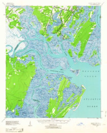
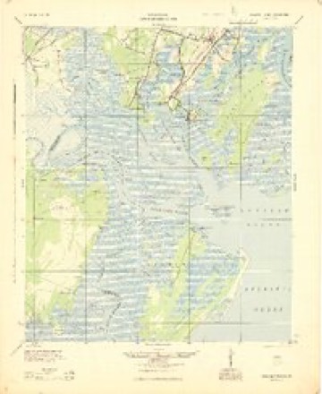
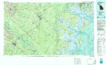
10 surveys from 15 printed sheetsMatched by testing this settlement's coordinate against the published boundary of every sheet in the United States Geological Survey's historical collection. Each opens the scanned sheet at the Survey.
- 1944 USGS Ossabaw Island quadrangle1:62500
- 1945 USGS Ossabaw Island quadrangle1:62500
- 1946 USGS Brunswick quadrangle1:250000
- 1948 USGS Brunswick quadrangle1:250000
- 1956 USGS Brunswick quadrangle1:250000, 2 printings
- 1957 USGS Isle of Hope quadrangle1:24000, 2 printings
- 1961 USGS Brunswick quadrangle1:250000
- 1978 USGS Brunswick quadrangle1:250000, 2 printings
- 1979 USGS Isle of Hope quadrangle1:24000, 3 printings
- 1981 USGS Jesup quadrangle1:100000
Fires near this place
83 since 1992Regional context, not property-specific evidence. The federal wildfire occurrence database lists 83 fires within 5 miles of Sandfly between 1992 and 2017, burning about 365 acres in total. 2 started naturally. 22 were recorded as arson. Distance is straight-line from the map coordinates, so a fire counted here may appear on a neighbouring settlement's page as well.
| Reported cause | Fires |
|---|---|
| Debris and open burning | 24 |
| Arson/incendiarism | 22 |
| Recreation and ceremony | 12 |
| Misuse of fire by a minor | 11 |
| Smoking | 7 |
| Natural | 2 |
| Missing data/not specified/undetermined | 2 |
| Railroad operations and maintenance | 2 |
| Equipment and vehicle use | 1 |
The most recent of them, most recent first, with the day each was reported and the service that recorded it.
| Date | Cause | Size | Reported by | Name on the report |
|---|---|---|---|---|
| 4 September 1999 | Debris and open burning | under an acre | Georgia Forestry Commission | not named |
| 2 September 1999 | Smoking | under an acre | Georgia Forestry Commission | not named |
| 3 August 2016 | Debris and open burning | 2.0 acres | Georgia Forestry Commission | FY2017-CHATHAM-002 |
| 26 July 1993 | Debris and open burning | under an acre | Georgia Forestry Commission | not named |
| 13 July 1993 | Recreation and ceremony | 2.2 acres | Georgia Forestry Commission | not named |
| 8 June 1999 | Smoking | under an acre | Georgia Forestry Commission | not named |
| 4 June 1996 | Debris and open burning | 4.8 acres | Georgia Forestry Commission | not named |
| 26 June 1996 | Recreation and ceremony | 14 acres | Georgia Forestry Commission | not named |
Settlements close enough to share some of these fires:
Storms near this place
16 since 2008Regional context, not property-specific evidence. The National Weather Service names Sandfly in 16 storm reports between 2008 and 2025: 10 thunderstorm wind, 2 hail, 2 lightning, 1 tornado. No death or injury is recorded in these reports. Each account below is quoted exactly as the forecast office filed it, from the NOAA Storm Events Database, and each date opens the federal record of that event.
| When | Event | Place named | Harm | What the report says |
|---|---|---|---|---|
| June 2008 | Tornado (EF1) | Sandfly | $3,100,000 | The National Weather Service Office in Charleston, South Carolina completed a damage survey in Chatham county Georgia and determined that an EF-1 Tornado occurred. The Tornado developed around 3:37 pm just north of the intersection of Montgomery Cross Road and the Harry Truman Parkway and traveled south-southwest just west of the Harry Truman Parkway for aproximately 3/4 of a mile before lifting. The maximum width of the Tornado was about 100 yards, and maximum sustained winds were estimated at 90 to 100 mph. This Tornado damaged a fire station and uprooted and snapped off numerous trees. ||The vast majority of the damage was caused by at least 5 strong downbursts. In general, fairly widespread damage occurred from the Bacon Park Golf Course starting around 3:32 pm and ended near the intersection of Ferguson Avenue and Route 204 around 3:45 pm. South and southeast of this intersection and north of the Bacon Park Golf Course damage was much more sporadic. In this concentrated damage area, damage was up to 2.5 miles wide. Downburst winds knocked the steeple off a church and knocked down or snapped off thousands of trees. Tree limbs and large branches damaged 40 to 50 homes, with about a dozen of the homes sustaining major damage. Trees or large limbs fell on and destroyed about a dozen vehicles. The winds knocked down power poles and power lines, resulting in thousands of people without power. In addition, shingle and siding damage was also observed on the some of the homes. ||One of the areas of most significant damage occurred in the Lake View Subdivision just west of Ferguson Avenue. In this area downburst winds snapped off or uprooted numerous trees. Trees or large branches fell on at least a dozen homes, several homes sustained shingle or minor roof damage. One of the homes was deemed uninhabitable after a tree fell through it. Wind speeds in this area were estimated to be 80 to 90 mph.||Another area of significant damage occurred at a Gun Club between Ferguson Avenue and Harry Truman Parkway. In this area, strong winds destroyed a building and tossed an outbuilding about 30 yards. In addition, numerous large trees were snapped off or uprooted, with one tree landing on and damaging another building. Wind speeds in this area were estimated to be 90 to 100 mph. |
| August 2009 | Flash Flood | Sandfly | $50,000 | The Chatham County Emergency Manager reported significant and widespread flooding of streets occurring, with some rescues of people from vehicles necessary in Savannah, Georgia. Just east of the Savannah near the intersection of Truman Parkway and Anderson Street, vehicles were floating in flood waters. |
| July 2015 | Lightning | Sandfly | $15,000 | Chatham County Emergency Management reported lightning struck a house on Majestic Oaks Drive. The roof caught on fire and the residents are displaced. |
| June 2015 | Lightning | Sandfly | $5,000 | A member of the broadcast media reported power lines down on Fox Chase Road due to a tree being struck by lightning. |
| July 2009 | Thunderstorm Wind | Sandfly | $5,000 | A trained weather spotter reported 5 trees down and blocking Paxton Drive and Central Avenue in the Isle of Hope area of Savannah, Georgia. |
| March 2008 | Thunderstorm Wind | Sandfly | $4,000 | A trained weather spotter reported a pine tree branch that was six inches in diameter and thirty feet long fell and dented the roof of a car. |
| April 2009 | Thunderstorm Wind | Sandfly | $2,000 | Law Enforcement reported several trees down and a downed power line along Parkersburg Road. |
| July 2025 | Thunderstorm Wind | Sandfly | $1,000 | Chatham County Emergency Management reported a tree down and blocking half of the roadway in the 7600 block of Central Avenue. |
| August 2023 | Thunderstorm Wind | Sandfly | - | A Chatham County emergency manager reported a tree down near the intersection of |Ferguson Avenue at Marvalingrove Drive. |
| June 2022 | Thunderstorm Wind | Sandfly | - | The Chatham County Emergency Management Agency reported a tree down along Richmond Drive. |
| April 2019 | Thunderstorm Wind | Sandfly | - | A report via social media indicated a tree snapped in the Isle of Hope area. |
| April 2015 | Thunderstorm Wind | Sandfly | - | An emergency manager reported power lines down and on fire at the 8500 block of Kent Drive. |
| June 2015 | Thunderstorm Wind | Sandfly | - | An emergency manager reported a tree down in the 8500 block along Kent Drive. |
| June 2014 | Thunderstorm Wind | Sandfly | - | The media reported a tree down on power lines on Skidaway Road. |
| March 2011 | Hail | Sandfly | - | A trained weather spotter reported that dime to nickel size fell for between 1 and 2 minutes in Sandfly, Georgia. |
| May 2009 | Hail | Sandfly | - | The broadcast media reported golf ball size hail in Isle of Hope, Georgia. |
Nearest settlements
The eight closest, with where each one stands in the county. Distances are straight-line, computed from the Geographic Names Information System coordinates.
| Map | Place | Distance | Sheets |
|---|---|---|---|
| Bakers Crossing | 0.3 miles | 15 | |
| Cresthill | 0.6 miles | 15 | |
| Harrock Hall | 0.6 miles | 15 | |
| Grimball Park | 0.7 miles | 15 | |
| Wymberly on the Marsh | 0.7 miles | 15 | |
| Lakeside Park | 0.8 miles | 15 | |
| Wormsloe | 0.8 miles | 15 | |
| Isle of Hope | 1.0 miles | 15 |
Elsewhere
Matched on this settlement's Geographic Names Information System number rather than its name, so it cannot be a different place of the same name in another state.
| Wikipedia article on Sandfly | An encyclopaedic summary. Its text is share-alike, so it is linked here rather than copied. |
| Wikidata item Q14686818 | The structured record the population and elevation above come from. Public domain (CC0). |
Provenance
This settlement is recorded in the Geographic Names Information System as feature 332970. The sheet list is computed by point-in-boundary test against the United States Geological Survey's historical topographic inventory. Both are works of the United States government and carry no copyright under 17 U.S.C. 105.
Wildfire. Short, Karen C. 2022. Spatial wildfire occurrence data for the United States, 1992-2020 [FPA_FOD_20221014]. 6th Edition. Fort Collins, CO: Forest Service Research Data Archive. https://doi.org/10.2737/RDS-2013-0009.6 Collected with United States Government funding and usable without additional permissions or fees.
Storms. NOAA National Centers for Environmental Information, Storm Events Database https://www.ncei.noaa.gov/stormevents/ A work of the United States government, no copyright under 17 U.S.C. 105. Narratives are quoted verbatim from the National Weather Service report and are not edited or summarised.