 Block
Savannah Beach, Georgia
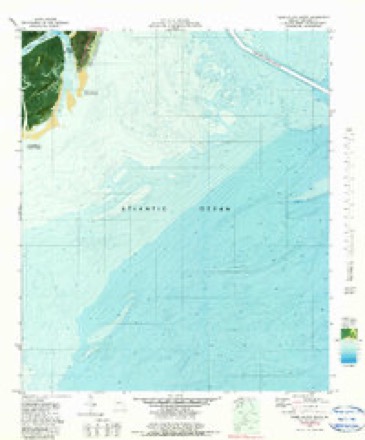
15 topographic sheets cover this place, the earliest surveyed in 1920 and the latest in 1980. It stands in the Tybee Island-Wilmington Island census division. It lies in ZIP code area 31328. It stands on Horse Pen Creek. The Survey maps it on the Tybee Island South quadrangle.
On record in Savannah Beach
Buildings and businesses the archive holds for this place. Each opens its own page, with the source record it came from.
On the National Register within a mile 12 records
The National Register names another town for these. They stand within one mile of this settlement's coordinate.
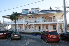 Carbo House, Thelisted 2010 · 0.1 miles away
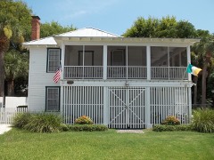 J. Herbert and Julia Johnson Raised Tybee Cottagelisted 2008 · 0.2 miles away
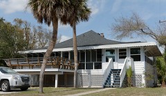 Tybee Island Strand Cottages Historic Districtlisted 1999 · 0.2 miles away
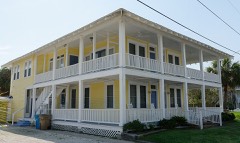 Sea View Apartmentslisted 2003 · 0.3 miles away
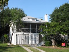 James and Odessa Rourke Jr. Raised Tybee Cottagelisted 2010 · 0.3 miles away
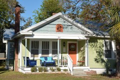 Edgar A. Weil Houselisted 2016 · 0.4 miles away
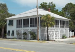 Mulherin-Righton Raised Tybee Cottagelisted 2008 · 0.7 miles away
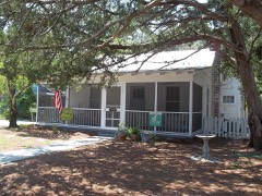 Morgan-Ille Cottagelisted 2008 · 0.8 miles away
- Curry-Miller-Byrd Cottagelisted 2021 · 0.1 miles away
- Bordley Cottage-Beach View Houselisted 2014 · 0.2 miles away
- Tybee Island Back River Historic Districtlisted 1999 · 0.3 miles away
- Edmund and Mildred Abrahams Raised Tybee Cottagelisted 2020 · 0.7 miles away
Topographic sheets covering this place
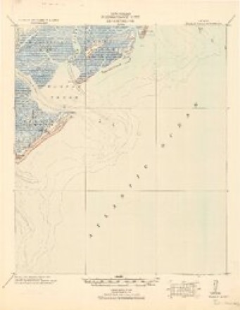
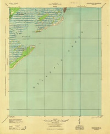
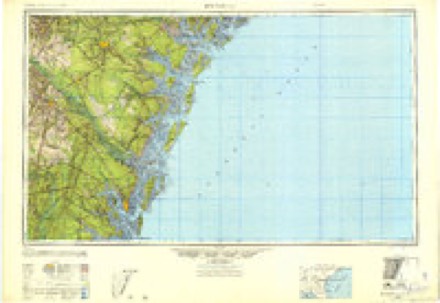
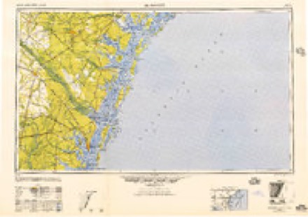
10 surveys from 15 printed sheetsMatched by testing this settlement's coordinate against the published boundary of every sheet in the United States Geological Survey's historical collection. Each opens the scanned sheet at the Survey.
- 1920 USGS Wassaw Sound quadrangle1:62500
- 1945 USGS Wassaw Sound quadrangle1:62500
- 1946 USGS Brunswick quadrangle1:250000
- 1948 USGS Brunswick quadrangle1:250000
- 1956 USGS Brunswick quadrangle1:250000, 2 printings
- 1957 USGS Savannah Beach South quadrangle1:24000, 2 printings
- 1961 USGS Brunswick quadrangle1:250000
- 1978 USGS Brunswick quadrangle1:250000, 2 printings
- 1979 USGS Tybee Island South quadrangle1:24000, 2 printings
- 1980 USGS Wassaw Sound quadrangle1:100000, 2 printings
Fires near this place
6 since 1995Regional context, not property-specific evidence. The federal wildfire occurrence database lists 6 fires within 5 miles of Savannah Beach between 1995 and 2017, burning about 108 acres in total. 3 started naturally. None was recorded as arson. Distance is straight-line from the map coordinates, so a fire counted here may appear on a neighbouring settlement's page as well.
| Reported cause | Fires |
|---|---|
| Recreation and ceremony | 3 |
| Natural | 3 |
The most recent of them, most recent first, with the day each was reported and the service that recorded it.
| Date | Cause | Size | Reported by | Name on the report |
|---|---|---|---|---|
| 24 July 1995 | Natural | under an acre | Fort Pulaski National Monument | TALLEY |
| 20 July 2009 | Natural | 1.5 acres | Georgia Forestry Commission | not named |
| 27 May 1996 | Recreation and ceremony | 3.8 acres | Georgia Forestry Commission | not named |
| 21 April 2000 | Recreation and ceremony | 68 acres | Georgia Forestry Commission | FY2000-CHATHAM-036 |
| 4 March 2017 | Recreation and ceremony | 10 acres | Georgia Forestry Commission | FY2017-CHATHAM-009 |
| 16 October 2012 | Natural | 25 acres | Georgia Forestry Commission | FY2013-CHATHAM-004 |
Settlements close enough to share some of these fires:
Mines and quarries near this place
1 within 5 milesRegional context, not property-specific evidence. The federal mineral resources record lists 1 working within 5 miles of Savannah Beach: 1 occurrence. None of them still produces. What was taken out: Titanium. Distance is straight-line from the map coordinates, so a quarry counted here may appear on a neighbouring settlement's page as well.
| Where | Site | Commodity | Status | Recorded |
|---|---|---|---|---|
| Savannah Beach Placer | Titanium | Occurrence | Beach Placer |
Storms near this place
34 since 1996Regional context, not property-specific evidence. The National Weather Service names Savannah Beach in 34 storm reports between 1996 and 2024: 15 thunderstorm wind, 11 hail, 4 lightning, 2 waterspout. The reports record 1 death and 7 injuries. Each account below is quoted exactly as the forecast office filed it, from the NOAA Storm Events Database, and each date opens the federal record of that event.
| When | Event | Place named | Harm | What the report says |
|---|---|---|---|---|
| June 2021 | Lightning | Savannah Beach | 1 killed, 1 hurt | The city of Tybee Island reported a fatality of a female teenager who was struck by lightning while swimming in the water near 17th Street. |
| July 2014 | Lightning | Savannah Beach | 3 hurt | A lightning strike on Tybee Island resulted in minor injuries to three males, two of which were taken to the hospital for treatment of burns. Tybee Island Ocean Rescue reported the injuries and the report was relayed to the National Weather Service by the broadcast media. |
| July 2012 | Thunderstorm Wind | Savannah Beach | 2 hurt, $10,000 | Law Enforcement reported one tree down on top of a vehicle along Laurel Avenue. Two people were injured and transported via ambulance. The extent of injuries are unknown. |
| July 2007 | Lightning | Savannah Beach | 1 hurt | One male was struck and injured by Lightning. |
| June 2019 | Lightning | Savannah Beach | $75,000 | Broadcast media shared pictures and video of a home on fire that had been struck by lightning along Marsh Creek Cove. Fire damage occurred to the attic and a portion of the second floor. |
| April 2018 | Thunderstorm Wind | Savannah Beach | $1,250 | The Tybee Island Police Department reported a power line down on Miller Avenue. |
| April 2018 | Thunderstorm Wind | Savannah Beach | $1,250 | A Chatham County emergency manager reported a power line down on San Marco Drive. |
| April 2018 | Thunderstorm Wind | Savannah Beach | $1,250 | The Tybee Island Police Department reported a power line down at Highway 80 and Lovell Avenue. |
| August 2024 | Thunderstorm Wind | Savannah Beach | $1,000 | A resident reported a large oak tree down on the 120 Block of Eagles Nest Drive. |
| July 2024 | Thunderstorm Wind | Savannah Beach | - | The Weatherflow site on the south end of Tybee Island measured a 67 mph (58 knot) wind gust. |
| August 2024 | Thunderstorm Wind | Savannah Beach | - | The Weatherflow site at Tybee South (XTYE) measured a 65 mph wind gust. |
| August 2023 | Thunderstorm Wind | Savannah Beach | - | The Weatherflow sensor at Tybee Island South measured a thunderstorm wind gust of 62 mph. |
| May 2022 | Thunderstorm Wind | Savannah Beach | - | The Weatherflow site on the south end of Tybee Island measured a 52 knot (60 mph) wind gust. |
| April 2018 | Thunderstorm Wind | Savannah Beach | - | The Weatherflow site at the south end of Tybee Island measured a peak wind gust of 67 mph. |
| April 2017 | Hail | Savannah Beach | - | A trained spotter reported quarter size hail lasting for about 10 minutes on Jones Avenue. |
| April 2017 | Hail | Savannah Beach | - | A report from social media indicated quarter inch hail observed near Andrea Drive. |
| April 2017 | Hail | Savannah Beach | - | A report from social media indicated golf ball size hail on Tybee Island. |
| April 2017 | Hail | Savannah Beach | - | Law enforcement reported ping pong ball size hail on Tybee Island. |
| April 2017 | Hail | Savannah Beach | - | A trained spotter reported penny size hail near the intersection of 15th Street and 2nd Avenue. |
| April 2015 | Thunderstorm Wind | Savannah Beach | - | A Weatherflow sensor on north Tybee Island measured a wind gust of 61 mph. |
| July 2015 | Thunderstorm Wind | Savannah Beach | - | The Tybee South Weatherflow site measured a 51 knot wind gust with a passing line of thunderstorms. |
| July 2015 | Thunderstorm Wind | Savannah Beach | - | Chatham County Emergency Management reported a tree down and power lines down on Solomon Avenue. |
| April 2015 | Thunderstorm Wind | Savannah Beach | - | A Weatherflow sensor on south Tybee Island measured a 60 mph wind gust. |
| July 2015 | Thunderstorm Wind | Savannah Beach | - | A report of a tree down on 12th Avenue and was Jones Avenue was relayed via Twitter. |
| August 2013 | Flash Flood | Savannah Beach | - | The public reports that Estill Hammock Road is flooded due to heavy rainfall. |
| March 2011 | Hail | Savannah Beach | - | A CoCoRaHS observer reported quarter size hail in Tybee Island, Georgia. |
| March 2011 | Hail | Savannah Beach | - | The public reported piles of nickel to quarter size hail on the ground in Tybee Island, Georgia. |
| March 2011 | Hail | Savannah Beach | - | The Public reported quarter size hail in Tybee Island, Georgia. |
| March 2011 | Hail | Savannah Beach | - | The Public reported quarter size hail in Tybee Island, Georgia. |
| March 2011 | Hail | Savannah Beach | - | A trained weather spotter reported quarter size hail in Tybee Island, Georgia. |
| June 2011 | Flash Flood | Savannah Beach | - | Police closed Butler Ave due to high water. |
| March 2009 | Hail | Savannah Beach | - | The public reported quarter size hail on Tybee Island. |
| May 1998 | Waterspout | Savannah Beach | - | Several waterspouts reported by public. |
| August 1996 | Waterspout | Savannah Beach | - | no account filed |
Nearest settlements
The eight closest, with where each one stands in the county. Distances are straight-line, computed from the Geographic Names Information System coordinates.
| Map | Place | Distance | Sheets |
|---|---|---|---|
| Tybee Island | 0.5 miles | 17 | |
| Lazaretto (historical) | 1.9 miles | 17 | |
| Fort Screven | 1.9 miles | 17 | |
| Woodridge Estates | 6.1 miles | 17 | |
| River Oaks | 6.4 miles | 17 | |
| Wilmington Island | 6.7 miles | 17 | |
| Golden Isles | 6.7 miles | 17 | |
| Harbor Creek | 6.9 miles | 17 |
Elsewhere
Matched on this settlement's Geographic Names Information System number rather than its name, so it cannot be a different place of the same name in another state.
| Wikidata item Q122552349 | The structured record the population and elevation above come from. Public domain (CC0). |
Provenance
This settlement is recorded in the Geographic Names Information System as feature 322593. The sheet list is computed by point-in-boundary test against the United States Geological Survey's historical topographic inventory. Both are works of the United States government and carry no copyright under 17 U.S.C. 105.
Wildfire. Short, Karen C. 2022. Spatial wildfire occurrence data for the United States, 1992-2020 [FPA_FOD_20221014]. 6th Edition. Fort Collins, CO: Forest Service Research Data Archive. https://doi.org/10.2737/RDS-2013-0009.6 Collected with United States Government funding and usable without additional permissions or fees.
Mines and quarries. USGS Mineral Resources Data System (MRDS) https://mrdata.usgs.gov/mrds/ A work of the United States government, no copyright under 17 U.S.C. 105.
Storms. NOAA National Centers for Environmental Information, Storm Events Database https://www.ncei.noaa.gov/stormevents/ A work of the United States government, no copyright under 17 U.S.C. 105. Narratives are quoted verbatim from the National Weather Service report and are not edited or summarised.