 Block
Stockbridge, Georgia
18 topographic sheets cover this place, the earliest surveyed in 1888 and the latest in 1981. It stands in the Stockbridge census division. It lies in ZIP code area 30281. It stands on Reeves Creek. The Survey maps it on the Stockbridge quadrangle. 28,973 people lived here at the 2020 count. It stands 801 feet above sea level.
Research this city
On record in Stockbridge
Buildings and businesses the archive holds for this place. Each opens its own page, with the source record it came from.
On the National Register 1 record
- Walden-Turner Houselisted 1980
Surveyed buildings and structures 1 record
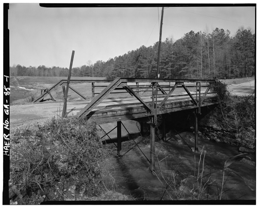
- Georgia DOT Bridge No. 151-00144-x-00055S, Spanning Little Cotton Indian Creek at Springdale Road (County Road 144), Stockbridgefederal building survey, 6 photographs
Population over time
2 figuresStockbridge grew from 25,636 to 28,973 between 2010 and 2020. These are the recorded population figures Wikidata holds for this place, reached through the Geographic Names Information System number this page is keyed on rather than by name, so they belong to this place and not to another of the same name. Most are census counts, but not all are: an early figure may be a founding or settlement estimate, and an estimate published within five years of a census is left out. The change column is computed, and is left blank where more than 20 years separate a figure from the one before it, because a gap that long is not a change between two counts.
| Year | People | Change |
|---|---|---|
| 2010 | 25,636 | |
| 2020 | 28,973 | +3,337 (+13%) |
Topographic sheets covering this place
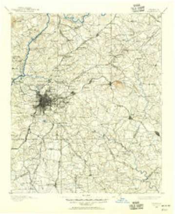
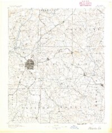
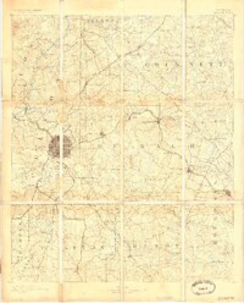
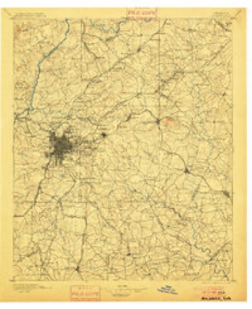
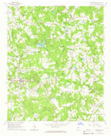
9 surveys from 18 printed sheetsMatched by testing this settlement's coordinate against the published boundary of every sheet in the United States Geological Survey's historical collection. Each opens the scanned sheet at the Survey.
- 1888 USGS Atlanta quadrangle1:125000
- 1890 USGS Atlanta quadrangle1:125000
- 1892 USGS Atlanta quadrangle1:125000
- 1895 USGS Atlanta quadrangle1:125000, 7 printings
- 1953 USGS Atlanta quadrangle1:250000, 2 printings
- 1957 USGS Atlanta quadrangle1:250000
- 1958 USGS Atlanta quadrangle1:250000
- 1964 USGS Stockbridge quadrangle1:24000, 3 printings
- 1981 USGS Atlanta quadrangle1:100000




Photographs
1 photograph,Taken for the Office of War Information and the Farm Security Administration, who photographed the country between 1935 and 1944. Works of United States government photographers, with no known restriction on use. Each opens its catalogue record.
Photographer not recorded. Library of Congress
Fires near this place
149 since 1992Regional context, not property-specific evidence. The federal wildfire occurrence database lists 149 fires within 5 miles of Stockbridge between 1992 and 2020, burning about 384 acres in total. 3 started naturally. 20 were recorded as arson. Distance is straight-line from the map coordinates, so a fire counted here may appear on a neighbouring settlement's page as well.
| Reported cause | Fires |
|---|---|
| Debris and open burning | 63 |
| Misuse of fire by a minor | 30 |
| Arson/incendiarism | 20 |
| Smoking | 10 |
| Missing data/not specified/undetermined | 7 |
| Recreation and ceremony | 7 |
| Railroad operations and maintenance | 6 |
| Natural | 3 |
| Equipment and vehicle use | 3 |
The most recent of them, most recent first, with the day each was reported and the service that recorded it.
| Date | Cause | Size | Reported by | Name on the report |
|---|---|---|---|---|
| 6 September 1997 | Misuse of fire by a minor | under an acre | Georgia Forestry Commission | not named |
| 23 September 1999 | Debris and open burning | under an acre | Georgia Forestry Commission | not named |
| 21 September 1999 | Railroad operations and maintenance | 2.1 acres | Georgia Forestry Commission | not named |
| 19 September 2011 | Debris and open burning | 3.9 acres | Georgia Forestry Commission | FY2012-HENRY-006 |
| 17 September 1999 | Debris and open burning | under an acre | Georgia Forestry Commission | not named |
| 17 September 1999 | Misuse of fire by a minor | under an acre | Georgia Forestry Commission | not named |
| 16 September 1999 | Debris and open burning | under an acre | Georgia Forestry Commission | not named |
| 15 September 1999 | Recreation and ceremony | 2.1 acres | Georgia Forestry Commission | not named |
Settlements close enough to share some of these fires:
Mines and quarries near this place
2 within 5 milesRegional context, not property-specific evidence. The federal mineral resources record lists 2 workings within 5 miles of Stockbridge: 1 producer, 1 past producer. 1 still produces. What was taken out: Stone, Crushed/Broken, Mica. Distance is straight-line from the map coordinates, so a quarry counted here may appear on a neighbouring settlement's page as well.
| Where | Site | Commodity | Status | Recorded |
|---|---|---|---|---|
| Maddox Mine | Mica | Past Producer | ||
| Stockbridge Quarry | Stone, Crushed/Broken | Producer |
Storms near this place
60 of 68 shownRegional context, not property-specific evidence. The National Weather Service names Stockbridge in 68 storm reports between 1994 and 2025: 35 thunderstorm wind, 28 hail, 2 tornado, 2 lightning. The reports record 1 injury. Each account below is quoted exactly as the forecast office filed it, from the NOAA Storm Events Database, and each date opens the federal record of that event.
| When | Event | Place named | Harm | What the report says |
|---|---|---|---|---|
| April 2011 | Thunderstorm Wind | Stockbridge | 1 hurt, $500,000 | The Henry County Emergency Management Director reported significant and widespread damage across the county from downed trees. Fourteen homes across the county were damaged from downed trees. At one of the affected homes, a person was trapped and injured. The person was later extricated and taken to a local medical facility. Seventy-five roads across the county were impacted by downed trees and power lines, including Interstate-75 near mile marker 216. |
| March 2013 | Hail | Stockbridge | $9,430,000 | Ham radio operators, spotters, and current and former National Weather Service employees reported golfball to baseball sized hail in Henry County in the first of two significant hailstorms to move through during the 6 PM hour. |
| September 2009 | Flood | Stockbridge | $250,000 | The Henry County 911 Center reported that significant flooding was occurring within the Pools Mobile Home Park in the northern portion of the county, five miles north of Stockbridge. Several familes were trapped in their homes because of rising flood waters. Minor flooding was reported on roads and many streams and creeks across the county were near or above bankfull. Monetary damage to roads and property was estimated to be $250,000. |
| January 2007 | Thunderstorm Wind | Stockbridge | $250,000 | A storm survey conducted by the National Weather Service Forecast Office in Peachtree City, GA confirmed straight-line winds, not a tornado, caused extensive damage from Stockbridge to McDonough. Numerous trees were blown down along Chambers-Jonesboro Road, Walnut Creek Drive, and Crossing Drive in Stockbridge and a deck was blown off a home. In McDonough near exit 222 on Interstate-75, three homes sustained major damage, and 25 homes sustained minor damage (mostly to roofs) from wind and downed trees. Most of the damaged homes were along Mount Olive Road, where three to four structures sustained major damage and 11 had minor damage. Another area of significant damage was in the Morgan Pond subdivision. Many trees were blown down throughout the area. A number of trees were down, topped, or twisted off on both sides of Interstate-75 four miles southeast of Stockbridge. |
| July 2005 | Thunderstorm Wind | Stockbridge | $150,000 | The public reported that many trees were down, several causing damage to homes, along Walt Stevens Road. Amateur radio operators also reported damage to several cars from fallen trees at a Golden Corral at the intersection of Interstate-75 and Georgia Highway 138. |
| December 2005 | Tornado (F0) | Stockbridge | $150,000 | A storm survey conducted by the National Weather Service and the Henry County Emergency Manager determined that an F0 tornado had touched down in extreme western Henry county near Interstate-75 just south of Georgia Highway 138. The tornado then traveled east-northeast through the Willow Spring Subdivision to near Old Atlanta Road. The tornado path was approximately 1.0 mile long and 100 yards wide. Numerous trees were snapped off or blown down throughout the area, some causing damage to homes in the area. In addition, one vehicle was damaged by a fallen tree. |
| July 2011 | Lightning | Stockbridge | $100,000 | FOX 5 Television of Atlanta reported that two lightning-related fires occurred almost simultaneously in Henry county during afternoon thunderstorms. A home in Stockbridge caught fire when lightning struck an adjacent tree. The current from the lightning apparently traveled from the tree through the nearby well pump to the house causing the fire. Significant structural damage was noted to the home as a result of the fire. |
| February 2009 | Thunderstorm Wind | Stockbridge | $50,000 | The Henry County Emergency Management Director reported that a roof was blown off a warehouse in McDonough. A few trees were also down, including one down on a house. |
| July 2003 | Thunderstorm Wind | Stockbridge | $25,000 | A trained storm spotter reported that a number of trees had been either blown down, uprooted, or twisted off near Georgia Highway 155 about two miles south of Georgia Highway 138. |
| July 2013 | Lightning | Stockbridge | $20,000 | The Henry County Emergency Manager reported that lightning started two house fires. The fires were quickly extinguished with little damage. |
| February 1997 | Thunderstorm Wind | Stockbridge | $20,000 | no account filed |
| June 2002 | Thunderstorm Wind | Stockbridge | $12,000 | The Henry county 911 center reported that numerous trees and power lines were blown down in Stockbridge and McDonough, with two trees down in Locust Grove. |
| February 2025 | Thunderstorm Wind | Stockbridge | $10,000 | Em reports numerous trees down in stockbridge area from i75 to ga23. |
| July 2016 | Thunderstorm Wind | Stockbridge | $8,000 | The Henry County 911 center reported multiple trees and power lines blown down between Stockbridge and McDonough. |
| April 2025 | Thunderstorm Wind | Stockbridge | $5,000 | Multiple trees downed on flippen road . |
| June 2013 | Thunderstorm Wind | Stockbridge | $5,000 | The Henry County Emergency Manager reported several trees and power lines down across Henry County, including six blocking roads. A sign was also damaged at the Atlanta Motor Speedway in Hampton. |
| May 2008 | Tornado (EF0) | Stockbridge | $5,000 | A storm survey conducted by the National Weather Service Forecast Office in Peachtree City, Georgia confirmed that the EF2 tornado, that first touched down in northeast Clayton county, northeast of Morrow, continued into Henry county, but weakened to an EF0. The tornado entered Henry county approximately four miles north of Stockbridge and continued on an east to east-southeastward track across northern Henry county and then into southern Rockdale county. The tornado entered Rockdale county approximately three miles north of Whitehouse or about four miles south-southeast of Panola Mountain State Park. Damage was confined to an intermittent path of tree and power line damage. No structural damage was reported within Henry county from this tornado. |
| May 1994 | Thunderstorm Wind | Stockbridge | $5,000 | Several large trees and power lines were downed on United States 23 between Stockbridge and McDonough from thunderstorm winds. |
| June 2001 | Thunderstorm Wind | Stockbridge | $4,000 | The public reported that seven large trees were blown down, mostly pine trees, but one was a tulip tree. One of the trees glanced off the side of the house as it fell and damaged the guttering. Another tree destroyed a fence as it fell. |
| December 2005 | Hail | Stockbridge | $3,000 | A number of reports of hail were received from the public. The hail size ranged from penny to half-dollar. The public reported damage to a car windshield in association with the half-dollar-sized hail. |
| May 2001 | Thunderstorm Wind | Stockbridge | $3,000 | The public reported several trees and large limbs down. |
| August 2023 | Thunderstorm Wind | Stockbridge | $2,000 | Emergency Manager reported a tree and powerlines down at Shields Rd and North Henry Blvd. Damage lines up with the outflow from the storm. |
| September 2007 | Thunderstorm Wind | Stockbridge | $2,000 | The public reported that at least seven large trees, some as large as two to three feet in diameter, were down in the Stockbridge area. One tree was down across Pinehurst Drive. Several street signs were also blown down in the area. |
| July 2000 | Thunderstorm Wind | Stockbridge | $2,000 | The public reported 5 trees down in the road. |
| August 2024 | Thunderstorm Wind | Stockbridge | $1,000 | Tree down on brookwater dr . |
| June 2023 | Thunderstorm Wind | Stockbridge | $1,000 | Tree down on power line near the intersection of Jodeco Way and Noahs Ark Rd. |
| June 2023 | Thunderstorm Wind | Stockbridge | $1,000 | Tree down on power line near the intersection of Jodeco Way and Noahs Ark Rd. |
| June 2023 | Thunderstorm Wind | Stockbridge | $1,000 | Tree down in the Oak Leaf Drive neighborhood. |
| July 2016 | Thunderstorm Wind | Stockbridge | $1,000 | The public reported trees and large limbs blown down off of Walt Stephens Road near the Clayton County line. |
| August 2014 | Thunderstorm Wind | Stockbridge | $1,000 | The Henry County 911 Center reported three to four trees down across northern Henry County. |
| February 2009 | Thunderstorm Wind | Stockbridge | $1,000 | An amateur radio operator reported that four to five trees were blown down in the far northern part of the county about two miles east-southeast of Ellenwood. |
| May 2007 | Thunderstorm Wind | Stockbridge | $1,000 | An amateur radio operator reported that a couple of trees were down on Interstate-75 at mile-marker 224 which briefly blocked a couple of lanes of traffic. He also reported that two to three trees were down in the Woodhaven Drive area of Stockbridge. |
| July 2007 | Thunderstorm Wind | Stockbridge | $1,000 | The public reported that four trees were blown down. |
| July 2001 | Thunderstorm Wind | Stockbridge | $1,000 | The Henry county 911 center reported that four trees were blown down. |
| July 1999 | Thunderstorm Wind | Stockbridge | $1,000 | Henry county 911 reported power lines blown down. |
| July 1998 | Thunderstorm Wind | Stockbridge | $1,000 | The public reported nickel size hail. Several trees were blown down and power outages were also reported. |
| June 1998 | Thunderstorm Wind | Stockbridge | $1,000 | A spotter reported a tree and 3 power poles were blown down. |
| June 1996 | Thunderstorm Wind | Stockbridge | $1,000 | no account filed |
| July 2002 | Thunderstorm Wind | Stockbridge | $500 | The Henry county 911 center reported that two trees were blown down. |
| May 1999 | Hail | Stockbridge | $500 | The public reported dime to quarter size hail. Also, shingles were blown off a home near Whitehouse. |
| April 2025 | Thunderstorm Wind | Stockbridge | - | Tree on home near Noahs Ark Rd and Jodeco Rd. |
| June 2023 | Thunderstorm Wind | Stockbridge | - | Power line down near the intersection of Flippen Rd and Chip Pl. |
| May 2009 | Hail | Stockbridge | - | The public observed penny-sized hail in extreme northeast Henry county, just north of Whitehouse near the intersection of Georgia Highway 138 and White Road. |
| April 2009 | Hail | Stockbridge | - | A storm spotter observed quarter-sized hail just west of Stockbridge, while the public observed quarter-sized hail for up to 10 minutes in the Stockbridge area. Nickel-sized hail was observed on Interstate-75 near Flippen and penny-sized hail was observed by the public in the McDonough area. |
| March 2008 | Hail | Stockbridge | - | The public observed yet another round of hail across northern Henry county. Half-dollar-sized hail was observed in the Stockbridge area. This thunderstorm took the same west-to-east path across the county as the previous storm. Once again, radar support this large or larger hail from Stockbridge in the west to Whitehouse on the east side of the county. |
| March 2008 | Hail | Stockbridge | - | The public observed quarter-sized hail in the Stockbridge area. |
| September 2007 | Hail | Stockbridge | - | The public reported penny-sized hail in the Stockbridge area. |
| January 2006 | Hail | Stockbridge | - | The public reported half-dollar-sized hail. |
| March 2005 | Hail | Stockbridge | - | The public reported quarter-sized hail. |
| March 2005 | Hail | Stockbridge | - | The public reported nickel-sized hail. |
| May 2003 | Hail | Stockbridge | - | The public reported penny-sized hail in Stockbridge and quarter-sized hail in Locust Grove. The hail lasted up to 10 minutes at one location in Locust Grove. |
| August 2003 | Hail | Stockbridge | - | The public reported quarter-sized hail. |
| May 2002 | Hail | Stockbridge | - | The public reported dime to nickel size hail. |
| July 2002 | Thunderstorm Wind | Stockbridge | - | The public reported pea size hail. |
| June 2001 | Hail | Stockbridge | - | The Henry County 911 center reported nickel size hail and a few tree limbs blown down. |
| May 1999 | Hail | Stockbridge | - | Ther were 2 public reports of golf ball size hail. |
| July 1998 | Hail | Stockbridge | - | Several public reports indicated dime to golf ball size hail fell in and around Stockbridge. |
| June 1998 | Hail | Stockbridge | - | The public reported nickel to quarter size hail. |
| July 1997 | Hail | Stockbridge | - | Dime to half dollar sized hail was reported. |
| February 1998 | Hail | Stockbridge | - | no account filed |
Nearest settlements
The eight closest, with where each one stands in the county. Distances are straight-line, computed from the Geographic Names Information System coordinates.
| Map | Place | Distance | Sheets |
|---|---|---|---|
| Parkwood | 0.3 miles | 18 | |
| Duval | 0.4 miles | 18 | |
| Club Drive | 0.7 miles | 18 | |
| Mahers (historical) | 0.7 miles | 18 | |
| Stockbridge North | 0.9 miles | 18 | |
| Ridgecrest | 0.9 miles | 18 | |
| Oakhill | 1.1 miles | 18 | |
| Fairlane | 1.2 miles | 21 |
Elsewhere
Matched on this settlement's Geographic Names Information System number rather than its name, so it cannot be a different place of the same name in another state.
| Wikipedia article on Stockbridge | An encyclopaedic summary. Its text is share-alike, so it is linked here rather than copied. |
| Wikidata item Q3260995 | The structured record the population and elevation above come from. Public domain (CC0). |
Provenance
This settlement is recorded in the Geographic Names Information System as feature 342357. The sheet list is computed by point-in-boundary test against the United States Geological Survey's historical topographic inventory. Both are works of the United States government and carry no copyright under 17 U.S.C. 105.
Wildfire. Short, Karen C. 2022. Spatial wildfire occurrence data for the United States, 1992-2020 [FPA_FOD_20221014]. 6th Edition. Fort Collins, CO: Forest Service Research Data Archive. https://doi.org/10.2737/RDS-2013-0009.6 Collected with United States Government funding and usable without additional permissions or fees.
Mines and quarries. USGS Mineral Resources Data System (MRDS) https://mrdata.usgs.gov/mrds/ A work of the United States government, no copyright under 17 U.S.C. 105.
Storms. NOAA National Centers for Environmental Information, Storm Events Database https://www.ncei.noaa.gov/stormevents/ A work of the United States government, no copyright under 17 U.S.C. 105. Narratives are quoted verbatim from the National Weather Service report and are not edited or summarised.