 Block
Teeterville, Georgia
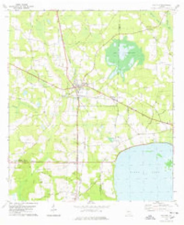
8 topographic sheets cover this place, the earliest surveyed in 1953 and the latest in 1988. It stands in the Lakeland census division. It lies in ZIP code area 31635. It stands on Fivemile Creek. The Survey maps it on the Ray City quadrangle.
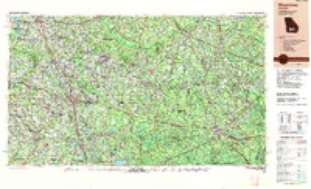
Topographic sheets covering this place
5 surveys from 8 printed sheetsMatched by testing this settlement's coordinate against the published boundary of every sheet in the United States Geological Survey's historical collection. Each opens the scanned sheet at the Survey.
- 1953 USGS Waycross quadrangle1:250000, 2 printings
- 1958 USGS Waycross quadrangle1:250000, 2 printings
- 1978 USGS Ray City quadrangle1:24000
- 1979 USGS Moultrie quadrangle1:100000, 2 printings
- 1988 USGS Waycross quadrangle1:250000
Fires near this place
481 since 1992Regional context, not property-specific evidence. The federal wildfire occurrence database lists 481 fires within 5 miles of Teeterville between 1992 and 2020, burning about 1,231 acres in total. 23 started naturally. 30 were recorded as arson. Distance is straight-line from the map coordinates, so a fire counted here may appear on a neighbouring settlement's page as well.
| Reported cause | Fires |
|---|---|
| Debris and open burning | 366 |
| Arson/incendiarism | 30 |
| Equipment and vehicle use | 29 |
| Natural | 23 |
| Misuse of fire by a minor | 12 |
| Smoking | 11 |
| Missing data/not specified/undetermined | 7 |
| Recreation and ceremony | 2 |
| Railroad operations and maintenance | 1 |
The most recent of them, most recent first, with the day each was reported and the service that recorded it.
| Date | Cause | Size | Reported by | Name on the report |
|---|---|---|---|---|
| 9 September 2003 | Arson/incendiarism | under an acre | Georgia Forestry Commission | not named |
| 9 September 2002 | Debris and open burning | 2.2 acres | Georgia Forestry Commission | FY2003-BERRIEN-011 |
| 9 September 1995 | Debris and open burning | 9.6 acres | Georgia Forestry Commission | not named |
| 8 September 1997 | Misuse of fire by a minor | under an acre | Georgia Forestry Commission | not named |
| 5 September 1996 | Equipment and vehicle use | under an acre | Georgia Forestry Commission | not named |
| 4 September 2003 | Debris and open burning | under an acre | Georgia Forestry Commission | not named |
| 3 September 2020 | Debris and open burning | 3.1 acres | Georgia Forestry Commission | FY2021BERRIEN003 |
| 26 September 2006 | Debris and open burning | 6.8 acres | Georgia Forestry Commission | not named |
Settlements close enough to share some of these fires:
Storms near this place
25 since 1995Regional context, not property-specific evidence. The National Weather Service names Teeterville in 25 storm reports between 1995 and 2024: 19 thunderstorm wind, 3 tornado, 2 flash flood, 1 hail. No death or injury is recorded in these reports. Each account below is quoted exactly as the forecast office filed it, from the NOAA Storm Events Database, and each date opens the federal record of that event.
| When | Event | Place named | Harm | What the report says |
|---|---|---|---|---|
| March 2012 | Tornado (EF3) | Teeterville | $500,000 | This is a continuation of the tornado that occurred in Lowndes county. This tornado strengthened to EF3 status while in Lanier county with maximum winds estimated around 140 mph. The tornado entered Lanier county along Highway 122 near Barber Road and then impacted a property just north of 122 along Boyette Road. As the tornado approached Boyette Road, it was likely reaching maximum intensity. Radar reflectivity showed a signature known as a debris ball and gave forecasters high confidence that a tornado was in progress, despite an actual tornado not having been reported yet. The damage at the aforementioned location was severe. A mobile home was completely destroyed with debris scattered for hundreds of yards in many directions. This site was originally unrecognizable as a mobile home to the survey team. A few trees at the location were almost totally debarked. A one story residence also had some roof and window damage, a small grain silo was completely destroyed, and a large shed structure was completely destroyed with debris swept well away from the original location. Other things were noted around this location. There were quite a few instances of objects driven into the ground, including metal bars, gutters, branches, and other debris. There was some ground scouring noted, and many of the shrubs were ripped out of their original spots. Large debris was lofted for hundreds of yards including what appeared to be a hatch door from the missing grain silo, a door off of a chest freezer, and a mower and propane tank. The main part of the chest freezer was found across the street. Near the location of the large shed structure that was swept away, an electric meter was ripped out of the ground, and additional deep gouges were found in the ground. The tornado continued to the east-northeast, cutting a clear path through some dense forest in the swampland to the south of Highway 122 and to the west of Banks Lake. Around that time, the damage path began to narrow as the tornado approached the town of Lakeland. Once in Lakeland, the tornado largely caused damage to trees and vegetation, although some structures were impacted. A mobile home was completely destroyed, a nearby full shipping container was rolled about 50 feet, and some debris was driven through metal. Near the end of the tornado path it impacted the hospital in Lakeland, pushing a trailer away from its original location and damaging the ambulance station. Some antennas were also snapped at the hospital, and some damage was reported to the AC units on the roof. Damage in Lanier county was estimated at around $500,000. |
| April 2020 | Tornado (EF0) | Teeterville | $50,000 | This is a continuation of the EF0 tornado that started in Berrien county. The tornado moved east out of Ray City and dissipated before reaching Lakeland. Straight line winds damage was observed however in Lanier County from U.S. Route 129 through parts of Lakeland to near the Clinch County line. Max winds were estimated near 80 mph. |
| April 2016 | Thunderstorm Wind | Teeterville | $50,000 | Trees were blown down along Royals Road along with structual damage to a mobile home. Damage was estimated. |
| April 2020 | Thunderstorm Wind | Teeterville | $25,000 | A tree was blown down onto a house on Thigpen Circle. |
| April 2020 | Thunderstorm Wind | Teeterville | $10,000 | Trees and power lines were blown down with light poles snapped. |
| October 1995 | Tornado (F1) | Teeterville | $10,000 | A tornado touched down in Teeterville causing minor damage to a church, destroying a chicken house, knocking down many large trees one of which totaled a car. (Length and width estimated.) |
| November 2011 | Thunderstorm Wind | Teeterville | $5,000 | A roof was blown off a barn along Bolling Road. Monetary damage was estimated. |
| May 2017 | Thunderstorm Wind | Teeterville | $2,000 | Damage occurred to privacy fences at 2 different properties in the area. A large trampoline was blown away and could not be found, and a sign was blown down. Damage cost was estimated. |
| March 2014 | Thunderstorm Wind | Teeterville | $1,000 | Trees were blown down on Teeterville Road. |
| November 2011 | Thunderstorm Wind | Teeterville | $1,000 | A tree was blown down across Highway 135N. Monetary damage was estimated. |
| January 2024 | Thunderstorm Wind | Teeterville | - | A tree was blown down across the road at 975 Teeterville Road. |
| April 2024 | Flash Flood | Teeterville | - | Flooding was reported on Highway 135 in both directions at Highway 64 with all lanes closed. |
| August 2022 | Thunderstorm Wind | Teeterville | - | A tree and power line were blown down on Boyette Road. |
| June 2022 | Thunderstorm Wind | Teeterville | - | A tree was reported down on Baskins Road near the Lanier-Berrien county line. |
| June 2022 | Flash Flood | Teeterville | - | Water was flowing over Highway 122 between mile markers 1 and 2. |
| April 2020 | Thunderstorm Wind | Teeterville | - | Trees and power lines were blown down near Royals Road and Lee Road. |
| April 2020 | Thunderstorm Wind | Teeterville | - | A tree was blown down on Ridge Road. |
| April 2020 | Thunderstorm Wind | Teeterville | - | A tree was blown down across the road. |
| April 2020 | Thunderstorm Wind | Teeterville | - | Tree were blown down at Highway 135 and Deerwood Road. |
| August 2015 | Thunderstorm Wind | Teeterville | - | Trees were blown down and blocked Giddens Lane. |
| July 2015 | Thunderstorm Wind | Teeterville | - | Three trees were blown down along Highway 135 North. |
| July 2015 | Thunderstorm Wind | Teeterville | - | Numerous trees were blown down across the county. |
| July 2015 | Thunderstorm Wind | Teeterville | - | A tree was blown down on Teeterville Highway. |
| May 2012 | Hail | Teeterville | - | Nickel size hail was reported between Ray City and Lakeland. |
| June 2009 | Thunderstorm Wind | Teeterville | - | Several trees were down. |
Nearest settlements
The eight closest, with where each one stands in the county. Distances are straight-line, computed from the Geographic Names Information System coordinates.
Provenance
This settlement is recorded in the Geographic Names Information System as feature 333200. The sheet list is computed by point-in-boundary test against the United States Geological Survey's historical topographic inventory. Both are works of the United States government and carry no copyright under 17 U.S.C. 105.
Wildfire. Short, Karen C. 2022. Spatial wildfire occurrence data for the United States, 1992-2020 [FPA_FOD_20221014]. 6th Edition. Fort Collins, CO: Forest Service Research Data Archive. https://doi.org/10.2737/RDS-2013-0009.6 Collected with United States Government funding and usable without additional permissions or fees.
Storms. NOAA National Centers for Environmental Information, Storm Events Database https://www.ncei.noaa.gov/stormevents/ A work of the United States government, no copyright under 17 U.S.C. 105. Narratives are quoted verbatim from the National Weather Service report and are not edited or summarised.