 Block
Temple, Georgia
15 topographic sheets cover this place, the earliest surveyed in 1889 and the latest in 1981. It stands in the Temple census division. It lies in ZIP code area 30179. It stands on Trestle Creek. The Survey maps it on the Temple quadrangle. 5,089 people lived here at the 2020 count. It stands 1,171 feet above sea level.
Population over time
2 figuresTemple grew from 4,228 to 5,089 between 2010 and 2020. These are the recorded population figures Wikidata holds for this place, reached through the Geographic Names Information System number this page is keyed on rather than by name, so they belong to this place and not to another of the same name. Most are census counts, but not all are: an early figure may be a founding or settlement estimate, and an estimate published within five years of a census is left out. The change column is computed, and is left blank where more than 20 years separate a figure from the one before it, because a gap that long is not a change between two counts.
| Year | People | Change |
|---|---|---|
| 2010 | 4,228 | |
| 2020 | 5,089 | +861 (+20%) |
Topographic sheets covering this place
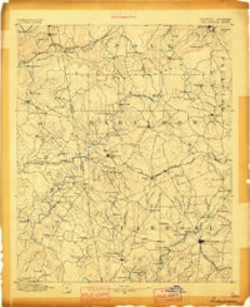
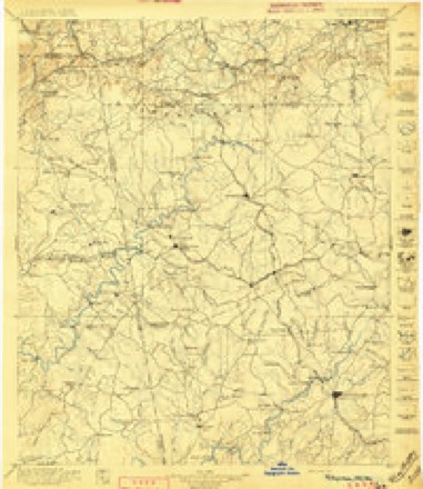
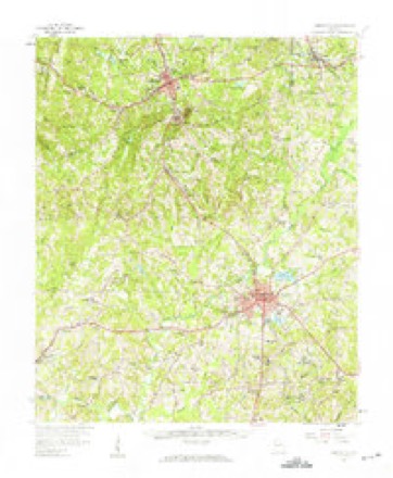
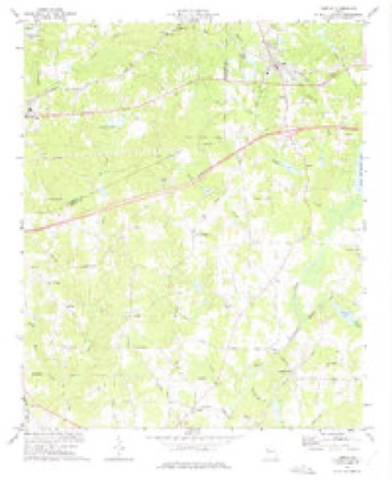
9 surveys from 15 printed sheetsMatched by testing this settlement's coordinate against the published boundary of every sheet in the United States Geological Survey's historical collection. Each opens the scanned sheet at the Survey.
- 1889 USGS Tallapoosa quadrangle1:125000
- 1892 USGS Tallapoosa quadrangle1:125000
- 1897 USGS Tallapoosa quadrangle1:125000, 4 printings
- 1953 USGS Atlanta quadrangle1:250000, 2 printings
- 1957 USGS Atlanta quadrangle1:250000
- 1958 USGS Atlanta quadrangle1:250000
- 1958 USGS Carrollton quadrangle1:62500
- 1973 USGS Temple quadrangle1:24000, 2 printings
- 1981 USGS Anniston quadrangle1:100000, 2 printings




Fires near this place
274 since 1992Regional context, not property-specific evidence. The federal wildfire occurrence database lists 274 fires within 5 miles of Temple between 1992 and 2020, burning about 836 acres in total. 3 started naturally. 89 were recorded as arson. Distance is straight-line from the map coordinates, so a fire counted here may appear on a neighbouring settlement's page as well.
| Reported cause | Fires |
|---|---|
| Debris and open burning | 121 |
| Arson/incendiarism | 89 |
| Misuse of fire by a minor | 18 |
| Equipment and vehicle use | 12 |
| Recreation and ceremony | 12 |
| Missing data/not specified/undetermined | 12 |
| Railroad operations and maintenance | 4 |
| Natural | 3 |
| Smoking | 3 |
The most recent of them, most recent first, with the day each was reported and the service that recorded it.
| Date | Cause | Size | Reported by | Name on the report |
|---|---|---|---|---|
| 9 September 2010 | Debris and open burning | under an acre | Georgia Forestry Commission | FY2011-HARALSON-007 |
| 9 September 2005 | Arson/incendiarism | under an acre | Georgia Forestry Commission | not named |
| 6 September 1999 | Arson/incendiarism | 1.5 acres | Georgia Forestry Commission | not named |
| 6 September 1999 | Misuse of fire by a minor | 1.0 acres | Georgia Forestry Commission | not named |
| 4 September 1999 | Debris and open burning | 1.0 acres | Georgia Forestry Commission | not named |
| 24 September 1993 | Debris and open burning | under an acre | Georgia Forestry Commission | not named |
| 22 September 1993 | Debris and open burning | under an acre | Georgia Forestry Commission | not named |
| 21 September 2010 | Debris and open burning | 1.8 acres | Georgia Forestry Commission | FY2011-HARALSON-019 |
Settlements close enough to share some of these fires:
Mines and quarries near this place
10 of 14 shownRegional context, not property-specific evidence. The federal mineral resources record lists 14 workings within 5 miles of Temple: 8 occurrences, 3 prospects, 3 past producers. None of them still produces. What was taken out: Gold, Sulfur, Manganese, Iron-Pyrite. Distance is straight-line from the map coordinates, so a quarry counted here may appear on a neighbouring settlement's page as well.
| Where | Site | Commodity | Status | Recorded |
|---|---|---|---|---|
| Treadway Prospect | Mica | Prospect | ||
| A. C. Watkins Prospect | Iron-Pyrite, Gold | Occurrence | Pyrite | |
| Lasseter Prospect | Iron-Pyrite | Past Producer | Pyrite | |
| W.M. Raburn Property | Manganese | Occurrence | 1919 | |
| Westbrook Property | Manganese | Occurrence | 1919 | |
| Ada Mrs W M Raburn Prospect | Sulfur | Occurrence | ||
| J Humphrey Prospect | Sulfur | Occurrence | ||
| W M Raburn Prospect | Sulfur | Occurrence | ||
| W T Raburn Prospect | Sulfur | Occurrence | ||
| Hart | Gold | Prospect | Vein |
Storms near this place
28 since 1994Regional context, not property-specific evidence. The National Weather Service names Temple in 28 storm reports between 1994 and 2026: 15 thunderstorm wind, 11 hail, 1 flash flood, 1 tornado. The reports record 1 death. Each account below is quoted exactly as the forecast office filed it, from the NOAA Storm Events Database, and each date opens the federal record of that event.
| When | Event | Place named | Harm | What the report says |
|---|---|---|---|---|
| September 2009 | Flash Flood | Temple | 1 killed, $1,330,000 | The Atlanta Journal-Constitution reported that flash floods in Carroll county took the life of a 2-year old boy. The mobile home of a family of four was swept away by flood waters from Snake Creek. The childs's body was found almost a mile away from where the trailer home was originally anchored. The mobile home was located in a trailer park near Snake Creek, which was observed to have been nearly 20 feet deep. Local law enforcement officials note that the creek is normally only at a depth of two to three feet. It took nearly four hours to rescue the three other residents of the home, a man, wife, and 1-year old boy, which were found clinging to trees several yards downstream. This initial flash flood marked the beginning of a period of historical and record flash flooding across several west central Georgia counties. Flood damage during this initial time frame was estimated to be in excess of $1.3 million. |
| March 2008 | Hail | Temple | $1,500,000 | An amateur radio operator in Villa Rica observed tennis ball to baseball-sized hail. Several other reports of golf ball-sized hail were received from the public across far northern Carroll county, especially in the Villa Rica area. |
| April 2006 | Hail | Temple | $600,000 | A thunderstorm moved across much of eastern Carroll county producing large hail. The Carroll County Emergency Management Director reported nickel-sized hail in the Temple area, the public reported quarter-sized hail in the Carrollton area, and the Emergency Management Director reported tennis ball-sized hail in the Whitesburg area and the public reported tennis ball-sized hail along Georgia Highway 16 between Whitesburg and Carrollton. |
| November 2004 | Thunderstorm Wind | Temple | $150,000 | The Carroll County Emergency Management Director reported extensive damage to trees in the Temple area. More than 25 large trees were blown down in the area. Three homes, two vehicles, and at least fifteen power lines sustained damage from downed trees. In addition, a commercial barn was damaged when the tin roof was ripped off the structure from the high winds. One road was also temporarily blocked from a downed tree. One resident in the area reported observing a tornado in the area. The Emergency Management Director noted that several trees were twisted off about 30 feet above the ground in this area, however there was no actual confirmation of a tornado in the area. |
| March 2026 | Thunderstorm Wind | Temple | $11,000 | Em reports tree down on home and outbuilding at 50 block of enterprise dr in temple ga. |
| July 2024 | Thunderstorm Wind | Temple | $3,000 | Three trees reported down on roadways in Temple City Limits. |
| February 2025 | Thunderstorm Wind | Temple | $2,000 | Tree and powerline down on southside of Temple near I20 on ramp. |
| March 2025 | Thunderstorm Wind | Temple | $1,000 | Multiple trees down near the intersection of hwy 113 and hwy 78. |
| May 2025 | Thunderstorm Wind | Temple | $1,000 | Tree down at sourwood lane and w hwy 78 . |
| April 2025 | Thunderstorm Wind | Temple | $1,000 | Report of a power line down on spiva rd near hwy 113. |
| August 2023 | Thunderstorm Wind | Temple | $1,000 | Tree down on a house along Lakeview Drive . |
| August 2023 | Thunderstorm Wind | Temple | $1,000 | Tree and powerlines down along Rainey Rd . |
| July 2003 | Thunderstorm Wind | Temple | $1,000 | The Carroll county Emergency Management Director reported that a few trees were blown down from Temple, to Mount Zion, to Bowdon. |
| July 1995 | Thunderstorm Wind | Temple | $1,000 | Thunderstorm winds knocked down several trees in the Venerable Road and Centerpoint Road Area. |
| May 2013 | Thunderstorm Wind | Temple | $500 | The Carroll County Emergency Manager reported a couple of trees down. Pea sized hail was also reported. |
| May 1999 | Thunderstorm Wind | Temple | $500 | The public reported thunderstorm winds took tree tops off and partially knocked a chain link fence down. |
| April 2025 | Hail | Temple | - | Public caller reported hail ranging from the size of a pea to the size of a quarter near the intersection of chrissy dr and kenny ln with hail falling for 15 minutes. |
| August 2023 | Thunderstorm Wind | Temple | - | A power pole was blown over onto a restaurant and multiple trees were downed onto power lines at the intersection of Rome St and hwy 113. |
| June 2022 | Thunderstorm Wind | Temple | - | Report of a tree on home near intersection of Center Point Rd and Oak Grove Rd. |
| December 2021 | Tornado (EF1) | Temple | - | A tornado from a rare LP supercell touched down near US-|78 between Temple and Villa Rica in far northern Carroll County|during the late afternoon/early evening hours of New Year's Eve.|Initially, several trees were noted snapped or uprooted between|Wilton Smith Road to Old Villa Rica Road. As the tornado moved|northeast, it appeared to strengthen as more numerous trees were|seen either uprooted or snapped along Long Branch Road and across|Cown Road. The number of large pines uprooted along Long Branch|Road supports an EF-1 rating here with max winds around 90 mph.|On the east side of Long Branch Road and just before Cown Road, a|barn was ripped apart along with a carport seen detached from a|well-built manufactured home that remained intact. This along|with the surrounding tree damage supported 95 mph max winds|(still an EF-1 rating). As the tornado crossed Cown Road and then|Astin Creek Road, additional large pines were snapped or|uprooted. A home sustained roof damage due to a falling tree and|a medium-sized shed was rolled up on the side of the house about|20 yards from its original location. A few more trees were seen|snapped or uprooted along N Van Wert Road, just south of Wert|Road where the tornado appeared to weaken and eventually lift|just past this location as no notable damage was reported or|seen. [12/31/21: Tornado #1, County #1/1, EF-1, Carroll, 2021:27]. |
| April 2011 | Hail | Temple | - | The Carroll County 911 Center reported penny-sized hail near Villa Rica. WSR-88D suggested that similar-sized hail likely fell from the Haralson county line, just north of Abilene to Villa Rica. |
| March 2010 | Hail | Temple | - | The public observed penny-sized hail near Temple. |
| June 2007 | Hail | Temple | - | The public reported half-dollar-sized hail in Temple for up to 10 minutes. The Temple Fire Department observed quarter-sized hail two miles east of Temple. |
| December 2005 | Hail | Temple | - | An amateur radio operator reported nickel-sized hail just north of Temple and several reports of nickel to quarter-sized hail were received from the public in Villa Rica. |
| May 1999 | Hail | Temple | - | The public reported quarter size hail and the Carroll county EMA ofice reported golf ball size hail. |
| May 1999 | Hail | Temple | - | The public and Carroll county 911 reported dime size to golf ball size hail. |
| May 1999 | Hail | Temple | - | The public reported nickel, dime and golfball size hail. |
| June 1994 | Hail | Temple | - | no account filed |
Nearest settlements
The eight closest, with where each one stands in the county. Distances are straight-line, computed from the Geographic Names Information System coordinates.
| Map | Place | Distance | Sheets |
|---|---|---|---|
| Hart Town | 3.8 miles | 17 | |
| Driskolls | 3.8 miles | 17 | |
| Chestnut Hill (historical) | 4.2 miles | 17 | |
| Paradise Estates | 4.4 miles | 17 | |
| Rolling View Estates | 4.8 miles | 16 | |
| Old Villa Rica | 5.5 miles | 17 | |
| Ithaca | 5.9 miles | 17 | |
| Villa Rica | 6.0 miles | 17 |
Elsewhere
Matched on this settlement's Geographic Names Information System number rather than its name, so it cannot be a different place of the same name in another state.
| Wikipedia article on Temple | An encyclopaedic summary. Its text is share-alike, so it is linked here rather than copied. |
| Wikidata item Q2854437 | The structured record the population and elevation above come from. Public domain (CC0). |
Provenance
This settlement is recorded in the Geographic Names Information System as feature 333205. The sheet list is computed by point-in-boundary test against the United States Geological Survey's historical topographic inventory. Both are works of the United States government and carry no copyright under 17 U.S.C. 105.
Wildfire. Short, Karen C. 2022. Spatial wildfire occurrence data for the United States, 1992-2020 [FPA_FOD_20221014]. 6th Edition. Fort Collins, CO: Forest Service Research Data Archive. https://doi.org/10.2737/RDS-2013-0009.6 Collected with United States Government funding and usable without additional permissions or fees.
Mines and quarries. USGS Mineral Resources Data System (MRDS) https://mrdata.usgs.gov/mrds/ A work of the United States government, no copyright under 17 U.S.C. 105.
Storms. NOAA National Centers for Environmental Information, Storm Events Database https://www.ncei.noaa.gov/stormevents/ A work of the United States government, no copyright under 17 U.S.C. 105. Narratives are quoted verbatim from the National Weather Service report and are not edited or summarised.