 Block
Thomson, Georgia
10 topographic sheets cover this place, the earliest surveyed in 1953 and the latest in 1988. It stands in the Thomson census division. It lies in ZIP code area 30824. The Survey maps it on the Thomson West quadrangle. 6,814 people lived here at the 2020 count. It stands 531 feet above sea level.
Research this city
On record in Thomson
Buildings and businesses the archive holds for this place. Each opens its own page, with the source record it came from.
On the National Register 12 records
 Hickory HillNational Historic Landmark · listed 1979
 Thomas E. Watson HouseNational Historic Landmark · listed 1976
 James L. Hardaway Houselisted 1993
 Old Rock Houselisted 1970
 Usry Houselisted 1974
- Thomas Carr Districtlisted 1975
- Hayes Line Historic Districtlisted 2000
- Hillman-Bowden Houselisted 2002
- McNeill Houselisted 1992
- Pine Top Farmlisted 1996
- Sweetwater Innlisted 1985
- Thomson Commercial Historic Districtlisted 2025
Surveyed buildings and structures 1 record
- Old Rock House, Stephen Hunter Road, Thomsonfederal building survey, 1 photograph
Population over time
2 figuresThomson grew from 6,778 to 6,814 between 2010 and 2020. These are the recorded population figures Wikidata holds for this place, reached through the Geographic Names Information System number this page is keyed on rather than by name, so they belong to this place and not to another of the same name. Most are census counts, but not all are: an early figure may be a founding or settlement estimate, and an estimate published within five years of a census is left out. The change column is computed, and is left blank where more than 20 years separate a figure from the one before it, because a gap that long is not a change between two counts.
| Year | People | Change |
|---|---|---|
| 2010 | 6,778 | |
| 2020 | 6,814 | +36 (+1%) |
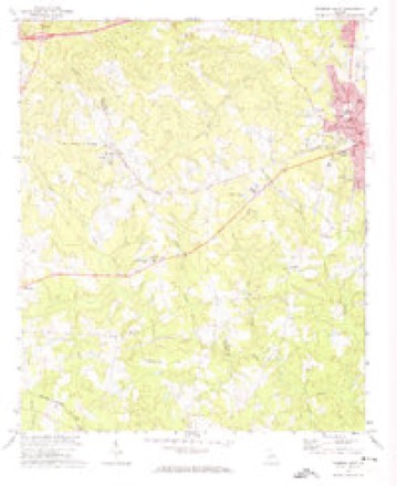
Topographic sheets covering this place
7 surveys from 10 printed sheetsMatched by testing this settlement's coordinate against the published boundary of every sheet in the United States Geological Survey's historical collection. Each opens the scanned sheet at the Survey.
- 1953 USGS Athens quadrangle1:250000, 3 printings
- 1958 USGS Athens quadrangle1:250000
- 1959 USGS Athens quadrangle1:250000
- 1963 USGS Athens quadrangle1:250000
- 1972 USGS Thomson West quadrangle1:24000, 2 printings
- 1981 USGS Thomson quadrangle1:100000
- 1988 USGS Athens quadrangle1:250000
Photographs
1 photograph,Taken for the Office of War Information and the Farm Security Administration, who photographed the country between 1935 and 1944. Works of United States government photographers, with no known restriction on use. Each opens its catalogue record.
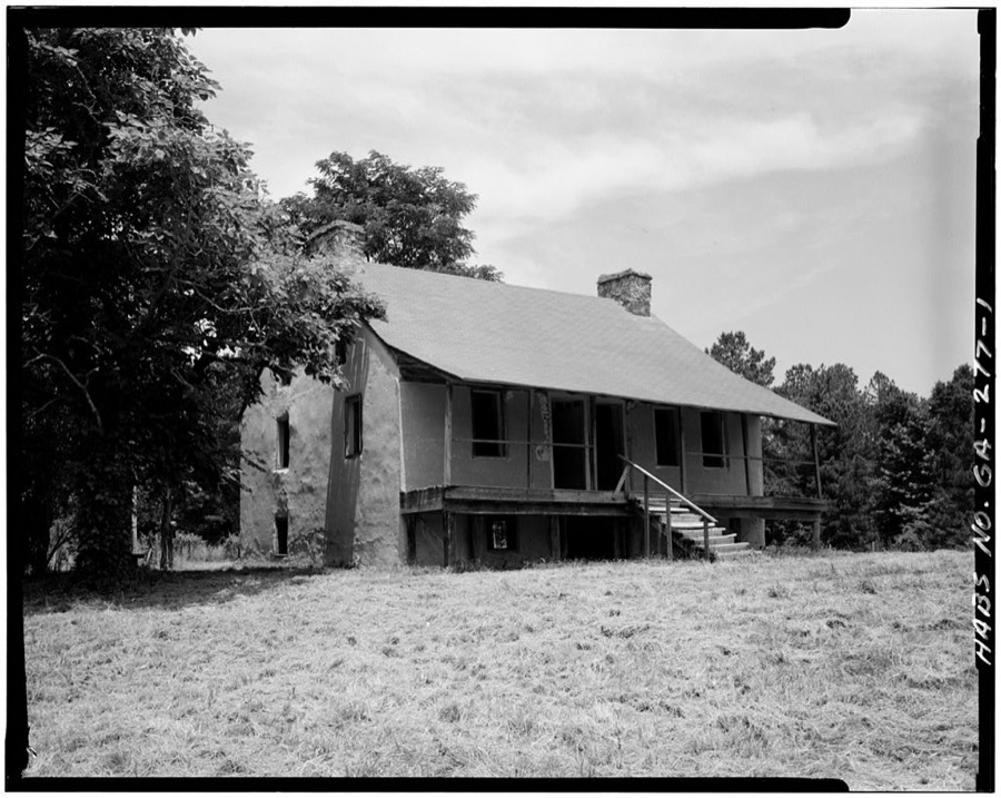
Photographer not recorded. Library of Congress
Fires near this place
493 since 1992Regional context, not property-specific evidence. The federal wildfire occurrence database lists 493 fires within 5 miles of Thomson between 1992 and 2020, burning about 854 acres in total. 14 started naturally. 39 were recorded as arson. Distance is straight-line from the map coordinates, so a fire counted here may appear on a neighbouring settlement's page as well.
| Reported cause | Fires |
|---|---|
| Debris and open burning | 287 |
| Smoking | 64 |
| Arson/incendiarism | 39 |
| Missing data/not specified/undetermined | 33 |
| Equipment and vehicle use | 27 |
| Misuse of fire by a minor | 19 |
| Natural | 14 |
| Recreation and ceremony | 8 |
| Railroad operations and maintenance | 2 |
The most recent of them, most recent first, with the day each was reported and the service that recorded it.
| Date | Cause | Size | Reported by | Name on the report |
|---|---|---|---|---|
| 9 September 1999 | Natural | 4.4 acres | Georgia Forestry Commission | not named |
| 8 September 2010 | Arson/incendiarism | under an acre | Georgia Forestry Commission | FY2011-MCDUFFIE-004 |
| 8 September 2010 | Arson/incendiarism | under an acre | Georgia Forestry Commission | FY2011-MCDUFFIE-005 |
| 8 September 1999 | Debris and open burning | under an acre | Georgia Forestry Commission | not named |
| 6 September 1999 | Debris and open burning | under an acre | Georgia Forestry Commission | not named |
| 6 September 1993 | Natural | under an acre | Georgia Forestry Commission | not named |
| 4 September 1999 | Misuse of fire by a minor | under an acre | Georgia Forestry Commission | not named |
| 30 September 2007 | Smoking | under an acre | Georgia Forestry Commission | not named |
Settlements close enough to share some of these fires:
Mines and quarries near this place
1 within 5 milesRegional context, not property-specific evidence. The federal mineral resources record lists 1 working within 5 miles of Thomson: 1 occurrence. None of them still produces. What was taken out: Sand and Gravel, Construction. Distance is straight-line from the map coordinates, so a quarry counted here may appear on a neighbouring settlement's page as well.
| Where | Site | Commodity | Status | Recorded |
|---|---|---|---|---|
| May's Pit | Sand and Gravel, Construction | Occurrence | Sedimentary |
Storms near this place
60 of 72 shownRegional context, not property-specific evidence. The National Weather Service names Thomson in 72 storm reports between 1995 and 2026: 41 thunderstorm wind, 25 hail, 3 tornado, 2 lightning. The reports record 1 injury. Each account below is quoted exactly as the forecast office filed it, from the NOAA Storm Events Database, and each date opens the federal record of that event.
| When | Event | Place named | Harm | What the report says |
|---|---|---|---|---|
| July 1997 | Lightning | Thomson | 1 hurt, $8,000 | Lightning struck a home and caused minor injuries to one occupant. |
| April 1997 | Thunderstorm Wind | Thomson | $2,750,000 | no account filed |
| May 1995 | Thunderstorm Wind | Thomson | $25,000 | Thunderstorm winds pulled a tin roof off of a Mr. Muffler and also knocked down several large tree limbs. |
| April 2011 | Thunderstorm Wind | Thomson | $24,000 | Sheriff reported numerous trees and powerlines down across McDuffie County. |
| July 2010 | Thunderstorm Wind | Thomson | $24,000 | Sheriff reported trees down in Thomson, one was on a car that did moderate damage to it. |
| June 2011 | Thunderstorm Wind | Thomson | $18,000 | Sheriff reported trees and powerlines down county wide. |
| July 2012 | Hail | Thomson | $15,000 | Half dollar size hail shredded leaves and left several dents on cars. |
| October 2011 | Thunderstorm Wind | Thomson | $15,000 | WRDW reported a tree down on a mobile home near Thomson. |
| May 2002 | Thunderstorm Wind | Thomson | $12,000 | Sheriff reported trees down on cars. |
| January 2000 | Thunderstorm Wind | Thomson | $12,000 | Sheriff reported a few trees down in Raysville. One fell on a car and totalled it. |
| July 2012 | Hail | Thomson | $10,000 | Public reported half dollar size hail partially covering the ground. |
| September 2008 | Flash Flood | Thomson | $10,000 | DOT reported secondary dirt roads washed out from flash flooding that will have to be re-excavated. |
| June 2010 | Thunderstorm Wind | Thomson | $8,000 | Sheriff reported trees down on Wrightsboro road and Harrison road. |
| June 2015 | Thunderstorm Wind | Thomson | $4,000 | Sheriff reported several trees down and 1 inch hail. |
| November 2010 | Thunderstorm Wind | Thomson | $4,000 | Sheriff reported trees and powerlines down on Central road. |
| June 2011 | Thunderstorm Wind | Thomson | $2,000 | Sheriff reported a couple of trees down along Mt. Pleasant Road in Thomson. |
| June 2011 | Thunderstorm Wind | Thomson | $2,000 | WRDW reported several trees down in Thomson. |
| March 2023 | Hail | Thomson | $100 | McDuffie Co EM reported hail, smaller than dime size, at the EM office in Thomson. |
| March 2026 | Thunderstorm Wind | Thomson | - | McDuffie County dispatch reported numerous trees and several power lines down throughout the county. |
| March 2025 | Thunderstorm Wind | Thomson | - | McDuffie County dispatch reported trees down on Cobbham Road. |
| May 2024 | Thunderstorm Wind | Thomson | - | Pictures and video show tree damage including a downed tree at this location due to strong winds. Time estimated by radar. |
| January 2023 | Tornado (EF1) | Thomson | - | A National Weather Service survey team confirmed a tornado touched down in Warren County GA (see Storm Data, Georgia, North and Central) where it produced EF-1 damage. The tornado continued moving to the NE and crossed into McDuffie County GA. While in McDuffie Co, the tornado also produced EF-1 damage,|with peak winds of 110 mph. The tornado dissipated west of Thomson in western McDuffie Co. The total tornado path was 16.42 miles, with about 14.4 miles in Warren Co and 2.02 miles in McDuffie Co. ||Just prior to crossing into McDuffie Co, the tornado strengthened to EF-1 intensity as it approached Mesena Road and continued northeast across the county line to Foster Sprouse Road. In this area, a couple of homes had roof and fascia damage, a metal work shed and outdoor kitchen were destroyed, and a swath of large and healthy pine trees were snapped and uprooted. As the tornado crossed Foster Sprouse Road, it continued to snap and uproot trees, one of which fell on a house. The tornado then weakened as it crossed Union Church Road and dissipated before reaching West Bypass. |
| July 2023 | Thunderstorm Wind | Thomson | - | A tree was downed on Johnson Ave near Ansley Dr in Thomson. Time estimated. |
| July 2023 | Thunderstorm Wind | Thomson | - | A tree was downed on Central Rd in Thomson. Exact location not given. Time estimated. |
| July 2023 | Thunderstorm Wind | Thomson | - | A tree was downed on Old Milledgeville Rd and Mt Pleasant Rd, SW of Thomson. Time estimated. |
| July 2022 | Thunderstorm Wind | Thomson | - | Emergency Manager reported damage to a fireworks trailer and shopping cart corral in the parking lot of a Walmart in Thomson. Public reports relayed from local media also indicate some roof damage to the store. About a half mile north on Old Washington Rd, a metal equipment canopy was heavily damaged with the roof torn off and several metal beams bent. |
| January 2020 | Thunderstorm Wind | Thomson | - | Reports of trees and power lines down throughout McDuffie Co GA. Times estimated. Exact locations unknown. |
| March 2018 | Thunderstorm Wind | Thomson | - | Highway Dept reported a tree down near the intersection of Warrenton Hwy and Plyant Crossing Rd. |
| March 2017 | Thunderstorm Wind | Thomson | - | Thunderstorm wind gusts downed two trees into a yard. |
| July 2016 | Thunderstorm Wind | Thomson | - | Dispatch reported trees down on power lines on Michael Street in Thomson. |
| July 2016 | Hail | Thomson | - | Public and the 911 Call Center reported pea to nickel size hail around the town of Thomson. |
| July 2016 | Thunderstorm Wind | Thomson | - | Tree down on a power line in Thompson. |
| July 2016 | Thunderstorm Wind | Thomson | - | McDuffie County dispatch reported power lines down on Dogwood Dr at Magnolia Dr in Thompson. |
| June 2015 | Hail | Thomson | - | Sheriff reported 1 inch hail on the south side of Thomson. |
| May 2013 | Hail | Thomson | - | Sheriff reported nickel to quarter size hail in the Thomson area. |
| June 2011 | Thunderstorm Wind | Thomson | - | Highway reported trees down in southeast McDuffie County. |
| June 2011 | Hail | Thomson | - | WRDW reported nickel size hail in Thomson. |
| July 2007 | Thunderstorm Wind | Thomson | - | Sheriff reported trees down on hwy 17S. |
| March 2007 | Thunderstorm Wind | Thomson | - | Sheriff reported many trees down across the northern portions of the county. |
| June 2007 | Hail | Thomson | - | SKYWARN spotter reported 3/4 inch hail. |
| June 2007 | Thunderstorm Wind | Thomson | - | SKYWARN spotter reported large limbs down in Thomson. |
| March 2007 | Tornado (EF2) | Thomson | - | An EF2 started in Warren county and moved through McDuffie county taking down numerous trees and powerlines. The twister moved along hwy 278 to Thomson then along hwy 150 to I-20. Several vehicles were totaled and many homes and a private school had moderate damage. Ground survey found a damage path of 9 miles in McDuffie county but an areal survey found the total length to be 15 miles. There were no injuries or deaths. |
| April 2006 | Hail | Thomson | - | Sheriff reported nickel size hail on hwy 150. |
| April 2006 | Hail | Thomson | - | Post Office employee reported nickel size hail |
| June 2006 | Lightning | Thomson | - | Lightning ingnited a home fire. Damage estimates were not available. |
| January 2005 | Tornado (F0) | Thomson | - | Storm Survey found an F0 broke trees in half at the intersection of I-20 and White Oak road. |
| February 2005 | Hail | Thomson | - | SKYWARN spotter and Sheriff reported 1 inch hail. |
| January 2005 | Hail | Thomson | - | WAGT weather sporter reported 3/4 inch hail just southeast of Thomson. |
| March 2005 | Hail | Thomson | - | Park service reported 3/4 inch hail while areas near Raysville Marina had 1/2 inch hail. |
| June 2004 | Thunderstorm Wind | Thomson | - | Sheriff reported several trees and powerlines down in and around Thomson. |
| November 2004 | Thunderstorm Wind | Thomson | - | Post Office reports trees and powerlines down in Raysville. |
| November 2003 | Thunderstorm Wind | Thomson | - | Highway dept reported trees down. |
| May 2003 | Hail | Thomson | - | Sheriff reported 3/4 inch hail in and around Thomson. |
| May 2003 | Thunderstorm Wind | Thomson | - | Sheriff reported trees down in Thomson on Quail road. |
| July 2003 | Hail | Thomson | - | Sheriff reported 3/4 inch hail. |
| March 2002 | Hail | Thomson | - | Post Office reported 1 inch hail in Thomson. |
| May 2002 | Hail | Thomson | - | Emergency manager reported 3/4 inch hail northwest of Thomson. |
| May 2002 | Hail | Thomson | - | Highway Patrol reported dime size hail in Thomson. |
| May 2002 | Hail | Thomson | - | Postal employee reported nickel size hail in Thomson. |
| May 2002 | Hail | Thomson | - | Postal employee reported quarter size hail. |
Nearest settlements
The eight closest, with where each one stands in the county. Distances are straight-line, computed from the Geographic Names Information System coordinates.
| Map | Place | Distance | Sheets |
|---|---|---|---|
| Scuffletown | 4.2 miles | 20 | |
| Boneville | 4.3 miles | 15 | |
| Three Points | 4.9 miles | 14 | |
| Stones Crossroads | 5.2 miles | 20 | |
| Ansley Mill | 5.9 miles | 20 | |
| Wrightsboro | 6.5 miles | 14 | |
| Hamilton Crossroads | 6.6 miles | 20 | |
| Cobbham Crossroads | 6.7 miles | 20 |
Elsewhere
Matched on this settlement's Geographic Names Information System number rather than its name, so it cannot be a different place of the same name in another state.
| Wikipedia article on Thomson | An encyclopaedic summary. Its text is share-alike, so it is linked here rather than copied. |
| Wikidata item Q2784008 | The structured record the population and elevation above come from. Public domain (CC0). |
Provenance
This settlement is recorded in the Geographic Names Information System as feature 356589. The sheet list is computed by point-in-boundary test against the United States Geological Survey's historical topographic inventory. Both are works of the United States government and carry no copyright under 17 U.S.C. 105.
Wildfire. Short, Karen C. 2022. Spatial wildfire occurrence data for the United States, 1992-2020 [FPA_FOD_20221014]. 6th Edition. Fort Collins, CO: Forest Service Research Data Archive. https://doi.org/10.2737/RDS-2013-0009.6 Collected with United States Government funding and usable without additional permissions or fees.
Mines and quarries. USGS Mineral Resources Data System (MRDS) https://mrdata.usgs.gov/mrds/ A work of the United States government, no copyright under 17 U.S.C. 105.
Storms. NOAA National Centers for Environmental Information, Storm Events Database https://www.ncei.noaa.gov/stormevents/ A work of the United States government, no copyright under 17 U.S.C. 105. Narratives are quoted verbatim from the National Weather Service report and are not edited or summarised.