 Block
Tifton, Georgia
9 topographic sheets cover this place, the earliest surveyed in 1953 and the latest in 1988. It stands in the Tifton census division. It lies in ZIP code area 31794. The Survey maps it on the Tifton West quadrangle. 17,045 people lived here at the 2020 count. It stands 354 feet above sea level.
Research this city
On record in Tifton
Buildings and businesses the archive holds for this place. Each opens its own page, with the source record it came from.
On the National Register 4 records
 Tift County Courthouselisted 1980
 Tifton Commercial Historic Districtlisted 1986
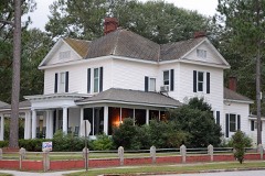 Tifton Residential Historic Districtlisted 2008
- Tifton Commercial Historic District (Boundary Increase)listed 1994
Surveyed buildings and structures 1 record
- Tifton Bridge, U.S. Route 82/State Route 50 over Seaboard Coastline Railroad, Tiftonfederal building survey, 9 photographs
Topographic sheets covering this place
5 surveys from 9 printed sheetsMatched by testing this settlement's coordinate against the published boundary of every sheet in the United States Geological Survey's historical collection. Each opens the scanned sheet at the Survey.
- 1953 USGS Waycross quadrangle1:250000, 2 printings
- 1958 USGS Waycross quadrangle1:250000, 2 printings
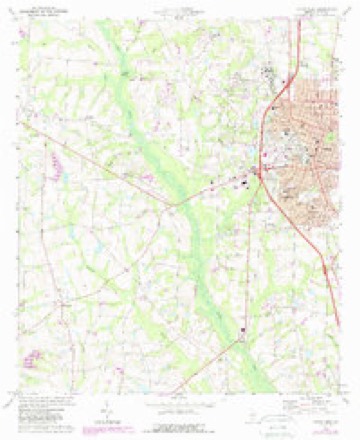
- 1973 USGS Tifton West quadrangle1:24000, 2 printings
- 1979 USGS Moultrie quadrangle1:100000, 2 printings
- 1988 USGS Waycross quadrangle1:250000
Photographs
8 of 24 photographs shown, 1938 to 1977Taken for the Office of War Information and the Farm Security Administration, who photographed the country between 1935 and 1944. Works of United States government photographers, with no known restriction on use. Each opens its catalogue record.
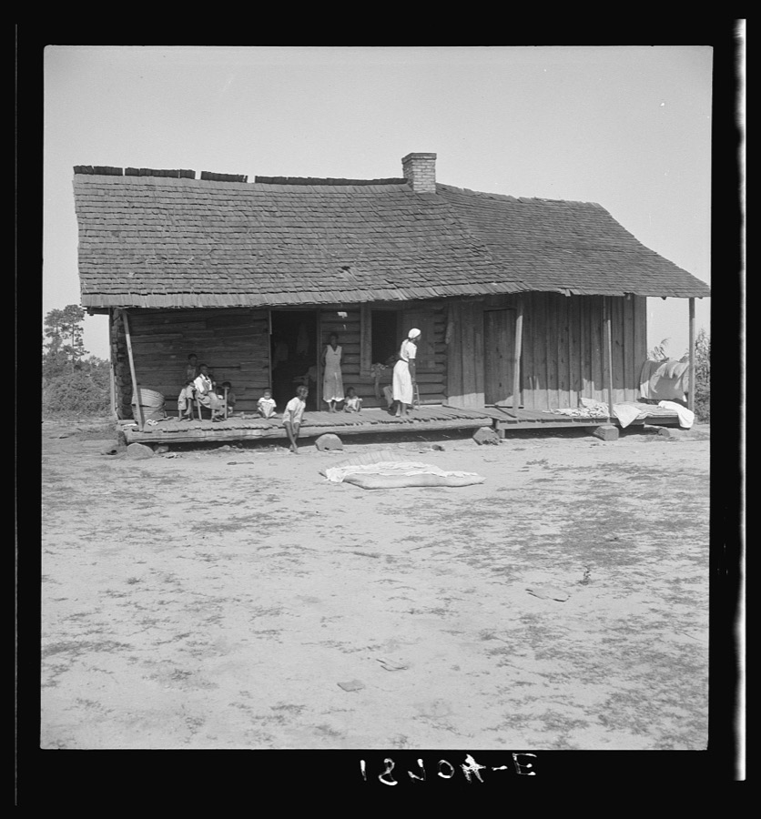
Lange, Dorothea, photographer, 1938. Library of Congress

Lange, Dorothea, photographer, 1938. Library of Congress

Lange, Dorothea, photographer, 1938. Library of Congress

Stanley, David, 1942- (Collector), 1977. Library of Congress
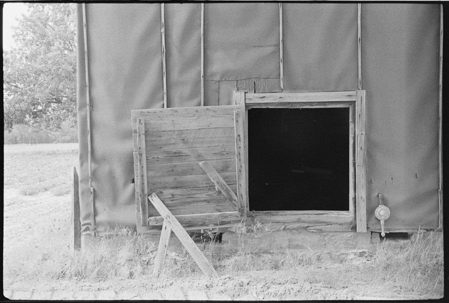
Marshall, Howard W. (Collector), 1977. Library of Congress
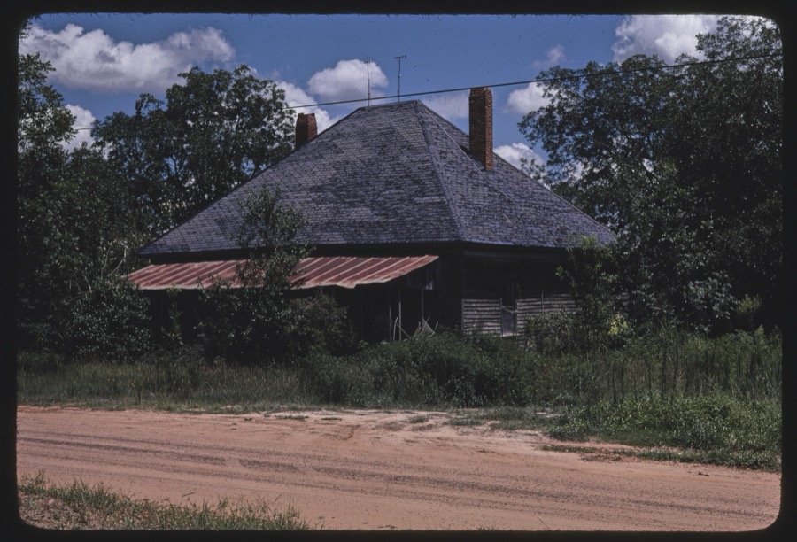
Lightfoot, William E. (William Edwin), 1940-, 1977. Library of Congress

Marshall, Howard W. (Collector), 1977. Library of Congress

Robinson, Beverly J, 1977. Library of Congress
Every photograph of Tift County
Fires near this place
782 since 1992Regional context, not property-specific evidence. The federal wildfire occurrence database lists 782 fires within 5 miles of Tifton between 1992 and 2020, burning about 1,163 acres in total. 12 started naturally. 162 were recorded as arson. Distance is straight-line from the map coordinates, so a fire counted here may appear on a neighbouring settlement's page as well.
| Reported cause | Fires |
|---|---|
| Debris and open burning | 431 |
| Arson/incendiarism | 162 |
| Equipment and vehicle use | 49 |
| Smoking | 44 |
| Misuse of fire by a minor | 36 |
| Missing data/not specified/undetermined | 26 |
| Natural | 12 |
| Railroad operations and maintenance | 12 |
| Recreation and ceremony | 10 |
The most recent of them, most recent first, with the day each was reported and the service that recorded it.
| Date | Cause | Size | Reported by | Name on the report |
|---|---|---|---|---|
| 9 September 2015 | Debris and open burning | 1.2 acres | Georgia Forestry Commission | FY2016-TIFT-003 |
| 9 September 2004 | Equipment and vehicle use | under an acre | Georgia Forestry Commission | not named |
| 9 September 1997 | Debris and open burning | 1.5 acres | Georgia Forestry Commission | not named |
| 7 September 1995 | Arson/incendiarism | under an acre | Georgia Forestry Commission | not named |
| 7 September 1995 | Arson/incendiarism | under an acre | Georgia Forestry Commission | not named |
| 7 September 1995 | Debris and open burning | under an acre | Georgia Forestry Commission | not named |
| 6 September 1997 | Debris and open burning | under an acre | Georgia Forestry Commission | not named |
| 5 September 1999 | Railroad operations and maintenance | under an acre | Georgia Forestry Commission | not named |
Settlements close enough to share some of these fires:
Storms near this place
60 of 87 shownRegional context, not property-specific evidence. The National Weather Service names Tifton in 87 storm reports between 1993 and 2026: 42 thunderstorm wind, 28 hail, 5 flood, 4 lightning. The reports record 1 injury. Each account below is quoted exactly as the forecast office filed it, from the NOAA Storm Events Database, and each date opens the federal record of that event.
| When | Event | Place named | Harm | What the report says |
|---|---|---|---|---|
| July 1998 | Lightning | Tifton | 1 hurt, $75,000 | Lightning struck the Tift County E911 tower, briefly knocking out emergency radio communications during a severe thunderstorm. Lightning struck several trees and a gymnasium in Tifton causing minor damage.A woman was injured when lightning struck her Tifton home. |
| August 2012 | Flash Flood | Tifton | $250,000 | Significant flash flooding occurred across Tifton and extending eastward into eastern Tift county along Highway 82. In Tifton, the bottom floor of the Ramada Inn hotel had to be evacuated due to water entering the hotel. There was also water damage to the Shoney's restaurant in Tifton. Exit 59 off of I-75 was also closed due to flooding along with Highway 82 east of Tifton. Around 11 inches rain fell during the overnight hours across the area. Monetary damage was estimated. |
| May 2006 | Lightning | Tifton | $150,000 | Lightning from an early evening thunderstorm was blamed for two house fires. Both structures suffered severe damage from flames and smoke. Reported by the Tifton Gazette. |
| April 2011 | Thunderstorm Wind | Tifton | $50,000 | Numerous trees and power lines were blown down with thousands of people without power. Tift Area Academy closed for the day because of storm damage to the school. The monetary damage figure provided is a rough estimate. |
| December 2002 | Thunderstorm Wind | Tifton | $50,000 | Numerous trees and power lines were down throughout the city. Several trees fell on houses near U.S. Highway 125 north of Tifton. A home lost part of its roof. Reported by Tift County 911. |
| June 2009 | Thunderstorm Wind | Tifton | $25,000 | Many trees were down just east of Interstate 75 from south of Tifton to near Eldorado. One house was damaged by a fallen tree. |
| March 1996 | Hail | Tifton | $20,000 | no account filed |
| February 2009 | Thunderstorm Wind | Tifton | $15,000 | Several trees were blown down. A shed at Veazey Farms was destroyed. Power lines were suspended above a home on Leeann Drive when the pole snapped in half. A pine tree fell on power lines at another home on the same street. |
| June 2001 | Lightning | Tifton | $10,000 | Lightning struck the 911 communications tower in Tifton. Several power lines down along U.S. Highway 82 just east of Tifton. Reported by the Tift County Sheriff. |
| June 1997 | Thunderstorm Wind | Tifton | $10,000 | no account filed |
| February 2007 | Thunderstorm Wind | Tifton | $5,000 | The Tift County EMA reported numerous downed trees and power lines throughout the city. A pontoon boat was blown off a road. |
| June 1999 | Thunderstorm Wind | Tifton | $5,000 | Tifton County 911 dispatcher reported downed power lines. |
| April 1998 | Thunderstorm Wind | Tifton | $5,000 | Thunderstorm winds split a double wide mobile home near the Tift-Worth county line (approximately 8 miles west of Tifton). |
| March 1993 | Thunderstorm Wind | Tifton | $5,000 | Thunderstorm winds destroyed one $800 patio shed and downed a few large trees. |
| April 2022 | Thunderstorm Wind | Tifton | $4,000 | Power lines were blown down at Ridge Ave S and 13th Street and Mullis Rd and Alabama Ave. |
| June 2021 | Lightning | Tifton | $3,000 | A transformer was struck by lightning. |
| June 2018 | Thunderstorm Wind | Tifton | $3,000 | Several trees and power lines were blown down in Tifton. |
| October 2014 | Thunderstorm Wind | Tifton | $3,000 | Multiple trees and power lines were blown down around Tifton. |
| July 2012 | Thunderstorm Wind | Tifton | $3,000 | Trees and power lines were blown down around Tifton. Monetary damage was estimated. |
| August 2000 | Thunderstorm Wind | Tifton | $3,000 | Scattered trees and power lines down. A few power outages. Reported by the Tift County EMA. |
| March 2026 | Thunderstorm Wind | Tifton | $2,000 | There were a couple of blown transformers reported in Tift county. |
| August 2016 | Thunderstorm Wind | Tifton | $2,000 | A tree was blown down onto a power line on Ferry Lake Road. |
| June 2014 | Thunderstorm Wind | Tifton | $2,000 | Power lines were blown down around Tifton. |
| July 1997 | Thunderstorm Wind | Tifton | $2,000 | no account filed |
| September 2011 | Thunderstorm Wind | Tifton | $1,000 | A tree was blown down in Tifton. The monetary damage figure provided is a rough estimate. |
| January 2009 | Thunderstorm Wind | Tifton | $1,000 | In Tifton, a few trees were blown down and a railroad crossing arm was damaged. |
| June 1994 | Thunderstorm Wind | Tifton | $500 | Thunderstorm winds downed a few large trees and a couple of power lines. |
| July 1994 | Thunderstorm Wind | Tifton | $500 | Thunderstorm winds downed several large tree limbs along U.S. Highway 319. |
| October 1994 | Thunderstorm Wind | Tifton | $500 | Thunderstorm winds knocked down trees and broke power line poles. |
| January 2024 | Thunderstorm Wind | Tifton | - | A trained spotter measured a wind gust of 70 mph. |
| May 2024 | Thunderstorm Wind | Tifton | - | Trees were blown down near Ferry Lake Road and Highway 319. |
| September 2024 | Flash Flood | Tifton | - | Tift county reported road washouts due to flash flooding. |
| September 2024 | Flash Flood | Tifton | - | Several roads were flooded in the Tifton area. |
| May 2023 | Hail | Tifton | - | There were multiple reports of quarter size hail from downtown Tifton. |
| May 2023 | Thunderstorm Wind | Tifton | - | Multiple trees were blown down along the highway in downtown Tifton. |
| July 2023 | Thunderstorm Wind | Tifton | - | Trees were blown down along Zion Hope Road. |
| August 2023 | Thunderstorm Wind | Tifton | - | Numerous trees were blown down across Tift county. |
| August 2023 | Thunderstorm Wind | Tifton | - | A tree blew down on Love Ave. |
| August 2023 | Thunderstorm Wind | Tifton | - | A tree blew down near the intersection of Madison Ave and Crescent Dr. |
| June 2023 | Thunderstorm Wind | Tifton | - | Trees were blown down. |
| April 2021 | Thunderstorm Wind | Tifton | - | Several trees were blown down. |
| January 2021 | Flood | Tifton | - | Water was reported on several roadways, but no roads were closed. |
| March 2020 | Flood | Tifton | - | Kent Road from Ocilla Road to Richards Dr was flooded and closed. |
| December 2020 | Thunderstorm Wind | Tifton | - | A tree was blown down on Love Ave near E 22nd Street. |
| April 2020 | Thunderstorm Wind | Tifton | - | Trees were blown down. |
| April 2020 | Thunderstorm Wind | Tifton | - | Trees were blown down. |
| June 2019 | Thunderstorm Wind | Tifton | - | Multiple trees were blown down. |
| April 2018 | Thunderstorm Wind | Tifton | - | A stop light was blown down on Highway 319 on the east side of Tifton. |
| February 2016 | Flood | Tifton | - | Kent Road at Cypress Ridge Road was closed due to flooding. |
| May 2016 | Hail | Tifton | - | Spiky hail around ping pong ball size was reported near the intersection of Highways 82 and 319. |
| May 2016 | Hail | Tifton | - | Half dollar sized hail was reported at the Tift County Health Department. |
| May 2016 | Hail | Tifton | - | A picture of an oblong, spiky hailstone was posted to the WALB-TV facebook page. It was estimated to be about 2 inches in diameter lengthwise, but narrower in width. |
| August 2016 | Thunderstorm Wind | Tifton | - | A tree was blown down onto a power line on Lee Ave. |
| April 2015 | Thunderstorm Wind | Tifton | - | A couple of trees were blown down around Tifton. |
| June 2013 | Flood | Tifton | - | Localized minor flooding occurred at the 500 Block of East 18th Street in Tifton. |
| February 2012 | Heavy Rain | Tifton | - | The Tift county 911 call center reported minor flooding of roads around Tifton. CoCoRaHS rainfall amounts around Tifton ranged between 2.05 and 2.41 inches. |
| August 2012 | Heavy Rain | Tifton | - | CoCoRaHS observer GA-TF-3 reported a 24 hour rainfall total of 9.65 inches. |
| August 2012 | Flood | Tifton | - | Flooding continued during the day after heavy rains ended in the morning, especially along Highway 82 east of Tifton, which remained closed for much of the day. |
| March 2012 | Heavy Rain | Tifton | - | A 24 hour total of 4.00 inches was measured at GA-TF-7. |
| March 2012 | Heavy Rain | Tifton | - | A 24 hour total of 3.33 inches was measured at GA-TF-3. |
Nearest settlements
The eight closest, with where each one stands in the county. Distances are straight-line, computed from the Geographic Names Information System coordinates.
| Map | Place | Distance | Sheets |
|---|---|---|---|
| Phillipsburg | 0.9 miles | 9 | |
| Unionville | 1.1 miles | 9 | |
| Ferry Lake | 2.2 miles | 9 | |
| Pebblebrook | 3.6 miles | 9 | |
| Vanceville | 3.8 miles | 9 | |
| Kelltown | 4.1 miles | 9 | |
| Linder | 4.4 miles | 9 | |
| Brighton | 4.6 miles | 8 |
Elsewhere
Matched on this settlement's Geographic Names Information System number rather than its name, so it cannot be a different place of the same name in another state.
| Wikipedia article on Tifton | An encyclopaedic summary. Its text is share-alike, so it is linked here rather than copied. |
| Wikidata item Q2729512 | The structured record the population and elevation above come from. Public domain (CC0). |
Provenance
This settlement is recorded in the Geographic Names Information System as feature 324159. The sheet list is computed by point-in-boundary test against the United States Geological Survey's historical topographic inventory. Both are works of the United States government and carry no copyright under 17 U.S.C. 105.
Wildfire. Short, Karen C. 2022. Spatial wildfire occurrence data for the United States, 1992-2020 [FPA_FOD_20221014]. 6th Edition. Fort Collins, CO: Forest Service Research Data Archive. https://doi.org/10.2737/RDS-2013-0009.6 Collected with United States Government funding and usable without additional permissions or fees.
Storms. NOAA National Centers for Environmental Information, Storm Events Database https://www.ncei.noaa.gov/stormevents/ A work of the United States government, no copyright under 17 U.S.C. 105. Narratives are quoted verbatim from the National Weather Service report and are not edited or summarised.