 Block
Vidalia, Georgia
9 topographic sheets cover this place, the earliest surveyed in 1957 and the latest in 1988. It stands in the Vidalia-Lyons census division. It lies in ZIP code area 30474. The Survey maps it on the Vidalia quadrangle. 10,785 people lived here at the 2020 count. It stands 299 feet above sea level.
Research this city
On record in Vidalia
Buildings and businesses the archive holds for this place. Each opens its own page, with the source record it came from.
On the National Register 6 records
 Crawford W. Brazell Houselisted 1982
 Citizens Bank of Vidalialisted 1992
 Leader-Rosansky Houselisted 1995
 McLemore-Sharpe Farmsteadlisted 1982
 Peterson-Wilbanks Houselisted 1990
 Vidalia Commercial Historic Districtlisted 1996
Surveyed buildings and structures 1 record
- Riddle-Jackson House, 608 Jackson Street, Vidaliafederal building survey, 10 photographs
Population over time
2 figuresVidalia grew from 10,473 to 10,785 between 2010 and 2020. These are the recorded population figures Wikidata holds for this place, reached through the Geographic Names Information System number this page is keyed on rather than by name, so they belong to this place and not to another of the same name. Most are census counts, but not all are: an early figure may be a founding or settlement estimate, and an estimate published within five years of a census is left out. The change column is computed, and is left blank where more than 20 years separate a figure from the one before it, because a gap that long is not a change between two counts.
| Year | People | Change |
|---|---|---|
| 2010 | 10,473 | |
| 2020 | 10,785 | +312 (+3%) |
Topographic sheets covering this place
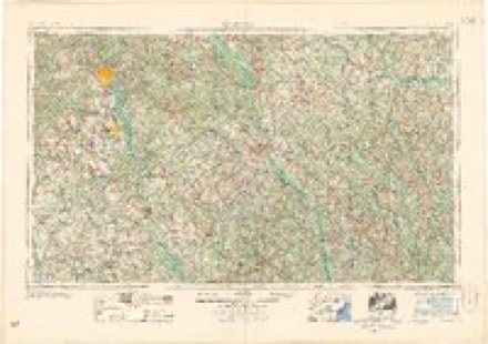
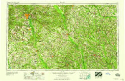
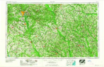
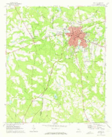
6 surveys from 9 printed sheetsMatched by testing this settlement's coordinate against the published boundary of every sheet in the United States Geological Survey's historical collection. Each opens the scanned sheet at the Survey.
- 1957 USGS Macon quadrangle1:250000
- 1958 USGS Macon quadrangle1:250000
- 1964 USGS Macon quadrangle1:250000, 2 printings
- 1970 USGS Vidalia quadrangle1:24000, 2 printings
- 1979 USGS Vidalia quadrangle1:100000, 2 printings
- 1988 USGS Macon quadrangle1:250000
Fires near this place
519 since 1992Regional context, not property-specific evidence. The federal wildfire occurrence database lists 519 fires within 5 miles of Vidalia between 1992 and 2020, burning about 1,510 acres in total. 12 started naturally. 88 were recorded as arson. Distance is straight-line from the map coordinates, so a fire counted here may appear on a neighbouring settlement's page as well.
| Reported cause | Fires |
|---|---|
| Debris and open burning | 276 |
| Arson/incendiarism | 88 |
| Equipment and vehicle use | 54 |
| Misuse of fire by a minor | 28 |
| Recreation and ceremony | 20 |
| Smoking | 18 |
| Missing data/not specified/undetermined | 18 |
| Natural | 12 |
| Railroad operations and maintenance | 5 |
The most recent of them, most recent first, with the day each was reported and the service that recorded it.
| Date | Cause | Size | Reported by | Name on the report |
|---|---|---|---|---|
| 3 September 2011 | Debris and open burning | 1.1 acres | Georgia Forestry Commission | FY2012-TOOMBS-012 |
| 28 September 2006 | Misuse of fire by a minor | 3.6 acres | Georgia Forestry Commission | not named |
| 28 September 2005 | Smoking | 3.0 acres | Georgia Forestry Commission | not named |
| 25 September 2019 | Debris and open burning | 3.8 acres | Georgia Forestry Commission | FY2020TOOMBS014 |
| 22 September 2019 | Debris and open burning | 1.9 acres | Georgia Forestry Commission | FY2020TOOMBS011 |
| 22 September 2006 | Debris and open burning | under an acre | Georgia Forestry Commission | not named |
| 22 September 1996 | Debris and open burning | 2.6 acres | Georgia Forestry Commission | not named |
| 20 September 2010 | Debris and open burning | under an acre | Georgia Forestry Commission | FY2011-TOOMBS-017 |
Settlements close enough to share some of these fires:
Storms near this place
37 since 1994Regional context, not property-specific evidence. The National Weather Service names Vidalia in 37 storm reports between 1994 and 2024: 20 thunderstorm wind, 10 hail, 2 lightning, 2 tornado. No death or injury is recorded in these reports. Each account below is quoted exactly as the forecast office filed it, from the NOAA Storm Events Database, and each date opens the federal record of that event.
| When | Event | Place named | Harm | What the report says |
|---|---|---|---|---|
| August 2007 | Thunderstorm Wind | Vidalia | $250,000 | The Toombs County Emergency Management Director reported that a thunderstorm downburst or microburst resulted in considerable damage across the northwest and north central part of the county, but especially in the Vidalia area. More than 30 large oak trees were blown down in the city of Vidalia, proper, with a scattering of other trees down from northwest of Vidalia to near Santa Claus southeast of Vidalia. The worst path of damage extended from just northwest of Vidalia, southeastward through the heart of the city, to just south of town. Several homes were damaged, some from downed trees and others had their roofs blown off. Furthermore, a Hardees restaurant under construction in Vidalia was destroyed when the wind blew down the frame. Several roads were blocked from downed trees, including portions of Georgia Highway 130 and U.S. Highway 1. More than a dozen power lines were also down throughout the northwest part of the county. Much of the city of Vidalia and surrounding areas were left without power, forcing many residents to take shelter in hotels or Red Cross facilities to escape the heat. The Automated Weather Observation Station (AWOS) located in Vidalia recorded a 61 mph wind gust around 440 pm EDT. |
| June 2012 | Hail | Vidalia | $134,500 | The public reported that golf ball sized hail fell in Vidalia for about 15 minutes. |
| August 2020 | Lightning | Vidalia | $75,000 | The Toombs County 911 center reported a home struck by lightning on Meadows Lane. The resulting fire caused substantial damage to the home. |
| June 1997 | Thunderstorm Wind | Vidalia | $25,000 | Thunderstorm winds overturned one airplane and damaged two others. The roof was torn off of one building and two side panels were damaged. Two other buildings and a car were also damaged. Several power lines were downed in the area. |
| May 2007 | Hail | Vidalia | $21,000 | The Toombs County Emergency Management Director reported that a very southwestward moving thunderstorm dumped hail for up to an hour across parts of north central and northwest Toombs county. Hail was first reported three miles northeast of Vidalia around 720 pm EDT and ended about three miles southwest of Vidalia near the Montgomery county line around 830 pm EDT. Hail ranged in size from golf balls northeast of Vidalia, to pennies in Vidalia, to half-dollars southwest of Vidalia near the Montgomery county line. |
| April 2018 | Thunderstorm Wind | Vidalia | $20,000 | The Toombs County Emergency Manager reported a few trees blown down around the intersection of Highway 292 and Fowler Street and damage to the roof of Vidalia High School nearby. |
| August 2020 | Thunderstorm Wind | Vidalia | $15,000 | The Toombs County Emergency Manager reported several trees blown down from Vidalia to Toombs Central. |
| April 2009 | Flood | Vidalia | $10,000 | The Toombs County Emergency Management Director reported that up to 30 roads across the county had to be closed as a result of flooding from several days of heavy rain. Several dirt roads were washed out. Minor flooding was also observed to fields and woodlands near creeks and rivers in the county. More than six inches of rain fell in parts of the county. This rain fell on saturated soil from several prior weeks of above normal rainfall. |
| June 1998 | Thunderstorm Wind | Vidalia | $10,000 | Toombs county 911 reported trees and power lines were blown down across the county. Some homes had damage to shingles and had trees fall on them. |
| June 1997 | Thunderstorm Wind | Vidalia | $7,500 | Trees were downed across the road on Lions Center Road, as well as on a mobile home in the same area. |
| August 2005 | Thunderstorm Wind | Vidalia | $6,000 | The Federal Aviation Administration (FAA) Automated Weather Observation Station (AWOS) at the Vidalia airport recorded a wind gust of 62 knots or 71 mph. The Toombs County Emergency Management Director reported that the wind gust blew shopping carts about the Vidalia Wal Mart parking lot, located adjacent to the airport, one of which rammed into a Dodge pickup truck damaging the vehicle. At a nearby technical institute, a large oak tree was blown down and a picnic umbrella was dislodged from its anchor causing damage to three nearby vehicles. |
| August 2014 | Thunderstorm Wind | Vidalia | $5,000 | The Emergency Manager reported 10 to 12 trees down around Vidalia, with several more down at the local golf course. |
| June 1994 | Thunderstorm Wind | Vidalia | $5,000 | Several trees and few power lines were downed by thunderstorm winds. |
| August 2020 | Thunderstorm Wind | Vidalia | $4,000 | The Toombs County 911 center reported trees and power lines blown down across the county from the south side of Vidalia to near English Eddy. |
| February 2008 | Thunderstorm Wind | Vidalia | $3,000 | The Toombs County 911 Center reported that over six trees and more than three power lines were down within the city of Vidalia. |
| March 2015 | Thunderstorm Wind | Vidalia | $2,500 | The Toombs County 911 center reported numerous trees blown down in and around Vidalia. |
| March 2015 | Thunderstorm Wind | Vidalia | $2,000 | The Toombs County 911 center reported several trees blown down across the county. |
| June 1997 | Thunderstorm Wind | Vidalia | $1,500 | Several tree limbs were blown down. |
| November 2011 | Thunderstorm Wind | Vidalia | $1,000 | The Toombs County 911 Center reported that three trees were down near Lyons, one of which was down on a power line. |
| April 2011 | Thunderstorm Wind | Vidalia | $1,000 | The Toombs County 911 Center reported that at least three trees were down around Lyons. |
| May 2009 | Thunderstorm Wind | Vidalia | $1,000 | The Vidalia AWOS measured a wind gust of 52 mph at 300 pm EDT. The Toombs County 911 Center reported that two trees and two power lines were down as a result of the strong winds in the area. Pea-sized hail was observed in the far northern part of the county near Normantown. |
| April 2007 | Thunderstorm Wind | Vidalia | $1,000 | The Toombs County Emergency Management Director reported that three trees were down in the northern part of the county. One large pine tree had been blown down onto New Normantown Road, one tree was down on a nearby farm, and another tree was down on Van Lewis Road, all between Vidalia and Normantown. |
| March 2013 | Thunderstorm Wind | Vidalia | $500 | The public reported a couple of trees down on the north side of Vidalia. |
| August 2007 | Lightning | Vidalia | $500 | The Toombs County Emergency Management Director reported that lightning struck his home. While no fire was reported, the refrigerator was rendered inoperative as a result. |
| November 1997 | Thunderstorm Wind | Vidalia | $500 | Toombs county 911 reported two trees were downed on highway 280. |
| May 2024 | Tornado (EF1) | Vidalia | - | Continuation of tornado from Montgomery County.||As the tornado entered the city of Vidalia, trees and powerlines|were downed throughout the city, particularly south of the|downtown area in the 7th to 9th street area along Adams street. |In the downtown area, a roof off of one of the buildings along|Church street was peeled off and thrown into the parking areas|below. The tornado continued ESE crossing Center Dr, Estroff Dr,|Aimwell Rd, and through the Cambridge Ct region where EF1 damage|to trees and homes was observed all along that route. The|tornado continued eastward crossing the Vidalia airport property.|It should be noted that the last observation from the Vidalia|airport occurred 10 min prior to the tornado crossing through. |The tornado continued eastward toward the Lyons community and|across the Lyons Elementary, Middle and High school complexes. |Minor, EF0 damage was observed in and around the schools mostly|to trees, fences, and to doors on some storage buildings. The|tornado continued east crossing Hwy 1 downing a few pecan trees|and numerous limbs before dissipating as it approached hwy|280 southeast of Lyons. Additional straight line wind damage was|observed south of the path including in the community of Santa|Claus. |
| January 2022 | Tornado (EF0) | Vidalia | - | A very brief QLCS tornado hit the south side of Vidalia around|7PM on Sunday, January 2nd. The tornado did the most damage to|one of the Vidalia fire station's off of Aimwell Road. The garage|doors were blown inward and outward along with a portion of the|roof and siding pulled off. Debris was thrown about 200 yards|downstream from this point where additional trees were seen|snapped or uprooted. Some minor roof damage along with a few more|trees down were noted along South Gate Blvd and Katherine Drive.|No other damage was seen beyond this point. [1/2/22: Tornado #2, County #1/1, EF-0, Toombs, 2022:002]. |
| April 2020 | Flash Flood | Vidalia | - | The Emergency Manager reported that Thompson Pond overflowed onto Thompson Pond Road near the county line, closing the roadway. Radar estimates indicate that 3 to 6 inches of rain fell over the area, resulting in the flash flooding. |
| March 2013 | Hail | Vidalia | - | The public reported quarter sized hail on the north side of Vidalia. |
| March 2011 | Hail | Vidalia | - | The public observed quarter-sized to half-dollar-sized hail across the northern part of the county near Vidalia. |
| July 2007 | Hail | Vidalia | - | The Toombs County Emergency Management Director reported penny-sized hail in the western part of the county near the Montgomery county line on Georgia Highway 130, just northwest of South Thompson. |
| July 2004 | Heavy Rain | Vidalia | - | The Toombs County 911 center reported that very heavy rain had caused some minor street flooding. |
| March 2002 | Hail | Vidalia | - | The Georgia State Patrol reported dime size hail. |
| June 2000 | Hail | Vidalia | - | The Toombs county 911 center reported quarter size hail near Vidalia. |
| August 1999 | Hail | Vidalia | - | no account filed |
| May 1998 | Hail | Vidalia | - | no account filed |
| June 1997 | Hail | Vidalia | - | no account filed |
Nearest settlements
The eight closest, with where each one stands in the county. Distances are straight-line, computed from the Geographic Names Information System coordinates.
| Map | Place | Distance | Sheets |
|---|---|---|---|
| Charles | 0.9 miles | 9 | |
| Lyons | 4.9 miles | 10 | |
| Santa Claus | 5.4 miles | 10 | |
| Center | 6.3 miles | 9 | |
| Normantown | 6.5 miles | 9 | |
| South Thompson | 7.9 miles | 9 | |
| Ponderosa | 8.6 miles | 10 | |
| Elton (historical) | 9.3 miles | 9 |
Elsewhere
Matched on this settlement's Geographic Names Information System number rather than its name, so it cannot be a different place of the same name in another state.
| Wikipedia article on Vidalia | An encyclopaedic summary. Its text is share-alike, so it is linked here rather than copied. |
| Wikidata item Q2695904 | The structured record the population and elevation above come from. Public domain (CC0). |
Provenance
This settlement is recorded in the Geographic Names Information System as feature 324704. The sheet list is computed by point-in-boundary test against the United States Geological Survey's historical topographic inventory. Both are works of the United States government and carry no copyright under 17 U.S.C. 105.
Wildfire. Short, Karen C. 2022. Spatial wildfire occurrence data for the United States, 1992-2020 [FPA_FOD_20221014]. 6th Edition. Fort Collins, CO: Forest Service Research Data Archive. https://doi.org/10.2737/RDS-2013-0009.6 Collected with United States Government funding and usable without additional permissions or fees.
Storms. NOAA National Centers for Environmental Information, Storm Events Database https://www.ncei.noaa.gov/stormevents/ A work of the United States government, no copyright under 17 U.S.C. 105. Narratives are quoted verbatim from the National Weather Service report and are not edited or summarised.