 Block
Watkinsville, Georgia
12 topographic sheets cover this place, the earliest surveyed in 1953 and the latest in 1988. It stands in the Watkinsville census division. It lies in ZIP code area 30677. It stands on Lampkin Branch. The Survey maps it on the Watkinsville quadrangle. 2,896 people lived here at the 2020 count. It stands 719 feet above sea level.
Research this city
On record in Watkinsville
Buildings and businesses the archive holds for this place. Each opens its own page, with the source record it came from.
On the National Register 7 records
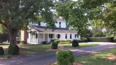 William Daniell Houselisted 1995
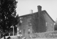 Eagle Tavernlisted 1970
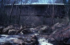 Elder's Mill Covered Bridge and Elder Milllisted 1994
 Abe Jones Houselisted 1994
- Durham Homeplacelisted 2000
- Farmers and Citizens Supply Company Blocklisted 1987
- South Main Street Historic Districtlisted 1979
Surveyed buildings and structures 1 record
- Eagle Tavern, Macon Road, Watkinsvillefederal building survey, 1 photograph
Population over time
2 figuresWatkinsville grew from 2,832 to 2,896 between 2010 and 2020. These are the recorded population figures Wikidata holds for this place, reached through the Geographic Names Information System number this page is keyed on rather than by name, so they belong to this place and not to another of the same name. Most are census counts, but not all are: an early figure may be a founding or settlement estimate, and an estimate published within five years of a census is left out. The change column is computed, and is left blank where more than 20 years separate a figure from the one before it, because a gap that long is not a change between two counts.
| Year | People | Change |
|---|---|---|
| 2010 | 2,832 | |
| 2020 | 2,896 | +64 (+2%) |
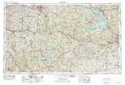
Topographic sheets covering this place
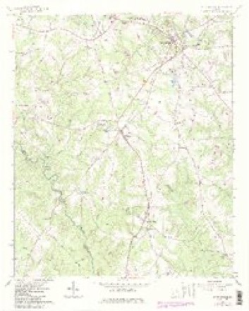
7 surveys from 12 printed sheetsMatched by testing this settlement's coordinate against the published boundary of every sheet in the United States Geological Survey's historical collection. Each opens the scanned sheet at the Survey.
- 1953 USGS Athens quadrangle1:250000, 3 printings
- 1958 USGS Athens quadrangle1:250000
- 1959 USGS Athens quadrangle1:250000
- 1963 USGS Athens quadrangle1:250000
- 1964 USGS Watkinsville quadrangle1:24000, 3 printings
- 1980 USGS Athens quadrangle1:100000, 2 printings
- 1988 USGS Athens quadrangle1:250000
Photographs
1 photograph,Taken for the Office of War Information and the Farm Security Administration, who photographed the country between 1935 and 1944. Works of United States government photographers, with no known restriction on use. Each opens its catalogue record.
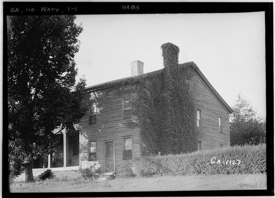
Photographer not recorded. Library of Congress
Fires near this place
135 since 1992Regional context, not property-specific evidence. The federal wildfire occurrence database lists 135 fires within 5 miles of Watkinsville between 1992 and 2018, burning about 238 acres in total. 7 started naturally. 10 were recorded as arson. Distance is straight-line from the map coordinates, so a fire counted here may appear on a neighbouring settlement's page as well.
| Reported cause | Fires |
|---|---|
| Debris and open burning | 71 |
| Equipment and vehicle use | 17 |
| Missing data/not specified/undetermined | 14 |
| Arson/incendiarism | 10 |
| Smoking | 7 |
| Natural | 7 |
| Recreation and ceremony | 4 |
| Misuse of fire by a minor | 3 |
| Railroad operations and maintenance | 2 |
The most recent of them, most recent first, with the day each was reported and the service that recorded it.
| Date | Cause | Size | Reported by | Name on the report |
|---|---|---|---|---|
| 4 September 2008 | Equipment and vehicle use | 2.7 acres | Georgia Forestry Commission | not named |
| 30 September 2016 | Debris and open burning | under an acre | Georgia Forestry Commission | FY2017-OCONEE-002 |
| 18 September 1999 | Recreation and ceremony | under an acre | Georgia Forestry Commission | not named |
| 16 September 2003 | Missing data/not specified/undetermined | under an acre | Georgia Forestry Commission | not named |
| 13 September 1997 | Smoking | under an acre | Georgia Forestry Commission | not named |
| 6 August 1998 | Debris and open burning | 2.5 acres | Georgia Forestry Commission | not named |
| 4 August 2007 | Equipment and vehicle use | 1.1 acres | Georgia Forestry Commission | not named |
| 31 August 1995 | Debris and open burning | under an acre | Georgia Forestry Commission | not named |
Settlements close enough to share some of these fires:
Mines and quarries near this place
1 within 5 milesRegional context, not property-specific evidence. The federal mineral resources record lists 1 working within 5 miles of Watkinsville: 1 prospect. None of them still produces. What was taken out: Mica. Distance is straight-line from the map coordinates, so a quarry counted here may appear on a neighbouring settlement's page as well.
| Where | Site | Commodity | Status | Recorded |
|---|---|---|---|---|
| Branch Prospect | Mica | Prospect |
Storms near this place
47 since 1993Regional context, not property-specific evidence. The National Weather Service names Watkinsville in 47 storm reports between 1993 and 2024: 24 thunderstorm wind, 15 hail, 7 lightning, 1 strong wind. No death or injury is recorded in these reports. Each account below is quoted exactly as the forecast office filed it, from the NOAA Storm Events Database, and each date opens the federal record of that event.
| When | Event | Place named | Harm | What the report says |
|---|---|---|---|---|
| August 2007 | Thunderstorm Wind | Watkinsville | $100,000 | The Oconee County Emergency Management Director reported that a thunderstorm downburst or microburst from a small thunderstorm caused considerable damage around the city of Watkinsville. The roof was blown off two chicken houses. In addition, two large feeding containers were blown from the chicken houses into an adjacent field. Twenty to 30 trees were blown down around the city. Trees were down on power lines at several locations and several roads were blocked from downed trees. |
| August 2006 | Lightning | Watkinsville | $100,000 | The Oconee Enterprise of Watkinsville reported that lightning struck a home on Wind Ridge Circle. The garage and bonus room above the garage burned. There was also heavy smoke and water damage in the house as well. The residents and their dog survived, but two pet rabbits did not. |
| August 2005 | Thunderstorm Wind | Watkinsville | $100,000 | The Oconee County Emergency Management Director reported that an apparent microburst or downburst associated with a strong thunderstorm blew down at least eight large trees near the intersection of Georgia Highway 53 and Experiment Station Road, or near the Phil Campbell USDA Research Center. At one location on the road, three large oak trees were blown down, one going through a portion of a residence. Another tree brought down power poles, including traffic signals and telephone cables. Next door, five large pecan trees were blown down, one causing minor damage to a residence and falling on another small structure on the premises. In addition, the tin roof was blown off a farm equipment shed on the same premises. |
| July 2002 | Lightning | Watkinsville | $100,000 | The Oconee Enterprise of Watkinsville reported that a fire was started at a home when lightning struck a pine tree and then traveled to the nearby garage. The garage caught fire and was gutted. Smoke and heat damage was also reported to neighboring parts of the home and all possessions stored in the garage were destroyed. Lightning caused problems at other locations in Watkinsville, including knocking out a transformer at a local bakery, damaging sheet rock at another home, and striking a tree which then fell onto a local road. |
| May 1998 | Thunderstorm Wind | Watkinsville | $50,000 | Newspaper reports said there were dozens of trees knocked down by a powerful thunderstorm. At least 3 homes, several vehicles, and other structures were damaged. Most of the damage occurred in the Oak Pointe subdivision off Flat Rock Road about 3 miles southeast of Watkinsville. One tree fell on a pickup truck then onto the roof of a home. A funnel cloud was observed in the same area. The Oconee county EMA reported trees and power lines down along highway 78 north of Watkinsville. |
| July 2008 | Thunderstorm Wind | Watkinsville | $35,000 | The public reported that two grain silos on South Milledge Road between Watkinsville and the Clarke county line were blown over onto the road. Several power lines were also down in the area. |
| August 2001 | Thunderstorm Wind | Watkinsville | $30,000 | The Oconee Emergency Management Director and the Georgia State Climatologist both reported that numerous trees and power lines were down in Watkinsville, including on the U.S. Highway 441 bypass west of town. Several of the trees were quite large and one large tree went through the roof of a house in town. |
| June 2010 | Lightning | Watkinsville | $27,000 | The Oconee County 911 Center reported two lightning-related fires approximately five miles west-northwest of Watkinsville near Eastville. One lightning strike resulted in a house fire on Hodges Mill Road and another resulted in a brust fire near the intersection of Collin Ferry and Carsons Grade. No specific details were provided with respect to the damage to the home. |
| October 2010 | Thunderstorm Wind | Watkinsville | $25,000 | The Oconee County Emergency Management Director reported damage to several trees and power lines in the far southeast part of Oconee County, approximately six to seven miles southeast of Watkinsville. One vehicle suffered damage from a fallen tree. The Emergency Management Director was suspicious that the damage appeared to be caused by a tornado as there was a path of damage and trees and power lines were twisted along the path of damage. |
| August 2007 | Lightning | Watkinsville | $25,000 | The Oconee County Emergency Management Director reported that lightning struck a building in the city and set it on fire. A damage amount was indeterminable. |
| June 1998 | Thunderstorm Wind | Watkinsville | $25,000 | The Oconee county sheriff reported wind damage to the Post Office in Watkinsville. Numerous trees were knocked down county-wide. |
| April 1997 | Thunderstorm Wind | Watkinsville | $15,000 | no account filed |
| April 1997 | Thunderstorm Wind | Watkinsville | $12,500 | no account filed |
| February 2001 | Thunderstorm Wind | Watkinsville | $10,000 | The Oconee county 911 center reported that in two separate incidents a tree was knocked down on a home. A storm spotter reported that some small limbs were broken off trees in North High Shoals at the intersection of Georgia Highway 186 and New High Shoals Road. |
| November 2003 | Thunderstorm Wind | Watkinsville | $5,000 | The Oconee county Emergency Manager reported that a number of trees and several power lines had been blown down. |
| December 2002 | Lightning | Watkinsville | $5,000 | The Oconee Enterprise reported that lightning struck a home in the Baker's Acres subdivision. The lightning struck just outside the house, but the current ran in on a Christmas light cord. The lightning strike caused extensive damage to the floor and sheet rock walls of the home's carport. Although the residents were home at the time of the incident, no injuries were reported. |
| June 1994 | Thunderstorm Wind | Watkinsville | $5,000 | Several large trees and power lines were downed by thunderstorm winds. |
| February 1993 | Thunderstorm Wind | Watkinsville | $5,000 | Several large trees were blown down. |
| August 2002 | Lightning | Watkinsville | $3,000 | The Oconee Enterprise reported that lightning struck and set on fire a barn off Hog Mountain road. The barn was full of hay. |
| June 2011 | Thunderstorm Wind | Watkinsville | $2,000 | The Oconee County 911 Center reported that at least six trees were down from Watkinsville to east of Bishop. |
| February 2024 | Thunderstorm Wind | Watkinsville | $1,000 | Tree down on Norton Rd between Barnett Shoals Rd and Williamsburg Pl. |
| September 2019 | Thunderstorm Wind | Watkinsville | $1,000 | The Oconee County Emergency Manager reported a tree blown down near the intersection of Summit Grove Drive and Summit Drive. |
| November 2010 | Thunderstorm Wind | Watkinsville | $1,000 | The Oconee County 911 Center reported that three trees were down in the Watkinsville area, one of which was on down on Colham Ferry Road. |
| April 2005 | Lightning | Watkinsville | $1,000 | The Oconee County Fire Chief reported that lightning struck a gas line causing a fire to erupt. No structural damage was reported. |
| May 2002 | Thunderstorm Wind | Watkinsville | $1,000 | The Oconee county 911 center reported that trees were blown down on Bellmount Road. |
| June 1998 | Thunderstorm Wind | Watkinsville | $1,000 | The public reported several trees were blown down and uprooted. |
| June 1995 | Thunderstorm Wind | Watkinsville | $1,000 | Thunderstorm winds knocked down numerous trees between Watkinsville and Eastville along Georgia Highway 53. |
| April 2005 | Thunderstorm Wind | Watkinsville | $500 | The Oconee County 911 Center reported that a couple of trees were blown down. |
| December 2002 | Strong Wind | Watkinsville | $500 | The Oconee Enterprise reported that two trees were blown down, both on Mars Hill Road. The strong winds, of 25 mph or greater, were the result of a tight pressure gradient behind a departing strong surface low on the east coast and a cold surface high advancing southeast from the Midwest. |
| June 2001 | Thunderstorm Wind | Watkinsville | $500 | The Oconee County 911 center reported that three trees were blown down. |
| August 1999 | Thunderstorm Wind | Watkinsville | $300 | The Oconee county sheriff's office reported several trees down. |
| March 2017 | Hail | Watkinsville | - | The public reported quarter size hail in Watkinsville. |
| May 2007 | Hail | Watkinsville | - | The Oconee County Emergency Management Director observed nickel-sized hail. |
| February 2005 | Hail | Watkinsville | - | The public reported penny-sized hail. |
| February 2005 | Hail | Watkinsville | - | The public reported penny-sized hail. |
| June 2005 | Hail | Watkinsville | - | The public reported nickel-sized hail. |
| December 2005 | Hail | Watkinsville | - | The Oconee County Emergency Management Director reported quarter-sized hail. |
| May 2003 | Hail | Watkinsville | - | The public reported nickel-sized hail. |
| July 1999 | Hail | Watkinsville | - | The public reported dime size hail and a tree down blocking the road. |
| June 1998 | Hail | Watkinsville | - | Several public reports of dime to quarter size hail were received from in and around the Watkinsville area. |
| June 1999 | Hail | Watkinsville | - | no account filed |
| March 1997 | Hail | Watkinsville | - | no account filed |
| April 1997 | Thunderstorm Wind | Watkinsville | - | no account filed |
| April 1997 | Hail | Watkinsville | - | no account filed |
| April 1996 | Hail | Watkinsville | - | no account filed |
| March 1996 | Hail | Watkinsville | - | no account filed |
| February 1993 | Hail | Watkinsville | - | no account filed |
Nearest settlements
The eight closest, with where each one stands in the county. Distances are straight-line, computed from the Geographic Names Information System coordinates.
| Map | Place | Distance | Sheets |
|---|---|---|---|
| Cedar Hills | 0.4 miles | 12 | |
| Crossties | 0.4 miles | 12 | |
| Harden Hills | 0.6 miles | 12 | |
| Marshall Estates | 0.7 miles | 12 | |
| The Briars | 1.0 miles | 12 | |
| Summit Grove | 1.2 miles | 15 | |
| Lake Wildwood | 1.4 miles | 12 | |
| Woodridge North | 1.5 miles | 15 |
Elsewhere
Matched on this settlement's Geographic Names Information System number rather than its name, so it cannot be a different place of the same name in another state.
| Wikipedia article on Watkinsville | An encyclopaedic summary. Its text is share-alike, so it is linked here rather than copied. |
| Wikidata item Q426428 | The structured record the population and elevation above come from. Public domain (CC0). |
Provenance
This settlement is recorded in the Geographic Names Information System as feature 333373. The sheet list is computed by point-in-boundary test against the United States Geological Survey's historical topographic inventory. Both are works of the United States government and carry no copyright under 17 U.S.C. 105.
Wildfire. Short, Karen C. 2022. Spatial wildfire occurrence data for the United States, 1992-2020 [FPA_FOD_20221014]. 6th Edition. Fort Collins, CO: Forest Service Research Data Archive. https://doi.org/10.2737/RDS-2013-0009.6 Collected with United States Government funding and usable without additional permissions or fees.
Mines and quarries. USGS Mineral Resources Data System (MRDS) https://mrdata.usgs.gov/mrds/ A work of the United States government, no copyright under 17 U.S.C. 105.
Storms. NOAA National Centers for Environmental Information, Storm Events Database https://www.ncei.noaa.gov/stormevents/ A work of the United States government, no copyright under 17 U.S.C. 105. Narratives are quoted verbatim from the National Weather Service report and are not edited or summarised.