 Block
Waycross, Georgia
7 topographic sheets cover this place, the earliest surveyed in 1953 and the latest in 1988. It stands in the Waycross census division. It lies in ZIP code area 31501. It stands on Bailey Branch. The Survey maps it on the Waycross East quadrangle. 13,942 people lived here at the 2020 count. It stands 131 feet above sea level.
Research this city
On record in Waycross
Buildings and businesses the archive holds for this place. Each opens its own page, with the source record it came from.
On the National Register 7 records
 Obediah Barber Homesteadlisted 1995
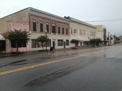 Downtown Waycross Historic Districtlisted 1992
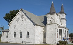 First African Baptist Church and Parsonagelisted 2003
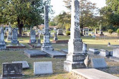 Lott Cemeterylisted 2008
 Phoenix Hotellisted 1986
 U.S. Post Office and Courthouselisted 1980
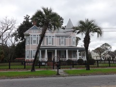 Waycross Historic Districtlisted 1976
Surveyed buildings and structures 6 records
- 808 Short Bewick Street (House), Waycrossfederal building survey, 7 photographs
- 815 Long Bewick Street (House), Waycrossfederal building survey, 7 photographs
- 830 Short Bewick Street (House), Waycrossfederal building survey, 7 photographs
- 912 Oak Street (House), Waycrossfederal building survey, 7 photographs
- 913 G Street (House), Waycrossfederal building survey, 9 photographs
- 930 Oak Street (House), Waycrossfederal building survey, 6 photographs
Population over time
2 figuresWaycross fell from 14,649 to 13,942 between 2010 and 2020. These are the recorded population figures Wikidata holds for this place, reached through the Geographic Names Information System number this page is keyed on rather than by name, so they belong to this place and not to another of the same name. Most are census counts, but not all are: an early figure may be a founding or settlement estimate, and an estimate published within five years of a census is left out. The change column is computed, and is left blank where more than 20 years separate a figure from the one before it, because a gap that long is not a change between two counts.
| Year | People | Change |
|---|---|---|
| 2010 | 14,649 | |
| 2020 | 13,942 | -707 (-5%) |
Topographic sheets covering this place
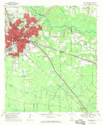
5 surveys from 7 printed sheetsMatched by testing this settlement's coordinate against the published boundary of every sheet in the United States Geological Survey's historical collection. Each opens the scanned sheet at the Survey.
- 1953 USGS Waycross quadrangle1:250000, 2 printings
- 1958 USGS Waycross quadrangle1:250000, 2 printings
- 1967 USGS Waycross East quadrangle1:24000
- 1978 USGS Waycross quadrangle1:100000
- 1988 USGS Waycross quadrangle1:250000
Photographs
8 of 42 photographs shown, 1936 to 2017Taken for the Office of War Information and the Farm Security Administration, who photographed the country between 1935 and 1944. Works of United States government photographers, with no known restriction on use. Each opens its catalogue record.
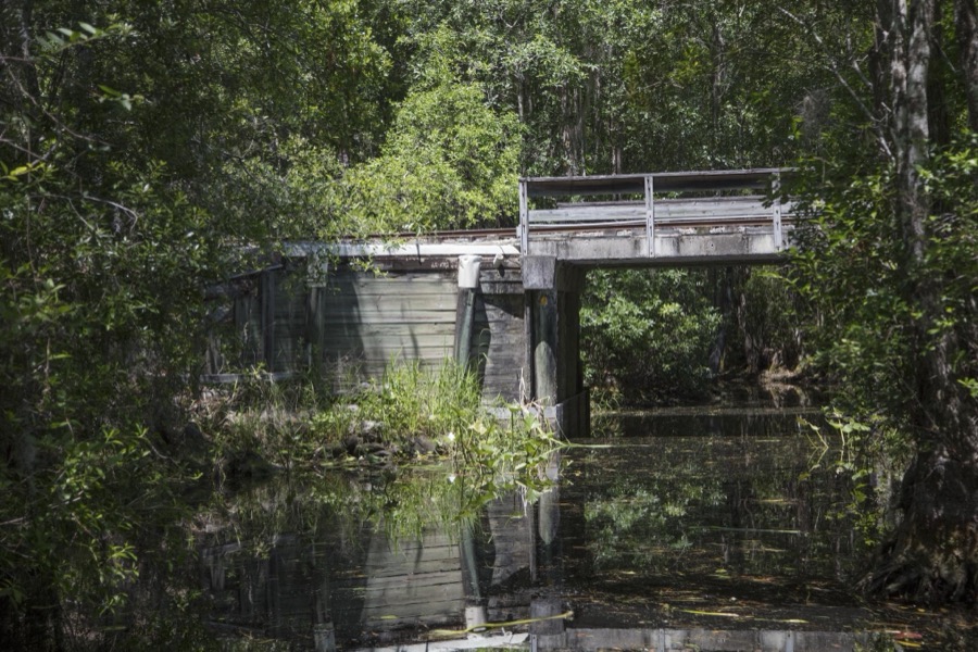
Highsmith, Carol M, 2017. Library of Congress
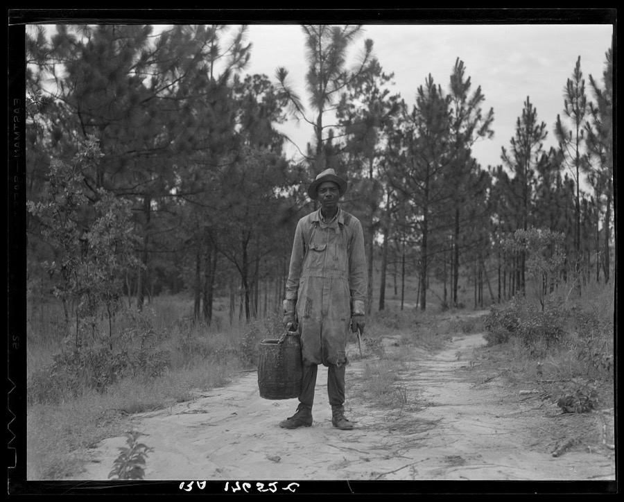
Lange, Dorothea, photographer, 1937. Library of Congress
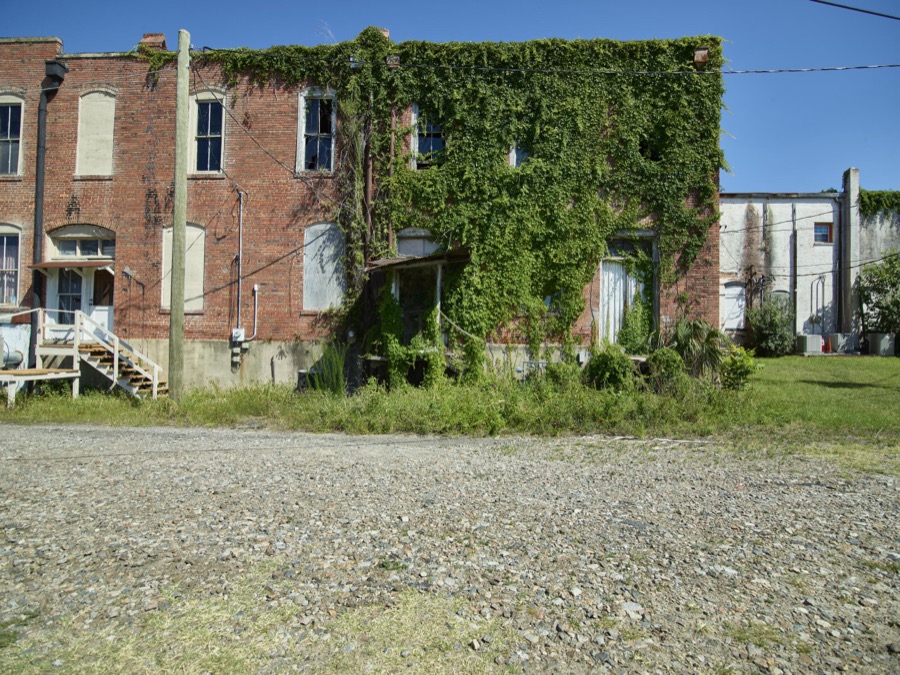
Highsmith, Carol M, 2017. Library of Congress

Highsmith, Carol M, 2017. Library of Congress
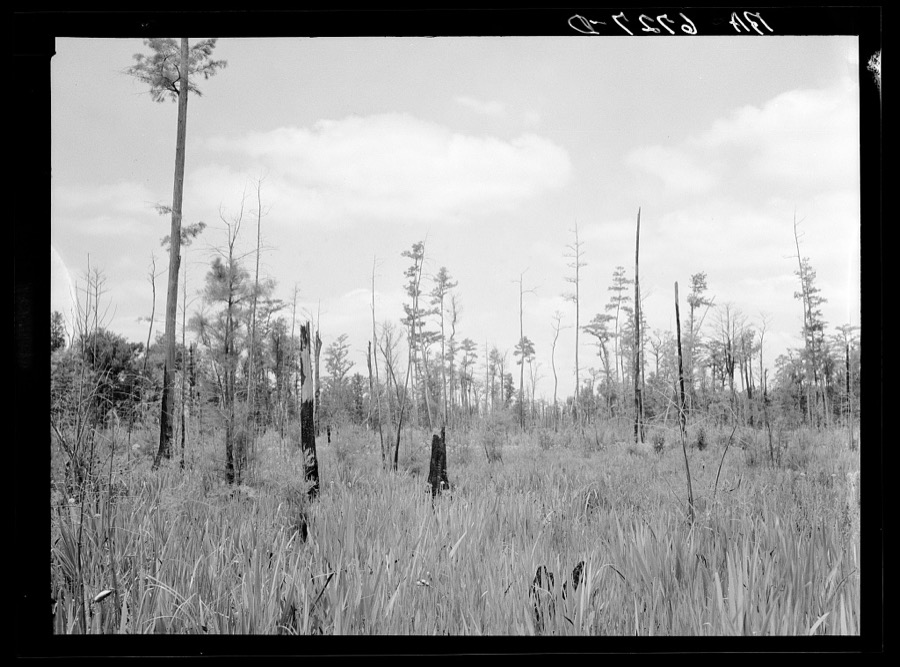
Mydans, Carl, photographer, 1936. Library of Congress
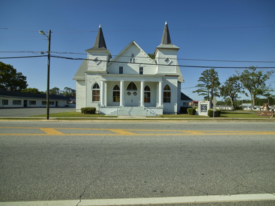
Highsmith, Carol M, 2017. Library of Congress
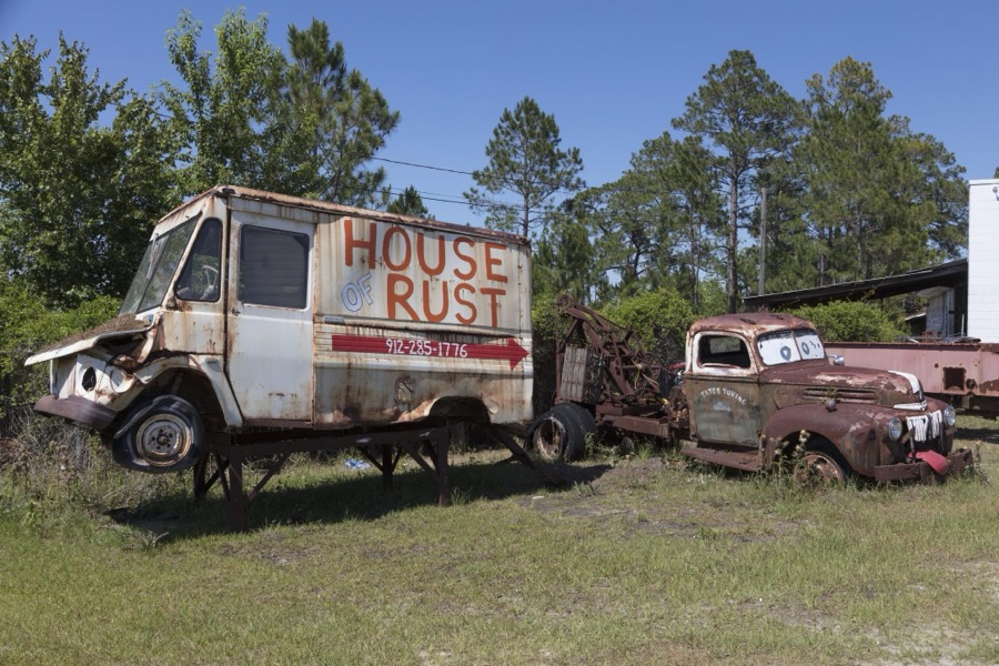
Highsmith, Carol M, 2017. Library of Congress
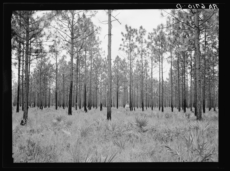
Mydans, Carl, photographer, 1936. Library of Congress
Every photograph of Ware County
Fires near this place
766 since 1992Regional context, not property-specific evidence. The federal wildfire occurrence database lists 766 fires within 5 miles of Waycross between 1992 and 2020, burning about 1,521 acres in total. 31 started naturally. 104 were recorded as arson. Distance is straight-line from the map coordinates, so a fire counted here may appear on a neighbouring settlement's page as well.
| Reported cause | Fires |
|---|---|
| Debris and open burning | 438 |
| Arson/incendiarism | 104 |
| Railroad operations and maintenance | 66 |
| Misuse of fire by a minor | 44 |
| Equipment and vehicle use | 34 |
| Natural | 31 |
| Missing data/not specified/undetermined | 21 |
| Recreation and ceremony | 20 |
| Smoking | 8 |
The most recent of them, most recent first, with the day each was reported and the service that recorded it.
| Date | Cause | Size | Reported by | Name on the report |
|---|---|---|---|---|
| 9 September 2006 | Debris and open burning | under an acre | Georgia Forestry Commission | not named |
| 9 September 2006 | Debris and open burning | 2.2 acres | Georgia Forestry Commission | not named |
| 6 September 2005 | Debris and open burning | 3.0 acres | Georgia Forestry Commission | not named |
| 4 September 2006 | Missing data/not specified/undetermined | 41 acres | Georgia Forestry Commission | not named |
| 29 September 2016 | Debris and open burning | 1.0 acres | Georgia Forestry Commission | FY2017-PIERCE-015 |
| 27 September 2008 | Debris and open burning | under an acre | Georgia Forestry Commission | not named |
| 26 September 2008 | Recreation and ceremony | 4.5 acres | Georgia Forestry Commission | not named |
| 25 September 1997 | Equipment and vehicle use | under an acre | Georgia Forestry Commission | not named |
Settlements close enough to share some of these fires:
Mines and quarries near this place
6 within 5 milesRegional context, not property-specific evidence. The federal mineral resources record lists 6 workings within 5 miles of Waycross: 4 producers, 2 past producers. 4 still produce. What was taken out: Sand and Gravel, Construction. Distance is straight-line from the map coordinates, so a quarry counted here may appear on a neighbouring settlement's page as well.
| Where | Site | Commodity | Status | Recorded |
|---|---|---|---|---|
| Mcneal Pit | Sand and Gravel, Construction | Past Producer | ||
| Minchew Mine No. 3 | Sand and Gravel, Construction | Producer | ||
| Minchew Sand Co Mine | Sand and Gravel, Construction | Producer | ||
| Pafford Pit | Sand and Gravel, Construction | Producer | ||
| Pafford Pit No. 2 | Sand and Gravel, Construction | Producer | ||
| Unnamed Sand Deposit | Sand and Gravel, Construction | Past Producer | Alluvium |
Storms near this place
60 of 110 shownRegional context, not property-specific evidence. The National Weather Service names Waycross in 110 storm reports between 1994 and 2025: 72 thunderstorm wind, 18 hail, 6 heavy rain, 4 lightning. The reports record 2 injuries. Each account below is quoted exactly as the forecast office filed it, from the NOAA Storm Events Database, and each date opens the federal record of that event.
| When | Event | Place named | Harm | What the report says |
|---|---|---|---|---|
| April 2019 | Thunderstorm Wind | West Waycross | 1 hurt | A mobile home was rolled over and destroyed by severe thunderstorm winds. Three vehicles were also overturned at the same location. One person was injured inside the mobile home. |
| May 1996 | Lightning | Waycross | 1 hurt | no account filed |
| January 1999 | Thunderstorm Wind | Waycross | $2,200,000 | In the Jamestown Community two residents with minor damage. In an Industrial Park a boat manufacturing company had one building destroyed and moderate damage to one end of their main building. A mobile home manufacturing plant had a 100,000 sq/ft building and shop destroyed, 5 new mobile homes were destroyed and 14 others were damaged, 5 semi-trailers were damaged and a pickup truck. |
| August 2000 | Thunderstorm Wind | Waycross | $50,000 | One large business with roof damage. Large trees and power lines were blown down. |
| June 1994 | Thunderstorm Wind | Waycross | $50,000 | Thunderstorm winds downed several large trees, power lines and knocked out telephone communications throughout Waycross including the 911 Emergency Operations Center. |
| June 2001 | Lightning | Waycross | $20,000 | Mobile home destroyed. |
| June 1998 | Thunderstorm Wind | Waycross | $15,000 | Large trees and power lines were blown down along HWY 122. Large tree fell on a truck. |
| January 2006 | Thunderstorm Wind | Waycross | $10,000 | Large billboard brought down and railroad crossing arm snapped by thunderstorm winds. Waycross Airport reported a gust to 41 mph as the storm moved over the area. |
| September 1998 | Flash Flood | Waycross | $10,000 | Underpasses with parts of some roads closed. Numerous stalled vehicles in standing water. |
| November 1995 | Thunderstorm Wind | Waycross | $10,000 | Numerous large trees were uprooted or blown down. |
| December 2018 | Lightning | Waycross | $5,000 | A lightning strike damaged a home along Carswell Avenue Tebeau Street in Waycross. The cost of damage was unknown, but it was estimated for the event to be included in Storm Data. |
| June 2014 | Thunderstorm Wind | Waycross | $5,000 | Trees and power lines were blown down. The time of damage was based on radar. The cost of damage was estimated for the event to be included in StormData. |
| April 1997 | Thunderstorm Wind | Waycross | $5,000 | Storage shed and destroyed, and numerous reports of large trees blown down. |
| June 1994 | Thunderstorm Wind | Waycross | $5,000 | Several large trees and power lines were downed by thunder- storm winds. |
| June 2000 | Thunderstorm Wind | Waycross | $3,500 | Large trees and power lines were blown down. |
| June 2000 | Thunderstorm Wind | Waycross | $3,500 | Large trees and power lines were blown down. |
| September 1999 | Thunderstorm Wind | Waycross | $3,500 | Large trees and power lines were blown down. |
| August 1999 | Thunderstorm Wind | Waycross | $3,500 | Large trees and power lines were blown down. |
| May 2015 | Thunderstorm Wind | Waycross | $3,000 | A tree fell onto a vehicle. The cost of damage was unknown but was estimated for the event to be included in Storm Data. |
| March 2012 | Thunderstorm Wind | Waycross | $3,000 | Trees were blown down near Plant Avenue and one large tree fell on a fence of a residence. The time of damage was based on radar imagery. The cost of damage was estimated. |
| November 2011 | Thunderstorm Wind | Waycross | $3,000 | The county 911 dispatch center reported that roofs were torn off of sheds and a trampoline was blown into the middle of the road. The cost of damage was estimated. |
| June 2001 | Thunderstorm Wind | Waycross | $3,000 | Storefront plate glass window was blown out. |
| March 2001 | Thunderstorm Wind | Waycross | $2,500 | Large trees and power lines were blown down. |
| June 2001 | Thunderstorm Wind | Waycross | $2,500 | Large trees and power lines were blown down. |
| June 2000 | Thunderstorm Wind | Waycross | $2,500 | Large trees and power lines were blown down. |
| July 1998 | Thunderstorm Wind | Waycross | $2,500 | Large trees and power lines were blown down. |
| July 1997 | Thunderstorm Wind | Waycross | $2,500 | Large trees and limbs were blown down. |
| August 2015 | Thunderstorm Wind | Waycross | $2,000 | Trees and power lines were blown down in and near Waycross. Locations included North McDonald Road and Frank Cowart Lane. A small tree fell on a vehicle. A tree fell on a home on Riley Road. The cost of damage was unknown but estimated. |
| April 1997 | Thunderstorm Wind | Waycross | $2,000 | Numerous large trees were blown down along RT 84. |
| June 2006 | Thunderstorm Wind | Waycross | $2,000 | no account filed |
| April 1998 | Thunderstorm Wind | Waycross | $1,500 | Large trees and power lines were blown down. |
| June 1998 | Thunderstorm Wind | Waycross | $1,500 | Large trees were blown down. |
| August 1998 | Thunderstorm Wind | Waycross | $1,500 | Large trees and power lines were blown down. |
| July 1998 | Thunderstorm Wind | Waycross | $1,500 | Large trees and power lines were blown down. |
| July 1998 | Thunderstorm Wind | Waycross | $1,500 | Large trees and power lines were blown down. |
| May 1997 | Thunderstorm Wind | Waycross | $1,500 | Large trees and power lines were blown down along SR-82. |
| November 1995 | Thunderstorm Wind | Waycross | $1,000 | Large limbs and power lines were blown down. |
| February 2000 | Thunderstorm Wind | Waycross | $600 | Large trees were blown down. |
| July 1997 | Thunderstorm Wind | Waycross | $600 | Large trees were blown down. |
| June 2018 | Thunderstorm Wind | West Waycross | $500 | A tree was blown down across Gibbs Street. The time of damage was based on radar data. The cost of damage was unknown, but it was estimated for inclusion of the event in Storm Data. |
| May 2001 | Thunderstorm Wind | Waycross | $500 | Large trees and power lines were blown down. |
| August 1998 | Thunderstorm Wind | Waycross | $500 | Large trees and power lines were blown down. |
| June 1994 | Thunderstorm Wind | Waycross | $500 | A few large trees were downed in Waycross from thunderstorm winds., |
| June 2024 | Thunderstorm Wind | Waycross | $100 | Ware County EM shared a photo of tree branch down along road in Waycross, GA. Time based off nearby weather station wind gust observation of 44 mph at AWOS station KAYS Waycross Ware Co. The cost of damage was unknown, but it was estimated for inclusion of the event in Storm Data. |
| April 2025 | Tornado (EF0) | Waycross | - | Around 7:03 PM EDT, an EF0 tornado touched down in Waycross, GA|beginning near Magnolia St and Clifton Grove St. As the tornado|trekked northeastward, it caused large softwood trees to either|snap near the base of their trunk or snap large branches that|ultimately fell on homes. The fallen tree branches damaged roofs,|gutters and/or siding to homes along Holly St, Euclid Ave, and|Camellia Dr. Multiple large hardwood trees were uprooted and some|damaged nearby fences along Laurel St, Shadow Lawn, Baltimore Ave,|and Jasmine Cir. Damaging winds caused the partial loss of|shingles to homes along Camellia Dr and Jasmine Cir. The tornado|dissipated just north of Jasmine Cir near Caney branch stream|around 7:08 PM EDT. |
| November 2024 | Flash Flood | Waycross | - | At 5:45 pm, the public shared a video shared via social media of minor flooding near Alice Street, including standing water and a vehicle partially submerged. Around the same time, the public shared images and video via social media of flooding in southeast Waycross, including parking lots with standing water and partially submerged vehicles. |
| June 2023 | Thunderstorm Wind | Waycross | - | A Commercial building was damaged by thunderstorm wind in Waycross at the intersection of Brunswick Hwy and Hatcher Point Road. Damage included part of the roof blown off. The time of damage was based on radar. |
| April 2020 | Funnel Cloud | Waycross | - | A funnel cloud was observed. |
| April 2020 | Hail | Waycross | - | Quarter size hail was reported in Waycross. |
| April 2020 | Hail | Waycross | - | The public posted a picture of quarter size hail on a porch swing in Waycross. |
| February 2020 | Thunderstorm Wind | Waycross | - | Tree limbs were blown down and shingles were blown off of a roof. |
| February 2020 | Tornado (EF0) | Waycross | - | A brief EF0 tornado damaged power lines and structures near the CSX Transportation Crossroads on the SSW side of Waycross. |
| August 2020 | Funnel Cloud | West Waycross | - | A funnel cloud was observed near Huckleberry Road. |
| December 2020 | Thunderstorm Wind | West Waycross | - | Multiple trees were blown down near Waycross. |
| April 2020 | Thunderstorm Wind | West Waycross | - | A snapped large tree snapped and fell onto a mobile home along Swamp Road. Severe damage occurred to the roof and walls. The time of damage was based on radar. |
| December 2018 | Flood | Waycross | - | Widespread flooding across the city of Waycross with road closures. Flood waters were at the door of many residences. |
| April 2016 | Thunderstorm Wind | Waycross | - | Several trees and power lines were blown down across Waycross. |
| June 2016 | Thunderstorm Wind | Waycross | - | Multiple trees were blown down across the county. |
| July 2016 | Thunderstorm Wind | Waycross | - | A tree was blown down on Dean Drive. |
| May 2015 | Hail | Waycross | - | Quarter to nickel size hail was reported. |
Newspapers printed here
4 digitised pages1 paper published in this town, digitised by the Library of Congress and free to read: 1 issue, 4 pages. Every page is searchable, so a name or a street can be looked for directly in what the town printed about itself at the time.
| Newspaper | Published |
|---|---|
| The Gazette and Land Bulletin | 1896 to 19?? |
What the paper printed
2,763 wordsFront pages of the local paper, read from the Library of Congress scans: 1 issue from 1900, 2,763 words in total. Each is reproduced on its own page, exactly as the recogniser returned it.
These pages read less well than anything else here, and the number is worth stating: about three words in four come through cleanly, against nine in ten for the building records. An 1896 broadsheet sets eight-point type in seven columns on microfilm, which is the hardest thing in this archive to read by machine. We tested our own recognisers against the Library's and they were not better, so the Library's text is what appears, with the wholly unreadable columns removed. Read it as a guide to what the paper covered, and follow the link to the scan before quoting anything.
| Issue | Paper | Length |
|---|---|---|
| 1900-01-27 | The Gazette and Land Bulletin | 2,763 words |
Nearest settlements
The eight closest, with where each one stands in the county. Distances are straight-line, computed from the Geographic Names Information System coordinates.
| Map | Place | Distance | Sheets |
|---|---|---|---|
| Garlington Heights Housing Project | 1.2 miles | 8 | |
| Deenwood | 1.8 miles | 8 | |
| Sunnyside | 1.9 miles | 7 | |
| Hebardville | 2.0 miles | 7 | |
| Winona Park | 2.1 miles | 8 | |
| Emerson Park | 2.9 miles | 8 | |
| Jamestown | 4.2 miles | 8 | |
| Wahoma | 5.3 miles | 8 |
Elsewhere
Matched on this settlement's Geographic Names Information System number rather than its name, so it cannot be a different place of the same name in another state.
| Wikipedia article on Waycross | An encyclopaedic summary. Its text is share-alike, so it is linked here rather than copied. |
| Wikidata item Q615027 | The structured record the population and elevation above come from. Public domain (CC0). |
Provenance
This settlement is recorded in the Geographic Names Information System as feature 356622. The sheet list is computed by point-in-boundary test against the United States Geological Survey's historical topographic inventory. Both are works of the United States government and carry no copyright under 17 U.S.C. 105.
Wildfire. Short, Karen C. 2022. Spatial wildfire occurrence data for the United States, 1992-2020 [FPA_FOD_20221014]. 6th Edition. Fort Collins, CO: Forest Service Research Data Archive. https://doi.org/10.2737/RDS-2013-0009.6 Collected with United States Government funding and usable without additional permissions or fees.
Mines and quarries. USGS Mineral Resources Data System (MRDS) https://mrdata.usgs.gov/mrds/ A work of the United States government, no copyright under 17 U.S.C. 105.
Storms. NOAA National Centers for Environmental Information, Storm Events Database https://www.ncei.noaa.gov/stormevents/ A work of the United States government, no copyright under 17 U.S.C. 105. Narratives are quoted verbatim from the National Weather Service report and are not edited or summarised.