 Block
Waynesboro, Georgia
15 topographic sheets cover this place, the earliest surveyed in 1919 and the latest in 1988. It stands in the Waynesboro census division. It lies in ZIP code area 30830. It stands on Maple Branch. The Survey maps it on the Waynesboro quadrangle. 5,799 people lived here at the 2020 count. It stands 295 feet above sea level.
Research this city
On record in Waynesboro
Buildings and businesses the archive holds for this place. Each opens its own page, with the source record it came from.
On the National Register 5 records
 Burke County Courthouselisted 1980
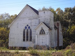 Haven Memorial Methodist Episcopal Churchlisted 1996
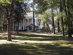 John James Jones Houselisted 1980
 Waynesboro Commercial Historic Districtlisted 1993
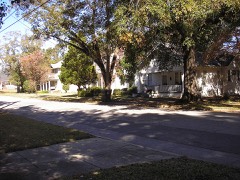 Waynesboro Historic Districtlisted 2009
Surveyed buildings and structures 1 record
- Munnerlyn House, Waynesborofederal building survey, 1 photograph
Population over time
2 figuresWaynesboro grew from 5,766 to 5,799 between 2010 and 2020. These are the recorded population figures Wikidata holds for this place, reached through the Geographic Names Information System number this page is keyed on rather than by name, so they belong to this place and not to another of the same name. Most are census counts, but not all are: an early figure may be a founding or settlement estimate, and an estimate published within five years of a census is left out. The change column is computed, and is left blank where more than 20 years separate a figure from the one before it, because a gap that long is not a change between two counts.
| Year | People | Change |
|---|---|---|
| 2010 | 5,766 | |
| 2020 | 5,799 | +33 (+1%) |
Topographic sheets covering this place
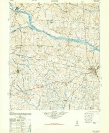
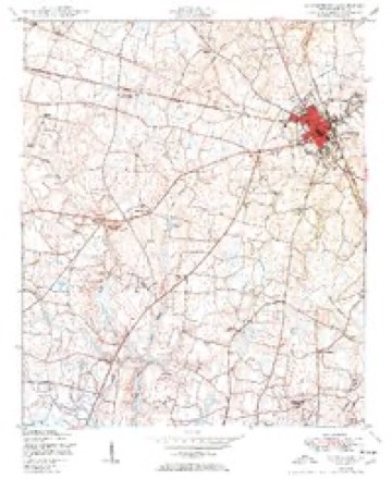
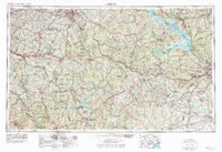
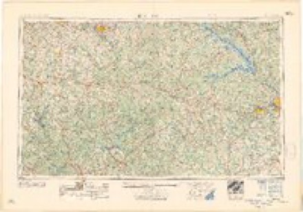
9 surveys from 15 printed sheetsMatched by testing this settlement's coordinate against the published boundary of every sheet in the United States Geological Survey's historical collection. Each opens the scanned sheet at the Survey.
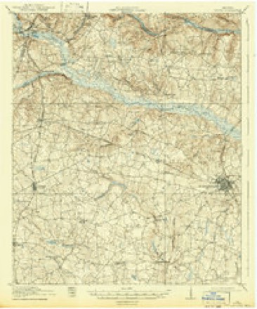
- 1919 USGS Gough quadrangle1:62500, 3 printings
- 1948 USGS Gough quadrangle1:62500, 2 printings
- 1950 USGS Waynesboro quadrangle1:24000, 2 printings
- 1953 USGS Athens quadrangle1:250000, 3 printings
- 1958 USGS Athens quadrangle1:250000
- 1959 USGS Athens quadrangle1:250000
- 1963 USGS Athens quadrangle1:250000
- 1981 USGS Thomson quadrangle1:100000
- 1988 USGS Athens quadrangle1:250000
Photographs
1 photograph,Taken for the Office of War Information and the Farm Security Administration, who photographed the country between 1935 and 1944. Works of United States government photographers, with no known restriction on use. Each opens its catalogue record.
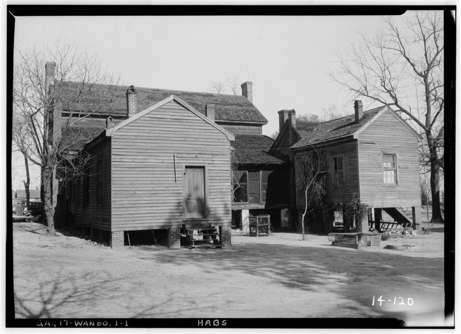
Photographer not recorded. Library of Congress
Fires near this place
241 since 1992Regional context, not property-specific evidence. The federal wildfire occurrence database lists 241 fires within 5 miles of Waynesboro between 1992 and 2020, burning about 1,071 acres in total. 5 started naturally. 48 were recorded as arson. Distance is straight-line from the map coordinates, so a fire counted here may appear on a neighbouring settlement's page as well.
| Reported cause | Fires |
|---|---|
| Debris and open burning | 145 |
| Arson/incendiarism | 48 |
| Misuse of fire by a minor | 16 |
| Missing data/not specified/undetermined | 13 |
| Smoking | 7 |
| Equipment and vehicle use | 7 |
| Natural | 5 |
The most recent of them, most recent first, with the day each was reported and the service that recorded it.
| Date | Cause | Size | Reported by | Name on the report |
|---|---|---|---|---|
| 9 September 1999 | Debris and open burning | under an acre | Georgia Forestry Commission | not named |
| 7 September 2019 | Debris and open burning | under an acre | Georgia Forestry Commission | FY2020BURKE004 |
| 28 September 2006 | Debris and open burning | under an acre | Georgia Forestry Commission | not named |
| 27 September 1994 | Debris and open burning | under an acre | Georgia Forestry Commission | not named |
| 26 September 2017 | Debris and open burning | under an acre | Georgia Forestry Commission | FY2018-BURKE-006 |
| 25 September 2010 | Smoking | under an acre | Georgia Forestry Commission | FY2011-BURKE-012 |
| 23 September 1999 | Missing data/not specified/undetermined | under an acre | Georgia Forestry Commission | not named |
| 22 September 2005 | Misuse of fire by a minor | 1.4 acres | Georgia Forestry Commission | not named |
Settlements close enough to share some of these fires:
Mines and quarries near this place
2 within 5 milesRegional context, not property-specific evidence. The federal mineral resources record lists 2 workings within 5 miles of Waynesboro: 1 occurrence, 1 past producer. None of them still produces. What was taken out: Sand and Gravel, Construction. Distance is straight-line from the map coordinates, so a quarry counted here may appear on a neighbouring settlement's page as well.
| Where | Site | Commodity | Status | Recorded |
|---|---|---|---|---|
| Saxon Pit | Sand and Gravel, Construction | Occurrence | Sedimentary | |
| Unnamed Sand Deposit | Sand and Gravel, Construction | Past Producer | Alluvium |
Storms near this place
60 of 86 shownRegional context, not property-specific evidence. The National Weather Service names Waynesboro in 86 storm reports between 1994 and 2025: 49 thunderstorm wind, 23 hail, 5 flash flood, 5 heavy rain. The reports record 1 injury. Each account below is quoted exactly as the forecast office filed it, from the NOAA Storm Events Database, and each date opens the federal record of that event.
| When | Event | Place named | Harm | What the report says |
|---|---|---|---|---|
| August 1999 | Thunderstorm Wind | Waynesboro | 1 hurt | EPD reported trees fell on car with one injury. |
| April 2011 | Thunderstorm Wind | Waynesboro | $750,000 | Numerous trees and powerlines down. Severe Damage to two manufacturing plants on the north side of town and trees on several homes. |
| October 2022 | Flash Flood | Waynesboro | $75,000 | Waynesboro Fire Chief reported about 5 to 7 homes were flooded with about a half foot of water or less. This included some apartments on Martin Luther King Jr Dr and Magnolia Acres and some homes along Waters St. Several roads were flooded and closed. About 8 vehicles were flooded. 2 people were rescued from a flooded compact car at E 7th St and Fulcher St. No injuries. |
| July 2015 | Thunderstorm Wind | Waynesboro | $54,000 | EM reported some trees down along Hwy 24 a couple miles west of Waynesboro and also in Waynesboro. A car port at a gas station/convenience store was badly damaged, a couple trees fell on homes and one fell on a vehicle. |
| July 2012 | Lightning | Waynesboro | $40,000 | Waynesboro Fire Dept. reported two fires from lightning strikes. One in the 400 block of 4th Street and the other on the 700 block of East 7th Street. |
| August 2012 | Thunderstorm Wind | Waynesboro | $32,000 | Sheriff and Emergeny Manager reported many trees down from Leonard Circle in Waynesboro to Barrett Plantation Road just north of Waynesboro. Some of the trees fell on homes doing minor damage. |
| September 2020 | Flash Flood | Waynesboro | $25,000 | Flash flooding reported, with numerous roads flooded and impassable roads throughout the city of Waynesboro and vicinity. Locations of flooded roadways included Barron St, Perry St, Shadrack St, N. Liberty St, Barron St, Herndon Rd, Burke Veterans Pkwy near Davis Rd, E 7th St, with a roadway washout on Hwy 56 S just south of Edmund Burke Academy. Vehicles were flooded with stranded motorists at Council St at Perry St, Shadrack St near First Baptist Church, and N Liberty St between 9th St and Williams St. Some water entered Brentwood Nursing Home on Brentwood Dr. Water came close to homes near Spring Valley Rd and Lake Bluff Rd. |
| March 2003 | Hail | Waynesboro | $25,000 | Public called and reported 3/4 to 1 inch hail. Several cars had been damaged. |
| June 2010 | Thunderstorm Wind | Waynesboro | $12,000 | Sheriff reported trees down on Thompson Bridge, Creek, and Seven Oaks roads. |
| May 2012 | Thunderstorm Wind | Waynesboro | $5,000 | Fire chief reported a rotten tree toppled a tree onto a home causing minor damage to the roof. |
| June 1994 | Thunderstorm Wind | Waynesboro | $5,000 | Numerous large trees were downed by thunderstorm winds. |
| June 1994 | Thunderstorm Wind | Waynesboro | $5,000 | Several large trees were downed along U.S. Highway 25. |
| June 1994 | Thunderstorm Wind | Waynesboro | $5,000 | Several large trees and power lines were downed near the intersection of Georgia Highways 56 and 23. |
| September 2002 | Tornado (F0) | Waynesboro | $4,500 | A small F0 briefly touched down at 153 Eagle Pass Court and destroyed 1 metal shed and did minor damage to 2 mobile homes. |
| May 2009 | Flash Flood | Waynesboro | $4,000 | Fire Dept. reported hwy 24 near Rosedale road closed due to flooding and high water. Half a mile of hwy 24 was closed as well as secondary roads a few miles west to northwest to north of Sardis. |
| June 2009 | Thunderstorm Wind | Waynesboro | $4,000 | SKYWARN spotter reported trees down in the Greens Cut Community and on hwy 56. |
| June 2011 | Thunderstorm Wind | Waynesboro | $3,000 | Sheriff reported a few trees down across count roadways. |
| May 2003 | Thunderstorm Wind | Waynesboro | $3,000 | EOC reported trees down and a shed destroyed at a home on hwy 25. |
| June 2002 | Thunderstorm Wind | Waynesboro | $3,000 | EOC reported trees down on a mobile home. |
| January 2020 | Lightning | Waynesboro | $2,000 | Waynesboro Fire Dept reported a lightning strike to a water tower on Myrick St in Waynesboro, GA. The strike caused a hole in the discharge pipe at the base of the tank and blew a hole in the natural gas line serving a generator that serves the radio equipment shed under the tower. It also damaged a surge protector on the electrical panel. |
| June 2009 | Thunderstorm Wind | Waynesboro | $2,000 | Police dept. reported a few trees down on hwy 56. |
| August 2008 | Thunderstorm Wind | Waynesboro | $2,000 | Sheriff and city Fire Chief reported large branches down in Waynesboro and powerlines down on Herndon road. |
| July 2012 | Thunderstorm Wind | Waynesboro | $500 | County Official reported a tree down on Usher Road north of Waynesboro. |
| June 2023 | Hail | Waynesboro | $100 | Trained spotter report of pea size hail near Pecan Ln and Hwy 56, SW of Waynesboro. Time estimated. |
| May 2018 | Flood | Waynesboro | $100 | City of Waynesboro PD reported water covering the roadway about four to six inches deep on the US Hwy 25 Bypass and on Davis Rd. |
| April 2017 | Hail | Waynesboro | $10 | Pea size hail reported at Burke Co EMA. |
| June 2025 | Thunderstorm Wind | Waynesboro | - | Burke County dispatch reported powerlines down at 1071 Hwy 80 in Burke County. Time estimated based on radar. |
| June 2023 | Thunderstorm Wind | Waynesboro | - | Multiple trees were snapped or uprooted in Waynesboro City Park. Also, a tree fell onto a car near Spring Valley Rd and Wood Valley Rd, nearby. Time estimated. |
| July 2023 | Thunderstorm Wind | Waynesboro | - | Trees were downed on Clarks Place Rd near Hwy 24, SE of Waynesboro. Time estimated. |
| October 2022 | Heavy Rain | Waynesboro | - | A COOP Observer measured a total rainfall amount of 5.20 inches on Pine Cone Rd about 1 mile south of Waynesboro. Most of that rain fell on the evening of Wednesday October 12th. |
| October 2022 | Heavy Rain | Waynesboro | - | CoCoRaHS observer about 3 miles SW of Waynesboro measured a total rainfall amount of 5.80 inches. Most of that rain fell on the evening of Wednesday October 12th. |
| October 2022 | Heavy Rain | Waynesboro | - | The public reported a total rainfall amount of 6.80 inches on Pecan Lane about 2 miles SW of Waynesboro. Most of that rain fell on the evening of Wednesday October 12th. |
| May 2022 | Thunderstorm Wind | Waynesboro | - | Burke County dispatch reported widespread trees and powerlines down across the county. Time estimate by radar. |
| March 2022 | Hail | Waynesboro | - | Public report, via social media, of one inch hail near and just NE of Waynesboro. Time estimated. |
| March 2021 | Thunderstorm Wind | Waynesboro | - | A tree was downed on Evans Dr. Time estimated. |
| May 2021 | Thunderstorm Wind | Waynesboro | - | Burke Co Emergency Manager reported multiple trees down along Hwy 56 SW of Waynesboro between Herndon Rd and Story Mill Rd. Time estimated. |
| May 2021 | Hail | Waynesboro | - | Burke Co Emergency manager reported nickel sized hail. Time estimated. |
| May 2021 | Thunderstorm Wind | Waynesboro | - | Burke Co Emergency Manager reported a large tree down along with a center pivot irrigation system that was overturned in a field. Exact location not given. Time estimated. |
| September 2020 | Heavy Rain | Waynesboro | - | A CoCoRaHS observer reported a 48 hour rainfall amount of 6.21 inches, most of which fell on Thursday September 17th. |
| June 2019 | Thunderstorm Wind | Waynesboro | - | Trees and power lines down in Waynesboro. |
| July 2018 | Thunderstorm Wind | Waynesboro | - | Tree down on a house on Park Dr in Waynesboro. |
| July 2018 | Thunderstorm Wind | Waynesboro | - | Tree down on a house on Pecan Grove Dr in Waynesboro. |
| July 2018 | Thunderstorm Wind | Waynesboro | - | Tree down on a house on Hwy 24 just outside the Waynesboro city limits. |
| June 2018 | Thunderstorm Wind | Waynesboro | - | Trees down on Liberty St in downtown Waynesboro. |
| March 2017 | Thunderstorm Wind | Waynesboro | - | Burke Co Emergency Manager reported that a roof partially peeled off a warehouse. |
| September 2017 | Heavy Rain | Waynesboro | - | A total rainfall amount of 6.67 inches was measured 3.3 miles SW of Waynesboro. |
| July 2017 | Thunderstorm Wind | Waynesboro | - | Burke Co dispatch reported trees down on Bates Rd at Clark Place Rd. |
| July 2012 | Thunderstorm Wind | Waynesboro | - | Waynesboro Fire Dept reported a tree across the road at Martin Luther King Jr Drive and West 8th St. |
| May 2011 | Hail | Waynesboro | - | Public reported quarter size hail in the Waynesboro area. |
| May 2011 | Hail | Waynesboro | - | Public reported quarter size hail just west of Waynesboro. |
| April 2009 | Hail | Waynesboro | - | Dispatch reported nickel size hail north of town on hwy 25. |
| May 2008 | Hail | Waynesboro | - | Fire department reported quarter size hail. |
| March 2008 | Thunderstorm Wind | Waynesboro | - | Dispatch reported trees and powerlines down from Waynesboro to Girard. |
| May 2008 | Thunderstorm Wind | Waynesboro | - | Sheriff reported several trees and powerlines down in Waynesville. NWS storm survey also confirmed this. |
| June 2007 | Hail | Waynesboro | - | Public and Post Offices reported quarter size hail across the norther portions of Burke County. |
| June 2007 | Thunderstorm Wind | Waynesboro | - | Sheriff reported trees and powerlines down around the city. |
| August 2007 | Hail | Waynesboro | - | Public reported nickel size hail south of the county line near US 25. |
| August 2007 | Hail | Waynesboro | - | Public reported dime to quarter size hail near GA hwy 56. |
| August 2007 | Thunderstorm Wind | Waynesboro | - | WAGT reported a large storage shed blown over and several 3 foot diameter trees blown down near Greystone Ranch. |
| August 2007 | Hail | Waynesboro | - | WAGT reported quarter size hail near Greystone Ranch which damaged a car. |
Nearest settlements
The eight closest, with where each one stands in the county. Distances are straight-line, computed from the Geographic Names Information System coordinates.
| Map | Place | Distance | Sheets |
|---|---|---|---|
| Hatchers Store | 3.6 miles | 15 | |
| Elmore (historical) | 4.2 miles | 15 | |
| Old Church | 5.1 miles | 16 | |
| Thomas Station | 5.3 miles | 16 | |
| Idlewood | 5.5 miles | 16 | |
| Asbury (historical) | 6.6 miles | 16 | |
| Shell Bluff | 7.4 miles | 16 | |
| Le Roy (historical) | 7.9 miles | 15 |
Elsewhere
Matched on this settlement's Geographic Names Information System number rather than its name, so it cannot be a different place of the same name in another state.
| Wikipedia article on Waynesboro | An encyclopaedic summary. Its text is share-alike, so it is linked here rather than copied. |
| Wikidata item Q1282929 | The structured record the population and elevation above come from. Public domain (CC0). |
Provenance
This settlement is recorded in the Geographic Names Information System as feature 347180. The sheet list is computed by point-in-boundary test against the United States Geological Survey's historical topographic inventory. Both are works of the United States government and carry no copyright under 17 U.S.C. 105.
Wildfire. Short, Karen C. 2022. Spatial wildfire occurrence data for the United States, 1992-2020 [FPA_FOD_20221014]. 6th Edition. Fort Collins, CO: Forest Service Research Data Archive. https://doi.org/10.2737/RDS-2013-0009.6 Collected with United States Government funding and usable without additional permissions or fees.
Mines and quarries. USGS Mineral Resources Data System (MRDS) https://mrdata.usgs.gov/mrds/ A work of the United States government, no copyright under 17 U.S.C. 105.
Storms. NOAA National Centers for Environmental Information, Storm Events Database https://www.ncei.noaa.gov/stormevents/ A work of the United States government, no copyright under 17 U.S.C. 105. Narratives are quoted verbatim from the National Weather Service report and are not edited or summarised.