 Block
Welcome, Georgia
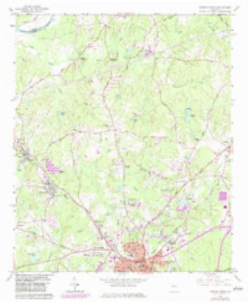
10 topographic sheets cover this place, the earliest surveyed in 1953 and the latest in 1979. It stands in the Newnan census division. It lies in ZIP code area 30263. The Survey maps it on the Newnan North quadrangle.
Topographic sheets covering this place
5 surveys from 10 printed sheetsMatched by testing this settlement's coordinate against the published boundary of every sheet in the United States Geological Survey's historical collection. Each opens the scanned sheet at the Survey.
- 1953 USGS Atlanta quadrangle1:250000, 2 printings
- 1957 USGS Atlanta quadrangle1:250000
- 1958 USGS Atlanta quadrangle1:250000
- 1965 USGS Newnan North quadrangle1:24000, 3 printings
- 1979 USGS Griffin quadrangle1:100000, 3 printings




Fires near this place
304 since 1992Regional context, not property-specific evidence. The federal wildfire occurrence database lists 304 fires within 5 miles of Welcome between 1992 and 2019, burning about 853 acres in total. 7 started naturally. 39 were recorded as arson. Distance is straight-line from the map coordinates, so a fire counted here may appear on a neighbouring settlement's page as well.
| Reported cause | Fires |
|---|---|
| Debris and open burning | 195 |
| Arson/incendiarism | 39 |
| Missing data/not specified/undetermined | 18 |
| Misuse of fire by a minor | 16 |
| Smoking | 11 |
| Recreation and ceremony | 8 |
| Natural | 7 |
| Equipment and vehicle use | 7 |
| Railroad operations and maintenance | 3 |
The most recent of them, most recent first, with the day each was reported and the service that recorded it.
| Date | Cause | Size | Reported by | Name on the report |
|---|---|---|---|---|
| 9 September 2019 | Debris and open burning | under an acre | Georgia Forestry Commission | FY2020COWETA001 |
| 5 September 1999 | Arson/incendiarism | under an acre | Georgia Forestry Commission | not named |
| 3 September 1997 | Arson/incendiarism | 2.3 acres | Georgia Forestry Commission | not named |
| 29 September 1993 | Debris and open burning | 1.3 acres | Georgia Forestry Commission | not named |
| 25 September 1993 | Debris and open burning | under an acre | Georgia Forestry Commission | not named |
| 23 September 1997 | Debris and open burning | under an acre | Georgia Forestry Commission | not named |
| 18 September 2019 | Debris and open burning | 1.0 acres | Georgia Forestry Commission | FY2020COWETA006 |
| 17 September 2019 | Debris and open burning | 1.0 acres | Georgia Forestry Commission | FY2020COWETA005 |
Settlements close enough to share some of these fires:
Mines and quarries near this place
1 within 5 milesRegional context, not property-specific evidence. The federal mineral resources record lists 1 working within 5 miles of Welcome: 1 past producer. None of them still produces. What was taken out: Granite. Distance is straight-line from the map coordinates, so a quarry counted here may appear on a neighbouring settlement's page as well.
| Where | Site | Commodity | Status | Recorded |
|---|---|---|---|---|
| Sam Hill Quarry | Granite | Past Producer |
Storms near this place
29 since 1997Regional context, not property-specific evidence. The National Weather Service names Welcome in 29 storm reports between 1997 and 2026: 22 thunderstorm wind, 4 lightning, 2 flash flood, 1 hail. The reports record 1 injury. Each account below is quoted exactly as the forecast office filed it, from the NOAA Storm Events Database, and each date opens the federal record of that event.
| When | Event | Place named | Harm | What the report says |
|---|---|---|---|---|
| June 2010 | Lightning | Welcome | 1 hurt | The Times Herald of Newnan reported that lightning struck a home on Murphy Road in the Welcome community of western Coweta county. Damages to the home were apparently minor. However, a 27-year old female inside the home was apparently injured by the lightning as she was having difficulty breathing following the incident and was transported to an Atlanta hospital. |
| September 2011 | Lightning | Welcome | $150,000 | The Coweta County Emergency Management Director reported that lightning struck yet a third home, this time in western Coweta county. The home suffered extensive fire and smoke damage as a result of the lightning strike, rendering the home uninhabitable. |
| August 2024 | Thunderstorm Wind | Welcome | $80,000 | Numerous trees down along a near continuous path extending from near Handy Rd and Keith Rd west of Newnan to near the Senoia Raceway northwest of Senoia. A few trees fell on homes and cars causing significant damage. Other damage of note included snapped power poles on the southside of Newnan. |
| August 2023 | Thunderstorm Wind | Welcome | $15,000 | Over a dozen trees blown down in a large swath north and west of Newnan. Heavily impacted areas include Welcome Rd, Mt Carmel Rd, Smith Rd and Roscoe Rd. |
| June 2018 | Thunderstorm Wind | Welcome | $15,000 | The Coweta County 911 center reported multiple trees and power lines blown down along a line from west of Newnan, along Welcome Road, to around Thomas Crossroads along Andrew Bailey Road. Damage from same storms continued into western Fayette County. |
| October 2010 | Lightning | Welcome | $15,000 | The Newnan Times-Herald reported that lightning struck an outbuilding on Providence Church Road just west of Newnan. The building was apparently destroyed from the resulting fire. |
| June 2010 | Lightning | Welcome | $10,000 | The Times Herald of Newnan reported that lightning struck an outbuilding on Jack Russell Road just off Mount Carmel Road in the Welcome community of western Coweta county. The structure and all of its contents were a total loss from the resulting fire. |
| August 2024 | Thunderstorm Wind | Welcome | $5,000 | Tree on house in the 500 block of ishman ballard rd. |
| May 2019 | Thunderstorm Wind | Welcome | $5,000 | Dispatch reported at least 2 trees down along Welcome Rd just before Hwy 34. |
| August 2013 | Thunderstorm Wind | Welcome | $5,000 | The Coweta County Emergency Manager and the public reported trees down near Thomas Crossroads, with power out as well. Power lines were down in four areas: the 500 block of Shaw Road, the 4000 and 4500 blocks of Highway 29 and the 200 block of Sam Road. Trees were also reported down on Lynhaven Drive, Salbide Avenue and Bruce Jackson Road. |
| June 2019 | Thunderstorm Wind | Welcome | $3,000 | The Coweta County Emergency Manager reported tress blown down in the 300 block of Summers McKoy Road. |
| July 2016 | Thunderstorm Wind | Welcome | $3,000 | The Coweta County 911 center reported several trees blown down along Providence Church Road and Turner Road. |
| September 2014 | Flash Flood | Welcome | $3,000 | The public reported from near Newnan to Grantville several roads and neighborhood yards flooded from nearby drainage creeks. The flood waters entered some garages and caused minor damage. |
| March 1997 | Thunderstorm Wind | Welcome | $3,000 | no account filed |
| June 2023 | Thunderstorm Wind | Welcome | $2,000 | Public report of two trees reported snapped at the 200 block of Handy Rd. |
| January 2026 | Thunderstorm Wind | Welcome | $1,000 | Tree down on derring cir and ishman ballard rd. |
| March 2025 | Thunderstorm Wind | Welcome | $1,000 | Report of powerlines downed by thunderstorms winds near Dixon Rd and Franklin Rd. |
| July 2024 | Thunderstorm Wind | Welcome | $1,000 | Tree down on Girl Scout Road near Welcome-to-Arnco Road. |
| August 2023 | Thunderstorm Wind | Welcome | $1,000 | A tree was reported down near the intersection of Austin Rd and Welcome Sargent Rd. |
| June 2023 | Thunderstorm Wind | Welcome | $1,000 | Emergency manager reported powerlines down at Franklin Rd and Newnan Bypass Rd. |
| June 2022 | Thunderstorm Wind | Welcome | $1,000 | A transformer fire and power line were reported down on Pete Davis Rd. |
| December 2021 | Thunderstorm Wind | Welcome | $1,000 | Tree reported down at the intersection of Providence Rd and Keith rd. |
| December 2021 | Thunderstorm Wind | Welcome | $1,000 | Tree reported down at the intersection of Lazenby Rd and Welcome Rd. |
| February 2019 | Thunderstorm Wind | Welcome | $1,000 | The Coweta County Emergency Manager reported a tree blown down near the intersection of Highway 34 and Providence Church Road. |
| June 2018 | Thunderstorm Wind | Welcome | $1,000 | The Coweta County 911 center reported a tree blown down on Mt. Carmel Road northwest of Newnan. |
| May 2014 | Thunderstorm Wind | Welcome | $500 | The Coweta County 911 Center reported that a couple of trees were blown down along Franklin Road. |
| August 2001 | Thunderstorm Wind | Welcome | $500 | The Coweta county 911 center reported that a large oak tree was blown down and tree tops were broken out of some large pine trees in Newnan. |
| May 2015 | Flash Flood | Welcome | - | Several inches of rain in a short period of time west of Newnan caused an apparent earthen dam to break at Aspen Lake. The lake was drained with water spilling out around the lake and surrounding community. No injuries were reported and it is unknown the exact damage costs. |
| June 1999 | Hail | Welcome | - | Coweta county 911 center and the public reported dime to golfball size hail. |
Nearest settlements
The eight closest, with where each one stands in the county. Distances are straight-line, computed from the Geographic Names Information System coordinates.
| Map | Place | Distance | Sheets |
|---|---|---|---|
| Arnco Mills | 1.7 miles | 10 | |
| Wedgewood | 2.1 miles | 10 | |
| Lynhaven | 2.3 miles | 10 | |
| Gloverton | 2.3 miles | 10 | |
| Sargent | 2.5 miles | 10 | |
| West Newnan | 2.5 miles | 10 | |
| Pine Hills | 3.2 miles | 10 | |
| Sherwood Forest | 3.5 miles | 10 |
Provenance
This settlement is recorded in the Geographic Names Information System as feature 333382. The sheet list is computed by point-in-boundary test against the United States Geological Survey's historical topographic inventory. Both are works of the United States government and carry no copyright under 17 U.S.C. 105.
Wildfire. Short, Karen C. 2022. Spatial wildfire occurrence data for the United States, 1992-2020 [FPA_FOD_20221014]. 6th Edition. Fort Collins, CO: Forest Service Research Data Archive. https://doi.org/10.2737/RDS-2013-0009.6 Collected with United States Government funding and usable without additional permissions or fees.
Mines and quarries. USGS Mineral Resources Data System (MRDS) https://mrdata.usgs.gov/mrds/ A work of the United States government, no copyright under 17 U.S.C. 105.
Storms. NOAA National Centers for Environmental Information, Storm Events Database https://www.ncei.noaa.gov/stormevents/ A work of the United States government, no copyright under 17 U.S.C. 105. Narratives are quoted verbatim from the National Weather Service report and are not edited or summarised.