 Block
Winston, Georgia
17 topographic sheets cover this place, the earliest surveyed in 1891 and the latest in 1981. It stands in the Winston census division. It lies in ZIP code area 30187. It lies near Andy Mountain. The Survey maps it on the Winston quadrangle. It stands 1,197 feet above sea level.
On record in Winston
Buildings and businesses the archive holds for this place. Each opens its own page, with the source record it came from.
On the National Register 1 record
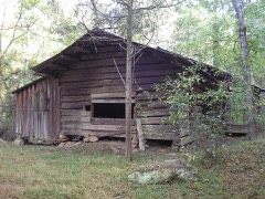 John Thomas Carnes Family Log Houselisted 2001
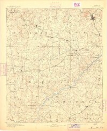
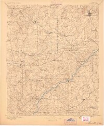
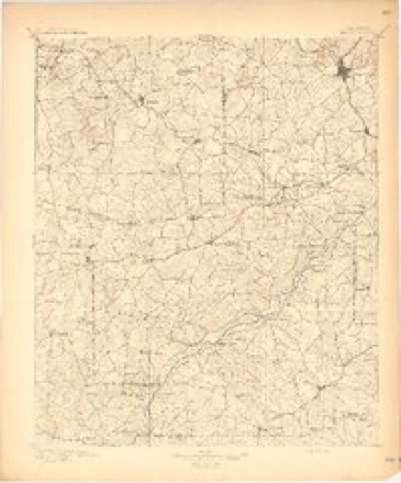
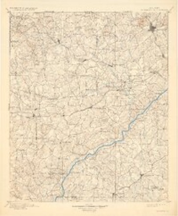
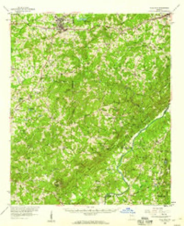
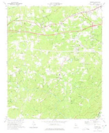
Topographic sheets covering this place
10 surveys from 17 printed sheetsMatched by testing this settlement's coordinate against the published boundary of every sheet in the United States Geological Survey's historical collection. Each opens the scanned sheet at the Survey.
- 1891 USGS Marietta quadrangle1:125000
- 1895 USGS Marietta quadrangle1:125000
- 1897 USGS Marietta quadrangle1:125000
- 1901 USGS Marietta quadrangle1:125000, 4 printings
- 1953 USGS Atlanta quadrangle1:250000, 2 printings
- 1957 USGS Atlanta quadrangle1:250000
- 1958 USGS Atlanta quadrangle1:250000
- 1958 USGS Villa Rica quadrangle1:62500, 2 printings
- 1973 USGS Winston quadrangle1:24000, 3 printings
- 1981 USGS Atlanta quadrangle1:100000




Fires near this place
175 since 1992Regional context, not property-specific evidence. The federal wildfire occurrence database lists 175 fires within 5 miles of Winston between 1992 and 2019, burning about 638 acres in total. 3 started naturally. 58 were recorded as arson. Distance is straight-line from the map coordinates, so a fire counted here may appear on a neighbouring settlement's page as well.
| Reported cause | Fires |
|---|---|
| Debris and open burning | 66 |
| Arson/incendiarism | 58 |
| Misuse of fire by a minor | 14 |
| Equipment and vehicle use | 12 |
| Recreation and ceremony | 10 |
| Missing data/not specified/undetermined | 9 |
| Natural | 3 |
| Smoking | 2 |
| Railroad operations and maintenance | 1 |
The most recent of them, most recent first, with the day each was reported and the service that recorded it.
| Date | Cause | Size | Reported by | Name on the report |
|---|---|---|---|---|
| 7 September 1999 | Recreation and ceremony | 1.0 acres | Georgia Forestry Commission | not named |
| 5 September 1995 | Debris and open burning | under an acre | Georgia Forestry Commission | not named |
| 26 September 1993 | Misuse of fire by a minor | 18 acres | Georgia Forestry Commission | not named |
| 22 September 1999 | Arson/incendiarism | 2.8 acres | Georgia Forestry Commission | not named |
| 20 September 1993 | Arson/incendiarism | under an acre | Georgia Forestry Commission | not named |
| 15 September 1999 | Arson/incendiarism | 8.1 acres | Georgia Forestry Commission | not named |
| 1 September 2011 | Arson/incendiarism | 3.1 acres | Georgia Forestry Commission | FY2012-PAULDING-007 |
| 24 August 2007 | Natural | 5.3 acres | Georgia Forestry Commission | not named |
Settlements close enough to share some of these fires:
Mines and quarries near this place
7 within 5 milesRegional context, not property-specific evidence. The federal mineral resources record lists 7 workings within 5 miles of Winston: 3 past producers, 2 occurrences, 1 prospect, 1 producer. 1 still produces. What was taken out: Iron-Pyrite, Sulfur, Gold, Gold, Copper. Distance is straight-line from the map coordinates, so a quarry counted here may appear on a neighbouring settlement's page as well.
| Where | Site | Commodity | Status | Recorded |
|---|---|---|---|---|
| Douglasville Quarry | Stone, Crushed/Broken | Producer | ||
| Keaten-Thomas Prospect | Iron-Pyrite, Gold, Copper | Occurrence | Gossan | |
| Villa Rica | Iron-Pyrite, Copper, Zinc, Cobalt, Nickel | Occurrence | Stratabound Concordant Massive Sulfide | |
| Keaton-Thomas Prospect | Sulfur | Prospect | ||
| No Name, Lot 77 2nd Dist. | Gold | Past Producer | Stream Placer | |
| Pine Mt. Mine | Gold | Past Producer | Stratabound Disseminated Sulfide | |
| Villa Rica Mine | Sulfur | Past Producer |
Storms near this place
60 of 65 shownRegional context, not property-specific evidence. The National Weather Service names Winston in 65 storm reports between 1997 and 2026: 42 thunderstorm wind, 17 hail, 3 flash flood, 2 lightning. The reports record 2 injuries. Each account below is quoted exactly as the forecast office filed it, from the NOAA Storm Events Database, and each date opens the federal record of that event.
| When | Event | Place named | Harm | What the report says |
|---|---|---|---|---|
| April 2025 | Thunderstorm Wind | Winston | 2 hurt | Tree down on car at high point rd near stockmar rd. |
| March 2008 | Hail | Winston | $5,000,000 | An amateur radio operator relayed a report of baseball-sized hail at Lee Road and Fairburn Road, just south of Interstate 20. The public and reported golf ball to tennis ball-sized hail across northern Douglas county, roughly along and just north of Interstate-20. Golf ball-sized hail was also reported by the public in Winston and west of Winston near Villa Rica. An amateur radio operator reported golf ball-sized just north of Douglasville, and the public observed tennis ball-sized hail east of Douglasville, between Douglasville and Sweetwater State Park. Another amateur radio operator observed nickel to tennis ball-sized hail approximately two miles southwest of the intersection of Interstate-20 and Georgia Highway 92. |
| June 2011 | Hail | Winston | $3,200,000 | Several reports of large damaging hail were received from across the northern half of Douglas county. The public observed baseball-sized hail in Douglasville. An amateur radio operator relayed a report of golf ball-sized hail in the northwest part of the county, near Winston. The public observed half-dollar-sized hail in the eastern part of the county near Lithia Springs. |
| February 2008 | Thunderstorm Wind | Winston | $500,000 | The Douglas County 911 Center reported that several trees and power lines were blown down across the entire county. The public reported that a portion of the roof covering pumps at a gas station in Lithia Springs, just down the street from the Lithia Springs High School, was torn off by strong winds. Several homes were damaged when trees fell on them. A total of 15,500 residents of the county were left without power for several hours following the storm. |
| December 2015 | Flash Flood | Winston | $478,000 | A USGS stream gauge on the Dog River at Bill Arp Road or Georgia Highway 5 near Fairplay reached flood stage of 13 feet. The river crest at 13.9 feet. Minor flooding occurred in the woodlands and natural flood plain upstream and downstream from the gauge. Several roads and culverts were washed out on tributaries leading to the river. |
| August 2010 | Lightning | Winston | $150,000 | The Douglas County Emergency Management Director reported that four lightning-related fires occurred across the county between 549 pm EDT and 601 pm EDT as strong thunderstorms tracked from northwest to southeast. |
| July 2003 | Thunderstorm Wind | Winston | $75,000 | The Douglas county 911 center reported that a number of trees had been blown down throughout the Douglasville area. The public reported that two trees were down near the Douglas/Carroll county border, just east of Villa Rica. The Douglas County Sentinel reported that a home on Hollis Street was partially crushed when a large tree fell on the house. Although the occupant was at home during the event, he did not suffer any injuries. |
| June 2011 | Thunderstorm Wind | Winston | $35,000 | The Douglas County Emergency Management Director reported that at least eight trees were down across the county, including one on a home on Bankhead Road in Lithia Springs. A tree was also down on a power line at Yeager Road near Bear Creek Road. Damage was scattered throughout the county from northwest to southeast. |
| November 2004 | Thunderstorm Wind | Winston | $25,000 | The Douglas County Emergency Management Director reported that power lines were down in the northwest part of the county and from 30 to 40 trees were blown down within a one-mile radius of downtown Lithia Springs. |
| June 2023 | Thunderstorm Wind | Winston | $20,000 | The 911 Center reported trees down at several locations in northwest Douglas county, including Stockmar Road, I-20, Andy Mountain Road, Nalley Road, several along Veterans Memorial Highway, GA Highway 61, Tyson Road, Summer Cypress Drive, and powerlines down at Stockmar Drive. |
| August 2023 | Thunderstorm Wind | Winston | $12,000 | Dozens of trees and powerlines down across the southwest Douglasville area. |
| July 2023 | Thunderstorm Wind | Winston | $10,000 | Emergency manager reported multiple trees down near the intersection of Highway 5 and Amber Dr. |
| July 2015 | Thunderstorm Wind | Winston | $10,000 | The Douglas County 911 Center and the Douglasville Police Department reported trees and power lines blown down in the Douglasville area. Trees were reported down along I-20 between Post Road and Highway 5 and on Knollwood Circle. Power lines were reported down at Fairburn Road and Durelee Lane. |
| April 2020 | Thunderstorm Wind | Winston | $8,000 | Trees reported down along Mason Creek Road. |
| June 2018 | Thunderstorm Wind | Winston | $7,000 | The Douglas County Emergency Manager reported several trees blown down from Winston to east of Fairplay. |
| June 2023 | Thunderstorm Wind | Winston | $5,000 | The 911 Center reported trees down at I-20 near mile 30 and Veterans Memorial Highway at the intersection with Post Road. |
| June 2023 | Thunderstorm Wind | Winston | $5,000 | Public report of several Trees downed at the intersection of Conners road and Tyson Road. |
| May 2008 | Thunderstorm Wind | Winston | $5,000 | The Douglas County 911 Center reported that several trees and power lines were blown down throughout the city of Douglasville. The public reported that tree limbs were down in Winston and estimated wind gusts at 60 mph. |
| August 2019 | Thunderstorm Wind | Winston | $4,000 | The Douglas County Emergency Manager reported trees and power lines blown down near the intersection of Mann Road and Poppy Drive. A single tree was also reported down near Dorsett Shoals Road, west of Chapel Hill. |
| May 2025 | Thunderstorm Wind | Winston | $3,000 | Three trees downed across roadway along liberty rd. |
| May 2025 | Thunderstorm Wind | Winston | $2,000 | Tree down at mann rd and brewer rd as well as indian trail and corn crib loop. |
| May 2025 | Thunderstorm Wind | Winston | $2,000 | Two trees downed across roadway along liberty rd. |
| December 2024 | Thunderstorm Wind | Winston | $2,000 | A tree and utility lines were downed on Cedar Mountain Rd at Mann Rd. |
| April 2020 | Thunderstorm Wind | Winston | $2,000 | Tree down at Andy Mountain Road and Hwy 78. |
| July 2010 | Thunderstorm Wind | Winston | $2,000 | The Douglas County 911 Center reported that three trees were down in the county from thunderstorm winds. The trees were down on Wallace Lake Road, Beaver Lake Road, and Mann Road at the railroad crossing. The tree down on Wallace Lake Road was also on a power line. The public measured wind gusts at 43 mph during this thunderstorm in the Douglasville area. |
| March 2026 | Thunderstorm Wind | Winston | $1,000 | The emergency manager relayed a report of a tree down on a roadway near napa valley drive and brewer road. |
| March 2026 | Thunderstorm Wind | Winston | $1,000 | The emergency manager relayed a report of a tree with powerlines blocking pool road near the intersection with post road. |
| February 2025 | Thunderstorm Wind | Winston | $1,000 | Emergency manager reports tree down on summer breeze dr at shaded oasis ln. |
| February 2025 | Thunderstorm Wind | Winston | $1,000 | Em reports tree down at post rd and mason creek rd. |
| May 2025 | Thunderstorm Wind | Winston | $1,000 | Emergency manager reported a tree down across the road on Pocahontas Dr. |
| May 2025 | Thunderstorm Wind | Winston | $1,000 | Tree downed across roadway on 9400 block of e liberty rd. |
| July 2024 | Thunderstorm Wind | Winston | $1,000 | Powerlines down along Mason Creek Road just south of Cowan Mill Road. |
| August 2023 | Thunderstorm Wind | Winston | $1,000 | Power line reported down on Mason Creek Rd at Franklin Forest Dr. |
| August 2023 | Thunderstorm Wind | Winston | $1,000 | Power lines reported down on Bright Star Rd near Douglas Blvd. |
| August 2023 | Thunderstorm Wind | Winston | $1,000 | Report of tree down on Oak Drive. |
| December 2011 | Thunderstorm Wind | Winston | $1,000 | The Douglas County 911 Center reported that three trees were down in the Winston area. |
| May 2011 | Thunderstorm Wind | Winston | $1,000 | The public reported that three trees were down near Winston. |
| June 2006 | Thunderstorm Wind | Winston | $1,000 | The public reported that four trees were blown down at a private residence. |
| July 2002 | Thunderstorm Wind | Winston | $500 | An amateur radio operator reported that some trees were down near Interstate 20 and Post Road. |
| June 2006 | Thunderstorm Wind | Winston | $250 | The Douglas County 911 Center reported that one tree was blown down. Wind gusts were estimated by the public at 40 to 50 mph in the area at the time. |
| June 2006 | Lightning | Winston | $250 | The public reported that a lightning strike split a large oak tree and caused the tree to fall. |
| April 2025 | Thunderstorm Wind | Winston | - | Multiple trees down in vicinity of veterans memorial parkway and tyson rd. |
| April 2025 | Thunderstorm Wind | Winston | - | Tree downed on a vehicle along liberty road . |
| December 2024 | Thunderstorm Wind | Winston | - | A tree was downed onto I-20 W at mile marker 27. Several vehicles hit the tree. |
| January 2023 | Thunderstorm Wind | Winston | - | Tree down near the intersection of Liberty Rd and E Liberty Rd. |
| August 2023 | Flash Flood | Winston | - | The Emergency Manager reported flooding at the intersection of Bright Star Road and Central Church Road. Radar estimates indicate that between 5 and 6 inches of rain occurred over the area, resulting in the flash flooding. |
| July 2022 | Thunderstorm Wind | Winston | - | Large tree down on powerlines on Village Entrance Road. |
| June 2022 | Thunderstorm Wind | Winston | - | Multiple trees down near intersection of East Liberty Rd and Liberty Rd. |
| February 2020 | Flash Flood | Winston | - | The Emergency Manager reported high water conditions closing Cedar Mountain Road and Brittain Road due to Waterfall Branch and Mud Creek. Radar estimates indicate that 2 to 4 inches of rain occurred, falling on already wet soils and producing flash flooding. |
| April 2017 | Hail | Winston | - | A report was received on social media of quarter size hail between Villa Rica and Douglasville. |
| March 2012 | Hail | Winston | - | The public reported that nickel-sized hail occurred at a location off Post Road. |
| May 2012 | Hail | Winston | - | The public reported pea to quarter sized hail in Winston. |
| January 2012 | Hail | Winston | - | The public reported 0.88 inch hail southwest of Winston. |
| August 2011 | Hail | Winston | - | The public observed nickel-sized hail between Villa Rica and Winston in the northwest part of the county and the Douglas County 911 Center relayed a report of penny-sized hail just east-southeast of Fairplay. WSR-88D radar data suggested that similar size hail likely fell from northwest to southeast across much of the county. The Douglas County 911 Center also reported that one tree was blown down just east-southeast of Fairplay. |
| June 2011 | Hail | Winston | - | The public observed nickel-sized hail near Douglasville. |
| September 2011 | Funnel Cloud | Winston | - | Amateur radio operators relayed a report of a funnel cloud just east of Winston. WSR-88D storm-relative velocity data indicated strong rotation in this area at the time. A tornado warning was in effect for the area. |
| May 2009 | Hail | Winston | - | The public observed nickel to quarter-sized hail in far western Douglas county west of Winston and toward Villa Rica and the Carroll county border. |
| June 2006 | Hail | Winston | - | The public reported penny-sized hail at the Fairmount Food Store in Winston. |
| April 2005 | Hail | Winston | - | A storm spotter reported quarter-sized hail in Winston, while the public observed penny-sized hail at the Wal Mart in Douglasville. |
| July 2002 | Hail | Winston | - | Several reports of hail, ranging in size from dimes to ping-pong balls, were received from the public and amateur radio operators. In one instance in Douglasville, the larger hail was interspersed within a ten minute period of dime-size hail, which covered the ground. |
Nearest settlements
The eight closest, with where each one stands in the county. Distances are straight-line, computed from the Geographic Names Information System coordinates.
| Map | Place | Distance | Sheets |
|---|---|---|---|
| White City | 1.2 miles | 17 | |
| Ephesus Heights | 1.4 miles | 17 | |
| Gregory Heights | 2.0 miles | 17 | |
| Blain Woods | 2.0 miles | 17 | |
| Executive Heights | 2.2 miles | 17 | |
| Bright Star | 2.3 miles | 17 | |
| Cowan Mill Estates | 2.3 miles | 17 | |
| White Oak Estates | 2.4 miles | 17 |
Elsewhere
Matched on this settlement's Geographic Names Information System number rather than its name, so it cannot be a different place of the same name in another state.
| Wikipedia article on Winston | An encyclopaedic summary. Its text is share-alike, so it is linked here rather than copied. |
| Wikidata item Q14686961 | The structured record the population and elevation above come from. Public domain (CC0). |
Provenance
This settlement is recorded in the Geographic Names Information System as feature 333453. The sheet list is computed by point-in-boundary test against the United States Geological Survey's historical topographic inventory. Both are works of the United States government and carry no copyright under 17 U.S.C. 105.
Wildfire. Short, Karen C. 2022. Spatial wildfire occurrence data for the United States, 1992-2020 [FPA_FOD_20221014]. 6th Edition. Fort Collins, CO: Forest Service Research Data Archive. https://doi.org/10.2737/RDS-2013-0009.6 Collected with United States Government funding and usable without additional permissions or fees.
Mines and quarries. USGS Mineral Resources Data System (MRDS) https://mrdata.usgs.gov/mrds/ A work of the United States government, no copyright under 17 U.S.C. 105.
Storms. NOAA National Centers for Environmental Information, Storm Events Database https://www.ncei.noaa.gov/stormevents/ A work of the United States government, no copyright under 17 U.S.C. 105. Narratives are quoted verbatim from the National Weather Service report and are not edited or summarised.