 Block
Woodstock, Georgia
23 topographic sheets cover this place, the earliest surveyed in 1890 and the latest in 1992. It stands in the Woodstock census division. It lies in ZIP code area 30188. It stands on Posey Branch. The Survey maps it on the Kennesaw quadrangle. 35,065 people lived here at the 2020 count. It stands 955 feet above sea level.
Research this city
On record in Woodstock
Buildings and businesses the archive holds for this place. Each opens its own page, with the source record it came from.
On the National Register 1 record
 Woodstock Depotlisted 1995
Surveyed buildings and structures 1 record
- Greenhouse Service Station, 522 South Main Street, Woodstockfederal building survey, 8 photographs
Population over time
2 figuresWoodstock grew from 23,896 to 35,065 between 2010 and 2020. These are the recorded population figures Wikidata holds for this place, reached through the Geographic Names Information System number this page is keyed on rather than by name, so they belong to this place and not to another of the same name. Most are census counts, but not all are: an early figure may be a founding or settlement estimate, and an estimate published within five years of a census is left out. The change column is computed, and is left blank where more than 20 years separate a figure from the one before it, because a gap that long is not a change between two counts.
| Year | People | Change |
|---|---|---|
| 2010 | 23,896 | |
| 2020 | 35,065 | +11,169 (+47%) |
Topographic sheets covering this place
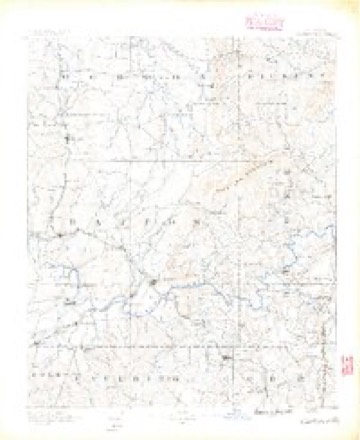
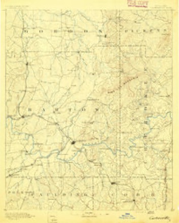
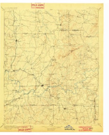
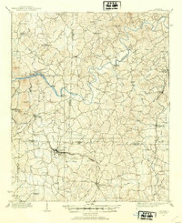
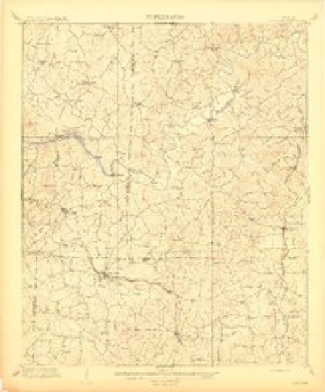
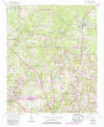
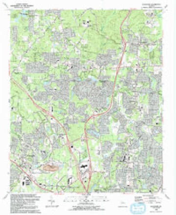
12 surveys from 23 printed sheetsMatched by testing this settlement's coordinate against the published boundary of every sheet in the United States Geological Survey's historical collection. Each opens the scanned sheet at the Survey.
- 1890 USGS Cartersville quadrangle1:125000
- 1891 USGS Cartersville quadrangle1:125000
- 1896 USGS Cartersville quadrangle1:125000, 4 printings
- 1907 USGS Acworth quadrangle1:62500
- 1909 USGS Acworth quadrangle1:62500
- 1955 USGS Rome quadrangle1:250000
- 1956 USGS Kennesaw quadrangle1:24000, 5 printings
- 1958 USGS Rome quadrangle1:250000, 3 printings
- 1961 USGS Rome quadrangle1:250000
- 1963 USGS Rome quadrangle1:250000
- 1981 USGS Cartersville quadrangle1:100000, 2 printings
- 1992 USGS Kennesaw quadrangle1:24000, 2 printings





Photographs
1 photograph,Taken for the Office of War Information and the Farm Security Administration, who photographed the country between 1935 and 1944. Works of United States government photographers, with no known restriction on use. Each opens its catalogue record.
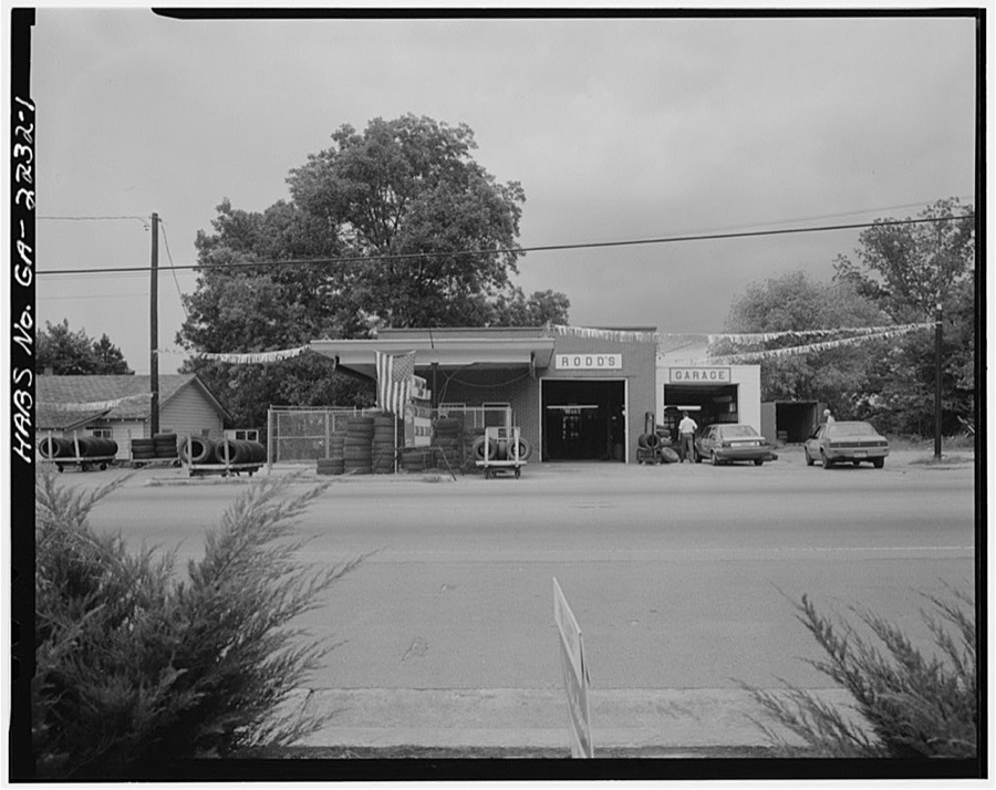
Photographer not recorded. Library of Congress
Fires near this place
349 since 1992Regional context, not property-specific evidence. The federal wildfire occurrence database lists 349 fires within 5 miles of Woodstock between 1992 and 2017, burning about 636 acres in total. 5 started naturally. 87 were recorded as arson. Distance is straight-line from the map coordinates, so a fire counted here may appear on a neighbouring settlement's page as well.
| Reported cause | Fires |
|---|---|
| Debris and open burning | 107 |
| Arson/incendiarism | 87 |
| Misuse of fire by a minor | 66 |
| Railroad operations and maintenance | 24 |
| Missing data/not specified/undetermined | 19 |
| Recreation and ceremony | 16 |
| Equipment and vehicle use | 15 |
| Smoking | 10 |
| Natural | 5 |
The most recent of them, most recent first, with the day each was reported and the service that recorded it.
| Date | Cause | Size | Reported by | Name on the report |
|---|---|---|---|---|
| 9 September 1999 | Arson/incendiarism | under an acre | Georgia Forestry Commission | not named |
| 9 September 1998 | Recreation and ceremony | 2.4 acres | Georgia Forestry Commission | not named |
| 8 September 1996 | Arson/incendiarism | under an acre | Georgia Forestry Commission | not named |
| 8 September 1996 | Arson/incendiarism | under an acre | Georgia Forestry Commission | not named |
| 5 September 2002 | Misuse of fire by a minor | under an acre | Georgia Forestry Commission | FY2003-CHEROKEE-006 |
| 5 September 1997 | Arson/incendiarism | 2.5 acres | Georgia Forestry Commission | not named |
| 5 September 1997 | Arson/incendiarism | 1.1 acres | Georgia Forestry Commission | not named |
| 5 September 1997 | Arson/incendiarism | under an acre | Georgia Forestry Commission | not named |
Settlements close enough to share some of these fires:
Mines and quarries near this place
10 of 21 shownRegional context, not property-specific evidence. The federal mineral resources record lists 21 workings within 5 miles of Woodstock: 16 past producers, 5 prospects. None of them still produces. What was taken out: Gold, Mica, Iron, Manganese. Distance is straight-line from the map coordinates, so a quarry counted here may appear on a neighbouring settlement's page as well.
| Where | Site | Commodity | Status | Recorded |
|---|---|---|---|---|
| Bell-Star Mine | Iron, Manganese | Prospect | 1918 | |
| Dean Mine | Mica | Past Producer | ||
| Delay Prospect | Mica | Prospect | ||
| Hause Mines | Mica | Past Producer | ||
| J D Hillhouse Mines | Mica | Past Producer | ||
| J V Ledford Mine | Mica | Past Producer | ||
| M M Cole Mine | Mica | Past Producer | ||
| Wacaster Mine | Mica | Past Producer | ||
| Bell-Star | Gold | Past Producer | Vein | |
| Cherokee Mine | Gold | Past Producer |
Storms near this place
60 of 106 shownRegional context, not property-specific evidence. The National Weather Service names Woodstock in 106 storm reports between 1993 and 2025: 44 hail, 37 thunderstorm wind, 14 lightning, 5 tornado. The reports record 13 injuries. Each account below is quoted exactly as the forecast office filed it, from the NOAA Storm Events Database, and each date opens the federal record of that event.
| When | Event | Place named | Harm | What the report says |
|---|---|---|---|---|
| August 2000 | Lightning | Woodstock | 6 hurt, $30,000 | The Atlanta Journal and Constitution reported that lightning injured six people and set one house on fire. One person was injured in his Woodstock house when a lightning bolt traveled through the electrical wiring of a lamp located on the piano he was playing. He was knocked unconscious for some time. Two women boating on Lake Allatoona were struck and injured by lightning. Finally, a house was set on fire and three people were injured in the Woodstock area when lightning struck the house. Damage to the house was confined mainly to the roof and attic. All of the injured were treated and released. None of the injuries were reported to be life-threatening. |
| February 2001 | Thunderstorm Wind | Woodstock | 4 hurt, $35,000 | The Cherokee county Emergency Management Director reported that glass was blown out of a building in Woodstock injuring four people. Two trees were blown down on a car, and numerous other trees were blown down in the Woodstock area, many on power lines. An amateur radio operator reported that traffic signals were blown down on Georgia Highway 92 at Interstate 575. Much of the damage occurred near Georgia Highway 92. |
| April 2009 | Tornado (EF1) | Woodstock | 2 hurt, $5,000,000 | A damage survey conducted by the National Weather Service Forecast Office in Peachtree City, Georgia confirmed that an EF1 tornado touched down in far southeast Cherokee county near the Cobb county line in the Woodstock area. The tornado touched down near the intersection of Georgia Highway 92 and Dial Drive, then continued north-northeast along Dial Drive crossing a large section of Coleman's Bluff. The tornado lifted just south of the intersection of Windcrest Court and River Chase Drive. The total path length of the tornado was 1.5 miles with a maximum path width of 1/2 mile or 880 yards. Maximum winds were estimated to be 90 mph. EF1 tornado damage to trees and structures was observed along a 3/4 mile-long path paralleling Dial Drive beginning just north of its intersection with Georgia Highway 92. Damage was observed to 120 homes along the path of the tornado, 12 of which were completely destroyed. The majority of the damage took place in the Coleman's Bluff area. Most of the damage was the result of large trees falling on the structures. Two residents of the affected homes were injured by debris. |
| September 2011 | Tornado (EF1) | Woodstock | 1 hurt, $17,000,000 | A damage survey conducted by the National Weather Service Forecast Office in Peachtree City, Georgia and the Cherokee County Emergency Manager confirmed that an EF1 tornado, spawned by strong shear associated with the remnants of Tropical Storm Lee, touched down in southern Cherokee county, just south of the Dixie Speedway, or just west of Woodstock, then tracked north-northeast across eastern Cherokee county before moving into southeastern Pickens county near the city of Nelson. The tornado, with a semi-continuous path nearly 24 miles long across Cherokee county, had a maximum path width of 1/4 mile and maximum wind gusts of 90 mph. The tornado caused extensive damage to homes and business across eastern Cherokee county. The Brookshire and Town Lake Hills South subdivisions sustained much of the structural damage within the county. The Dixie Speedway, just west of Woodstock, suffered extensive damage as well. A number of recreational vehicles and boats were parked at the facility in anticipation of an event. Dozens of these were overturned and destroyed by the tornado. Over 600 single-family homes sustained some form of structural damage, with seven of these homes completely destroyed. One injury was confirmed at one of the heavily damaged homes. A total of 148 homes sustained major damage and 269 sustained minor damage. In addition, six apartment units sustained damage, with three of these classified as having major damage. Twenty commercial businesses were affected by the tornado, three of which were destroyed. Sixteen of these businesses suffered major damage. Finally, three churches sustained damage, two of which suffered major damage. In addition to the structural damage, hundreds of trees were damaged or destroyed by the tornado, many of which subsequently caused damage to adjacent structures and dozens of vehicles.||[09/05/11: Tornado #1, County #1-2, EF1, Cherokee-Pickens, 2011:025]. |
| September 2015 | Hail | Woodstock | $2,300,000 | The Woodstock Police Department reported quarter to golf ball sized hail at Towne Lake Parkway and Running Deer Parkway. |
| July 2005 | Flash Flood | Woodstock | $1,600,000 | The Cherokee County Emergency Manager reported that flash flooding associated with Noonday Creek, just west of Woodstock, caused extensive damage to the Walden-Chase apartments. Residents of the apartment complex had to be evacuated from the area by boat. Water was up to the first floor level of many of the apartments of the complex. Damages to just one apartment complex alone were estimated at $1,400,000. Businesses and hotels were flooded along Interstate 575 near Georgia Highway 92. At least 15 homes sustained significant damage from flooding. Dozens of cars were completely submerged by the flood waters. A record flood stage of 16.3 feet at 2 pm EDT was observed on Noonday creek at Shallowford Road near Woodstock. This exceeded the previous record stage of 13.8 feet recording on September 17, 2004 during Hurricane Ivan. General flooding was also reported across much of the remainder of the county, especially the western areas. Several roads were under water and at least one road was closed because of flooding. |
| April 2009 | Hail | Woodstock | $1,500,000 | Several reports of large hail were received from southern Cherokee county. The public observed penny to quarter-sized hail from southwest Cherokee county approximately six miles west-northwest of Woodstock into the city of Woodstock. Golf ball-sized hail was observed by the public in the southeast corner of the county, or about five miles east-southeast of Woodstock. The Fulton County EMA Director was in the area at the time and estimated wind gusts of 60 mph. However, no tree, power line, or structural damage was reported. |
| July 2005 | Lightning | Woodstock | $250,000 | The Cherokee Tribune reported that lightning struck and set a home on fire. The home was located on Cardinal Cove near Mountain Park and the Fulton county line. One third of the roof was completely destroyed and the remainder of the home suffered extensive fire, smoke, and water damage making it uninhabitable. |
| June 2008 | Lightning | Woodstock | $150,000 | The Cherokee County 911 Center reported that lightning set a home on fire on Remington Court just northeast of Woodstock. |
| May 2006 | Lightning | Woodstock | $100,000 | The Cherokee County Emergency Management Director and FOX 5 TV of Atlanta reported that a home was struck by lightning and set on fire. The structure sustained significant damage as a result. |
| August 2007 | Thunderstorm Wind | Woodstock | $75,000 | The Cherokee County Emergency Management Director reported that several trees were down east of Woodstock, several blocking roads. One home in the area also sustained damage when two trees fell on the structure. The Cherokee Tribune reported that several power lines were also down in the area. |
| May 2020 | Thunderstorm Wind | Woodstock | $60,000 | The Cherokee County Emergency Manager reported several trees blown down across the southeastern portion of the county from the Lebanon area to Union Hill. A tree fell onto a vehicle and a mobile home near Lebanon causing significant damage to both. No injuries were reported. |
| June 2001 | Flash Flood | Woodstock | $58,000 | The Cherokee County 911 center, as well as several residents of the county, reported flash flooding caused by thunderstorms with excessive rainfall. The heaviest rain occurred between 730 pm EDT and 900 pm EDT. These thunderstorms occurred a little further south than the thunderstorms that caused significant flooding in the Waleska and Canton areas the previous two days. This time, the heaviest rain was focused in the southern sections of the county from Hickory Flat, south to Woodstock and Arnold Mill. At least two roads were reported to have been washed out, including Georgia Highway 140 near Hickory Flat. Several creeks were out of their banks near Woodstock and Hickory Flat and water was observed in some basements at Hickory Flat. |
| June 2011 | Thunderstorm Wind | Woodstock | $55,000 | The Cherokee County Emergency Management Director reported that a large tree was down on a home four miles west of Woodstock, causing damage to the structure. A power line was down three miles north of Canton, and two to three trees were down in the southeast part of the county, near Hickory Flat. The emergency manager measured the wind gusts at 41 mph in Canton. |
| April 2011 | Lightning | Woodstock | $50,000 | The Cherokee County Emergency Management Director reported that lightning struck and set on fire yet a second home in Cherokee county. This time the incident was five miles east of Woodstock in the far southeast corner of the county. |
| January 2006 | Lightning | Woodstock | $50,000 | The Cherokee Ledger reported that lightning struck two homes. One home suffered significant damage when the resulting fire damaged the bedrooms. The other home only suffered minor damage. |
| August 2006 | Lightning | Woodstock | $50,000 | The Cherokee Tribune reported that two homes in the Woodstock area were struck by lightning. Lightning struck a home on Chatley Way in the Wellington Manor subdivision causing a fire in the electrical panel. Another home was struck on Overhill Drive in the Deer Run subdivision. This home suffered minor damage from the resulting fire. |
| April 2005 | Hail | Woodstock | $50,000 | The Cherokee County Emergency Management Director reported that penny to quarter-sized hail covered the ground from just west to just east of Woodstock in far southern Cherokee County. Damage to vehicles and landscaping was reported in the area. |
| June 1994 | Tornado (F0) | Woodstock | $50,000 | A weak and short-lived tornado was reported by Cherokee county 911. The tornado was first observed two miles east of Woodstock along Georgia Highway 92 near Bells Ferry Road. The weak tornado skipped east southeast and uprooted several trees along Georgia Highway 92 before receding. One restaurant had its roof peeled off while three homes received roof damage and glass damage from wind blown debris. |
| September 2009 | Flash Flood | Woodstock | $42,400 | The USGS stream gage on Noonday Creek at Woodstock reached its flood stage of 10 feet at 445 am EDT and remained above flood stage until 615 am EDT. Minor flooding of several creeks and streams in the Woodstock area of southern Cherokee county was also observed. Some roads in this portion of the county were flooded and became impassable during the early morning hours. Damage, however, was confined to minor debris removal. |
| August 2006 | Lightning | Woodstock | $41,000 | The Cherokee County Emergency Management Director reported that several homes in the southern and east central part of the county sustained damage from lightning strikes. Two homes in the Woodstock area were struck by lightning, with $20K and $10K in damages, respectively. Two other homes were struck in the Holly Springs area with $5K and $1K in damages, respectively. Lightning also caused $5K in damages to electronic equipment at the 911 Center in Canton. Damaged equipment included the phone system, satellite, and televisions. |
| June 2016 | Thunderstorm Wind | Woodstock | $30,000 | The Cherokee County Emergency Manager reported numerous trees and power lines blown down across the county. Locations included Pine Creek Way near Pine Creek Circle; Ball Ground Road at Hightower Road; Fincher Road between Setser Trail and Old Fincher Trail; Old Batesville Road near Charles Cox Drive; Batesville Road between Hickory Road and Old Batesville Road; S. McCollum Drive at Univeter Road; S. Jett Road between Cambridge Court and Willow Creek Overlook; Highway 372 just north of Highway 369; Kennett Street at Marietta Road; Northridge Road at Gilmer Ferry Road; Reinhardt College Parkway at Sardis Circle; McCollum Road at Brick Mill Road; P Rickman Industrial Drive near Jackson Street; and Lowry Street at Northridge Road. |
| July 2011 | Lightning | Woodstock | $25,000 | The Cherokee County Emergency Management Director reported that lightning started a fire in the attic of a home in the Towne Lake Hills West area, just west-northwest of Woodstock. |
| July 2011 | Thunderstorm Wind | Woodstock | $25,000 | The Cherokee County Emergency Management Director reported that three trees were down at Fire Station No. 19 near Hickory Flat. Two of the trees fell on the station and one fell on a vehicle in the parking lot. |
| June 2010 | Lightning | Woodstock | $25,000 | The Cherokee County Emergency Management Director reported that a commercial building was struck by lightning. No specific damage details were provided. |
| June 2010 | Lightning | Woodstock | $25,000 | The Cherokee County Emergency Management Director reported that an apartment building was struck by lightning. No specific damage details were provided. |
| August 2007 | Lightning | Woodstock | $25,000 | The Cherokee County Emergency Management Director reported that lightning struck a home east of Woodstock. The home suffered minor damage as a result. There were also several areas without power because of lightning strikes. One tree was also down just east of Woodstock. |
| July 2003 | Lightning | Woodstock | $25,000 | The Cherokee county Emergency Management Director reported that lightning struck several buildings and homes just off Arnold Mill Road. Damage estimates were inconclusive. Pea-sized hail was reported 5-6 miles north of Woodstock. |
| March 1997 | Thunderstorm Wind | Woodstock | $25,000 | no account filed |
| July 1998 | Thunderstorm Wind | Woodstock | $20,000 | A public report indicated a quarter-mile long path of straight-line wind damage about 3 miles west of Woodstock. Numerous large trees were downed and one inch hail fell. Other public and spotter reports indicated dime to nickel size hail and trees down. A mobile home was damaged by a falling tree and another home sustained roof damage. |
| August 2020 | Thunderstorm Wind | Woodstock | $15,000 | The Cherokee County Emergency Manager reported several trees and some power lines blown down from Woodstock to Holly Springs and Ball Ground. |
| June 2008 | Thunderstorm Wind | Woodstock | $15,000 | The Cherokee County 911 Center reported that many trees and power lines were down across the eastern half of the county from just east of Woodstock, to Canton, to North Canton, to Ball Ground. |
| April 2020 | Thunderstorm Wind | Woodstock | $10,000 | Large tree reported down on structure along Pioneer Circle. |
| July 2019 | Thunderstorm Wind | Woodstock | $10,000 | The Cherokee County Emergency Manager reported a tree blown down onto a house in Woodstock. |
| June 2017 | Thunderstorm Wind | Woodstock | $10,000 | The Cherokee County Emergency Manager reported trees and power lines blown down from Woodstock to Hickory Flat. Locations include East Main Street in Woodstock, near the intersection of Univeter Road and Stover Road, along Highway 140 near Big Springs Road and Riverlake Drive. |
| February 2006 | Hail | Woodstock | $10,000 | The Cherokee County Emergency Management Director and the public reported penny to quarter-sized hail on the west, north, and east side of Woodstock, including the Buffington area. Hail reports were received from three miles west of Woodstock to one mile south of Buffington. Minor to moderate damage was reported to vehicles throughout the area. |
| June 1998 | Thunderstorm Wind | Woodstock | $10,000 | The public reported several trees blown down. Winds were estimated at 60 to 70 mph. A spotter reported a building was destroyed. |
| September 2015 | Thunderstorm Wind | Woodstock | $7,000 | The Woodstock Police Department reported several trees and power lines blown down in the vicinity of Towne lake Parkway and Running Deer Parkway. |
| June 2019 | Thunderstorm Wind | Woodstock | $6,000 | The Cherokee County Emergency Manager reported trees and power lines blown down across the county from Woodstock to Lathemtown. |
| June 2010 | Thunderstorm Wind | Woodstock | $5,000 | The Cherokee County 911 Center reported that six to seven trees and two power lines were down in the vicinity of Woodstock on both side of Interstate-575. |
| October 2009 | Flash Flood | Woodstock | $5,000 | The USGS stream gage on Noonday Creek near Woodstock rose to minor flood stage at 1230 pm EDT and remained in flood until 2:30 pm EDT. Damage was confined to minor debris removal adjacent to the creek. |
| July 2007 | Lightning | Woodstock | $5,000 | The Cherokee County Emergency Management Director reported that lightning struck a Kroger food store. Smoke was reported in the building, but damage was determined to be minor by the local fire department. |
| June 1998 | Thunderstorm Wind | Woodstock | $5,000 | The Cherokee county EMA reported numerous trees and power lines were blown down. |
| February 2024 | Thunderstorm Wind | Woodstock | $4,000 | Four trees down North of Highway 92 and South of Arnold Mill Rd, between Neese Rd and Wiley Bridge Rd. |
| August 2020 | Thunderstorm Wind | Woodstock | $4,000 | Local law enforcement reported Highway 92 closed in both directions due to power lines blown down across the road near the intersection with Stonecroft Lane. |
| June 2025 | Thunderstorm Wind | Woodstock | $3,000 | The Emergency Manager relayed reports of trees and wires down in SE Cherokee County, in the area of Arnold Mill Road, including Barnes Road at Arnold Mill Road, Trickum Road at Barnes Road, and along Hunters Mill Lane. |
| July 2024 | Thunderstorm Wind | Woodstock | $3,000 | A tree was downed onto a structure in the 100 block of Hideaway Village Rd. |
| January 2014 | Thunderstorm Wind | Woodstock | $3,000 | The Cherokee County 911 Center reported that numerous trees were down across the southern portion of the county. Several were down at the intersection of Highway 140 and East Cherokee Drive. |
| December 2000 | Thunderstorm Wind | Woodstock | $3,000 | The public reported trees and power lines down near the Fulton county line in the southwest part of the county. |
| June 1999 | Thunderstorm Wind | Woodstock | $3,000 | Cherokee county 911 reported several power lines and some transformers were blown down. Also, a tree fell on a house. |
| June 2013 | Tornado (EF0) | Woodstock | $2,500 | A National Weather Service survey team determined that a second tornado touched down just within a tenth of a mile of the Cherokee-Cobb County line along Woodhaven Drive. Trees and large limbs were reported down at this location before the tornado moved into Cobb County.|[06/13/13: Tornado #2, County #1-3, EF1, Cherokee-Cobb-Fulton, 2013:012]. |
| March 2013 | Thunderstorm Wind | Woodstock | $2,500 | The Cherokee County 911 Center reported that several trees were blown down or snapped in the Woodstock area. |
| June 2018 | Thunderstorm Wind | Woodstock | $2,000 | The Cherokee County Emergency Manager reported power lines blown down along Wiley Bridge Road near Pioneer Circle. |
| May 2005 | Thunderstorm Wind | Woodstock | $2,000 | The Cherokee County Emergency Management Director reported that a couple of trees and power lines were down. |
| February 2024 | Thunderstorm Wind | Woodstock | $1,000 | Tree down in Woodstock Park near Dupree Rd . |
| July 2016 | Thunderstorm Wind | Woodstock | $1,000 | The Cherokee County 911 center reported a tree blown down on Arnold Mill Road in Woodstock. |
| August 2006 | Thunderstorm Wind | Woodstock | $1,000 | The Cherokee County Emergency Management Director reported that about four trees were blown down. The trees took down a power line and phone line. |
| June 1995 | Thunderstorm Wind | Woodstock | $1,000 | Thunderstorm winds knocked a few trees down on power lines. |
| July 2001 | Thunderstorm Wind | Woodstock | $750 | The public reported that two trees were blown down on Arnold Mill Road and the Cherokee county 911 center reported that several large size tree branches were knocked down in town as well. |
| July 1999 | Thunderstorm Wind | Woodstock | $200 | The public reported dime size hail and limbs and trees blown down. |
Nearest settlements
The eight closest, with where each one stands in the county. Distances are straight-line, computed from the Geographic Names Information System coordinates.
| Map | Place | Distance | Sheets |
|---|---|---|---|
| Dobbs Estates | 0.3 miles | 23 | |
| Woodstock Station | 0.4 miles | 23 | |
| Pine Hill | 0.4 miles | 23 | |
| Joshua Landing | 0.4 miles | 23 | |
| Sherwood Forest | 0.5 miles | 23 | |
| Breeze Hill Estates | 0.6 miles | 23 | |
| Springfield | 0.7 miles | 23 | |
| Wood Glen | 0.8 miles | 23 |
Elsewhere
Matched on this settlement's Geographic Names Information System number rather than its name, so it cannot be a different place of the same name in another state.
| Wikipedia article on Woodstock | An encyclopaedic summary. Its text is share-alike, so it is linked here rather than copied. |
| Wikidata item Q2797172 | The structured record the population and elevation above come from. Public domain (CC0). |
Provenance
This settlement is recorded in the Geographic Names Information System as feature 333462. The sheet list is computed by point-in-boundary test against the United States Geological Survey's historical topographic inventory. Both are works of the United States government and carry no copyright under 17 U.S.C. 105.
Wildfire. Short, Karen C. 2022. Spatial wildfire occurrence data for the United States, 1992-2020 [FPA_FOD_20221014]. 6th Edition. Fort Collins, CO: Forest Service Research Data Archive. https://doi.org/10.2737/RDS-2013-0009.6 Collected with United States Government funding and usable without additional permissions or fees.
Mines and quarries. USGS Mineral Resources Data System (MRDS) https://mrdata.usgs.gov/mrds/ A work of the United States government, no copyright under 17 U.S.C. 105.
Storms. NOAA National Centers for Environmental Information, Storm Events Database https://www.ncei.noaa.gov/stormevents/ A work of the United States government, no copyright under 17 U.S.C. 105. Narratives are quoted verbatim from the National Weather Service report and are not edited or summarised.